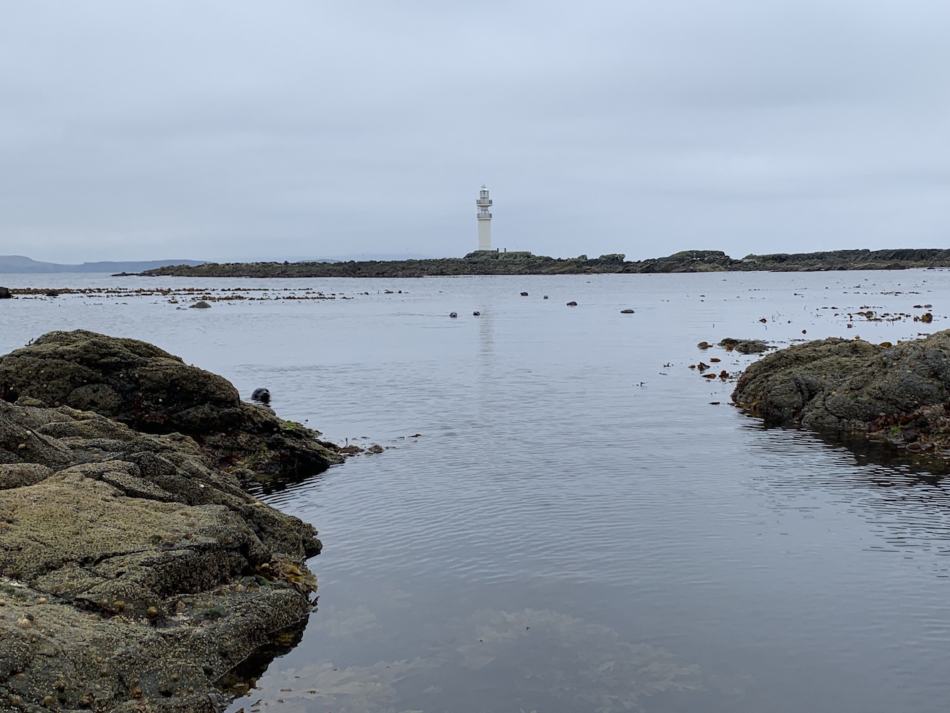
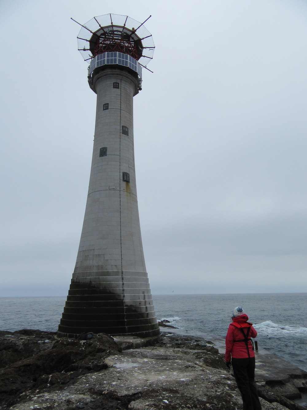
It’s been the final full day in Shetland today, ending a 10-day period of absolute perfection in terms of achieving everything I wanted to. With only three days of no boat trips, plus an extra day for me to spend with the family, there was just enough time to get to the land-based lights I had left to visit.
After the visit to Peerie Bard, home to Mousa Lighthouse, yesterday I have now visited all of the modern flat-pack (SPLAT) lighthouses in Scotland. There are a few I’ve not been close enough to touch yet, but have seen at very close range.
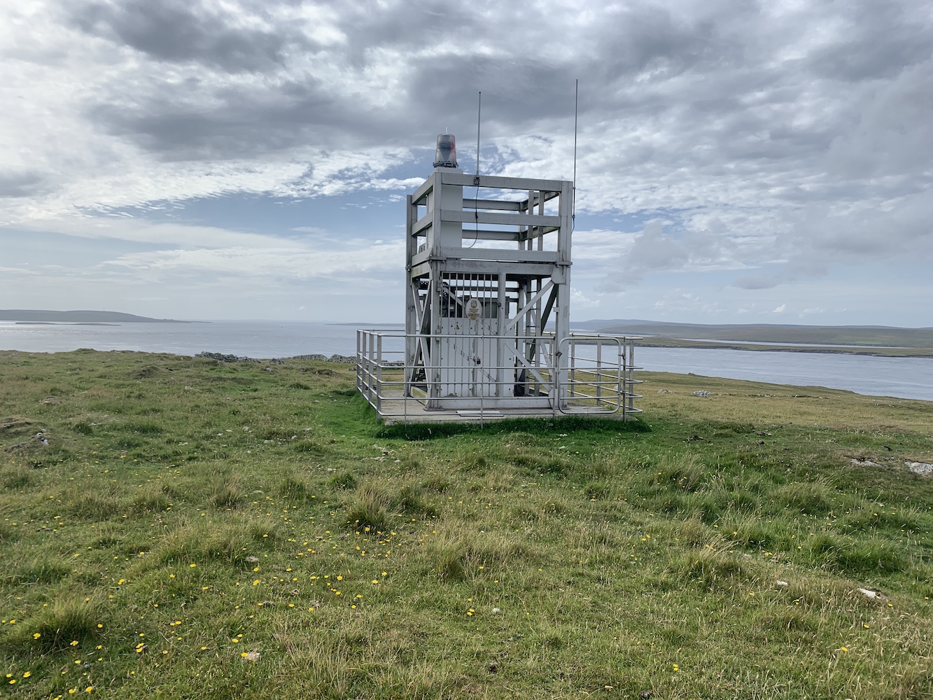
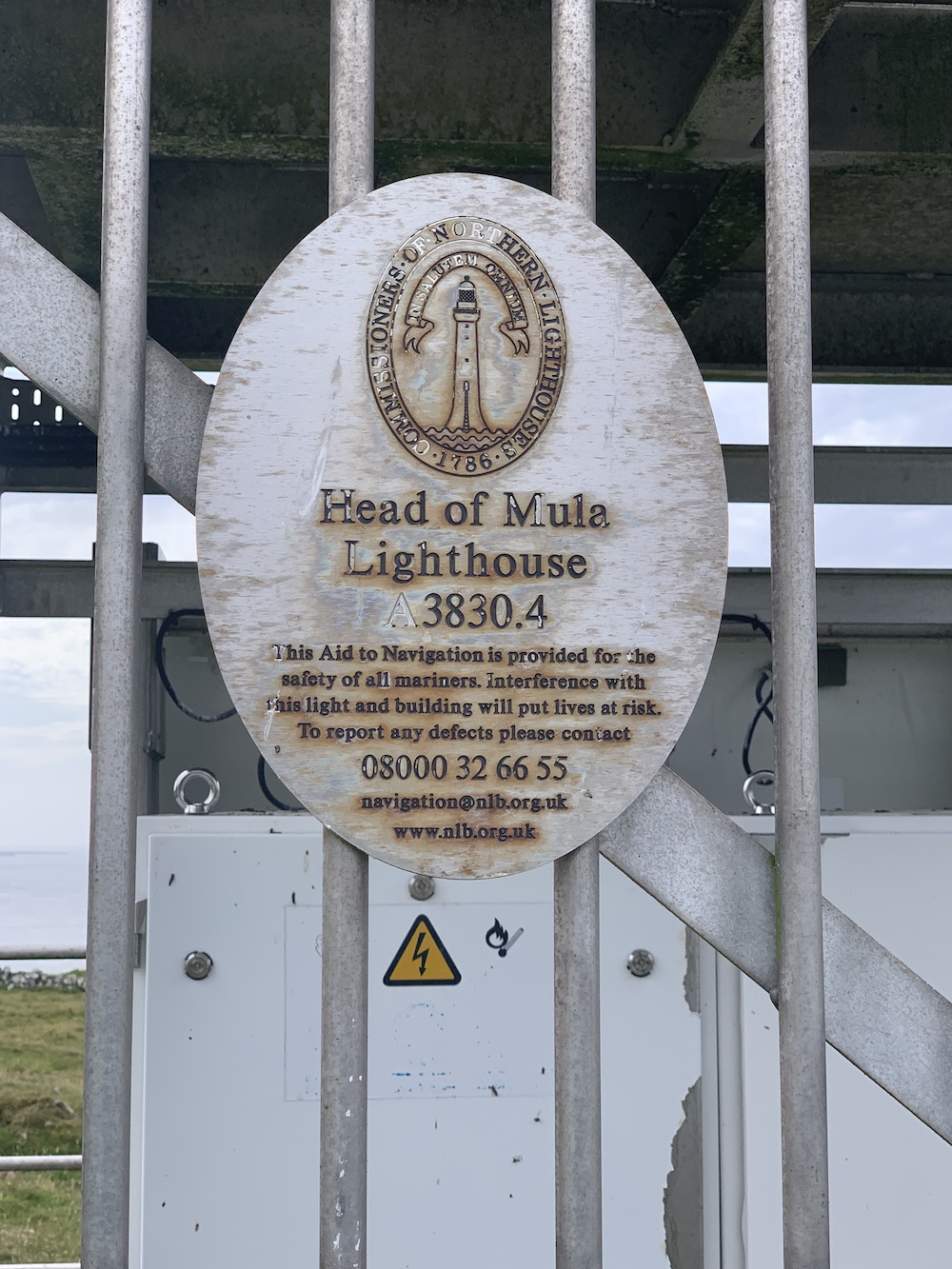
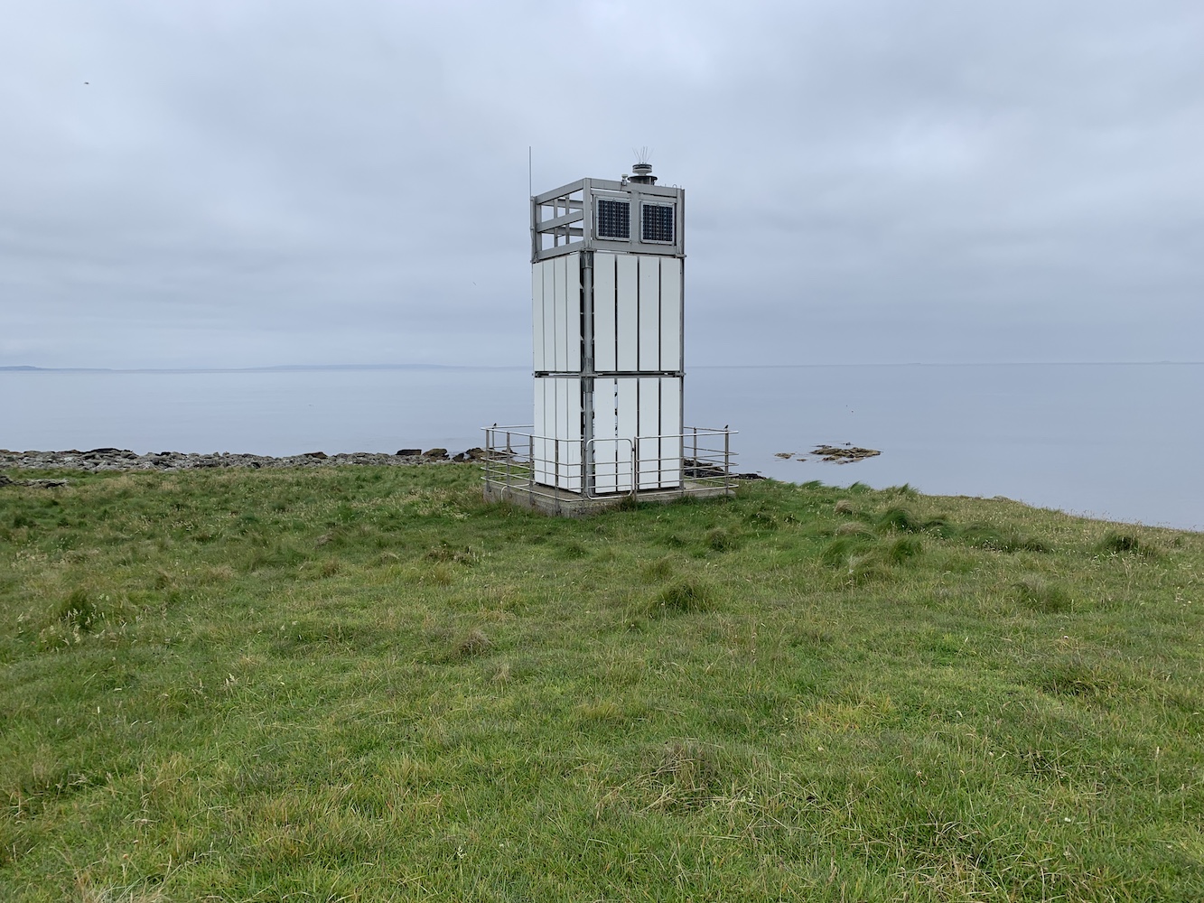
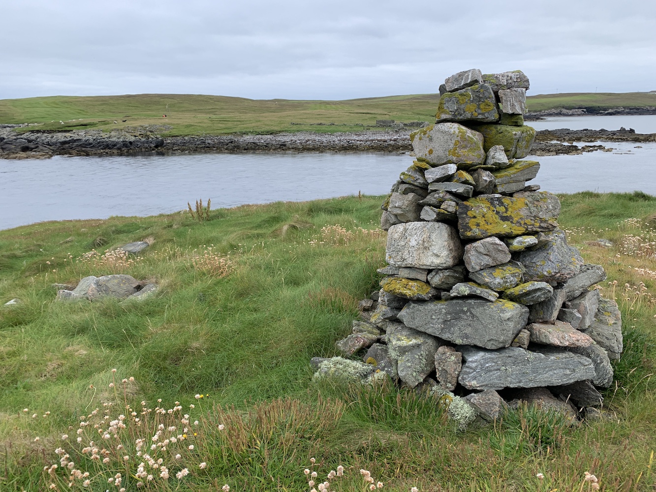
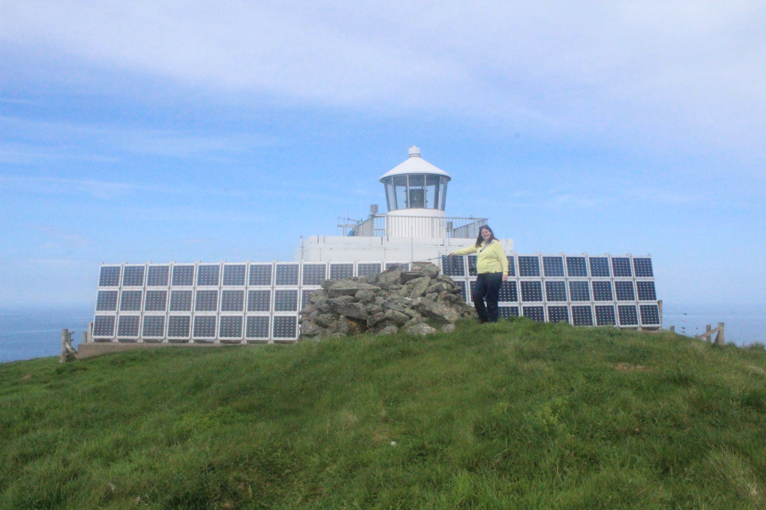
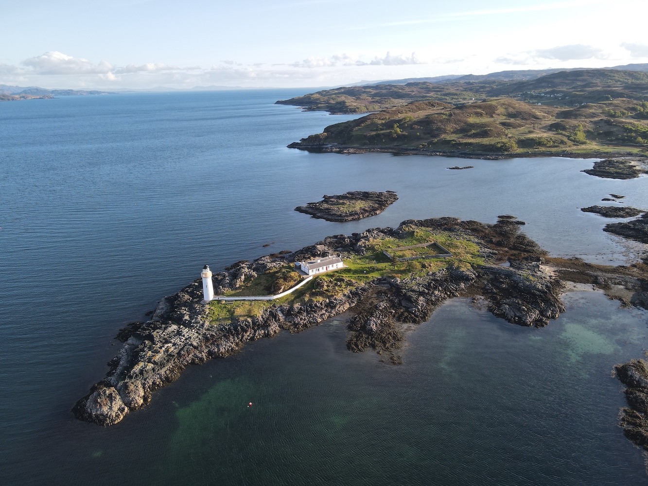
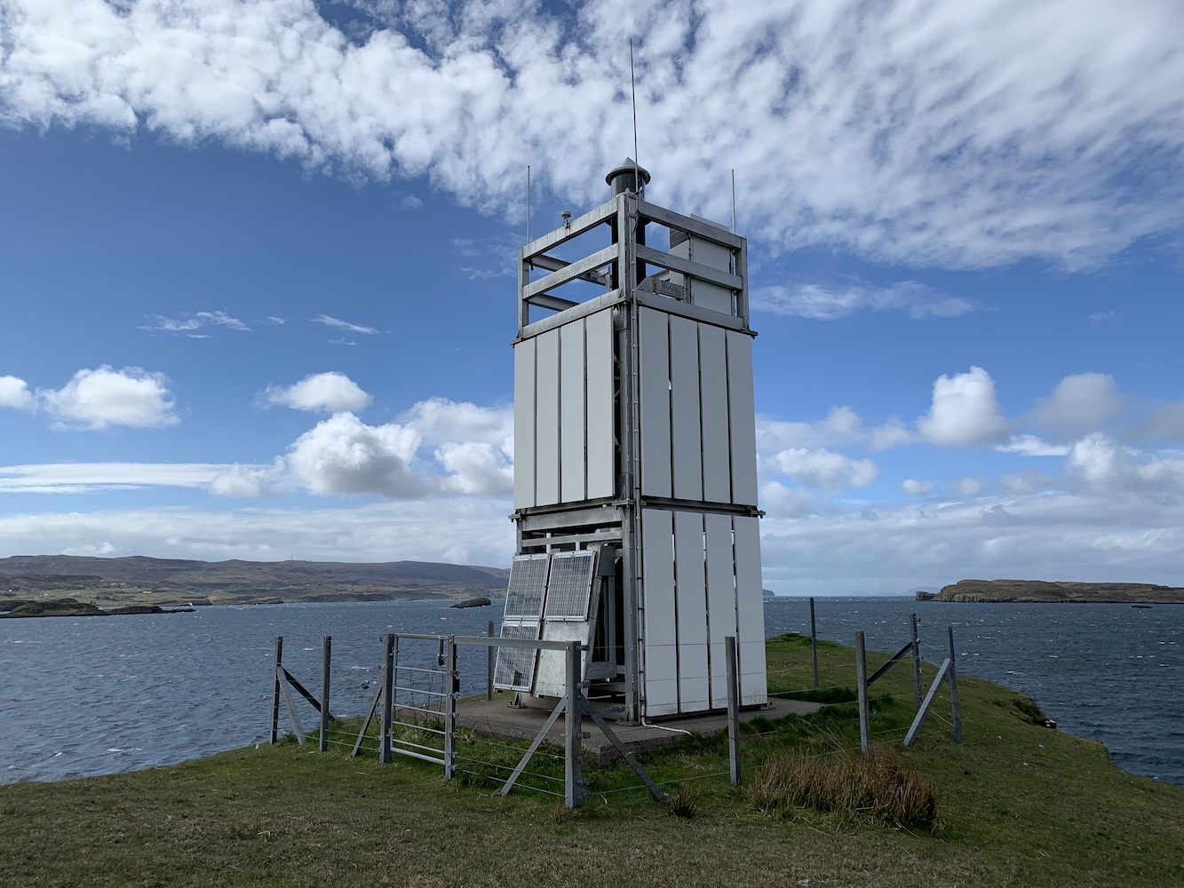
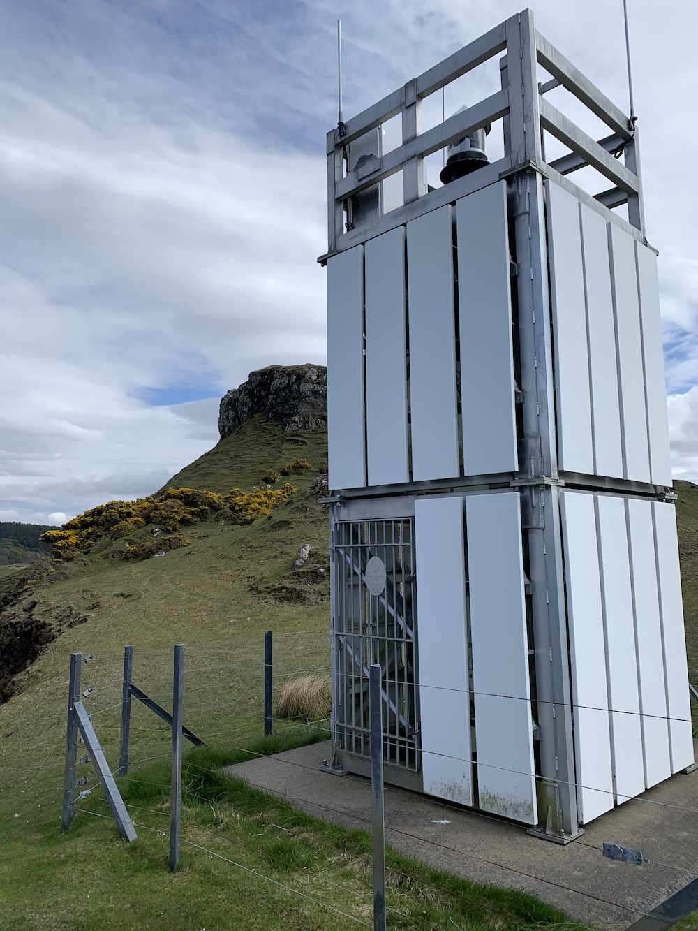
There was one, however, that had been mentioned to me and I’d not included on my list: Head of Mula. This one was built of the same aluminium framework as the flat-packs, but if didn’t have the white cladding on it, which to me is an open structure and therefore not meeting the criteria for inclusion on my list.
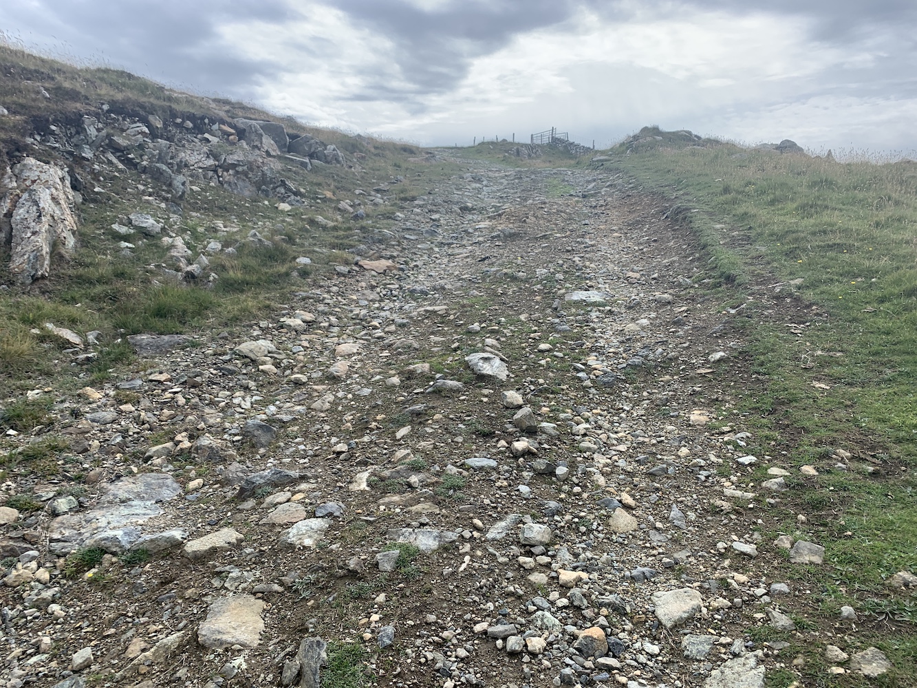
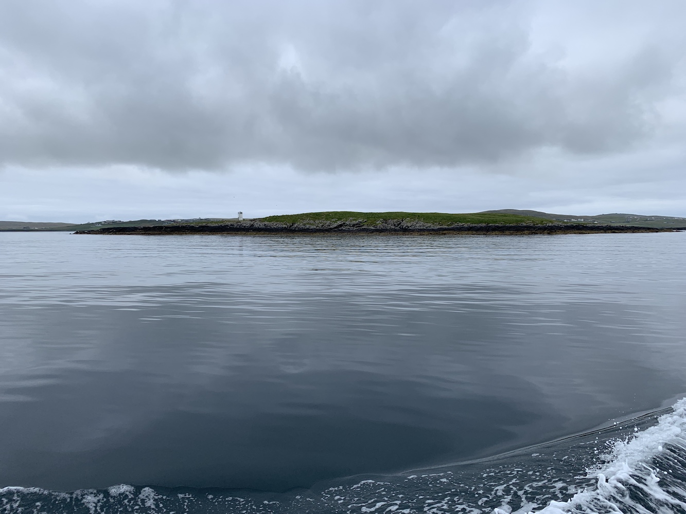
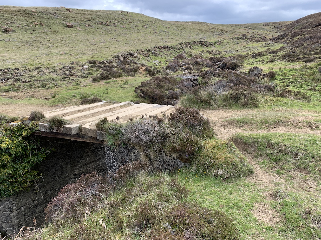
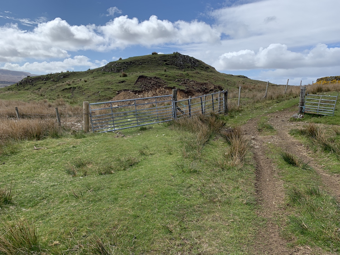
I mentioned Head of Mula to my lighthouse pal John and he was keen to see it. I thought it was definitely worth going along to check it out too, given that I am such a fan of the flat-pack type. It looked to be only a short walk from the ferry terminal on Unst. I wasn’t wrong. It is very easily accessed by following the main road north of the terminal for a short distance and then taking a right turn at a track heading uphill.
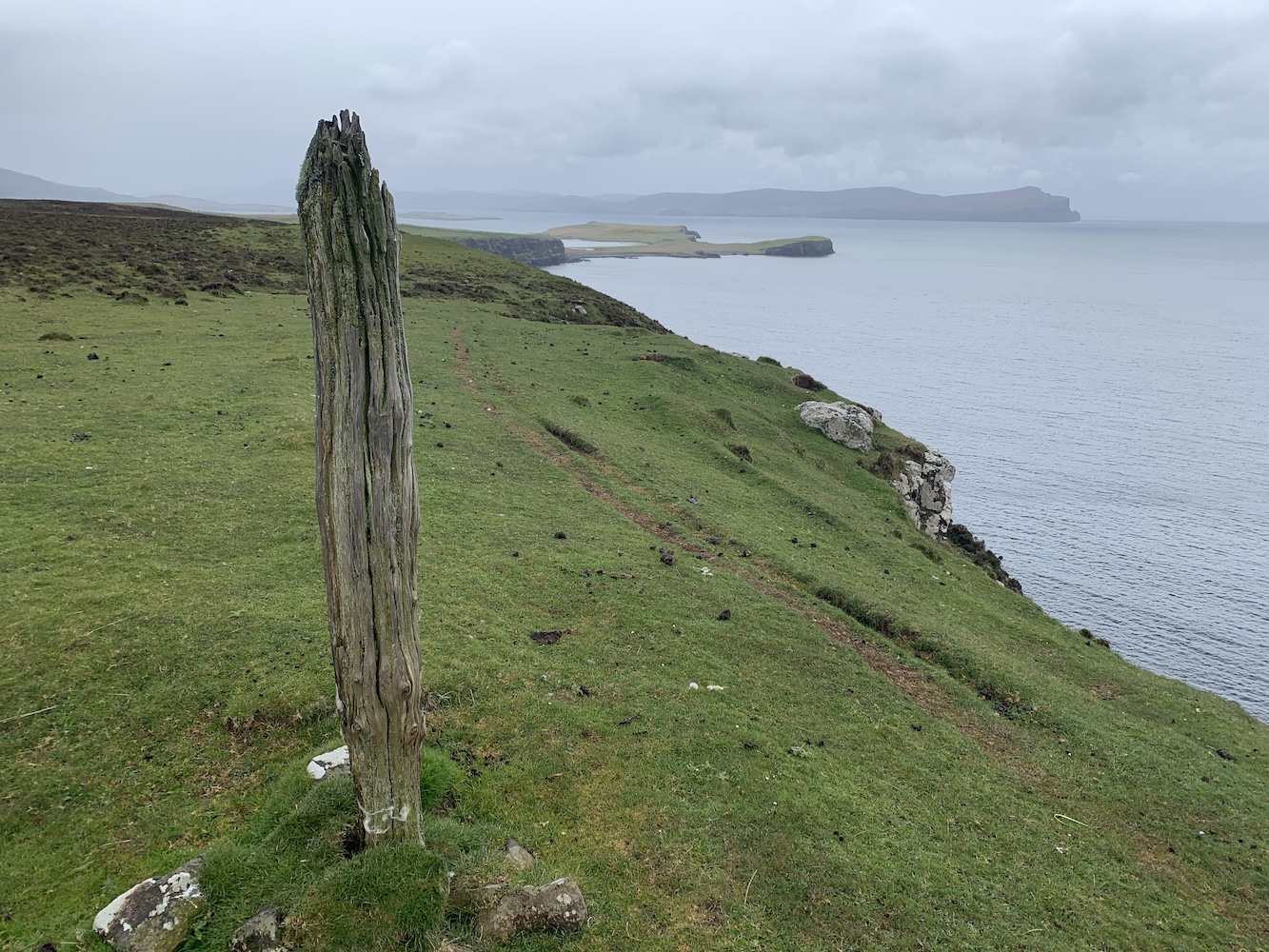
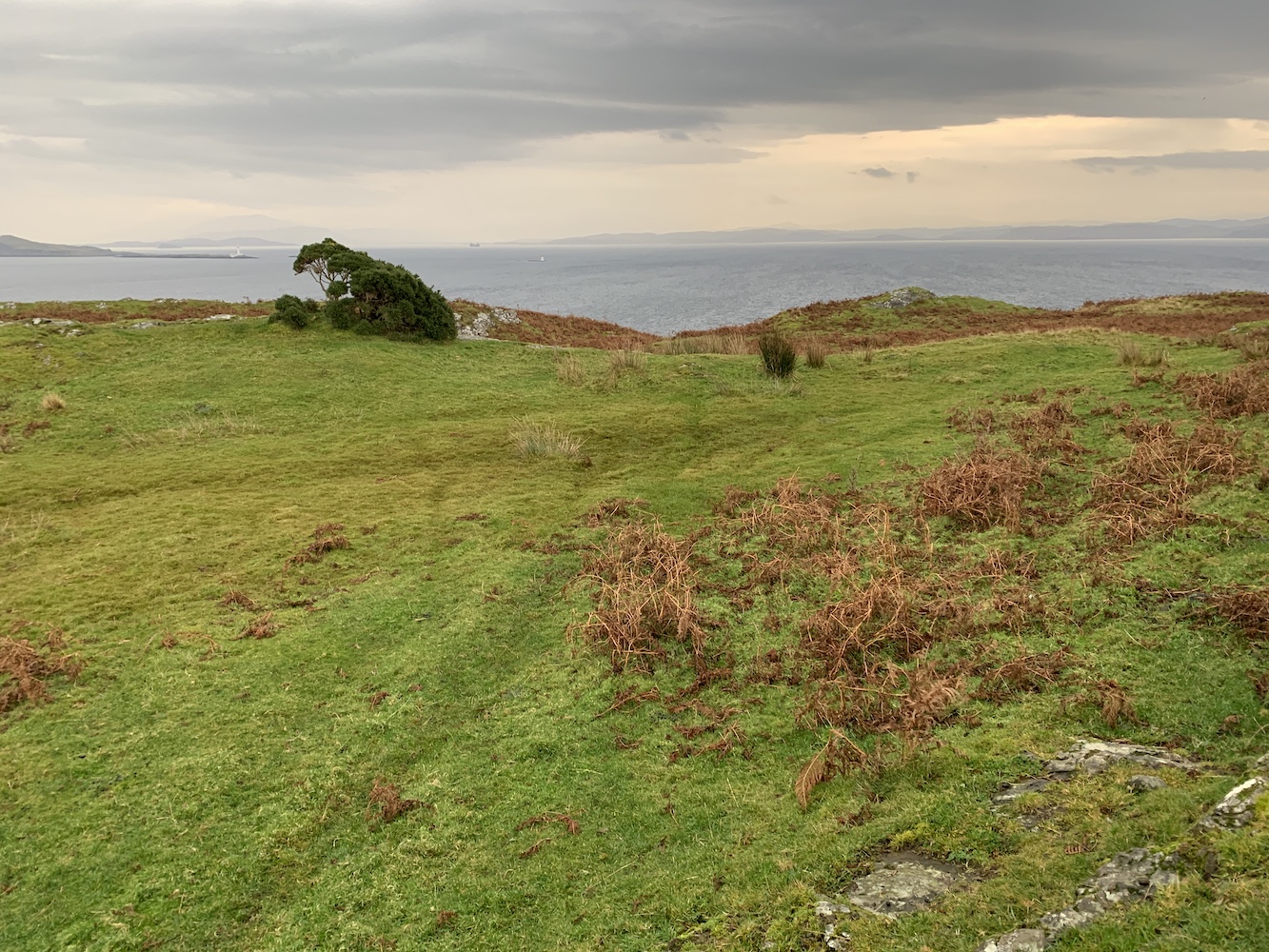
The track up to to Head of Mula
The track was great and after just a few minutes we spotted the top of the light just above an old wall ahead.
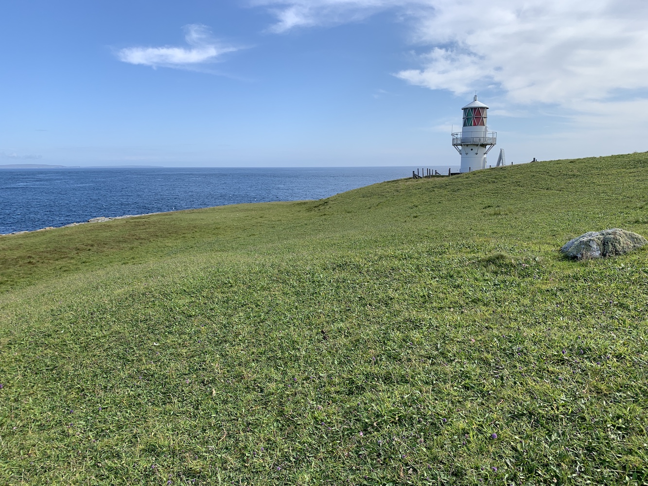
The light on Head of Mula
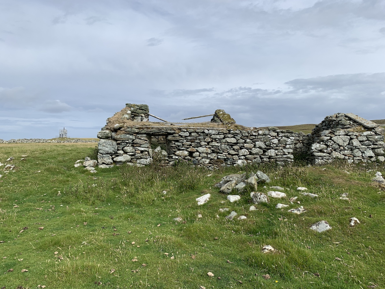
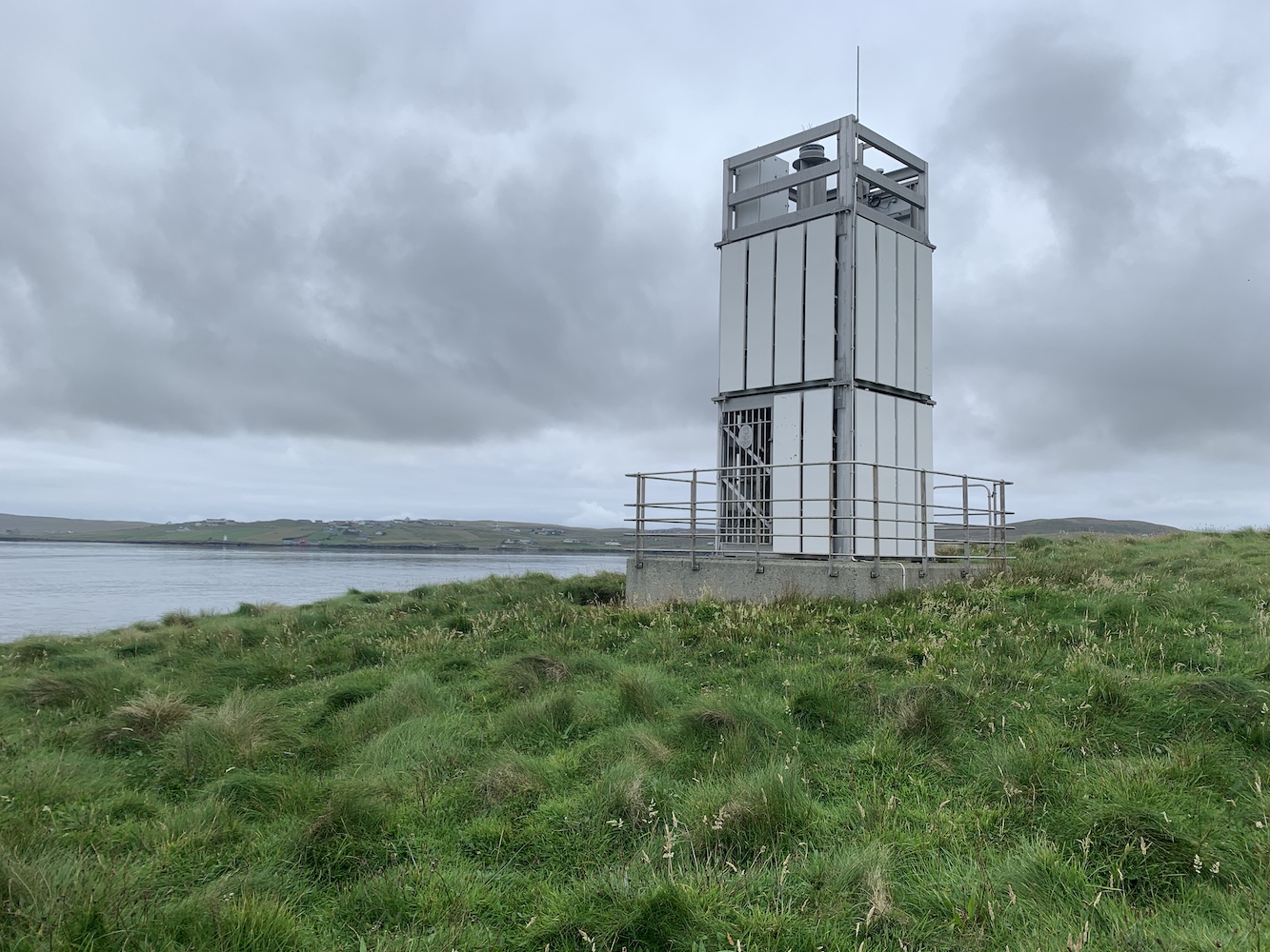
Beyond the lighthouse there were the remains of abandoned houses and it was really quite strange to be seeing such old buildings against the backdrop of a relatively new light structure.
The new light and the old building
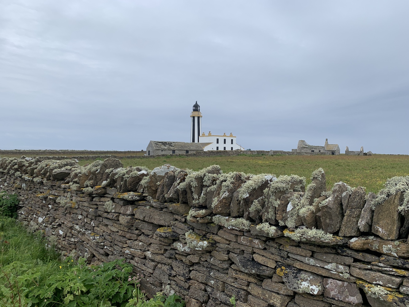
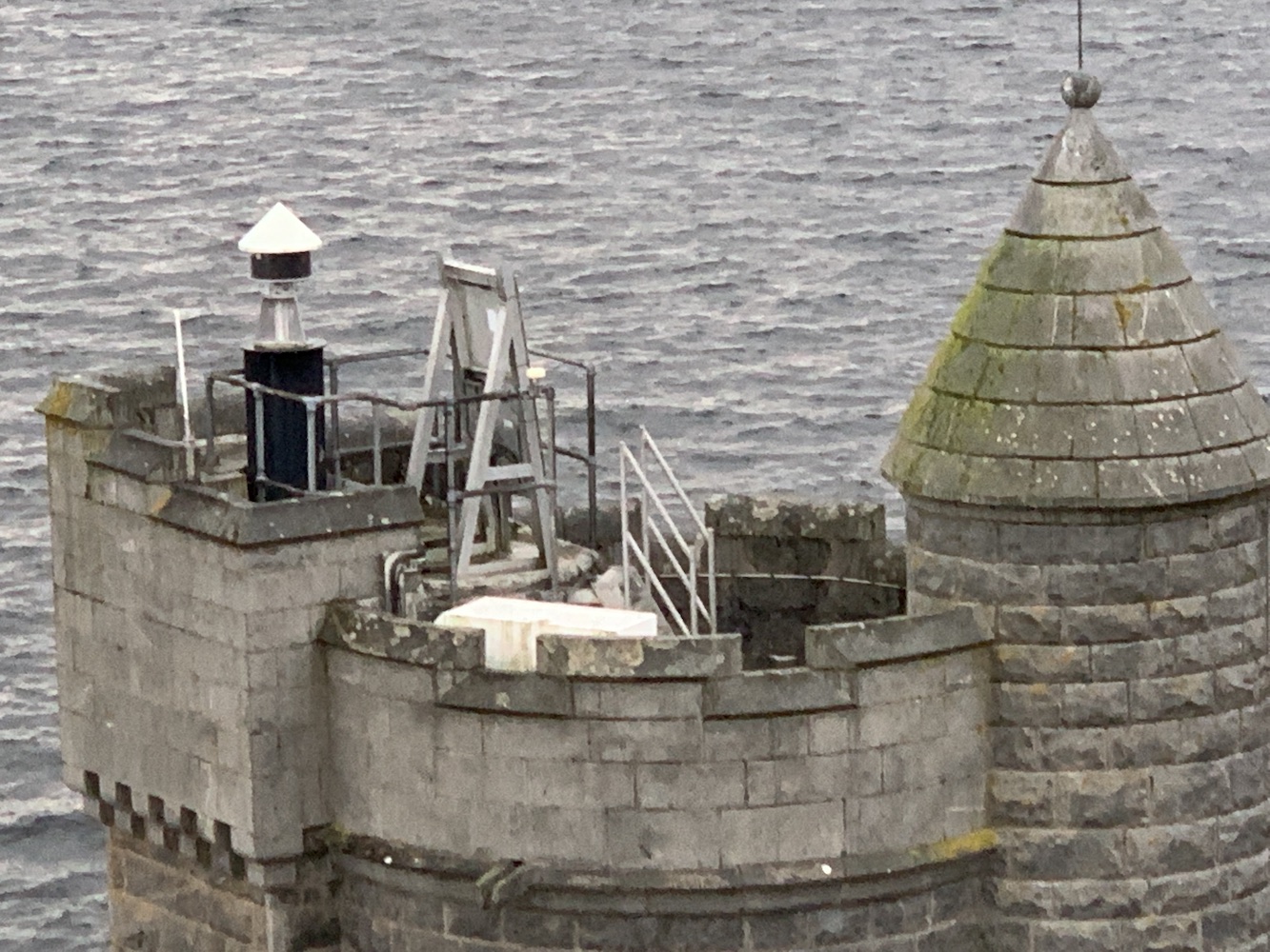
The tower was exactly as had been described to me. This was where it got tricky though as the debate was then on as to whether or not it did qualify for my list. Is it possibly for someone to be enclosed within it? Not really. Someone could certainly step inside the frame, but they would still be completely exposed to the elements and visible to anyone on the outside. Therefore it doesn’t meet the criteria, but here is where the challenge has always been for me in preparing a definitive list of lighthouses.
Head of Mula Lighthouse (as the Northern Lighthouse Board plaque on the door says)
I always wanted my list to be objective and based entirely on what did or didn’t meet the criteria. I am well aware that one lighthouse may mean a lot to one person and very little to another. I’ve seen plenty of subjective lighthouse lists for Scotland out there and they usually feature the biggest and most impressive of the Stevenson lighthouses, often leaving out the smaller lights that (in my option) are just as enjoyable to visit – if not more so in some cases – as the large ones.
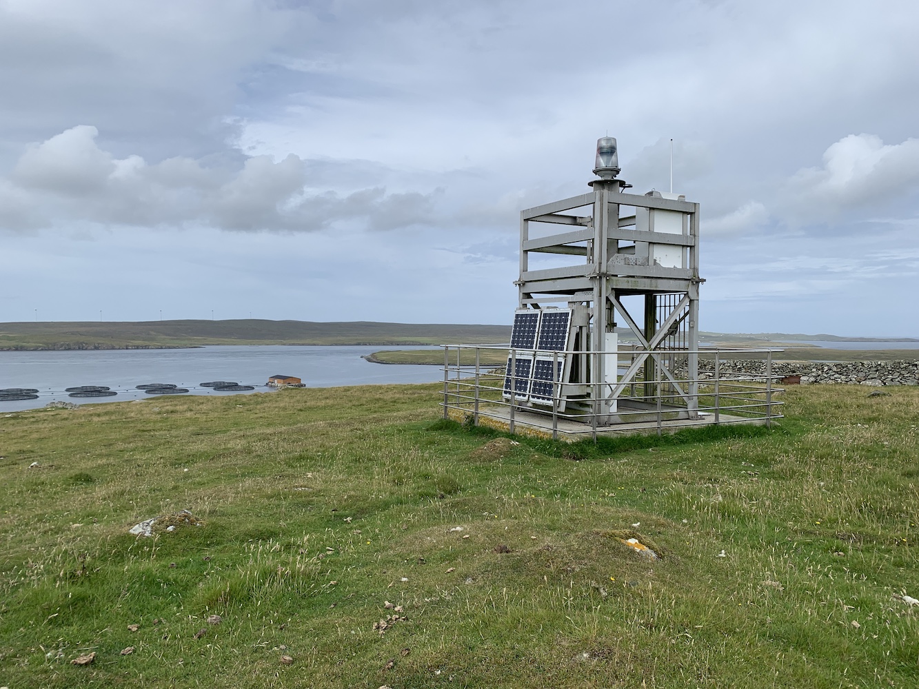
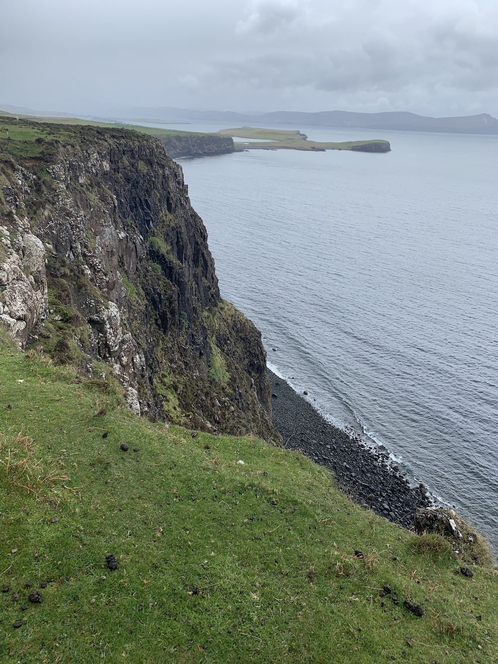
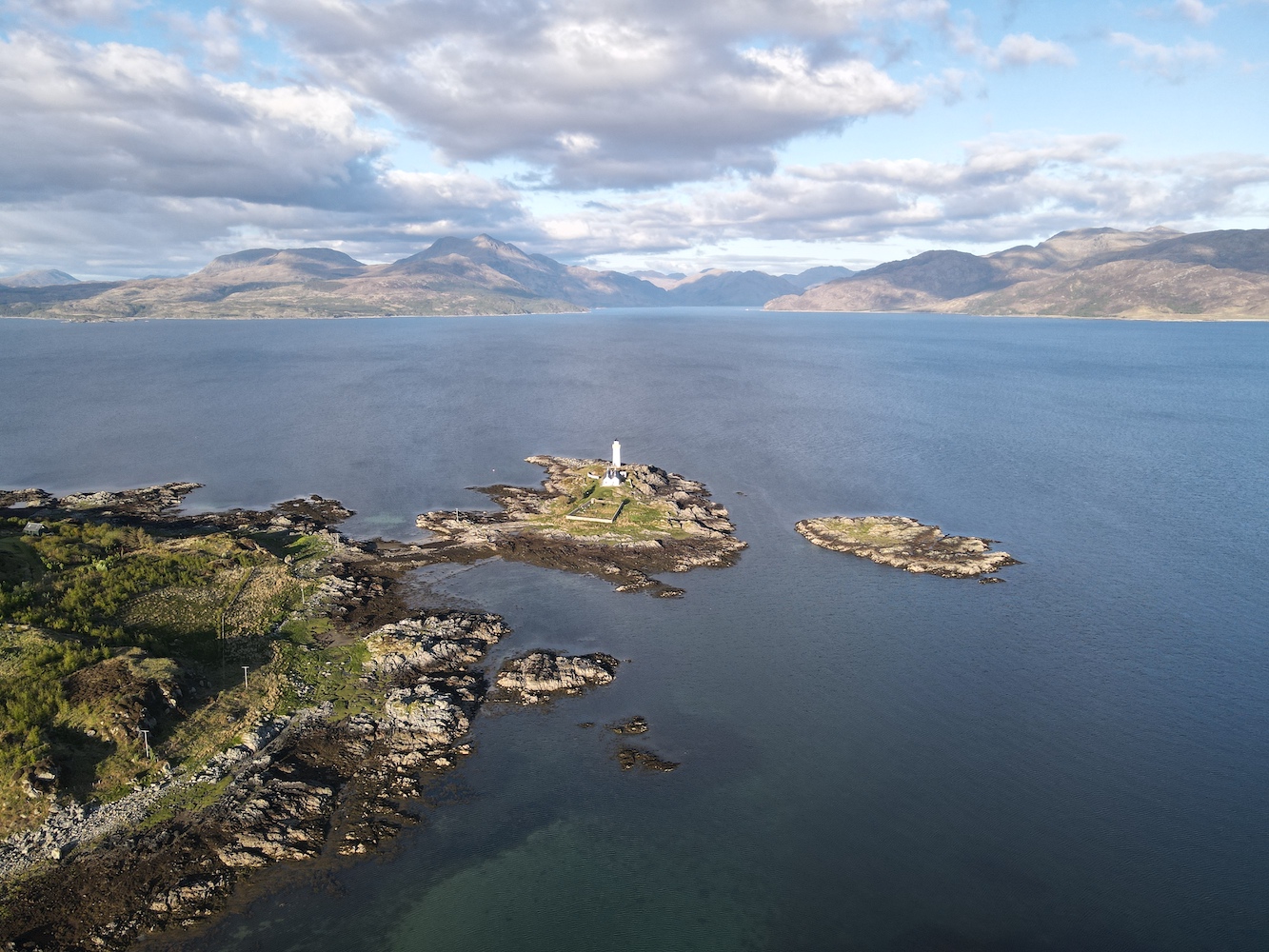
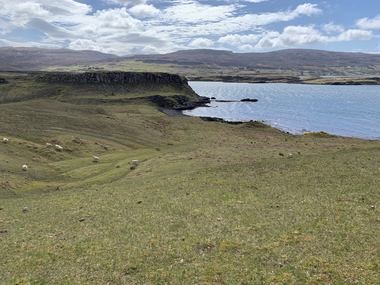
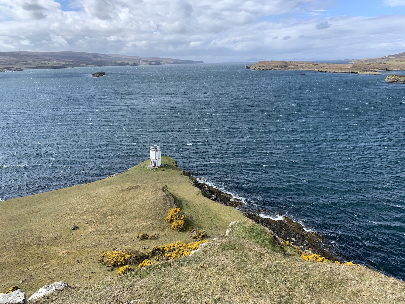
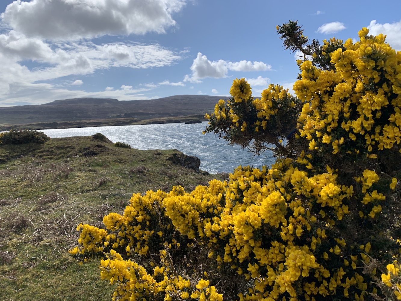
For me one of the big appeals of the flat-pack lighthouses has always been the beautiful places they take you to. Often places rarely explored by the masses and this too is the case at Head of Mula. The views here are fantastic, particular looking south/south east towards the Loch of Heogland and Holm of Heogland close in and then beyond to Fetlar.
The view to the south east
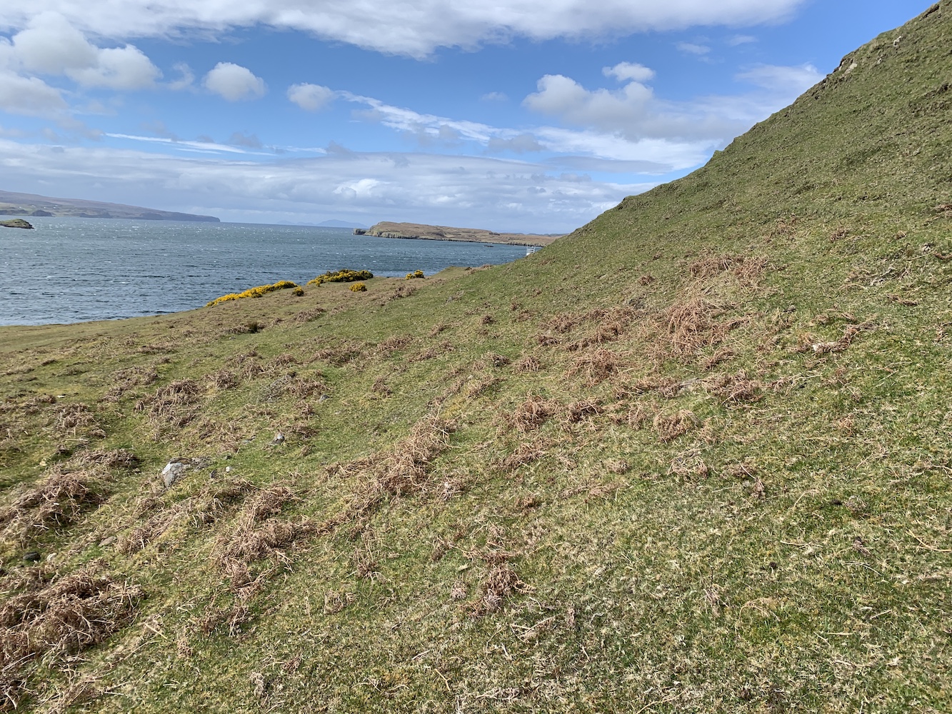
Looking west over Bluemull Sound was also excellent and the ferry moving back and forth between Yell and Unst was a regular reminder that civilisation was just down the track.
The view to the west
The light at Head of Mula has everything going for it that most flat-pack lighthouses have, except the white cladding. We jokingly referred to it all day as the ‘naked flat-pack’ due to its lack of white cladding “clothes”.
A closer look at Head of Mula
Thinking about my list, there are some lighthouses on there that I would be more than happy not to visit again, usually due to their location, but I’d happily stroll back up to Head of Mula again. This is where I feel a little envious of those who have their own personal list and can add/take away anything they please. From the point of view of The British Lighthouse Trail though, I need to be less subjective and not adjust it to become a list of lighthouses I personally think people should visit – although I do think that would make an excellent list.
The final decision on Head of Mula then? I’m going to have to say that the jury is still out. In terms of meeting the definition it’s a no. But if I think it’s important that people get to hear about it and visit it then absolutely yes. If any readers have any thoughts on this then do feel free to share these below in the comments.
The plaque on the lighthouse door
Back to Shetland though and, as mentioned in yesterday’s post, the past 10 days have really been made so successful by the crew on the two boats we have used. Kevin, Michael and Alan on Lysander and the wonderful aluminium tender were exceptional. Magnie and John on the Papa Stour and Ve Skerries trip were more than happy to get us wherever we wanted to go too. It makes such a difference to have boat crew who enjoy their time out with the baggers. It was a real pleasure to spend time with them all.
That’s it for another trip. I’m not sure where the next one will be yet, but I shall be sure to take my followers on here along wherever it is and report back. 🙂
It’s been another day onboard Lysander in Shetland today and it’s really starting to feel like home now. With Michael the fantastically knowledgeable and friendly skipper, and the equally knowledgeable and skilled tender skipper Alan, we have been in very good hands.
My first lighthouse stop of the day was Wether Holm. We were informed by Alan that ‘wether holm’ is the name given to islands where the sea gets shallower and breaks on the island. There are plenty of Wether Holms about in Shetland, but only one of them has a lighthouse. This is a flat-pack lighthouse and after we were dropped off it was just a quick stroll up to it. There were nice views across to Whalsay from the lighthouse including Suther Ness Lighthouse just across the water.
Wether Holm
Wether Holm Lighthouse
Wether Holm Lighthouse and you can just make out Suther Ness Lighthouse on Whalsay in the background
After we left the island Joe the Drone went for a fly and got some great aerial shots of the island and surrounding area.
Wether Holm from above
The tiny Wether Holm Lighthouse in a grand landscape
Next we landed on Inner Holm of Skaw. There’s no lighthouse here, but we were told that there were stories suggesting there was a human skull to be found near the cairn on the island. This intrigued us all so we took the opportunity to have a hunt for it, and with success too. Lying under a flat round rock close to the cairn were indeed bones. There was part of a skull, a jawbone still with some teeth in it and a few other bones too. It was very strange. Bob pointed out that there was a chapel marked on the map and when we looked back towards the cairn there was evidence of rows of stones that could well have been the walls of the old chapel. Our skipper looked into it a bit more and was informed that the remains are actually believed to be of the monk who built the chapel there.
The cairn on Inner Holm of Skaw
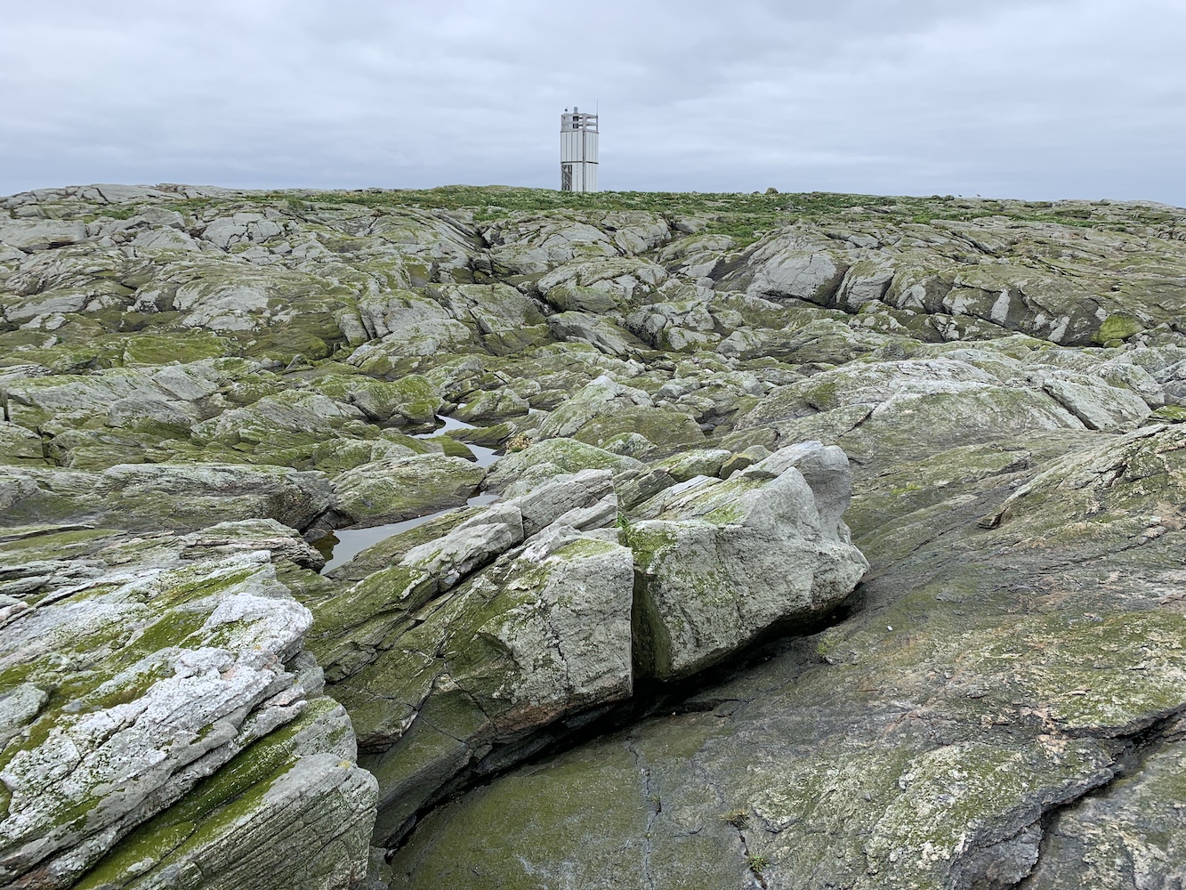
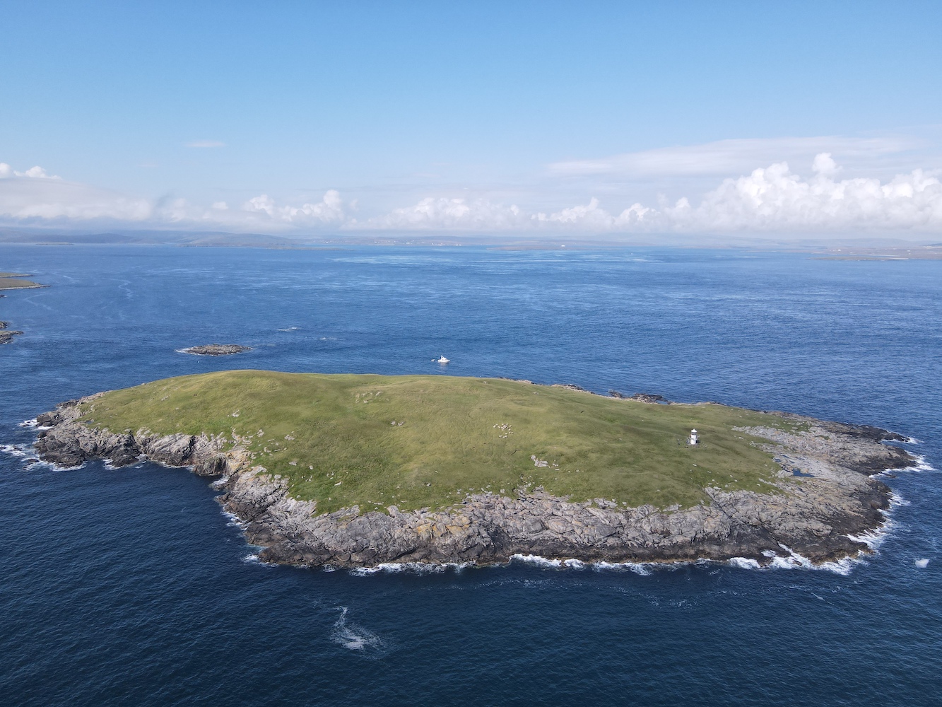
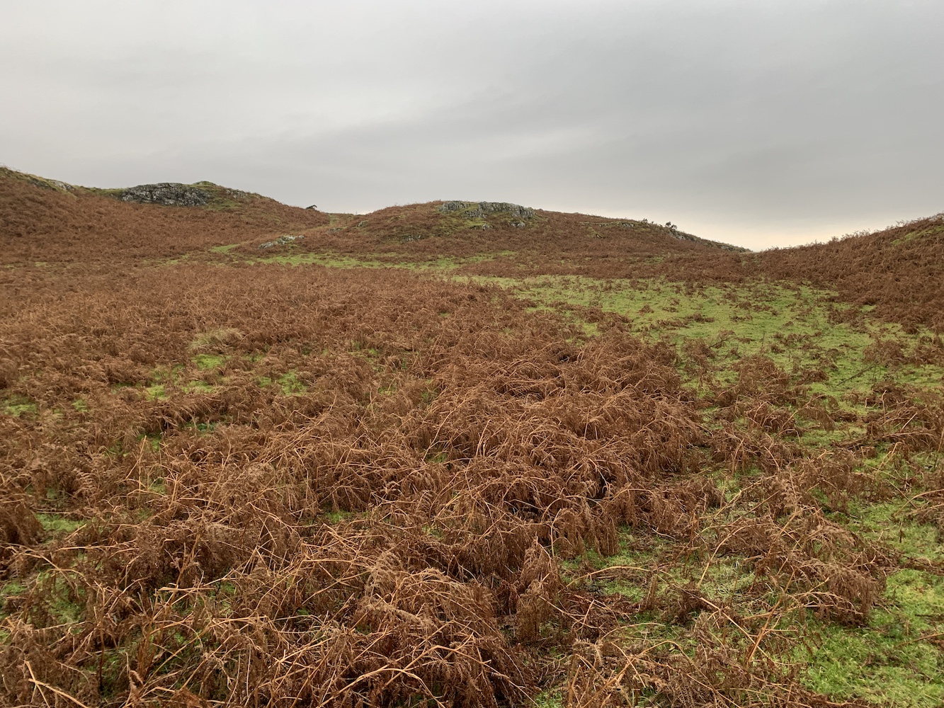
Onto my second new lighthouse of the day, Muckle Skerry. We’d considered landing on this one two years ago, but it had been raining and – given my experience of it today – I’m glad we didn’t. It’s a skerry so it’s rock really and although it looks from a distance like it has some nice grass on top it’s really just flora and fauna that thrives in wet environments combined with an occasional hard bit of soil and then random rocks in and around it all.
Muckle Skerry
It took us a little while to pick where we would land. The side of the island looked like any landing there would involve a scramble up rocks that looked green and potentially very slippery. We made our way around the island on the tender coming across another potential landing area where there turned out to be too many rocks just under the water. We then found a deeper section which got us onto some barnacle-covered rocks followed by a short section of slippy rock and then it was rock hopping all the way up to the mixed terrain described above.
Muckle Skerry Lighthouse
Muckle Skerry Lighthouse is another flat-pack and this time without a fence around it. There are great views all around which always make the less straightforward landings more worthwhile. It’s certainly somewhere you would struggle to land without the near perfect conditions we had today. We were very fortunate with sea conditions today.
Muckle Skerry Lighthouse, surrounded by the varied terrain
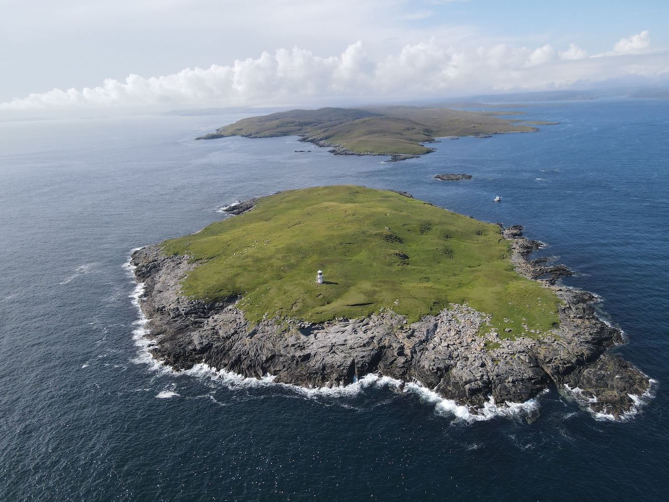
Joe was launched from the boat and caught some pictures which hopefully illustrate the tricky terrain of this one.
Muckle Skerry from Joe’s eye view
A very skerry-looking Muckle Skerry
We were bound for Out Skerries next. There are so many islands within this group that it wasn’t surprising that to save time we all dispersed a bit. Skipper Michael and I were dropped off on Bound Skerry, home to Out Skerries Lighthouse. Michael had never landed on the island before so we left the big boat moored up on the main island and Alan took us across.
Out Skerries Lighthouse on Bound Skerry
Although I’d been to Out Skerries Lighthouse before it was really nice to visit it with someone who was really looking forward to getting there. We had the island to ourselves for some time before the others arrived and we took a stroll around the rocks, getting as far to the east as possible so Michael could reach the most easterly he’s ever been in Shetland. One particular view from the highest point of the island was excellent with the lighthouse in the foreground and the shore station on neighbouring Grunay beyond.
The lighthouse on Bound Skerry
The walkway linking the lighthouse and the landing point
On a calm day it’s very hard to imagine how wild it must get there. Today is just seemed so tranquil and serene. For a while I sat at the base of the lighthouse and just enjoyed being there – that was until Bob came and asked me to move so I didn’t get in Joe the Drone’s pictures! However, I can’t complain as he did get some superb images. The blue sky appeared too!
Bound Skerry with its own lighthouse
A few hours – and a number of islands – later we arrived at Hoo Stack. John as well as Alan the boatman were keen to land here and I went ashore too, but stayed down on the rocks. I’d already been to this lighthouse back in 2019 and with the swell picking up I didn’t want to slow anyone down. The swell had picked up a fair amount by this point so landing wasn’t so easy, but we all did it and stayed dry, and John and Alan were happy.
Hoo Stack from above
Hoo Stack and its lighthouse
It’s been a long day, but another successful one. Mervyn has now set foot in one way or another on over 100 islands so far and I just have one lighthouse left to achieve my personal goal for this trip. That one is lined up for tomorrow. All fingers are crossed 🙂
It’s been some day today and certainly varied, taking in two very different lighthouses in extremely different settings. It is the day I have been waiting for, to make it to the remote and challenging Ve Skerries Lighthouse.
Leaving from Aith this morning, we set off for Papa Stour with our skipper Magnus Scott and John Anderson from Simmer Dim Charters. All four of us baggers on board had something of interest on this island that’s not so easy to get to, with one ferry a day in each direction only three days a week. For me, or course, it was a lighthouse – or, as I call it, a lightbox.
Upon arrival at the island Bob and John set off for the island high point and trig pillar while Mervyn and I took a stroll along the road, discovering quite a lot about the island community. For a start they have a great ferry terminal with tea and coffee making facilities, a book swap, a nice seating area and toilets.
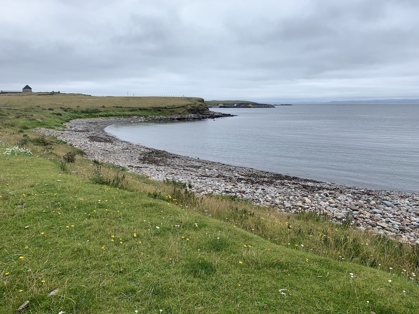
Looking back at the pier on Papa Stour
There aren’t many houses on the island and those that are there are scattered alongside the road that runs from the pier to the airport landing strip. There’s a Primary School which has been closed now for around 8 years and the population of the island is just 6. A small community, but a really wonderful one which embraces its island and its history. This is very clear to see throughout Papa Stour.
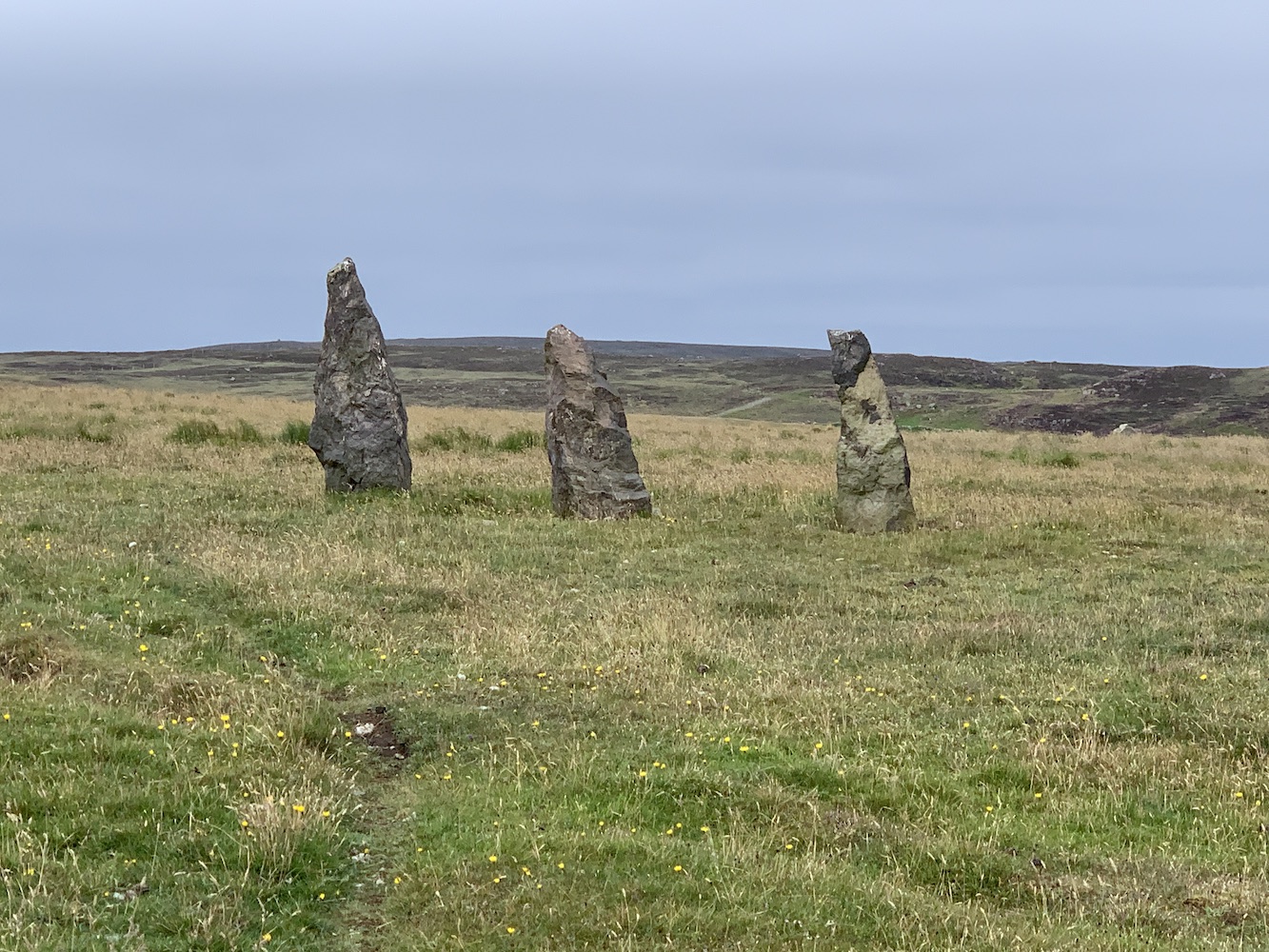
Standing stones on Papa Stour
There is a wonderful ‘stofa’, an old Norwegian-style house made from carved wood. This was built in the place of a former stofa, but part of the build project was to allow younger people to learn the traditional skills of Norwegian building. It is really quite beautiful to see how well-constructed it is.
The Norwegian stofa on Papa Stour
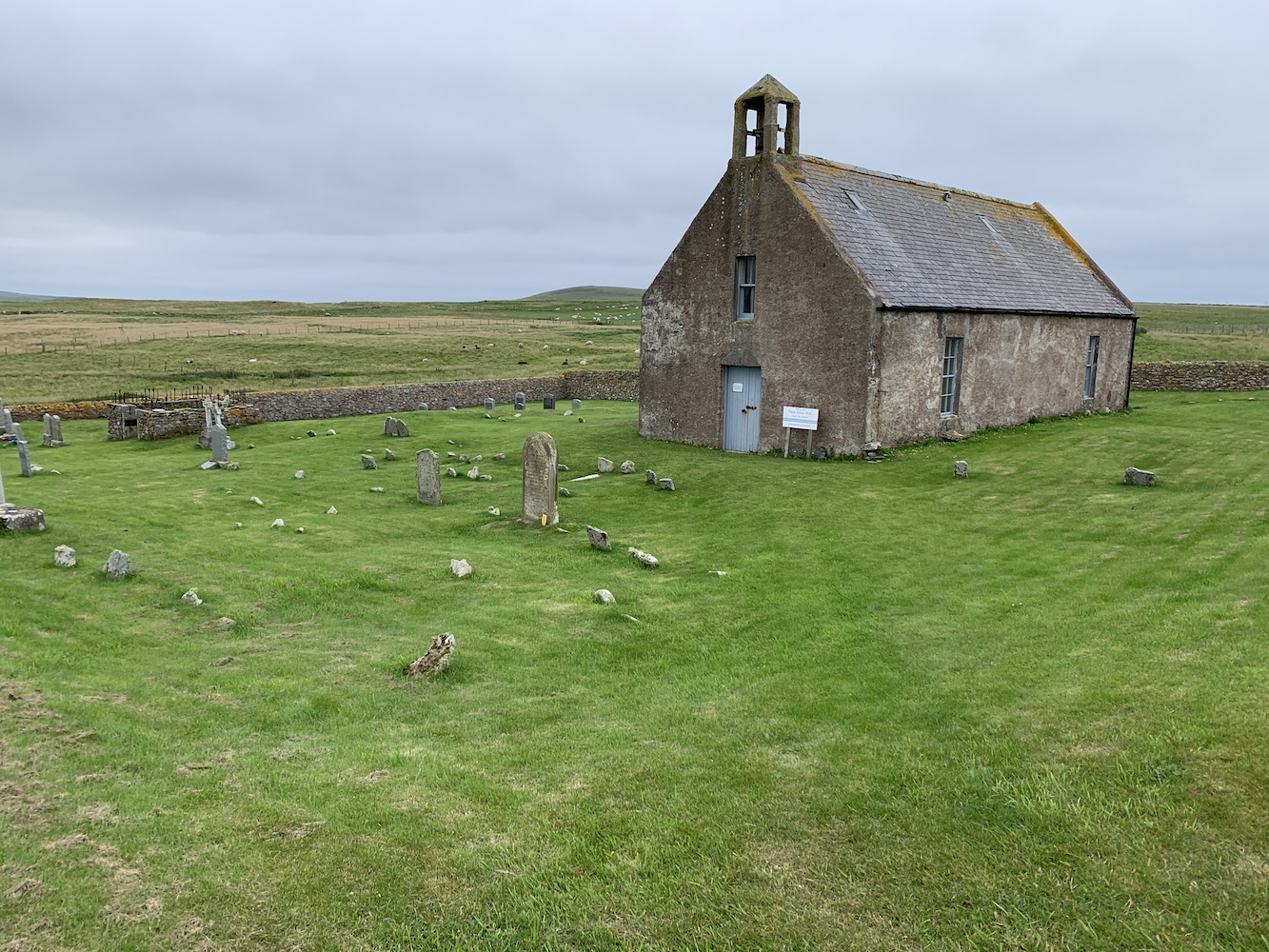
We also took a look inside the Kirk, which is perfect for a small community. The building features a stained glass window that was designed and made by the locals to commemorate the lives of the four men from Papa who lost their lives during the Great War. It also contains a prayer tree which people can hang messages on explaining who they are praying for. There is also a small room with local history information and some locally made products for sale.
Papa Stour Kirk
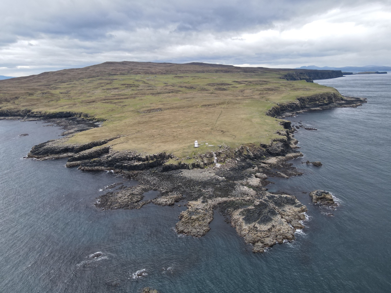
From the Kirk we walked around to East Biggings and then began the attempt to reach the lighthouse. It had been visible nearly all the way around the road, but we’d not spotted a clear way to reach it. On our return journey we found a gate and followed the edge of a field down towards Housa Voe. Through one more gate and another field and we were there.
The field we walked around the edge of to reach the lighthouse
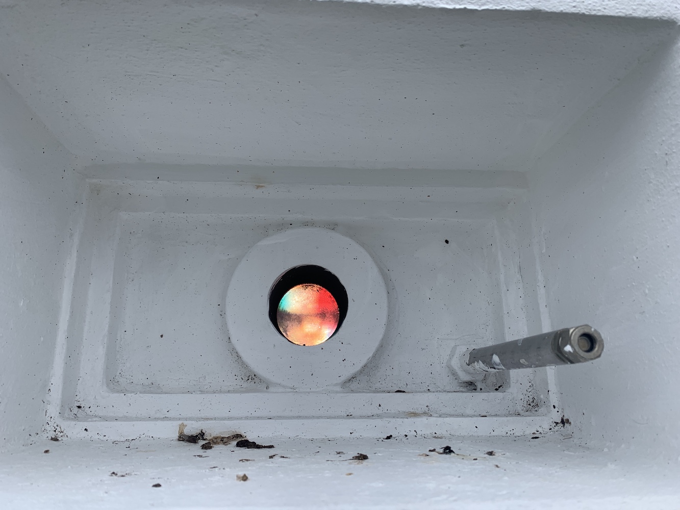
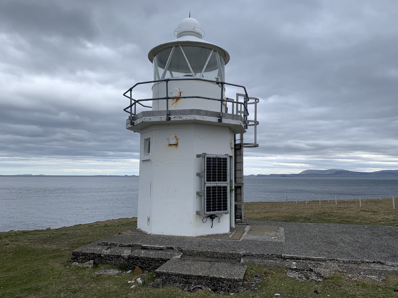
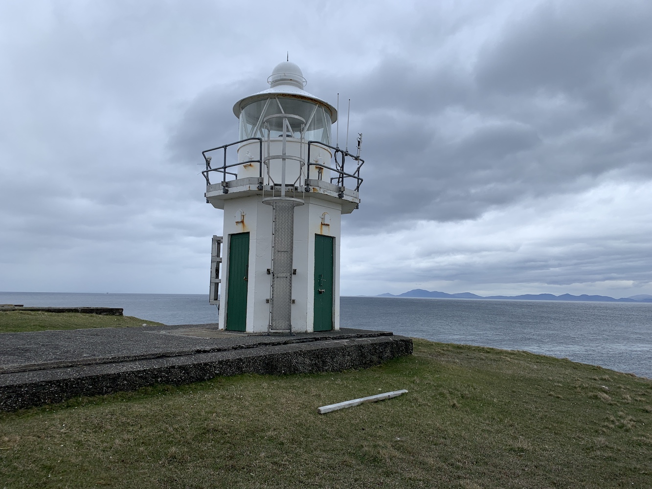
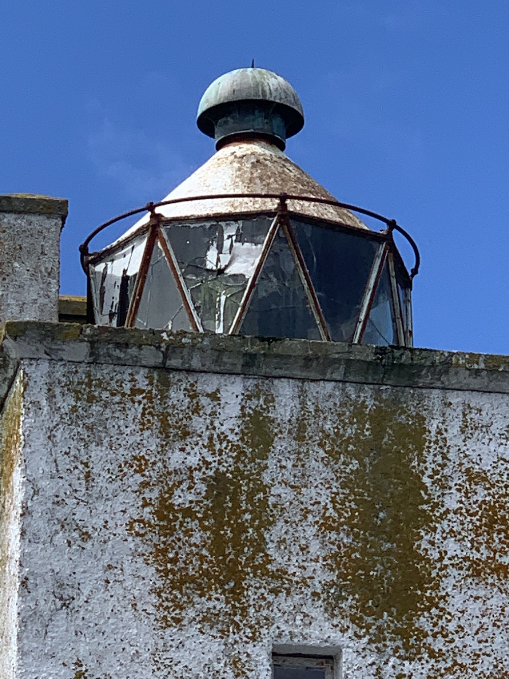
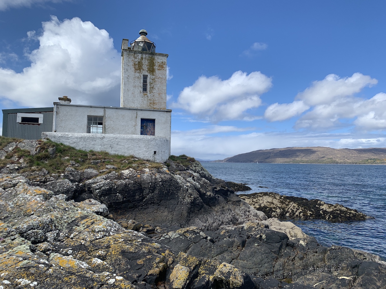
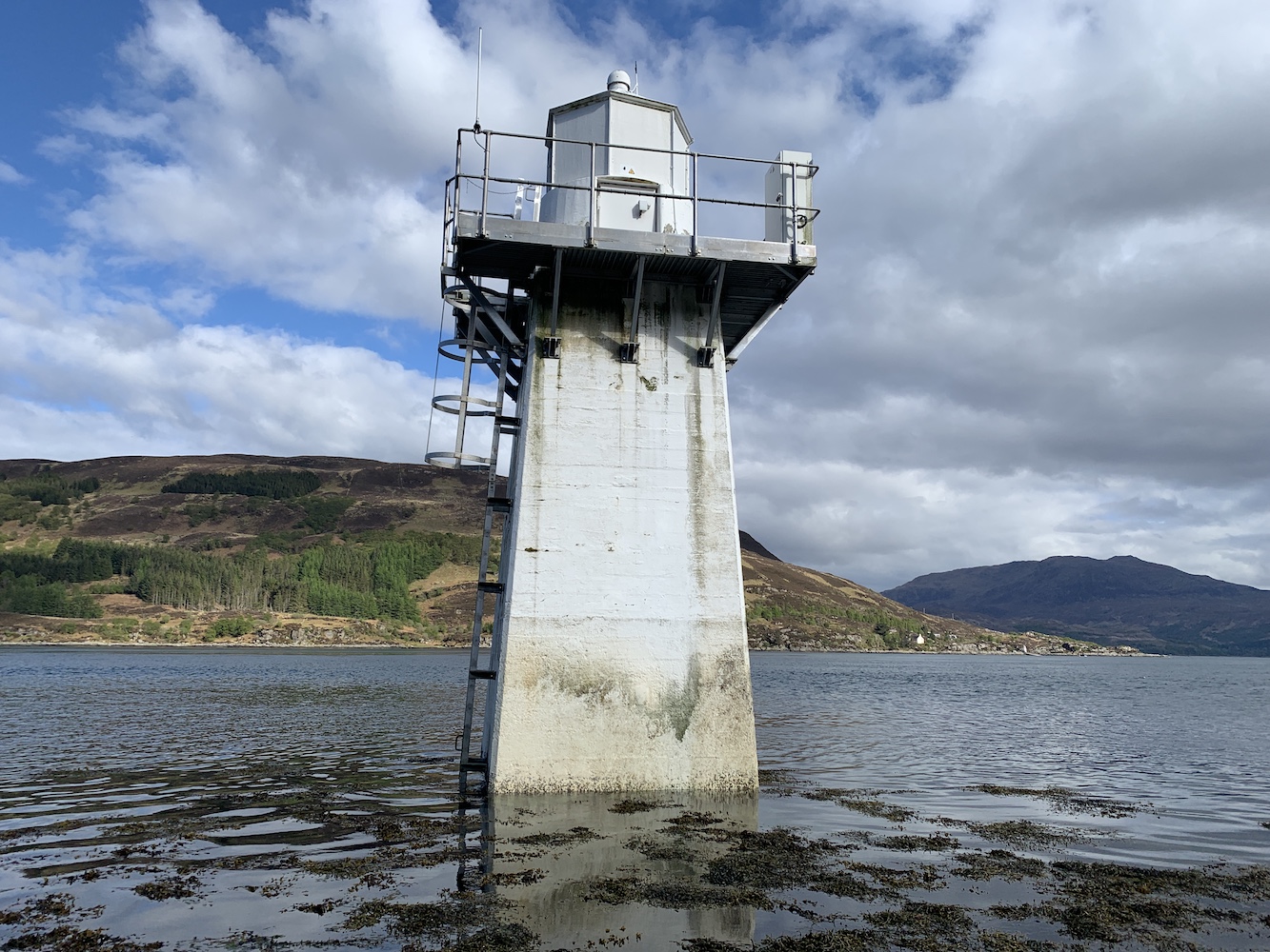
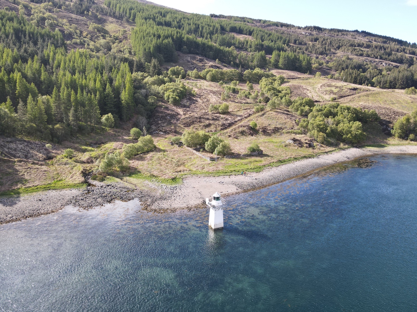
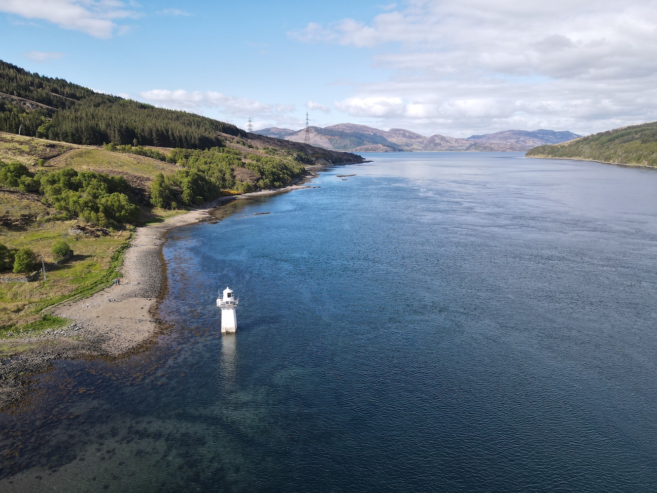
I would never say that these little lightboxes are anywhere near the most impressive, but they certainly do the job. The one here at Housa Voe is a similar type of structure to the two at West Burrafirth. It’s essentially a small square dry dashed building with a door at the back and a directional sector light shining out the front. There’s little more to it than that, but you can see when you step into the path of the light that it does it’s job very effectively. I had some fun for a few minutes walking back and forth in front of it and watching the red light change to white and then to green. This light is owned by Shetland Islands Council, which sort of explains its appearance. Clearly its purpose is to guide vessels safely into Housa Voe.
House Voe Lighthouse from the landward side
House Voe Lighthouse
House Voe light source
It was nice to introduce Mervyn to this type as well as they are very rarely visited. I’m not sure he was particularly impressed, but he pretended to be which was good of him. This is one of the delights of lighthouse bagging, discovering new places above and beyond just looking at the lighthouse.
The green light in House Voe Lighthouse
We left the lightbox behind and headed for the ferry terminal for a nice cup of tea. Even the waiting room is a trove of historical treasures relating to Papa Stour.
A little cove near the lighthouse
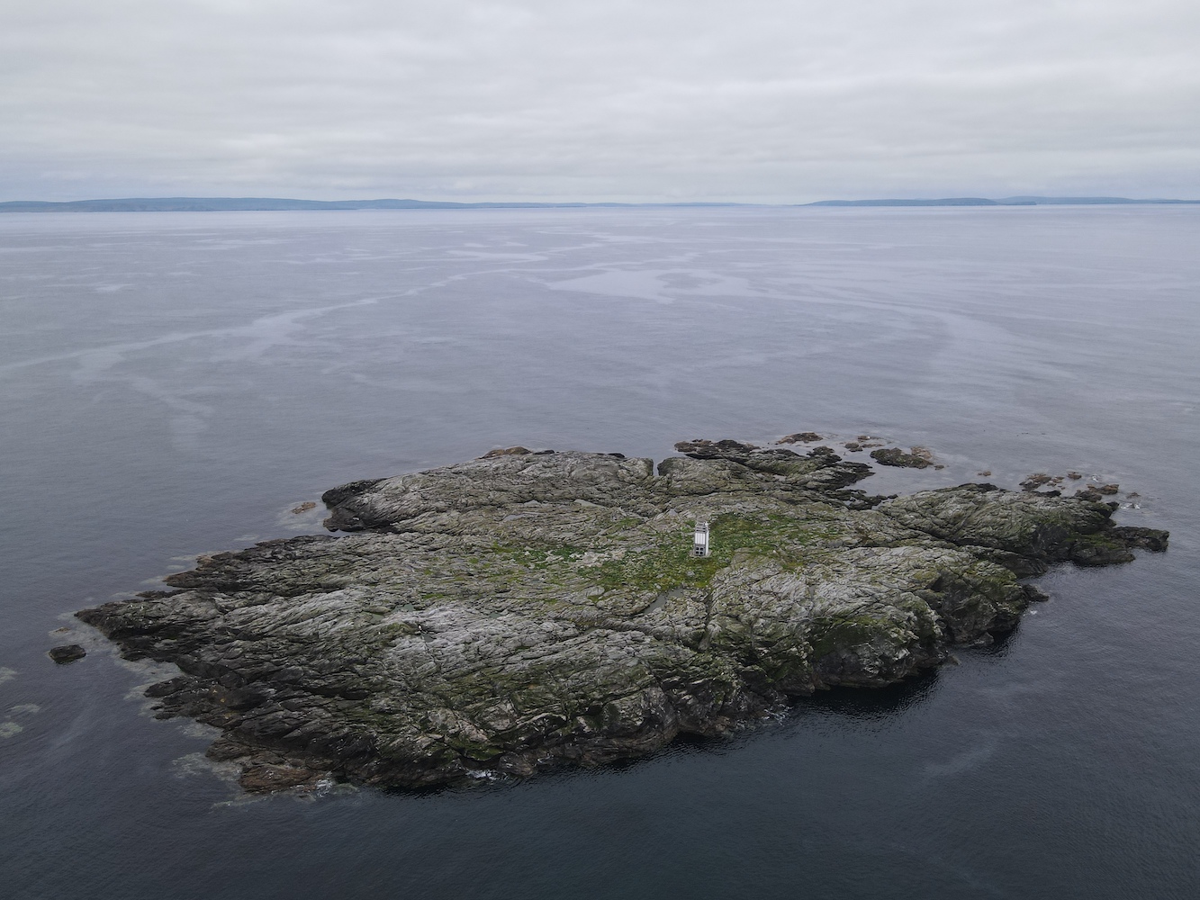
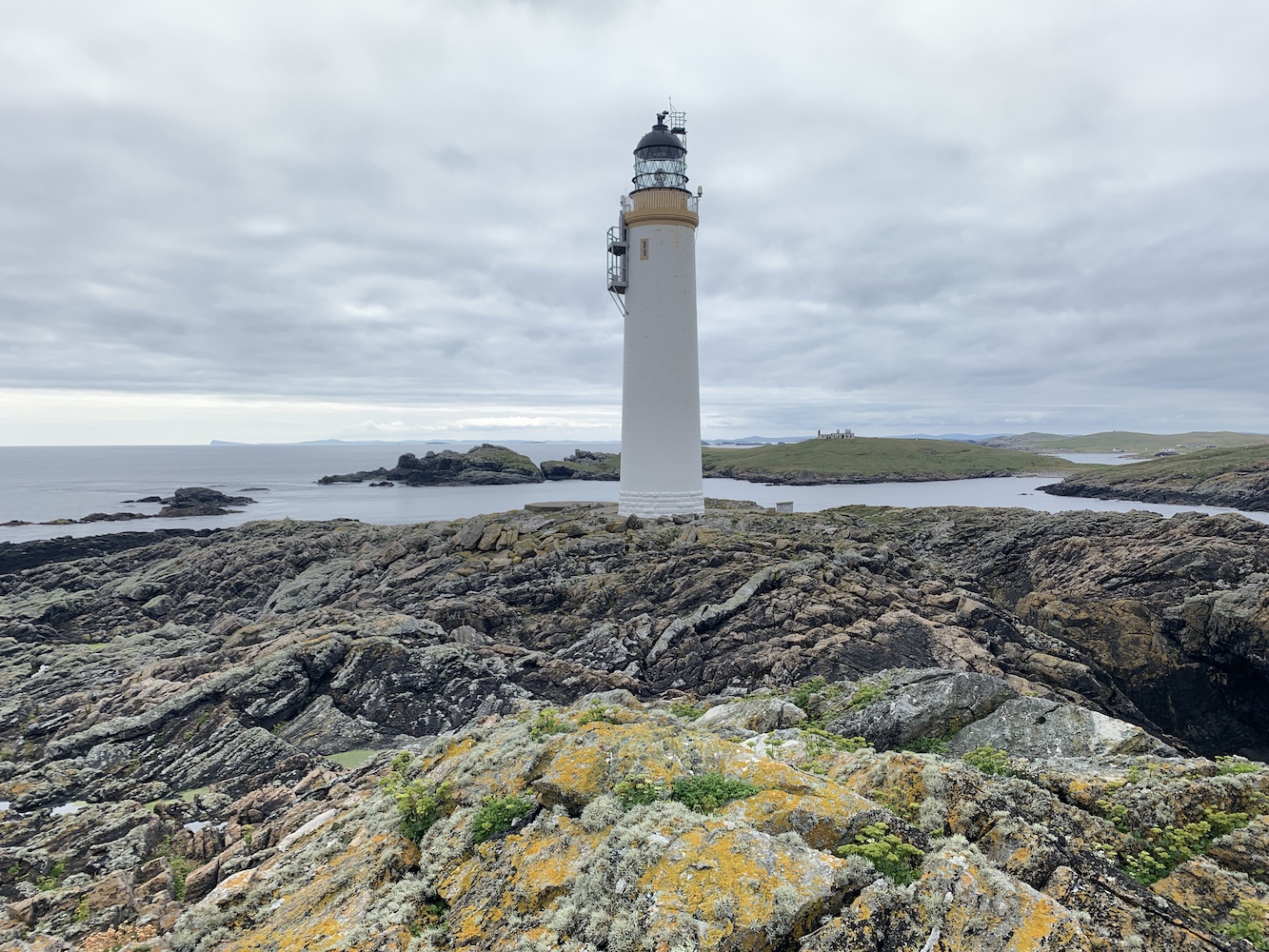
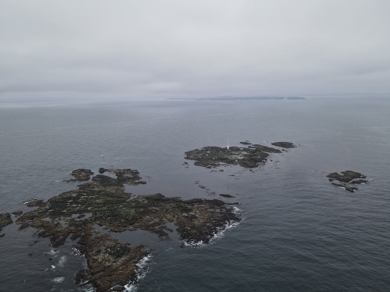
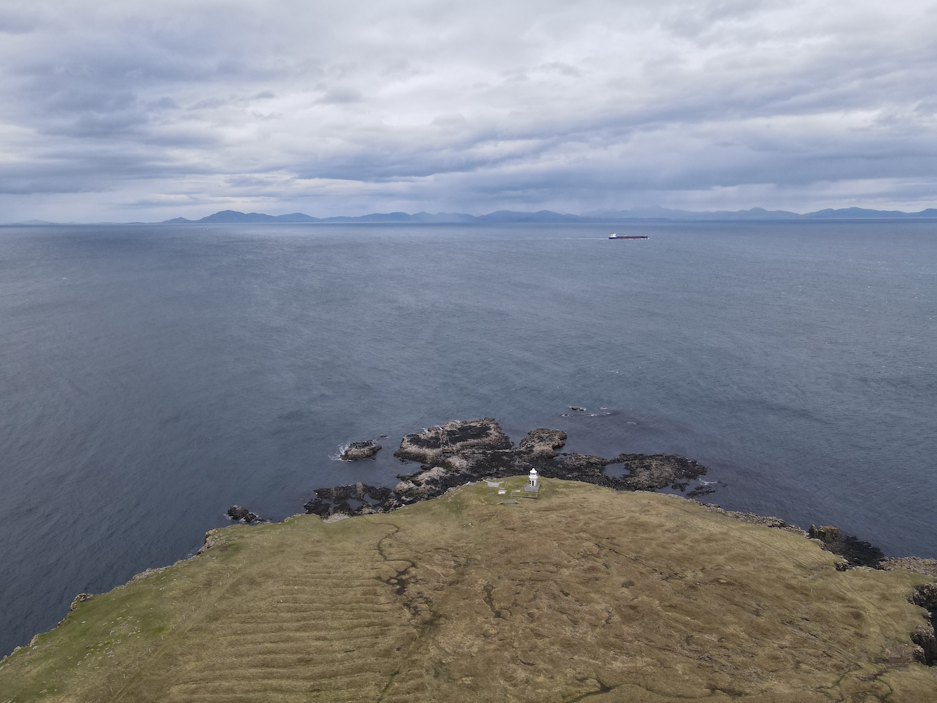
Once we were all back we set off to a few islands off of Papa Stour before we began to head north west towards a little collection of rocks called Ve Skerries. I’m not sure how well known Ve Skerries is in lighthouse circles. When you are as into lighthouses as I am you sort of lose any sense of what others do or don’t know. Anyway, for those who don’t know, Ve Skerries is a collection of very small islands/large rocks off the west coast of Mainland Shetland. They mark the most south westerly point of St Magnus Bay. On a clear day you can just make out the lighthouse in the distance from Eshaness. It is renowned for being a very dangerous area for ships with numerous wrecks occurring there. The most recent of which was the Corelleira in 2019 though thankfully there has been no loss of life there since the Ben Doran wrecked in 1930.
Ve Skerries
The sail out to Ve Skerries was actually not too bad at all and it was very encouraging to see hardly any swell around the islands. A fairly rare occurrence I think. I climbed into the tender with Bob and John and we set off to land on Ormal, the lighthouse island. We found somewhere to land and getting out of the boat was easy enough, but then the challenge began. Although the Ve Skerries are low-lying that doesn’t mean they are flat. The island is made up of tidal sections of rock and near enough all of these rocks seem to be jagged with no flat, horizontal edges. While some were covered in barnacles there was plenty of seaweed and slimy stuff about. Bob lent me his micro spikes which certainly made moving over the rocks much easier. It was a long section of rocks to cross though before we got to the helipad. Now whenever I think about Ve Skerries I remember those rocks and just have to laugh. It was quite an experience.
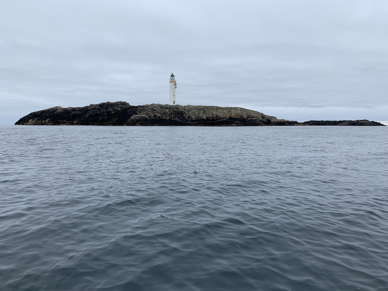
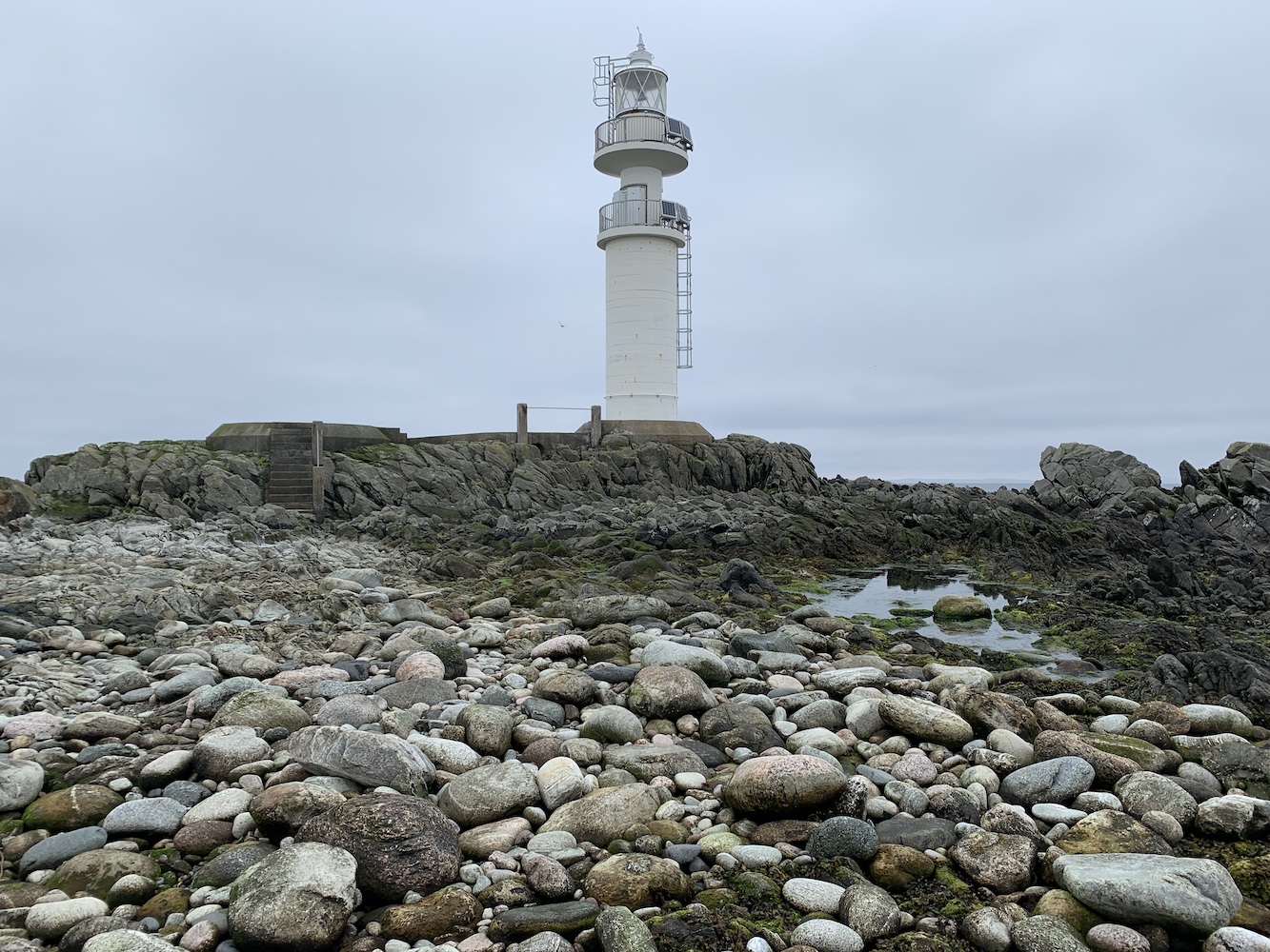
Ve Skerries Lighthouse
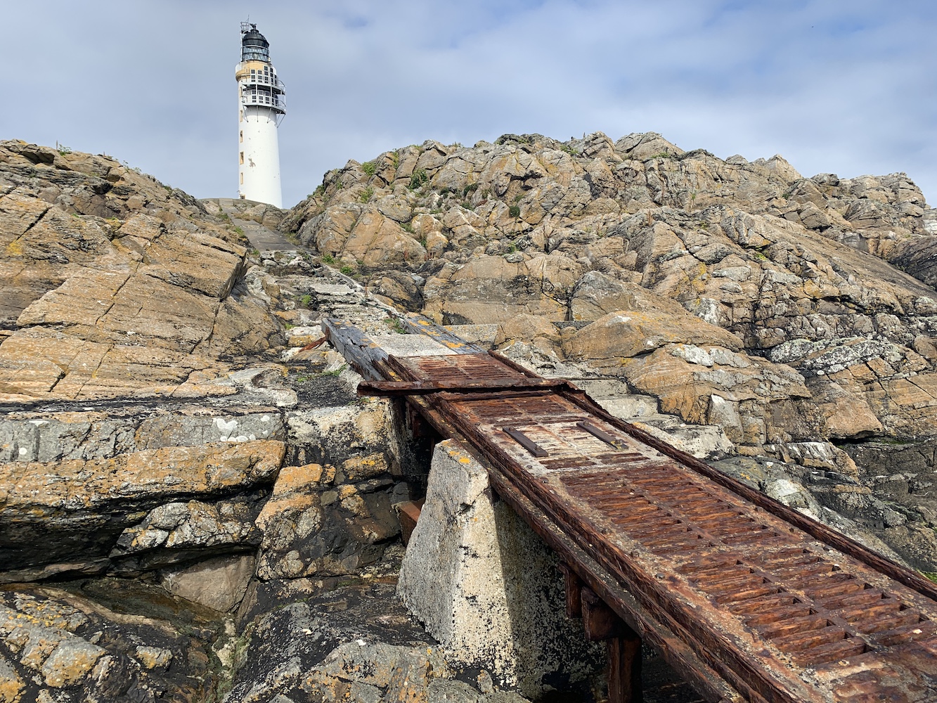
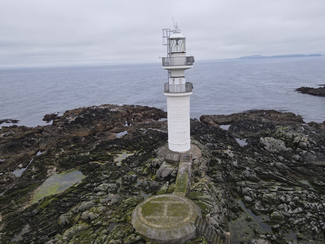
Relief set in when I finally got to the helipad which has a nice walkway across to the base of the lighthouse. There was a little stoney area down some steps from the helipad and John Anderson said it’s possible to find bits of ballast from the ships wrecked on the Skerries sometimes. I did have a look around, but couldn’t see anything.
Ve Skerries Lighthouse with a little of the stoney beach
Of course, we couldn’t have gone to Ve Skerries on a calm day without Joe the Drone coming along.
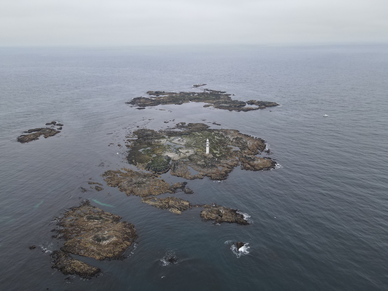
Ve Skerries Lighthouse and neighbouring islands
A Joe’s eye view of Ve Skerries Lighthouse
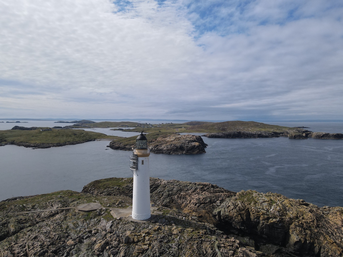
The lighthouse on Ve Skerries was first lit in 1979, built mainly to aid the large vessels moving around the area going to and from Sullom Voe. The wrecking of the Elinor Viking in December 1977 was also a deciding factor for the lighthouse which was already being spoken of at that point. After the lighthouse was built it received an award for its design and construction, and has very recently been granted listed status. It is a very unique structure, a real modern day rock lighthouse.
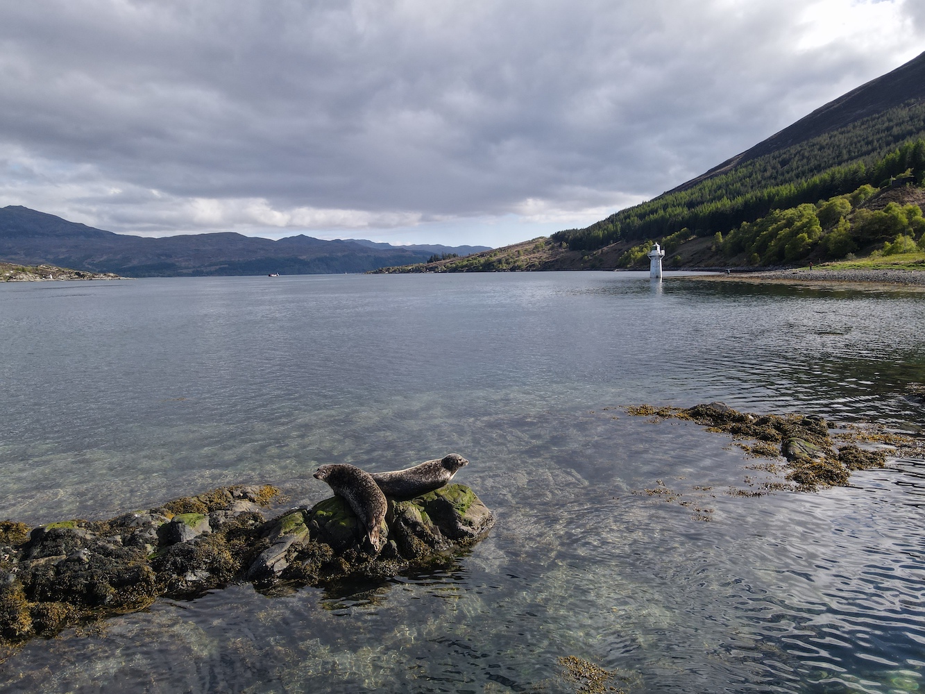
Getting back to the boat was slightly easier than the way we’d gone onto the island. However when I got towards the boat one of my feet slipped on some seaweed and my right foot ended up in the sea. Fortunately it was just my foot and I was able to get back into the boat safely before we had a quick stop in the very sheltered little harbour on North Isle, which was a great spot for watching the seals flopping on the rocks and swimming around.
Ve Skerries Lighthouse from North Skerry with plenty of seals keeping an eye on us
Reaching Ve Skerries Lighthouse felt like a great achievement. It is not frequently visited and probably for good reason.
Today was a great reminder to me of why I love doing this so much. That combination of straightforward, understated lighthouse trips and heading out into the wild extremes and creeping about over slippery rocks. Lighthouse bagging like this isn’t for everyone, but it certainly is for me – even if I do get a wet foot every now and then! 🙂
The wind had dropped for us in Shetland overnight and, although we knew it may be a while before the sea recovered from 48 hours of strong wind, we decided to head out on Lysander again today and see what we could achieve.
Today’s trip started off at Ulsta on Yell and the agenda featured a number of islands including Lunna Holm which I’d been keen to get to for a while.
A few islands were visited and we got a closer look at the light on Rumble too. The tide in the area made it a very rocky little detour.
The Rumble light
A little while later we arrived at Lunna Holm. There was still plenty of movement in the water, but it didn’t prevent us landing thankfully. It‘s a nice little island and we wandered up towards the high point and then cut across in the direction of the lighthouse.
The first sighting of Lunna Holm lighthouse after landing
The lighthouse on Lunna Holm dates back to 1985 and it was introduced to mark the south eastern approaches to Sullom Voe during the hours of darkness. The foundations were prepared in the first half of 1985 and by the end of that year the structure was complete and the light operational.
Lunna Holm in the sunshine
The lighthouse, which is still the original 1985 tower, and it’s surrounding fence look like they could do with some attention so I was pleased to find that, in June this year, the Northern Lighthouse Board put out a tender for full refurbishment of the lighthouse. This is due to include not only a refurb of the tower and concrete base, but also replacement of the lighting system and the fence that surrounds the structure.
Lunna Holm Lighthouse
One of the crew on board informed us that a former inter-island ferries, The Earls, ran aground on Lunna Holm back in the 1980s, which may well have occurred before the lighthouse was installed.
The island reminded me a lot of Cava in Scapa Flow, Orkney. The lighthouse is the same type, the island has a similar sort of layout (for want of a better word), and the grassy terrain was the same. I always see Shetland and Orkney as being completely different, but there are definitely some similarities in certain areas, which geographically makes sense due to their relatively close proximity.
Joe the Drone went for a spin while we were there too.
Lunna Holm from above
Lunna Holm with Lunna Ness beyond
It was just the single lighthouse for me today, but I was happy. After a couple of busy walking days I was more than willing to spend a day on the boat and I even managed to fit in a nap, lying on the comfy seat, while the others ticked off another 6 islands in one go.
Tomorrow has the potential to be a very exciting day and I cannot wait! 🙂
For the last couple of months we’d had a lovely long weekend away to the Western Isles planned, including being on a chartered boat out to Sula Sgeir and North Rona, which I’d previously visited back in 2014. We had accommodation organised, ferries booked and had got the green light from the organiser of the trip. All was well, but actually it wasn’t, which I realised the day before we were due to leave when my good pal John called to check which ferry we were booked on as the time I’d told him didn’t tie in with any of the sailings. It was then that I discovered somehow we’d managed to book the ferries the wrong way around and we were due to sail from Stornoway to Ullapool instead of the other direction on Friday. We made a hasty call to Calmac having checked all sailings to the Western Isles to find nothing was available. The man on the other end of the phone confirmed this was the case and apologised, to which I reminded him it was our fault for getting the booking wrong in the first place so he had no need to apologise. With no way to get across there (due to COVID-19 related restrictions we couldn’t even hop into a friend’s car as they had no space even for extra foot passengers), the decision was made that we needed a backup plan.
6 months pregnant at North Rona back in 2014. A revisit this time just wasn’t meant to be
I didn’t want to drive for hours as that’s an easy way to waste a weekend and so I began researching Orkney and, more specifically Westray for Noup Head Lighthouse. The ferry times didn’t tie in and, wanting to leave North Ronaldsay for another time, I took a look at Start Point Lighthouse on a tidal island off Sanday. The fact that the island is tidal has made it a really tricky one to get to and I’d previously resigned myself to the fact that we’d need to stay overnight on Sanday sometime to be able to do it. Thankfully, looking at the tide times for Sunday, I found low tide in the area to be at 1.50pm with the ferry arriving 10.25am and then departing at 5.40pm. It seemed to me like an ideal day to get to Start Point Lighthouse finally.
Luckily Bob agreed to my suggestion and suggested I contact a friend who lives on Sanday to see if he knew of anyone who had a key to the lighthouse and could show us around. I thought it was probably a bit of a long-shot especially given the current pandemic, but it was worth a try. The lighthouse used to be open routinely with guided tours run by the Sanday Ranger, but these tours no longer take place. It didn’t take long to get a response from our friend with a couple of people to contact. I called and left a message with the man suggested as the best place to start and he got back to me later that day (this was Friday so there wasn’t much time to organise it) and said I’d need to get permission from his manager, but that he’s be willing to show us up the tower if his boss said yes. Rather fortunately I had met his boss on a couple of occasions over the past two years and when I called him he said he was happy. So it was all planned and I was going to get inside a lighthouse for the first time in 17 months!
The (correct) ferries for Orkney and Sanday were booked and camping arranged in Kirkwall so on Saturday we set off. Upon arriving we took a drive up to Birsay for a look at Brough of Birsay and its lighthouse.
Brough of Birsay
Brough of Birsay Lighthouse
Joe the Drone took a fly around his first Orkney lighthouse there too.
A Joe the Drone’s eye view of Brough of Birsay
Sunday morning came and it was off to Sanday. Heading straight for Start Point, I contacted Ian to say we were on the island and he confirmed he was just heading over to the lighthouse. Reaching the end of the public road we found the three spaces in the parking area already full so we found a verge further back that wasn’t blocking any gates etc. and began the walk. The first bit was easy, following a good path along the coast.
On the way to Start Point with the lighthouse in sight
The section between the main island and Start Point is rather deceptive. Initially you see a seaweed-covered track leading towards the tidal bit and think ‘oh, that looks fine to cross’. It’s not until you get beyond it that you encounter the very tidal section, which was still very wet when we arrived. At this point it was 2.5 hours before low tide and, as Bob escorted me across the seaweed and very wet bits like I was an old lady, we both ended up with wet feet. We made it to the other side though with no mishaps and then the path was easy going as the lighthouse got closer and closer.
Looking back across the tidal section about 2.5 hours before low tide
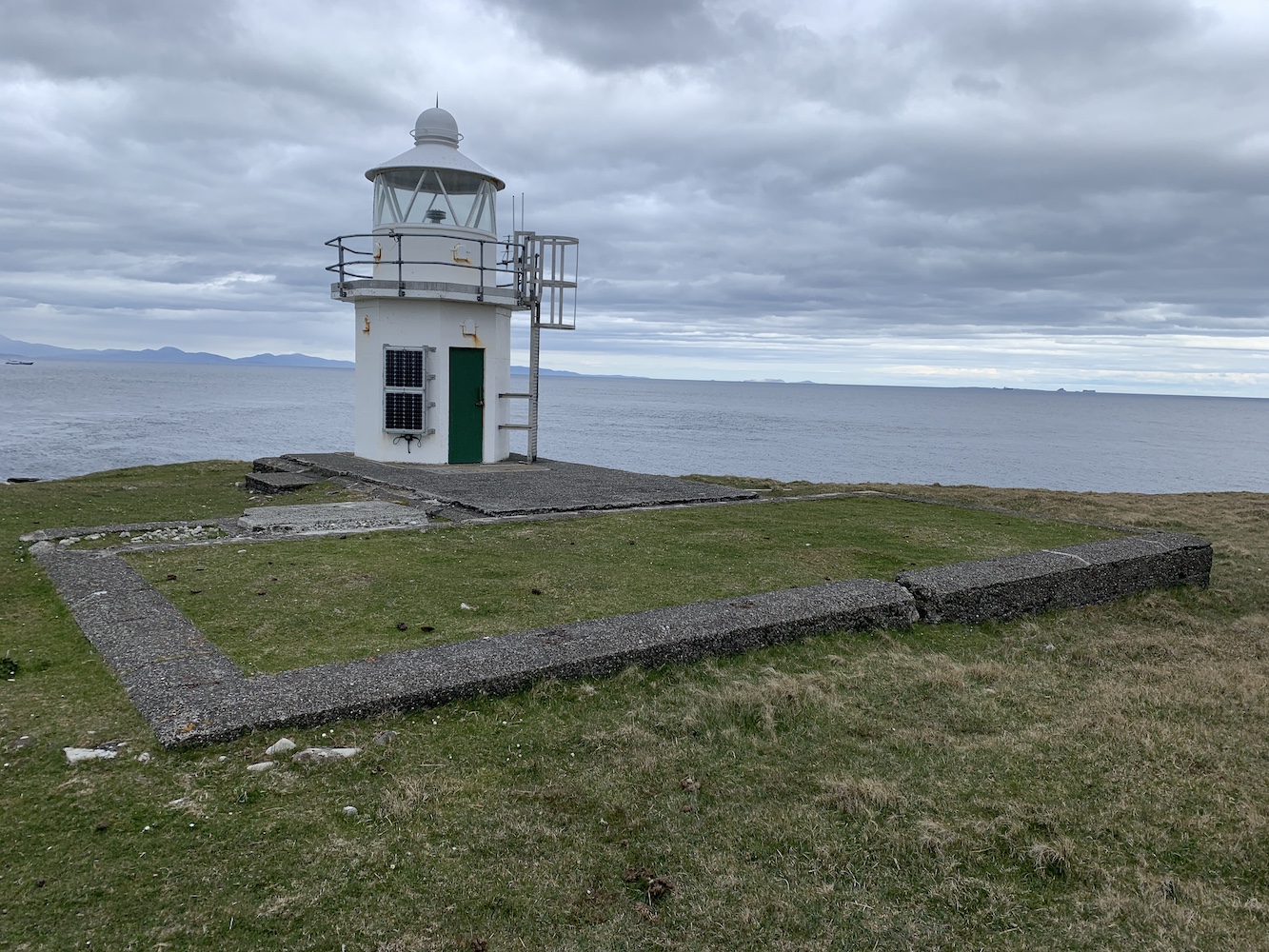
As we approached the lighthouse Ian, our tour guide appeared, and after a short chat we were off into the tower. Ian was wearing wellies, which is something I would highly recommend to anyone considering visiting Start Point – not for the tower of course, but for the crossing.
The unmistakable Start Point Lighthouse
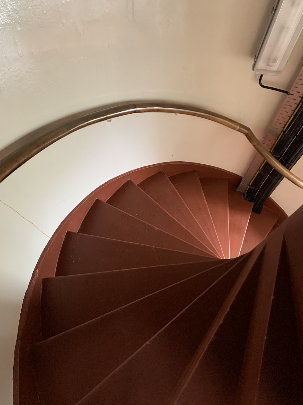
Now climbing a lighthouse can cause some breathlessness anyway, but climbing with a face mask on makes it a lot harder. It wasn’t so bad though and I was just glad it wasn’t North Ronaldsay (the tallest land-based tower in Britain) we were going up.
The staircase inside Start Point Lighthouse
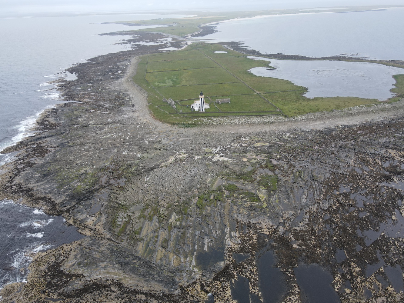
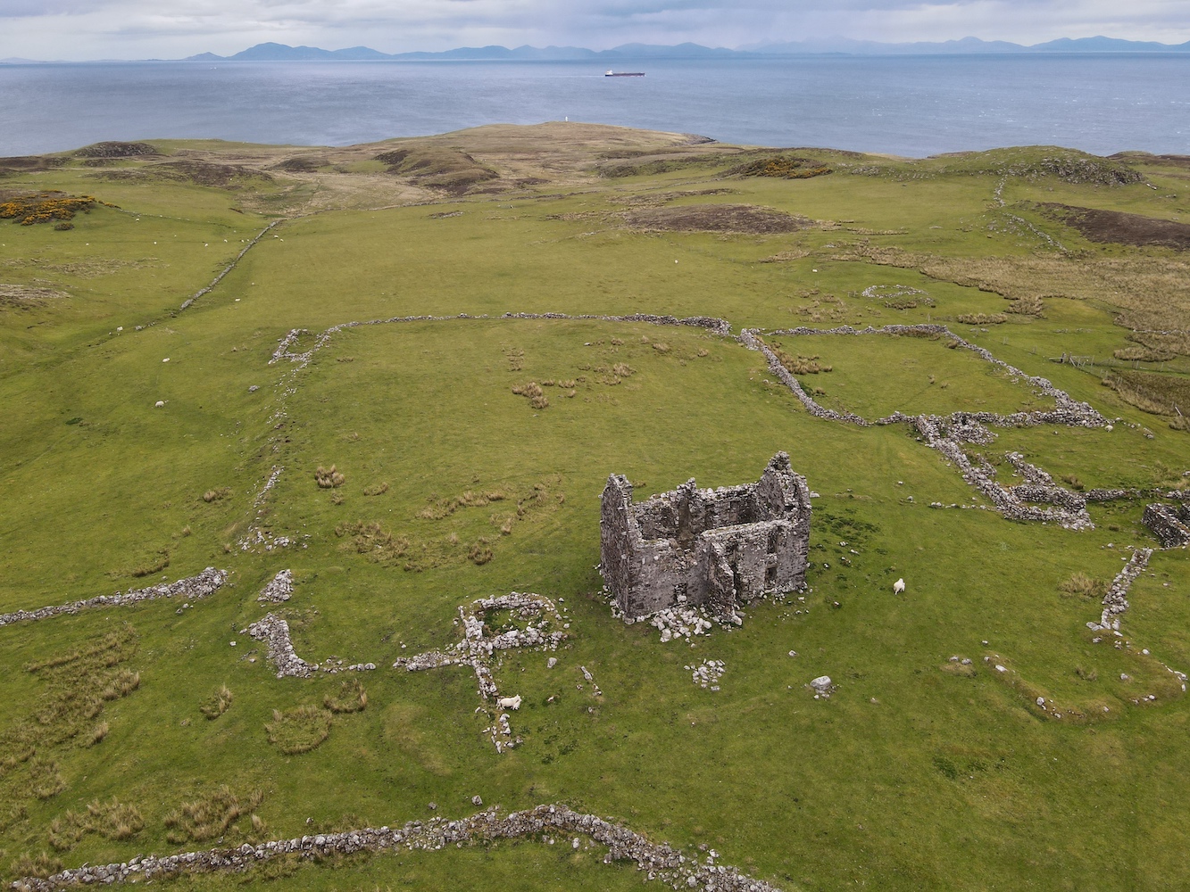
After the spiral staircase there were the obligatory ladders to climb and then, there we were, right at the top with some stunning views in all directions. Looking back towards Sanday, out towards the sea, down on the old ruined buildings, there was plenty to see and Ian pointed out roughly where the previous lighthouse used to be.
Based on maps we later saw at Sanday Heritage Museum, the former lighthouse would have been in the top right hand corner of the square field, next to the old buildings
Start Point had confused me for some time. On the Northern Lighthouse Board’s website the tower/light is dated 1806, but other sources said the current tower replaced the 1806 tower in 1870. I thought there was no better way to find out the truth than to look and ask around locally. Ian confirmed the current tower is the second with the first one introduced as a day mark in 1802. When wrecks continued to occur in the area it was decided a light was required and so a lantern and light replaced the stone ball on top of the tower (the ball can now be found on top of the old North Ronaldsay lighthouse). It was the first lighthouse in Scotland to have revolving lighthouse apparatus, paving the way for the light characteristics used in all lighthouses today and listed in the Admiralty List of Lights.
Ian opened up the wonderful fourth order Fresnel lens to show us the bulbs and explained that, for a while, there had been the risk of the lens being removed from the tower and replaced with a modern LED. It now sounds like this is not going to be the case, which is always a pleasure to hear.
Start Point Lighthouse lens
Inside the lens
Back down on the next floor Ian opened up the door to the balcony and we were blessed with even better views of the surrounding area. The tide at Start Point is really interesting. There is roughly 45 minutes in time difference between high and low tide on either side of the tidal section getting out to Start Point. Ian explained just how unpredictable the tides can be there and that he limits his visits to 2 hours maximum in order to make sure he can get back across to Sanday safely.
The view from the top of the lighthouse. Ian pointed out how the rocks almost look to be shaped like waves in places.
With Ian at the top of Start Point lighthouse
Back down the bottom of the tower I gave Ian a copy of my book as a little thank you gift. I think it’s safe to assume that anyone who signs up to be a Retained Lighthouse Keeper must have an interest in lighthouses. We bade farewell to Ian and set off to explore some of the ruined buildings in the area as well as getting some awesome views of the very unique striped lighthouse.
Start Point Lighthouse and part of the old mill buildings nearby
Start Point Lighthouse from the east
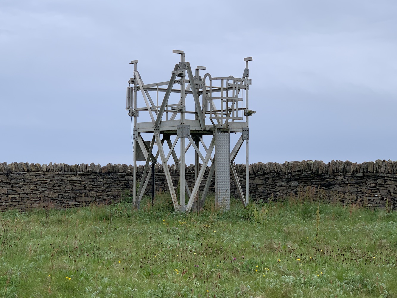
In the grounds of the lighthouse was a framework platform the type of which I’d seen at Ushenish last year. Since that visit I’ve been informed that it was a wind power trial the Northern Lighthouse Board has carried out, but (as at Ushenish) it had failed as it was blown to pieces within the first couple of weeks.
The platform used to test wind power generation at Start Point
Stopping for lunch it was time for Joe the Drone to have another flight and, as usual, he caught some fantastic shots from the sky.
Start Point Lighthouse from above with Sanday in the background
Joe’s view of Start Point
Once Joe was safely back down it was time to head back. It was still 50 minutes before low tide, but the tidal section was significantly less wet than it had been on our outward journey. I wouldn’t go so far as to say dry as I imagine with all the rocks and seaweed it never really completely dries out.
We paid a visit to Sanday Heritage Centre on the way back and the lady handed us their reference book about the lighthouse, which had some great little pieces in it and further confirmed the history of the lighthouse(s) mentioned above. There was a large poster on display about the lighthouse, showing an old map with the location of the former lighthouse, which having been there, we were able to picture how it would have looked out there.
That evening, leaving Sanday behind, I was satisfied in the knowledge that sometimes things happen for a reason. If the reason for the incorrect Western Isles ferry booking was that I really should go to Start Point instead then I’m certainly not complaining 🙂
As I mentioned in Friday’s post, I had just two lighthouses on Skye left to visit before this weekend. With Dunvegan Lighthouse bagged that just left one more: Waternish Point.
With rain forecast for this afternoon – and the need to get home today – a fairly early start was required. After the kayaking and then the added extras from yesterday it was a balance between setting off at a decent time and getting enough sleep.
It was nice and dry when we set off and quite some time later we arrived in Trumpan (I’ve said it before, Skye is big). Spotting the starting point for the walk as we drove past we then parked up opposite the old church. This church was the scene of a particularly nasty episode in the long-running battles between the MacLeods of Skye and the MacDonalds of Uist. In revenge for an equally sinister event on the island of Eigg, the MacDonalds made their way to Trumpan and burned the church while it was full of local worshippers. The churchyard surrounding the ruins contains a number of graves, including some quite recent ones.
The remains of Trumpan church
There’s also a Dark Skies area next to the car park and I can imagine it gets very interesting there at night with the lack of light in almost every direction.
Once we were ready we set off along the road and through the gate. We were very much aware that cows could play a part in the day’s adventure, which is always enough to put Bob on edge certainly. He adopted the role of ‘cow lookout’ and went on ahead a little way, scanning the track and surrounding area. We reached a little mound featuring a cairn and Bob headed on up and ushered me up once he’s got to the top. He’d spotted the cows which had young with them and a couple had stood up when they spotted Bob. They weren’t far at all from the track so a bit of off-piste was required just to be sure we didn’t spook them.
The cairn from which Bob spotted the cows (not shown in this picture)
We headed for the coast across the heather and after a very short time encountered a gaping chasm (Bob called it a gully, but it was definitely a chasm). ‘Follow the sheep track’ Bob advised me as we started to scramble down into the chasm. My response was ‘But I’m not a sheep.’ Sheep manage to balance their way about on all sorts of skinny ledges – which isn’t so easy for me as a human. ‘Follow the staircase’ was another one of his comments and I didn’t even dignify that one with an answer.
This picture doesn’t show very well just how gaping the chasm really was!
We made it safely and slowly to the bottom of the chasm and, of course, then there was a burn to cross. I am rubbish at crossing rivers or streams, but thankfully this time I managed not to get wet. Then it was up the other side, which actually was much easier. More sheep must have been up that side of the chasm prior to my visit.
From here we followed the coast for a while to make sure we were out of sight of the cows. I’m usually always on the look out for silver linings when things don’t quite go to plan. I certainly wasn’t while in the chasm (although it did look nice), but once we were back on the well-trodden sheep track along the coast there were some spectacular views both to the west and onwards in our direction of travel to the north.
The view to the north with the hills of Harris in the distance
We ended up following the coast for far longer than I expected and our 1km off-piste detour came to an end as we joined the track again at a nice little bridge. From here it was just trudging on, passing sheep and their lambs occasionally.
The bridge where we rejoined the track
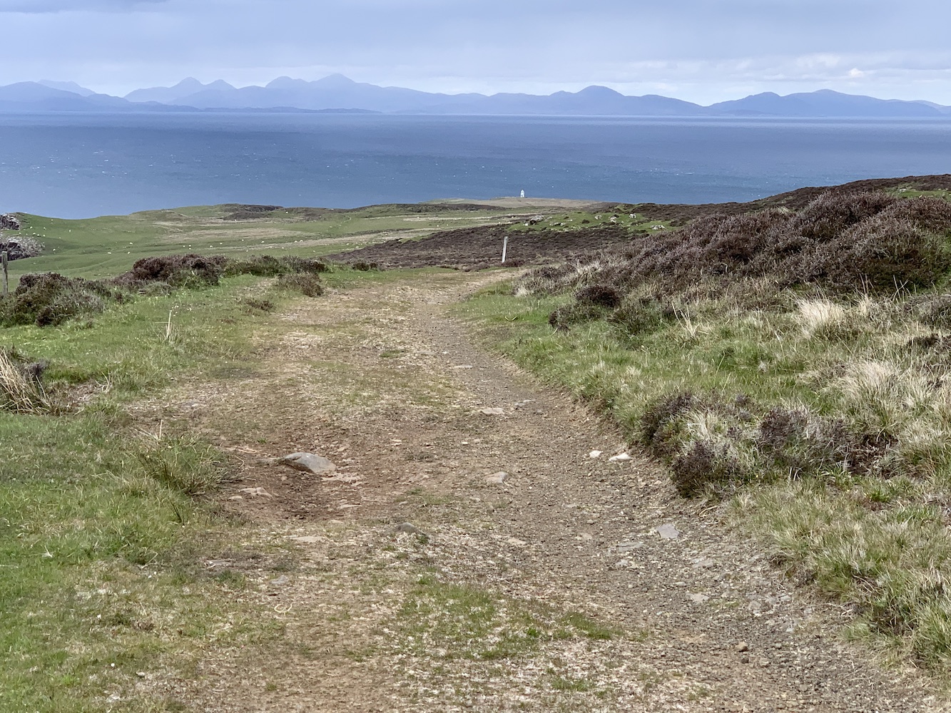
Eventually I got my first glimpse of our destination, Waternish Point Lighthouse. It did look about 500 miles away (I exaggerate), but it was a positive sign. We passed a couple of chaps who were just on their way back from the lighthouse and chatted to them for a few minutes before continuing on our way.
My very first glimpse of Waternish Point Lighthouse
Reaching the end of the track we encountered the remains of walls and most notably the ruins of a house, which Joe had a fly over.
The remains of the old house at Unish
From here it was all downhill to the lighthouse and the lower you got the boggier it became, but thankfully the ground wasn’t too wet today. The lighthouse gradually got closer and then finally I was there at my final lighthouse on Skye!
Waternish Point Lighthouse
What can I say about Waternish? Immediately you notice the stunning views across to the Outer Hebrides with the incredible hills of Harris on display and then a flurry of islands (I’m not sure at all that’s the correct name for a group of islands, but we’ll go with it) including the Shiants and the interestingly shaped and very appropriately named Lord Macdonald’s Table. Sadly the Uists had disappeared into the distance by then, but there was plenty to keep you occupied. Apparently it’s a great place for spotting whales and dolphins, but we didn’t see any of them, but we did see a Calmac ferry passing en route to Uig and the men we met on the way there had seen a submarine come up above the surface. Who needs whales and dolphins, eh!?
Waternish Point Lighthouse with the Shiants and other islands visible to its left
Onto the lighthouse. The current structure was built in 1980 and like just a few others has more than one door – presumably this is so you can access the inside of the tower safely without the door flying off in the wind and you would use the appropriate door based on the wind direction. This tower replaced the 1924 tower, designed by David and Charles Stevenson. It’s clear when you are there that there must originally have been a fair number of buildings on the site and now all that remains of them are the foundations. I really like the current tower as it is. There are very few like it left standing now so it’s always a pleasure to see one.
Waternish Point Lighthouse and the Harris hills beyond
Of course Joe the Drone had to have another little fly around.
Waternish Point from above
A fabulous view of the Waternish (or Vaternish) peninsula
Just before we left I decided, for no apparent reason, to give the lighthouse a ‘high five’. Even as I was doing it I said ‘Can you give a lighthouse a high five?’ Anyway, I did. I even added a bonus ‘on the side’ high five! Then it was time to head back. The slog back up to the ruined house was tough. The energy from my lunch hadn’t quite kicked in at that point so I was slow and tired, and incredibly glad to get to the track when we eventually did. On the way we spotted a white-tailed eagle soaring around and being chased off by a smaller bird, who we imagined was defending its nest. There were also the remains of a small sheep and tiny lamb in the area, further evidence that we were on eagle hunting ground.
Back on the track we retraced our steps, with the wind and rain in our faces, we got to the bridge and left the track again. The cows were in roughly the same place as before, but had moved even closer to the track and so we strolled on quickly while we were in sight of them. The gaping chasm wasn’t quite so gaping on the way back (still a chasm though – and wet this time too). I had expected us to head for the track again once we were past the cows, but Bob thought we should continue to follow the coastal route. Imagining even more gaping chasms opening up in front of me, I reluctantly followed. I’m actually very glad we did as there were even more wonderful views to behold in the final section. We followed the coast as far as we could before heading slightly inland and following a fence line which took us directly to the gate. Just a bit more track to go, one more gate and then we were back at the car.
The view to the south west
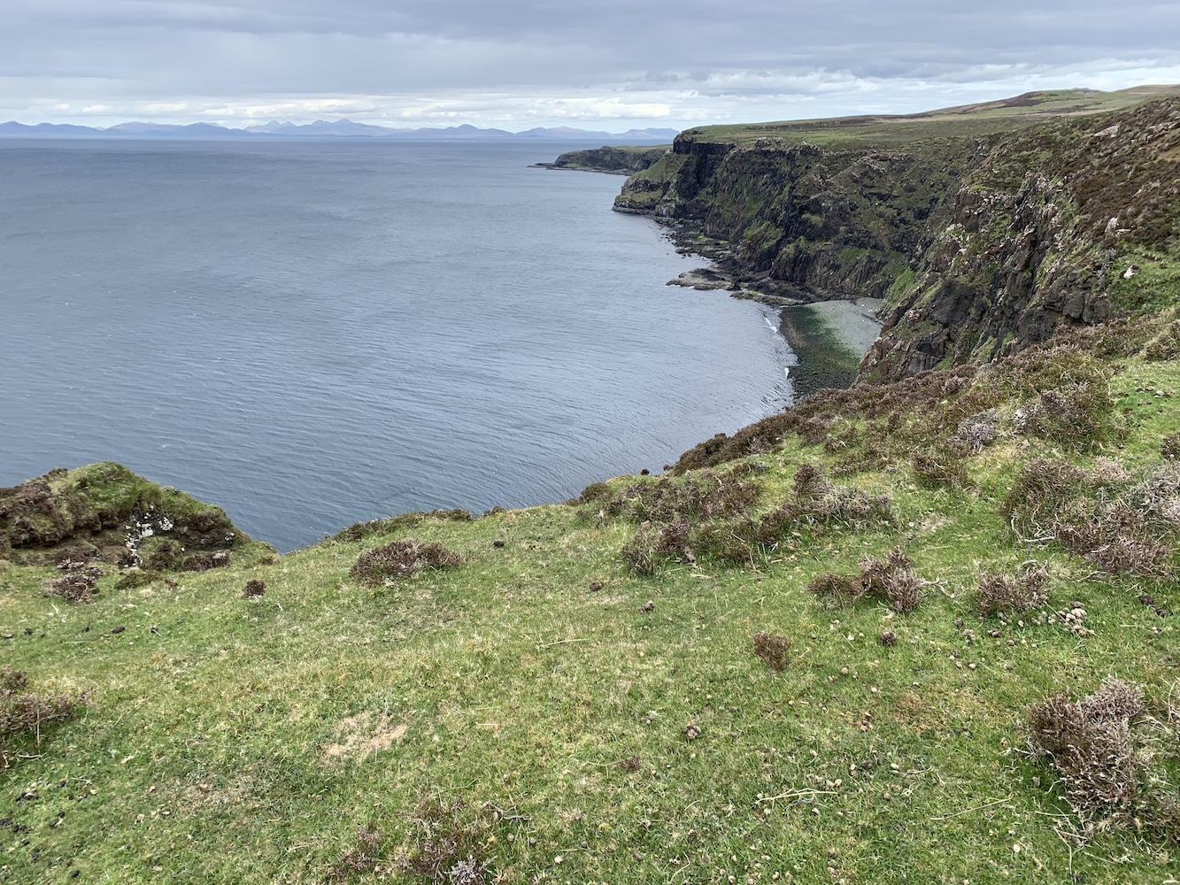
A great combination of towering cliffs and low lying land
It had been quite a walk and I’d struggled a bit at times, mainly I think because of tiredness from the weekend’s adventures. It was so worth doing though and I would definitely recommend doing that coastal route to anyone visiting. It really is superb for impressive panoramic views. Just mind the gaping chasm! 🙂
In 2015 – almost exactly 6 years ago, in fact – we took a tour with Calum’s Seal Tours from Plockton for a closer look at Eilean a’Chait Lighthouse. Having done that trip it was one I thought I’d never manage to get a closer look at…
Fast forward to the week just gone when Bob said to me ‘Do you fancy going to Eilean a’Chait and landing?’ to which I obviously responded ‘Of course’. It was a few minutes later that he announced we’d be going by kayak. There have been a few occasions when Bob has made announcements like this and a wave of dread has swept over me. The first time it was skiing (which I didn’t enjoy so much), the second time was going up in a tiny helicopter to fly over Mew Island (which I thought was great fun in the end, Bob thought otherwise, especially when I took control of the steering!), and the last time was a skid control driving course, which was frightening. Nevertheless, each time I did them and accepted that I was being forced out of my comfort zone. This time I knew would be no different and I just had to get on with it.
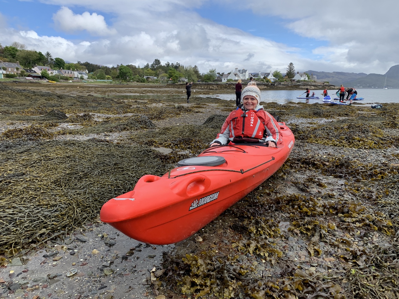
We arrived in Plockton this morning ready to meet Willie from Sea to Skye and our fellow novice kayakers for an introduction to kayaking course. Bob had hired a double kayak for us and made Willie aware that our key priority was to get out to and landed on Eilean a’Chait.
One of many things I’ve learned from today is that kayaking takes preparation time. You don’t just turn up, jump into the kayak and go so there was plenty of time for me to stand around thinking ‘Can we just get this over with?’ After some really handy advice on how to get into the kayak, paddling techniques, and what to do if you capsize (terrifying!) we were ready to go and off we set.
Trying out the kayak
We spent a while in the harbour at Plockton just having a try before Bob and I were sent off with a couple of the guides to head straight for the lighthouse. It was actually really quite relaxing, apart from the occasions when Bob decided to paddle like there was no tomorrow and any attempt I made to paddle along was lost in the midst of his frantic oar-use.
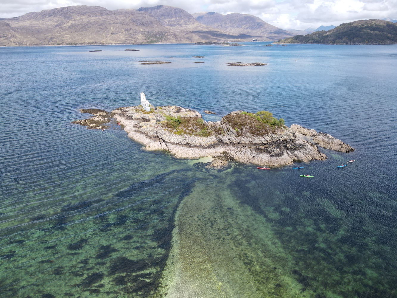
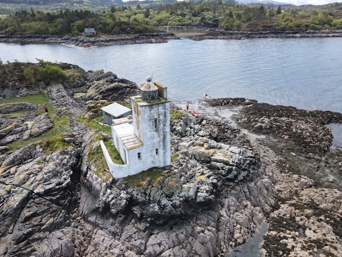
After a while the lighthouse came into view as we neared the neighbouring island of Eilean-an-Duine, which is where the house for the former keepers’ family is located. The house can still be seen today and at low tide it is possible to wade between the two islands. This time we were aiming straight for the lighthouse though and we found a nice little seaweed pool to stop alongside the rocks and haul ourselves out of the kayak. It was a bit of a scramble to get up to the grass at the top of the island and there is actually very little grass there, but the barnacles on the rocks were great for grip even if they were a little rough on the skin.
Approaching Eilean a’chait Lighthouse
Eilean a’Chait Lighthouse, or Plockton Lighthouse as some call it, is looking a little worse for wear. It’s now privately owned and there is some evidence that work has been done here to renovate it, but maybe that the work has come to a bit of a standstill. I am told that it was open as a holiday let some years ago.
A closer view of the Eilean a’Chait lantern
The lighthouse actually had quite a short-lived period as an active aid to navigation. It was built around 1880, 10 years after the train connection between Dingwall and Stromeferry was introduced. From Stromeferry people could catch a steamer from the pier over to Skye and this light was deemed necessarily for the steamers to navigate the surrounding waters safely. There are varying accounts of when the light was deactivated, with one source citing 1904 and another the 1920s. Either way its discontinuation ties in with the further extension of the railway to Kyle of Lochalsh, which provided a much shorter ferry route to Skye.
Eilean a’Chait Lighthouse
The two of us explored the island for a while as our fellow kayakers glided across the calm sea surrounding it. It’s a really interesting island and was also great to see it from above with some Joe the Drone images, including one which clearly shows the shallow the sandbank between Eilean a’Chait and Eilean-an-Duine.
The sandbank leading from Eilean a’Chait to Eilean-an-Duine is visible here
Another angle from Joe the Drone
After a while I made my way back to the kayak while Bob quickly bagged the island high point. Once we were safely back in the kayak we set off to meet the others for lunch on a beach to the west. It was a good opportunity to have a chat with Willie, the other guides and others in the group. Willie explained that when he’d heard that a lighthouse bagger was coming along he thought I must be mad, but he actually admitted that having talked about lighthouses for a while he could understand the appeal.
Continuing further west it was getting quite choppy on the water and paddling was getting much harder. Turning back we were told to aim for the lighthouse, which was just fine with me. Bob and I returned to shore with Chris the guide while the others continued on for a bit longer. Frankly I was pretty tired by that point and felt the need to stretch my legs. It was an excellent adventure and I was nicely surprised that I felt very safe out in the kayak and that getting into and out of it during the day was actually not as challenging as I’d expected. Kayaking would certainly be something I’d be up for doing again – so well done to Willie and his team (and to Bob of course) for making it such an enjoyable day out.
This picture shows Eilean a’Chait in the foreground with the other islands we kayaked around today beyond
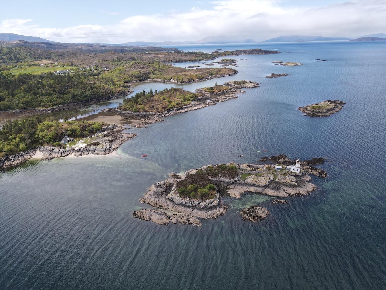
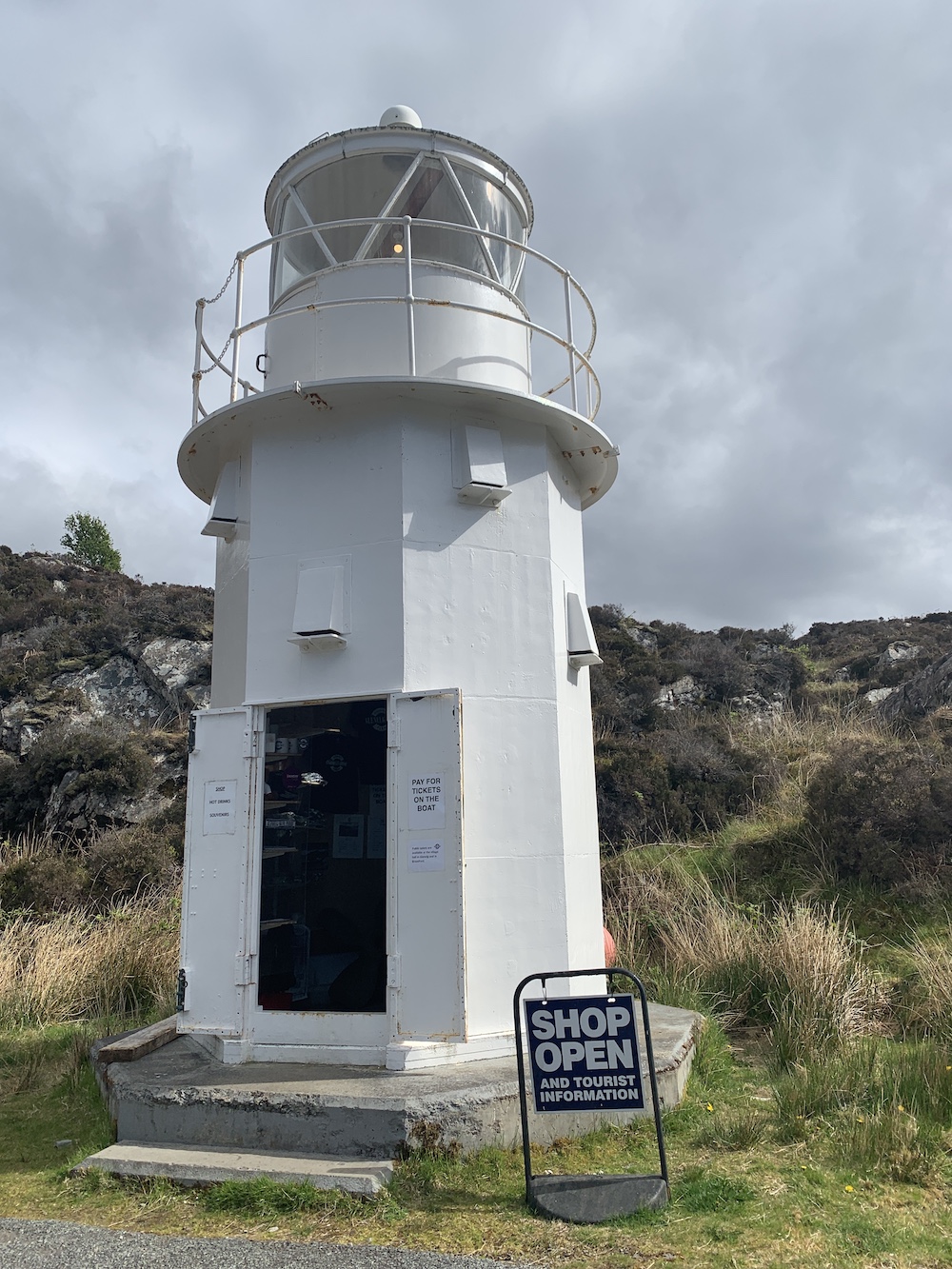
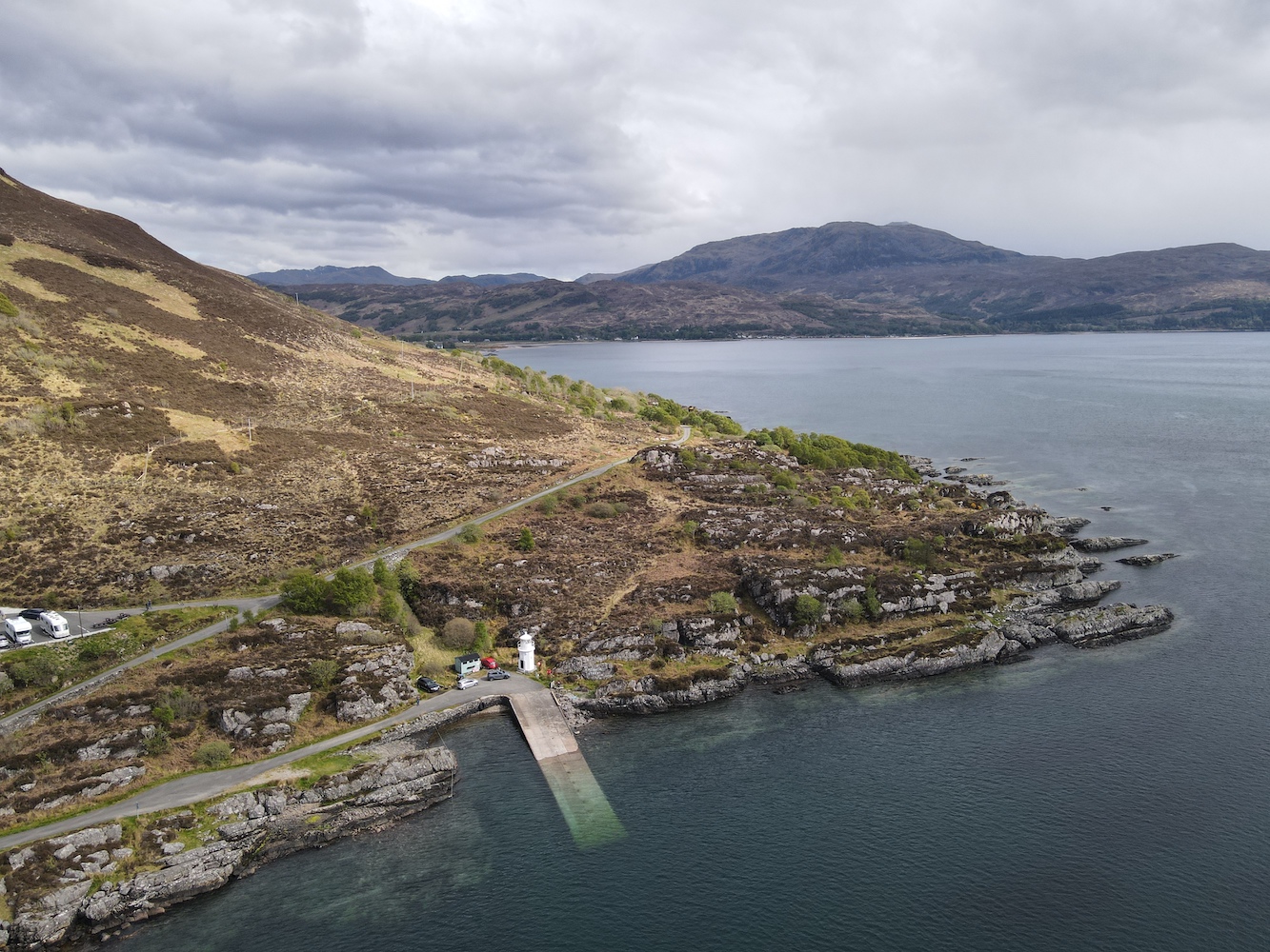
By the time we were back in the car and heading off I was pretty worn out, but there was still work to be done. We’d decided to use the afternoon to catch the turntable ferry from Glenelg to Kylerhea and then see if we could touch the little Kylerhea Lighthouse. We were looking forward to a cup of tea in the old Sandaig Islands Lighthouse, now positioned just at the top of the ferry slipway, but sadly the flasks were no longer there and it looks like a tea room has opened nearby instead.
The old Sandaig Islands Lighthouse – with it’s light on!
While we waited for the ferry Joe the Drone took another spin.
The Glenelg turntable ferry slipway and the old Sandaig Islands Lighthouse
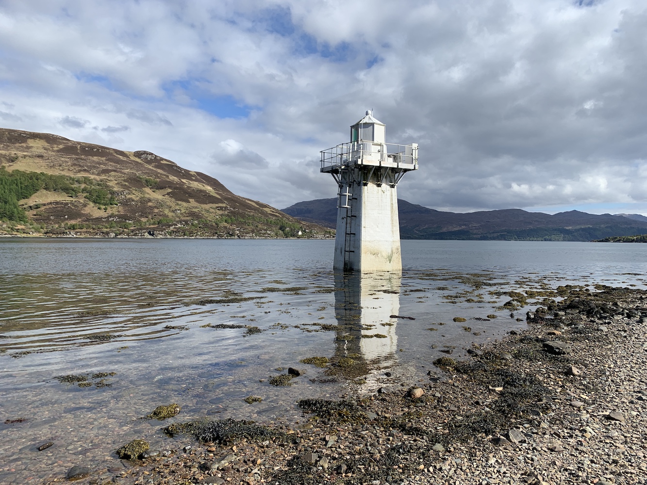
Once in Kylerhea we headed for the car park for the bird/nature hide, which is a good (or probably the only) starting point for walking to the lighthouse. Last time we visited part of the path down to the shore had been washed away so we weren’t able to get so close. This time though we followed the little track down to the pebbly beach. It was only an hour after high tide so I couldn’t touch the lighthouse, but it was nice to see it much closer than before anyway.
Kyle Rhea Lighthouse
If I’d been willing to wait another hour I might have been able to touch Kyle Rhea Lighthouse
It was also another outing for Joe too.
Some very relaxed seals were quite happy on a rock near Kyle Rhea Lighthouse
A bird’s eye view of Kyle Rhea Lighthouse
Kyle Rhea Lighthouse seen from the south
It would have been rude not to have given Joe the chance to clap eyes on the beauty that is Ornsay lighthouse when we are staying so close to it, so we made one final stop on the way back.
It’s not possible to photograph Ornsay Lighthouse from a bad angle. I think the shape of the island is like a crocodile!
Ornsay Lighthouse with the wonderful mountainous backdrop
It’s been a thoroughly exhausting day, but also great fun. Don’t tell Bob, but I’m quite glad he organised the trip. 🙂
A few years ago Skye became the place to be on my birthday, but it’s now been a while since I spent any length of time there – and birthdays were taken up with other trips like 2019’s Sule Skerry extravaganza!
This meant I still had a couple of lighthouses left unvisited on Skye. A long-awaited return was in order and there was no way I was going to turn down a weekend there.
Today was the day to set off. Nana was in position to take over child management at home (thanks Nana!). There was the usual packing at the last minute, throwing stuff into the car and then saying ‘have we got everything?’ This is especially the case at the moment after not being away much at all over the past year.
The journey felt long today, but we finally made it to Skye. That’s always only part of the journey though. I always forget just how big the island is and sometime later we were still in the car heading towards Dunvegan.
I’d found a walk report on the Walkhighlands website that took in Dunvegan Lighthouse at Uiginish Point, just to the north west of Dunvegan. This was really handy as, although we had Bob’s GPS device with us, it told us a particular gate we needed to go through (climb over) to be on the right side of the fence for the lighthouse.
The view from the starting point, across the loch to Dunvegan Castle
Parking up just before Uiginish Farmhouse, we wrapped up warm as the northerly breeze was fairly strong and chilly. We set off through the farm, passing Uiginish Lodge, which is painted incredibly bright white. There’s a nice track along here and, while we were on the lookout for cattle making an appearance, we only encountered sheep.
The first part of the walk follows the track
The Walkhighlands report advised that when you reach two gates you should go through the one on the left. This was great advice as the lighthouse is one of those you can’t see until you are near enough at it, so being on the right side of the fence when it’s easy enough to do so is always helpful.
The point at which you leave the track and choose the gate on the left
Bob, as usual, took the high route with the excuse that he was looking out to see if there were any cattle about. I wandered along a much less resistant route and enjoyed the views to the west across to a little bay with some stunning cliffs beyond.
The beautiful view to the west
The lighthouse soon came into sight and we battled into the breeze to get to it. It is one of the flat-pack kind and, boy, was the wind whistling through it today! When you see it on a map it looks like it could be a nice sheltered spot nestled there in Loch Dunvegan, but don’t be fooled, especially when the wind is coming from the north. It was great to look across and see the entrance to Loch Dunvegan and The Minch beyond. To the east there are good views across to Dunvegan Castle. It’s a superb spot for panoramic views.
The first glimpse of Dunvegan Lighthouse
Made it to Dunvegan Lighthouse
There’s some quite dramatic scenery in the area
Dunvegan Lighthouse looking out towards the entrance to Loch Dunvegan
There’s not a lot of information out there about Dunvegan Lighthouse. A Google search brings up lots of links to, relatively, nearby Neist Point and a search for Uiginish Point instead doesn’t fare much better. It is clear that the lighthouse is used to help guide vessels safely out of the Minch and into Loch Dunvegan. It is also used by vessels negotiating the route between Uiginish Point itself and the nearby island of Gairbh Eilean. My research has shown that in the 1890s steamers bound for the Western Isles stopped off in Dunvegan and this continued until the 1950s, which would explain why a Northern Lighthouse Board light would be required in this area. The lighthouses installed by the NLB were generally those that provided some sort of national importance, such as ferry and general shipping routes, while the lighting of harbours for local fishing, for example, fell to the local harbour authorities.
The view from the top of the lump behind the lighthouse
The walk back from the lighthouse was rather more pleasant without the wind in our faces and there ended a rather nice little wander and a great new bag for me.
I write this post after thinking over it for a few days, I can honestly say that the thing I miss most, aside from seeing family and close friends, at these times are the times I spent out on chartered boats, setting off for the relatively unexplored islands around the UK, particularly those in Scotland. These “bagging” years, as I call them, ran from around mid-2014 to mid-2019, although this post will only cover up until Summer 2018 for reasons that will be made clear in the next and final post. I have thought about those times a lot over the past year and not only because I’ve not been able to do them as I used to, but because I don’t imagine they will feature in my life in the same way going forward.
This is a fairly long post this time as there is a lot to say. I did consider splitting it over two, but I didn’t want readers to lose the essence of it in the transition between posts. I have included pictures from the bagging years throughout to make it slightly easier on the eye.
The beautiful Barra Head lighthouse
To clarify what the bagging years were here is a bit of background. As explained in my previous post, I’d met and married Bob. For those who don’t know Bob, two of his favourite pastimes are hill-bagging (reaching the summit of hills – mostly in the UK now, but he has also completed 6 of the 7 summits – or 6.9 as he says after his Everest attempt in 2013) and island-bagging (reaching the high point of an island). Both of these are guided by lists. Of course I like lists too, more specifically lighthouse lists. Bob was, back in 2014, a member of a group of like-minded people called the Relative Hills of Britain (now the Relative Hills Society) with islands naturally falling under that as they also contain hills, although members are also interested in various Ordnance Survey-related points such as trig pillars and benchmarks. Members of RHB organised group trips to islands not covered by schedule or routine ferries and boats. With Bob going off on these adventures it was only a matter of time before I was invited along too.
One of my favourite non-lighthouse islands, Scarp just off the west coast of Lewis. What remains of the old schoolhouse on the island can be seen here.
The term “bagging” and the idea of ticking things like islands off a list seems to divide opinion. Those against its use see it as simply a ticking exercise with no time spent enjoying or experiencing these places. There are three reasons I fully support what they (and I, in fact) do:
It is not necessarily the case that baggers do nothing in these places to enhance their experience of it. On some of the very small islands there is little else to do than walk around a bit and then leave. On the larger islands they often do spend more time there, checking out old buildings, walking the beaches or looking at other points of interest.
When they get to these islands they do what they love, walking up hills, visiting a lighthouse or getting to trig points. If others with different interests went to these places they may choose to sit on the beach and sunbathe, for example.
Finally, but most importantly in my opinion, when you have been out on any of the trips with the baggers, you will end up in places that you can never imagine, that most people don’t even know exist. If they weren’t into lists then they would never see these magnificent places.
From those I’ve met most are happy to be called “baggers” and to do what they are doing. In the process they aren’t harming anyone and that, to me, is the most important thing.
My introduction to these trips came in May 2014 with a trip organised by Alan who has done so much towards getting me and others to places we had only dreamed of. We went out from Skerray harbour on the north coast of Scotland to the Rabbit Islands, which had looked so alluring from a distance for some time. It was rather an embarrassing start actually as when I went to get off the boat onto the island I was completely in control of what I was doing and going at my own speed, but Bob obviously thought otherwise and went to haul me onto the island faster than I was planning to go. The result of this being me ending up lying on top of Bob. It gave everyone a laugh and all of those on the trip went on to become friends who I always looked forward to seeing in one place or another, just like many of the others I was yet to meet.
The view looking towards the north coast of Scotland from the beach that separates the two Rabbit Islands at high tide
A month later, at 6 months pregnant, we spent a week over in the Outer Hebrides, camping at various stunning locations and heading out on a couple of boat trips, including my next island bagging adventure. This one was to the tiny island of Sula Sgeir followed by nearby North Rona, both to the north of the main Outer Hebrides. This was organised by John who I’d met on the Rabbit Islands trip. If I was ever going to wonder what I’d let myself in for and say “never again” it would have been then. Thankfully, whatever stressors I had to deal with at Sula Sgeir were all forgotten upon arrival at North Rona. North Rona was bliss, with the exception of a few bonxies hanging around ready to swoop on any unsuspecting bagger. While there the group wandered in groups or alone in various directions, chatting and laughing – just really enjoying their time on the island. The atmosphere was wonderful and from that point I was a little bit hooked.
North Rona with its lighthouse near the highest point of the island
Over the few years that followed our annual holiday would always tie in with the hill/island bagger events. One of my most memorable days spent out on boats was in 2015 on another Alan trip from Oban with Coastal Connection when we visited the island of Oigh Sgeir and its lighthouse, more commonly known as Hyskeir lighthouse. During that visit I grew so fond of the place, and I recall the enjoyment I hit from wandering along the bridges, checking out the basalt columns, spotting minke whales in the distance – in fact everything about the place was stunning. We also visited Eigg lighthouse on the little island Eilean Chathastail afterwards which I enjoyed so much for the peaceful surroundings. I remember staying at the lighthouse enjoying the sounds and views while the others went to the high point. Later that day a couple of us waited on the boat while the rest of the group disembarked for a trek across Muck. Heading around to the pier the rest of us then enjoyed sitting in the sunshine outside the little cafe where we had lunch, ready to welcome the others back with big smiles.
Hyskeir lighthouse on the island of Oigh Sgeir
The bagging years have taken me completely out of my comfort zone on numerous occasions. In fact most island landings without a nice pier, jetty or steps get me a little nervous. Thankfully I’ve not had any major incidents so far and hopefully it stays that way, but I think that is down to the other baggers and the boatmen always being willing to help me out if I end up struggling at all. I am always amazed at the baggers who will sit on the boat, fall asleep, wake up when we get to the next island and just go without giving any thought to checking out where the landing might be. One landing attempt stands out far above the others though for being really frightening and it was actually at Dubh Artach lighthouse, which we attempted to land at the day after the perfect Oigh Sgeir day mentioned above. A group of us were in the tender edging closer to the rock and Bob was just about to attempt to step out onto the rock. He got his foot onto a bit of metal grate just as the swell came in and as it was going back out we weren’t going with it. A result of this could well have been that we’d be tipped out of the boat, but thankfully the skipper handled it superbly. I was pretty glad to be back on the main boat that day!
Dubh Artach lighthouse
Later in 2015 and then into 2016 there were some Welsh visits organised by Adrian. We visited the Skerries, a truly beautiful island off the Anglesey coast, and Tudwal East in South Wales to get a closer look at the Tudwal West lighthouse, as well as landing at both Smalls and South Bishop lighthouses off the west coast. One of my most amusing memories was on The Smalls. There were numerous seals hanging around on the rock as we approached and they went off for a swim and kept a close eye on us as their heads bobbed up and down in the water. Seals, like most animals, leave a lot of mess and I recall making my way over a section of rock that was pretty slippy with their waste. I remember seeing a slightly craggier bit and thought “oh, I might get better grip on those rocks” and a few seconds later I was stranded on said rocks knowing that wherever I stepped I was going to slip. Thankfully Bob came to the rescue and escorted me to safety.
At Smalls lighthouse
Later on in 2016 Rick organised a trip out to Little Cumbrae. This was an excellent island to explore and a real treat to be able to get inside the old lighthouse for a look around. One of my favourite parts though had to be standing around for about 20 minutes at or near the island high point while a few members of the group debated which point out of two was actually the highest. I have some amazing pictures of the group standing around with some scrutinising their GPS devices while others gaze at a bit of rock looking a little bemused by the whole situation. Before the boat came to pick us up we had a little time to spare back at the jetty on the east side of the island and so we decided to make the most of the falling tide and visit the tidal Castle Island. The tide wasn’t low enough to get across without getting wet feet initially, but Bob went wading on through boots and all anyway. Others removed their boots and paddled through. I joined the final lot who waited patiently until the tide had dropped enough to allow for a dry crossing.
Little Cumbrae
Building on an already successful year, Alan’s annual trip for 2016 saw us all travelling to the Isles of Scilly. We were so lucky with the weather that week and managed to achieve near enough everything we wanted to. Lighthouses were visited, island high points were bagged and on one particular day I ended up staying in the small tender with another of the ladies on the trip as the side of the main boat was so high I knew I would struggle to get back into it from the tender. The skipper said that Gladys and I could stay in the tender and be dragged along until we reached an island where he could get the main boat in to pick us up. It was such a fun ride along. There was minor panic (probably more major panic in the main boat though) when a wave caught the boat and sent Gladys falling backwards into the middle of the tender. She was absolutely fine and we had a good laugh about it.
On board our little chariot in the Isles of Scilly
2017 didn’t start so well with an awful bout of morning sickness, but by April I was ready to head out on a Douglas-organised trip and this time to Lady Isle. It was so good to be out in the real fresh air again and going to a lighthouse that was so unique too. We were accompanied on the boat by the skipper’s lively spaniel who wasted no time in jumping into the tender for a big old run around on Horse Island, which the group visited after Lady Isle. It was a really enjoyable day and the time spent on Lady Isle itself was really pleasant.
On Lady Isle with its very distinctive lighthouse
Then came the big bagging year: 2018. For three years between 2014 and 2017 we’d been to the Outer Hebrides, shipping in grandparents for childcare duties once the kids had come along. The big aim was always to get out to the Flannans Isles and the Monach Islands, but we’d just never had good enough sea conditions to be able to do it. Then 2018 came around and our first two bagging days offered calm seas, calm enough to allow us to reach both of these places, the Flannans on the Monday and Monachs on the Tuesday. Those were both such special trips and to have waited for so long to get there made me appreciate them all the more. I was also delighted to land at Haskeir after the Monachs which allowed me to see the little light there too.
The two lighthouses on Shillay, one of the Monach Islands
Later that year Mervyn planned a trip to Barra with a number of boat trips organised including one to Berneray, home to Barra Head lighthouse. That was a superb day and not only for the lighthouse. Some of the highlights of trips I have been on have actually been on islands with no lighthouse in sight. On this particular trip one such moment was on a beach on Pabbay where I walked along the beach and at one point spent about 10 minutes watching a ball of foam spinning around in one of the little streams leading down the sea.
The beautiful beach on Pabbay
During these few years there were many other lighthouse adventures with Bob, and then with our son, and from 2017 our daughter too – all of which have been included in posts on this site. I am delighted to report that the kids are well and truly into this lighthouse bagging malarkey, and can even be encouraged to do a small hill here and there if there is the promise of Smarties at the top. The little one even demands to be let into every lighthouse we see. She will go far, that one!
I am super grateful to all of those who organised the trips mentioned here as well as the other adventures not included in this write-up. I am also hugely thankful to the baggers who really supported my book and bought their own copies – to Douglas who suggested the inclusion of the listing on haroldstreet.org.uk and then to Alex and Rob who supported the case for it to be added to the site which usually only features hill lists and walking routes. Charlie and Mervyn were among the handful of people I knew at the launch of my book at the National Library of Scotland in Edinburgh in September 2019, and the Relative Hills Society were keen to feature my book in their regular newsletter as a members’ publication.
I have a lot to thank so many of the baggers for. Although my interests didn’t start out being the same as theirs (and they really are “collectors of all things” as a skipper once described it) they welcomed me, helped me and – probably because they love a good list anyway – embraced the opportunity to visit lighthouses too, even enjoying bagging the flat-pack types more than most other lighthouse enthusiasts I know. I have a real fondness for them and what they do. They are amazing to watch when you’re out and about with them, they just seem to keep going and going. They will be out on a boat doing island after island and it gets to the afternoon lull period at 2.30/3pm and they are still going and you know it’s because it is what they love to do, and for some it is even more than that – it is what they live to do. 🙂
Contrary to what the title of this post suggests, we actually started yesterday in Oban with a short visit to Dunollie lighthouse. This little lighthouse, made up of a stone tower and lantern with gallery placed on top of it, is quite understated and that’s one of the things I like about it. I also like the fact that it’s still standing as actually, close up, it looks like it’s just made of a big pile of rocks – the sort of thing my 6-year-old might make, just on a larger scale. But standing it is and it has been for over 100 years.
Dunollie lighthouse
Looking up at Dunollie Lighthouse
Joe the Drone had a little flight around the area.
Dunollie lighthouse from the seaward side
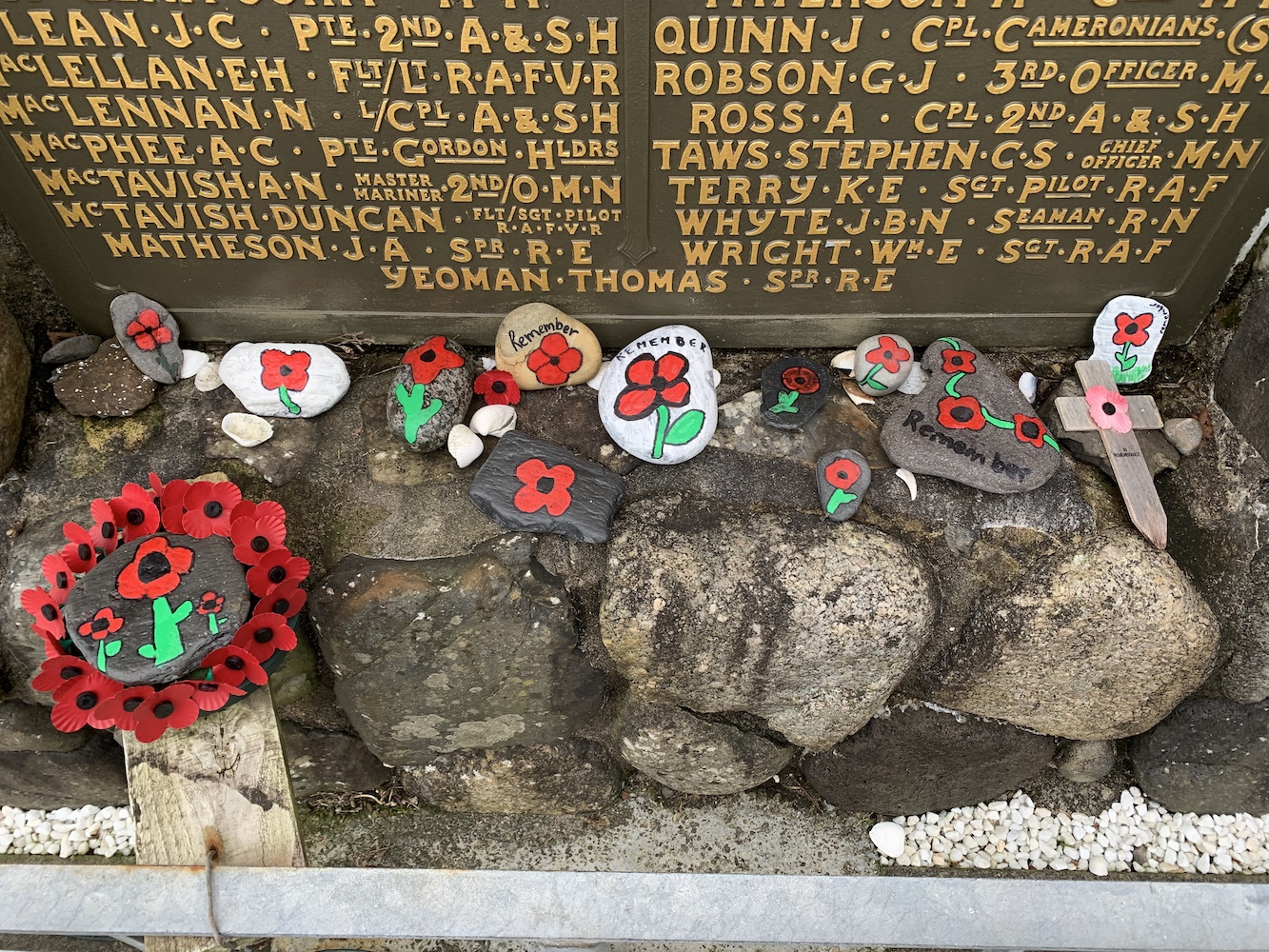
Meanwhile I spent a while at the nearby War Memorial to mark an early 2-minute silence for Remembrance Sunday.
War Memorial at Dunollie
We had a little time before we had to be at the ferry and I mentioned the old Northern Lighthouse Board houses on Pulpit Hill so we took a drive up to find them. I took a guess at which they were and the series of 5 large buildings with four front doors each seemed most likely. This has since been confirmed by my former keeper friend Ian. He actually stayed in one of them while off duty during his time serving on Skerryvore.
The old Northern Lighthouse Board buildings on Pulpit Hill
The houses were built to house the families of those keepers (and the keepers themselves when off duty) while they were based at some of the major rock stations off the west coast.
After taking a look at the buildings I contacted Ian again as I wasn’t sure how it had worked with the families. I knew the families of the keepers on Skerryvore, Dubh Artach, Barra Head and Hyskeir lived there, but I wasn’t sure if there were any others. Ian explained that initially each block was for each lighthouse, so Dubh Artach, Skerryvore, Ushenish, Barra Head and Lismore. The families of the Hyskeir keepers stayed in a separate house (Glenmore House) which is still on the other side of Pulpit Hill.
It changed when Lismore was automated in 1965 though and the Hyskeir families moved to the blocks. He added though that, as time passed and more of the lights were automated, the blocks began to house families and keepers from other lighthouses. Ian himself stayed in one of them while off duty from Pladda, for example. It was good to see these buildings and Ian has said before that it was quite a community up there with, I imagine, anything up to 20 families there at any one time.
It was time to hop on the ferry to Mull, which was thankfully very quiet. The sailing to Mull (or in fact a lot of sailings out of Oban) are always enjoyable as you pass a number of lights including Dunollie followed by Lismore and Lady Rock. It was good to see Lismore with the main island in the background thinking “I was there yesterday” and then looking over to Lady Rock thinking “I landed there last year”!
Lismore lighthouse with the island of Lismore to the right
Lismore lighthouse
Lady Rock lighthouse
Almost immediately Duart Point was next to us and to this one I thought “I’ll be there shortly – hopefully”. We weren’t sure how easy it would be to get to as we knew there was a big craggy Rock behind it and it wasn’t clear how easily we would get around that. There was only one way to find out.
We headed straight for Duart Castle, which is currently closed, but the car park is a good starting point for the walk to the Point. Bob had managed to find some directions on his GPS device for reaching a geocache very close to the lighthouse and this was a great help. I will try to include them as best I can here for anyone wanting to walk out to it.
The view from the approach road to Duart Castle
Walking back along the road we found the gate on the left just after a row of trees. Once through the gate (remembering to leave it as we found it, of course) I spotted another gate on the skyline at the top of the field as the instructions suggested.
Setting off for Duart Point
This gate marks the starting point from the road
Looking back at the second gate
Passing through that gate we turned left immediately and followed the fence and wall along. There are rough paths through the vegetation and I would actually recommend this time of year to visit if you can as the ferns have all died back exposing the grassy paths. I imagine they would be harder to see in Spring/Summer.
The landscape begins to open up – you want to head just to the right of the tree and then onwards between the two raised sections of ground
Where the wall ends the landscape opens up and we headed “straight on to the left” as Bob calls it (which basically means somewhere between straight on and left!) This route zigzags as you go downhill and once you are on a flatter section you have two options, you can either stay up high and view the tower from above first or continue around and down to the right. The tower is tucked away just to the left of the trees at the coast. As you go down you should then spot the tower as you follow the grassy track down.
Looking back up at the zig zag section
The final approach to the lighthouse
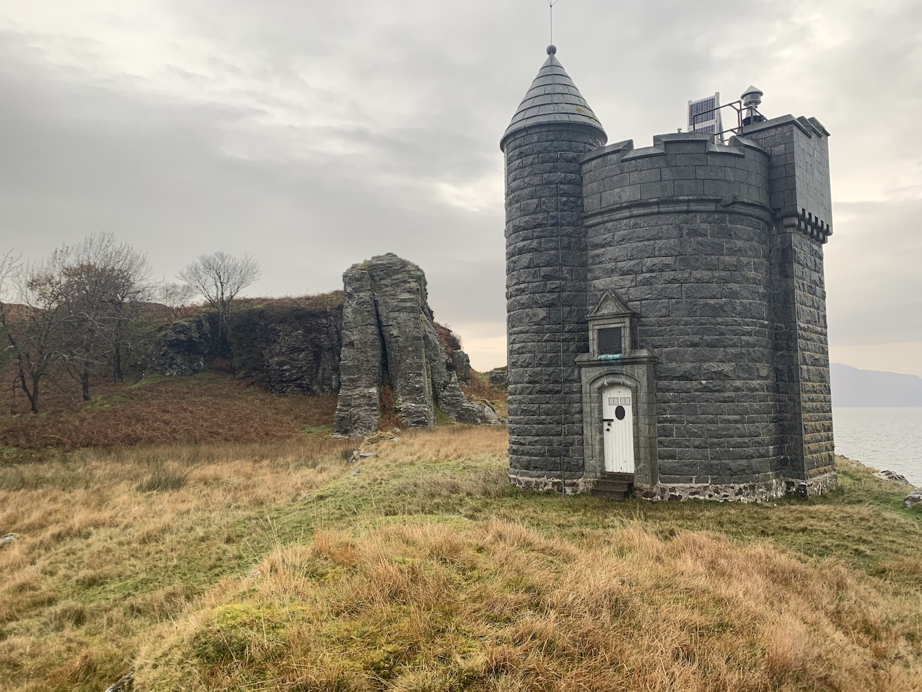
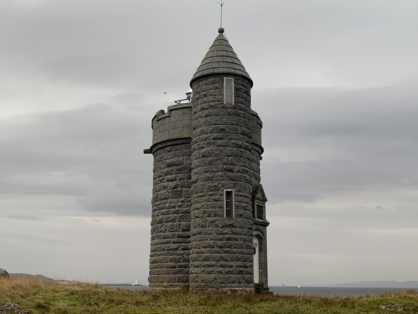
It was raining today so it was quite wet underfoot and a lot of the ground was covered in leaves, understandable as Autumn draws to a close. It was great to spot the tower through the threes and craggy rocks though. It’s a beautiful tower, originally built as a memorial of the Scottish author William Black who died in 1898 and always enjoyed Duart Point. The cost of the tower was partially covered by Black’s family and friends and there is a lovely plaque above the door explaining this.
Duart Point lighthouse
The only real indications of this being a lighthouse are the Northern Lighthouse Board plaque on the door and the modern little light and solar panel on top of the tower. There is a little platform nearby that looked like it may once have accommodated some sort of derrick.
The platform in front of the tower
The tower has enough variety in its shape to make pictures from every angle look quite different. My favourite view was of the lighthouse in the foreground with the big rock behind it.
A picturesque angle on Duart Point lighthouse
Another great angle was from the fence around the trees. This angle gave you a view of the Duart Point tower with Lismore to its left and Lady Rock to its right. It’s not often you get that kind of view.
A view of three lighthouses: Lismore in the distance, Duart Point and Lady Rock
Joe the Drone had come along and, although it was slightly wet, Bob thought he’d give him a fly anyway and he got a few great shots.
Duart Point from above
One of Joe’s great shots of Duart Point
Following the path back up we then wandered along to the top of the craggy rock to look down on the tower. This is an excellent angle on it, particularly if you want to get a better view of the lighting equipment. The viewpoint allowed us to get some Joe-type images without needing to use Joe. I would highly recommend including a stop here in your walk if you go (just be careful near the edge).
Duart Point lighthouse as seen from the top of the craggy rock
The lighting equipment on top of the William Black memorial
Annoyingly the weather started to clear up as we walked back, but we’d still enjoyed the visit to the light and the nice walk to get to it.
With no ferry leaving the island until after 4pm we had a few hours to kill. Unfortunately we didn’t have long enough for Bob to do a hill or for the walk out to Rubha nan Gall so we went for a drive. Mull seemed very unfamiliar to me, particularly the southern part, and it’s no surprise really as I worked out I’d only been once before (if you exclude the quick stop off at Ardmore Point from a chartered boat last year). It was beautiful to see it though, especially with the clearing skies and the sun eventually deciding to make an appearance.
A lone sheep on the banks of Loch na Keal on the west coast of Mull
The change on weather conditions was evident at a number of points
Looking back at Loch na Keal
After a fair wait at the terminal at Fishnish we boarded the ferry for the short crossing to Lochaline. By this point it was beginning to get dark and so I enjoyed the outline of the landscape as Bob drove us along to Corran. I always find Corran lighthouse just seems to suddenly appear when you aren’t expecting it and that was exactly what happened yesterday evening as we arrived suddenly at the Corran ferry at Ardgour. The joy of seeing lighthouses at night is, of course, seeing them in action. Corran is a good one as it has the red and green sectors which make for a more colourful view. This was another one I could look at and think “I was at the top of that tower last year”.
Corran lighthouse
Across the water I could also see the little Corran Narrows light flashing away and I remembered the unnecessarily tricky walk down to that one!
After crossing the channel on the Corran ferry we began the journey northwards and home. It had been great to get another weekend away this year, while we could. Who knows what the coming weeks and months will bring. Stay safe everyone and, if I don’t manage another post then have a restful Christmas time. Let’s hope 2021 can be an improvement upon this year. 🙂