It had been a long 4 years since I’d last joined any Relative Hills Society (RHSoc) trips and with this year’s AGM a mere hop, skip and a jump away in Kintail in late May it would have been rude not to pop along and catch up with some good old friends from the 2014-2019 period covered in this previous reflections post of mine.
For me, the spare time during the few days in the area was reserved for exploring some nice walking routes both in Kintail and on Skye. There was also a couple of very successful boat trips to the Bracadale Islands and Soay from Elgol as well as an evening trip to Iosaigh on Loch Dunvegan. It was great to be back out on the water again with the chilled out ‘baggers of all things’ as a boatman once referred to them.
Rather fortunately one of the baggers, Jonathan, had purchased an inflatable boat with an outboard engine and, as the days progressed he was off out shipping people to otherwise inaccessible islands.
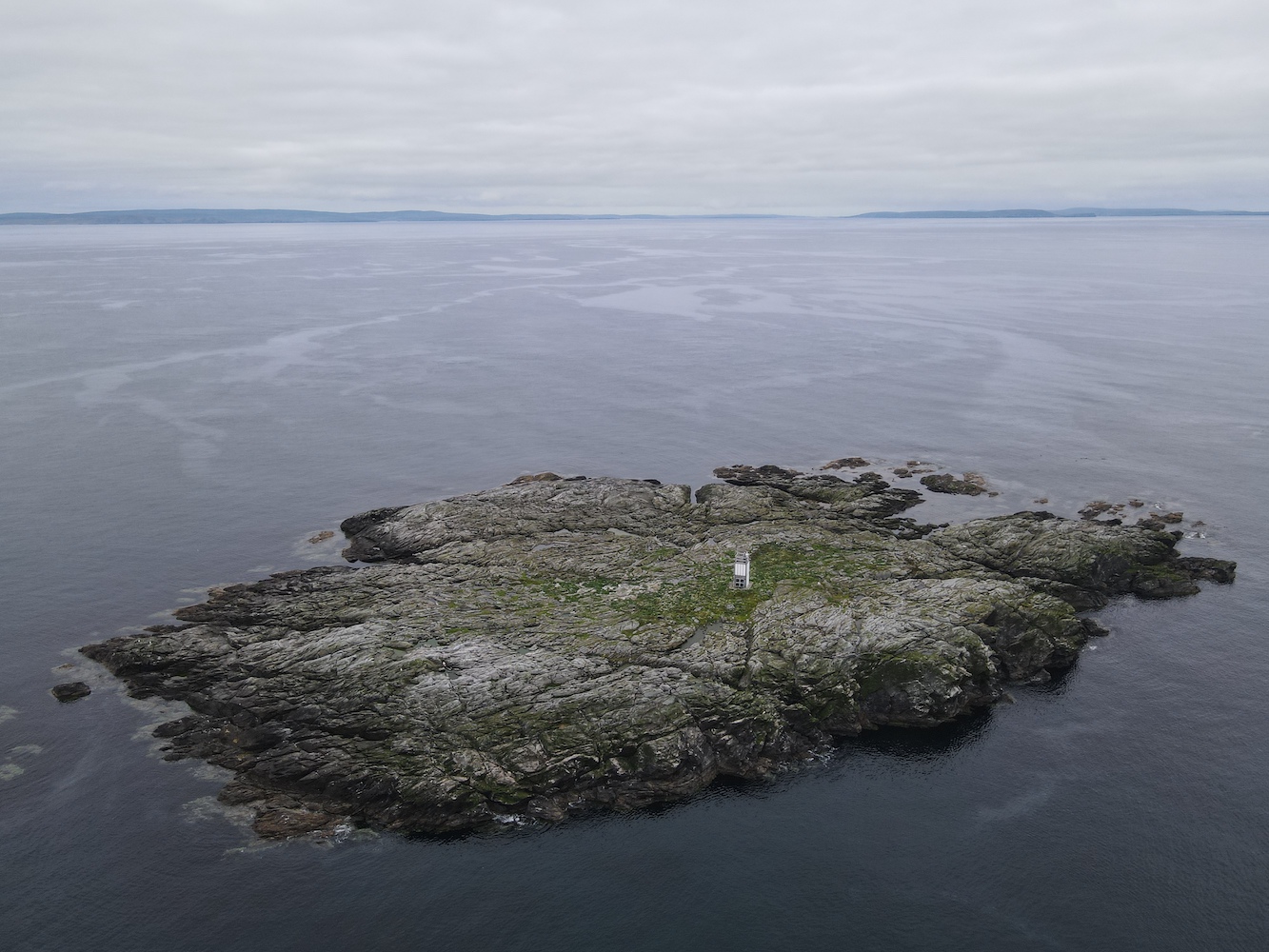
After passing through the Kyle of Lochalsh a good few times that week, the idea of getting a closer look at the little flat pack lighthouse on Eileanan Dubha East to the east of the Skye bridge crept into my mind. I approached Jonathan with this opportunity and he was happy to help out so I gathered interest from others wishing to head out during the RHSoc AGM and evening meal.
A merry band of us (or not so merry as was the case for myself and one or two others after one – or five – too many drinks the night before) gathered at Kyle of Lochalsh on the Sunday morning and Jonathan prepared our chariot for the short ride across to Eileanan Dubha East.
The skipper preparing the vessel
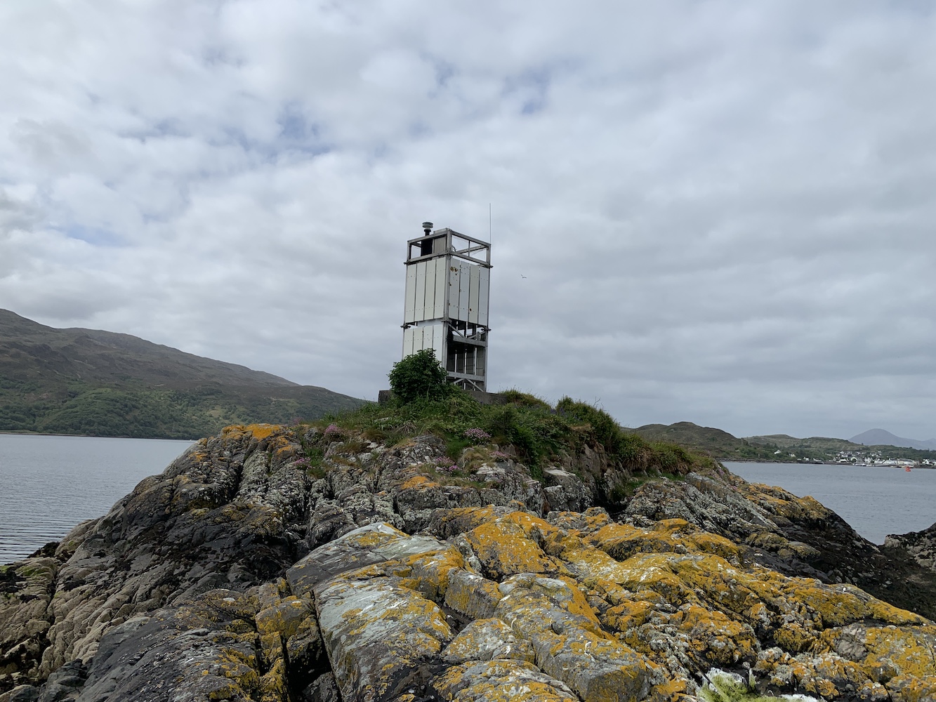
Off we set, two at a time, and the calm water and fresh air did wonders at bringing me closer to some sort of sensible state. It didn’t do a huge amount for my energy levels though as, once I’d navigated my way across the rocks to the lighthouse, that was where I stayed for the duration of the visit. I had to borrow pictures to help populate this post!
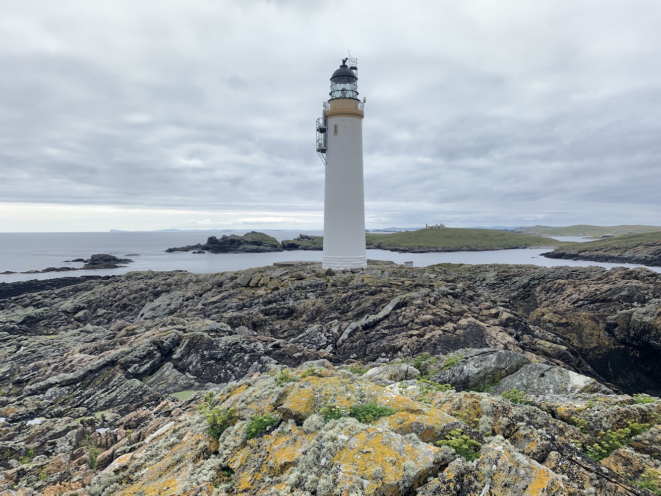
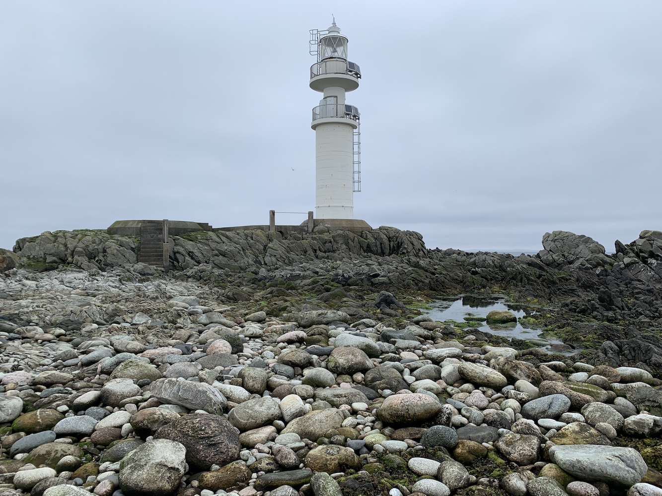
Eileanan Dubha Lighthouse
It was an excellent spot to just sit and watch as others made their way over and went off exploring whether the tide was low enough to get to one of the neighbouring islands in the Eileanan Dubha group. The glass-bottomed boat from Kyleakin went past at one point, with passengers enjoying watching the seals on another island – and probably wondering what we were up to as well.
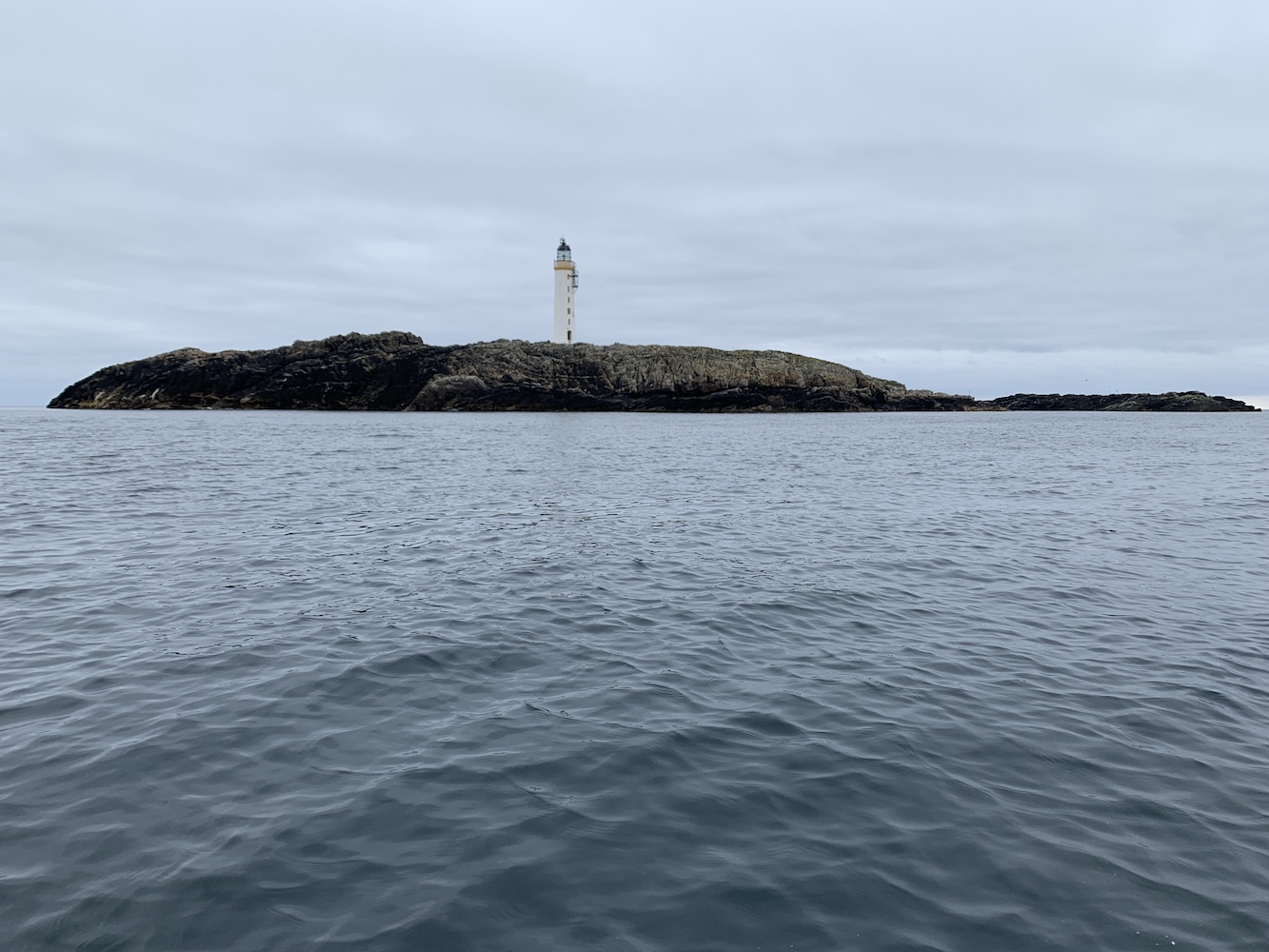
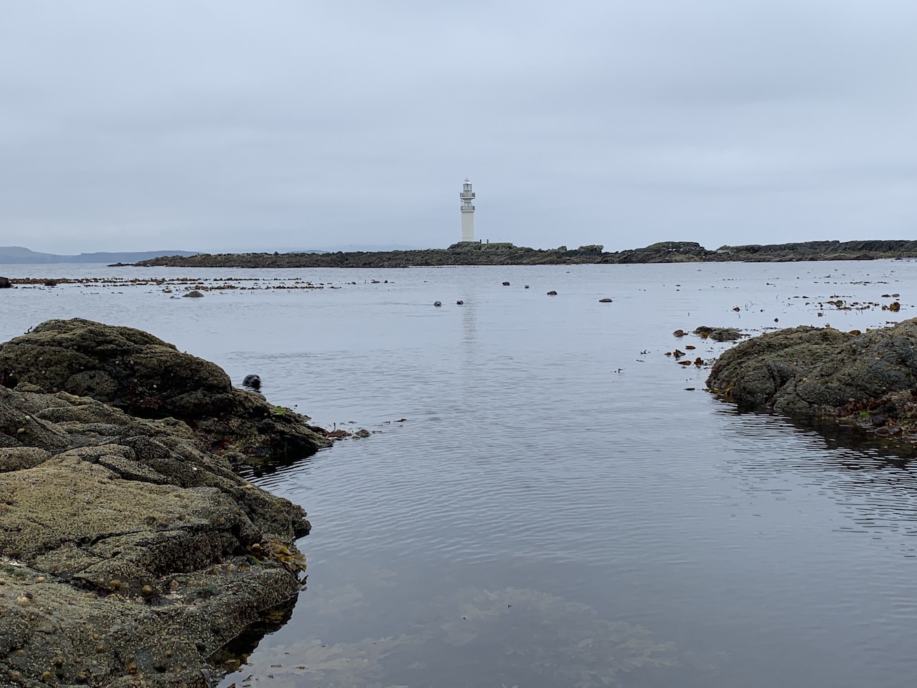
Skye provides a dramatic backdrop to this little island
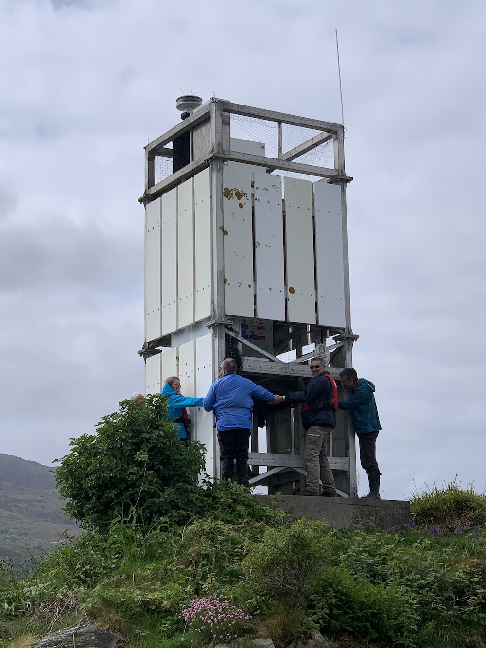
I clearly wasn’t the only one enjoying watching the world go by from that tiny island as the others, rather unusually, also took to sitting around, chatting and just generally enjoying that Sunday morning chilled feeling. Once we (or I) had mustered up some energy we used the opportunity to give the light a group hug, which went rather well. It’s always a fun activity to introduce people to and makes for some great pictures too, even if it is impossible to get everyone in the picture.
The lighthouse hug in action
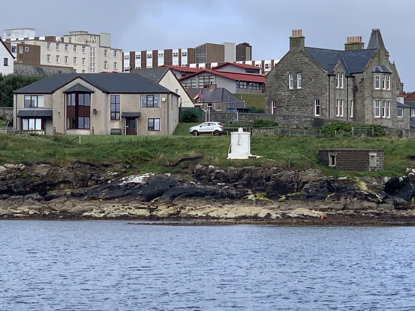
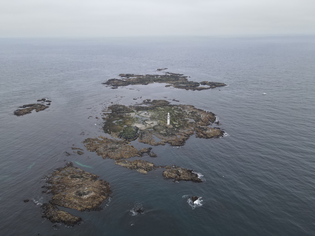
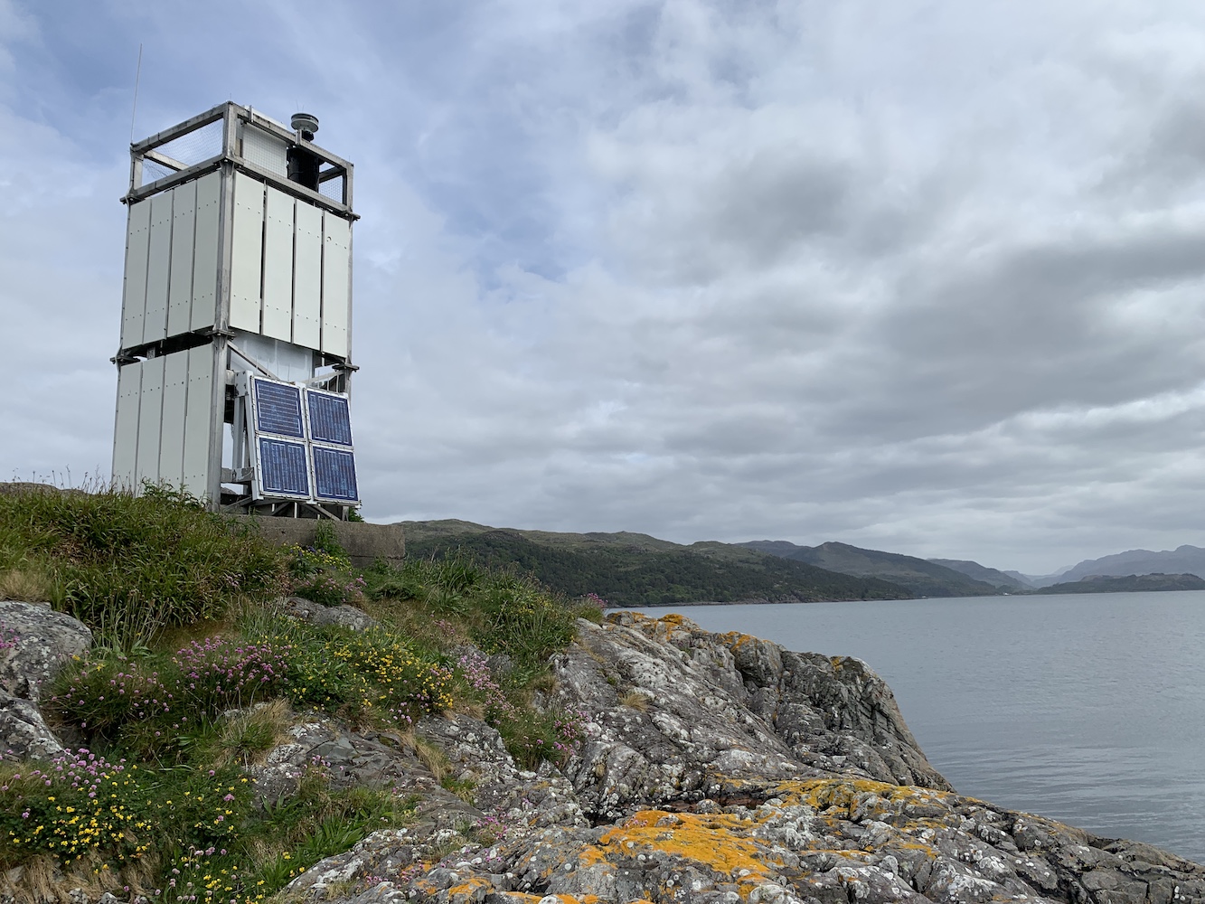
Eileanan Dubha marks the east entrance to Kyle Akin, the relatively short stretch of water separating Skye from the mainland. At the west end of the Kyle is the now inactive Eilean Ban, or Kyleakin, Lighthouse which is very much overshadowed now by the bridge.
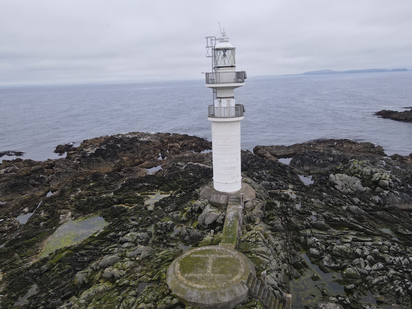
The lighthouse and Loch Alsh
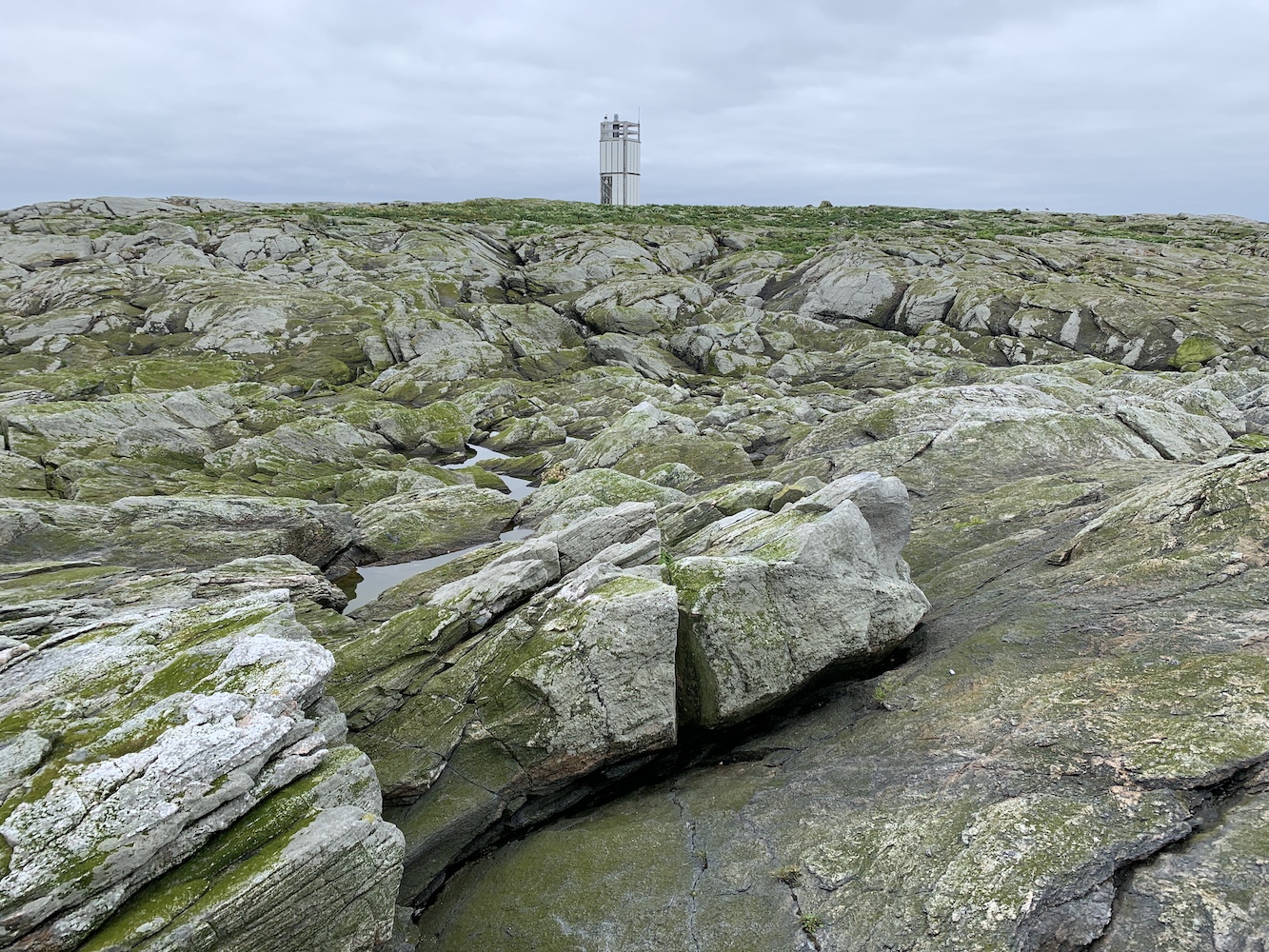
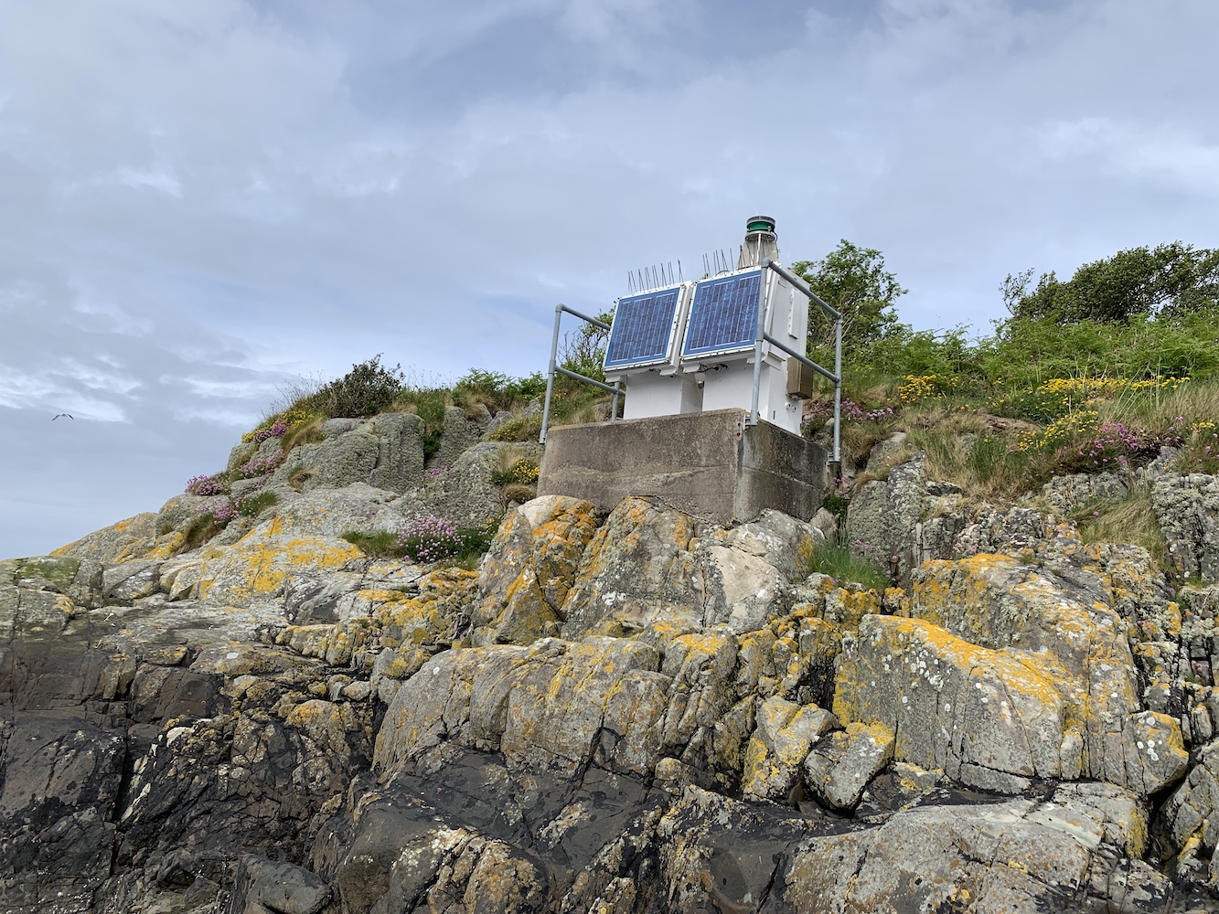
Further along the Eileanan Dubh group is the teeny tiny Eight Metre Rock Lighthouse, or so it says anyway. In my view it’s a couple of little cabinets with a light on top of one of them, so doesn’t hold anywhere near as much interest.
Eight Metre Rock Lighthouse
With a journey back home ahead that day it was time to head back and bid a fond farewell to Eileanan Dubha East which had provided a little piece of calm and quiet on a day where it was very much needed 🙂
A somewhat delayed post from three months ago, concluding the Berwickshire-based bagging series.
After a few good days of lighthouse-related antics, it all went a bit pear-shaped with my knee-related incident. Any plans I’d had for walking to lighthouses from that point had to be cast aside. However, there was still some fun to be had after I got past the initial painful days.
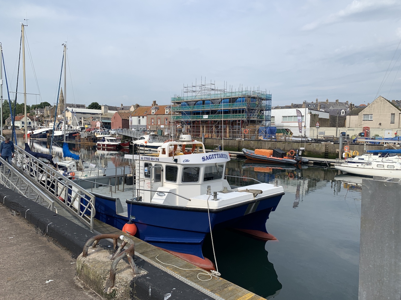
In terms of lighthouses, there were a couple more days of discovery around St Abbs. I’d found a fantastic company based in Eyemouth who ran boat trips around St Abbs. Even better, the boat they used was ‘accessible’ so I could go along without having to worry about whether or not I would be able to get aboard.
Our accessible chariot awaited!
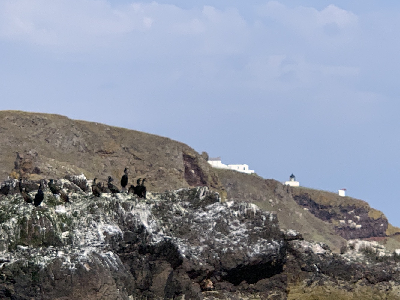
In Our Nature is run by Liza Cole who used to be a Ranger for St Abbs so knows a considerable amount about the geology and wildlife all along the coastline. I learnt a lot more during the trip than I feel I have done during previous trips in any other area – or maybe it’s just Liza’s style of presentation. Learning that a collection of shags is called a ‘hangout’ was rather fun. Liza and I were actually equally delighted to learn that she owns a copy of my book and loves it. It goes without saying that she shares my passion for lighthouses!
The ‘hangout’ of shags and St Abbs Lighthouse coming into view
As we sailed up the coast we passed multitudes of tiny coves and pebbly beaches, each of which had little sloping pathways leading down to them. Liza informed us that this was to enable local people to access the beaches, although I’ve managed to forget during the last three months exactly what the purpose of this was.
If you look closely you can see the paths leading down to the coast on both the right and left of the picture
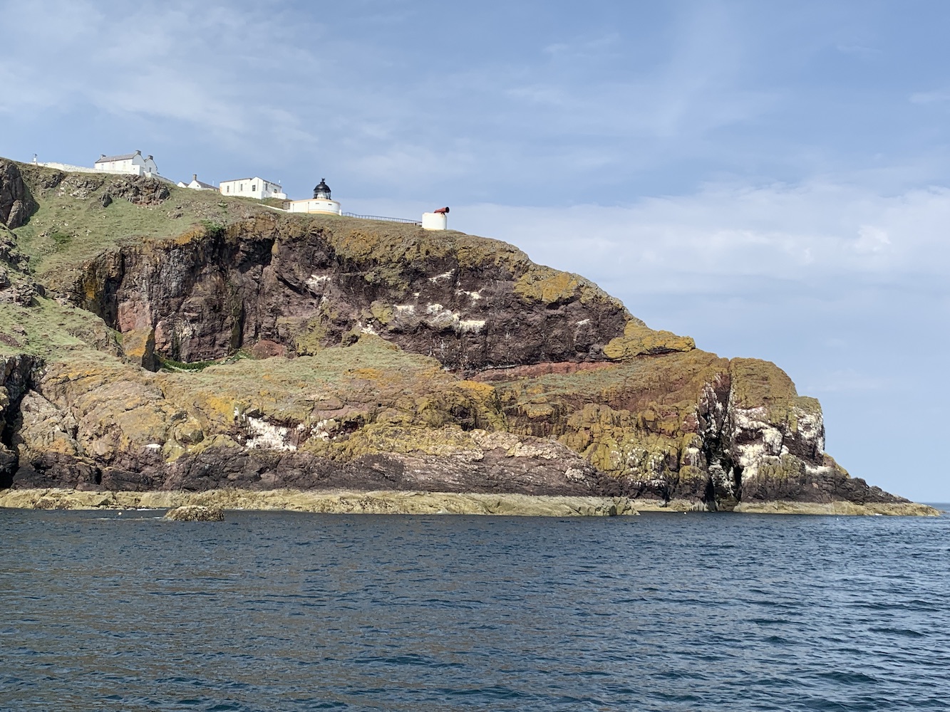
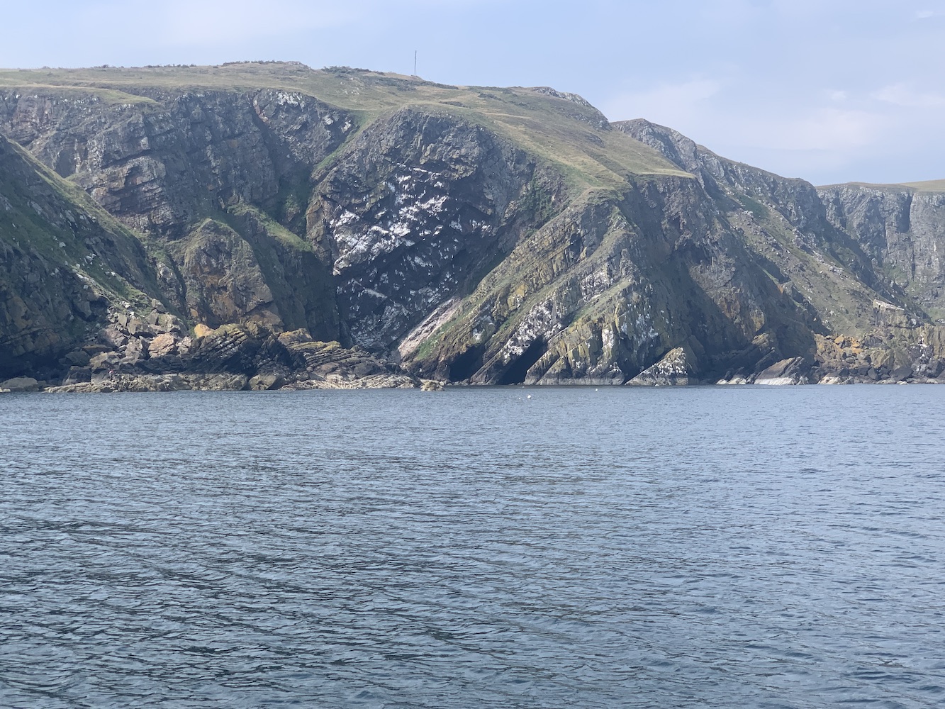
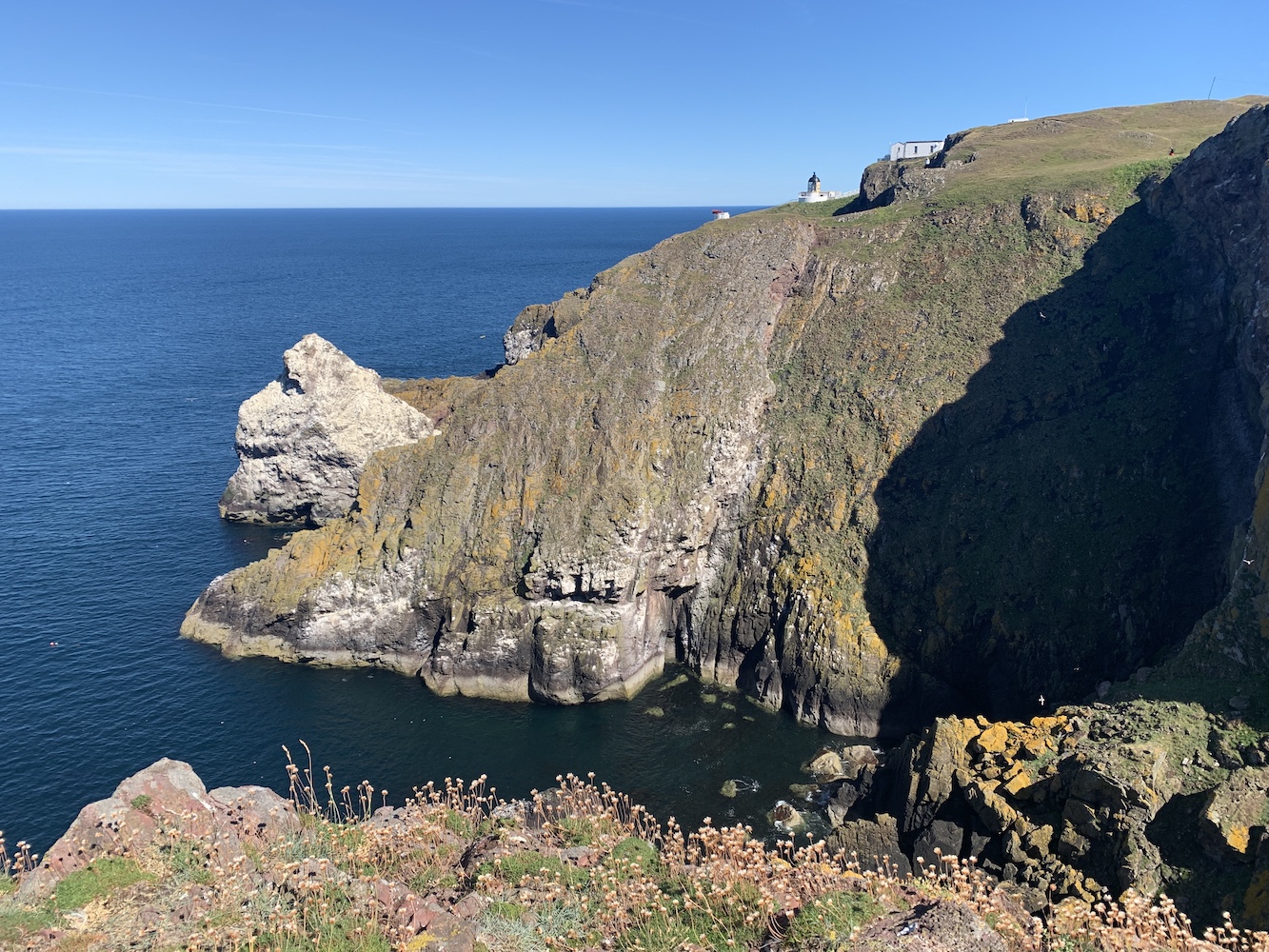
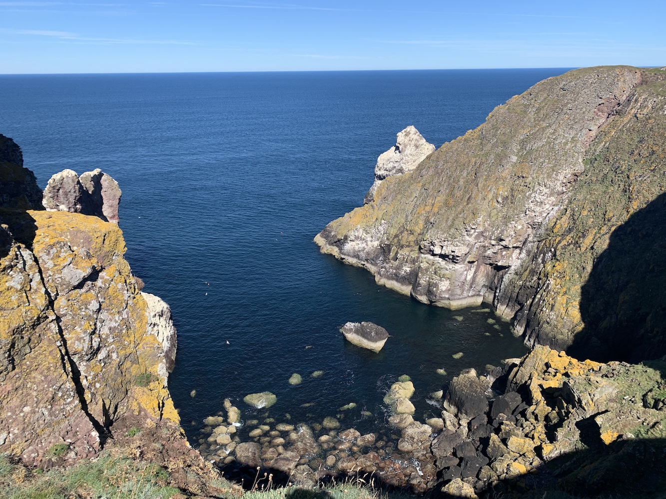
Reaching St Abbs in the boat, this was where the dramatic rocky coastal scenery really kicked in. I’d seen a lot of it from the landward side, but to see it from the sea and experiment the sheer scale of some of the jutting out headlands and sea stacks was marvellous. Although it was late in the season there still seemed to be a fair few seabirds about, both young and old. We were also able to spot my mum sitting just outside the wall of the lighthouse complex and happily waved away to each other as we passed.
The headland at St Abbs
St Abbs Lighthouse and the old foghorn
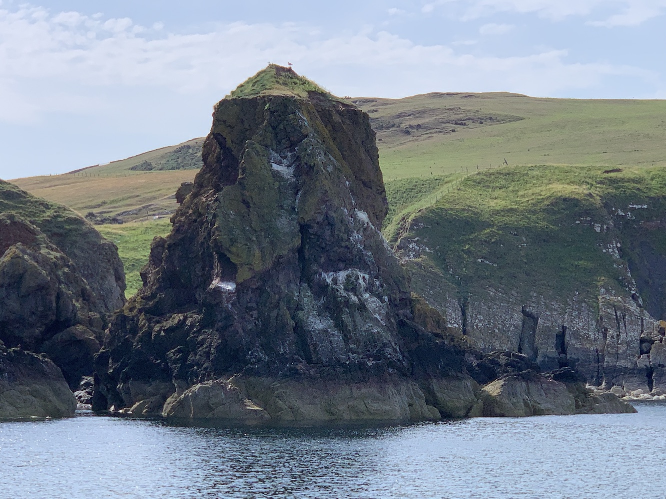
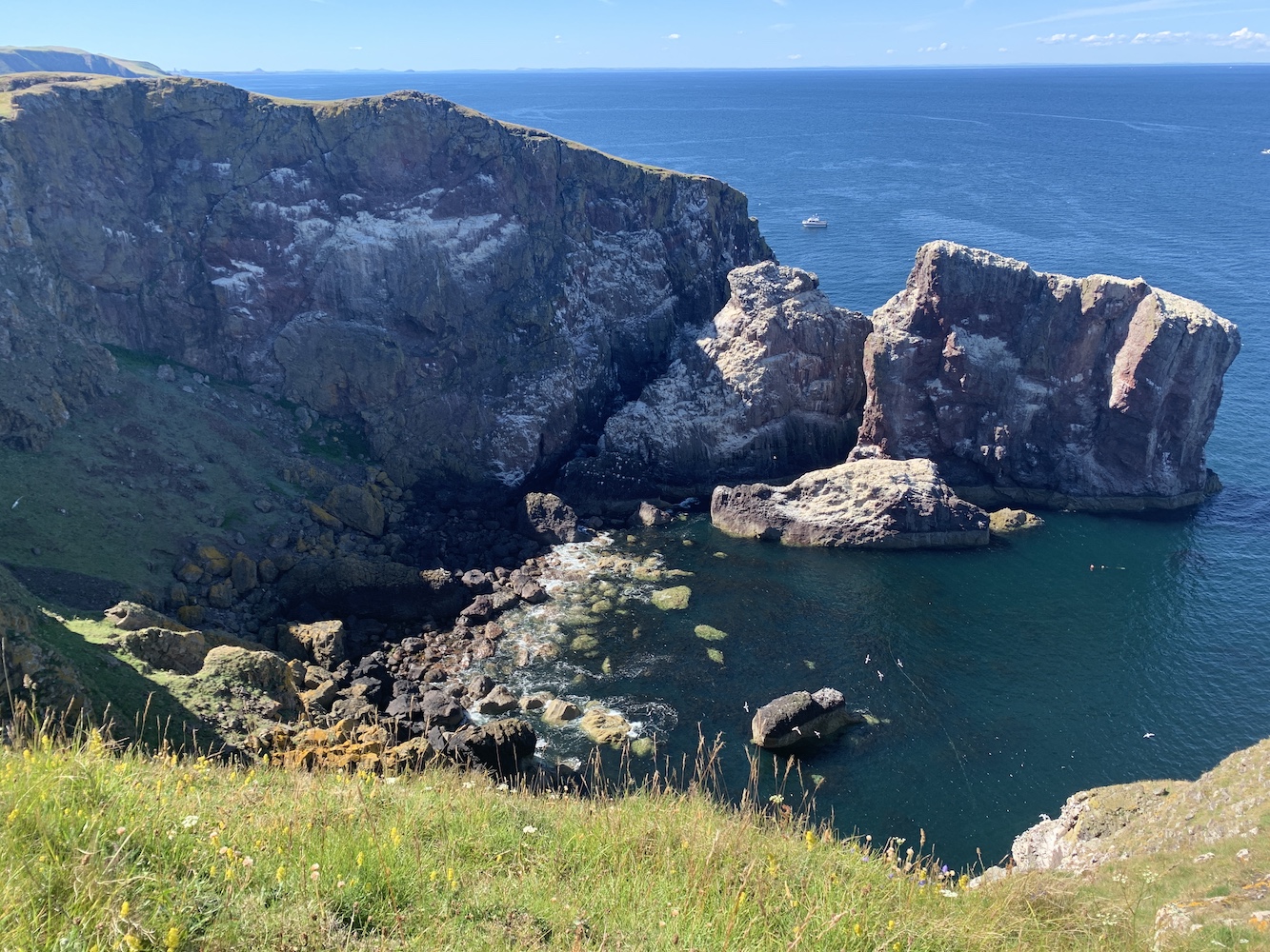
Once we had rounded the headland we were edging closer to the little Pettico Wick harbour which we’d explored a bit a couple of days before. The large pinnacles of rock just to the north of the harbour had looked so impressive from the shore, but were now dwarfed in comparison to the big stacks and cliffs that surrounded them.
One of the numerous stacks around St Abbs
For days I’d also been admiring the wonderful rocks to the west of the cove and it was fantastic to see them from this different view. The amazing folding effect which Liza explained was a result of two different types of rock meeting, was just as prominent from the sea and, of course, there was a better view of the geology even further to the west.
Heading back around the headland
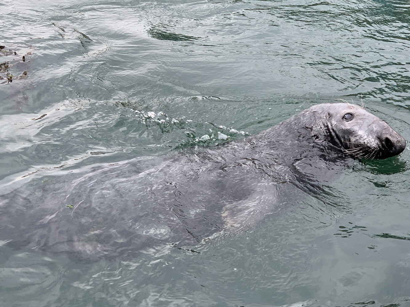
After just the right amount of time to study the cliffs or birds, we set off back for Eyemouth. Liza uses local fishing boats for her trips and the seals are very used to receiving titbits when the boats return from trips so it was great to see them following us back into the harbour, even if they were slightly disappointed at the lack of food on this occasion.
A hopeful seal
Having spent a few days being able to do very little, it was great to be back out in the proper fresh air, enjoying a boat trip once again. There’s nothing quite like a sea breeze to bring you around after a difficult few days.
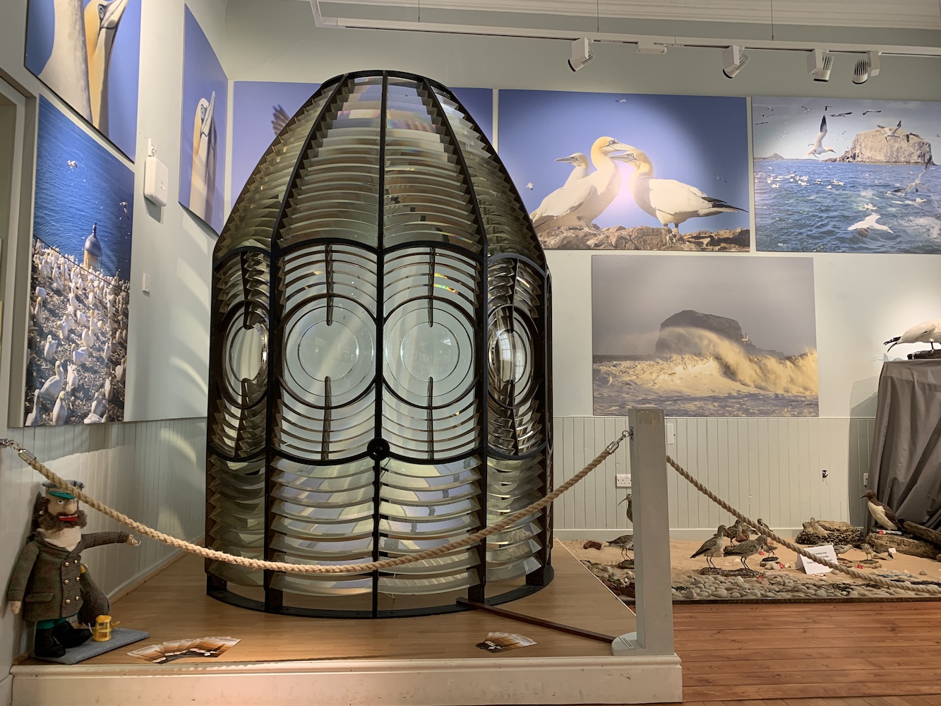
The following day we visited North Berwick again and this time visited the Coastal Communities Museum which I’d been wanting to get to for some time. The main reason for this was to see the old Bass Rock Lighthouse lens. As with so many of these lenses it was a real pleasure to see.
The former Bass Rock Lighthouse lens
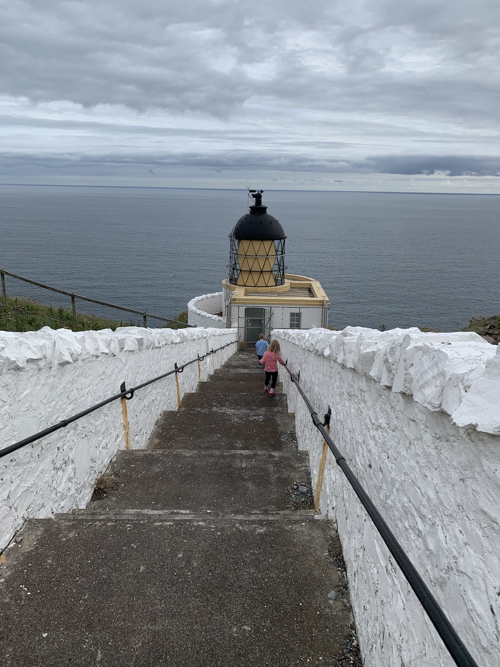
There I was then thinking the holiday was over and we’d be leaving St Abbs behind on that Friday morning, but little did I know that there was one last surprise in store! As we were packing up the car, a couple of people arrived, one of which was the Planning Engineer for the Northern Lighthouse Board, Craig, who was undertaking the annual inspection of St Abbs Lighthouse. Seizing the opportunity for a peek inside the lighthouse, he very willingly agreed to show us around and I hobbled on down the steps to the lantern. It was fortunate that we were at St Abbs really as the majority of lighthouses would have been inaccessible for me and my crutches.
The kids were also keen to get a look inside the lighthouse
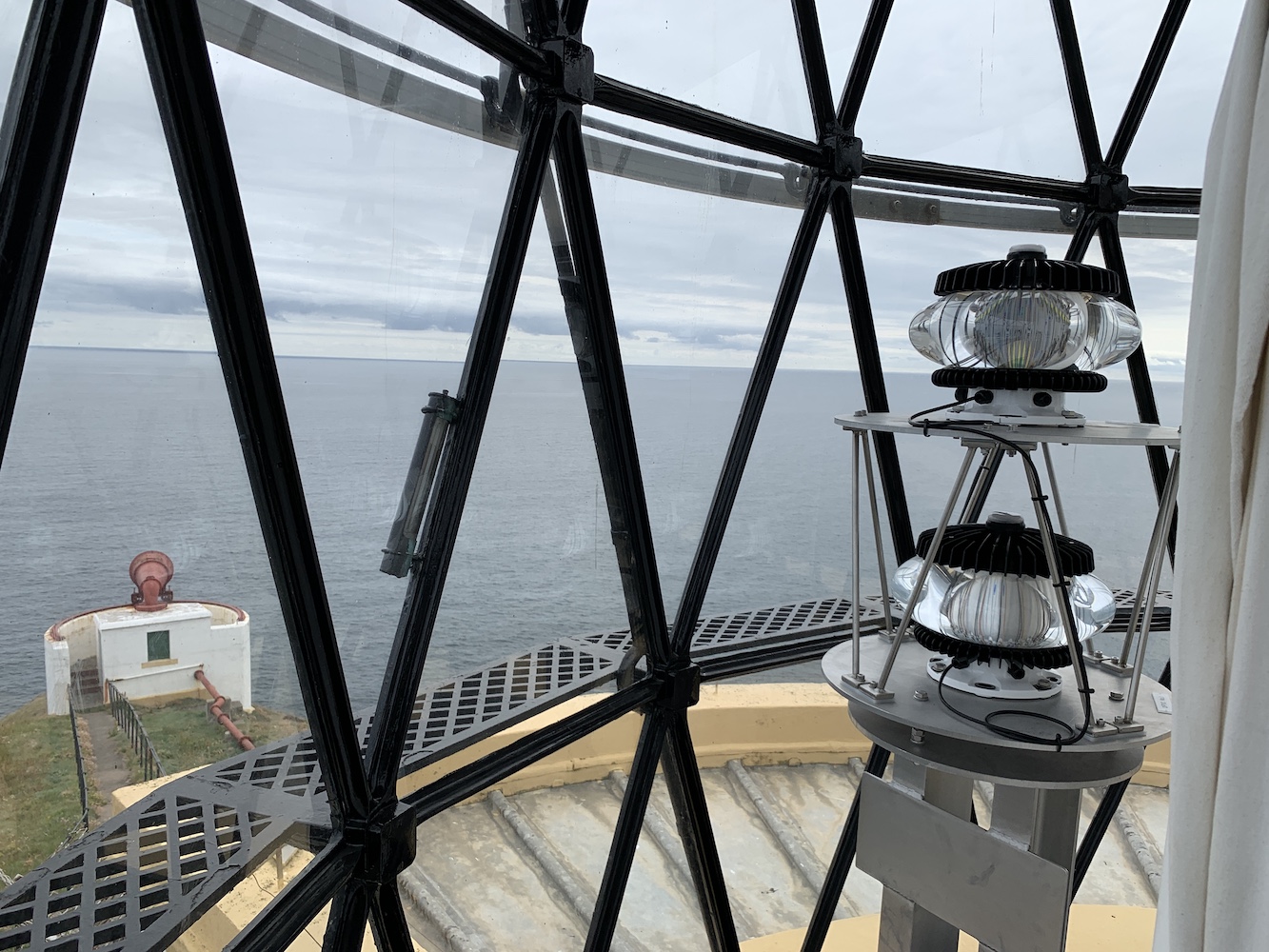
Unsurprisingly, the lighthouse isn’t very big inside. You enter into a small hallway which leads straight into the lantern with the light mechanism. There is also a separate room off to the right. There is only then one set of ladder-type steps to get up inside the lantern. I decided to pass on this opportunity and stayed on the ground floor level, but I was happy enough with that. The others went up and I was still able to join in their conversations with them above the lattice flooring and me below.
A picture taken for me from the top of St Abbs Lighthouse
Inside the magnificent lens at St Abbs Lighthouse
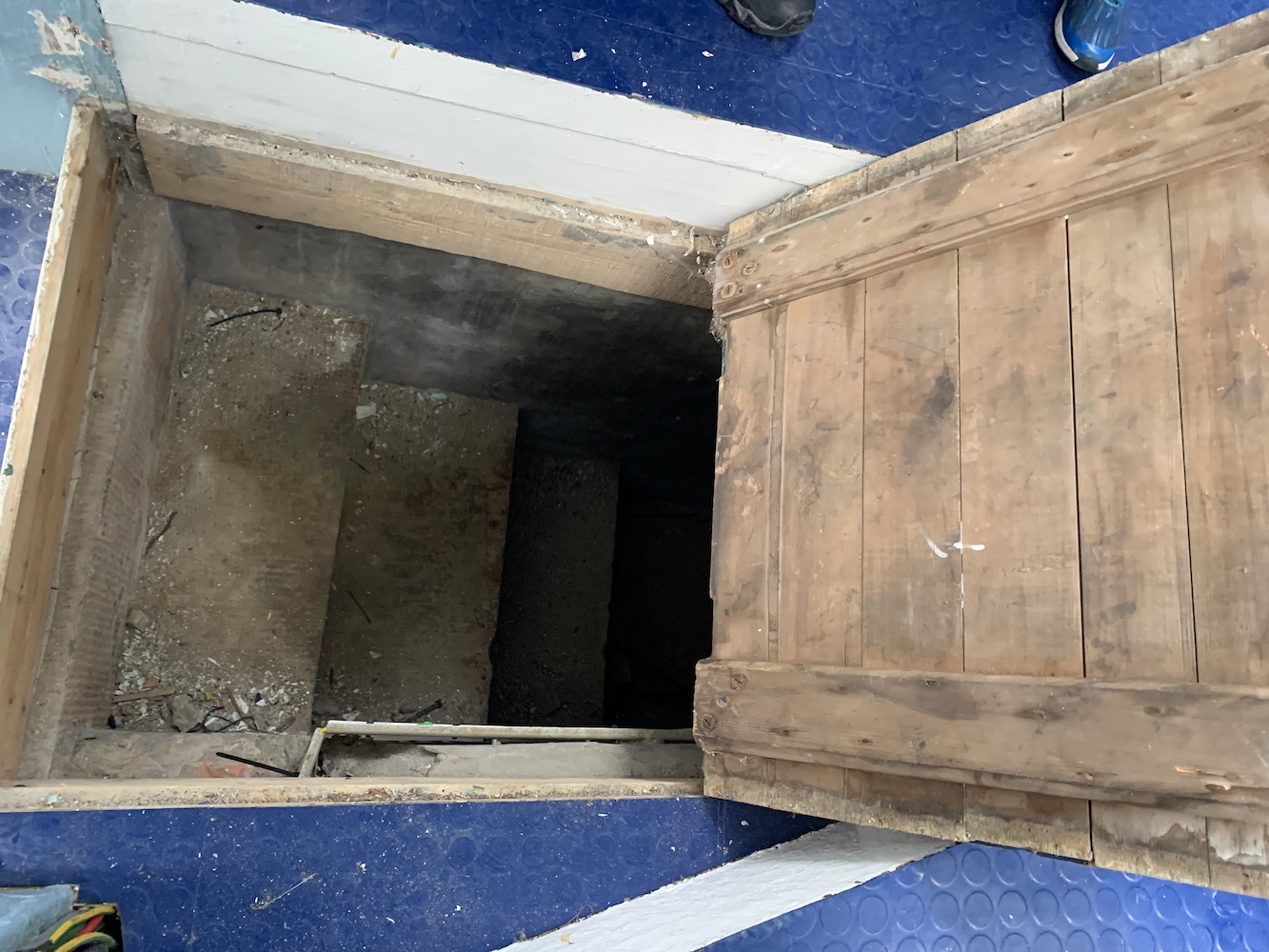
While we were inside the lighthouse Craig managed to prise the old hatch open in the steps that would have allowed access to the weight mechanism when the lighthouse was operated by the clockwork system. Due to the lantern being near enough at ground level it was necessary for them to dig into the ground to accommodate the mechanism.
The hatch inside St Abb’s Lighthouse
Craig has worked for the Northern Lighthouse Board for a number of years and has seen the majority of their lighthouses with very few left unvisited. For him lighthouses are his work, but I got a sense that he takes more enjoyment from being around them than most people do their workplace. 🙂
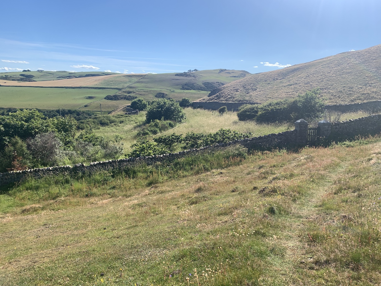
Taking a break from holidays on the west coast of Scotland, we decided to have a family holiday with my parents in the Scottish Borders this time. I gave my son the choice of whether we stayed in a house on a farm or in lighthouse cottages. Thankfully he gave the right answer and so St Abbs it was.
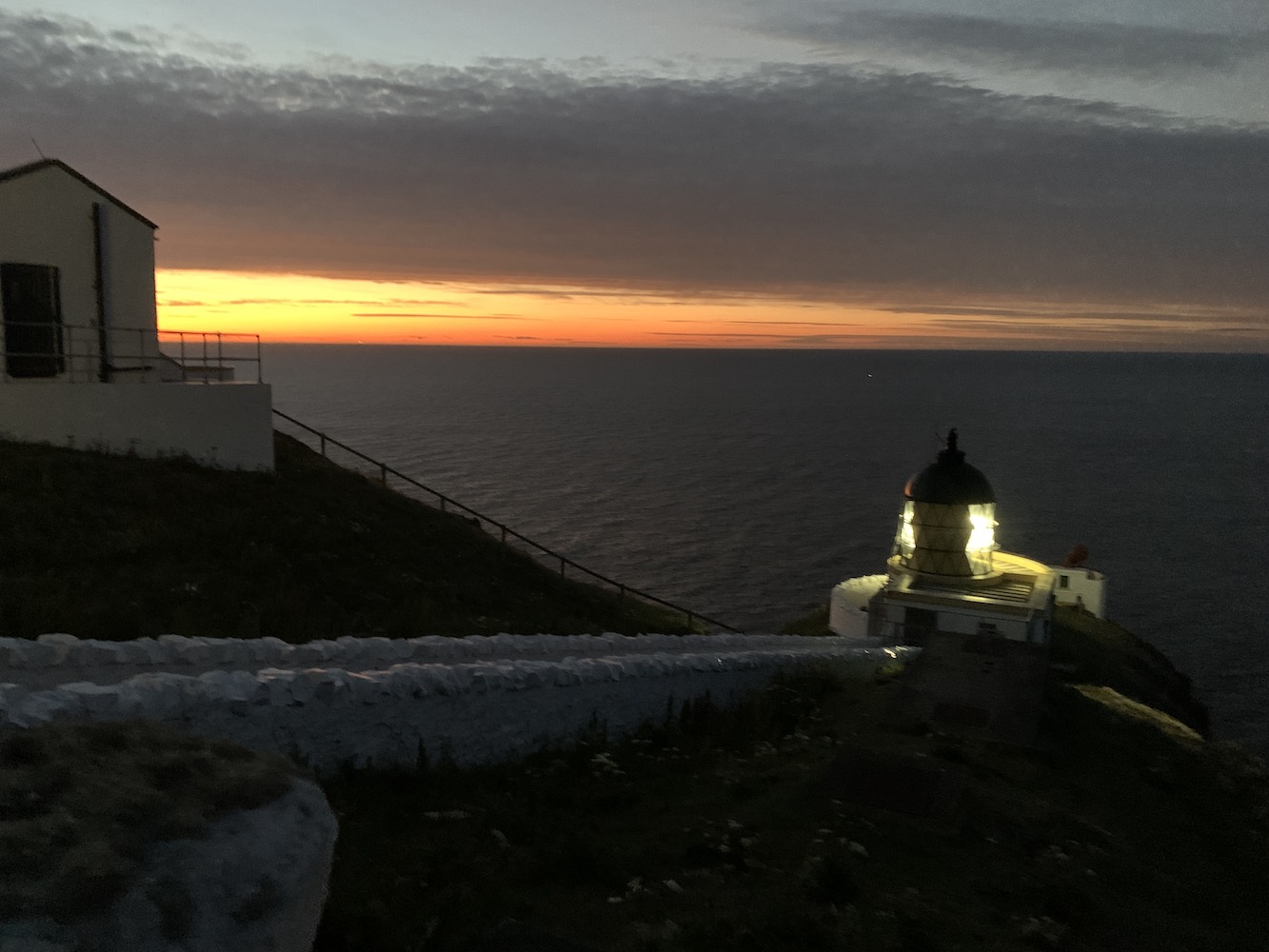
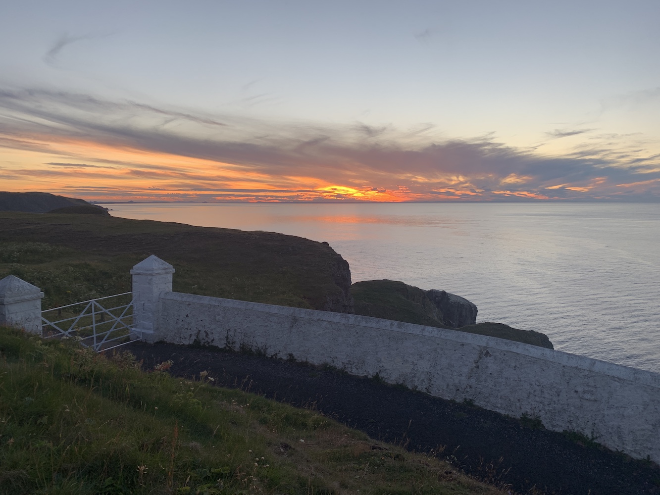
A few hours after arriving on Friday evening, there was a beautiful sunset, which surprised me as I’d not quite got my bearings and it appeared to me that the sun was setting in the north.
Of course I couldn’t miss the opportunity to see St Abbs Lighthouse flashing. The lens has now been covered by a big sheet here and the light source is now one of the LED “puddings”. So sadly no sweeping beam, but still a joy to see.
St Abbs Lighthouse at sunset
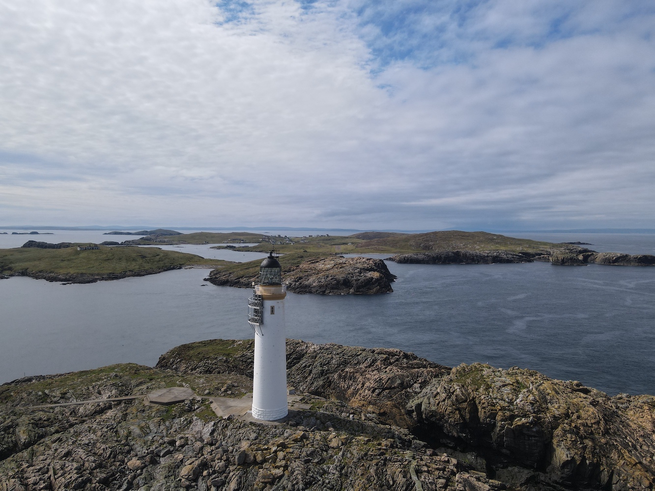
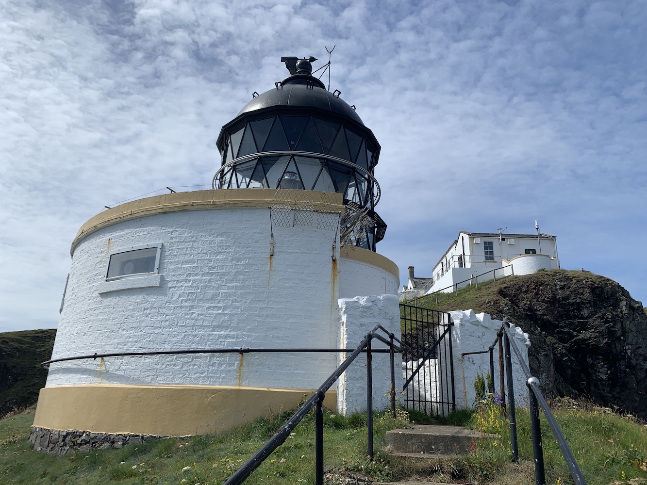
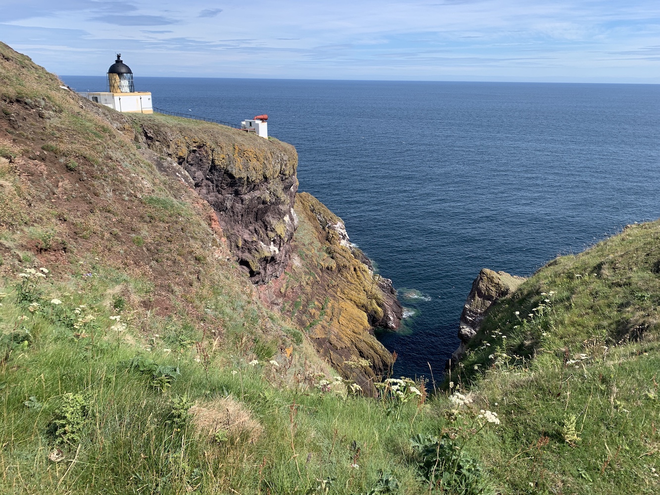
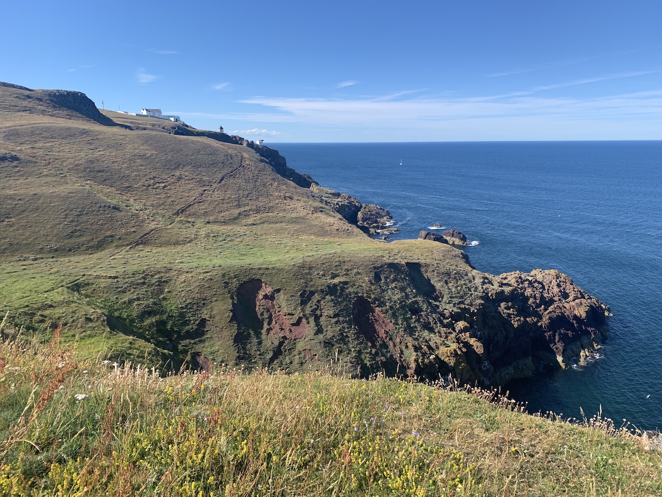
I took a closer look at the lighthouse and old foghorn yesterday in the glorious sunshine. The tiny tower was great to see close up and it’s always nice to see a foghorn still in situ. St Abbs has the benefit of being relatively close to Edinburgh, where the Northern Lighthouse Board has their head office, and this proximity without the need for a boat means the station has often been used in the past for testing new practices and technology.
What really makes St Abbs so special is the incredible coastline. I remembered it very fondly from my first visit back in 2012 when it was the first Scottish lighthouse I visited on my tour. That day was also particularly sunny and the tall cliffs were certainly a good introduction to Scotland’s coastal scenery.
St Abbs Lighthouse
I was also delighted to find yesterday morning that Barns Ness Lighthouse is visible from St Abbs too and out of the cottage window last night I spotted the flashing of the lighthouse on the Isle of May. The light from the wonderful tower on the Isle of May is very powerful and I enjoyed seeing just how bright it was from Arbroath in recent years. Seeing it from so far south though was excellent. Bass Rock is visible from here too, but the light is perhaps not strong enough to reach St Abbs.
This evening’s sunset view towards the north west
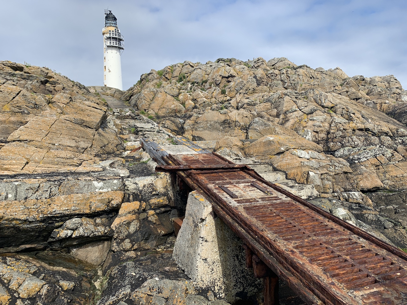
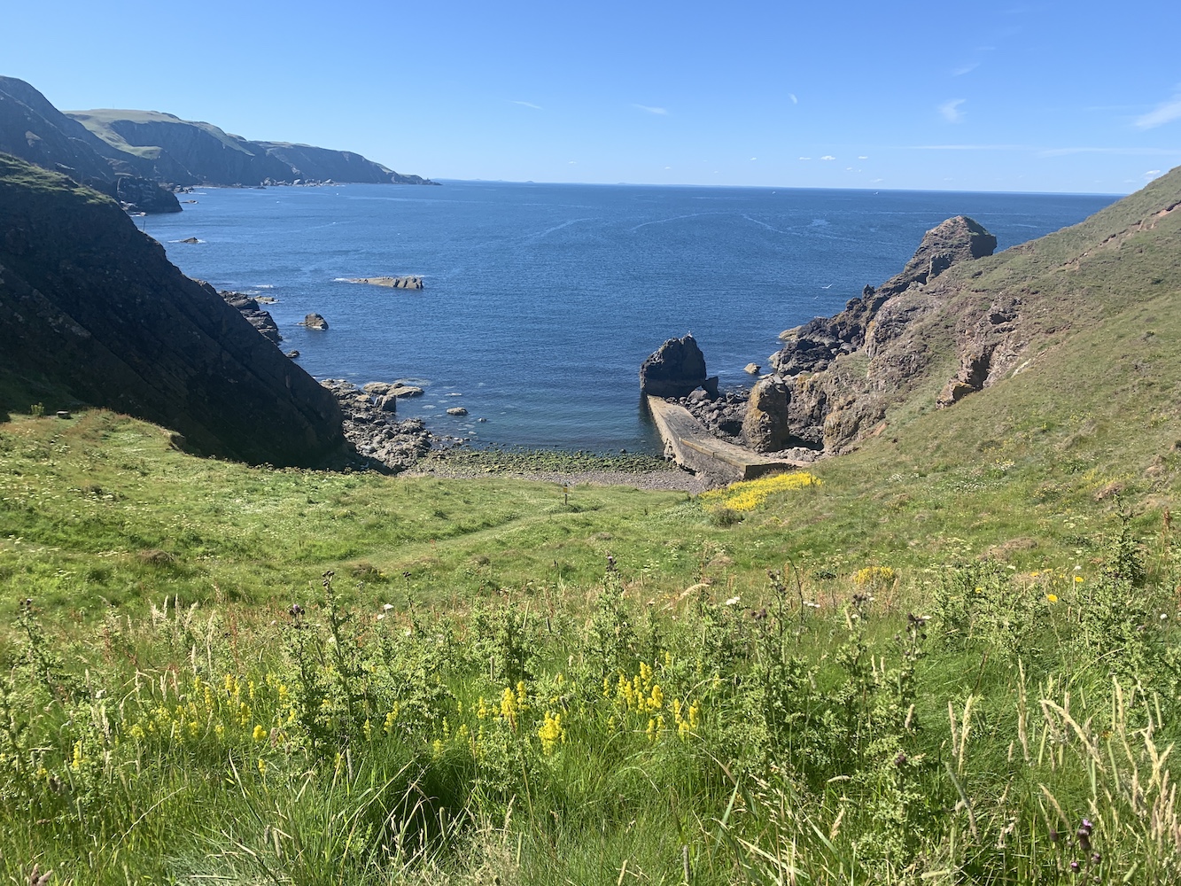
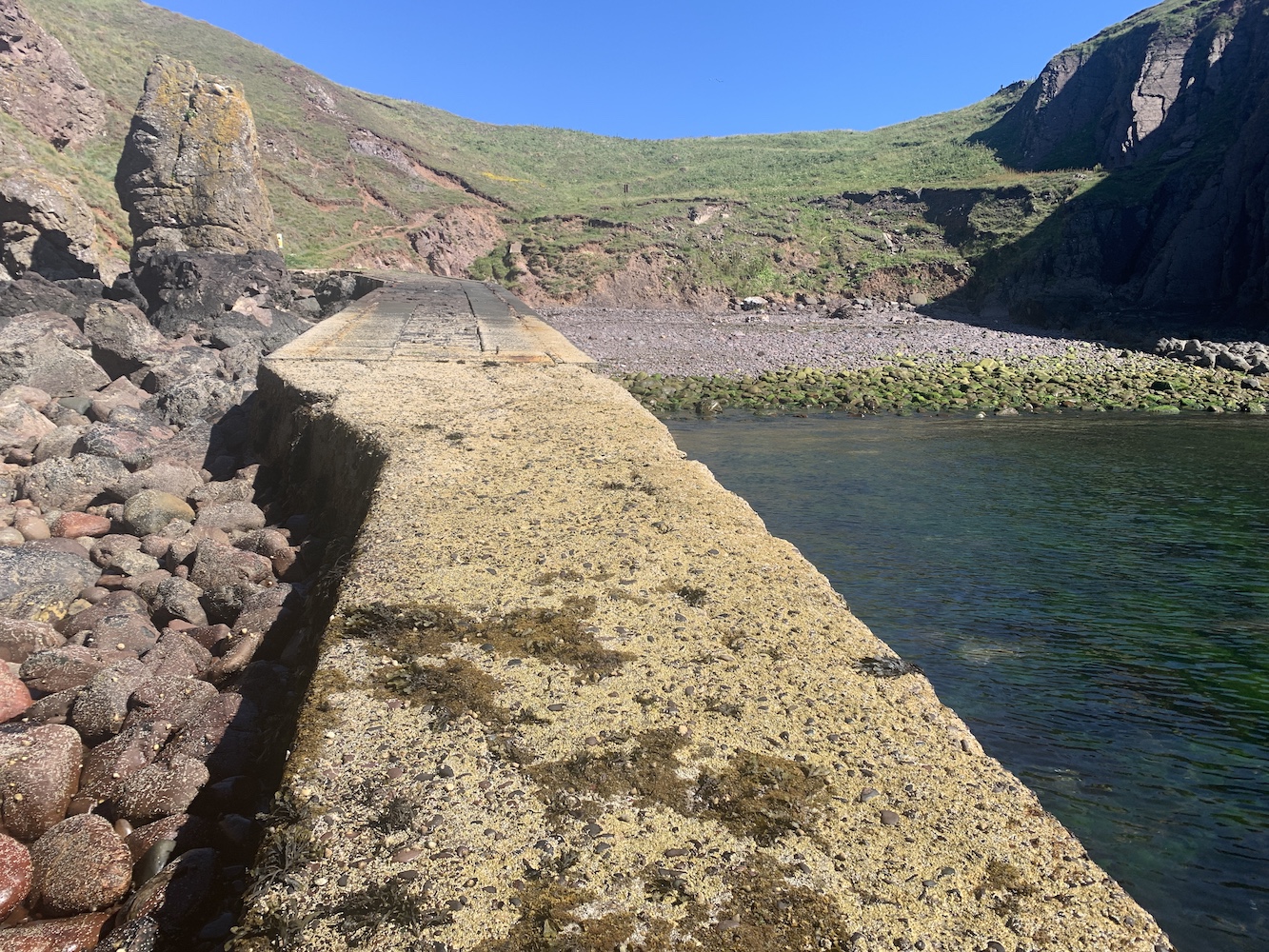
This afternoon I’ve done plenty more exploring around the area. The aim was to check out the old jetty at Pettico Wick Harbour just down the road, which was reportedly built for landing supplies for the lighthouse. However, the coastal paths were a bit distracting. There’s only one way to describe the views and that is in pictures so here are a few.
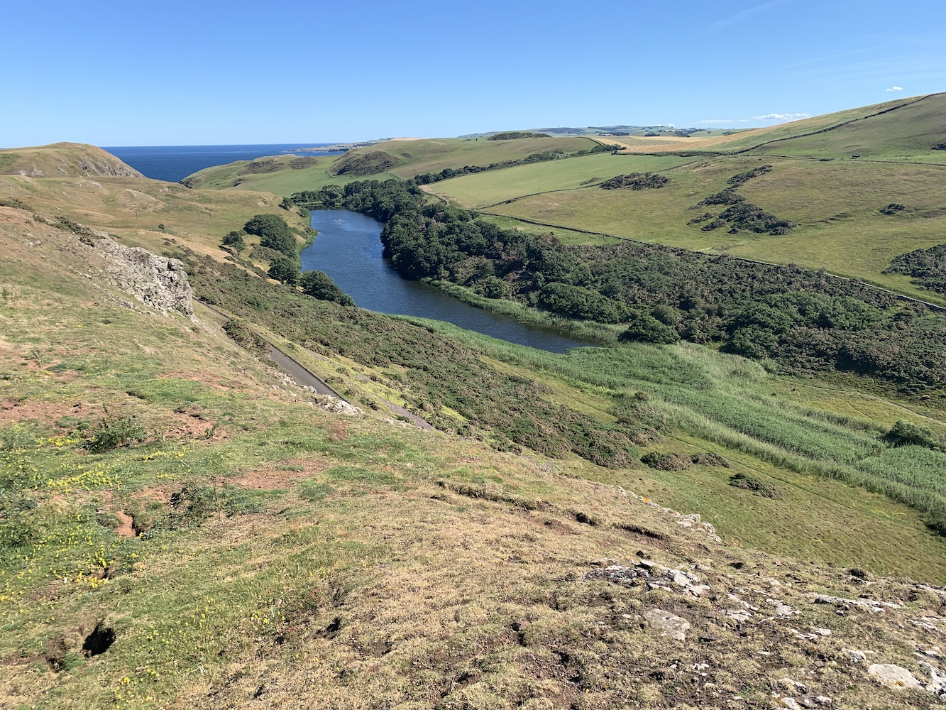
Returning to the road, the view across Mire Loch, which I remembered so well from the first visit, was stunning. The loch is manmade, created around 1900 for leisure purposes.
Mire Loch
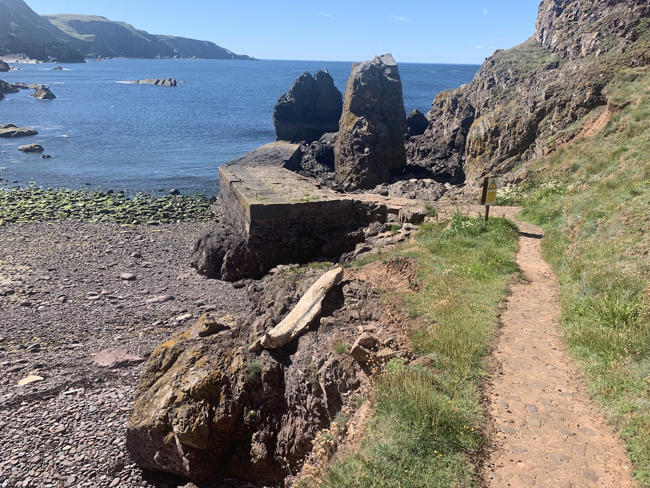
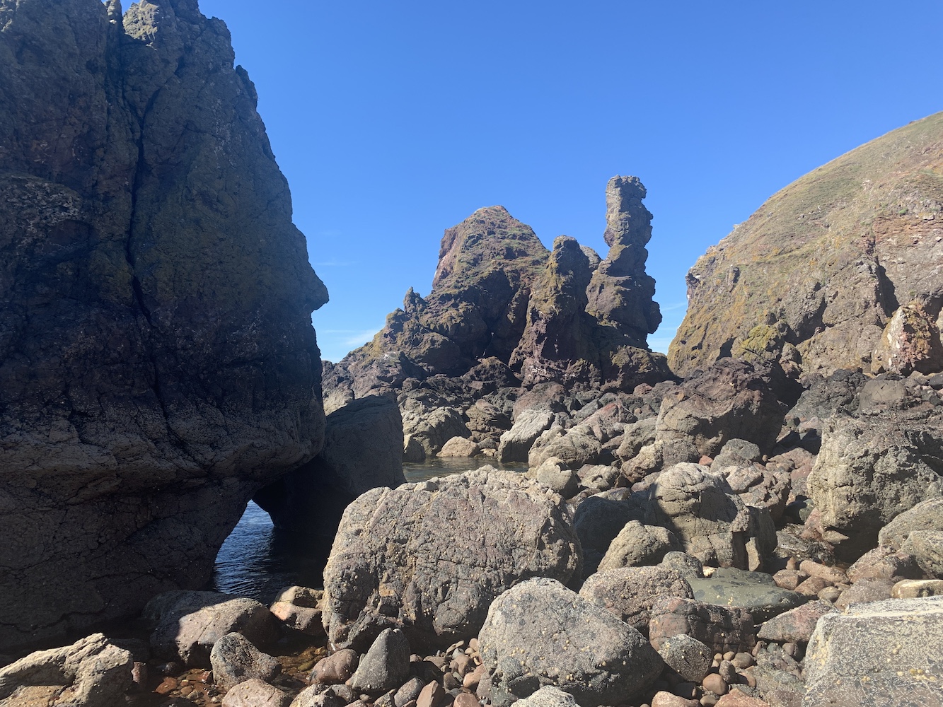
There was a surprisingly good little path down to the old jetty. It quickly deteriorated though after rock falls in the area and you can clearly see that rocks underneath the jetty have been washed away. We passed a few warning signs on the way there. It’s a great little cove and the rock formations on the east side were very impressive.
Approaching the jetty at St Abbs
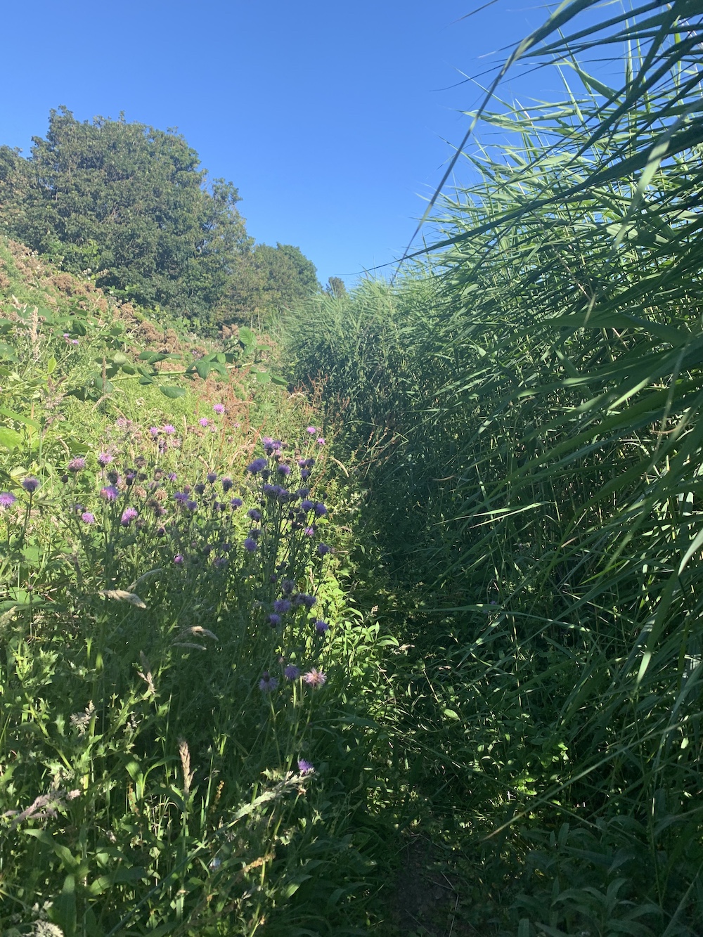
Lured by the loch I decided we should take the loch side route back. This was an interesting little path, overgrown in some places and open in others, and even a small tree-lined stretch at one point.
The rather overgrown route on the east side of the loch
At the end of the loch the path meets the main walking route to the lighthouse. Following this track, we took one last detour for a closer look at the old walled garden used by the lighthouse keepers and their families. It is all very overgrown now, but it’s a huge area in a sheltered spot.
The view of the lighthouse from the south
Approaching the old lighthouse garden
Inside the garden at St Abbs
I’m looking forward to seeing what the coming days bring here and whether it does actually ever rain at St Abbs! 🙂
There are the odd occasions when you spend some time in a place and plans just don’t work out as you’d hoped. Usually, in the case of visiting island lighthouses, this is due to the weather. This was certainly the case over the past week which we spent in South Uist.
The Western Isles islands of Lewis and Harris hold a special place in my heart, but the shores of the chain of islands comprising of North Uist, Benbecula, South Uist and Eriskay plus a multitude of smaller islands around them, were fairly unexplored. The area doesn’t boast the volume of lighthouses that the islands to the north do and most that can be found there I had visited last year, including Ushenish, Weavers Point and Gasay. There was one that remained though, Calvay. I’d seen it from the ferry last year as we left Lochboisdale, but seeing it from the ferry just wasn’t close enough and so it was part of the agenda for the week just gone.
As the week approached it was clear that the weather wasn’t got to play ball. With strong winds and wet weather forecast, it looked like we’d be lucky to get out on a boat trip at all. I was in regular contact with David from Uist Sea Tours and it only took a couple of days to realise that Friday was really going to be the only day a trip would be possible. It was no big problem as we occupied ourselves as tourists on the islands with the kids and met up with friends who had joined us for the week.
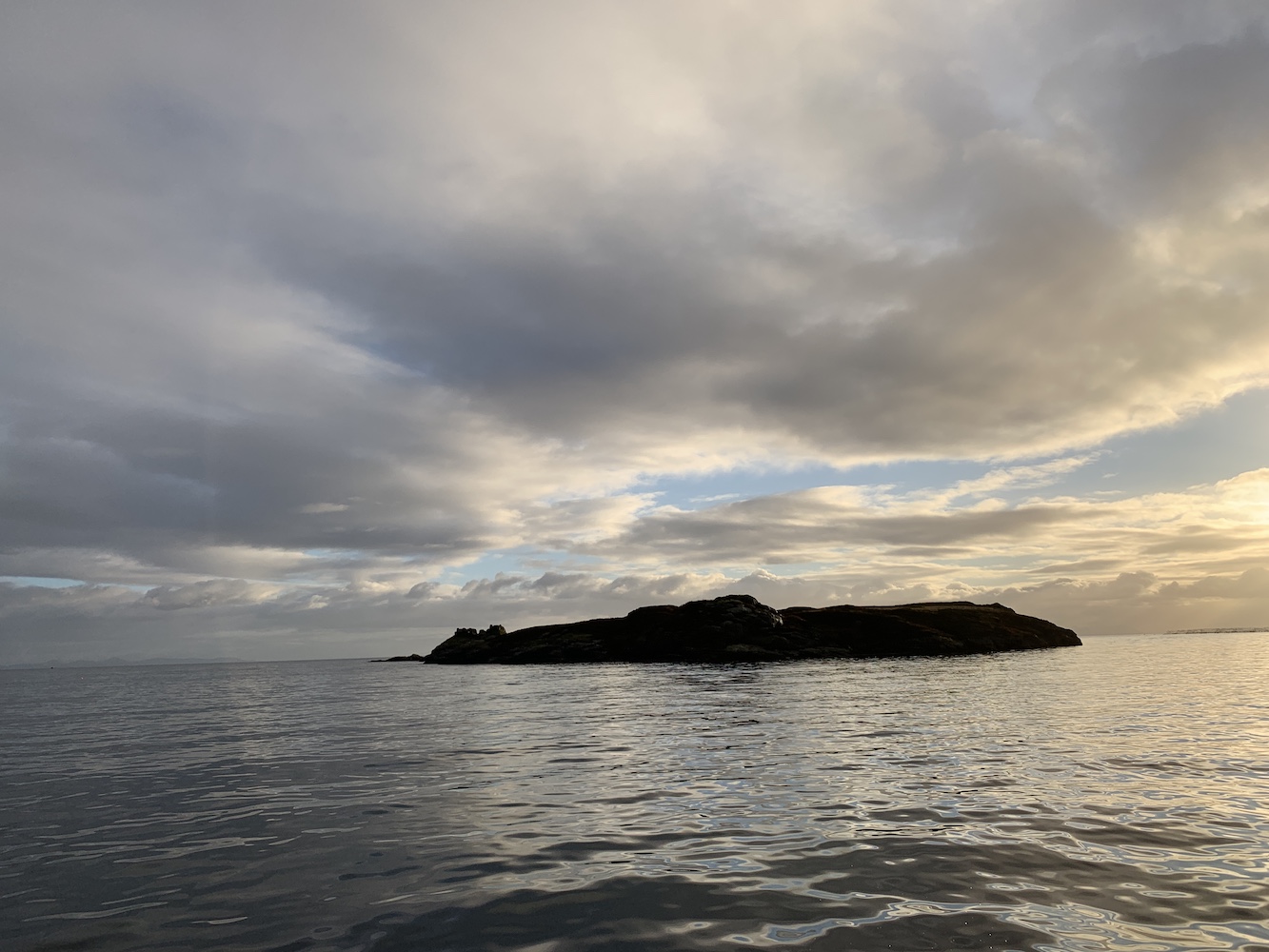
As Friday approached we got the final confirmation from David that we were good to go. The plan was to stick to Lochboisdale area and then creep up the east coast a little way and, if conditions allowed, to sail down to the island of Gighay to the south west of Eriskay. With the kids in tow it was decided that I would join for the beginning of the trip only, taking the kids along for a short ride out to Calvay and back.
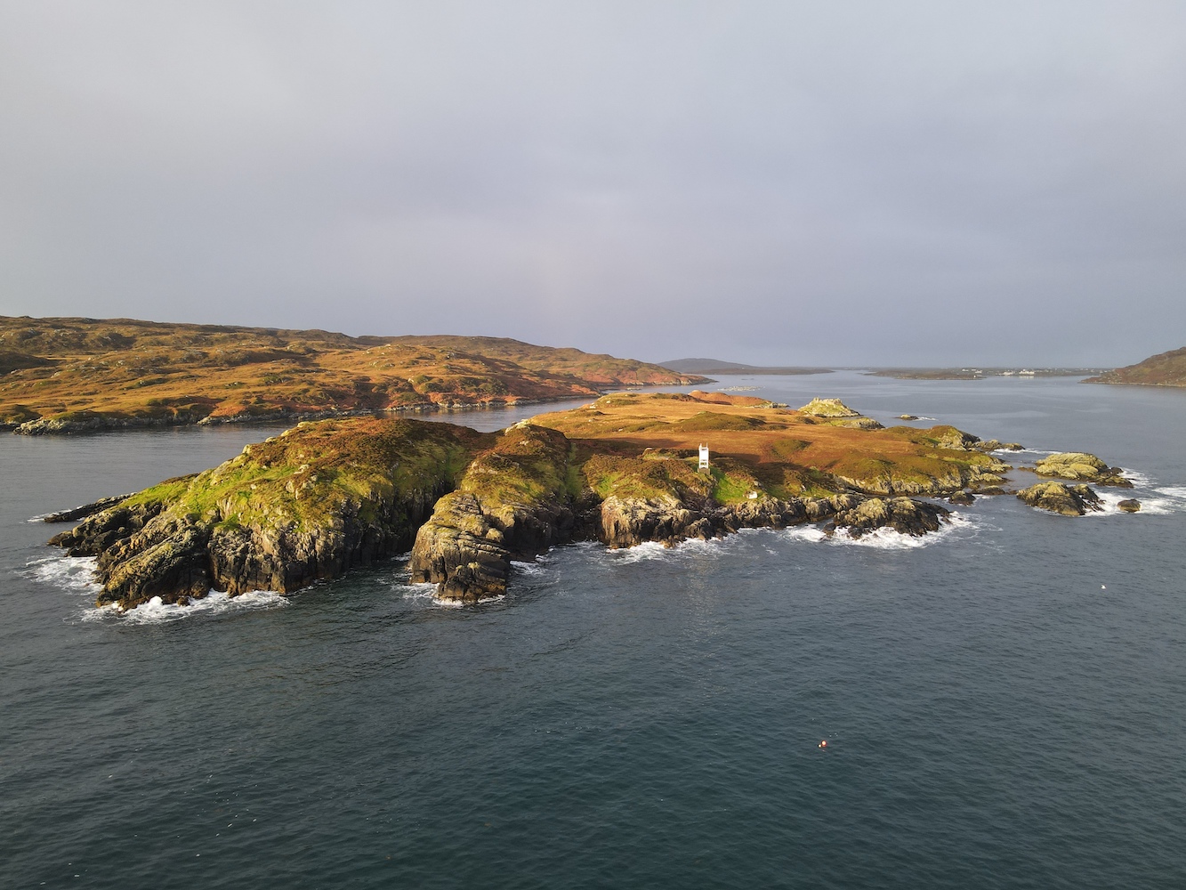
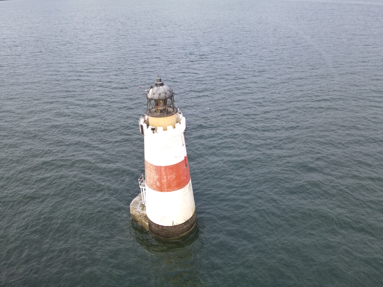
Calvay island
There was still some swell about, remnants of a few days of strong winds, and so landing on the north side of the island looked like it might be a bit tricky. Although it would land us further from the lighthouse, we headed around to the south side where it seemed nice and calm. For this first venture onto the island (the others returned later) it was just my lighthouse pal John and I.
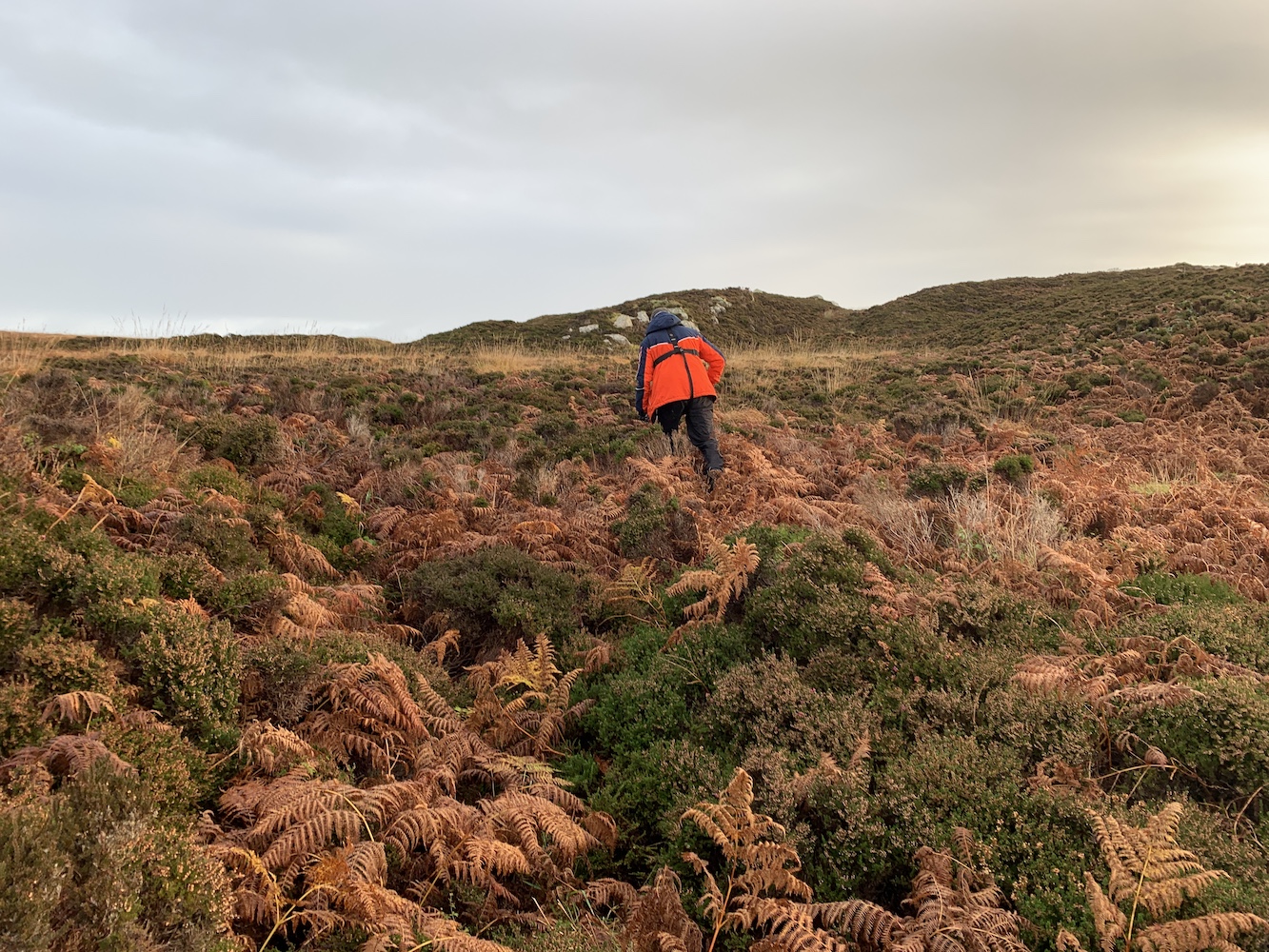
Landing on seaweed is never the nicest way to set a first foot on an island, but we managed it with some assistance from David. There aren’t many occasions when you hear someone say ‘Grab any part of me you need to’! Then it was making our way across the wet and dry rocks before we hit the heather. There are good things about heather, it’s really grippy underfoot, but it’s also very hard work to walk through. You can never really see where you are stepping and on occasionally there will be a hole hidden underneath and I ended up with a foot in a hole a few times, which would end with me having a ‘quick sit down’ two or three times.
John making his way through the heather and ferns
John did a great job of navigating, heading off ahead and then advised as to whether we should continue on that route or head for a slightly easier looking track. We find a nice grassy route at one point, but then lost the benefit of the ground being fairly dry underfoot. The distance from the landing point to the lighthouse was relatively short, but it wasn’t easy going. We arrived to some lovely views across the entrance to Lochboisdale waters. The island is really best known for its castle (which is on a different tidal section of the island) and was one of Bonnie Prince Charlie’s hiding places. The full story of his escapes on and around Calvay can be found here.
Calvay Castle, taken later in the day
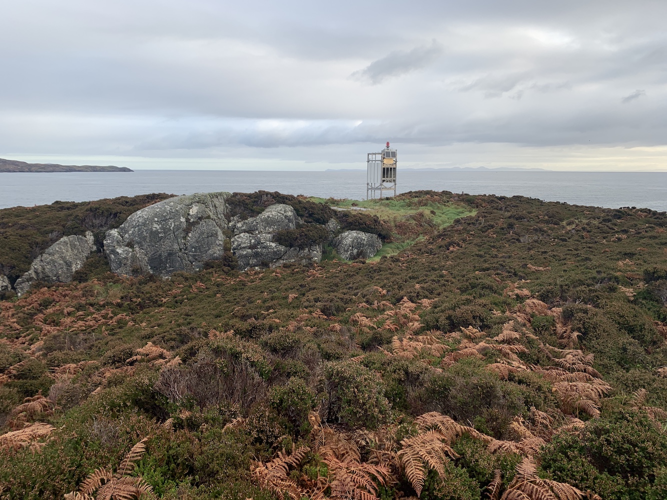
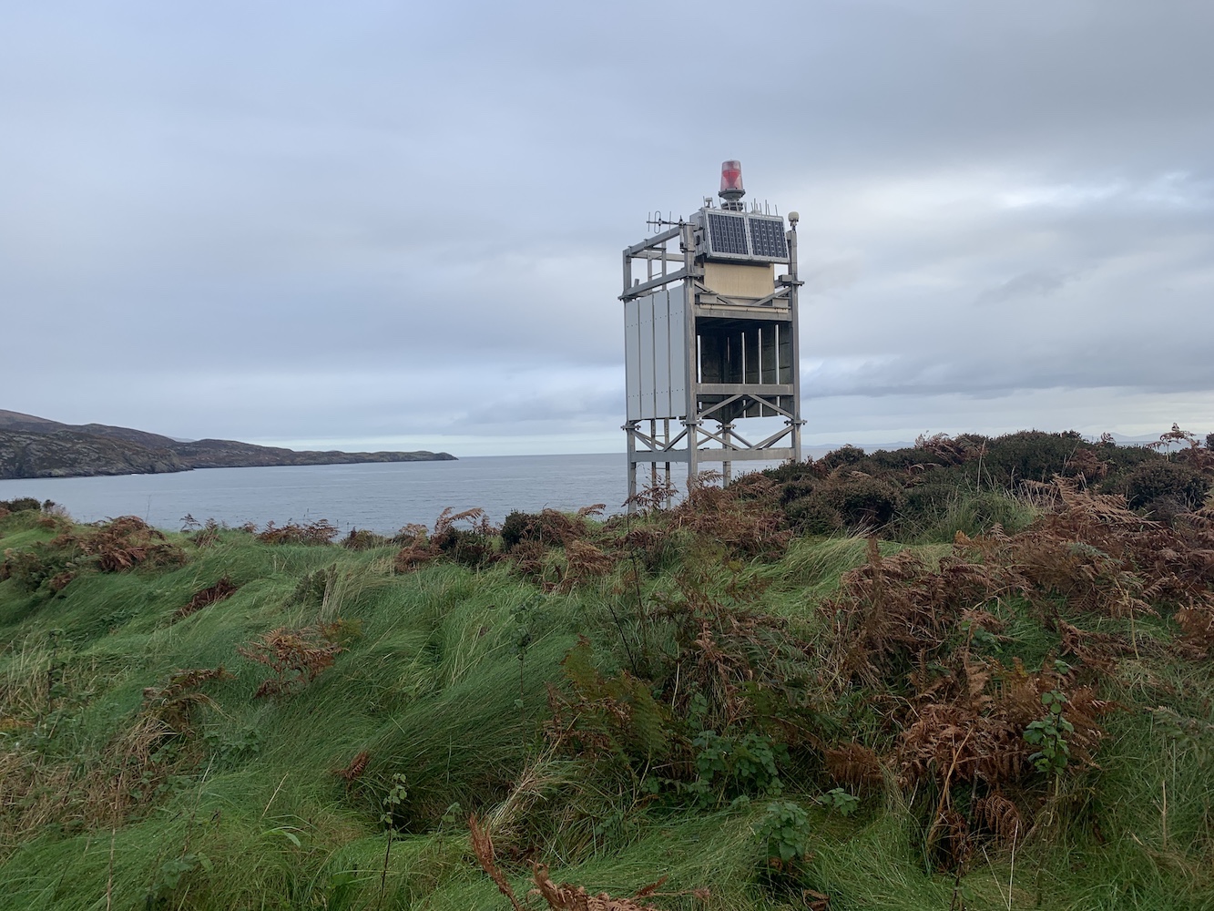
The existing lighthouse here was installed in 1985 and, along with its twin light on Gasay, was the first of the second generation of this type (a friend of mine who was on the trip refers to them as Stefansons – a combination of a link to the Stevenson lighthouse engineers, and the flat-pack style of the towers. The original ‘Stefanson’ was on Eilean nan Gabhar near Jura, but it has since been replaced making these two the oldest still in existence.
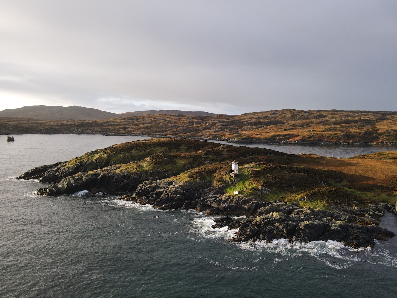
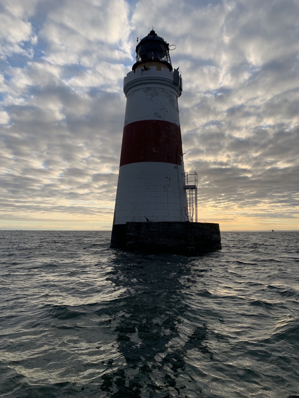
Approaching Calvay Lighthouse
The structure is the Northern Lighthouse Board’s standard framework tower with white cladding – known as SPLATS (solar powered lattice aluminium tower). It is slightly different though in that it has no cladding on the ground level and a section on the first floor that is also unclad, on the landward side. These white cladding panels work wonders as daymarks and have certainly helped me to spot many a flat-pack lighthouse in the past.
Plenty of long, thick, tufty grass near the lighthouse
The first lighthouse on Calvay was built in 1891 to a design of David A Stevenson with the assistance of his brother Charles. The light was installed following a request from the West Highland Commission that more aids to navigation be built to support trade in the area. The purpose of the lighthouse on Calvay specifically was to mark the entrance to Lochboisdale. Nothing there at present resembles the style of lighthouse he often designed, although he didn’t stick to the a standard design with examples of more unusual styles being Dunollie and Kyle Rhea lighthouses.
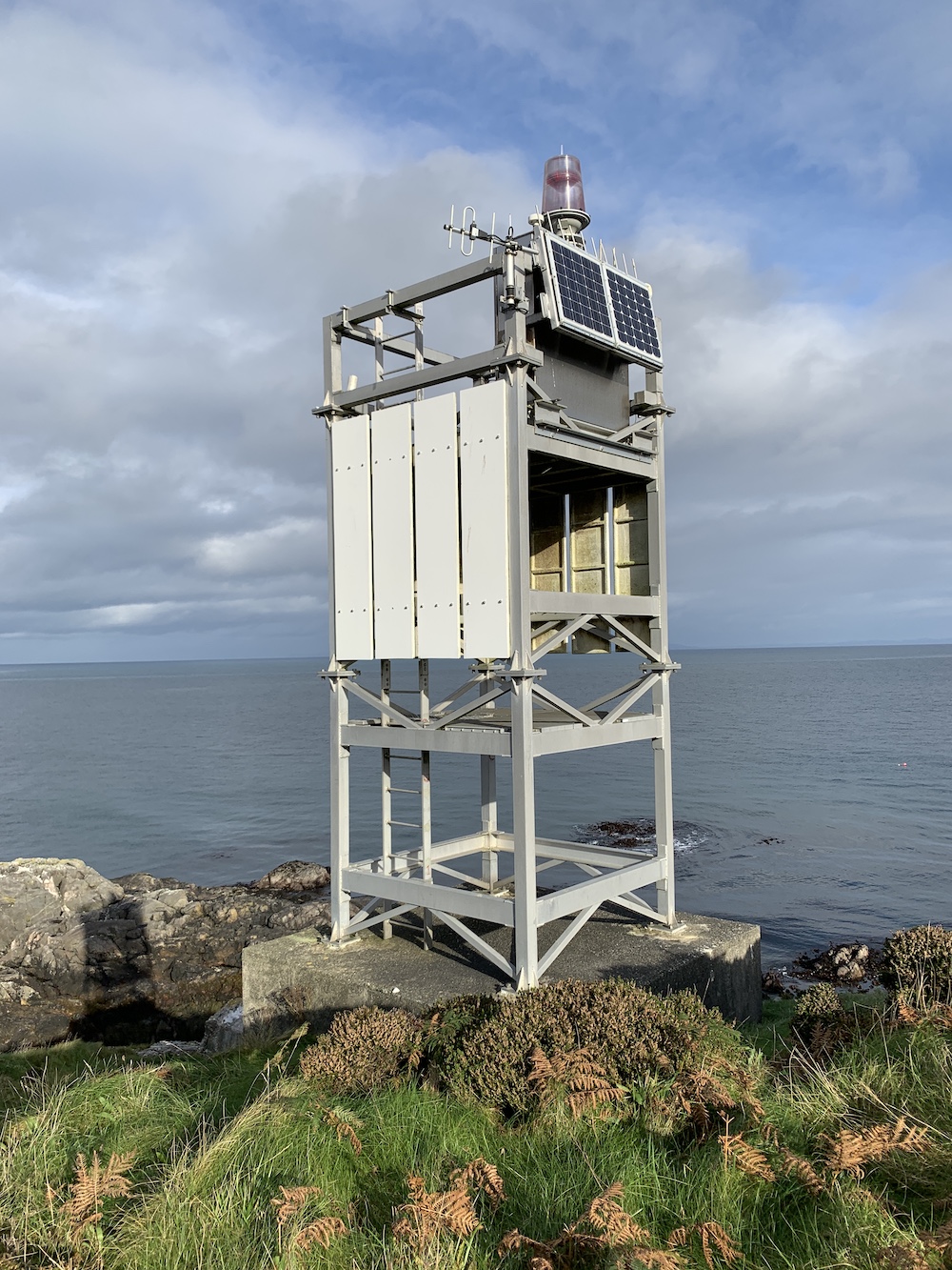
Calvay Lighthouse, taken later in the day after the sun had risen
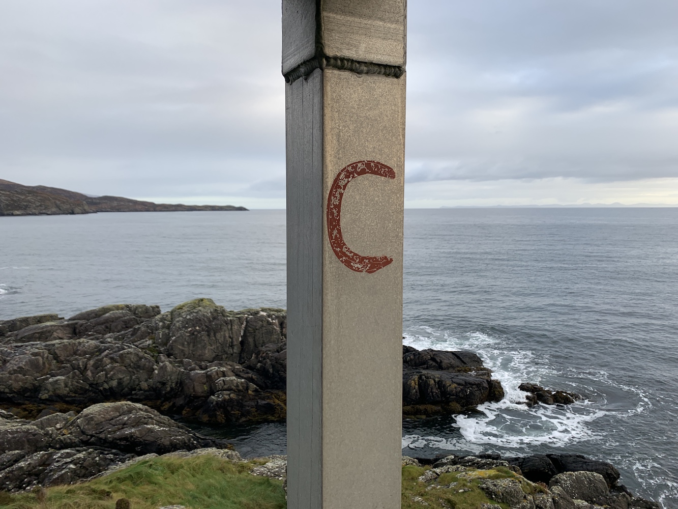
The Calvay equivalent of a Northern Lighthouse Board plaque
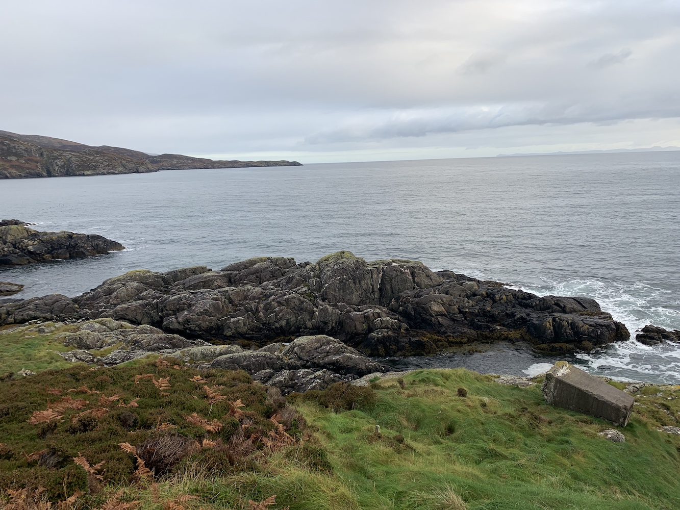
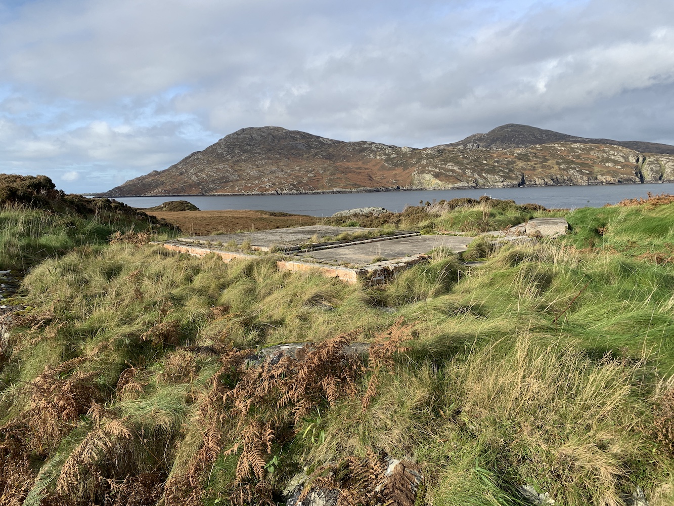
While there we noticed an old concrete pillar laying on its side on the ground in front of the light. I have since asked the boatman what purpose this served and whether it was somehow related to the stone platform just to the west of the light (which is shown as a shed here). It may well be that this pillar was part of the former lighthouse. He is going to look into it, but if any readers have further information about this then do get in touch here.
The entrance to Lochboisdale and the old concrete structure below the lighthouse
The old platform where a shed once stood
Keen not to hold everyone up for too long at the start of the day, we began the slow walk back to the pick-up point, which was easier than the drop-off, but still seaweed-covered. I think that was unavoidable really and John was a big help in getting me safely across the seaweed without slipping.
Joe the Drone had a nice flight as the sun was rising
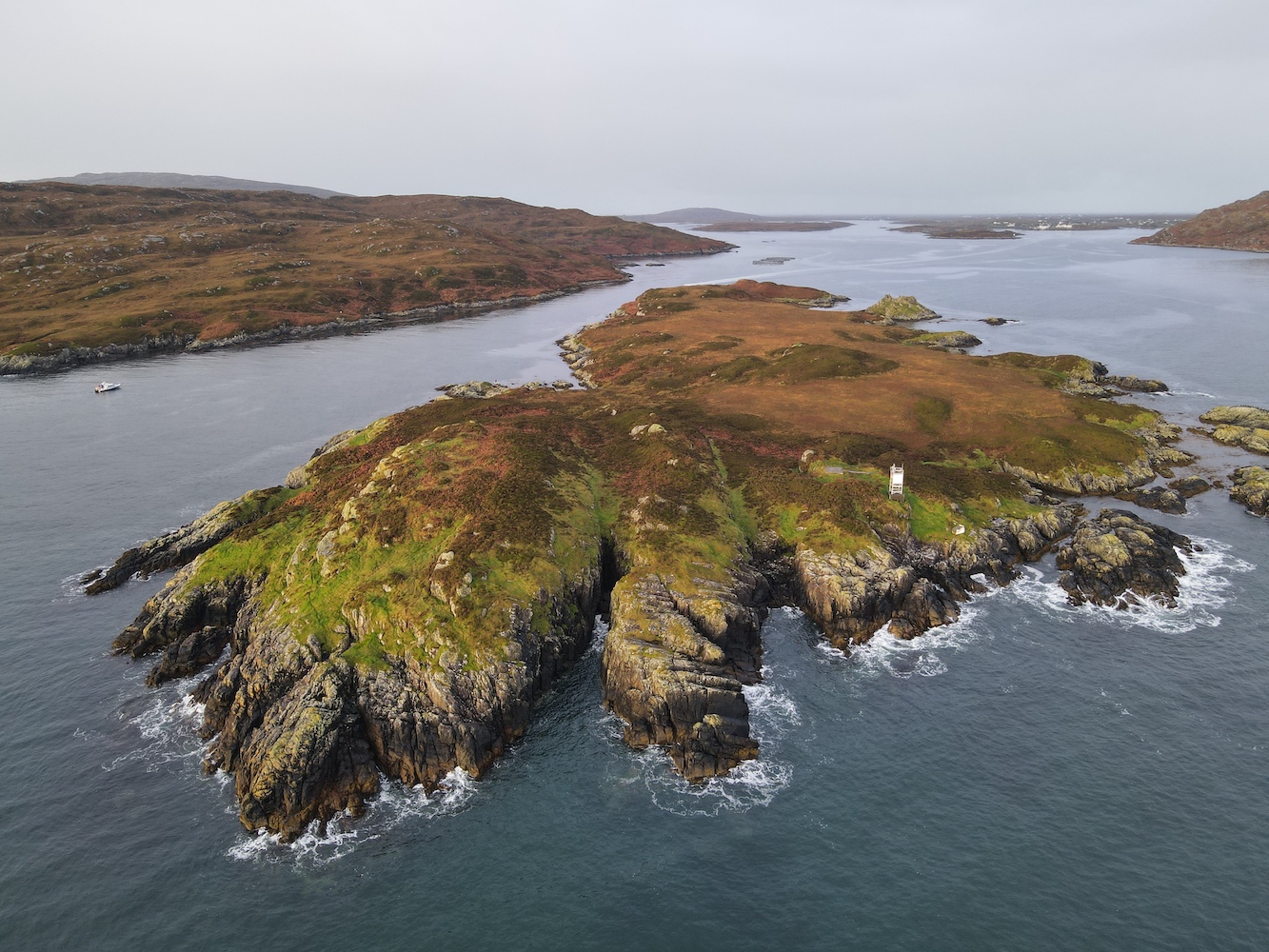
Calvay Lighthouse from above with the old pillar visible below it
The island of Calvay which, in my view, looks like a tarantula from this angle!
Just this evening, while looking back through some of the drone images we spotted a little jetty not far at all from the lighthouse. It’s quite tucked away, understandably given that its primary purpose is probably to allow vessels to land to maintain the lighthouse. The walk from it wouldn’t have been half as fun though!
The jetty gives quick access to the lighthouse
Back on the main boat it was time for the kids and I to head back to dry land. We had some lovely reflection views of the light on Gasay en route back to the marina, which incidentally is where the starting point is for the short walk to Gasay lighthouse – made accessible without a boat since the new marina was built.
Gasay Lighthouse
It may only have been a single lighthouse on this trip, but actually that was really the only one on the original itinerary that I’d not managed to get close to before so I’m happy. 🙂
I’m not really a morning person, but when there is something worth getting up at 2.45am for then I will do what needs to be done to make the most of an opportunity. Bob had managed to arrange a boat charter for us today from Burntisland for a bit more of an explore on the Firth of Forth. To ensure we could make the most of high tide it meant getting on board Calypso Marine’s RIB Alert at 5.30am (allowing a two-hour drive over from Ayrshire), before the sun had even risen. We had a bit of a laugh about how early it was with Stewart and Leanne who were taking us out and then climbed on board and off we went.
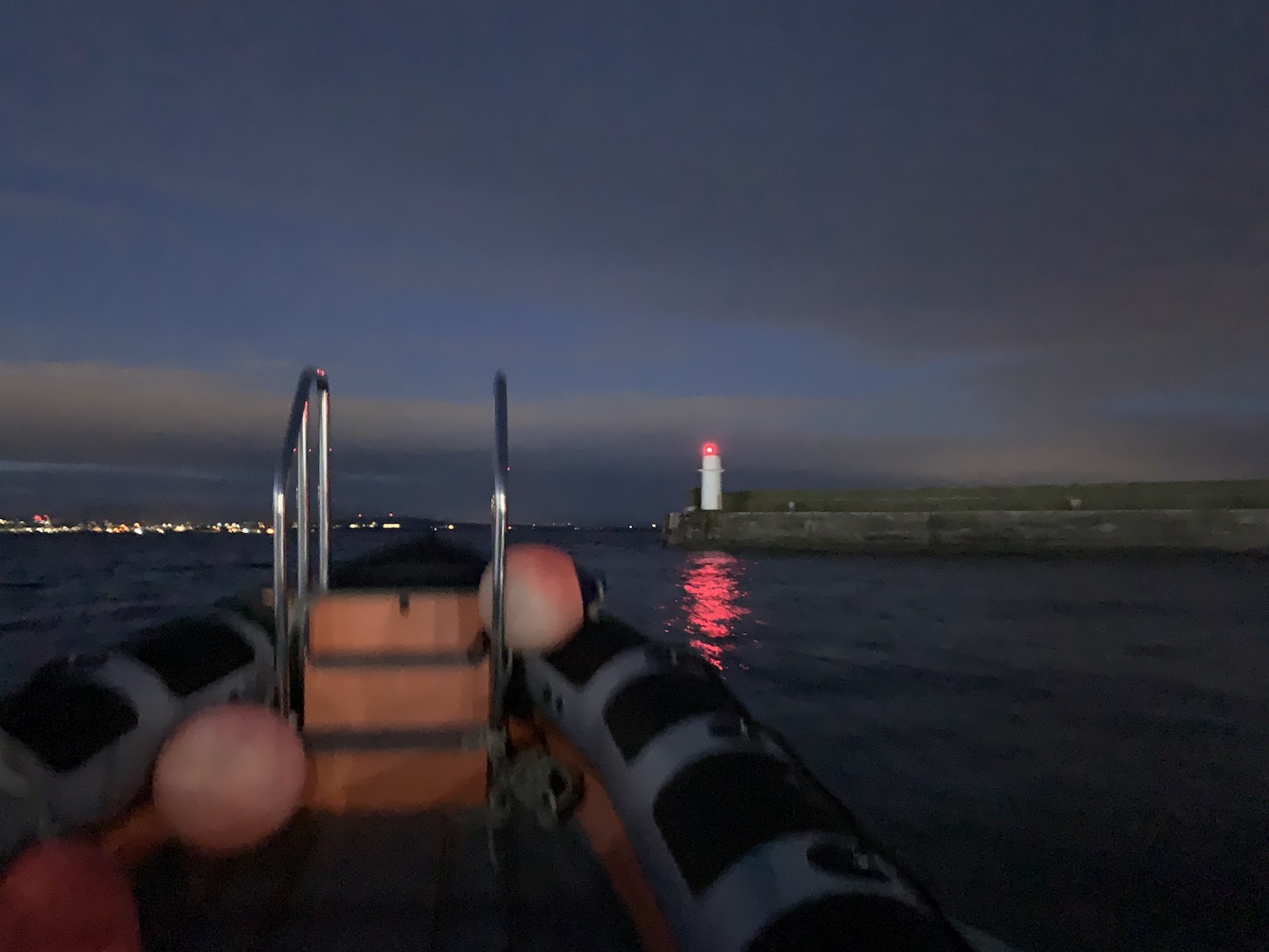
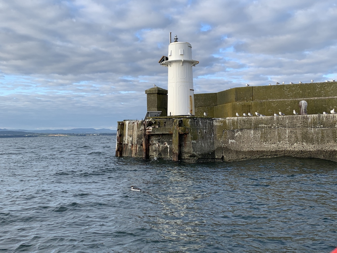
Setting off from Burntisland gave us a good opportunity to see how the west pier head light is looking after being struck by a ship and the lantern knocked off in January this year. Sadly it’s still not been repaired yet. However, at this point it was still quite dark so at least I got to see it in action.
Leaving Burntisland with the damaged lighthouse flashing away
It was great to be out on the water, heading west along the Forth, seeing lights flashing all around. Although mainly buoys it was good to see Oxcars Lighthouse operating and also see its red sector light too as we sailed away from it. Seeing the bridges too was also fantastic, with the incredible rail bridge, the road bridge (home to little Inch Garvie Lighthouse) and the new bridge, also known as Beamer Memorial Bridge (because the lighthouse on Beamer Rock was removed to make way for the bridge – I should add it’s not officially called that at all).
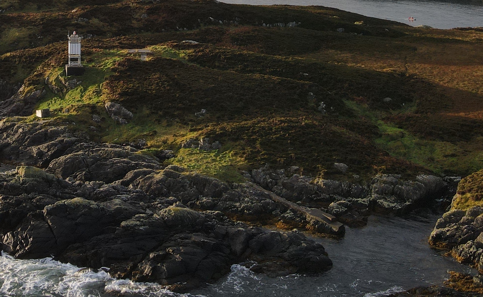
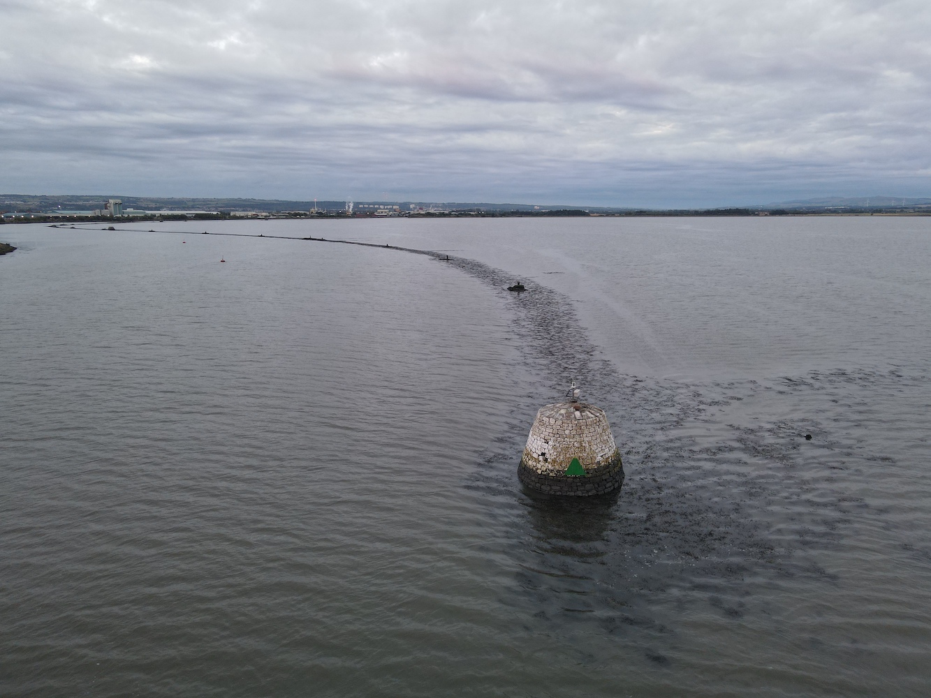
With the big chimney at Longannet edging closer I knew it wouldn’t be long until we arrived at Grangemouth, our first stop for the day. At the west of the entrance to the River Carron there is what looks like a very large cairn with a modern light and solar panel on top. This was significantly bigger than I expected it to be, but it wasn’t what I’d come for.
The light (or lit oversized cairn) at the entrance to the River Carron
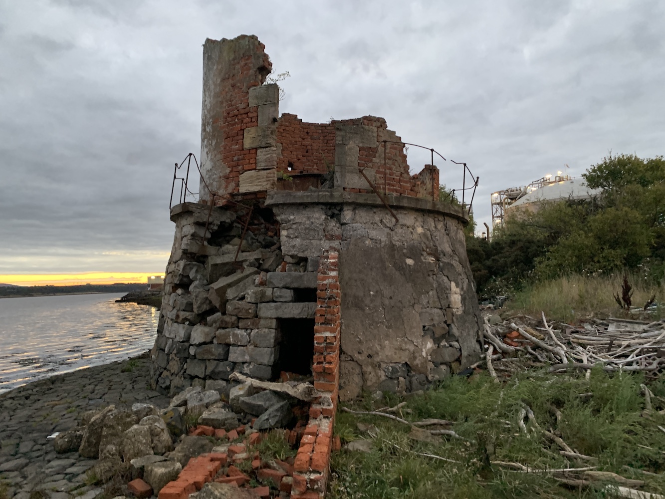
The main point of interest for me was the old lighthouse opposite, which is just outside to boundary of the Ineos complex. I’d known not to expect much here. There are a small number of pictures about of it from the past thirty or so years, including this one, and also a couple (here and an artist’s impression here)showing how it looked when it was operational. I had partly been expecting just a big piles of rocks so was nicely surprised to see that there was something that still vaguely resembled a lighthouse, though a derelict one.
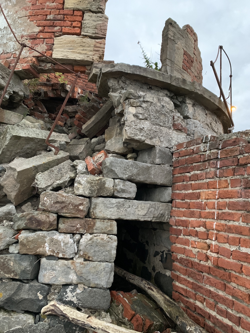
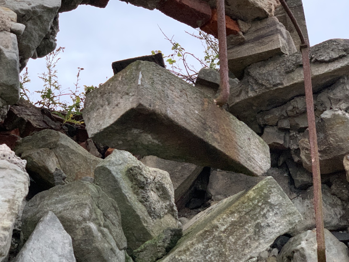
The remains of Grangemouth Lighthouse
It’s really sad to see the state it’s in now with parts of the walls fallen away and it just generally looking like a very unsafe structure. It’s devastating really how it’s been left to just gradually be destroyed now it no longer serves its purpose.
The former entrances to Grangemouth Lighthouse
A piece of rock dangling from the old handrail on Grangemouth Lighthouse
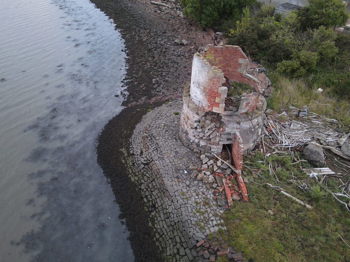
Very aware of our close proximity to the Ineos complex, Bob put Joe the Drone up and got some shots keeping clear of their boundaries.
The ruined Grangemouth Lighthouse from above
After I’d been manhandled back on to the boat with a push from behind by Bob and a pull up from Leanne we were ready to continue our journey. I left Grangemouth Lighthouse behind, feeling very glad that I’d made it there and put in the effort. I wonder how many more generations of lighthouse baggers will be able to do so.
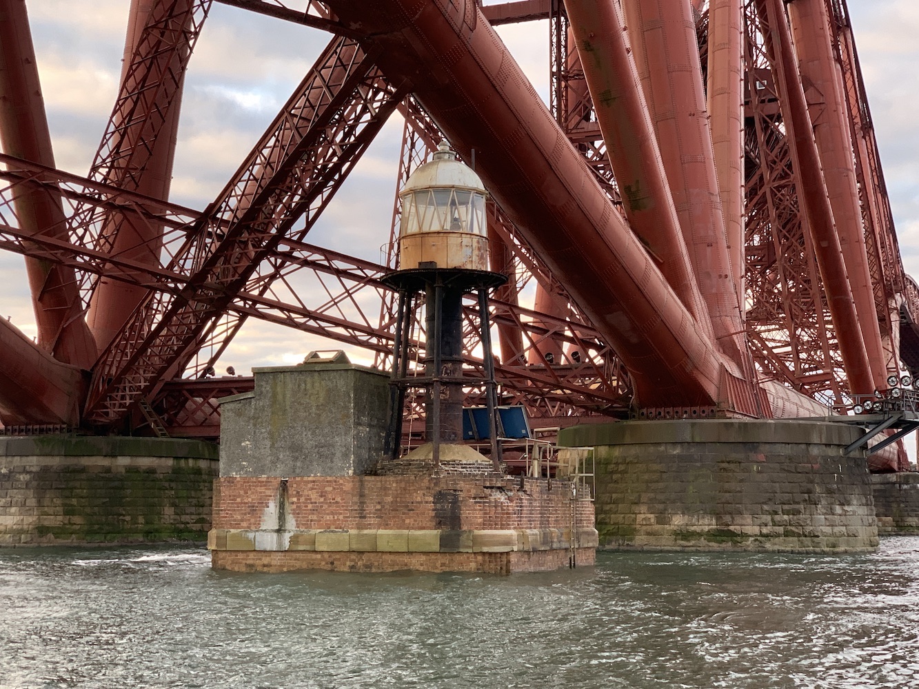
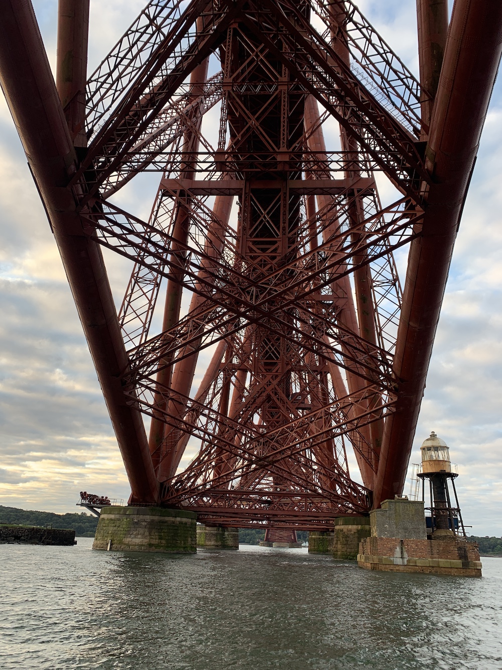
With the rising sun in our eyes we began our return journey. Stewart and Leanne very kindly offered to sail us close to Inchgarvie Lighthouse on the way. It’s always seemed so small before, dwarfed by the infamous rail bridge, but when you get a closer look it is actually a good sized structure. It’s clearly had a bit of weathering over time but is still a perfect example of what I like to call a ‘lantern on legs’.
Inch Garvie Lighthouse
Inch Garvie Lighthouse under the Forth Rail Bridge
There was just time on the way back for Joe the Drone to take a quick flight around the very understated Oxcars Lighthouse.
A Joe the Drone’s eye view of Oxcars Lighthouse
I see Oxcars as the east coast’s equivalent of Skervuile near Jura on the west coast. Fairly little known, particularly outside of lighthouse circles, but still as much of a rock structure as the big ones like Skerryvore and Bell Rock – just not quite so far out to sea.
Oxcars Lighthouse at sunrise
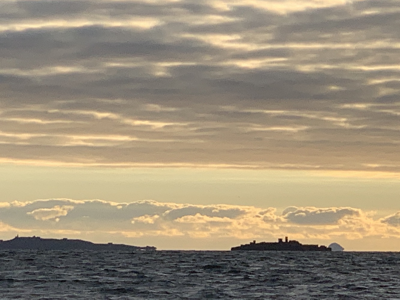
I’ve found in recent years that revisiting places does increase your appreciation of them. Yes, it’s nice to pick off all lighthouses in an area in one trip, but it’s only by going somewhere a few times you notice some of the smaller details and start to familiarise yourself with a place. Today was my fifth time out on the Forth, but the first time I’ve truly appreciated how unique it is. To be going underneath those three bridges with an array of variously shaped islands ahead of you, from the ship-shaped Inchmickery, to the relatively vast Inchkeith, to the very recognisable lump that is Bass Rock in the distance, the Forth is unique in possessing so many islands, particularly as it’s on the east coast. It’s also got plenty of interest for those into history (particularly military) and scientific study. With it’s close proximity to Edinburgh, it’s been used as a playground for many inventors throughout the years, from testing the strength of lighthouse lens, foghorn trials and even paint sampling to establish the best exterior paint to use in marine environments, there’s been a lot going on in the Forth for many years.
The islands of (left to right) Inchkeith, Inchmickery (built up to resemble a warship) and Bass Rock in the distance
As we returned to Burntisland we had a clearer view of the damaged lighthouse.
Burntisland West Pier Head Lighthouse minus its lantern
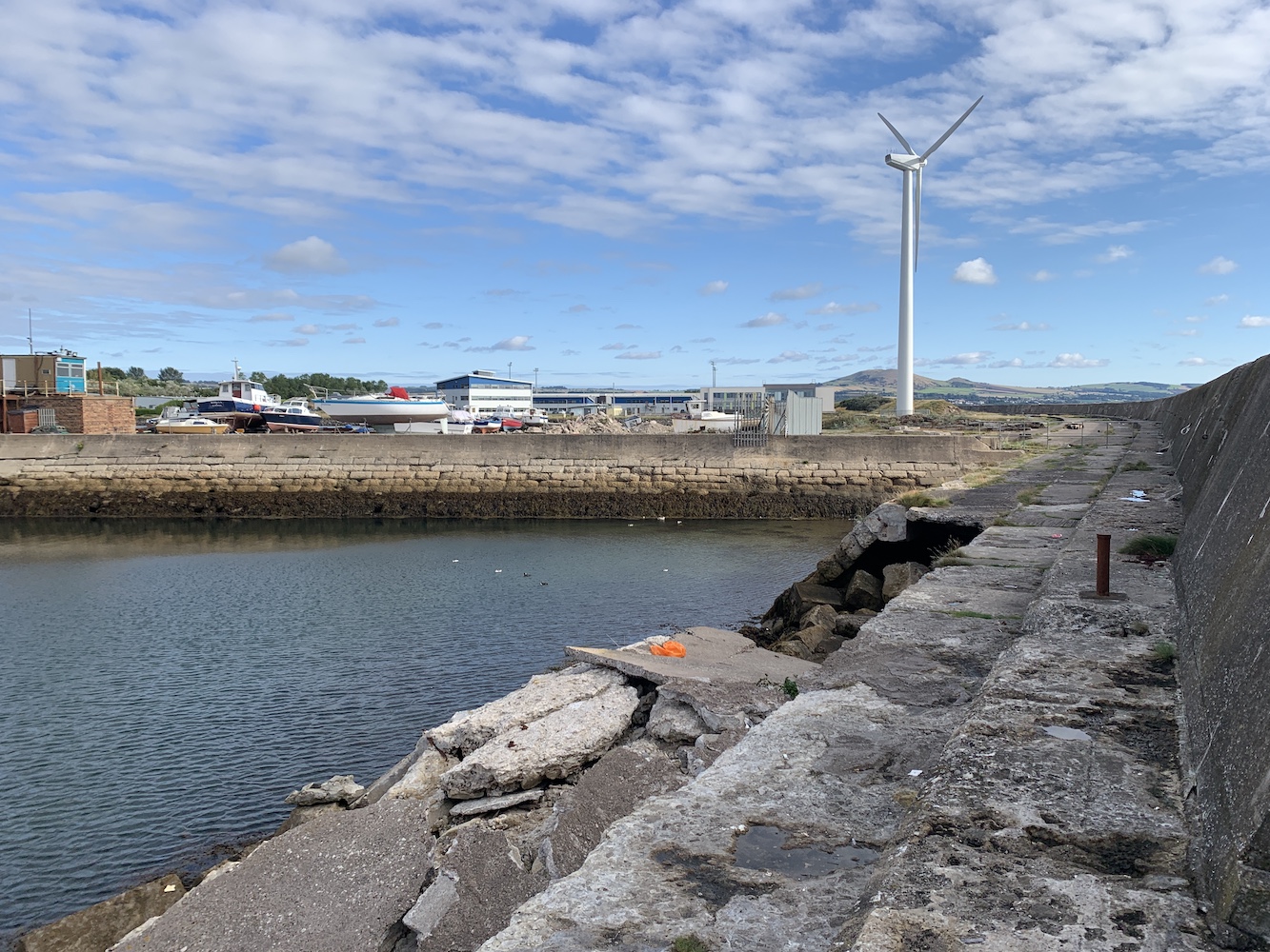
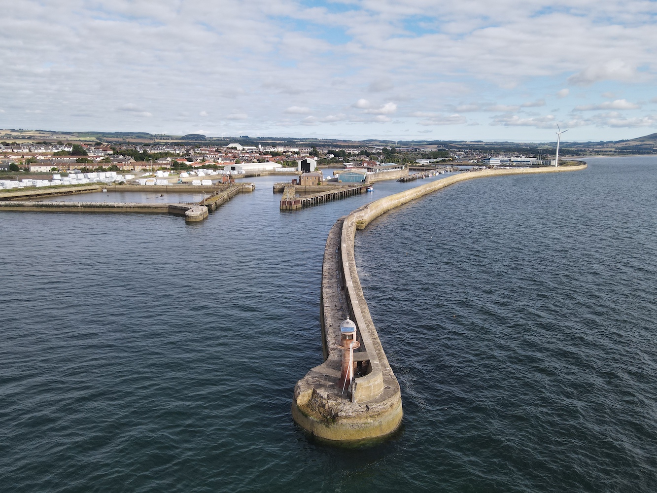
After a coffee, freshly baked pain au chocolat and chat on board Stewart’s bigger boat, Pathfinder, we set off for Methil where I had some improvement work to do. Back in 2012 I was a lazy lighthouse bagger and if I couldn’t see a lighthouse very well I wouldn’t put in much effort. Methil was one of these. It isn’t actually very easy to see at all with so much of the harbour inaccessible to the general public. Last time I’d seen it from quite a distance so it was time to rectify that while in the area.
Parking up in an industrial area we set off on foot for the longest pier in the world (no, sorry, in Methil). We still hadn’t seen the light at this point and didn’t for some time to come. We wandered along a grassy mound and then down onto the pier which may have technically been closed to the public. This rule is clearly not abided by very often, although you can see why the rule has been made as one section of the pier in particular has been partially washed away.
The most damaged section of the pier in Methil
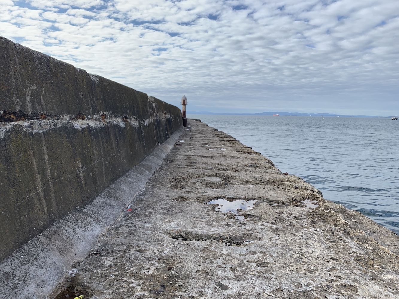
Onwards we continued, and by this point I was wondering whether or not the lighthouse was still there at all as it still hadn’t come into view. Thankfully I spotted the top of the lantern over the sea wall a short while later and then there it was.
Finally approaching Methil Lighthouse
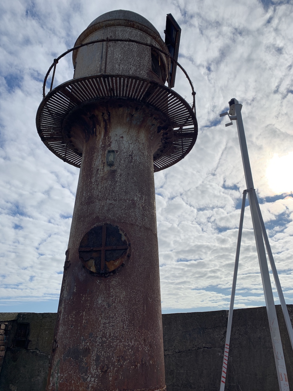
The tower is no longer operational as a lighthouse. It’s only function now seems to be to hold the solar panels for powering the replacement light on a stick which is just in front of the old structure.
Methil Lighthouse with the new ‘light on a stick’
After a few quick pictures and a short flight by Joe the Drone we set off back along the heavily weathered pier.
Methil harbour from above
While doing some research into Grangemouth Lighthouse I’d come across some pictures of what seemed like an interesting structure worth closer inspection at Burnmouth. It meant a detour but, being the Lighthouse Detective I am, I just had to look into it. On the way there we happened to stop for lunch not far from Barns Ness so a bit of time there was required.
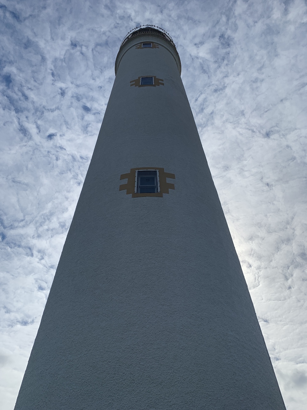
Barns Ness Lighthouse
I never give Barns Ness the credit it deserves. I visited it on my 2012 tour and, although it was nice to see, the low lying land it’s on didn’t wow me in the same way many of the others did. As I mentioned above though, the more you visited a place the more you enjoy it (with a few exceptions, of course) and I did really enjoy seeing Barns Ness and wandering around a bit more this time.
Barns Ness Lighthouse and cottages
Barns Ness Lighthouse tower
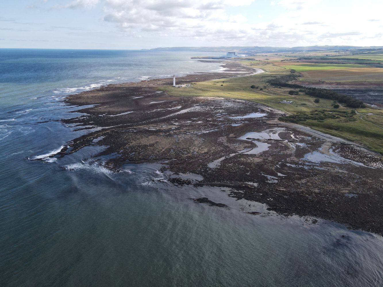
There’s a flying exclusion zone in the area due to Torness Power Station so Bob wandered off along to beach to where he could legally fly Joe the Drone and get some nice distance shots of the lighthouse and landscape. I used the spare time very wisely, having a lie down on the grass next to the beach and enjoying the peace, fresh air, sunshine and sound of the sea. My spot also offered great views across to Bass Rock which, as always, was looking fantastic.
Barns Ness from above
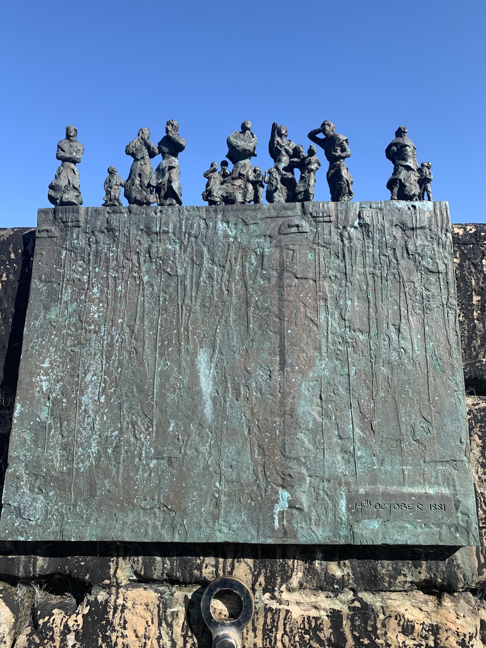
Half an hour down the road we made it to Burnmouth. Neither of us had been there before and it’s a beautiful little place. A real harbour, a fishing village as it should be. There were local men sitting around on the pier having a chat and some beautiful memorials to a local fishing disaster that occurred on 14th October 1881, where five boats carrying 24 local men were lost during a storm.
One of the memorials in Burnmouth to those lost in the 1881 disaster
From the moment we parked up I was fairly confident the little structure at the end of the east pier wouldn’t qualify as a lighthouse. We walked along the pier and climbed the very high steps up to it. It’s certainly not the same structure as before as it’s now just a hollow round metal tube with a cap on top. What I imagine has happened is that the old light was redundant and in a bad state, so it was replaced with something similar that was never intended as a navigational light. Something similar has happened with the light structure in Cullen. I think it’s great to see as it often shows how much the community values these small but important little features in their community.
The replacement structure on the end of the pier in Burnmouth
There may not have been an exciting new lighthouse in Burnmouth, but it’s a great place with a really lovely feel about it. Sometimes it’s nice to go somewhere different and change your focus a bit. Quite often you find the unexpected there 🙂
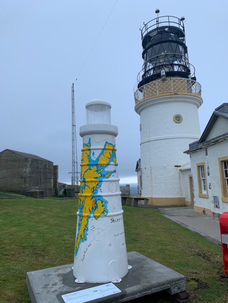
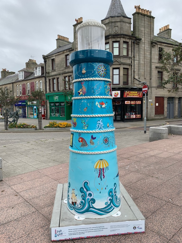
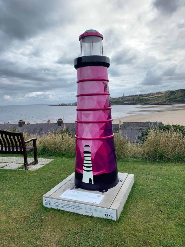
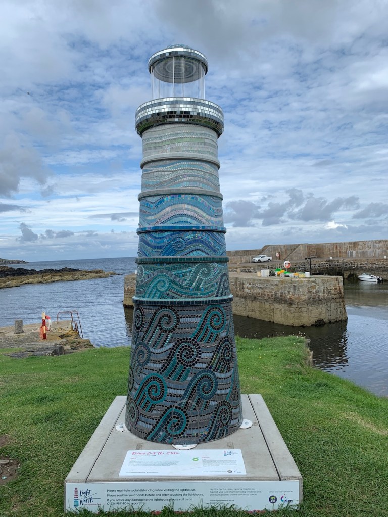
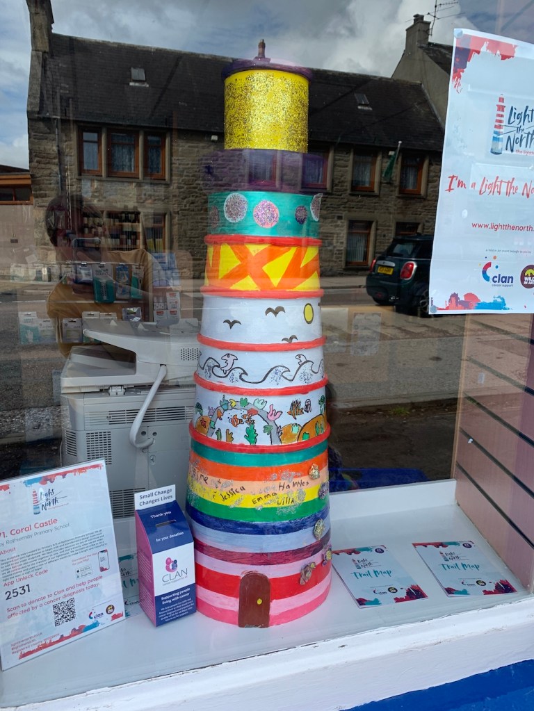
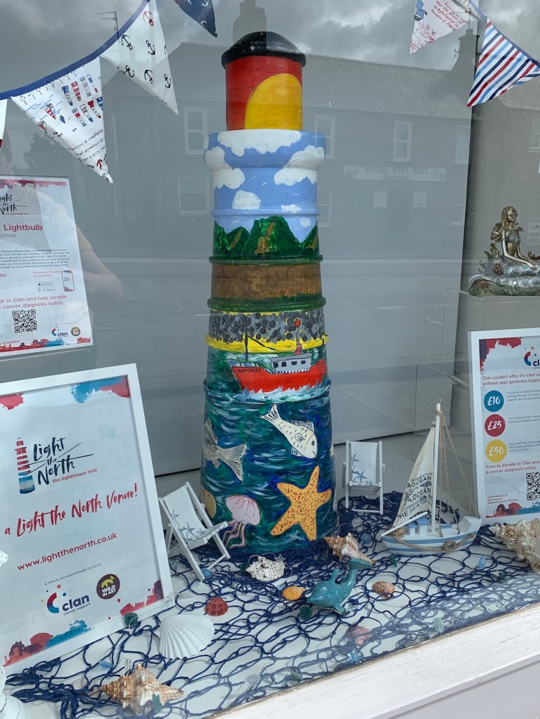
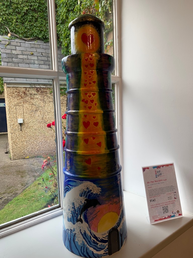
A week ago a brand new lighthouse trail was launched across Aberdeenshire, Moray, Orkney and Shetland. Light the North is a collection of 2.5 metre tall lighthouses designed/painted by artists, as well as a series of smaller lighthouses featuring designs from local schools.
Why is this happening, you may ask. Well it’s all for an excellent cause, Clan Cancer Support. Clan provides free support to those with cancer across the geographical area mentioned above. The outcome of the trail is that the lighthouses will be auctioned off in mid-November, raising funds for the charity.
The trail has an associated app, which features a map showing you where the lighthouses are, details about each lighthouse and also lets you collect the lighthouses by entering the individual code found on the plinth of each model. Trail maps with a suggested donation of £3 are available in various locations, or you can take a look at the website to find out more.
Anyone who knows me well will know that I can’t resist a list, especially when it is lighthouse-related. It worked out rather well us being in Shetland for the start as I was able to see those based there. Then travelling back via Aberdeen we followed the coast, picking off more as we went.
It’s great fun and I’m hoping to get a chance to see some more before the trail finishes at the end of October.
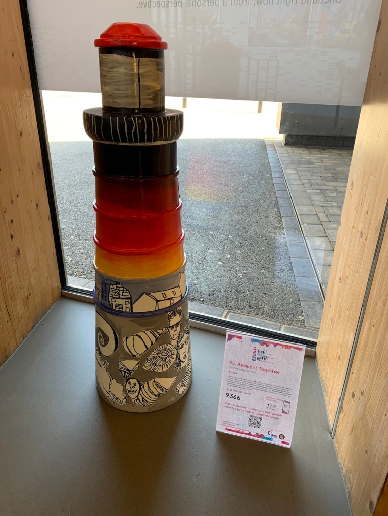
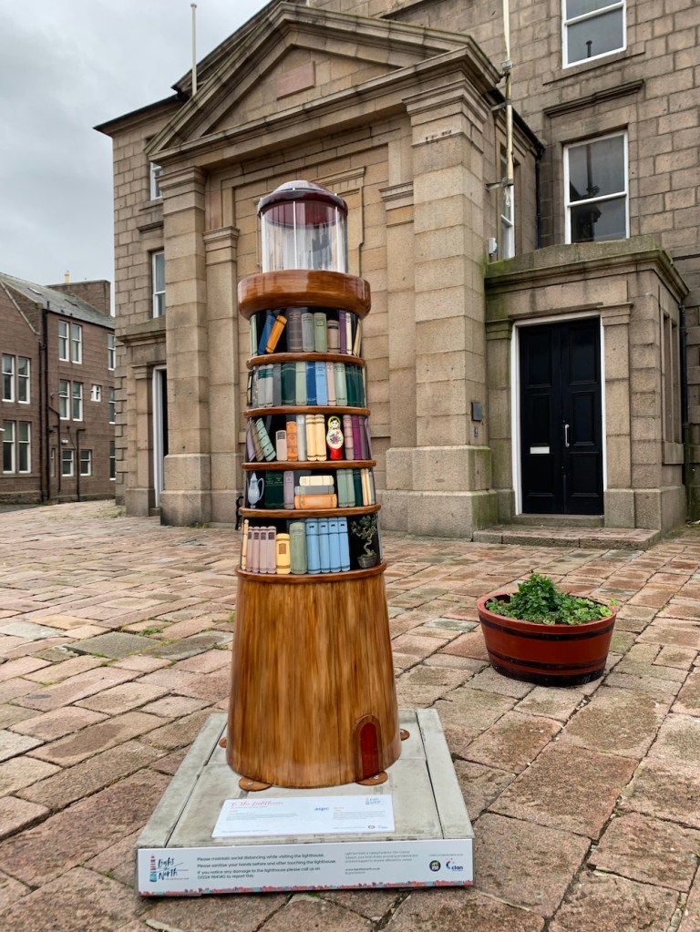
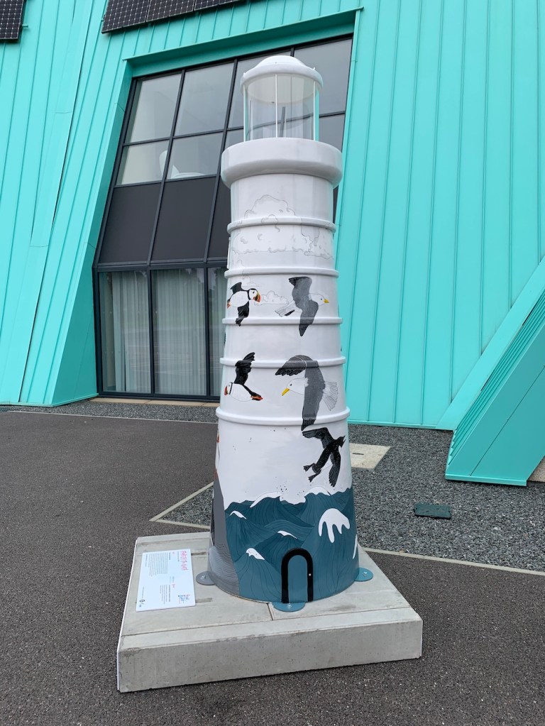
Here are some of the models I bagged over the past week. 🙂
It’s been the final full day in Shetland today, ending a 10-day period of absolute perfection in terms of achieving everything I wanted to. With only three days of no boat trips, plus an extra day for me to spend with the family, there was just enough time to get to the land-based lights I had left to visit.
After the visit to Peerie Bard, home to Mousa Lighthouse, yesterday I have now visited all of the modern flat-pack (SPLAT) lighthouses in Scotland. There are a few I’ve not been close enough to touch yet, but have seen at very close range.
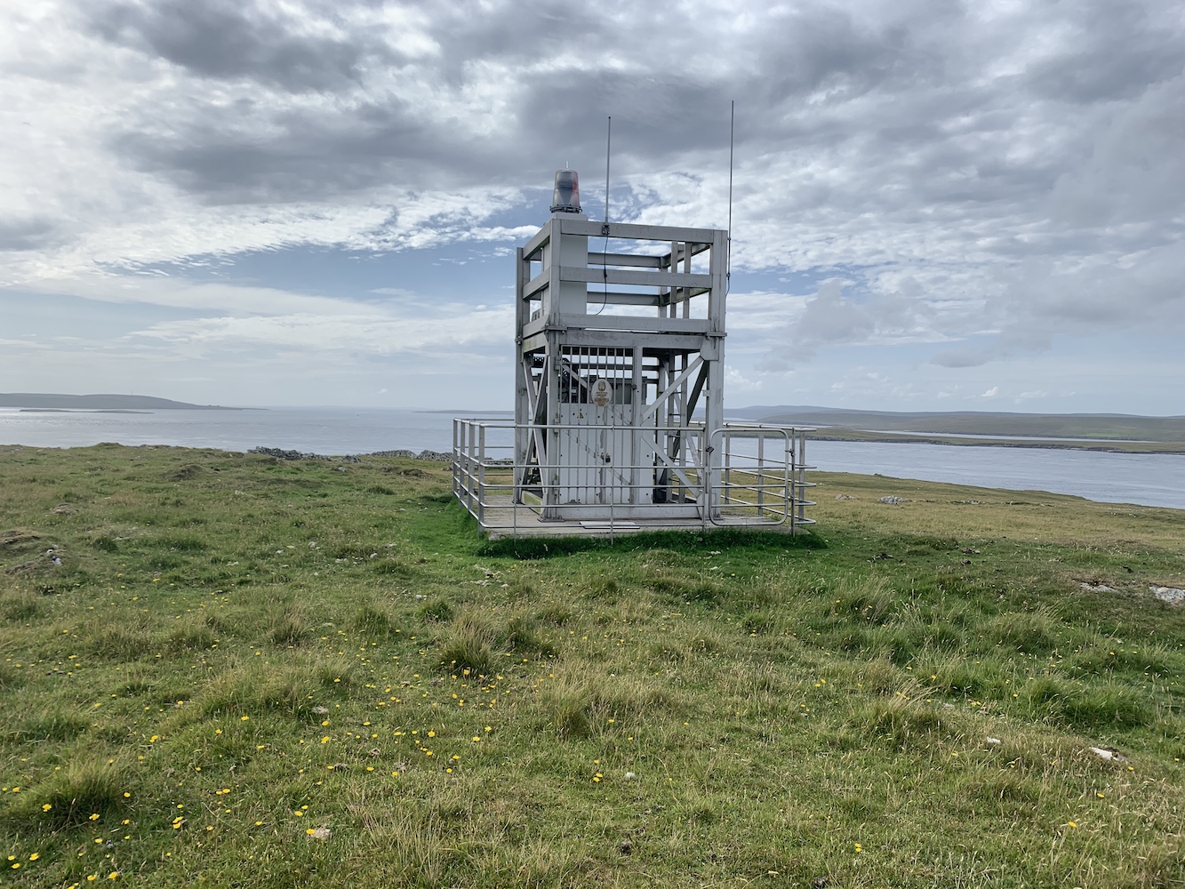
There was one, however, that had been mentioned to me and I’d not included on my list: Head of Mula. This one was built of the same aluminium framework as the flat-packs, but if didn’t have the white cladding on it, which to me is an open structure and therefore not meeting the criteria for inclusion on my list.
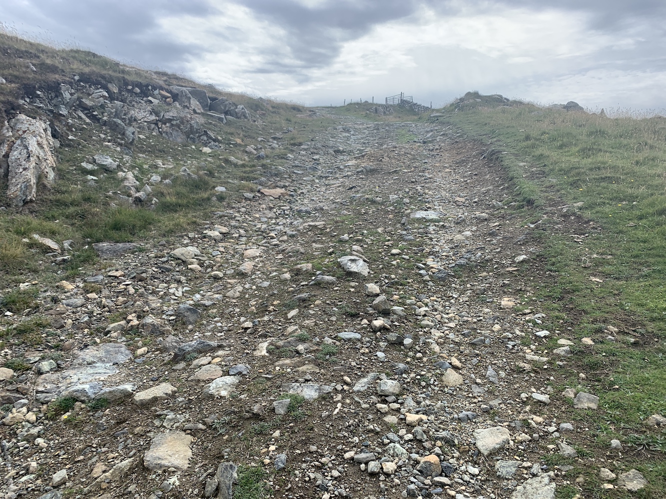
I mentioned Head of Mula to my lighthouse pal John and he was keen to see it. I thought it was definitely worth going along to check it out too, given that I am such a fan of the flat-pack type. It looked to be only a short walk from the ferry terminal on Unst. I wasn’t wrong. It is very easily accessed by following the main road north of the terminal for a short distance and then taking a right turn at a track heading uphill.
The track up to to Head of Mula
The track was great and after just a few minutes we spotted the top of the light just above an old wall ahead.
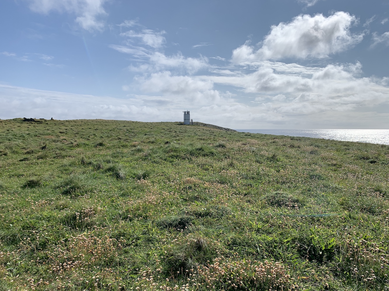
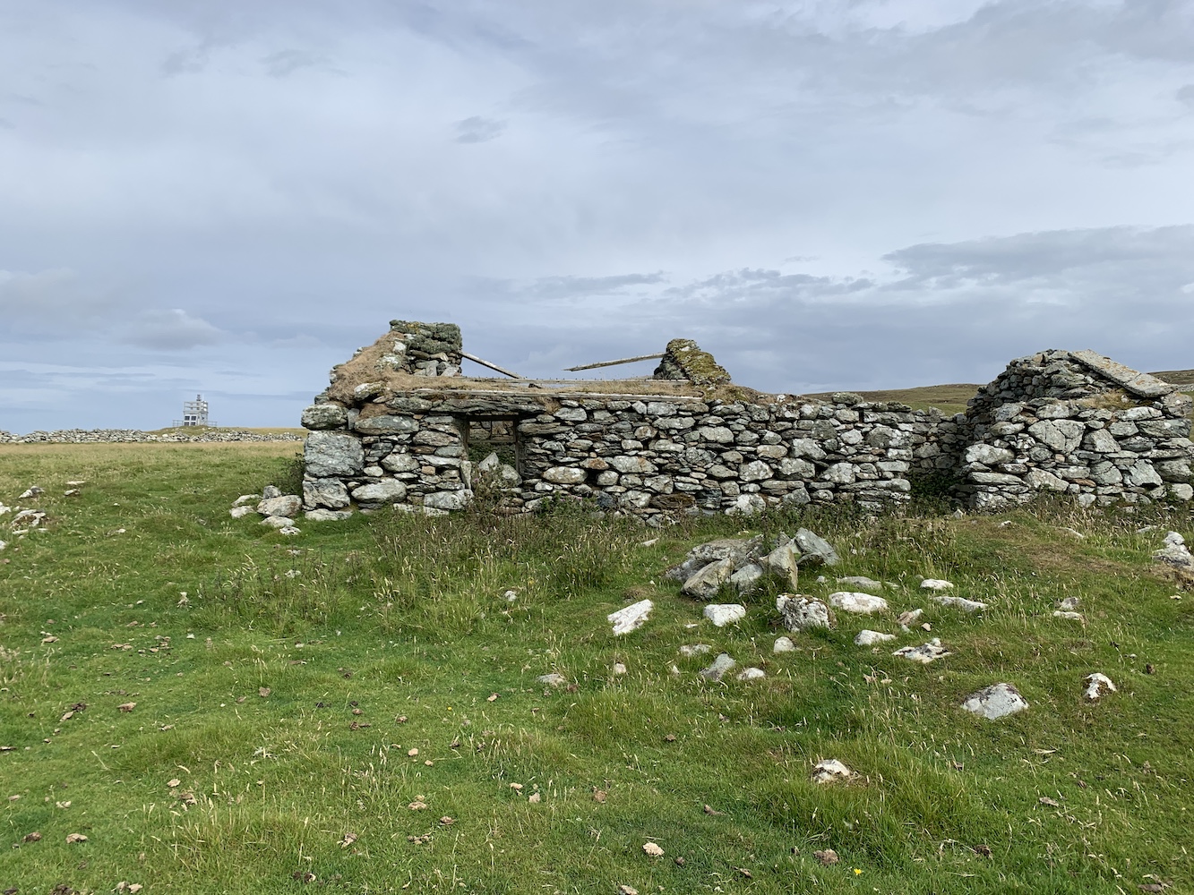
The light on Head of Mula
Beyond the lighthouse there were the remains of abandoned houses and it was really quite strange to be seeing such old buildings against the backdrop of a relatively new light structure.
The new light and the old building
The tower was exactly as had been described to me. This was where it got tricky though as the debate was then on as to whether or not it did qualify for my list. Is it possibly for someone to be enclosed within it? Not really. Someone could certainly step inside the frame, but they would still be completely exposed to the elements and visible to anyone on the outside. Therefore it doesn’t meet the criteria, but here is where the challenge has always been for me in preparing a definitive list of lighthouses.
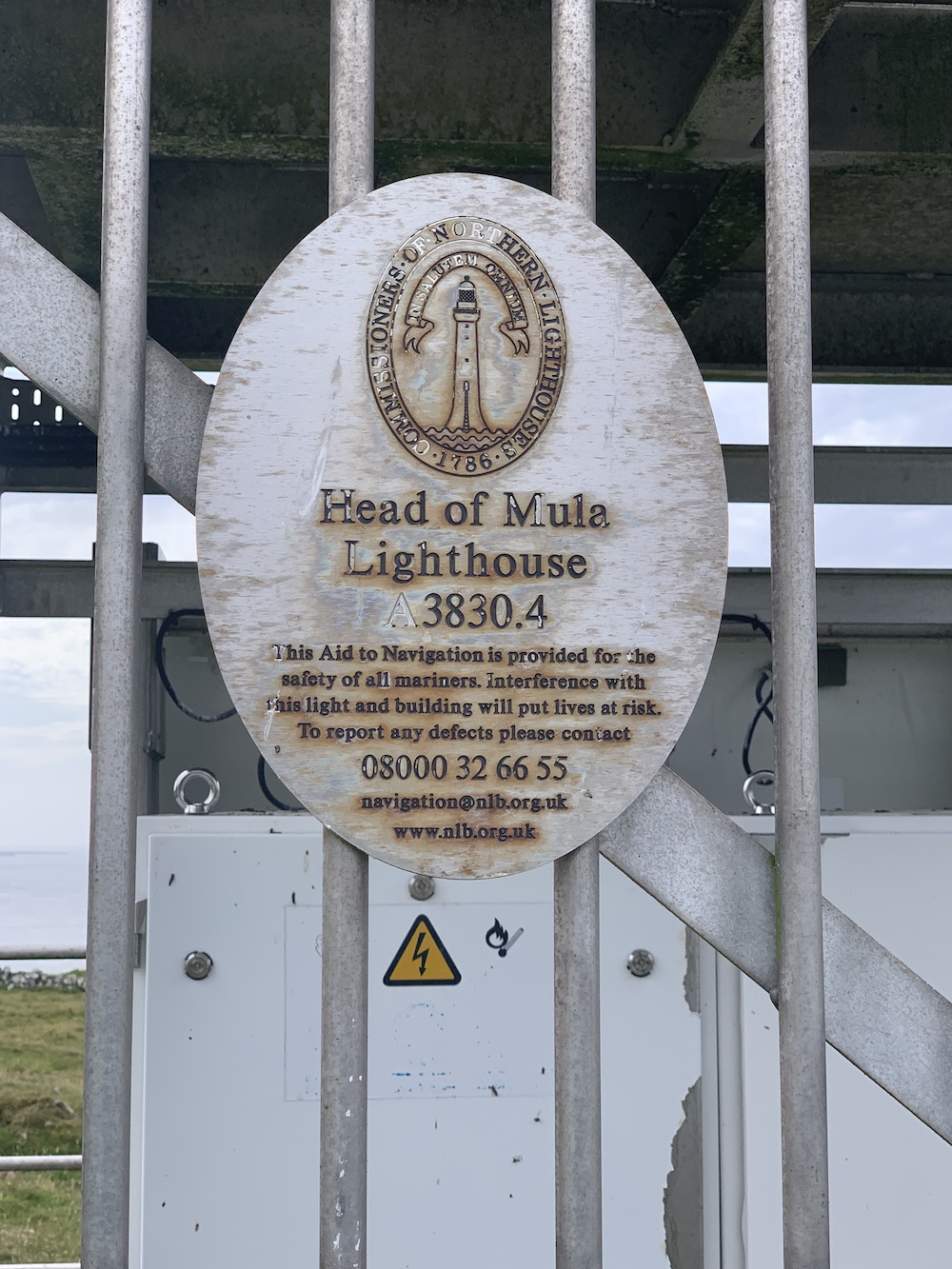
Head of Mula Lighthouse (as the Northern Lighthouse Board plaque on the door says)
I always wanted my list to be objective and based entirely on what did or didn’t meet the criteria. I am well aware that one lighthouse may mean a lot to one person and very little to another. I’ve seen plenty of subjective lighthouse lists for Scotland out there and they usually feature the biggest and most impressive of the Stevenson lighthouses, often leaving out the smaller lights that (in my option) are just as enjoyable to visit – if not more so in some cases – as the large ones.
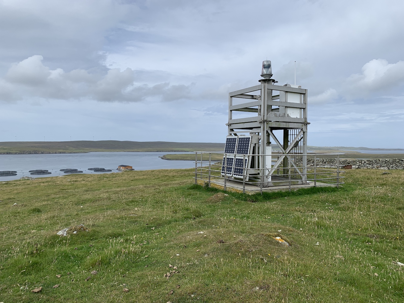
For me one of the big appeals of the flat-pack lighthouses has always been the beautiful places they take you to. Often places rarely explored by the masses and this too is the case at Head of Mula. The views here are fantastic, particular looking south/south east towards the Loch of Heogland and Holm of Heogland close in and then beyond to Fetlar.
The view to the south east
Looking west over Bluemull Sound was also excellent and the ferry moving back and forth between Yell and Unst was a regular reminder that civilisation was just down the track.
The view to the west
The light at Head of Mula has everything going for it that most flat-pack lighthouses have, except the white cladding. We jokingly referred to it all day as the ‘naked flat-pack’ due to its lack of white cladding “clothes”.
A closer look at Head of Mula
Thinking about my list, there are some lighthouses on there that I would be more than happy not to visit again, usually due to their location, but I’d happily stroll back up to Head of Mula again. This is where I feel a little envious of those who have their own personal list and can add/take away anything they please. From the point of view of The British Lighthouse Trail though, I need to be less subjective and not adjust it to become a list of lighthouses I personally think people should visit – although I do think that would make an excellent list.
The final decision on Head of Mula then? I’m going to have to say that the jury is still out. In terms of meeting the definition it’s a no. But if I think it’s important that people get to hear about it and visit it then absolutely yes. If any readers have any thoughts on this then do feel free to share these below in the comments.
The plaque on the lighthouse door
Back to Shetland though and, as mentioned in yesterday’s post, the past 10 days have really been made so successful by the crew on the two boats we have used. Kevin, Michael and Alan on Lysander and the wonderful aluminium tender were exceptional. Magnie and John on the Papa Stour and Ve Skerries trip were more than happy to get us wherever we wanted to go too. It makes such a difference to have boat crew who enjoy their time out with the baggers. It was a real pleasure to spend time with them all.
That’s it for another trip. I’m not sure where the next one will be yet, but I shall be sure to take my followers on here along wherever it is and report back. 🙂
Today was my last day of my boat trips in Shetland and it marked one final success, achieving everything I had intended to during this trip. In fact, today was a success with an extra bonus too.
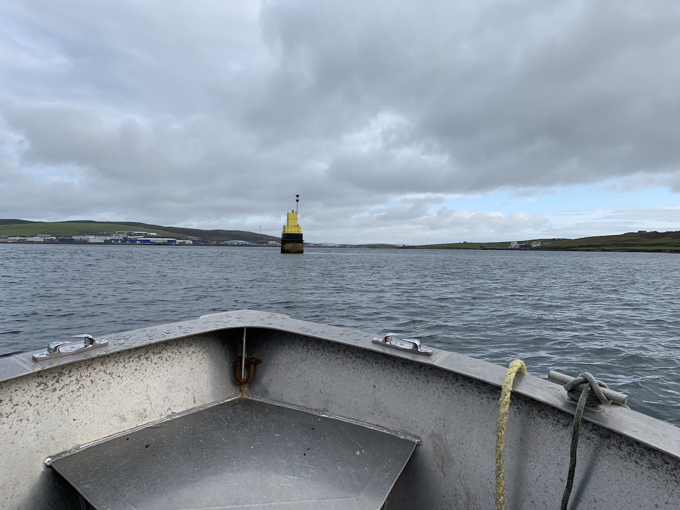
On the way back to Lerwick yesterday evening we took a quick look at the Loofa Baa light. Bob and I had seen it on a previous trip two years ago, but not so close and we had always wondered whether or not it met my criteria for a lighthouse. At the time of my last distant look at it I was right at the final proof of my book and so it was excluded based on the likelihood of it having only external access. We agreed we would go out first thing today in the tender to have a closer look.
Approaching Loofa Baa on the tender
Loofa Baa is used by larger vessels entering and leaving Lerwick harbour. It’s fairly understated in appearance, although it does feature that appealing combination of yellow and black paint. We sailed around the light and discovered that, although access to the light on top was entirely by external ladder, the top section did actually feature a door and therefore internal access. I always knew when having my book published that there may well be structures missed, but this is the first I’ve found over the past two years which isn’t too bad going.
Loofa Baa with its door
It looks like access to the ladder on Loofa Baa is only possible at higher tides. We were there at low tide which meant there was no landing today, but both John and I managed to reach out of the tender and touch the tower with help from Mervyn and Alan, and that is a good enough bag for me given the circumstances.
With the southbound journey today we passed close by both Bressay and Twageo Point lighthouses on the way to our next lighthouse stop. It’s always good to see these structures from the angle from which they were intended to be used.
Twageos Point Lighthouse
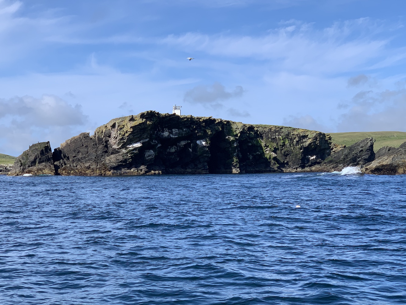
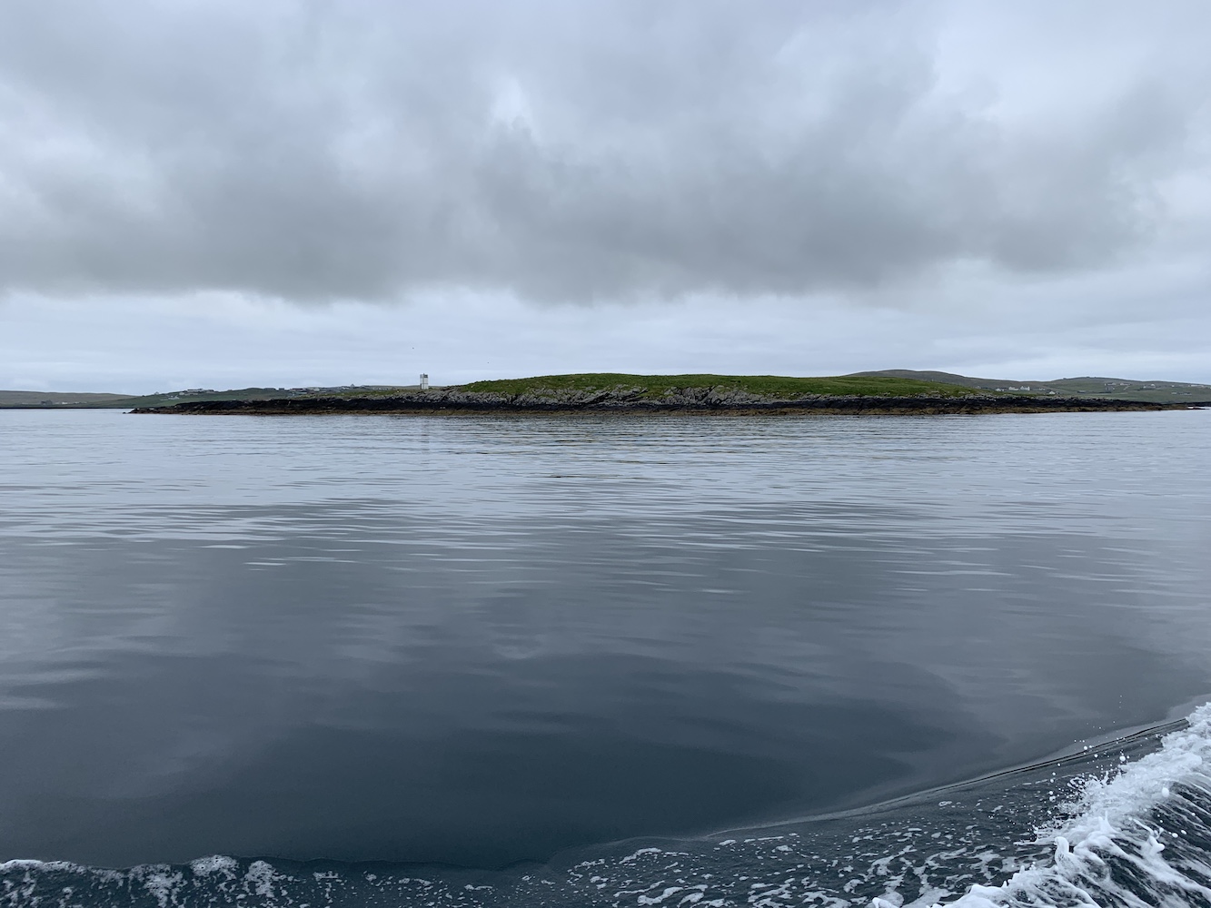
Peerie Bard off the east coast of Mousa island is a tricky little one to get to. With daily boats trips to Mousa itself when conditions allow during the summer, the RSPB insist that no one attempts to walk to Peerie Bard at low tide from the main island due to breeding birds or seals on the islands. We found a boatman willing to take us there and land so we went for it.
Peerie Bard
On the map it looked like there was a path marked across Peerie Bard going from a low lying section of the island. Four of us hopped into the tender and set off. As we neared the point at which it looked like the path started on the island, we spotted some landing-related ironmongery and a sloped rock leading up to them.
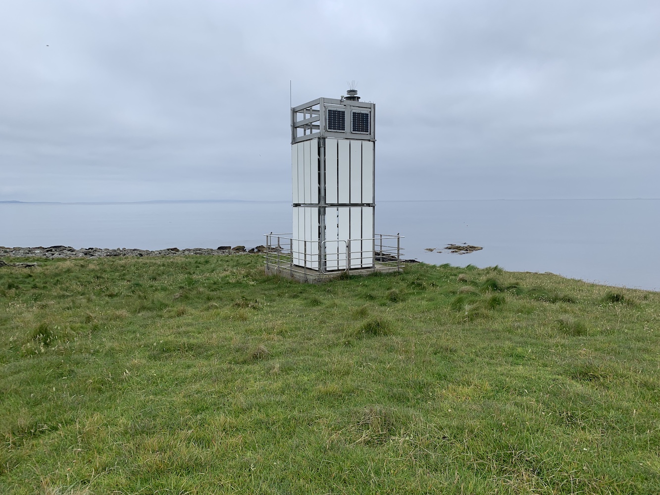
The slope was a little green and slimy so we needed to go carefully and then at the top there was a concrete path for a little way leading in the direction of the lighthouse. After the path it was just thick grass which was easy enough to walk on and just a few minutes later the top of the lighthouse came into sight.
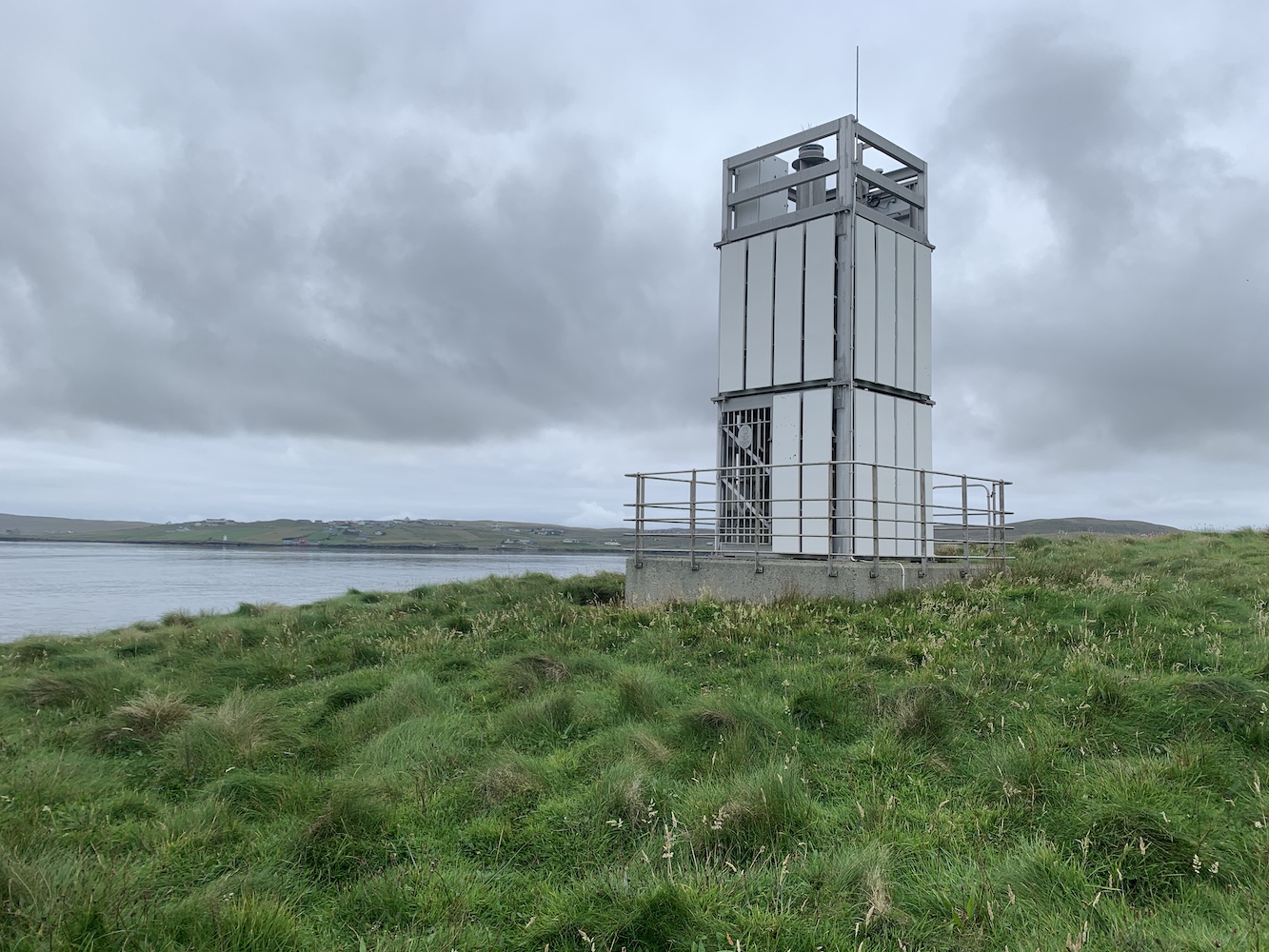
Mousa lighthouse on Peerie Bard
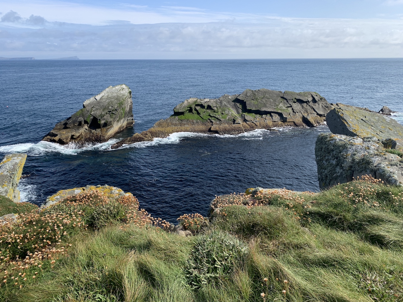
We made it to the lighthouse and, rather oddly, my attention was drawn in the opposite direction to the fantastic rocks instead of the lighthouse. There are some overhanging rocks there and jutting rocks just off the coast. With the direction the sea was coming up at the island there were waves breaking on the rocks below.
The rocks off Peerie Bard
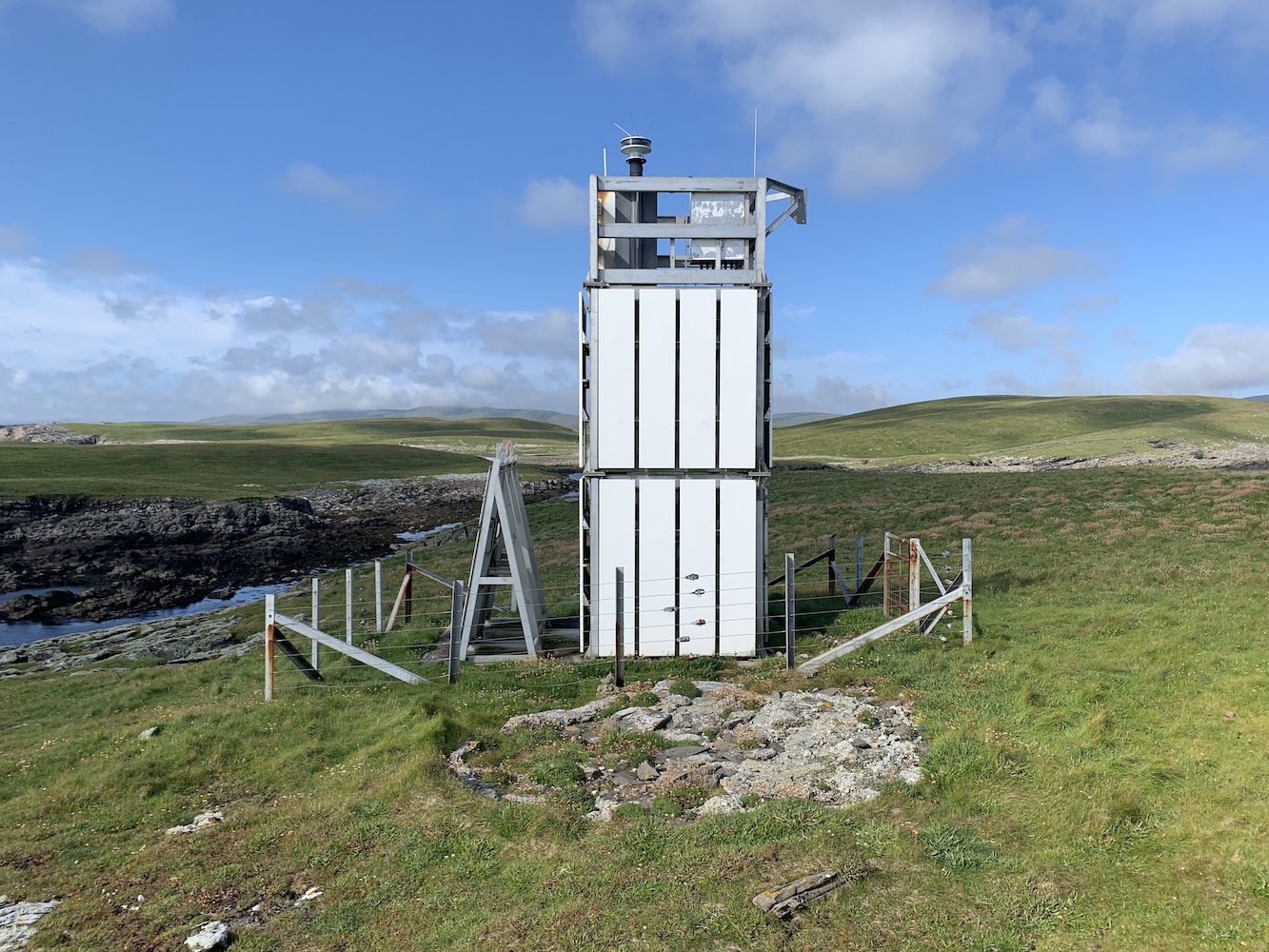
Mousa Lighthouse is yet another flat-pack in a superb location. This structure replaced an older tower. The only remains of the old tower now is the foundation stone, which is broken up a bit.
The modern lighthouse with what could have been a former tower on the circle of stones.
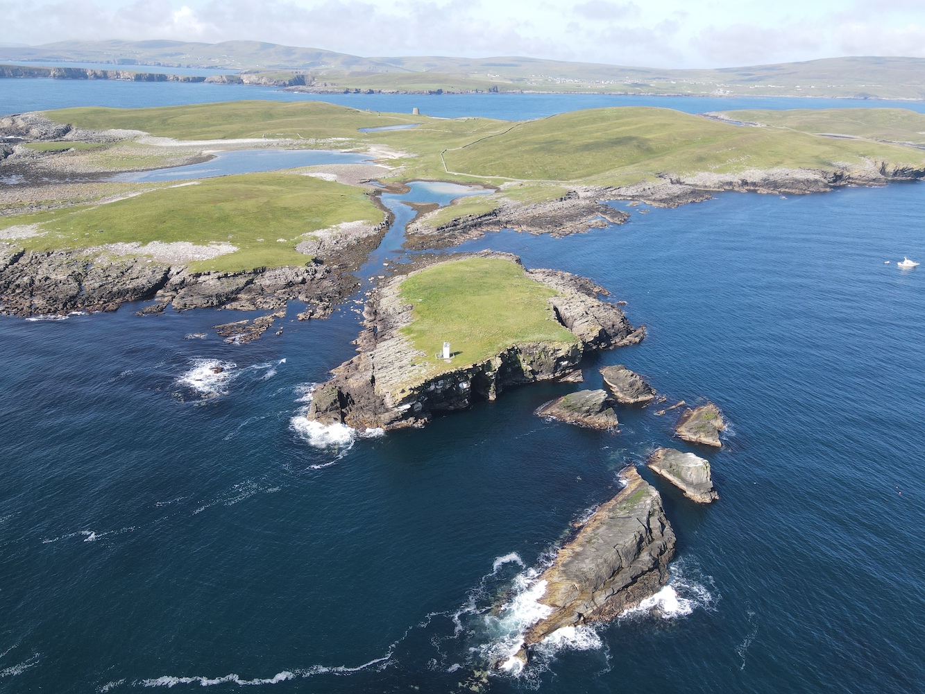
Peerie Bard as an island surprised me. I’d imagined it to be very small, but it was much bigger. Having said that, when you see some of Joe the Drone’s aerial views you realise that it is small in comparison to its neighbours, hence the name Peerie Bard compared to nearby Muckle Bard. I quite like that the name includes ‘peerie’ rather than ‘little’ which is used in a lot of other places across Shetland.
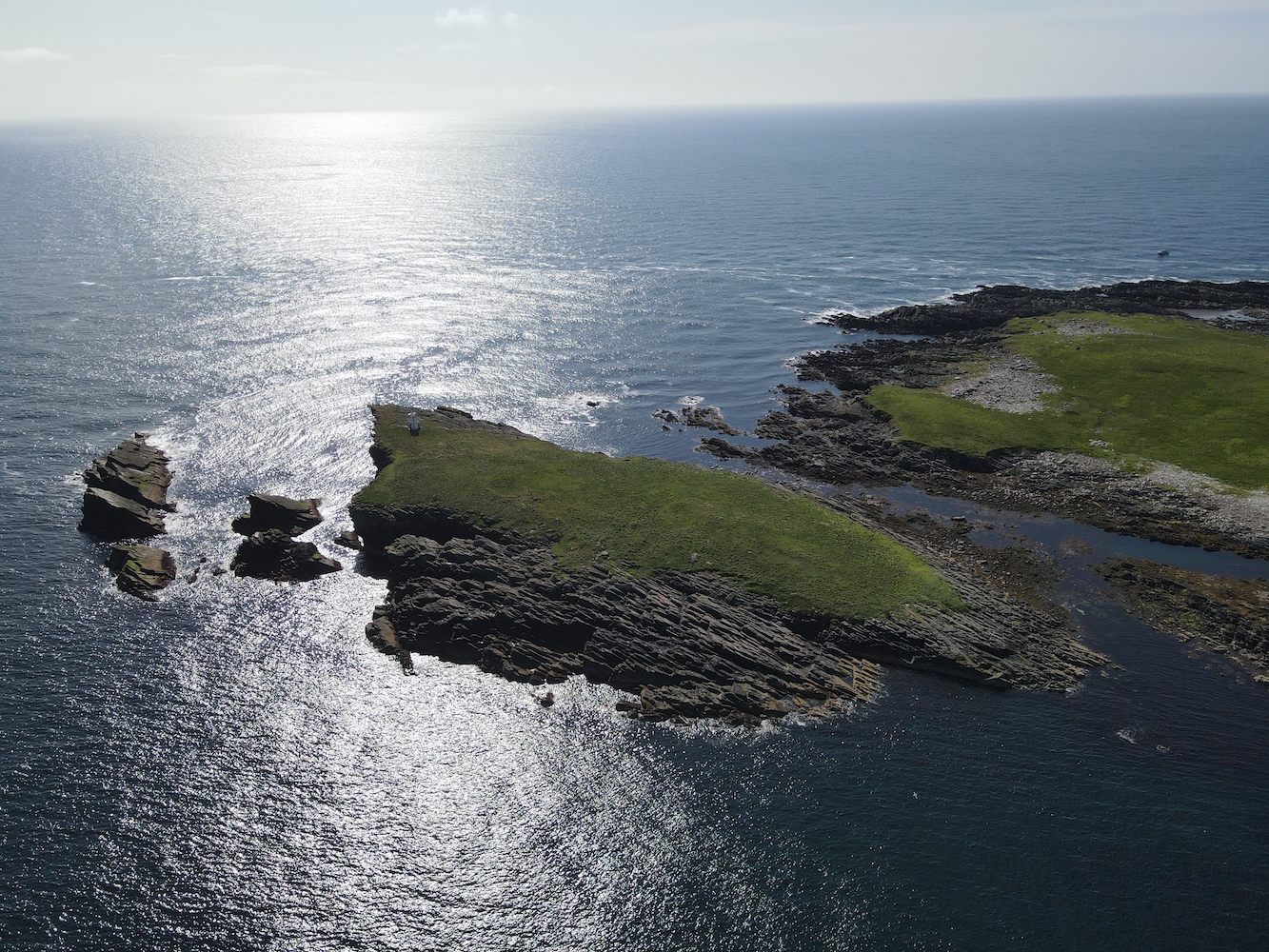
Peerie Bard as seen from Joe the Drone
Peerie Bard from a different angle
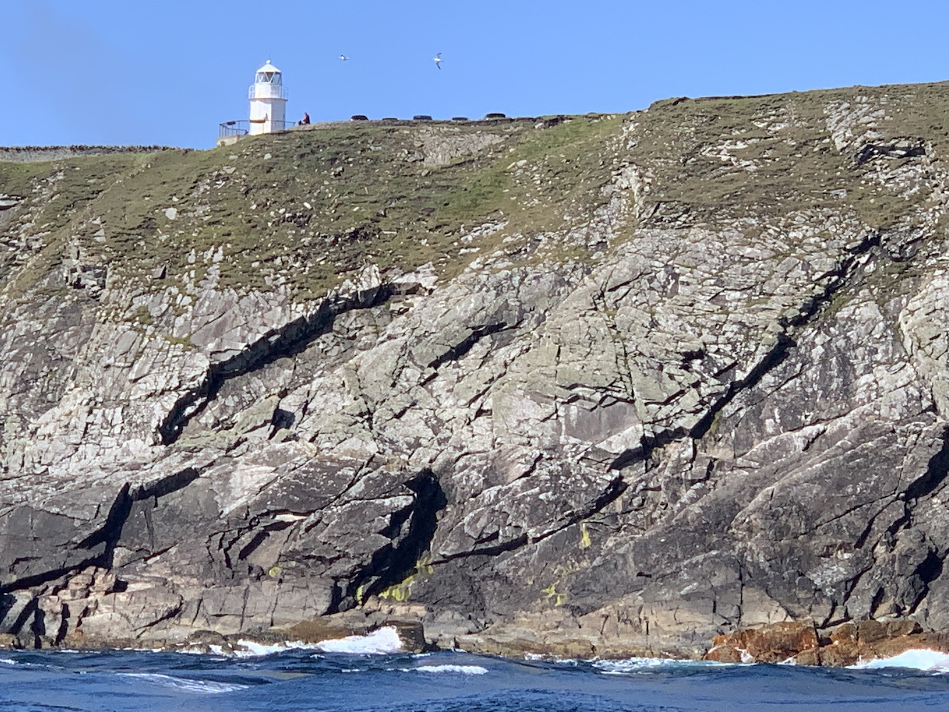
I’d known that the trip would involve a trip around the coast at Sumburgh Head, but hadn’t expected much beyond seeing the lighthouse high up on a cliff. What I’d completely forgotten about was the old Muckle Roe Lighthouse just down the road from Sumburgh Head. Seeing it up there on the cliff made me more glad than ever that it had been relocated there. I can’t recall any of these old structures still in situ that are located on a cliff. This one would, of course, have been when it was in place on Muckle Roe originally. It was just so great to see it almost looking like it was still doing its job up there.
The old Muckle Roe Lighthouse, now near Sumburgh Head
The route around Sumburgh Head was, as I’d expected, a bit rough with plenty of rocking and rolling, but fortunately I was able to still capture some images as we went. Again I was very pleasantly surprised at how stunning this one is from the sea. The cliffs and natural rock formations there are incredible and topped off with that wonderful tower and the old foghorn too… well, it was quite a special experience.
Sumburgh Head from the sea
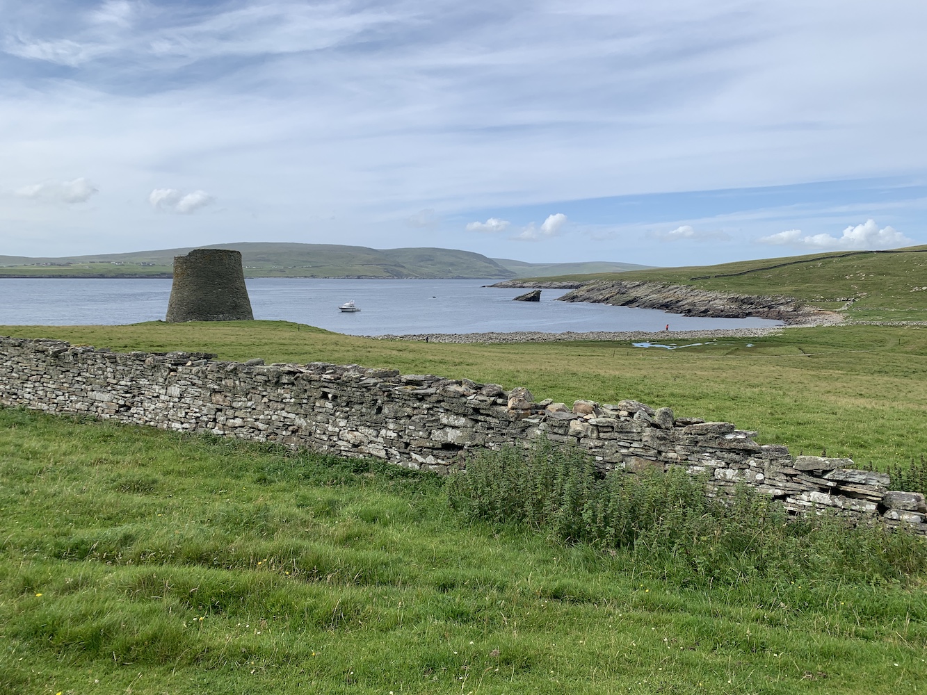
There were a few islands to do for a couple of the others round on the west side before we returned to the east. One of the reasons for taking the kids along today was so they could visit the broch on Mousa. In the interests of efficiency we were dropped off at an old pier next to the broch and the kids got to experience going on the tender. The big one was a little wary and the little one giggled all the way and said she loved the little boat. The broch was fascinating to see and we also took a closer look at a couple of the old buildings around. There wasn’t really time to explore properly or take it all in with the kids about, but it was still a great island to go to by a non-traditional method.
Mousa
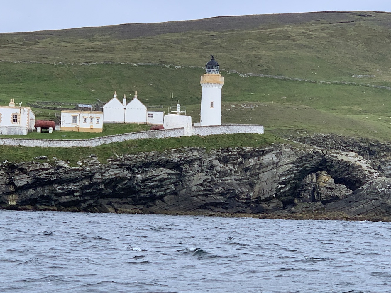
The rest of the journey back to Lerwick went very smoothly. We sailed fairly close to Bressay, which was good. It’s a beautiful lighthouse and superbly located too.
Bressay Lighthouse
I’ve had some fantastic days out on the boats in Shetland over the past 10 days. It was above and beyond what I expected and I will leave Shetland after this visit with only 3 Shetland lighthouses left to do – Foula and the two on Fair Isle. This trip has far surpassed my expectations and I am hugely grateful to Mervyn for organising it all. Also to Bob for leaping onto these islands and helping us all to achieve what we want to do. The boatmen – Kevin, Alan and Michael – have been so brilliant. I cannot praise them enough. They are great company and so willing to help us on getting what we need.
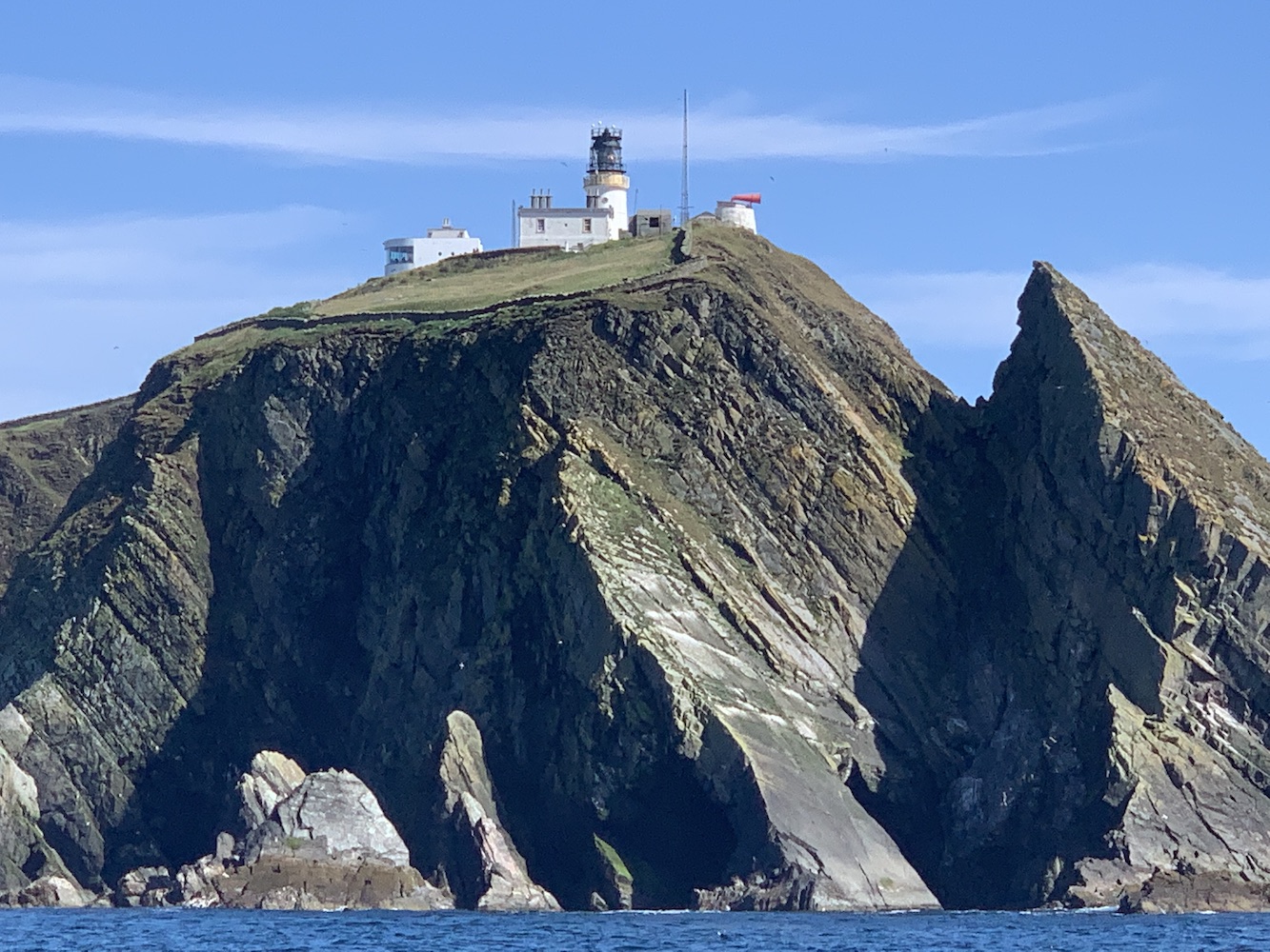
A very memorable and massively enjoyable trip, and amazingly we have managed to sail the full length of Shetland (excluding Fair Isle) since we arrived, right from Muckle Flugga on that first day to Sumburgh Head on the last boat day for me today 🙂
It’s been another day onboard Lysander in Shetland today and it’s really starting to feel like home now. With Michael the fantastically knowledgeable and friendly skipper, and the equally knowledgeable and skilled tender skipper Alan, we have been in very good hands.
My first lighthouse stop of the day was Wether Holm. We were informed by Alan that ‘wether holm’ is the name given to islands where the sea gets shallower and breaks on the island. There are plenty of Wether Holms about in Shetland, but only one of them has a lighthouse. This is a flat-pack lighthouse and after we were dropped off it was just a quick stroll up to it. There were nice views across to Whalsay from the lighthouse including Suther Ness Lighthouse just across the water.
Wether Holm
Wether Holm Lighthouse
Wether Holm Lighthouse and you can just make out Suther Ness Lighthouse on Whalsay in the background
After we left the island Joe the Drone went for a fly and got some great aerial shots of the island and surrounding area.
Wether Holm from above
The tiny Wether Holm Lighthouse in a grand landscape
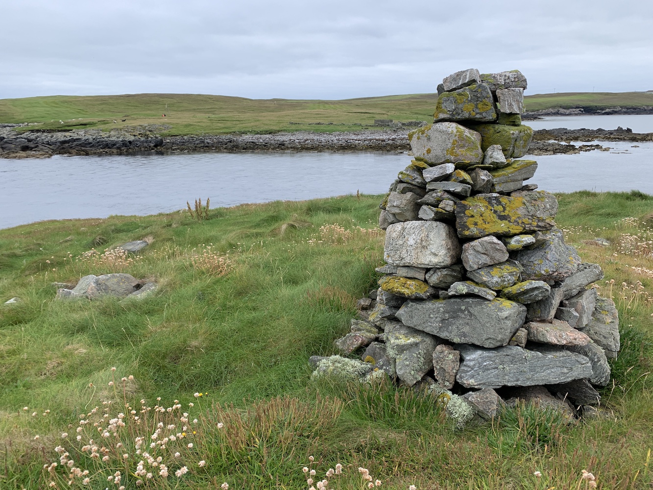
Next we landed on Inner Holm of Skaw. There’s no lighthouse here, but we were told that there were stories suggesting there was a human skull to be found near the cairn on the island. This intrigued us all so we took the opportunity to have a hunt for it, and with success too. Lying under a flat round rock close to the cairn were indeed bones. There was part of a skull, a jawbone still with some teeth in it and a few other bones too. It was very strange. Bob pointed out that there was a chapel marked on the map and when we looked back towards the cairn there was evidence of rows of stones that could well have been the walls of the old chapel. Our skipper looked into it a bit more and was informed that the remains are actually believed to be of the monk who built the chapel there.
The cairn on Inner Holm of Skaw
Onto my second new lighthouse of the day, Muckle Skerry. We’d considered landing on this one two years ago, but it had been raining and – given my experience of it today – I’m glad we didn’t. It’s a skerry so it’s rock really and although it looks from a distance like it has some nice grass on top it’s really just flora and fauna that thrives in wet environments combined with an occasional hard bit of soil and then random rocks in and around it all.
Muckle Skerry
It took us a little while to pick where we would land. The side of the island looked like any landing there would involve a scramble up rocks that looked green and potentially very slippery. We made our way around the island on the tender coming across another potential landing area where there turned out to be too many rocks just under the water. We then found a deeper section which got us onto some barnacle-covered rocks followed by a short section of slippy rock and then it was rock hopping all the way up to the mixed terrain described above.
Muckle Skerry Lighthouse
Muckle Skerry Lighthouse is another flat-pack and this time without a fence around it. There are great views all around which always make the less straightforward landings more worthwhile. It’s certainly somewhere you would struggle to land without the near perfect conditions we had today. We were very fortunate with sea conditions today.
Muckle Skerry Lighthouse, surrounded by the varied terrain
Joe was launched from the boat and caught some pictures which hopefully illustrate the tricky terrain of this one.
Muckle Skerry from Joe’s eye view
A very skerry-looking Muckle Skerry
We were bound for Out Skerries next. There are so many islands within this group that it wasn’t surprising that to save time we all dispersed a bit. Skipper Michael and I were dropped off on Bound Skerry, home to Out Skerries Lighthouse. Michael had never landed on the island before so we left the big boat moored up on the main island and Alan took us across.
Out Skerries Lighthouse on Bound Skerry
Although I’d been to Out Skerries Lighthouse before it was really nice to visit it with someone who was really looking forward to getting there. We had the island to ourselves for some time before the others arrived and we took a stroll around the rocks, getting as far to the east as possible so Michael could reach the most easterly he’s ever been in Shetland. One particular view from the highest point of the island was excellent with the lighthouse in the foreground and the shore station on neighbouring Grunay beyond.
The lighthouse on Bound Skerry
The walkway linking the lighthouse and the landing point
On a calm day it’s very hard to imagine how wild it must get there. Today is just seemed so tranquil and serene. For a while I sat at the base of the lighthouse and just enjoyed being there – that was until Bob came and asked me to move so I didn’t get in Joe the Drone’s pictures! However, I can’t complain as he did get some superb images. The blue sky appeared too!
Bound Skerry with its own lighthouse
A few hours – and a number of islands – later we arrived at Hoo Stack. John as well as Alan the boatman were keen to land here and I went ashore too, but stayed down on the rocks. I’d already been to this lighthouse back in 2019 and with the swell picking up I didn’t want to slow anyone down. The swell had picked up a fair amount by this point so landing wasn’t so easy, but we all did it and stayed dry, and John and Alan were happy.
Hoo Stack from above
Hoo Stack and its lighthouse
It’s been a long day, but another successful one. Mervyn has now set foot in one way or another on over 100 islands so far and I just have one lighthouse left to achieve my personal goal for this trip. That one is lined up for tomorrow. All fingers are crossed 🙂
It’s been some day today and certainly varied, taking in two very different lighthouses in extremely different settings. It is the day I have been waiting for, to make it to the remote and challenging Ve Skerries Lighthouse.
Leaving from Aith this morning, we set off for Papa Stour with our skipper Magnus Scott and John Anderson from Simmer Dim Charters. All four of us baggers on board had something of interest on this island that’s not so easy to get to, with one ferry a day in each direction only three days a week. For me, or course, it was a lighthouse – or, as I call it, a lightbox.
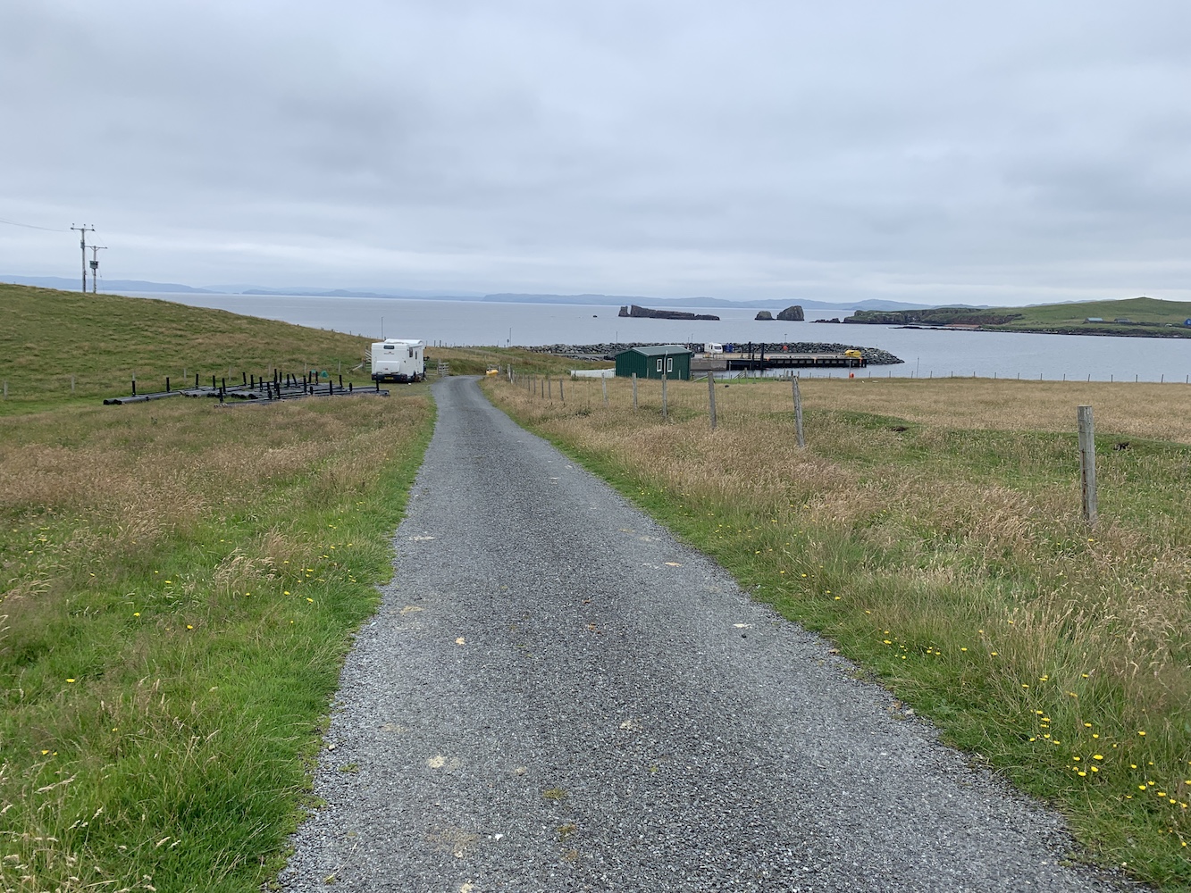
Upon arrival at the island Bob and John set off for the island high point and trig pillar while Mervyn and I took a stroll along the road, discovering quite a lot about the island community. For a start they have a great ferry terminal with tea and coffee making facilities, a book swap, a nice seating area and toilets.
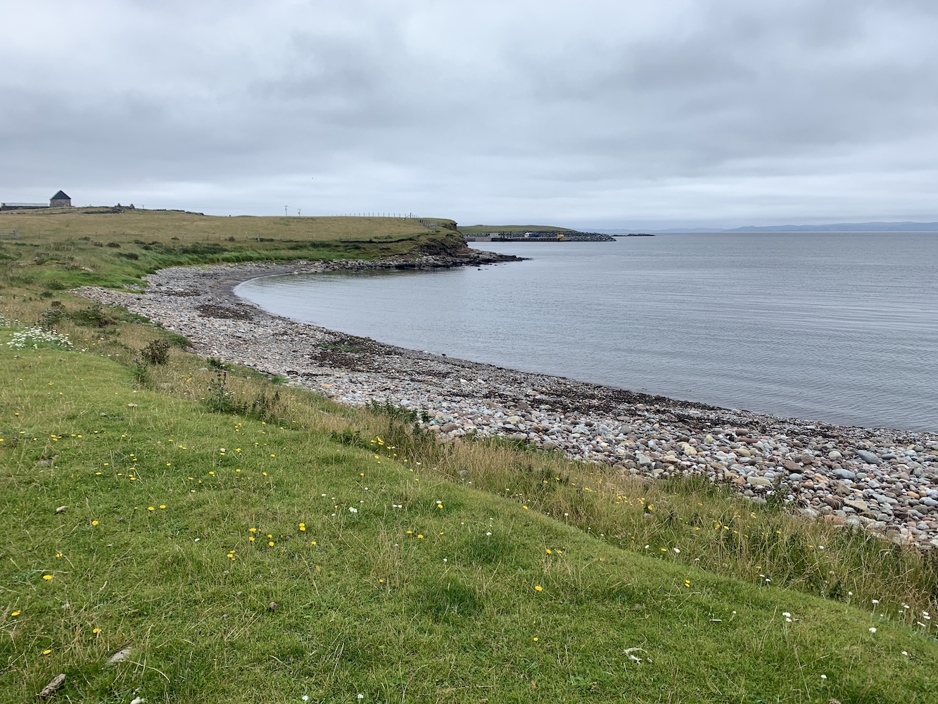
Looking back at the pier on Papa Stour
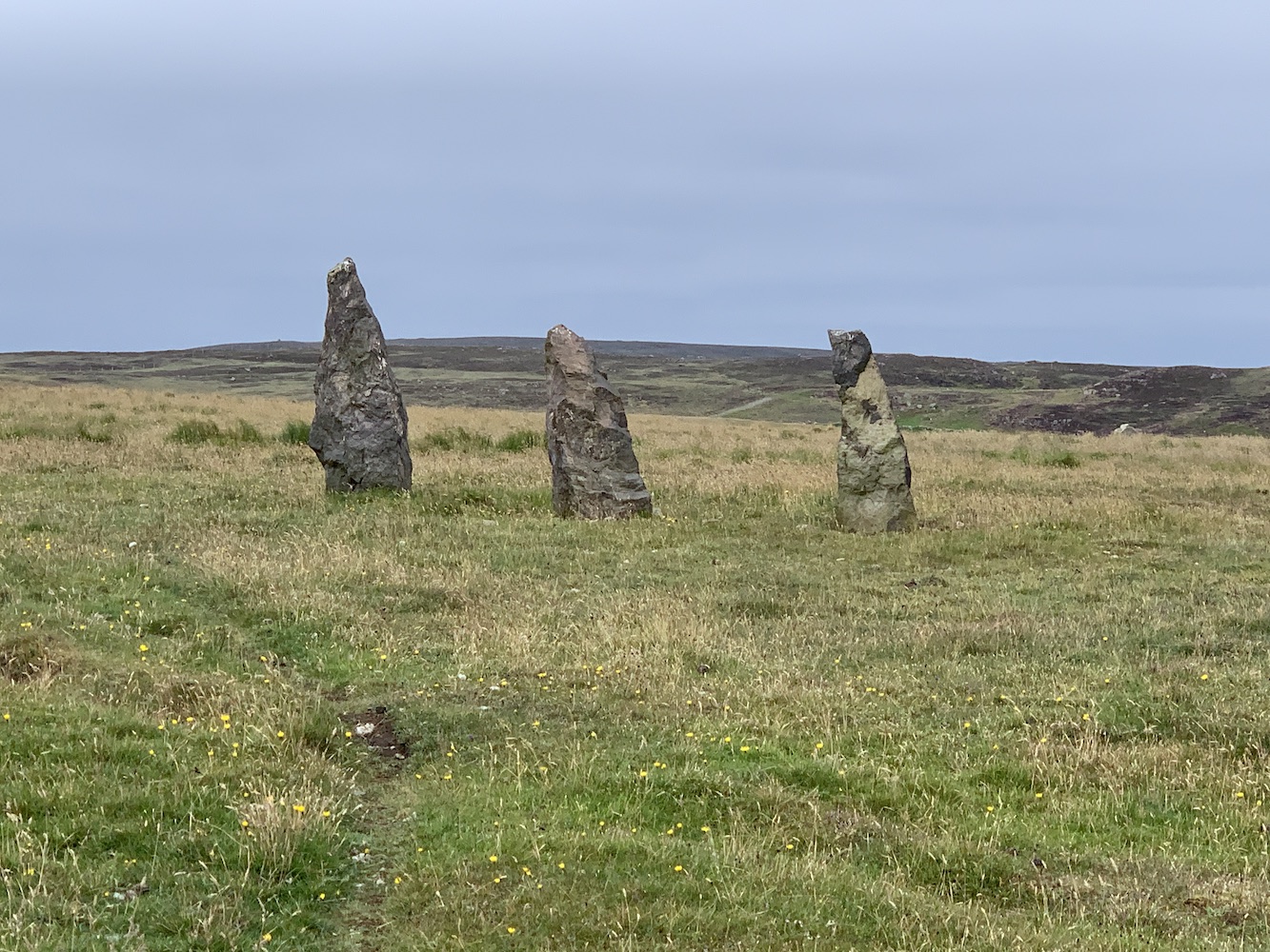
There aren’t many houses on the island and those that are there are scattered alongside the road that runs from the pier to the airport landing strip. There’s a Primary School which has been closed now for around 8 years and the population of the island is just 6. A small community, but a really wonderful one which embraces its island and its history. This is very clear to see throughout Papa Stour.
Standing stones on Papa Stour
There is a wonderful ‘stofa’, an old Norwegian-style house made from carved wood. This was built in the place of a former stofa, but part of the build project was to allow younger people to learn the traditional skills of Norwegian building. It is really quite beautiful to see how well-constructed it is.
The Norwegian stofa on Papa Stour
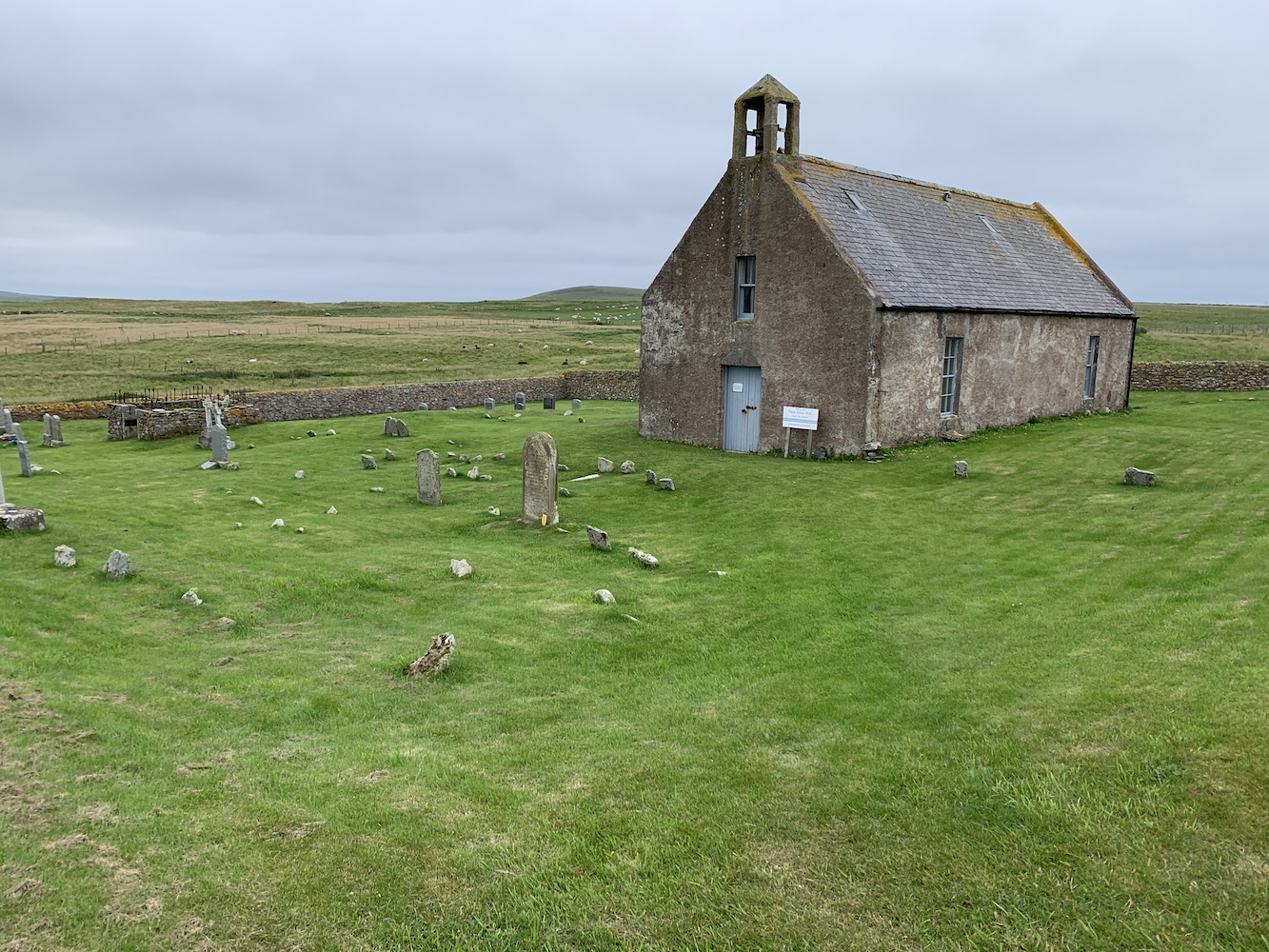
We also took a look inside the Kirk, which is perfect for a small community. The building features a stained glass window that was designed and made by the locals to commemorate the lives of the four men from Papa who lost their lives during the Great War. It also contains a prayer tree which people can hang messages on explaining who they are praying for. There is also a small room with local history information and some locally made products for sale.
Papa Stour Kirk
From the Kirk we walked around to East Biggings and then began the attempt to reach the lighthouse. It had been visible nearly all the way around the road, but we’d not spotted a clear way to reach it. On our return journey we found a gate and followed the edge of a field down towards Housa Voe. Through one more gate and another field and we were there.
The field we walked around the edge of to reach the lighthouse
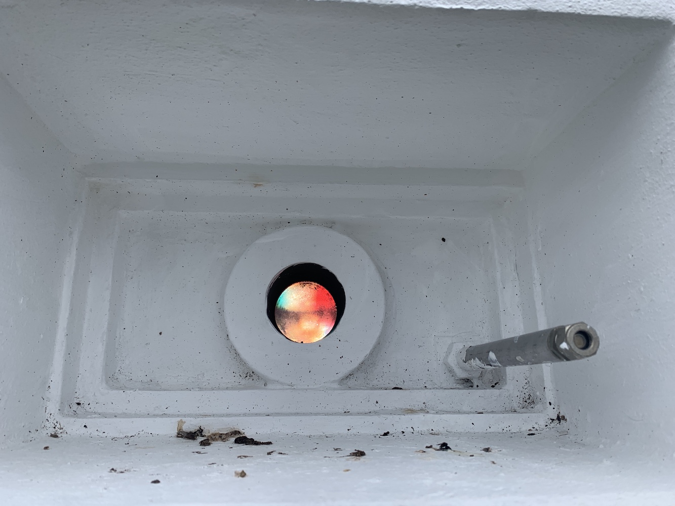
I would never say that these little lightboxes are anywhere near the most impressive, but they certainly do the job. The one here at Housa Voe is a similar type of structure to the two at West Burrafirth. It’s essentially a small square dry dashed building with a door at the back and a directional sector light shining out the front. There’s little more to it than that, but you can see when you step into the path of the light that it does it’s job very effectively. I had some fun for a few minutes walking back and forth in front of it and watching the red light change to white and then to green. This light is owned by Shetland Islands Council, which sort of explains its appearance. Clearly its purpose is to guide vessels safely into Housa Voe.
House Voe Lighthouse from the landward side
House Voe Lighthouse
House Voe light source
It was nice to introduce Mervyn to this type as well as they are very rarely visited. I’m not sure he was particularly impressed, but he pretended to be which was good of him. This is one of the delights of lighthouse bagging, discovering new places above and beyond just looking at the lighthouse.
The green light in House Voe Lighthouse
We left the lightbox behind and headed for the ferry terminal for a nice cup of tea. Even the waiting room is a trove of historical treasures relating to Papa Stour.
A little cove near the lighthouse
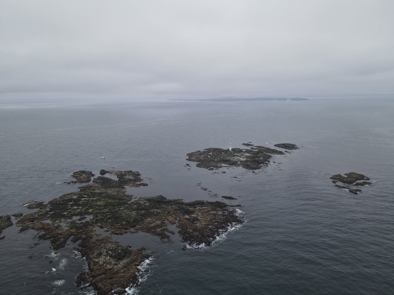
Once we were all back we set off to a few islands off of Papa Stour before we began to head north west towards a little collection of rocks called Ve Skerries. I’m not sure how well known Ve Skerries is in lighthouse circles. When you are as into lighthouses as I am you sort of lose any sense of what others do or don’t know. Anyway, for those who don’t know, Ve Skerries is a collection of very small islands/large rocks off the west coast of Mainland Shetland. They mark the most south westerly point of St Magnus Bay. On a clear day you can just make out the lighthouse in the distance from Eshaness. It is renowned for being a very dangerous area for ships with numerous wrecks occurring there. The most recent of which was the Corelleira in 2019 though thankfully there has been no loss of life there since the Ben Doran wrecked in 1930.
Ve Skerries
The sail out to Ve Skerries was actually not too bad at all and it was very encouraging to see hardly any swell around the islands. A fairly rare occurrence I think. I climbed into the tender with Bob and John and we set off to land on Ormal, the lighthouse island. We found somewhere to land and getting out of the boat was easy enough, but then the challenge began. Although the Ve Skerries are low-lying that doesn’t mean they are flat. The island is made up of tidal sections of rock and near enough all of these rocks seem to be jagged with no flat, horizontal edges. While some were covered in barnacles there was plenty of seaweed and slimy stuff about. Bob lent me his micro spikes which certainly made moving over the rocks much easier. It was a long section of rocks to cross though before we got to the helipad. Now whenever I think about Ve Skerries I remember those rocks and just have to laugh. It was quite an experience.
Ve Skerries Lighthouse
Relief set in when I finally got to the helipad which has a nice walkway across to the base of the lighthouse. There was a little stoney area down some steps from the helipad and John Anderson said it’s possible to find bits of ballast from the ships wrecked on the Skerries sometimes. I did have a look around, but couldn’t see anything.
Ve Skerries Lighthouse with a little of the stoney beach
Of course, we couldn’t have gone to Ve Skerries on a calm day without Joe the Drone coming along.
Ve Skerries Lighthouse and neighbouring islands
A Joe’s eye view of Ve Skerries Lighthouse
The lighthouse on Ve Skerries was first lit in 1979, built mainly to aid the large vessels moving around the area going to and from Sullom Voe. The wrecking of the Elinor Viking in December 1977 was also a deciding factor for the lighthouse which was already being spoken of at that point. After the lighthouse was built it received an award for its design and construction, and has very recently been granted listed status. It is a very unique structure, a real modern day rock lighthouse.
Getting back to the boat was slightly easier than the way we’d gone onto the island. However when I got towards the boat one of my feet slipped on some seaweed and my right foot ended up in the sea. Fortunately it was just my foot and I was able to get back into the boat safely before we had a quick stop in the very sheltered little harbour on North Isle, which was a great spot for watching the seals flopping on the rocks and swimming around.
Ve Skerries Lighthouse from North Skerry with plenty of seals keeping an eye on us
Reaching Ve Skerries Lighthouse felt like a great achievement. It is not frequently visited and probably for good reason.
Today was a great reminder to me of why I love doing this so much. That combination of straightforward, understated lighthouse trips and heading out into the wild extremes and creeping about over slippery rocks. Lighthouse bagging like this isn’t for everyone, but it certainly is for me – even if I do get a wet foot every now and then! 🙂


")