
It’s been some day today and certainly varied, taking in two very different lighthouses in extremely different settings. It is the day I have been waiting for, to make it to the remote and challenging Ve Skerries Lighthouse.
Leaving from Aith this morning, we set off for Papa Stour with our skipper Magnus Scott and John Anderson from Simmer Dim Charters. All four of us baggers on board had something of interest on this island that’s not so easy to get to, with one ferry a day in each direction only three days a week. For me, or course, it was a lighthouse – or, as I call it, a lightbox.
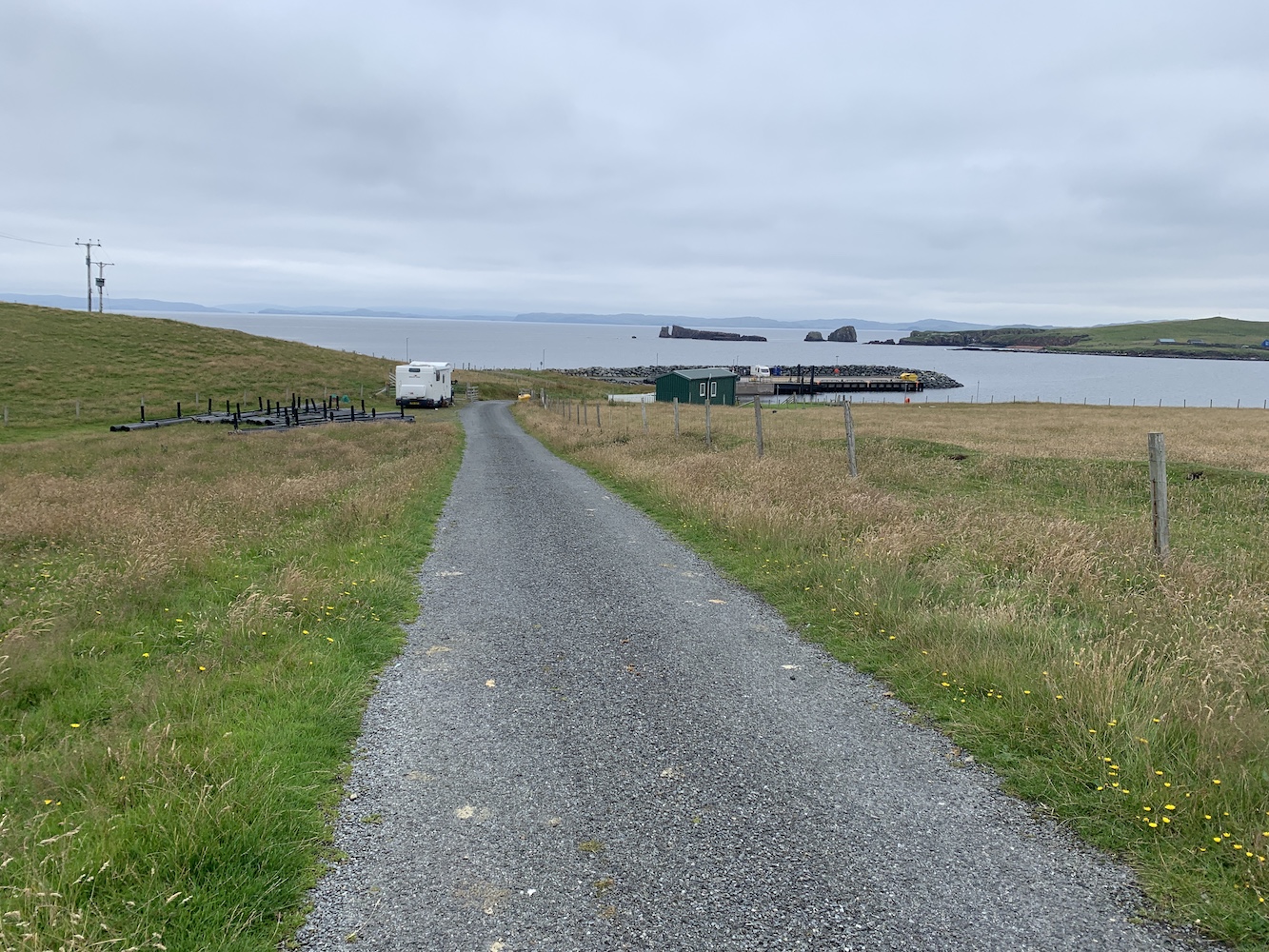
Upon arrival at the island Bob and John set off for the island high point and trig pillar while Mervyn and I took a stroll along the road, discovering quite a lot about the island community. For a start they have a great ferry terminal with tea and coffee making facilities, a book swap, a nice seating area and toilets.
There aren’t many houses on the island and those that are there are scattered alongside the road that runs from the pier to the airport landing strip. There’s a Primary School which has been closed now for around 8 years and the population of the island is just 6. A small community, but a really wonderful one which embraces its island and its history. This is very clear to see throughout Papa Stour.
There is a wonderful ‘stofa’, an old Norwegian-style house made from carved wood. This was built in the place of a former stofa, but part of the build project was to allow younger people to learn the traditional skills of Norwegian building. It is really quite beautiful to see how well-constructed it is.

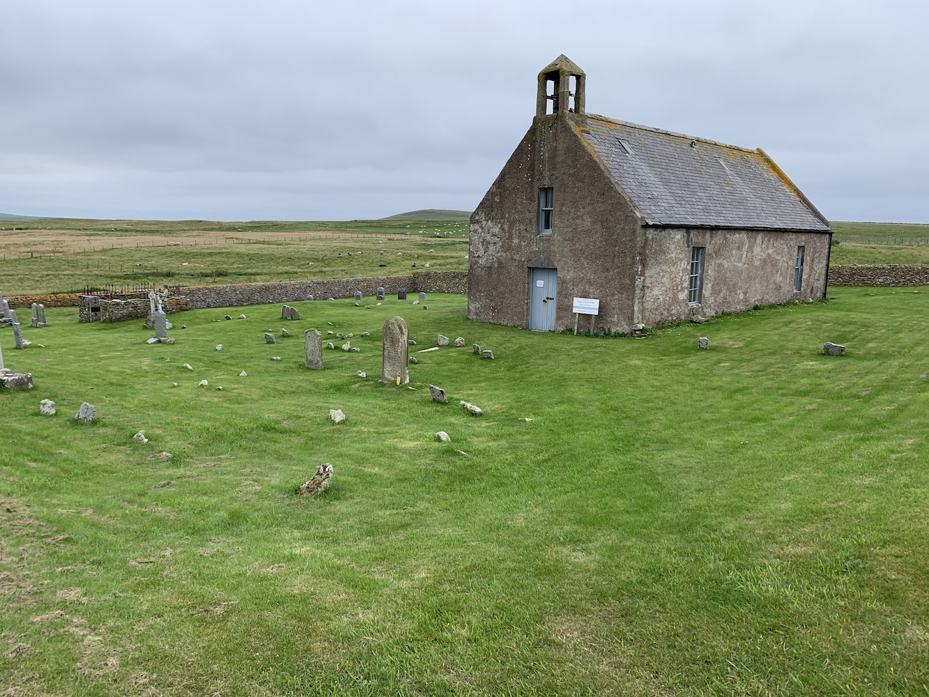
We also took a look inside the Kirk, which is perfect for a small community. The building features a stained glass window that was designed and made by the locals to commemorate the lives of the four men from Papa who lost their lives during the Great War. It also contains a prayer tree which people can hang messages on explaining who they are praying for. There is also a small room with local history information and some locally made products for sale.
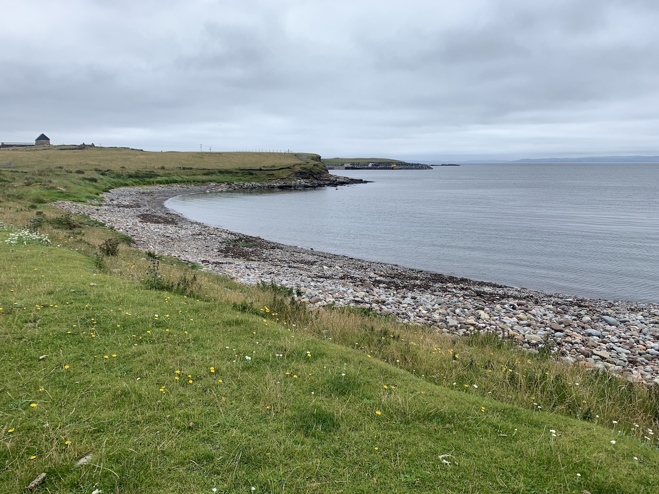
From the Kirk we walked around to East Biggings and then began the attempt to reach the lighthouse. It had been visible nearly all the way around the road, but we’d not spotted a clear way to reach it. On our return journey we found a gate and followed the edge of a field down towards Housa Voe. Through one more gate and another field and we were there.

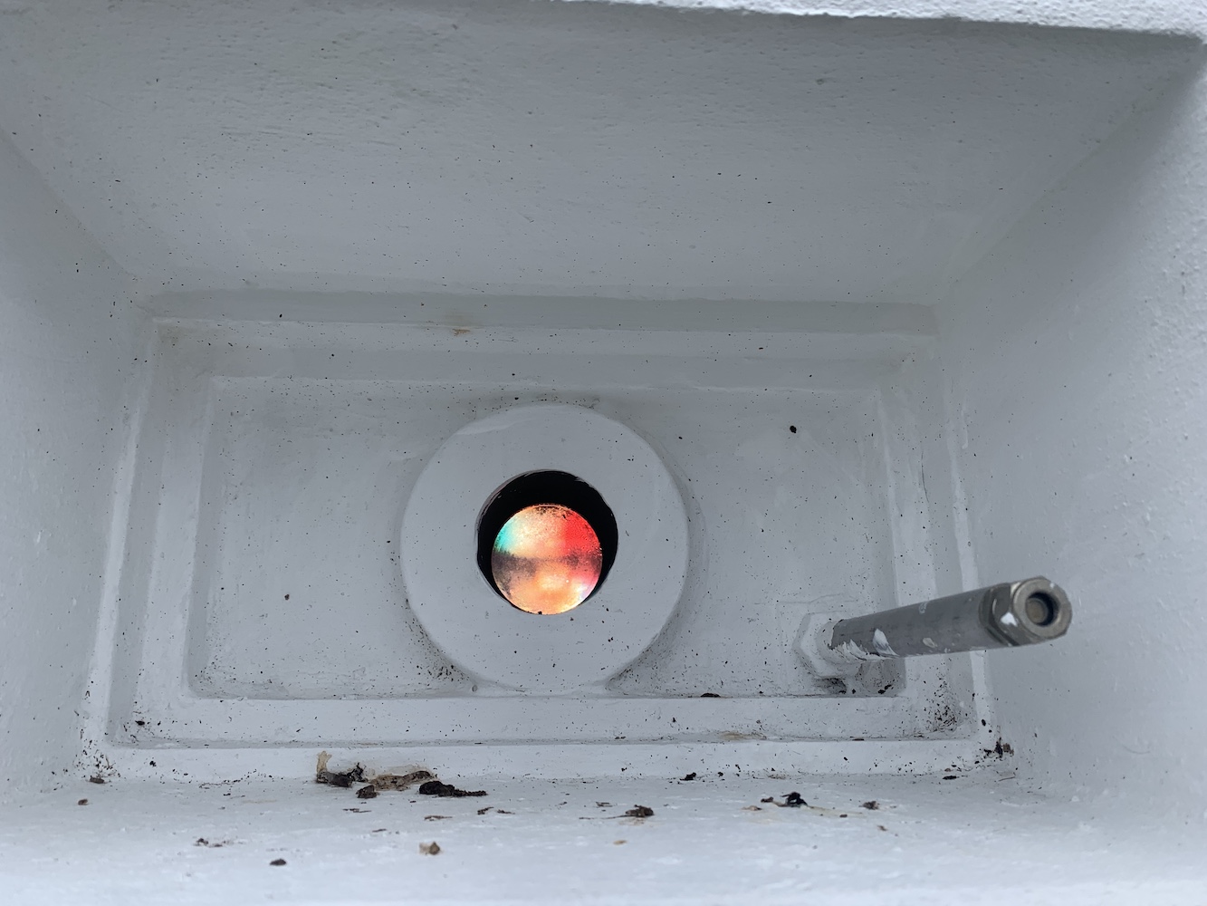
I would never say that these little lightboxes are anywhere near the most impressive, but they certainly do the job. The one here at Housa Voe is a similar type of structure to the two at West Burrafirth. It’s essentially a small square dry dashed building with a door at the back and a directional sector light shining out the front. There’s little more to it than that, but you can see when you step into the path of the light that it does it’s job very effectively. I had some fun for a few minutes walking back and forth in front of it and watching the red light change to white and then to green. This light is owned by Shetland Islands Council, which sort of explains its appearance. Clearly its purpose is to guide vessels safely into Housa Voe.


It was nice to introduce Mervyn to this type as well as they are very rarely visited. I’m not sure he was particularly impressed, but he pretended to be which was good of him. This is one of the delights of lighthouse bagging, discovering new places above and beyond just looking at the lighthouse.

We left the lightbox behind and headed for the ferry terminal for a nice cup of tea. Even the waiting room is a trove of historical treasures relating to Papa Stour.
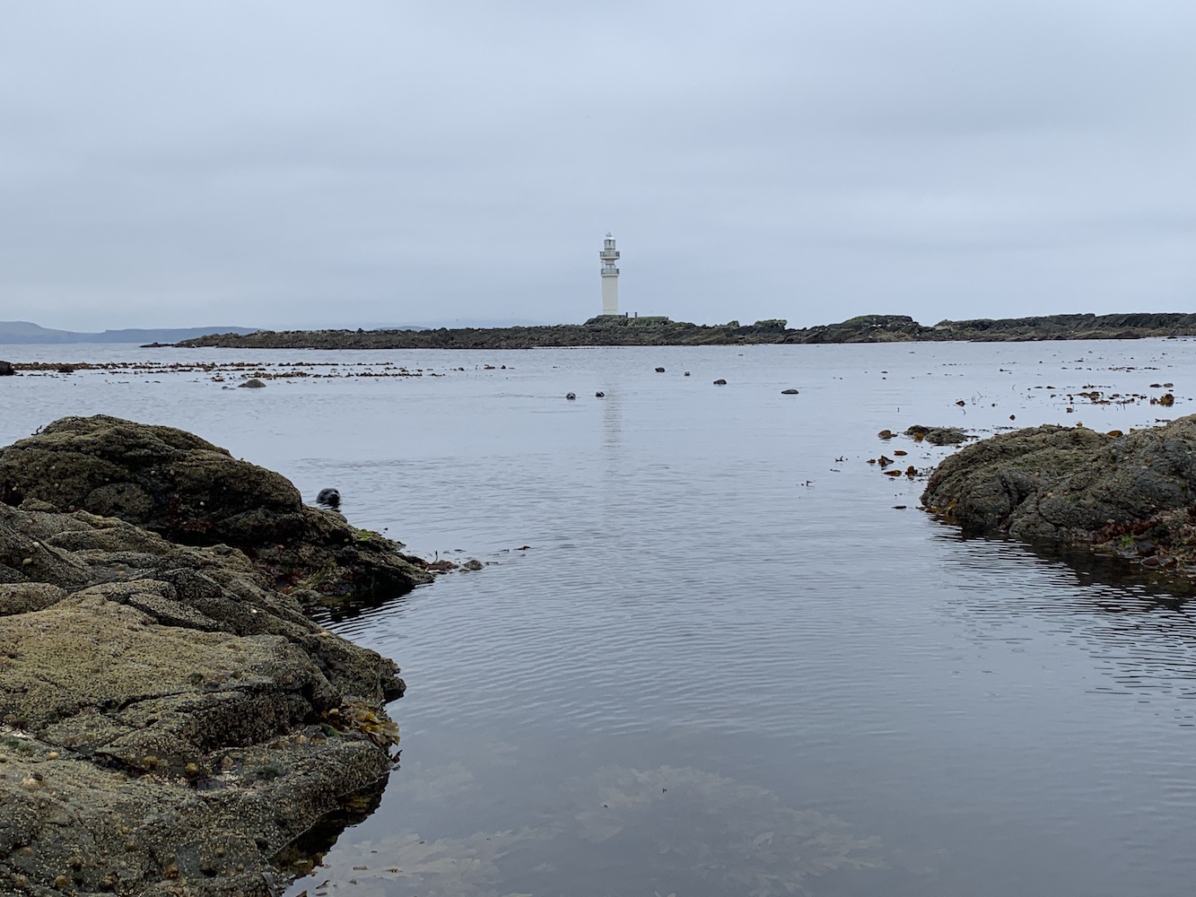
Once we were all back we set off to a few islands off of Papa Stour before we began to head north west towards a little collection of rocks called Ve Skerries. I’m not sure how well known Ve Skerries is in lighthouse circles. When you are as into lighthouses as I am you sort of lose any sense of what others do or don’t know. Anyway, for those who don’t know, Ve Skerries is a collection of very small islands/large rocks off the west coast of Mainland Shetland. They mark the most south westerly point of St Magnus Bay. On a clear day you can just make out the lighthouse in the distance from Eshaness. It is renowned for being a very dangerous area for ships with numerous wrecks occurring there. The most recent of which was the Corelleira in 2019 though thankfully there has been no loss of life there since the Ben Doran wrecked in 1930.
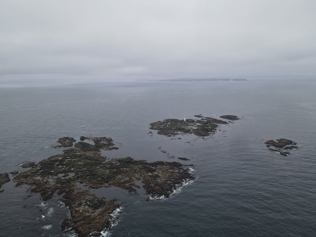
The sail out to Ve Skerries was actually not too bad at all and it was very encouraging to see hardly any swell around the islands. A fairly rare occurrence I think. I climbed into the tender with Bob and John and we set off to land on Ormal, the lighthouse island. We found somewhere to land and getting out of the boat was easy enough, but then the challenge began. Although the Ve Skerries are low-lying that doesn’t mean they are flat. The island is made up of tidal sections of rock and near enough all of these rocks seem to be jagged with no flat, horizontal edges. While some were covered in barnacles there was plenty of seaweed and slimy stuff about. Bob lent me his micro spikes which certainly made moving over the rocks much easier. It was a long section of rocks to cross though before we got to the helipad. Now whenever I think about Ve Skerries I remember those rocks and just have to laugh. It was quite an experience.

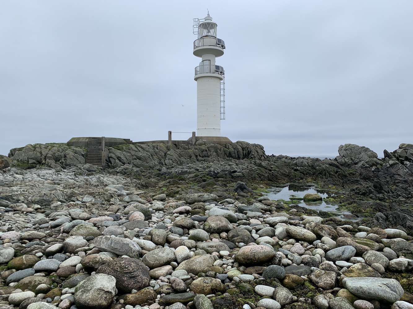
Relief set in when I finally got to the helipad which has a nice walkway across to the base of the lighthouse. There was a little stoney area down some steps from the helipad and John Anderson said it’s possible to find bits of ballast from the ships wrecked on the Skerries sometimes. I did have a look around, but couldn’t see anything.
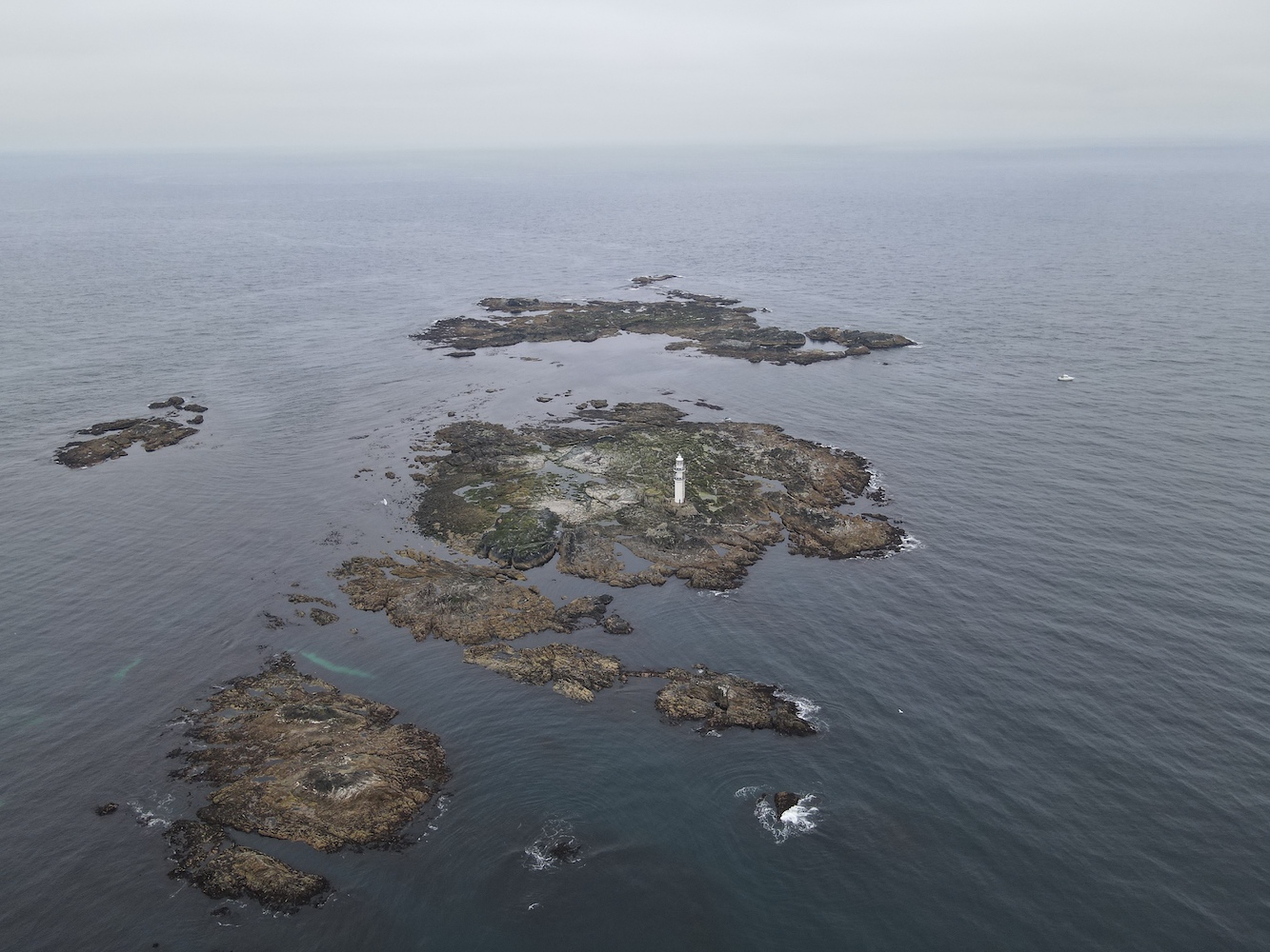
Of course, we couldn’t have gone to Ve Skerries on a calm day without Joe the Drone coming along.
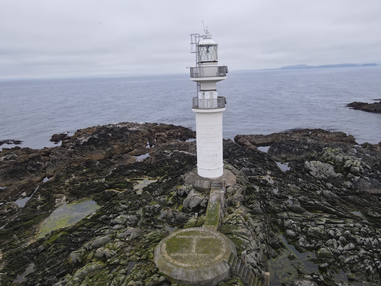
The lighthouse on Ve Skerries was first lit in 1979, built mainly to aid the large vessels moving around the area going to and from Sullom Voe. The wrecking of the Elinor Viking in December 1977 was also a deciding factor for the lighthouse which was already being spoken of at that point. After the lighthouse was built it received an award for its design and construction, and has very recently been granted listed status. It is a very unique structure, a real modern day rock lighthouse.
Getting back to the boat was slightly easier than the way we’d gone onto the island. However when I got towards the boat one of my feet slipped on some seaweed and my right foot ended up in the sea. Fortunately it was just my foot and I was able to get back into the boat safely before we had a quick stop in the very sheltered little harbour on North Isle, which was a great spot for watching the seals flopping on the rocks and swimming around.
Reaching Ve Skerries Lighthouse felt like a great achievement. It is not frequently visited and probably for good reason.
Today was a great reminder to me of why I love doing this so much. That combination of straightforward, understated lighthouse trips and heading out into the wild extremes and creeping about over slippery rocks. Lighthouse bagging like this isn’t for everyone, but it certainly is for me – even if I do get a wet foot every now and then! 🙂
