The lesser known lights

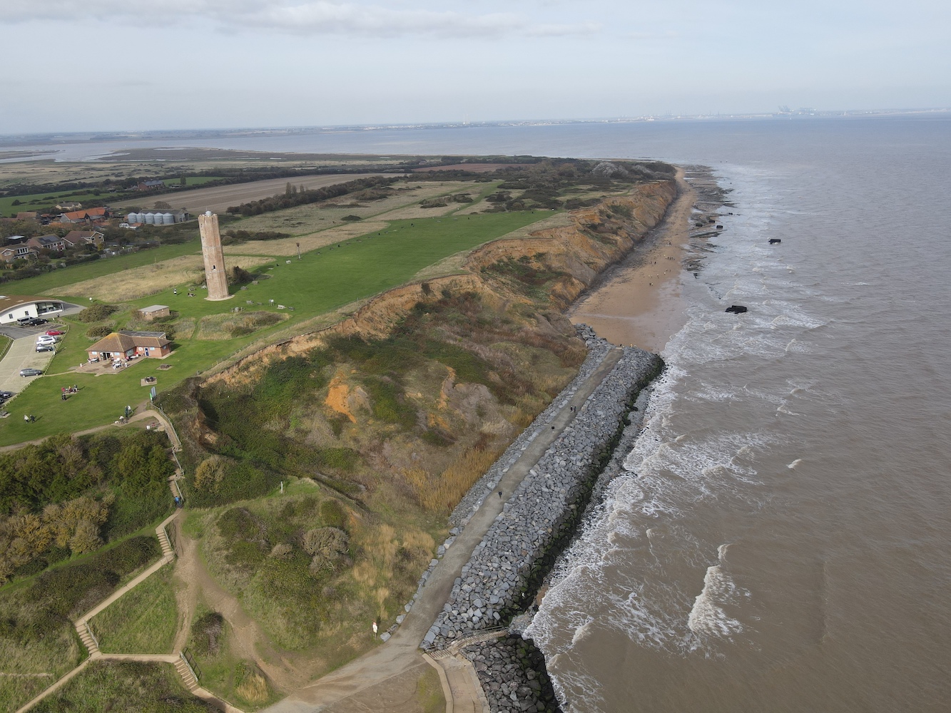
Our recent break in Suffolk had come to an end and it was time to head home, as suggested by my last post – which was due to be the final one for the year. Always wanting to get the most out of these trips though there was something that needed to be cleared up and this took us to Hawkcraig Point in Aberdour on the east coast of Scotland.

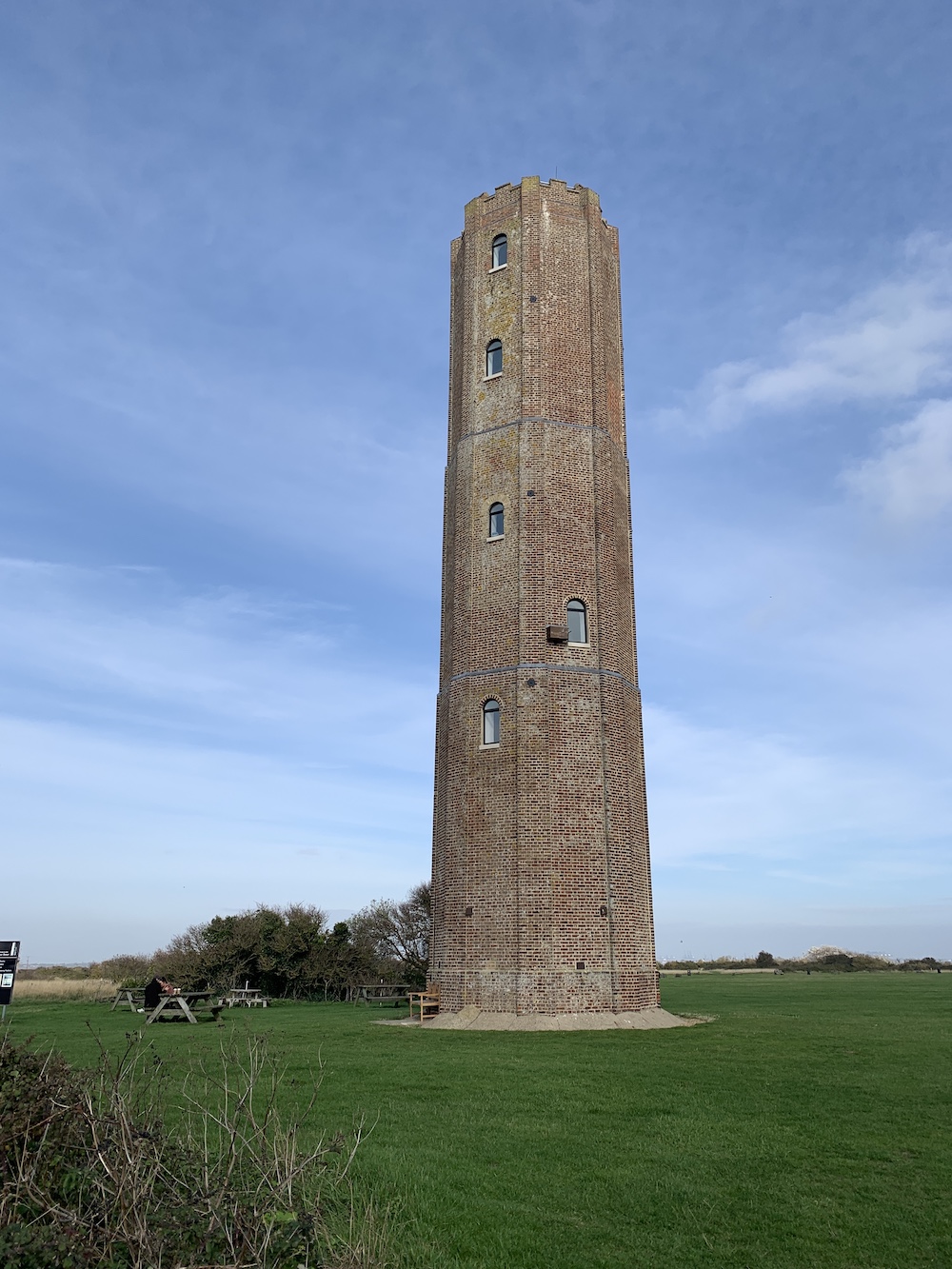
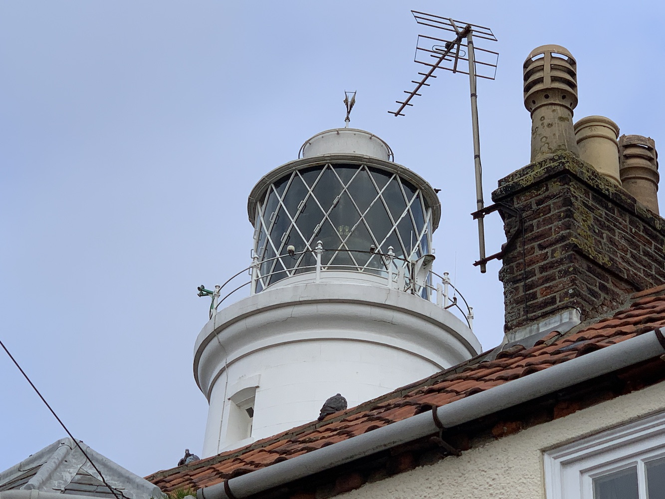
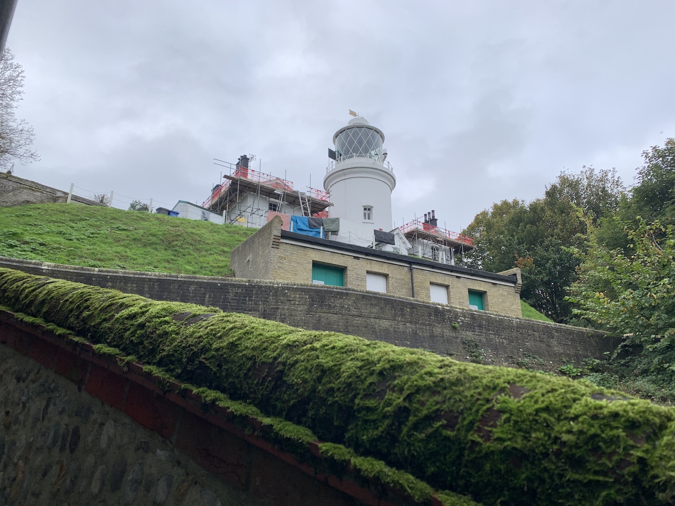
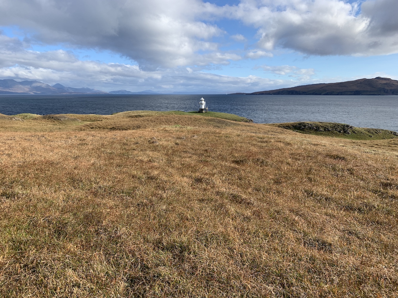
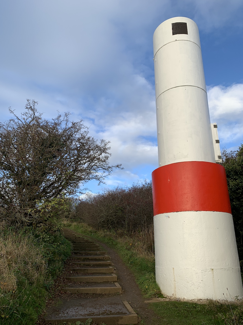
The last time I visited Hawkcraig Point was two years ago when I was entering the last few months of preparing the content for my book. I had a list of lighthouses I needed to check out to ensure they met the criteria for inclusion, and the two towers here were on that list. On the last visit we discovered that the rear of the two lights had internal access through a door on the side. However, there were no visible signs of an entrance on the front tower. Returning home I looked into it and discovered some aerial images that seemed to suggest there was a hatch on the top of the front lighthouse and so it made it onto the final list for the book.

Hawkcraig Point front and rear lights

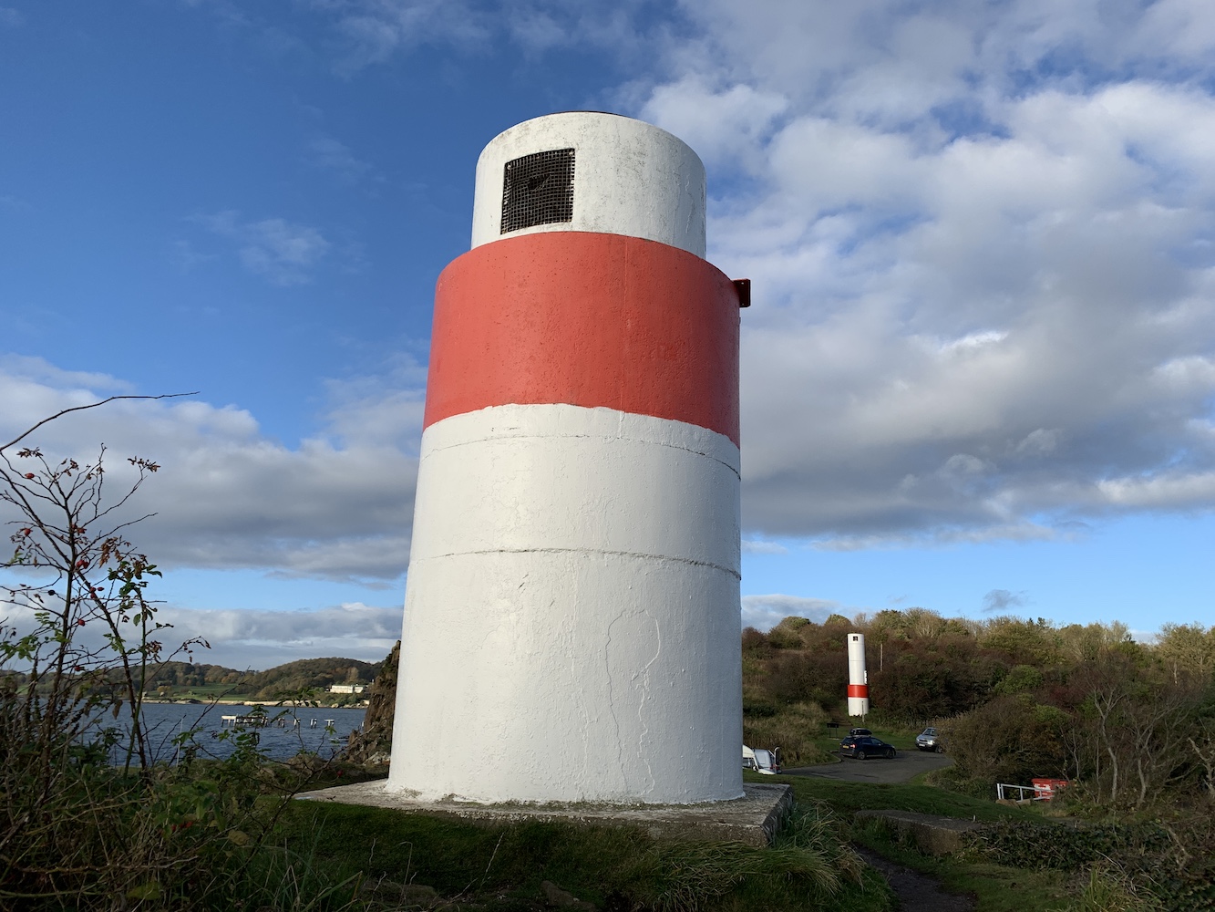
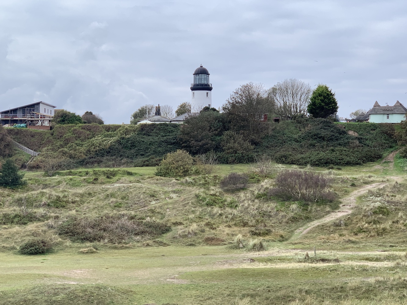
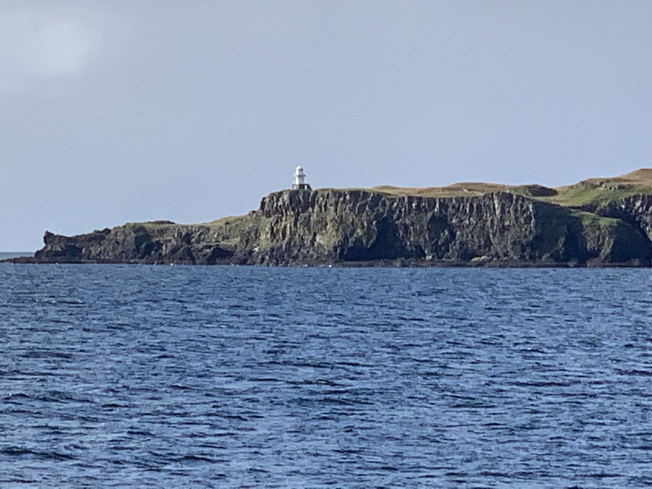
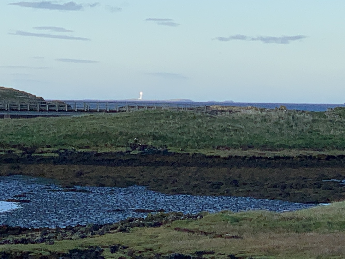
Now that we were equipped with Joe the Drone though it was time to check it for ourselves. While I kept the kids entertained by walking to each of the lighthouses and then up the nearby steps which gave great views across the Firth of Forth (Oxcars lighthouse was clearly visible), Bob sent Joe up to investigate. It very quickly became clear that there is indeed a hatch on top of the tower which allows access to the light itself.

Hawkcraig Point from above

The lights at Hawkcraig Point remain a bit of a mystery to me as there is really no information about them online, even basic information such as when they were first introduced. Much of the history of this particular area centres on HMS Tarlair, a Royal Navy facility that was used to research and develop hydrophones to listen out for any enemy submarines in the area during the First World War. There are still remnants of this base, such as the remains of the old pier and foundations of a couple of buildings.

Hawkcraig Point rear lighthouse

Information about the lighthouses here is very scarce. This is something I am coming across more and more frequently as I look into the smaller lighthouses, particularly in Scotland, and I find it frustrating and feel the urge to be more proactive about uncovering whatever history there might be out there.

Hawkcraig Point

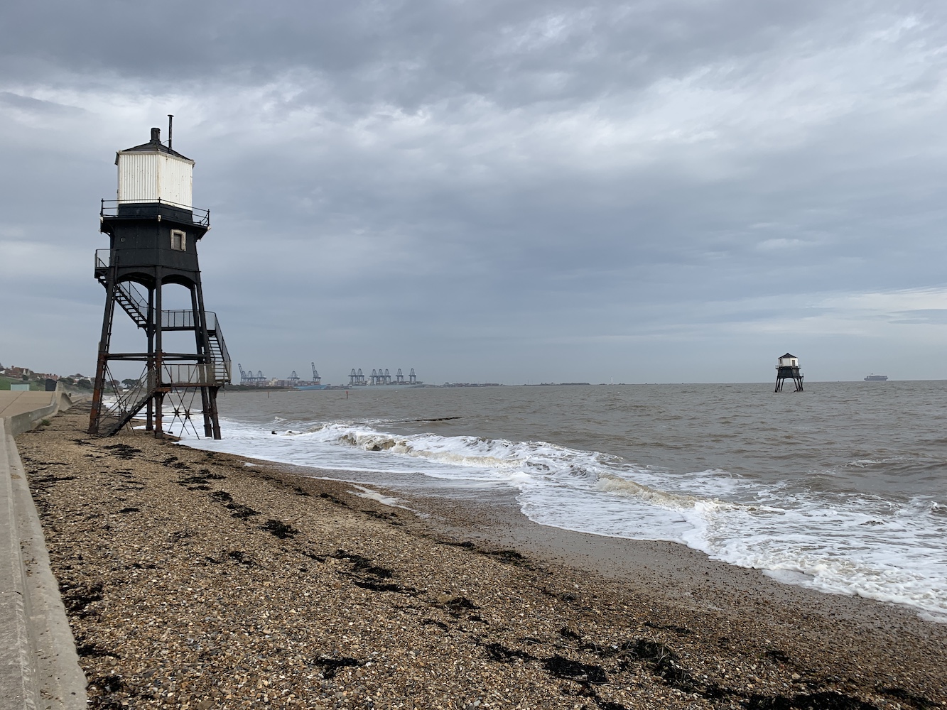
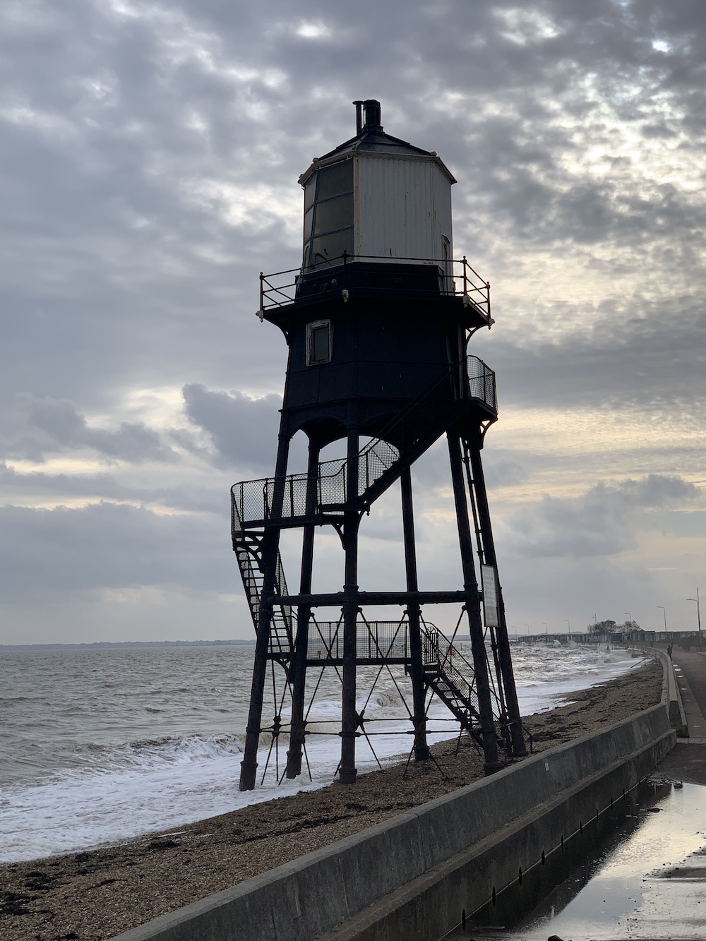
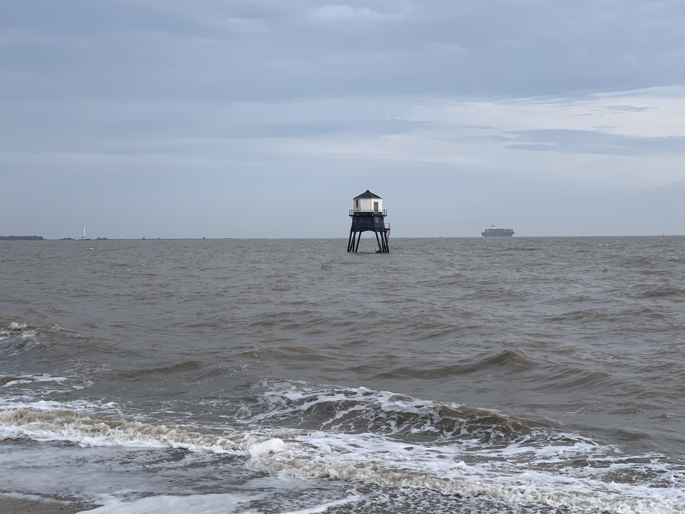
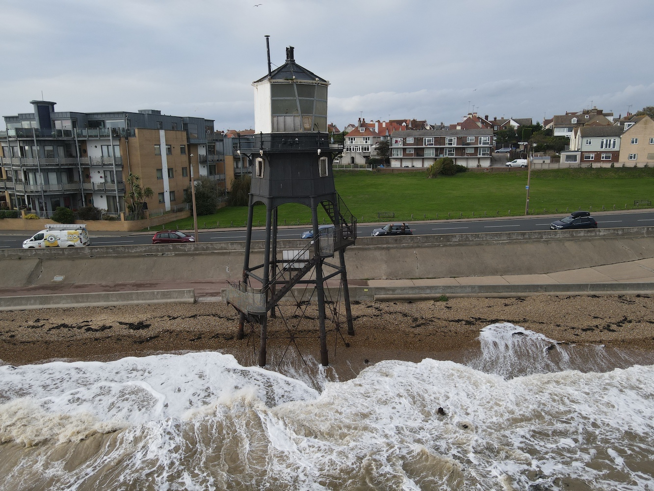
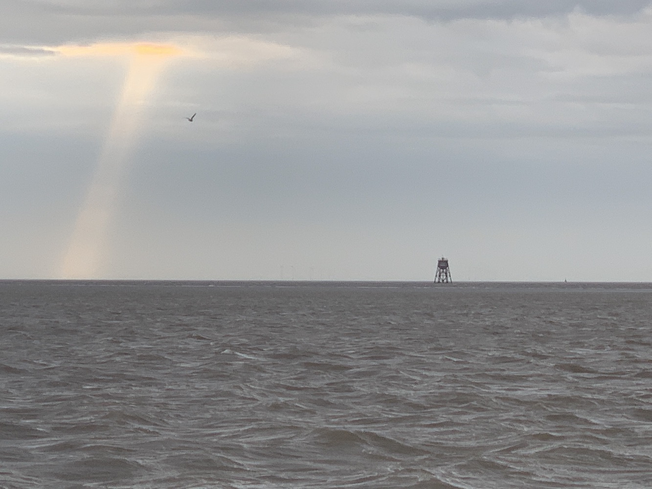
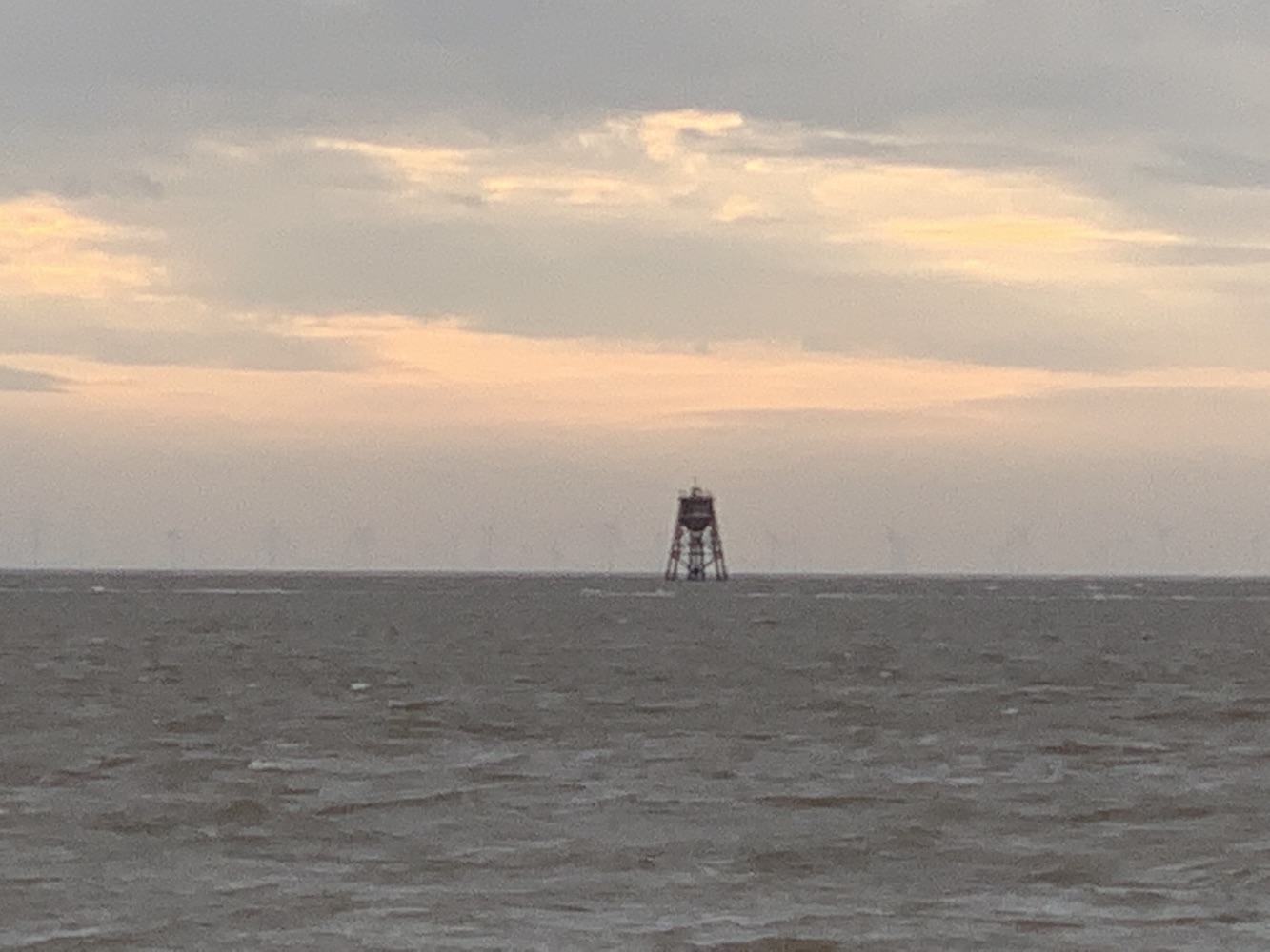
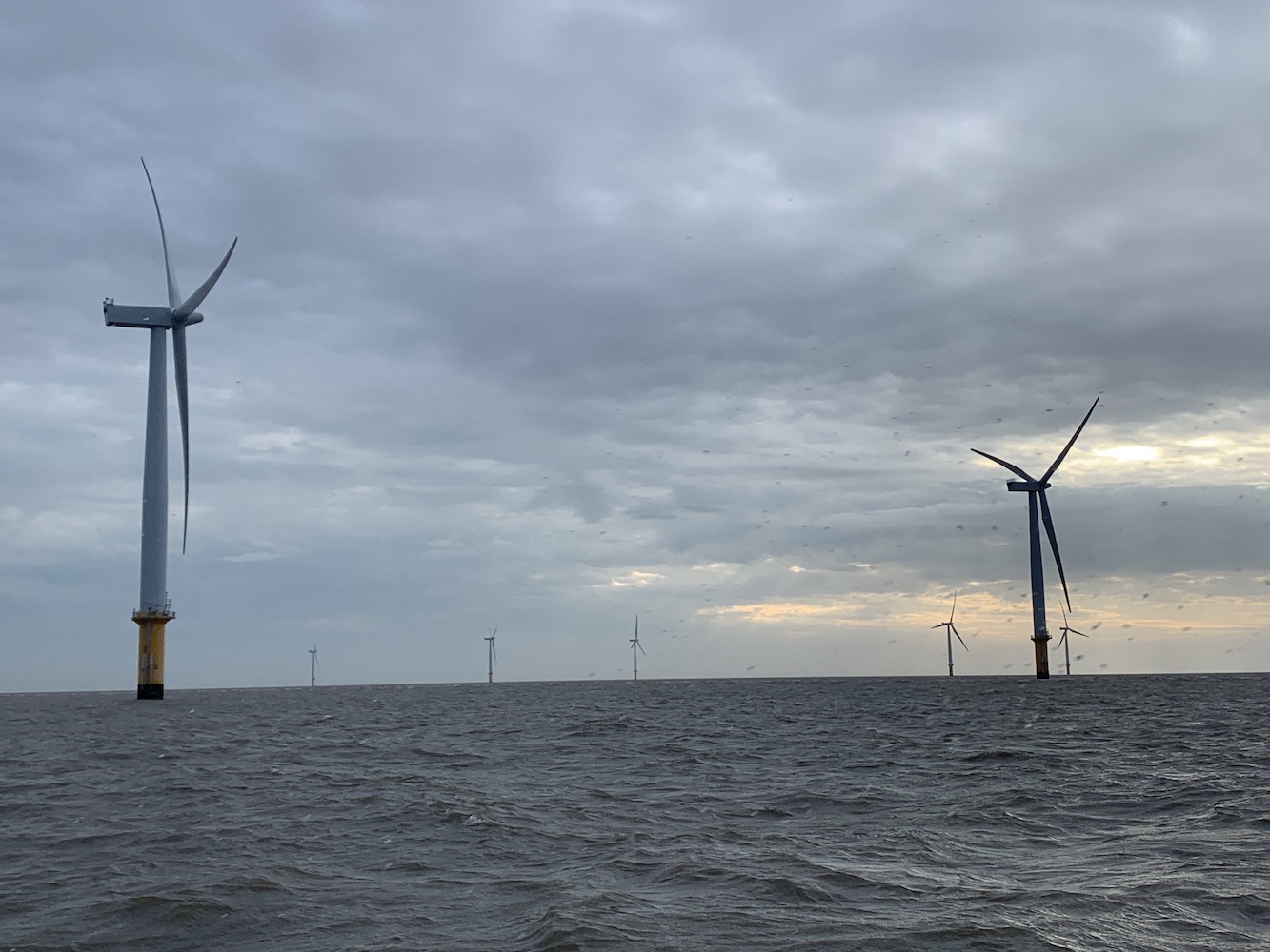
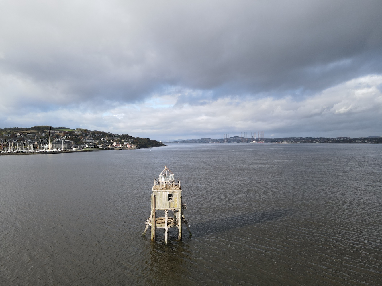
Bob made the error, much to my delight, of asking if there was anywhere else I wanted to go as we continued our journey home. After seeing three screw pile lighthouses during the week and my suggestion was Tayport to see the Pile lighthouse as I knew, with Joe, we could get a closer look at it – or at least better pictures of it. That was exactly what we did.

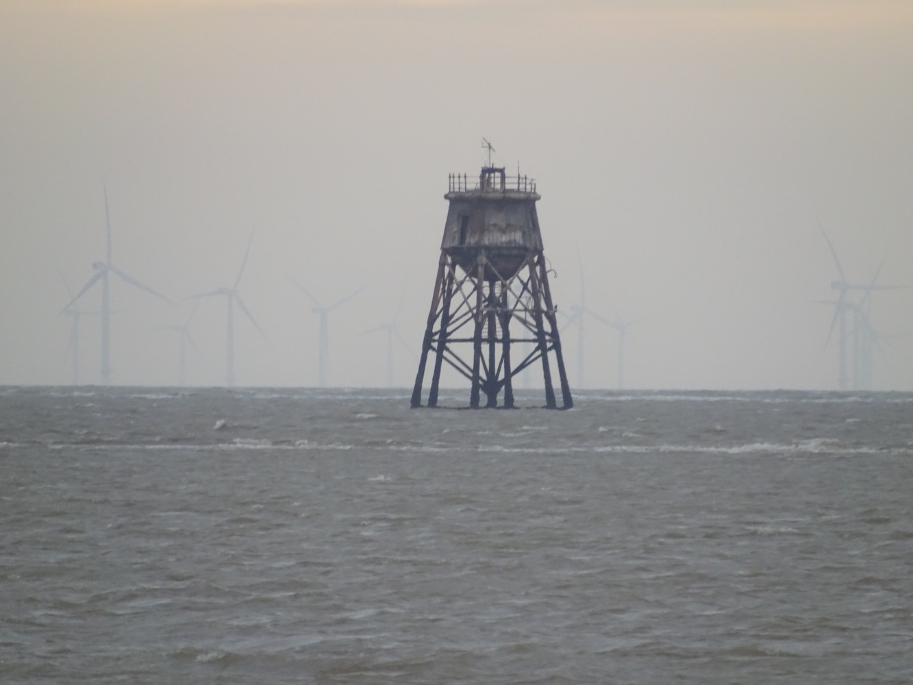
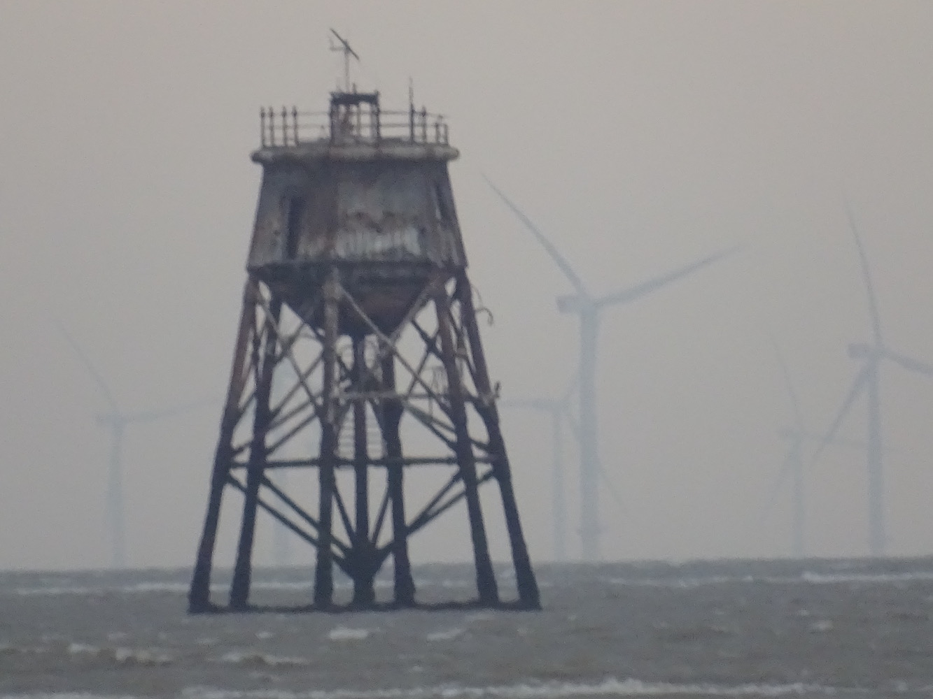
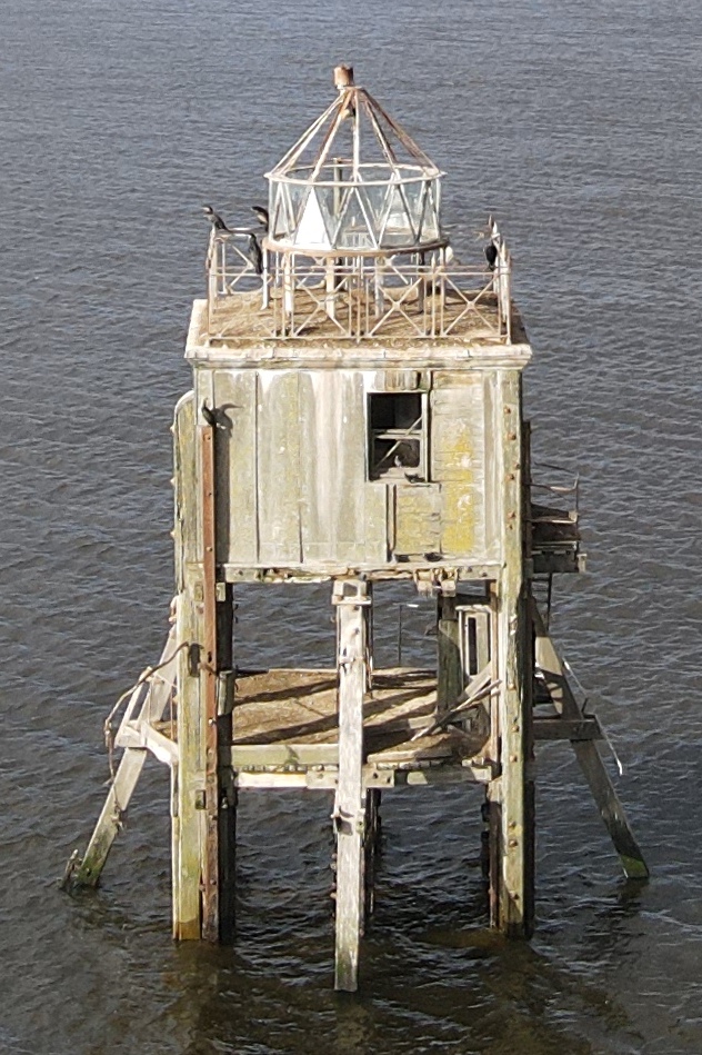
I was left with child management duties (directing them to run around benches and trees, and taking a look at a nearby large pond) while Bob and Joe got to work. There were a fair amount of birds about and Bob was keen not to disturb them too much so he got some pictures and then left the birds alone. It’s fair to say the Pile lighthouse has seen better days, but it is also looking remarkably good considering it’s not been in use for around 60 years.

Tayport Pile lighthouse

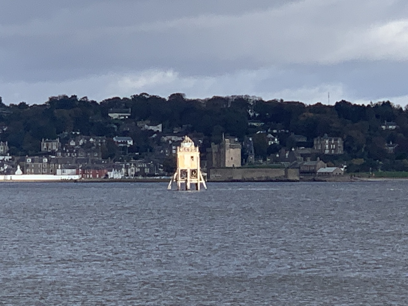
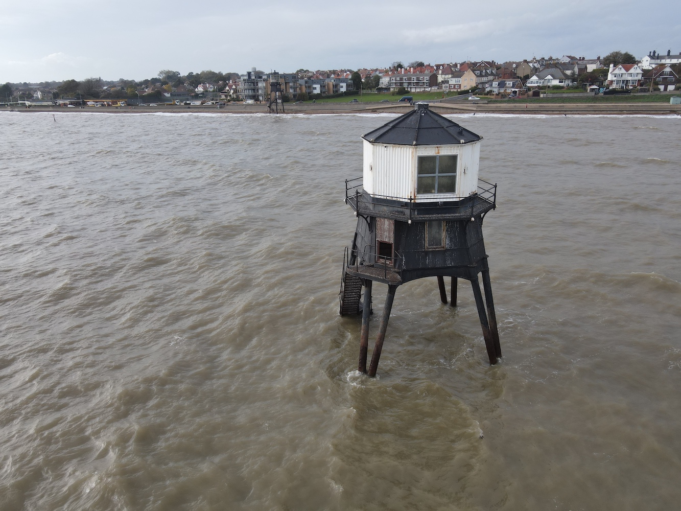
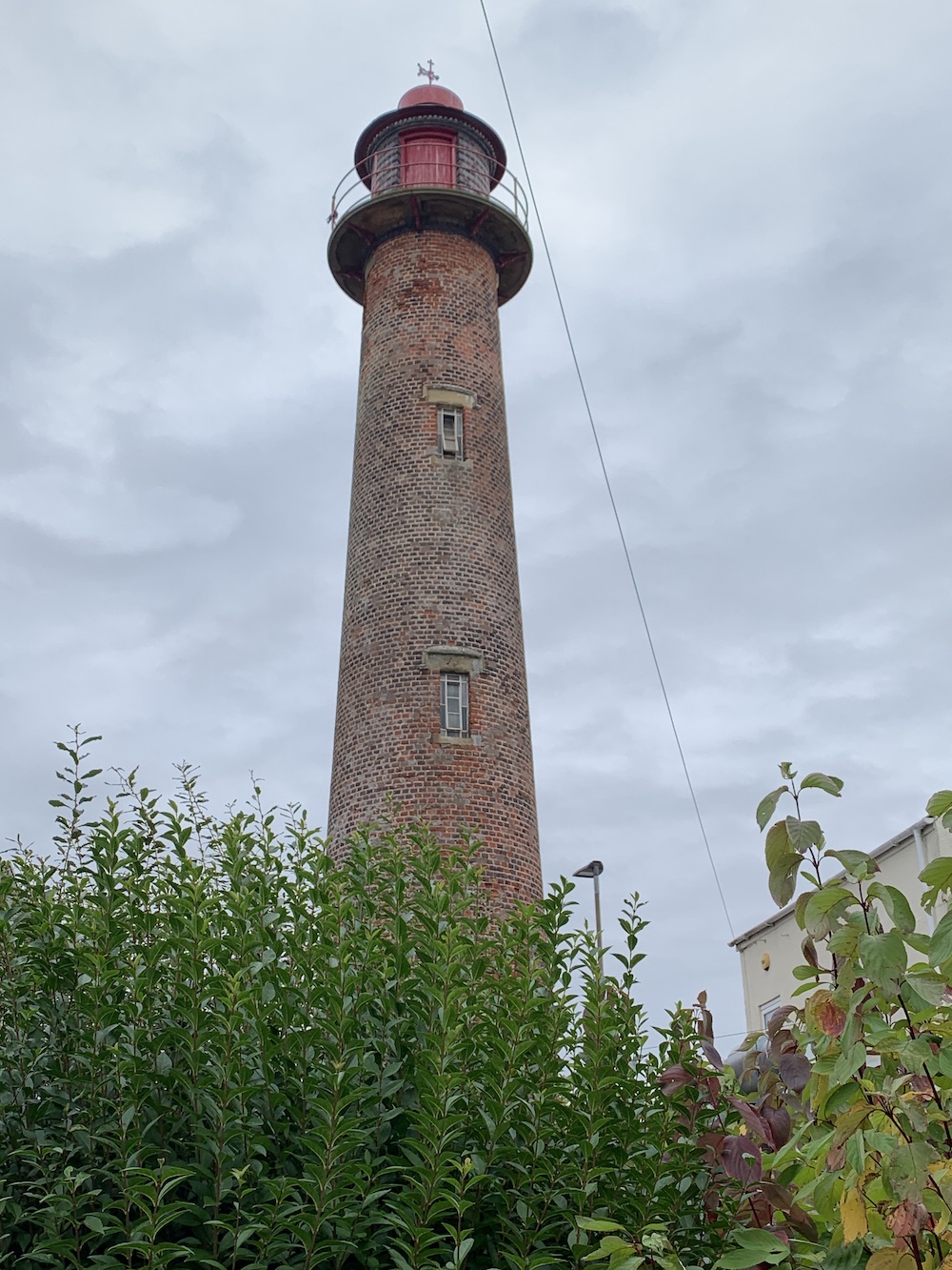
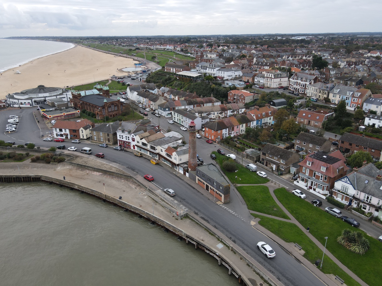
The tower was introduced in 1848 to replace the front of the two lighthouses along the coast of Tayport. It’s essentially a wooden box with a lantern (or the remains of one) on top and it stands on timber stilts which are screwed into the sea bed, hence the name ‘screw pile’.

The Tayport Pile light from above

Much like Hawkcraig, there’s not a lot on information available about this one, and perhaps the most valuable information comes from comments on Facebook posts in more modern times. It had been suggested that the lighthouse was never manned and instead someone would just travel out by boat each evening to turn the light on and then back again in the morning. There were numerous comments though from those who live or lived in the area confirming that it was in fact manned and had 24 hour cover. One particular person explained that the tower had initially contained a candle in a prism, but had later been converted to oil and paraffin. They added that there was a bell that rung from the tower too in the event of fog. The lighthouse marked the entrance channel for Tayport harbour and aided ships in avoiding the sand banks that lie to the south of the tower.

The lighthouse has also been known as the Larick Beacon, but locally it’s the Pile Light

A report on the Canmore website states that though the condition of the Pile Lighthouse does not look so good it is structurally still quite sound, although it will need some work done to prevent it from deteriorating to the point of being at risk of collapse.

A cropped version of the picture above of the Pile lighthouse in Tayport

An interesting morning and the weather had been kind too. That honestly is it for now with no more sneaky posts appearing for a little while. Hopefully it’s not too long before more adventures can happen though. 🙂

A lighthouse adventure in Essex

After our short boat trip out to see Gunfleet lighthouse on Tuesday morning it seemed a good opportunity to revisit some of the Essex lighthouses – and introduce Bob and Joe the Drone to them as well.

Back in 2012 the Naze Tower had been my first stop on my lighthouse tour and I’d not been back since. Some may argue that the Naze Tower might not have been a lit aid to navigation, but it also may have been – and, more importantly, it’s a lovely place to visit.

The Naze Tower

Due to Covid-19 the tower is currently closed, but that didn’t matter as the sun was shining and it was dry. My lighthouse pal John had joined us and we were all pleased to be able to spot Gunfleet lighthouse in the far distance having been closer to it that very morning.

The Naze Tower is quite impressive and is clearly very well looked after. The beautiful brickwork is looking excellent when you consider that the tower was built in 1720. The tower had been somewhat neglected in the past, but the owners did some extensive renovation and, in 2004, it opened to the public for the first time. Presumably it needed, and will continue to need, some repairs and maintenance done on it – it is 300 years old after all.

When it does reopen, hopefully next year, you can see it’s 8 floors which feature an art gallery with exhibitions, and a museum about the tower and surrounding area. On top of that, quite literally, you get the panoramic views.

Joe took to the sky and, as usual, captured the glorious coastline. Seeing this coastline is always tinged with a little bit of sadness though as it really does suffer from erosion. There is evidence on the beach here that some measures have been taken to try to reduce the erosion in the area as you can see in the picture below.

The sea defences were clear in one of Joe’s shots
The view from above looking towards the south

There’s a lovely little tea room nearby too and we chose to have lunch outside on a bench before waving goodbye to John and continuing on our way.

Harwich awaited our arrival and this is quite a special place for those with any maritime interest. It is where Trinity House monitor their lighthouses from – as well as the Northern Lighthouse Board lights during evenings and weekends. Trinity House also has a depot and buoy yard here. It has its own two old lighthouses, a Light Vessel you can (under normal circumstances) look around, the Lifeboat Museum and an array of other points of interest that make up the town’s Maritime Heritage Trail. In addition we were able to see three more light vessels anchored off shore in the area.

Harwich High Light and the Harwich Town Buoy at the start of the Maritime Heritage Trail
Light Vessel 18 which is usually open to visitors

The two lighthouses here are no longer active and haven’t been since 1863 when they were replaced by the two Dovercourt lights (more on those in a bit). The low light has housed the Maritime Museum since 1980 and the high light is now run by Harwich Society as a local interest museum.

Harwich High Light

The existing towers replaced the town’s original leading lights. All of these lights were intended to work in pairs to guide ships safely into the harbour.

Harwich Low Light with the High Light visible in the background

Joe had a little fly around the area too, which is actually how we realised the light vessels were offshore.

An aerial view of Harwich’s harbour area with the three light vessels visible
The lighthouses in Harwich

Harwich is a fascinating place and it would be nice to spend some more time here getting stuck into the maritime history.

Just a short drive to the south we found the two Dovercourt lighthouses. On my original tour I’d seen these two at low tide and with high tide now approaching it was interesting to see the bottom of the outer light under water and the rapidly heightening waves splashing around the base of the inner light.

The lighthouses at Dovercourt

As mentioned, these lighthouses were introduced in 1863 to replace the Harwich lights. At the time they were built they were believed to have been fairly revolutionary in that they were of the new screw pile design and were prefabricated. A ‘causeway’ was introduced between the two lighthouses which can be walked with care at low tide.

Dovercourt Inner lighthouse

The lights were decommissioned in 1917 when buoy markers were installed to mark the approach to Harwich and since then have been through a period of restoration in the 1980s. Recent investigations have found that further restoration work is required to secure their future and it looks like this is in hand, which is always good to hear.

Dovercourt Outer lighthouse

They are quite unique structures and it was good to also see them from a different angle with the help of Joe the Drone.

Dovercourt Inner light from the seaward side
Dovercourt Outer lighthouse from above

Yet another day of doing a little more exploring and revisiting had come to an end. A very good day it had been and with it also being the last planned lighthouse trip of the year I was glad it had been a success and undertaken with great company.

Let’s hope even a little lighthouse visit can occur at some point before the year is out. Finger crossed 🙂

Catching Gunfleet just in time

A key target for this trip was to attempt to get out on a boat for a closer look at Gunfleet lighthouse. After spotting it in the distance during my first visit to the Naze Tower, it had always felt so out of reach, but I like to think that these things are never really out of reach. You just need to find a way of getting there so I did some research and found a boat company, Sophie Lea Charters based in Brightlingsea, who were willing to take us out. 

I’d originally selected Wednesday as the day of the trip but having spoken to the boatman on Monday evening it was looking like Wednesday wouldn’t be possible. However, he did say an early trip on Tuesday would be an option. You have to jump at these chances when they come, don’t you? I’d also invited my lighthouse partner in crime John to join us, but the early start meant he deprived himself of a few hours’ sleep in order to arrive on time for the trip.

We found Sleeping Beauty in his van when we arrived at the car park and once we were all ready, we had a nice stroll around the harbour area, which seemed picturesque. Thankfully the rain had stopped and we could enjoy the views while we waited for the boat to arrive.

The boat arrives

Once Lee arrived with the boat and we’d hopped on board we were warned that we wouldn’t be able to get very close to the lighthouse as it sits on Gunfleet Sands, the very sandbank it was designed to make mariners aware of. This reminded me of something an island/hill-bagging friend said to me last year, that lighthouses were built to warn boats to stay away from them so by trying to get as close as we can to them goes against their intended purpose. Gunfleet was a perfect reminder of this, and in this case Gunfleet wins as the tide was low. Waiting for high tide that day wasn’t an option due to worsening conditions as the day went on and attempting to get around the east side of the sandbank would also not have been wise given the increasing wind and swell.

John pointed out a nearby faux lighthouse, Batemans Tower, which is actually a memorial. Historic England’s website suggests that the tower, when built, was actually intended to be used as a lighthouse, but the port plans in the area never materialised.

Bateman’s Tower

The trip out was good and we passed the Gunfleet Sands wind farm. It was the first time I’d sailed close to an offshore wind farm and I think we were all impressed, even those who aren’t normally so keen on wind turbines!

Passing the wind farm – apologies for the wonky horizon!

It seemed to be a while before the lighthouse came into view, but eventually we spotted it. It has a fairly distinctive shape now without the lantern on top. There’s a lovely postcard online (towards the bottom of the page) showing how it looked when it was an active lighthouse marking the sandbank. It’s actually a really interesting tower – and the sole surviving screw pile lighthouse in the area with the other few lost over the years. The whole idea of building a lighthouse on a sandbank sounds a little bit mad, but it clearly worked for a long time, although gradually these structures are being lost to the sea as time passes and they are no longer maintained. The latest casualty is the Wyre light that guided ships safely into Fleetwood on the Lancashire coast which has now almost completely collapsed. 

Gunfleet was an active lighthouse, operated by Trinity House, from 1850 until 1921 as a manned station. It lies six miles off the coast of Frinton-on-Sea. It must have been a rather interesting place of work, almost like a rock station but with less space. There’s a great page online showing a few pictures from inside the tower in 2005 when a couple of chaps visited, which can be seen here.

Edging closer to Gunfleet lighthouse

There’s another interesting tale from Gunfleet’s history, which perhaps explains a little why it wasn’t in such a bad state internally in 2005. In 1974, it was partially renovated by the team behind the Dutch Radio Atlantis (to be broadcast as Radio Dolphin from Gunfleet lighthouse). After much of the equipment was installed representatives from the police, Home Office and Trinity House visited and demanded to be allowed into the tower. Eventually the broadcasters relented and were arrested with all of their equipment being removed from the tower before they had managed to get it up and running. A full account of this story can be found here.

With the lighthouse now looking clearer Lee stopped the boat and informed us that it was as close as he could go as we didn’t have much water depth to play with. Although we weren’t as close as we would have liked to have been, we were able to enjoy a bit more of a broader view. As we began to take our pictures a wonderful ray of sunlight shone through the clouds to the left of the lighthouse which was great to see.

The lovely scene that greeted us near Gunfleet

In the meantime Bob launched Joe the Drone with my assistance (I’ve got rather good at helping with take offs and landings on boats, I must admit) and flew him towards the lighthouse. The wind had picked up by this point and Bob kept a close eye on how Joe was managing with the conditions. Always a bit worrying when the drone is flying over a massive expanse of water. Thankfully Joe made it out towards the lighthouse and got some excellent pictures, showing us more of the detail we couldn’t see from the distance we were at.

Gunfleet lighthouse from above
My favourite of Joe the Drone’s shots
A cropped version of Joe’s picture showing a bit more detail

John took these great pictures of the lighthouse with the wind turbines in the background haze, which I thought made for really interesting images.

Gunfleet lighthouse (picture: John Best)
A closer view with the wind farm in the background (picture: John Best)

We admired the lighthouse for a while and enjoyed the view as it changed again with the lovely orange sky as the sun began to break through even more of the cloud. Joe arrived safely back on the boat and we began our return journey, watching the lighthouse getting smaller and smaller.

The beautiful orange sky at Gunfleet lighthouse

We passed even closer to the wind turbines on the way back and John also pointed out the buoy that has now replaced Gunfleet lighthouse and marks one end of the sands.

Taking a closer look at the wind farm on the return journey

It had been a really good little boat ride and to get out and see something that most people take little or no interest in was pretty special. Gunfleet lighthouse had always felt like a tricky one and in a way it still is as it has that element of not being able to get close to it. At least with rock lighthouses they are on a rock that you can either sail close to or, if you’re lucky, even land on, but this is something else. But the trip was worth it, that’s for sure.

One of the lovely views on the journey back

There was more lighthouse visiting later that day, but I shall save that for another post. 🙂

New routes in Norfolk

Following a day visiting the lights of Suffolk on Sunday, it’s was Norfolk’s turn yesterday. It’s another area I’ve been to a few times but covered very few of them in detail on here.

Gorleston-on-Sea was first up and I was happy to return to this one. On my 2012 tour I was in the habit of parking in any old car park and then walking to the lighthouse rather than parking as close as I could to it. That meant I spent a little longer wandering the streets of Gorleston that time.

Gorleston lighthouse

This time I spent a little more time seeking different angles and approaches rather than just close-ups of the tower. This theme continued for much of the day, but more on that later. I made a point of walking around the back of the tower this time and then strolling out along the pier, noticing the beach on the other side, which I’d not realised was there before.

Gorleston lighthouse from behind

Joe the Drone had a bit of a fly around and captured some excellent pictures as usual.

Gorleston lighthouse with the beach in the distance
Gorleston harbour from above

Northwards we went to Winterton-on-Sea. Last time I was there I got the feeling that visitors weren’t massively welcome with lots of private road signs in the area. So I then settled for a view above the houses in nearby roads. This time though we went for a different approach, this time from the beach and sand dunes. 

Winterton-on-Sea lighthouse across the dunes

I’m glad we did as it’s a much more enjoyable approach. While Bob flew Joe about over me like I was in some sort of action film, I wandered as close as I could get to the lighthouse, which wasn’t that close, but I found some higher ground and got some nice views from there.

Winterton lighthouse from the coast

Joe had got some great views too.

Winterton lighthouse from above, looking north
Winterton lighthouse from above, looking south
Winterton lighthouse from the east

Bob then suggested we try approaching from the nearby holiday camp area so we set off back over the dunes. This turned out to be a good idea as, although we still couldn’t get close enough to touch the lighthouse we got much closer than I’d been before. So I was happy with that – and it was nice to see the tower behind the coloured little houses too! Winterton lighthouse is actually available as a holiday let and Lighthouse Accommodation can provide more details about this.

Winterton lighthouse from the neighbouring holiday accommodation

On the subject of Lighthouse Accommodation, which is written and compiled by my lovely friend Joy, our next stop was Happisburgh lighthouse where Joy is a very active volunteer. As we arrived at the lighthouse the clouds cleared and blue sky and sunshine came out. It’s always been nice weather when I’ve visited Happisburgh. 

Happisburgh lighthouse
Approaching Happisburgh lighthouse

It was also nice and calm there today so the walk along the track to the lighthouse was very enjoyable as was the stroll around the wall. The lighthouse is currently closed because of the pandemic, but I would highly recommend going there once it opens again. It’s such a special place and you can see why the community work so hard to keep it running.

Happisburgh lighthouse from the entrance
Happisburgh lighthouse from the east

One more stop of the day and that was Cromer. The lighthouse here is at the end of a private road and the cottages here are let out by Rural Retreats. On other occasions we may have been tempted to drive up the road, but with Bob wanting to be there long enough to fly the drone I suggested we take the coastal route by walking from the town centre. It’s a great walk, although initially we weaved our way through the people in the town to ensure we kept our distance. Once we started walking along the promenade it was a bit easier and the views opened up. We reached the row of beach huts and Bob, who was in his usual position in front of me, spotted the steps leading up the cliff.

The sign that marks the start of the steps

I knew there would be quite a few steps and they were pretty tiring, but thankfully they changed direction enough to keep them a bit more interesting. Once at the top we took a left turn and followed the various paths along the coast. It wasn’t long before the lighthouse came into view, which is always encouraging! Bob, off in front again, found a narrow track leading from the path up to the lighthouse which went from a fair little path to quite a steep final section, but once at the top I was there and could enjoy views all around. 

Cromer lighthouse comes into view

There was a perfectly positioned helipad for Joe the Drone to borrow for take off.

Cromer lighthouse
Cromer lighthouse from the north
Cromer lighthouse from the west

I imagine Cromer lighthouse would probably have been quite a popular station to serve at as it looks fairly spacious judging by the size of the associated buildings and the width of the lighthouse. It was great to see the light on too. That’s always an added bonus.

Cromer lighthouse in action

On the walk back I enjoyed the occasional look back to the lighthouse as I took a slightly different route along the paths. The views down to the beach and pier were wonderful too with people’s reflections in the water.

Cromer beach and pier

Rather than taking the steps back down to the beach huts we followed the path down and came out in the town. More weaving between people ensued and we were soon back at the car.

A great day and I’m so glad I took the opportunity of suggesting the alternative routes at both Winterton and Cromer. The coastal route is near enough always more enjoyable. 🙂

Suffolk: the second round

In recent blog posts I’ve become very aware of how little credit and attention I gave each lighthouse as I was whizzing around so many – particularly in the early days of my 2012 tour when I only included one picture per post. The methods of posting on this blog then were somewhat different with me needing to send the text by email to a particular address and attach a picture to have that included at the end.

This week I am in East Anglia and, although I’ve seen a couple of these lighthouses a number of times they’ve not received the coverage they deserve on here. So I now want to rectify that.

Yesterday was a day for exploring the lighthouses of Suffolk and our first stop was Southwold. With grandparents living in the area, Southwold is a place I spent many a wonderful childhood holiday. Perhaps it was the lighthouse here, sitting proudly in amongst the houses, that contributed to my love of lighthouses. It’s hard to say, but I can certainly see that it might have been.

Southwold beach

With all the times I’ve seen the lighthouse here I’ve not yet managed to make it inside and yesterday was no exception. It may well be closed as it’s now out of season or it could well be the pandemic, but either way I had to satisfy myself with an external view, but what a lovely view it is. With this one, although I love to see it close-up, the best views are the glimpses you catch of it above and between the roofs and the houses as you walk around the area.

Southwold lighthouse

With very calm conditions Joe the Drone was able to get an outing too. Bob attracted a bit of interest from passers by, which he’s not used to in the more remote places we go to in Scotland! My favourite view of Joe’s was taken from above the sea looking down on the town with the lighthouse standing proud. It was also good to see how it looked facing south with the shape of the coastline.

Southwold lighthouse from above

Our second stop of the day was Pakefield, which we managed to catch between showers. The lighthouse here is no longer active with the squat tower now used as a Coastwatch station. Again, this is one you can visit under normal circumstances, but the virus is currently impacting on that. Pakefield is the only lighthouse I’m aware of that you access through a holiday park!

Pakefield lighthouse

Up went Joe again and captured some great images showing just how small the lighthouse looks in relation to its surroundings (unlike Southwold) and the beautiful coastline here that is so characteristic of the area.

Pakefield lighthouse from above

Three lighthouses awaited in Lowestoft. Rather greedy of Lowestoft, but you will not hear me complaining. The two lighthouses on the end of the north and south piers in Lowestoft can be easily seen from the south pier, but you can’t get close enough to either to be able to touch them. The north pier is closed completely to the public while a fence prevents you from getting to the south pier light.

Lowestoft North and South Pier lighthouses

However, we had Joe and we weren’t afraid to use him – between rain showers again.

Lowestoft South Pier lighthouse
Lowestoft North Pier lighthouse

It was fairly overcast, but still good to get a different angle on these two and see the harbour from above. The harbour is far bigger than I ever remember it being.

Lowestoft harbour

With one lighthouse to go we continued north. As the lighthouse appeared among the trees on the landward side of the car I pointed it out to Bob’s surprise. I don’t think he’d expected it to be there and it’s another one that’s not in a standard location. It is right next to a main road on the west side and slightly further inland than you would expect. We parked up and wandered up through Sparrow’s Nest Gardens to get to it. This was rather good as I’d remembered the area being quite picturesque and filled with trees on my previous visit, but that time I’d parked to the north and so missed most of the nicest bit.

Lowestoft lighthouse

We strolled up the steps to the south of the lighthouse, which I think gives the best land-based views of the tower. From almost every other angle the lighthouse is obscured by trees. There is currently some work going on here with scaffolding covering the two buildings, which detracts a bit from the loveliness of it, but of course that’s only temporary.

We followed the steps up to the road, passing the lighthouse complex and then strolled back into the Gardens. We were delighted to see some fairly tame squirrels running about across the paths and on the grass.

A squirrel at Sparrow’s Nest Gardens

That kept the kids and I entertained for a while as Bob went to the car to pick up Joe for his final flight of the day. From above you can really see how well surrounded the tower is by trees, and you also get an idea of just how big Lowestoft is, which amazed me.

Lowestoft from above
Lowestoft lighthouse from above

It had been a lovely day of revisiting a few old friends, now with my greater appreciation of these structures and their wonderful surroundings. It’s nice to do these things at a slower pace every now and then. 🙂

The stunning Canna and Sanday

I am posting this from the community shop on the island of Canna, one of Scotland’s Small Isles to the south west of the southern point of Skye. That in itself says a lot about the island. The community shop is the only place on the island where visitors can access WiFi and there is very patchy mobile phone signal. To some that may be a reason not to visit, but my opinion is that it adds to the charm. As a result, Canna has been able to retain that traditional community feel where no one needs to lock their doors, and everyone helps and supports each other. The community shop is open 24 hours a day and works on an honesty box system where customers write down what they bought and how much they paid.

The logo for the Community Shop on Canna

Owned by the National Trust for Scotland, the island is unique in that the National Trust will sometimes do calls for new residents on the island and people must apply. The school on the island has not been open for some years now as the teacher and all primary aged pupils moved away.

Canna – or its neighbour Sanday, which it is attached to by a bridge – boasts a little lighthouse and this was a key reason for choosing to visit the island. Bob had also never been here, so he was keen to get to the island’s high point. The trip had originally been planned for Easter and we had booked accommodation in the West Caravan run by Canna Campsite. Due to the pandemic, we had to postpone our visit and we re-booked for the October half term holiday in the hope that we would be able to travel. The announcement by the Scottish Government last week meant that we were still able to travel thankfully. 

We had a stroll along the beach at Chanonry Point on the way to Mallaig. It was the first time I’d been to Chanonry Point since my 2012 tour and there were the usual dolphin spotters about. It was nice to approach it from the road end this time as last time I’d walked to it along the beach from the campsite to the east. 

Chanonry Point lighthouse

It also meant I got to see the old pier, which I assume was built for servicing the lighthouse.

The pier at Chanonry Point

After an overnight stay in Fort William we arrived in Mallaig. Another point I should highlight about Canna before I continue is that it is not allowed for non-residents to bring vehicles over to the island, so we struggled on board with our masses of luggage and food supplies.

The ferry journey was good with very few other passengers on it and everyone keeping their distance. The best part, of course, was seeing Canna lighthouse on the approach to the island. I do enjoy seeing these types of towers and it made me look forward to the walk to it even more – although it seemed like quite a long way!

Canna lighthouse from the sea

After we’d had our bags collected by the campsite owner to take along to the caravan, we set off along the road passing the shop, the post office and a few houses on the way. The day was so calm and there were beautiful views all around.

The view shortly after arrival on Canna

I had two aims for my visit to Canna. The first was to reach the lighthouse and the second was to find a point on the island from which I would be able to see Hyskeir lighthouse flashing at night. Hyskeir is around 6 miles off of Canna and the lighthouse and island it sits on are one of my favourite places. My visit there a few years ago (that blog post doesn’t give it enough credit) was fantastic. It wasn’t long after we arrived at the caravan that Bob called ‘I don’t think you’ll need to go far to see Hyskeir flashing’. Looking out of the big living room window of the caravan I could see Hyskeir there on it’s low lying island, visible just above the bridge across the Sanday. I’ve since noticed that the caravan may be one of the only houses/places to stay on the island from which you’d be able to see it without going outside. So lucky! You can probably guess what I spent the evening doing that first night – oh, ok and the second evening!

A distant view of Hyskeir lighthouse shining in the sun

After a showery day yesterday we decided today would be the best day to walk out to Canna lighthouse. The wind was still strong as it had been yesterday, but it was dry and sunny. We wrapped up in our numerous layers and set off. The puddles were still full this morning, which occupied the kids for the first half an hour of the walk. We’d been to the high point of Sanday on our first day here so we knew where we had to go. The track continued all the way along to the church and disappeared just before the six wildly spinning wind turbines.

The church on Sanday

From this point we became a bit more wary. The lady who owns the caravan had told us that there were some cows out towards the lighthouse and one of them had been a pet last year and so could be a little bit too approachable. We aren’t keen on cows and are very aware of the risks of coming across them when they have calves. We were on our guard and, as we reached the off piste and sometimes boggy section, Bob navigated us across higher ground to give us good vantage points as we went to help with spotting the cows before we reached them.

One of the views on the way to the lighthouse

We found them eventually, in a small gully area – presumably sheltering from the wind to the south west of the lighthouse. We crept past as fast as we could and made our way up the other side. Checking back every now and then to make sure we weren’t being followed, we slowly began to let our guard down on the final stretch to the lighthouse.

The final approach to the lighthouse

These lighthouses are always in such beautiful locations. I think of Eigg lighthouse on Eilean Chathastail in particular. They look great with the extra platforms and, at this one, the platform made the perfect spot for a picnic. Here it was also possible to walk underneath the platform which I’d not been able to do before. Just down from the lighthouse is the landing area for the lighthouse with an old derrick. Here are a few pictures of the lighthouse.

Canna lighthouse
An engraving on the stone under the lighthouse platform
Looking back on the return journey

Once we were satisfied that we had spent enough time there and eaten enough to get us through the return journey we set off. Considering the location of the cows on the southern side of the island on our walk out, Bob suggested we take the more direct route along the north coast on the way back. This turned out quite well with no sign of the cows and we got back to the ‘Gate of Safety’, as we called it, a lot quicker. From here it wasn’t long before we were back on the track near the wind turbines and church again, and then the walk was straightforward.

One of the views on the walk back along the north side of the island

It had been a great walk and we were amazed at how well our six-year-old had coped with it. He was still managing to find enough energy to run up to and jump into the puddles as we neared the caravan! It had also been fantastic to see another new lighthouse and explore Canna and Sanday. There are so many reasons I would recommend Canna as a perfect holiday destination. Firstly, it’s a great place to ‘get away from it all’ as they say. Secondly, it is beautiful – it is the lowest lying of the Small Isles and therefore much easier to get around and explore. Which relates to the third reason to visit, which is that there is so much to see here as demonstrated by the fact that my son says he wants to stay forever and explore all of the tidal islands, hills, and other points of interest. There is a fantastic sea stack over on the east coast which we saw yesterday. Finally, if you are into lighthouses, the walk out to Canna lighthouse is great, if a little challenging in places, and getting to see the lighthouse on Hyskeir flashing is such a treat.

Another one of my favourite views on Canna

We have another two evenings left here, and I intend to make the most of seeing that beautiful Hyskeir flashing out of the window as the dark descends. 🙂