A very fresh restart to the UK lighthouse tour

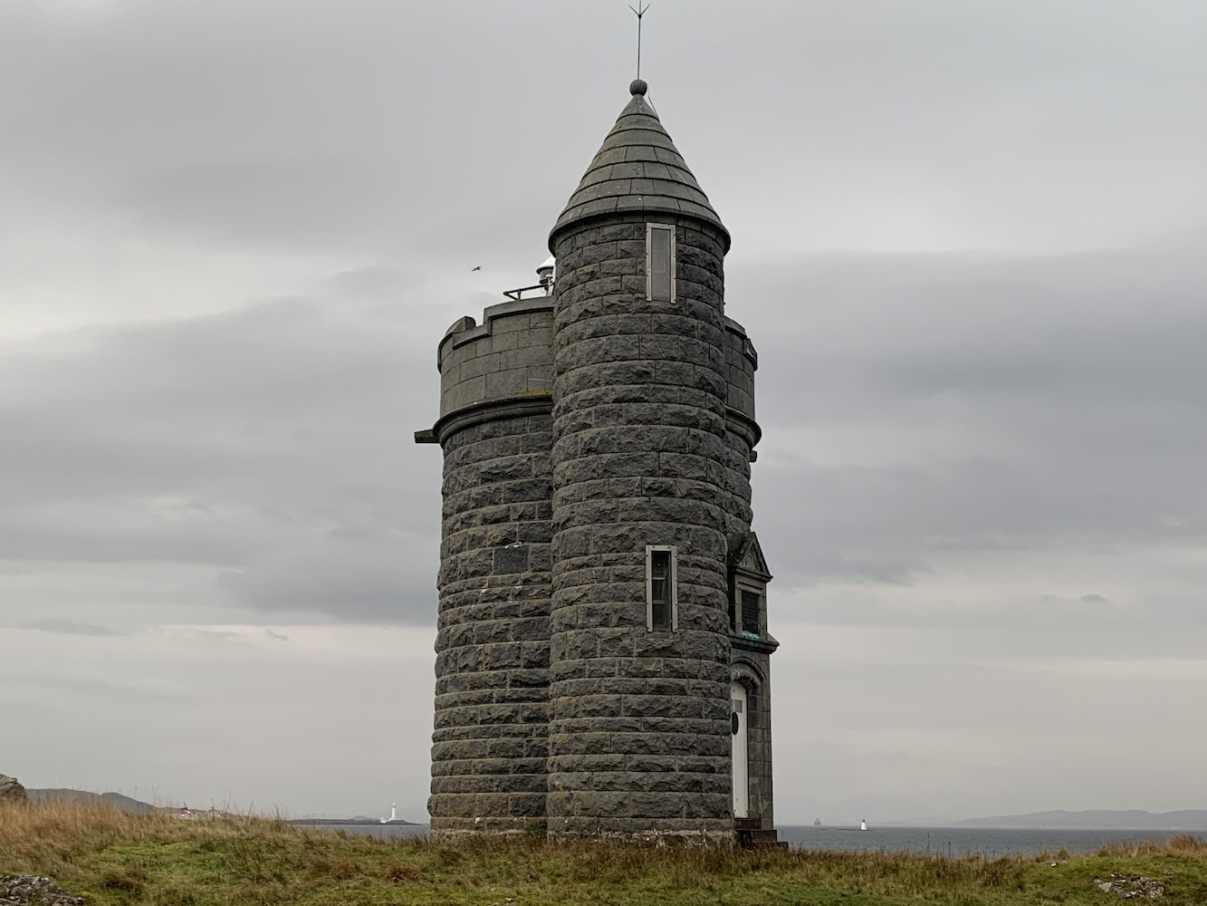
It’s been, and feels like it too, a long time since I posted on here about a lighthouse visit. What day could be better to get back up and running than May Day. A new month in mid-Spring and a brand new challenge. By brand new I mean it quite literally with a visit to a one-month old lighthouse. In March this year the Northern Lighthouse Board (NLB) switched on their first lighthouse built in almost 12 years on Rubha Cuil-cheanna in Onich, just to the south of Corran.

The need for a lighthouse here was recognised due to the increasing use of Corran Narrows by cruise ships arriving at and departing from Fort William. It was in 2009 that the Corran Narrows North East light was installed just to the north of Corran for this same purpose and to supplement the well-known light at Corran Point. The North East light previously held the title for youngest NLB lighthouse.

A drone shot Bob captured of the Corran Narrows North East lighthouse yesterday

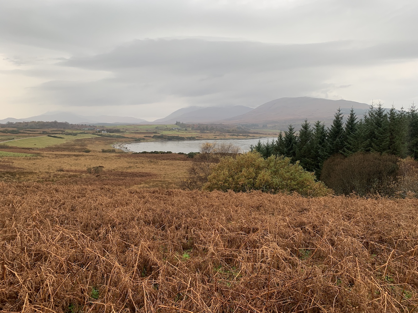
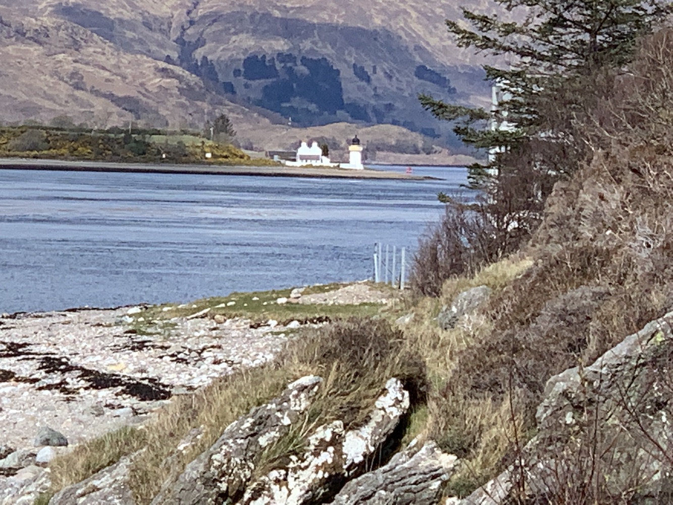
On the way to Onich yesterday, I was keen to find out the meaning of the name Rubha Cuil-cheanna. I established that ‘rubha’ means ‘headland’ or ‘promontory’. This is a word I’d encountered before in lighthouse names, and understandably so. ‘Cuil’ means ‘recess’ or ‘nook’, and ‘cheanna’ is ‘head’. The hyphenation in the name indicates that ‘cuil’ is an adjective giving an indication of place to ‘cheanna’. Based on this my very rough translation is ‘nook head promontory’. That’s a very literal translation of course and if we look at Rubha nan Gall on Mull, which translates as ‘Stranger’s Point’ then ‘nook head point’ might be a bit more like it. Either way it’s a very good description of the geography of the area as you will see in this picture.

The very end of Rubha Cuil-cheanna, clearly showing the ‘nook’ at the bottom

I’d spent quite some time looking at maps prior to the trip to work out the best approach. It seemed over land probably wouldn’t be ideal as there looked to be houses about. I know the Scottish laws make many areas very accessible, but it’s usually best not to push it and risk being shouted at, especially when we had the kids with us. A coastal approach seemed best. Onich seemed the obvious starting point, but again it wasn’t clear where you could park without it becoming a long walk for the kids. I also looked at a Bunree start from the caravan site.

The map also suggested that it might be best visited at low tide as there wasn’t much room for manoeuvre around the coast at high tide. Our timing this morning didn’t really tie in with low tide, in fact it was only 90 minutes after high tide. Knowing that our chances of success were much better if we left it another two or three hours, we spent a while playing about on the rocky beach (having thankfully found a great place to park up just above the beach – there’s an area for those in camper vans to park by arrangement too). Joe the Drone went for a spin and was the first to catch a glimpse of the lighthouse we were aiming for. We decided to find a park for the kids to have a run about in to pass some time.

Onich beach at high tide
Joe the Drone’s first view of Rubha Cuil-Cheanna lighthouse with Corran Narrows beyond

En route we drove along to the caravan site at Bunree to check out access from that side, although the map suggested the tide would need to be even lower to get along parts of that stretch. A sign on the gate at the campsite said ‘No visitors’ so without trying to find a long way around the caravan site that didn’t seem a decent alternative.

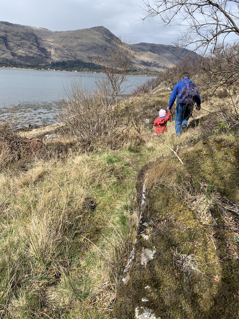
I spent a couple of hours being very impatient, desperate to be heading to the lighthouse but realising the longer we waited the better. We arrived back at Onich about 2 and a half hours before low tide and it was clear that the route was looking much drier so off we set. These things always take so much longer with kids in tow, stopping to pick up shells and rocks or having a bit of a whinge about being tired.

The start of the walk at lower tide
At the ‘nook’

All seemed to be going relatively smoothly until we reached the far end of the promontory where the water was still quite high. Bob went off to check how wet it was while we waited. As he returned from inland I knew that he’d obviously found an alternative way that didn’t require wading.

Rubha Cuil-cheanna from above with the water still high around the very tip

We all set off up the grassy slope through the trees and followed a track to a certain point where Bob went off ahead again to check the route before continuing on.

Heading off the beach
The view from our first waiting point was particularly good

We made it to a point where we could catch sight of the lighthouse through the trees, but we were still above the beach with no really clear route down. Again Bob continued along the track while we waited and he then appeared on the beach below informing us that we needed to go down the rocks where we were instead. The rocks were all fairly grippy, just a bit steep and so Bob manhandled the kids down one at a time.

Continuing along at the higher level
A zoomed in view of the first glimpse of the lighthouse through the trees with Corran lighthouse in the background
The route down the rocks, which wasn’t so bad

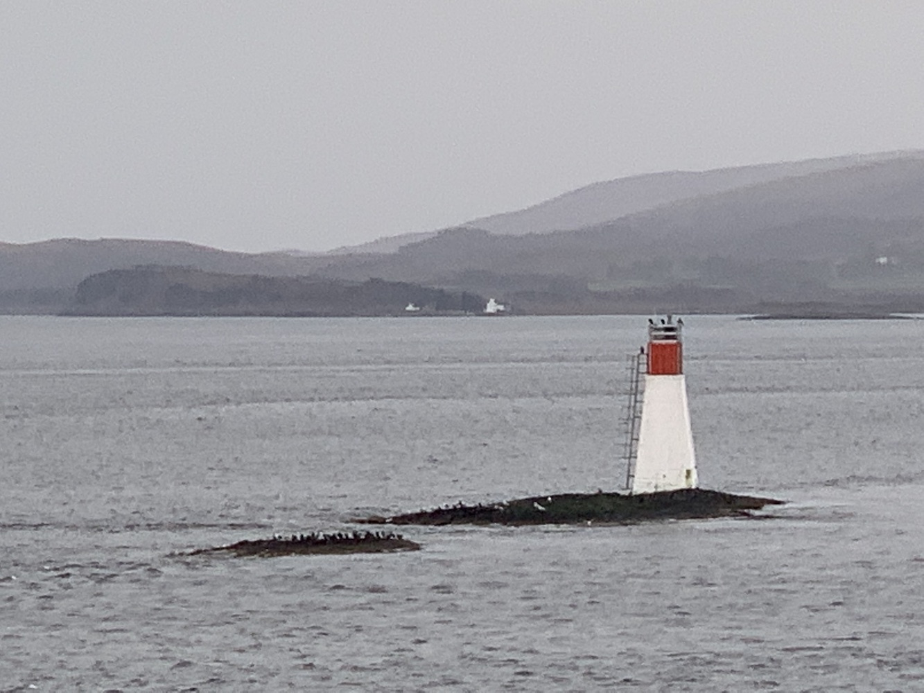
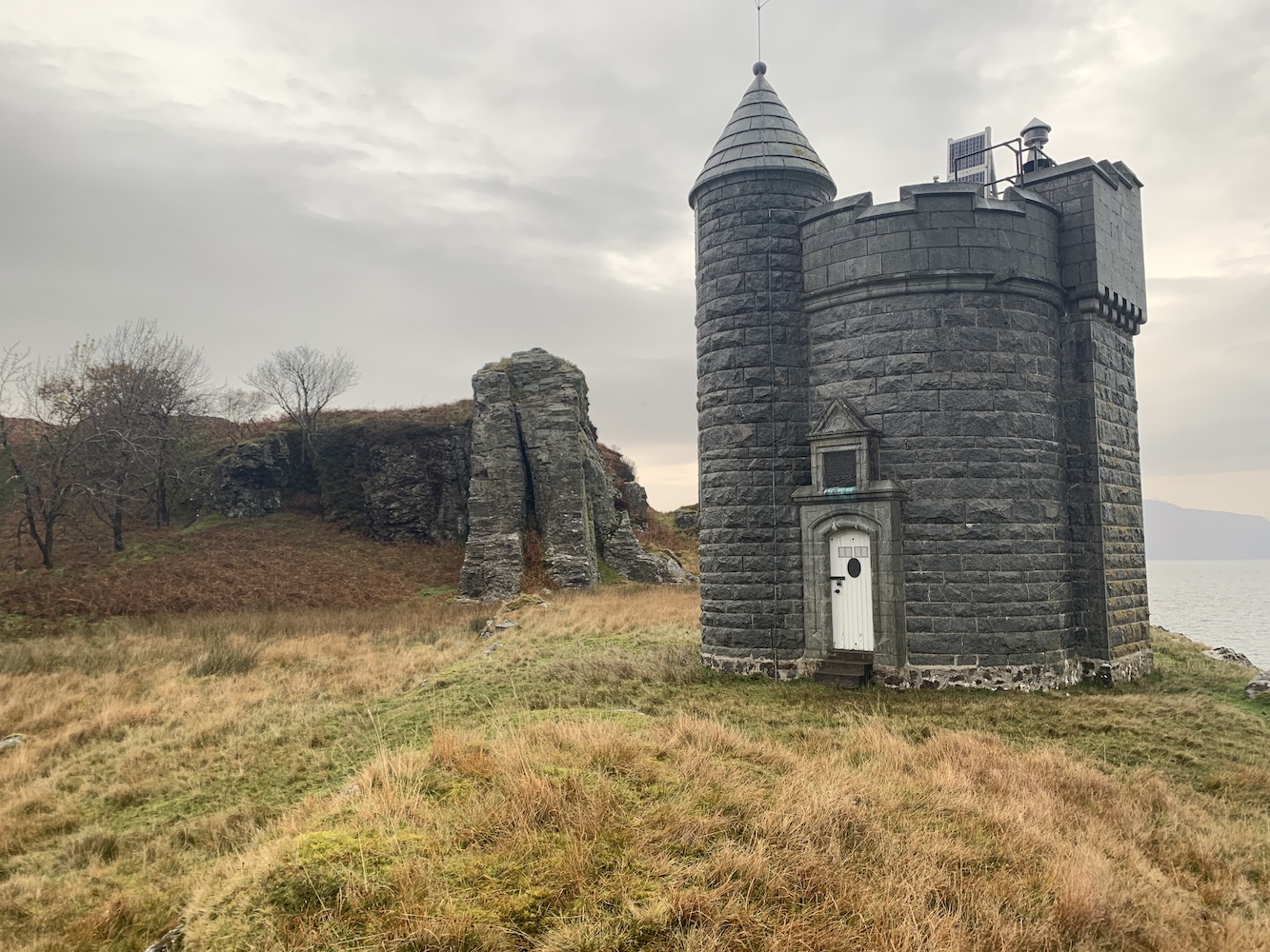
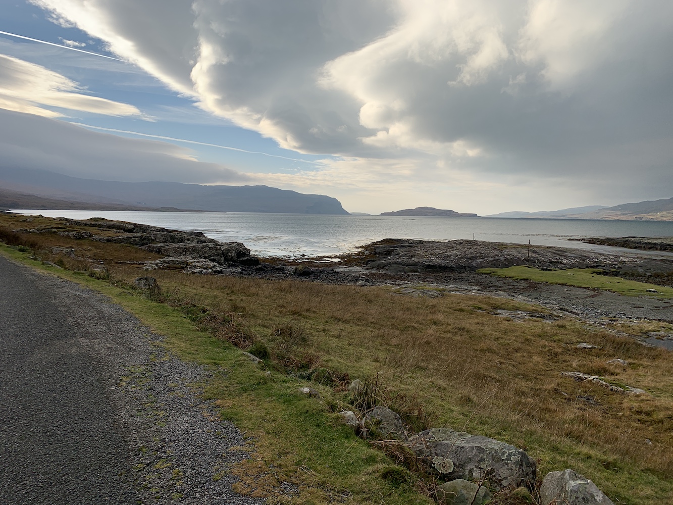
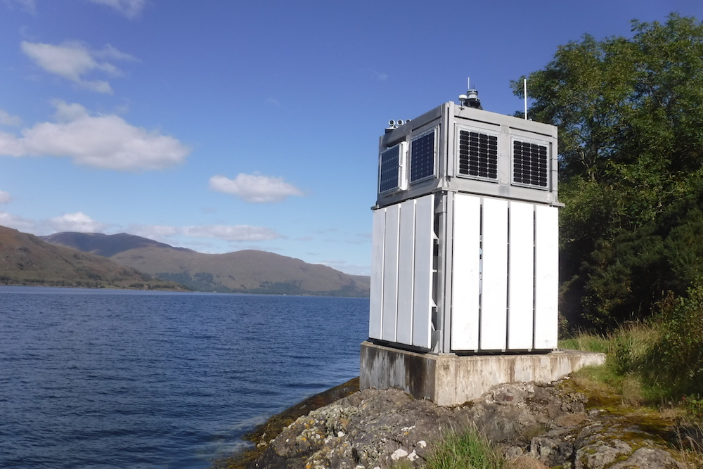
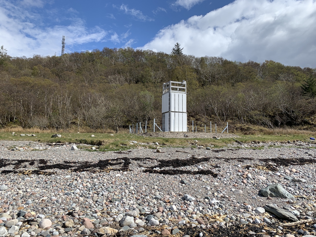
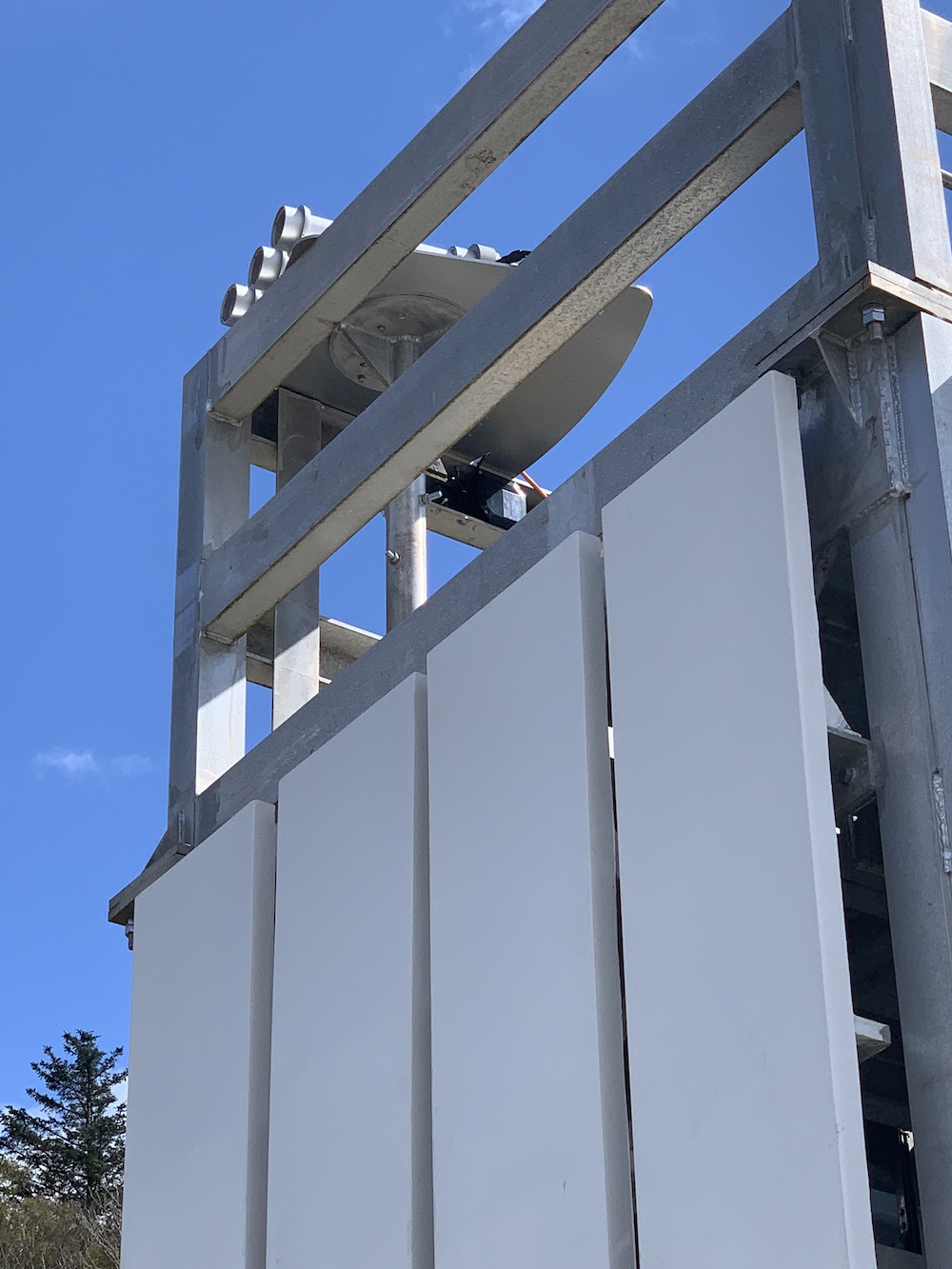
Once we were down on the beach we knew it was plain sailing and a short time later we arrived at the lighthouse. It’s a stunning location with magnificent views up Corran Narrows and over to the hills on the opposite side of Loch Linnhe. The lighthouse is quite a standard flat-pack style, but (like the Corran Narrows North East light) with the solar panels mounted on one side of the structure rather than separate. The lighting arrangements are particularly interesting with an All Round Light for the benefit of vessels heading north and three directional lights helping navigation through the narrowest section near the main Corran lighthouse. The tower doesn’t have a NLB plaque on the door as yet, but hopefully it will soon.

Rubha Cuil-Cheanna lighthouse comes into view (the NLB capitalise the ‘c’ in ‘cheanna’
Rubha Cuil-Cheanna lighthouse
Rubha Cuil-Cheanna and Corran lighthouses will clearly work well together
The view down Loch Linnhe from the lighthouse
The All Round Light is visible here with the back of the directional lights
The Rubha Cuil-Cheanna directional lights

Joe the Drone had a fly around too and captured some beautiful shots before we began the walk back. By this point it was an hour before low tide and we were able to get back around the coast. It was still quite wet in places around the end of the headland, but it was fine to navigate along the seaweed section. Depending on the tides, I would say it’s only really going to be passable 90 minutes or so either side of low tide. Once we were a bit further around we headed out to the shingle bar from which the walk back to the car was nice and dry.

A Joe’s eye view showing the status of the tide around the point

It felt like a great achievement to have made it there while it’s still so new. It’s another example of a flat-pack being a real adventure to get to, and it was great to have the kids along this time. It’s the first flat-pack for them both and hopefully they will see many more in the years to come. When sharing a picture of the kids with the lighthouse with a friend earlier their response was ‘And your kids will think they just do the same as everyone else on a Saturday!’, and then going on to describe the adventures with the kids as ‘delightfully different’. It’s not something I’d thought about as it’s just what we’ve always done. Hopefully they’ll continue to embrace it as they grow older rather than rebelling and losing interest entirely. Time will tell.

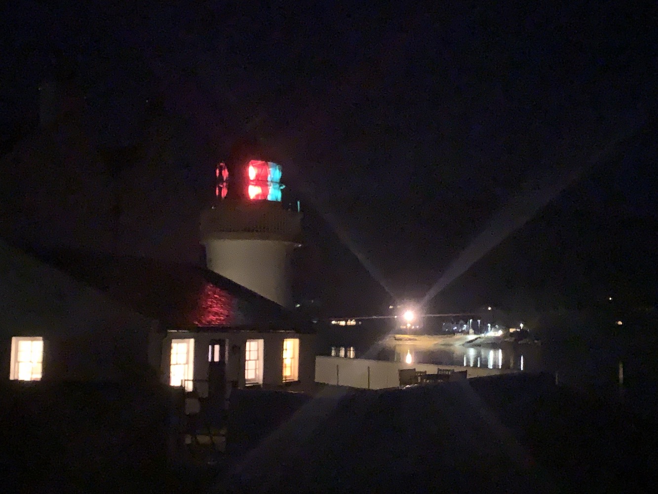
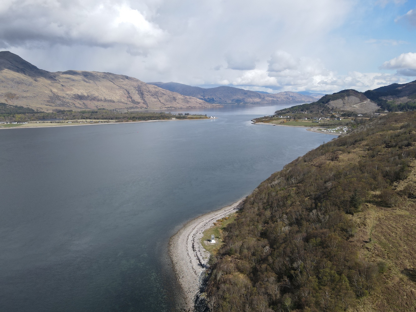
On the way back, as shown earlier in the post, we stopped just up the A82 from the Corran Narrows North East lighthouse and Joe took a spin to get some pictures, including this great one showing the whole area lit along Corran Narrows.

Corran Narrows from above with the North East light in the bottom left, Corran Point on the right of the narrowest point and Rubha Cuil-cheanna in the distance

I would highly recommend this walk to others interested in exploring the area and it’s been a really good experience to check out access to this one which won’t have been visited so much just yet 🙂

A cloudy day on Mull

Contrary to what the title of this post suggests, we actually started yesterday in Oban with a short visit to Dunollie lighthouse. This little lighthouse, made up of a stone tower and lantern with gallery placed on top of it, is quite understated and that’s one of the things I like about it. I also like the fact that it’s still standing as actually, close up, it looks like it’s just made of a big pile of rocks – the sort of thing my 6-year-old might make, just on a larger scale. But standing it is and it has been for over 100 years.

Dunollie lighthouse
Looking up at Dunollie Lighthouse

Joe the Drone had a little flight around the area.

Dunollie lighthouse from the seaward side

Meanwhile I spent a while at the nearby War Memorial to mark an early 2-minute silence for Remembrance Sunday.

War Memorial at Dunollie

We had a little time before we had to be at the ferry and I mentioned the old Northern Lighthouse Board houses on Pulpit Hill so we took a drive up to find them. I took a guess at which they were and the series of 5 large buildings with four front doors each seemed most likely. This has since been confirmed by my former keeper friend Ian. He actually stayed in one of them while off duty during his time serving on Skerryvore.

The old Northern Lighthouse Board buildings on Pulpit Hill

The houses were built to house the families of those keepers (and the keepers themselves when off duty) while they were based at some of the major rock stations off the west coast.

After taking a look at the buildings I contacted Ian again as I wasn’t sure how it had worked with the families. I knew the families of the keepers on Skerryvore, Dubh Artach, Barra Head and Hyskeir lived there, but I wasn’t sure if there were any others. Ian explained that initially each block was for each lighthouse, so Dubh Artach, Skerryvore, Ushenish, Barra Head and Lismore. The families of the Hyskeir keepers stayed in a separate house (Glenmore House) which is still on the other side of Pulpit Hill.

It changed when Lismore was automated in 1965 though and the Hyskeir families moved to the blocks. He added though that, as time passed and more of the lights were automated, the blocks began to house families and keepers from other lighthouses. Ian himself stayed in one of them while off duty from Pladda, for example. It was good to see these buildings and Ian has said before that it was quite a community up there with, I imagine, anything up to 20 families there at any one time.

It was time to hop on the ferry to Mull, which was thankfully very quiet. The sailing to Mull (or in fact a lot of sailings out of Oban) are always enjoyable as you pass a number of lights including Dunollie followed by Lismore and Lady Rock. It was good to see Lismore with the main island in the background thinking “I was there yesterday” and then looking over to Lady Rock thinking “I landed there last year”!

Lismore lighthouse with the island of Lismore to the right
Lismore lighthouse
Lady Rock lighthouse

Almost immediately Duart Point was next to us and to this one I thought “I’ll be there shortly – hopefully”. We weren’t sure how easy it would be to get to as we knew there was a big craggy Rock behind it and it wasn’t clear how easily we would get around that. There was only one way to find out.

We headed straight for Duart Castle, which is currently closed, but the car park is a good starting point for the walk to the Point. Bob had managed to find some directions on his GPS device for reaching a geocache very close to the lighthouse and this was a great help. I will try to include them as best I can here for anyone wanting to walk out to it.

The view from the approach road to Duart Castle

Walking back along the road we found the gate on the left just after a row of trees. Once through the gate (remembering to leave it as we found it, of course) I spotted another gate on the skyline at the top of the field as the instructions suggested.

Setting off for Duart Point
This gate marks the starting point from the road
Looking back at the second gate

Passing through that gate we turned left immediately and followed the fence and wall along. There are rough paths through the vegetation and I would actually recommend this time of year to visit if you can as the ferns have all died back exposing the grassy paths. I imagine they would be harder to see in Spring/Summer.

The landscape begins to open up – you want to head just to the right of the tree and then onwards between the two raised sections of ground

Where the wall ends the landscape opens up and we headed “straight on to the left” as Bob calls it (which basically means somewhere between straight on and left!) This route zigzags as you go downhill and once you are on a flatter section you have two options, you can either stay up high and view the tower from above first or continue around and down to the right. The tower is tucked away just to the left of the trees at the coast. As you go down you should then spot the tower as you follow the grassy track down.

Looking back up at the zig zag section
The final approach to the lighthouse

It was raining today so it was quite wet underfoot and a lot of the ground was covered in leaves, understandable as Autumn draws to a close. It was great to spot the tower through the threes and craggy rocks though. It’s a beautiful tower, originally built as a memorial of the Scottish author William Black who died in 1898 and always enjoyed Duart Point. The cost of the tower was partially covered by Black’s family and friends and there is a lovely plaque above the door explaining this.

Duart Point lighthouse

The only real indications of this being a lighthouse are the Northern Lighthouse Board plaque on the door and the modern little light and solar panel on top of the tower. There is a little platform nearby that looked like it may once have accommodated some sort of derrick.

The platform in front of the tower

The tower has enough variety in its shape to make pictures from every angle look quite different. My favourite view was of the lighthouse in the foreground with the big rock behind it.

A picturesque angle on Duart Point lighthouse

Another great angle was from the fence around the trees. This angle gave you a view of the Duart Point tower with Lismore to its left and Lady Rock to its right. It’s not often you get that kind of view.

A view of three lighthouses: Lismore in the distance, Duart Point and Lady Rock

Joe the Drone had come along and, although it was slightly wet, Bob thought he’d give him a fly anyway and he got a few great shots.

Duart Point from above
One of Joe’s great shots of Duart Point

Following the path back up we then wandered along to the top of the craggy rock to look down on the tower. This is an excellent angle on it, particularly if you want to get a better view of the lighting equipment. The viewpoint allowed us to get some Joe-type images without needing to use Joe. I would highly recommend including a stop here in your walk if you go (just be careful near the edge).

Duart Point lighthouse as seen from the top of the craggy rock
The lighting equipment on top of the William Black memorial

Annoyingly the weather started to clear up as we walked back, but we’d still enjoyed the visit to the light and the nice walk to get to it.

With no ferry leaving the island until after 4pm we had a few hours to kill. Unfortunately we didn’t have long enough for Bob to do a hill or for the walk out to Rubha nan Gall so we went for a drive. Mull seemed very unfamiliar to me, particularly the southern part, and it’s no surprise really as I worked out I’d only been once before (if you exclude the quick stop off at Ardmore Point from a chartered boat last year). It was beautiful to see it though, especially with the clearing skies and the sun eventually deciding to make an appearance.

A lone sheep on the banks of Loch na Keal on the west coast of Mull
The change on weather conditions was evident at a number of points
Looking back at Loch na Keal

After a fair wait at the terminal at Fishnish we boarded the ferry for the short crossing to Lochaline. By this point it was beginning to get dark and so I enjoyed the outline of the landscape as Bob drove us along to Corran. I always find Corran lighthouse just seems to suddenly appear when you aren’t expecting it and that was exactly what happened yesterday evening as we arrived suddenly at the Corran ferry at Ardgour. The joy of seeing lighthouses at night is, of course, seeing them in action. Corran is a good one as it has the red and green sectors which make for a more colourful view. This was another one I could look at and think “I was at the top of that tower last year”.

Corran lighthouse

Across the water I could also see the little Corran Narrows light flashing away and I remembered the unnecessarily tricky walk down to that one!

After crossing the channel on the Corran ferry we began the journey northwards and home. It had been great to get another weekend away this year, while we could. Who knows what the coming weeks and months will bring. Stay safe everyone and, if I don’t manage another post then have a restful Christmas time. Let’s hope 2021 can be an improvement upon this year. 🙂

The long road to Ardnamurchan

The Association of Lighthouse Keepers (ALK) Oban-based event continued today (see yesterday’s post for adventures on Lismore and the in Northern Lighthouse Board’s Oban Depot). While yesterday involved very little travel time, today was a different matter – as it always the way when you attempt to get all the way to the most westerly point of the Ardnamurchan peninsula.

Corran across the loch
Corran Point lighthouse seen from the other side of Loch Linnhe

I met the rest of the group at the Corran ferry and had a little while to wander around taking in the views of the Corran Point lighthouse on the other side of the narrow stretch of Loch Linnhe. It was a dull morning with drizzly rain and overcast skies. I knew this would be the case as I have a theory that there are never blue skies at Ardnamurchan lighthouse, which is a shame as the beautiful Alan Stevenson granite tower would look much more wondrous with a bit of sunshine on it. Anyway, the group arrived on the minibus and I joined them before crossing over on the ferry. The plan had originally been to stop for a look around Corran lighthouse before heading along the peninsula, but with the weather as it was and the conditions looking better for the afternoon we decided to stop at that one on the way back.

You forget just how long a road it is out to the lighthouse at Ardnamurchan. There is no doubt it is picturesque, but there are some pretty scary moments when you are on a small coach, passing other vehicles on single-track roads or on particularly narrow stretches with a fairly sheer drop on one side. We stopped briefly at the distillery for a break before continuing the journey. We finally got there and the group showed their true commitment to lighthouse bagging by heading straight to the cafe!

After a cup of tea we set off to the lighthouse. I can’t recall a lighthouse with a more beautiful welcoming design inside the door. I could describe it, but instead I shall just include a picture as it really does speak for itself (see below). Ardnamurchan lighthouse has some very subtle design features which take some time to notice. The walk (or should I call it a hike) to the top of the tower is fairly exhausting and there is very little to see on the way up – in fact there is nothing except the stairs, blue walls and the occasional window.

Ardnamurchan entrance
Welcome to Ardnamurchan lighthouse

Near the top of the tower we met Stevie. He had a tough job today with all of us turning up in groups of 2 or 3 at a time and often overlapping. We did chat to him for a while though and he explained the concerns they have over the new LED arrangement they have very recently had installed in the tower. He, quite understandably, misses the rotating beam and is hopeful that at some point they may bring it back in some way. He used to enjoy seeing the sweeping beam across the beach near his home.

Ardnamurchan light
The current lights at the top of Ardnamurchan lighthouse

I went for a somewhat bracing stroll around outside at the top of the tower, looking down on the old fog horn and as far as I could see in all other directions. Neil Wright from the Northern Lighthouse Board, who also joined us on the trip, said that on a clear day you could see all the way out to the incredible Hyskeir from the top of Ardnamurchan lighthouse. It certainly wasn’t that clear today.

At the top of the tower Neil had turned the new LED light on. We were warned not to look directly at it due to the power of the light. As I mentioned before, the detail at the lighthouse is subtle. There are small lion heads within the metal frames around the windows which would very easily escape your attention. As I have tended to do at the top of all of these towers over the past couple of days, I was chatting to Neil about all things Northern Lighthouse Board. He said that when they do any work at Ardnamurchan they most often travel by road, which takes around 2.5 hours from Oban, but they sometimes arrive by boat, which knocks about half an hour off of the journey time. It really is quite remote. Stevie explained to us what life is still like out there and how you are fairly self-sufficient due to not being able to just pop to the shop! It’s refreshing to hear when so many people’s lives these days are all about convenience and spending money.

Adnamurchan decoration
An example of the decoration inside the tower at Ardnamurchan


I had a wander around the buildings there before we left. They have the original lens from the tower on display in the exhibition room and you can also see the old compressors for the fog horn. I had a quick look down towards where Neil said the NLB boat arrives when they do travel there by sea. There are even picnic benches down that way. I was surprised to learn that the lighthouse still attracts visitors in the winter months, which often causes problems for the NLB guys when they are trying to work.

Ardnamurchan fog horn
The lighthouse and fog horn at Ardnamurchan

Once we had all gathered back on the coach we set off on the long return journey. The sky had cleared a little by that point, although there was still some low cloud hanging around the hills, which was very atmospheric.

We made it back to Corran lighthouse and spent a while in the chilly breeze on the beach in front of the tower. From here it was possible to see across to the Corran Narrows light on the opposite site of the loch. I recalled from our visit to Islay in January that the Loch Indaal lighthouse seemed to very closely resemble the Corran lighthouse, and this was confirmed by Neil. Not only are they similar towers, but they both benefit from having a mountainous backdrop. They also, apparently, feature the same type of LED light, although the Loch Indaal light still holds a lens rather than the two lights we saw inside Corran today.

Corran Point
Corran Point lighthouse

It’s a tiny tower in comparison to Ardnamurchan and features three sets of very steep ladders. There’s not a lot to it, but the sector light panels at the top make for a very colourful picture. The light had been turned on again so we could get the full experience. Although there is no longer a lens filling the lantern it was a wonderful place to be and we did need to be kicked out in the end as we’d been up there too long! I could happily have stayed there for longer.

Corran light
Inside the lantern at Corran

Once we’d left the lighthouse we returned on the ferry and that was where I left the group. What a fantastic couple of days it has been, meeting new people, getting to know others I’d met before a bit better and seeing some great places I would never have otherwise been able to see. The highlights for me: Lismore, the tour of Pharos (the Northern Lighthouse Board’s vessel) and probably getting inside the tower at Corran. It’s been a lot of fun and I’m looking forward to more adventures with my new-found lighthouse friends 🙂

A few random bags en route home

I’ve had a couple of short trips away recently, the Isle of Wight and Tiree, and the return journey on these trips has provided a perfect opportunity for some tidying up of lighthouses I still had to visit.

Photo 2018-08-25 09.12.02
The lighthouse at Egypt Point

I had been visiting family on the Isle of Wight last month and, during the process of finalising my lighthouse list, I discovered that the light at Egypt Point (the most northerly point of the Isle of Wight) qualified for inclusion. As is usually the case with places you have lived, you often pass by landmarks without taking much notice. I know that I’ve  been at Egypt Point a number of times, but that was long before my lighthouse definition was decided. So, my dad/chauffeur very kindly took a detour along the seafront and pulled over while he, my mum and aunt all watched me bag the lighthouse (a very kind lady who was walking her dog even paused while I took a picture of the lighthouse)! While the lighthouse is an unusual structure, it is not the most fascinating. Surprisingly, it’s actually quite old and the former lantern and optic is now on display in the Association of Lighthouse Keepers rooms at Hurst Castle. It was only a quick visit, but an important one, just to be confident that it can be ticked off of the list!

The second trip that allowed for more bagging was on the way back from Tiree (see my previous post for details of that very exciting weekend). Although we knew that travelling north on the A9 would be considerably quicker than the more scenic (and slow-moving) A82, Corran Narrows North East lighthouse beckoned. We’d looked it up on the map and wondered if it would be possible to see it from Corran itself, but when we got there it was clear that, with the new and beautiful homes being built along the coast, access would not be possible from there. Not what we were hoping for as the A82 north of Corran is lined with trees, which we didn’t fancy picking our way through.

DSCF5128
Corran Narrows North East lighthouse

We pulled over into a parking area north of Corran and, with both kids asleep, Bob went for a bit of a recce, heading straight down through the trees from where the car was parked. When he returned about 20 minutes later, he was able to report that that route certainly wasn’t the best. He described which point was the best to take from the main road and I set off. It was only after I’d attempted to get down by at least three routes and decided that I must have gone wrong somewhere that I found the lighthouse. It is a “flat-pack” type, but in a wonderful location. It is so close to the A82, but you wouldn’t really know it when standing there looking out over Corran Narrows. Bob had informed me that, to get back from the lighthouse, just head straight up to the road from behind the lighthouse. Amusingly, there was a well-cleared route up this way and, once I’d got back up, I discovered the best point to walk down from (for anyone interested, it’s at the first post to the south of the sharp corner sign)!

DSCF5155.JPG
The non-lighthouse at Dalmore

Further north we finally made a stop off at Dalmore Distillery – sadly not for a tour or taster, but to check out a potential lighthouse we had been meaning to take a look at for a while. On the end of what it known as Yankee Pier (apparently due to it being built by the American Navy during World World I). During my research I’d seen mention of the structure at the end of the pier being a lighthouse – or tower with a light on top, but I was unsure whether the tower was built for the sole purpose of being an aid to navigation or for another purpose. It was a nice walk out to and along the pier, which the kids seemed to enjoy too – probably because they had freedom from the confines of the car for a change! As we reached the end of the pier we asked a couple who were just leaving what they knew of the building, and they told us of the American war link. We both felt that the tower looked a little more military than lighthouse-y! I then spent most of the remainder of the journey home researching its history online and, although there was clearly evidence of a light on top (it is no longer there), there was nothing to suggest it had been built for such a purpose. After much deliberation I made the decision that it doesn’t qualify for the list, based on the aspect of my definition about the structure needing to be built to be an aid to maritime navigation.

Not the most enjoyable bags, but if it helps with ticking some more off… 🙂