My final Skye light

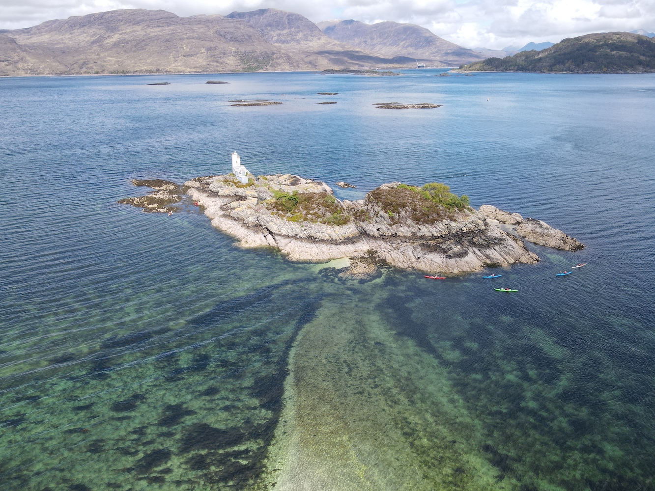
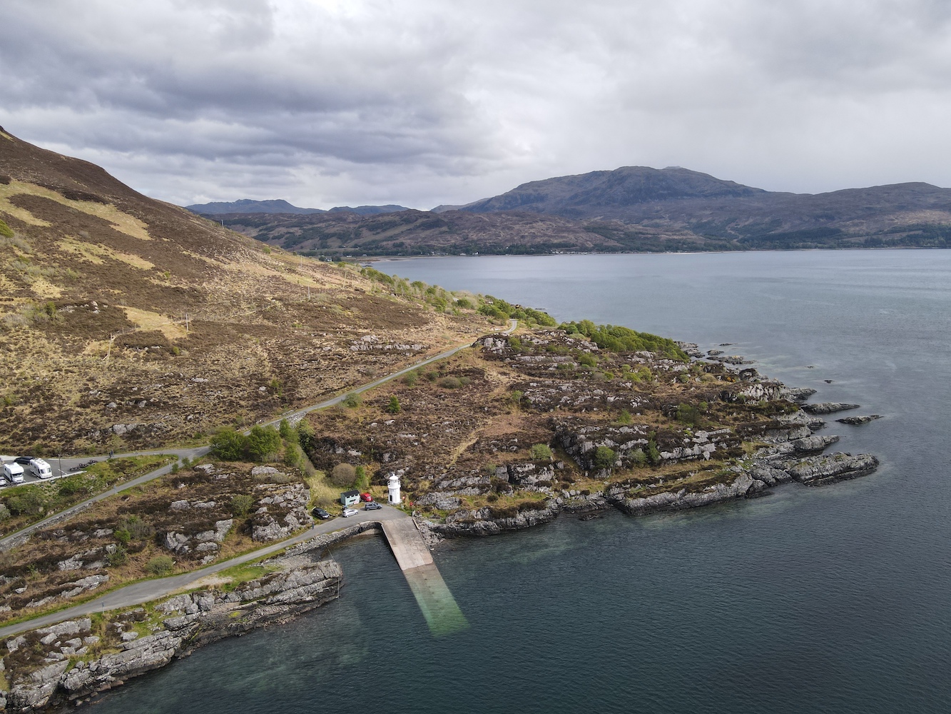
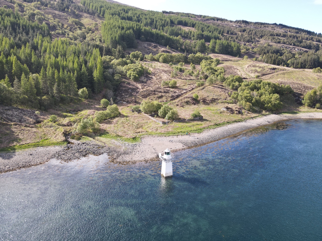
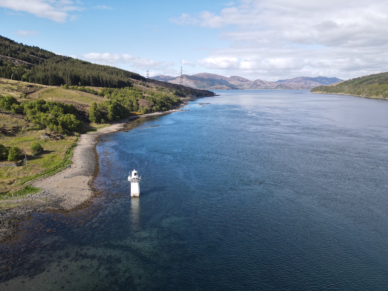
As I mentioned in Friday’s post, I had just two lighthouses on Skye left to visit before this weekend. With Dunvegan Lighthouse bagged that just left one more: Waternish Point.

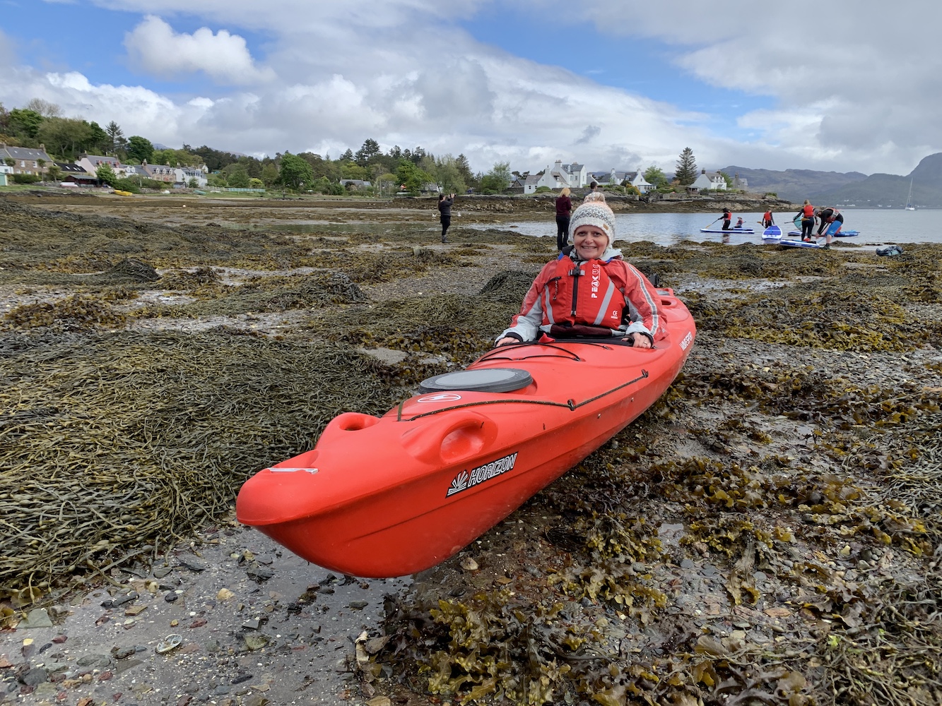
With rain forecast for this afternoon – and the need to get home today – a fairly early start was required. After the kayaking and then the added extras from yesterday it was a balance between setting off at a decent time and getting enough sleep.

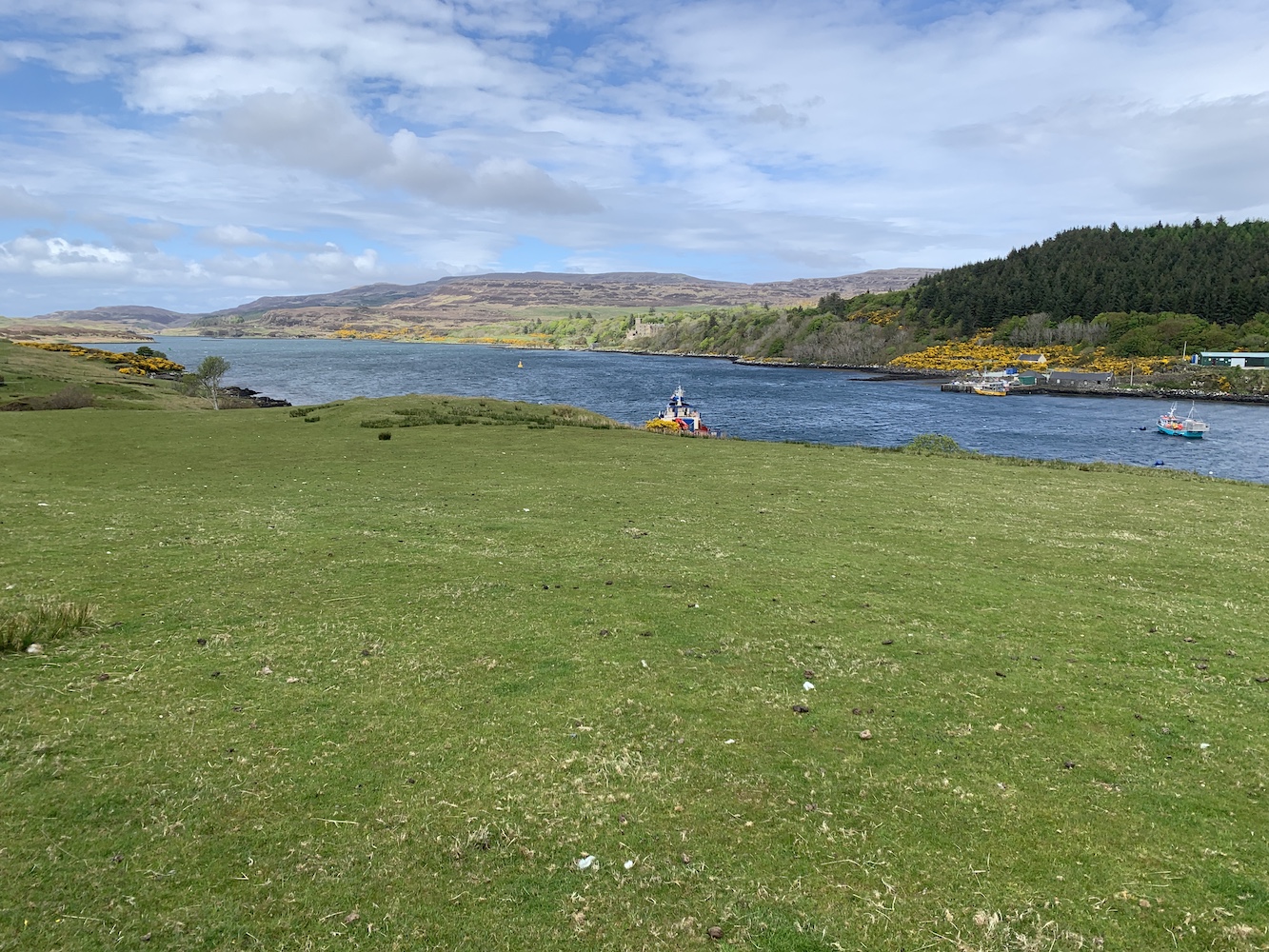
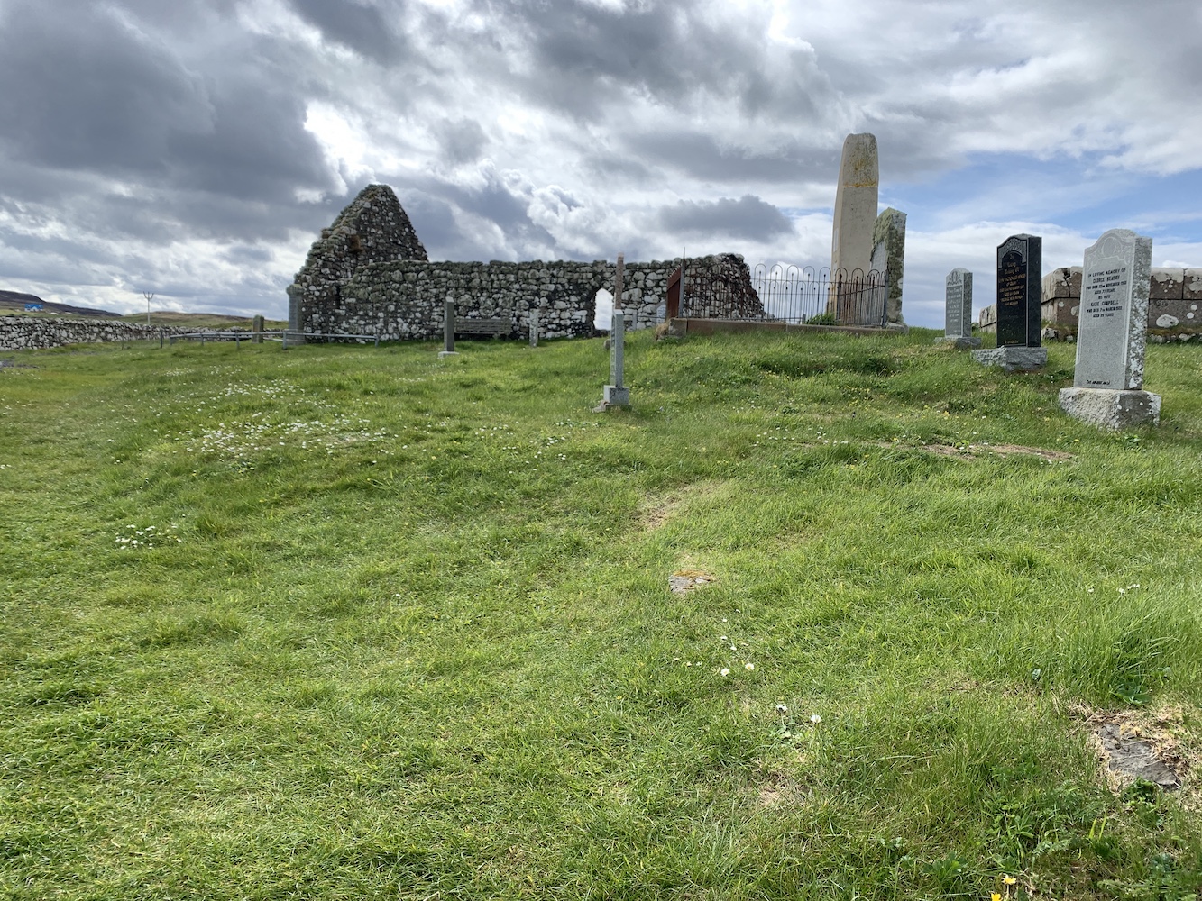
It was nice and dry when we set off and quite some time later we arrived in Trumpan (I’ve said it before, Skye is big). Spotting the starting point for the walk as we drove past we then parked up opposite the old church. This church was the scene of a particularly nasty episode in the long-running battles between the MacLeods of Skye and the MacDonalds of Uist. In revenge for an equally sinister event on the island of Eigg, the MacDonalds made their way to Trumpan and burned the church while it was full of local worshippers. The churchyard surrounding the ruins contains a number of graves, including some quite recent ones.

The remains of Trumpan church

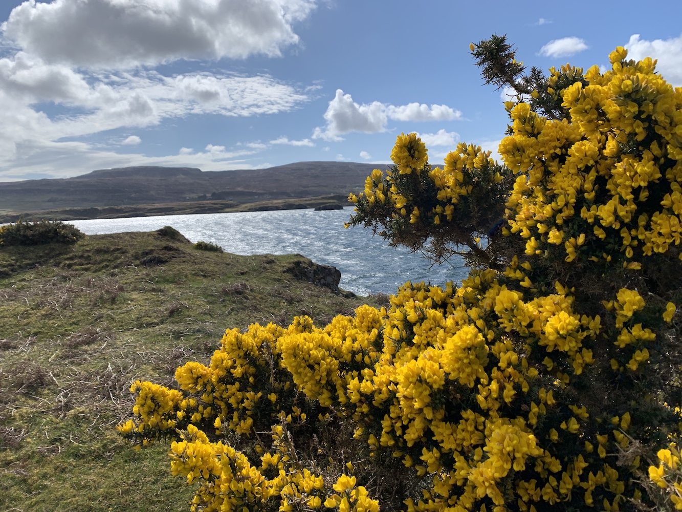
There’s also a Dark Skies area next to the car park and I can imagine it gets very interesting there at night with the lack of light in almost every direction.

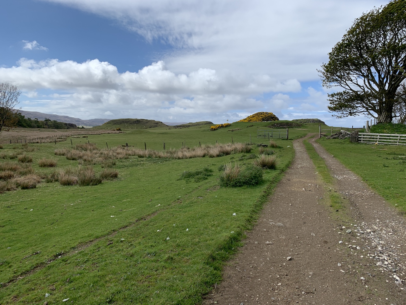
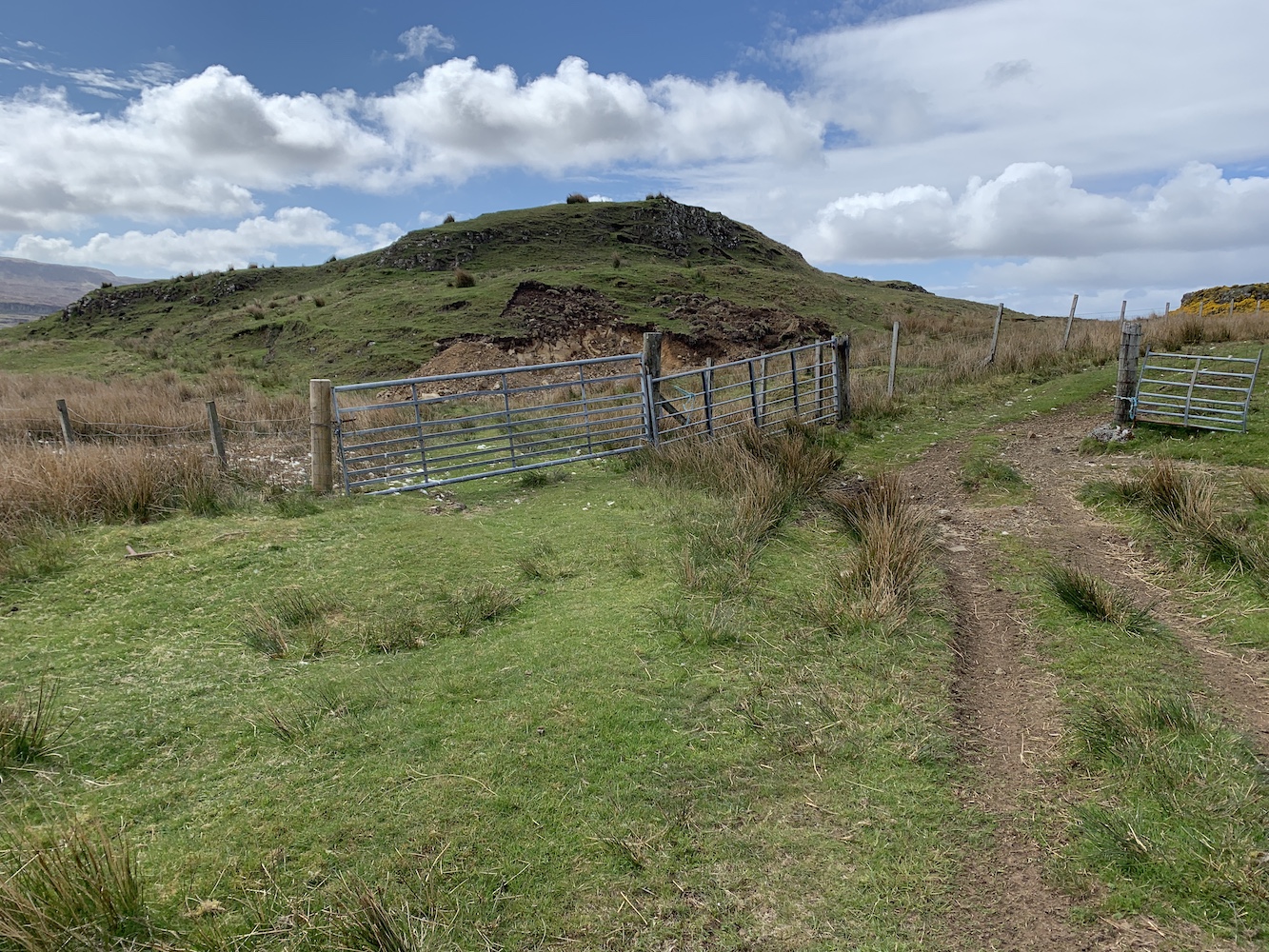
Once we were ready we set off along the road and through the gate. We were very much aware that cows could play a part in the day’s adventure, which is always enough to put Bob on edge certainly. He adopted the role of ‘cow lookout’ and went on ahead a little way, scanning the track and surrounding area. We reached a little mound featuring a cairn and Bob headed on up and ushered me up once he’s got to the top. He’d spotted the cows which had young with them and a couple had stood up when they spotted Bob. They weren’t far at all from the track so a bit of off-piste was required just to be sure we didn’t spook them.

The cairn from which Bob spotted the cows (not shown in this picture)

We headed for the coast across the heather and after a very short time encountered a gaping chasm (Bob called it a gully, but it was definitely a chasm). ‘Follow the sheep track’ Bob advised me as we started to scramble down into the chasm. My response was ‘But I’m not a sheep.’ Sheep manage to balance their way about on all sorts of skinny ledges – which isn’t so easy for me as a human. ‘Follow the staircase’ was another one of his comments and I didn’t even dignify that one with an answer.

This picture doesn’t show very well just how gaping the chasm really was!

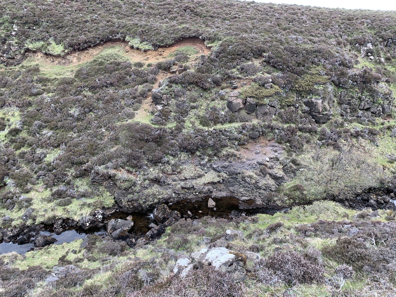
We made it safely and slowly to the bottom of the chasm and, of course, then there was a burn to cross. I am rubbish at crossing rivers or streams, but thankfully this time I managed not to get wet. Then it was up the other side, which actually was much easier. More sheep must have been up that side of the chasm prior to my visit.

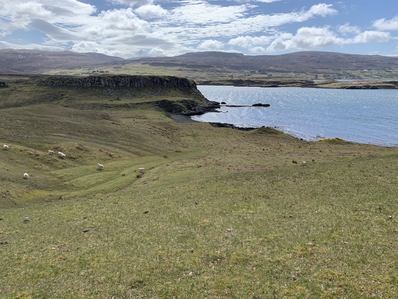
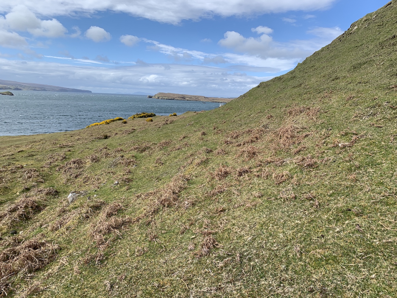
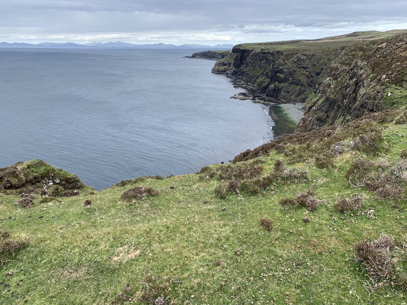
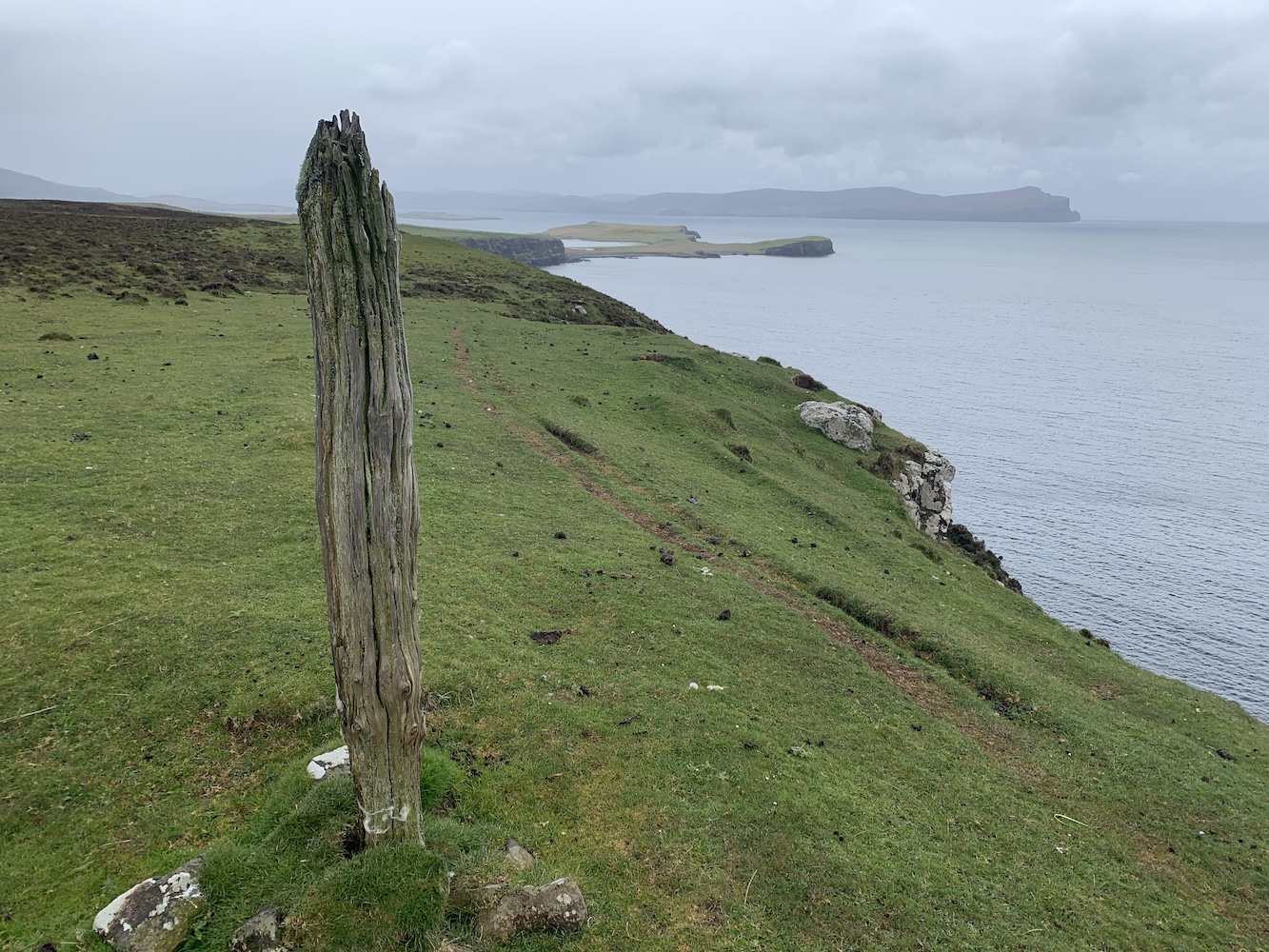
From here we followed the coast for a while to make sure we were out of sight of the cows. I’m usually always on the look out for silver linings when things don’t quite go to plan. I certainly wasn’t while in the chasm (although it did look nice), but once we were back on the well-trodden sheep track along the coast there were some spectacular views both to the west and onwards in our direction of travel to the north.

The view to the north with the hills of Harris in the distance

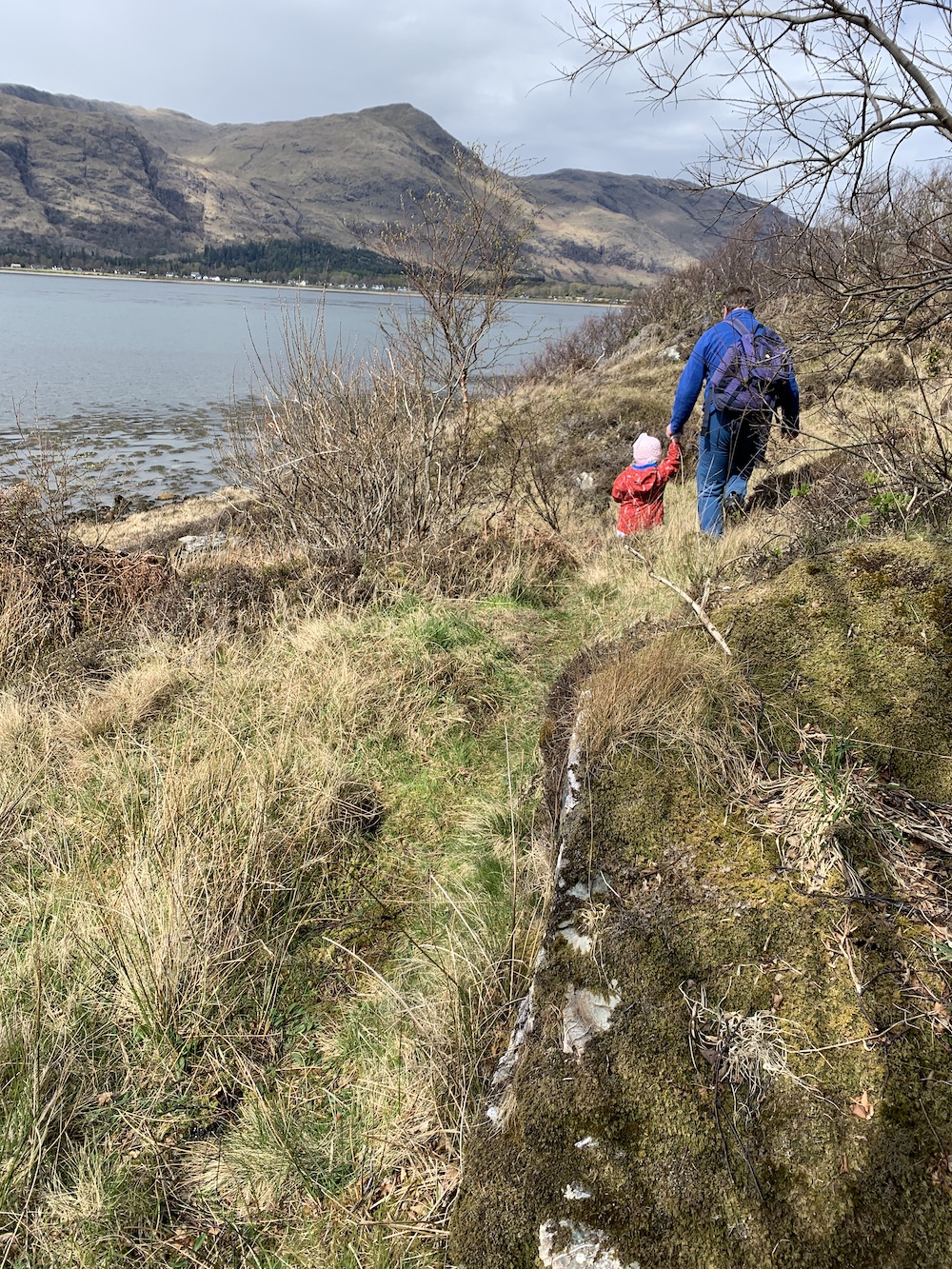
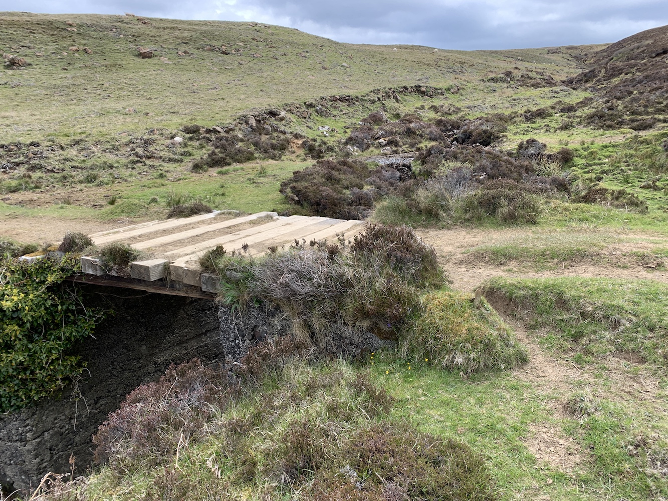
We ended up following the coast for far longer than I expected and our 1km off-piste detour came to an end as we joined the track again at a nice little bridge. From here it was just trudging on, passing sheep and their lambs occasionally.

The bridge where we rejoined the track

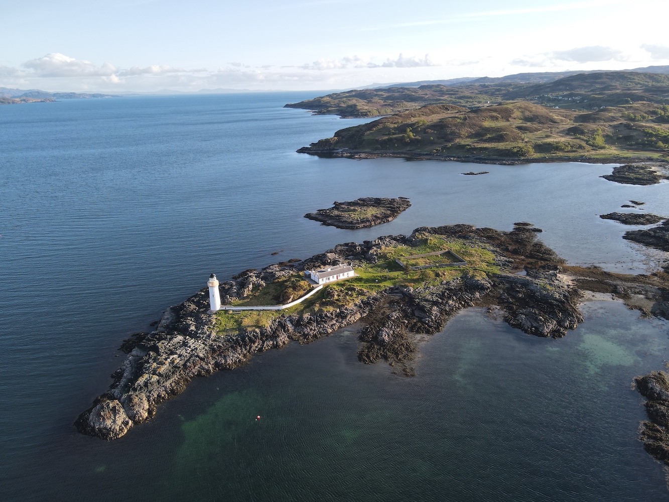
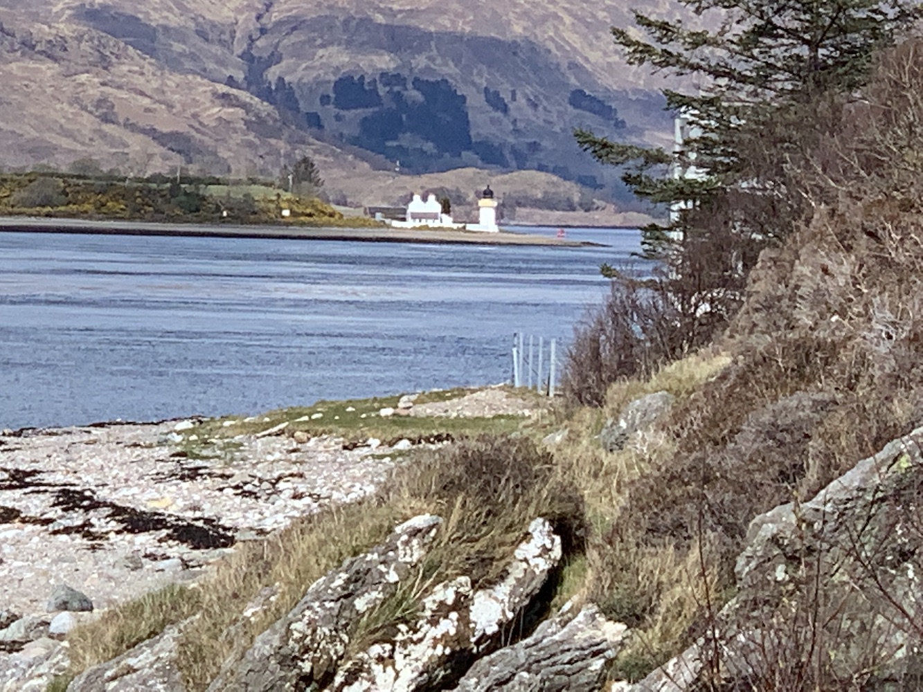
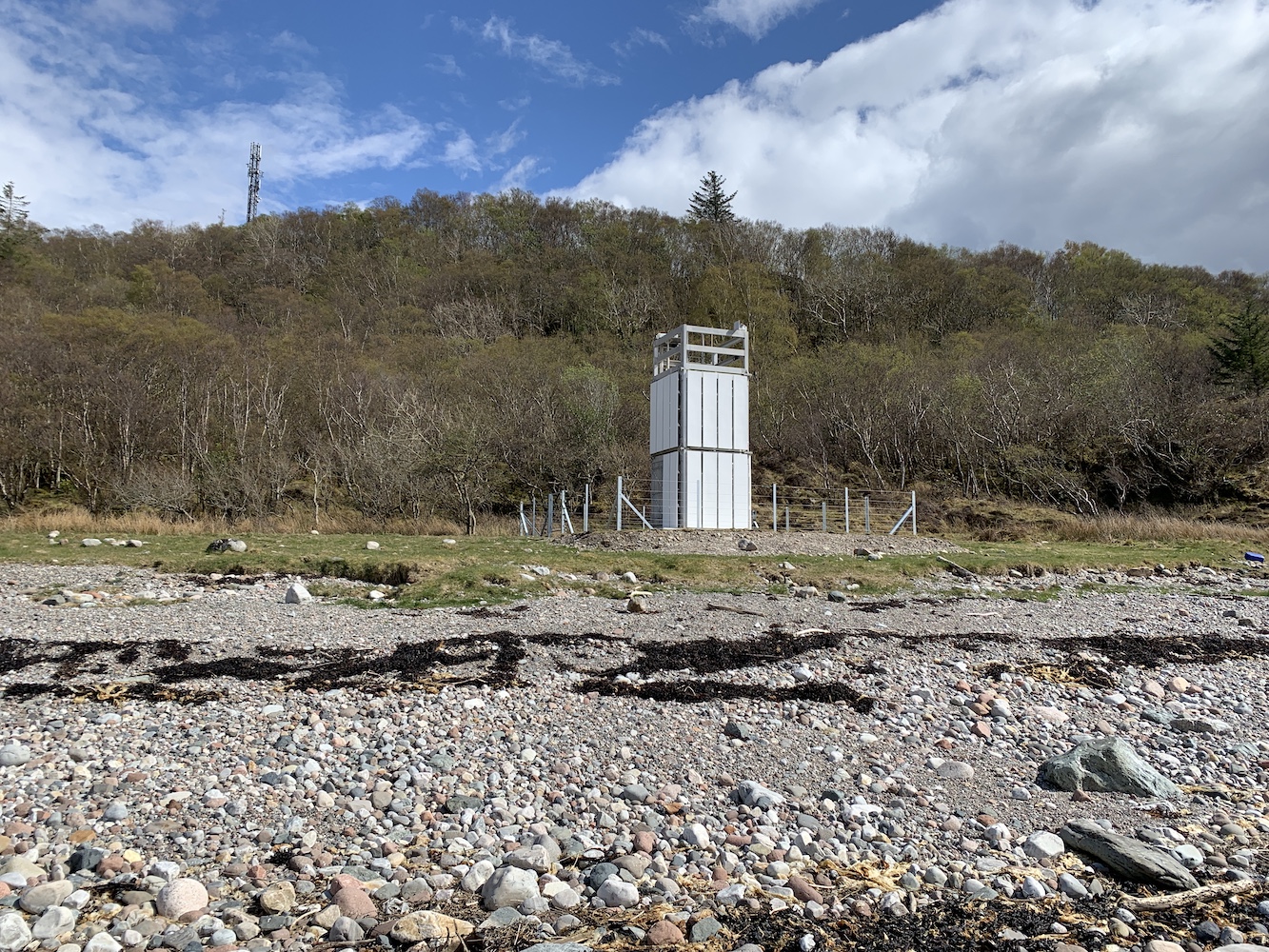
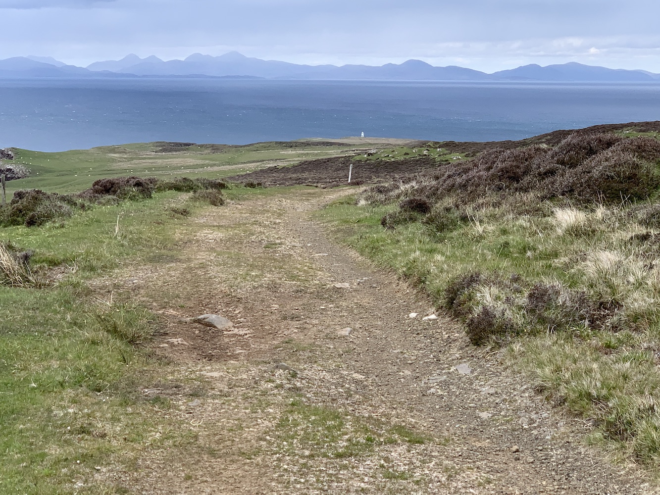
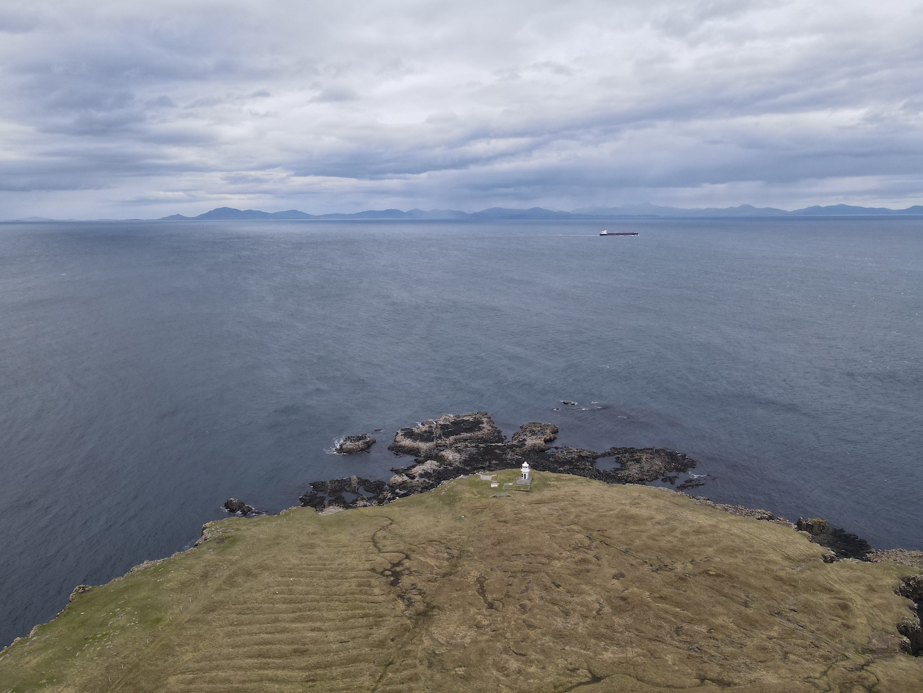
Eventually I got my first glimpse of our destination, Waternish Point Lighthouse. It did look about 500 miles away (I exaggerate), but it was a positive sign. We passed a couple of chaps who were just on their way back from the lighthouse and chatted to them for a few minutes before continuing on our way.

My very first glimpse of Waternish Point Lighthouse

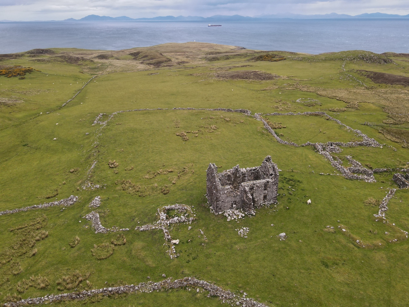
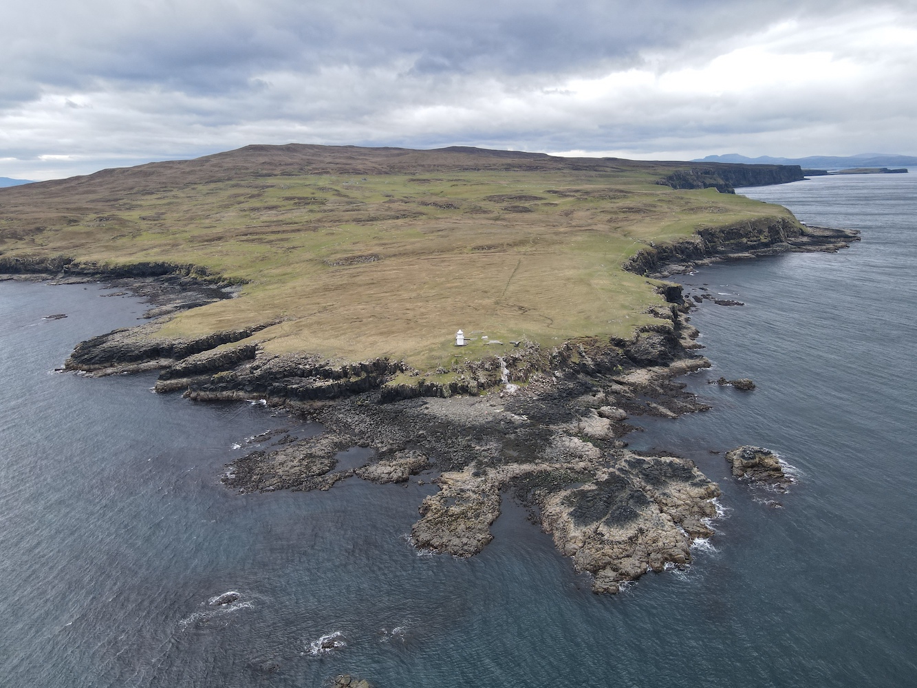
Reaching the end of the track we encountered the remains of walls and most notably the ruins of a house, which Joe had a fly over.

The remains of the old house at Unish

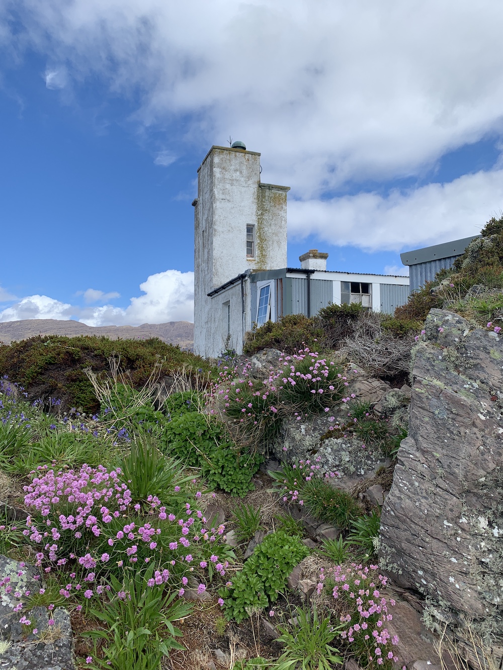
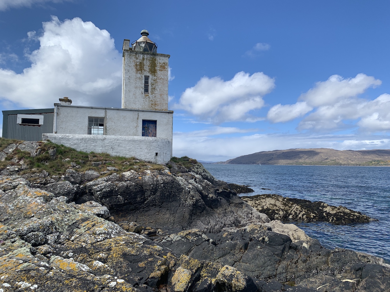
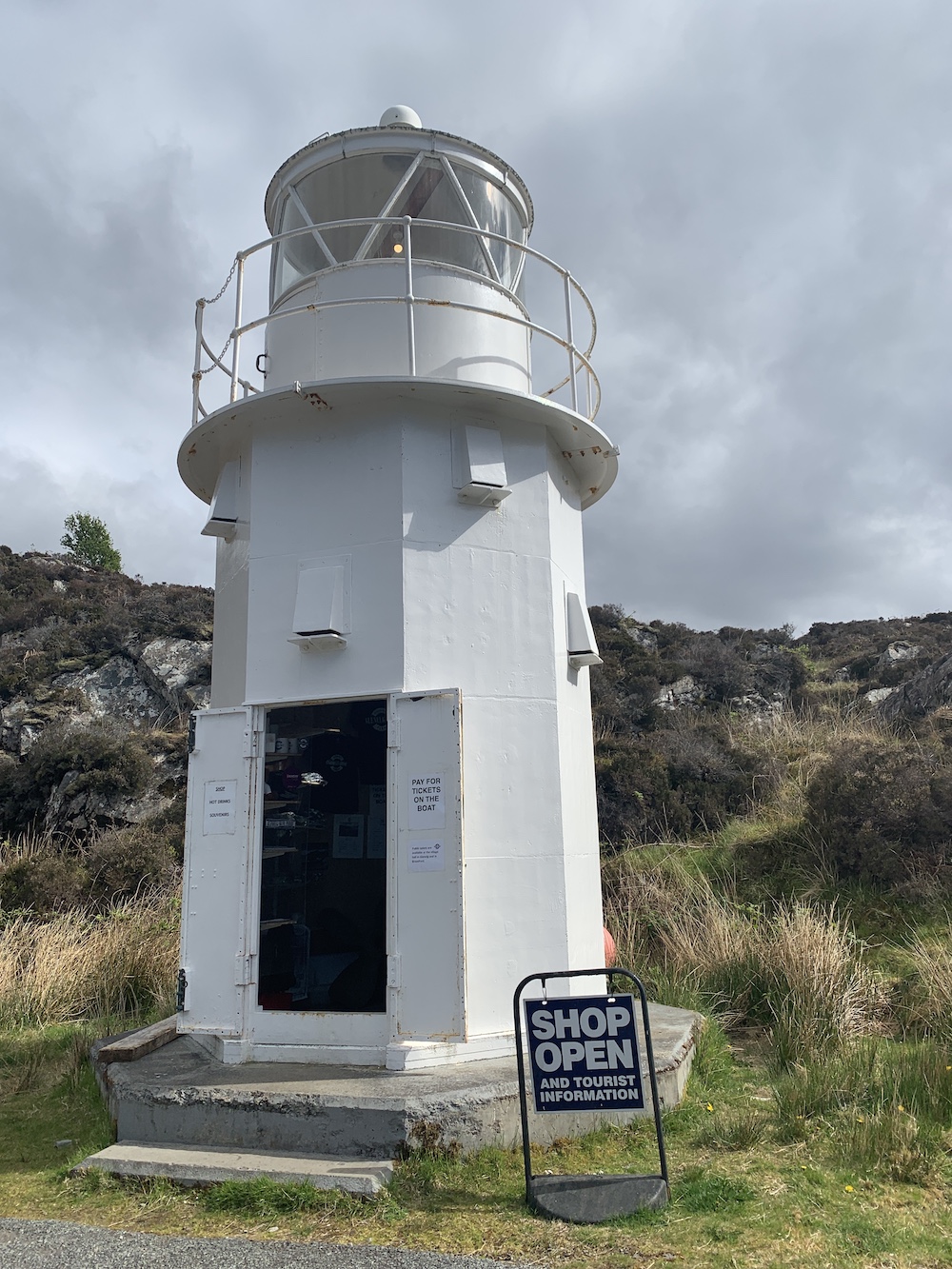
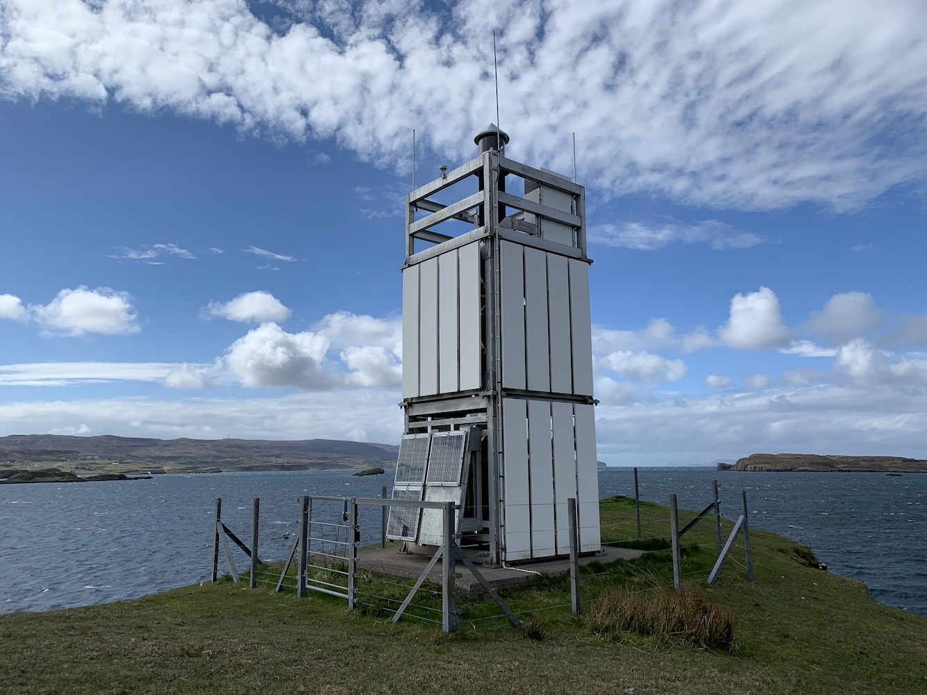
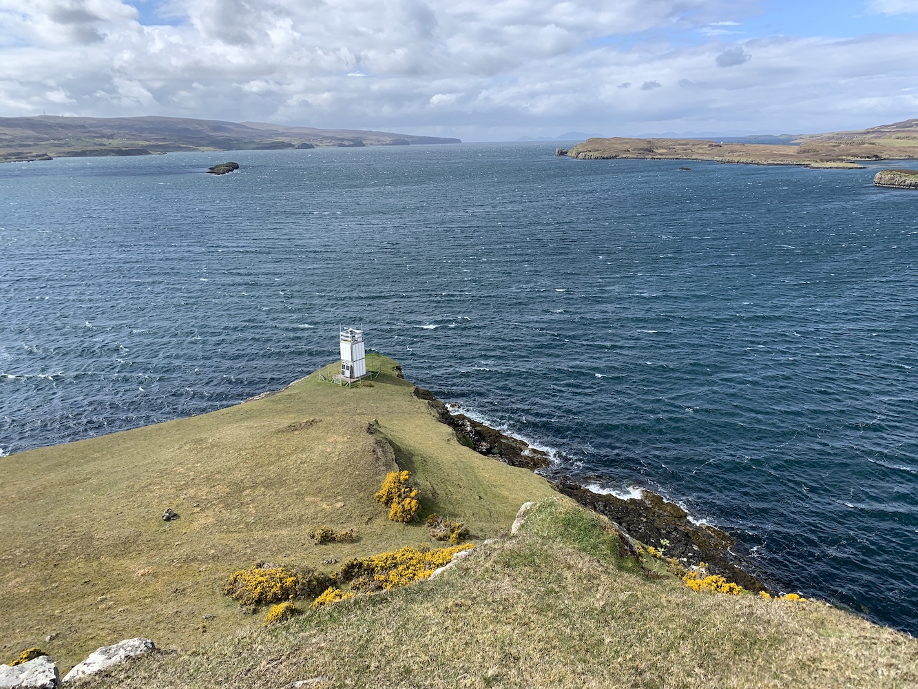
From here it was all downhill to the lighthouse and the lower you got the boggier it became, but thankfully the ground wasn’t too wet today. The lighthouse gradually got closer and then finally I was there at my final lighthouse on Skye!

Waternish Point Lighthouse

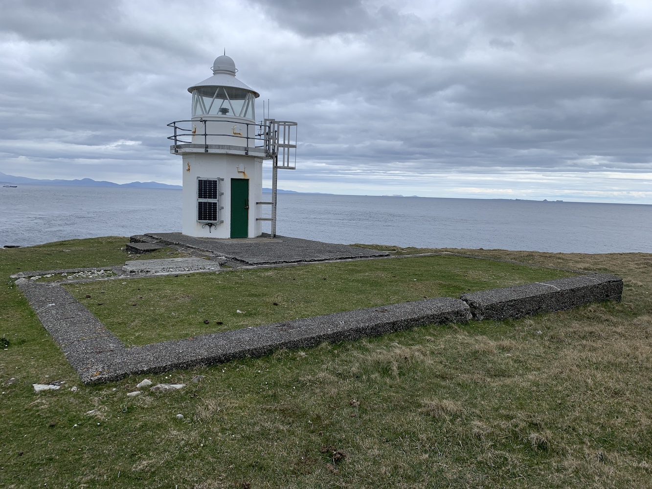
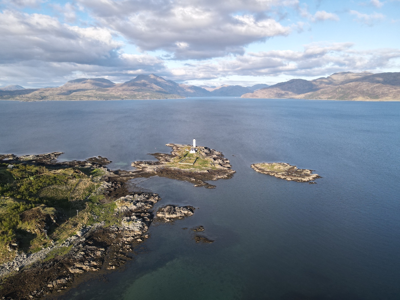
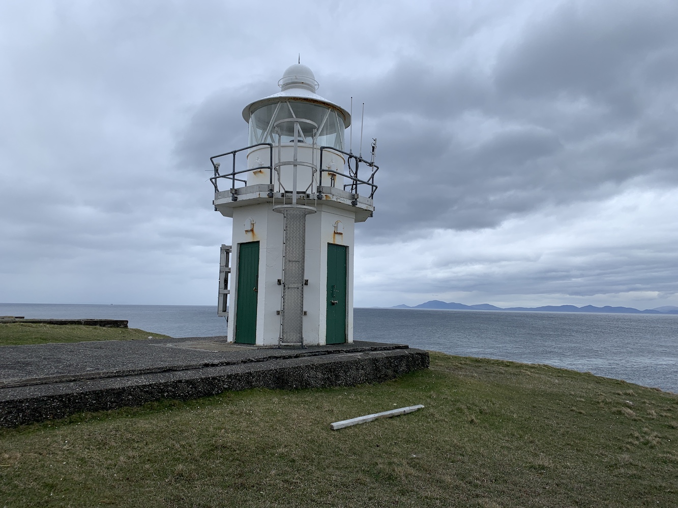
What can I say about Waternish? Immediately you notice the stunning views across to the Outer Hebrides with the incredible hills of Harris on display and then a flurry of islands (I’m not sure at all that’s the correct name for a group of islands, but we’ll go with it) including the Shiants and the interestingly shaped and very appropriately named Lord Macdonald’s Table. Sadly the Uists had disappeared into the distance by then, but there was plenty to keep you occupied. Apparently it’s a great place for spotting whales and dolphins, but we didn’t see any of them, but we did see a Calmac ferry passing en route to Uig and the men we met on the way there had seen a submarine come up above the surface. Who needs whales and dolphins, eh!?

Waternish Point Lighthouse with the Shiants and other islands visible to its left

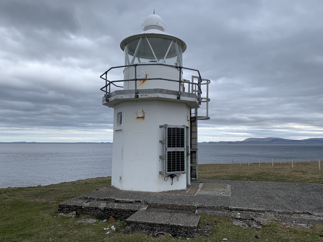
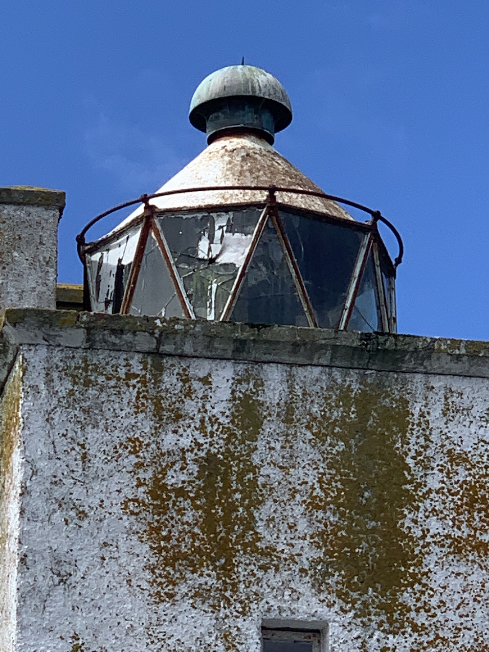
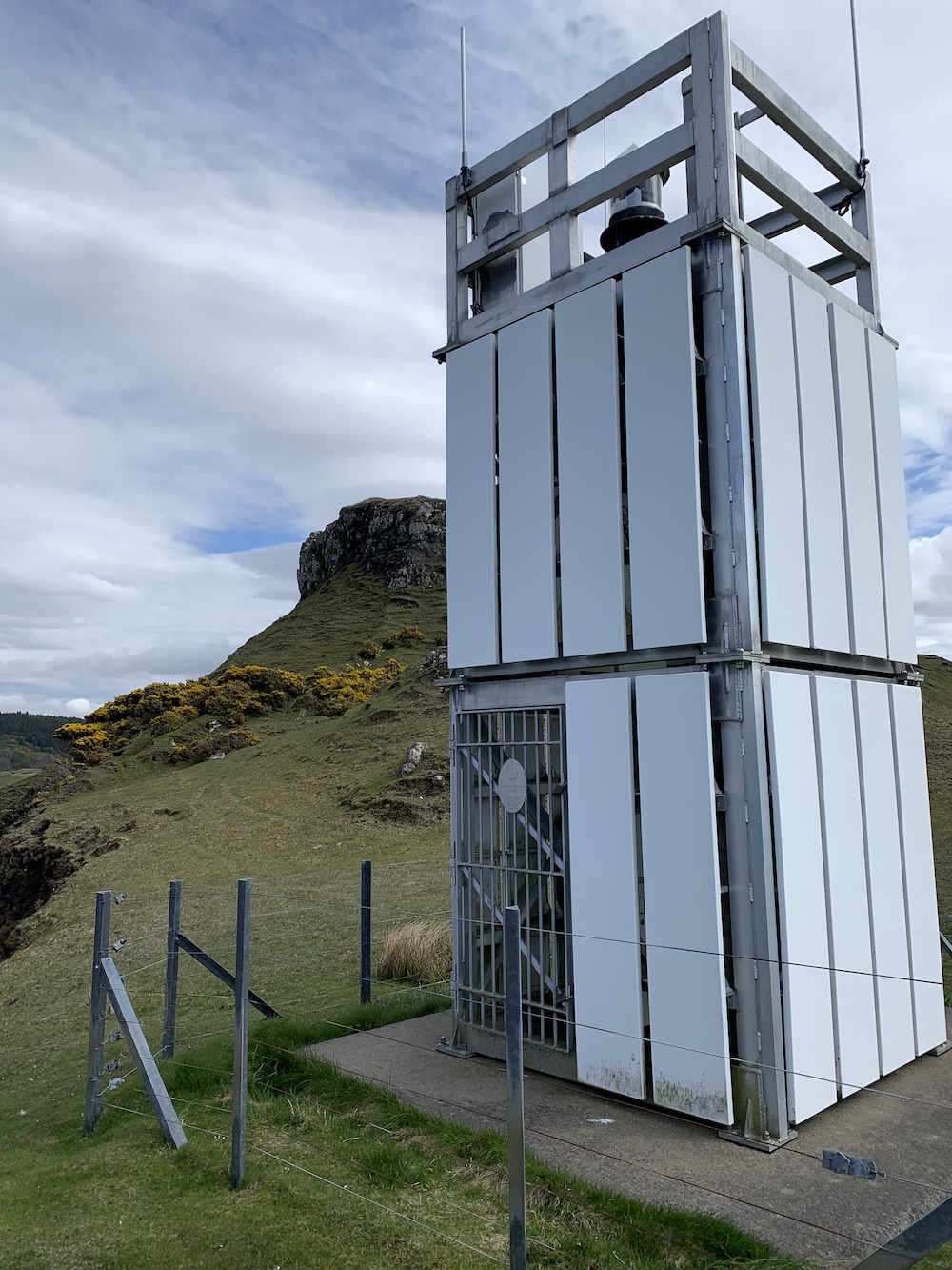
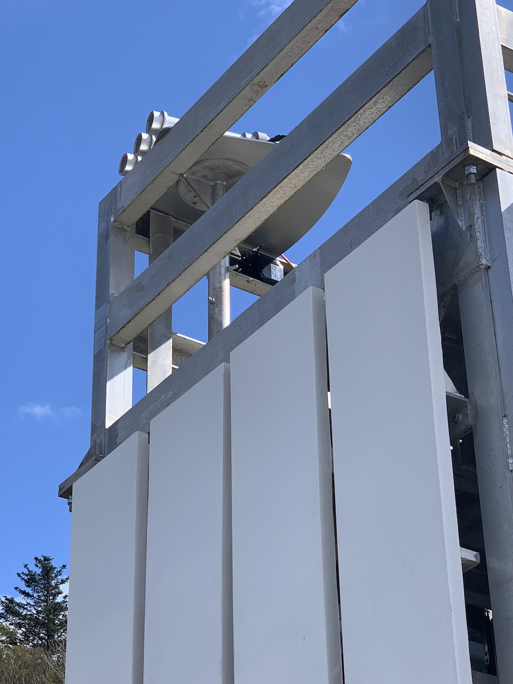
Onto the lighthouse. The current structure was built in 1980 and like just a few others has more than one door – presumably this is so you can access the inside of the tower safely without the door flying off in the wind and you would use the appropriate door based on the wind direction. This tower replaced the 1924 tower, designed by David and Charles Stevenson. It’s clear when you are there that there must originally have been a fair number of buildings on the site and now all that remains of them are the foundations. I really like the current tower as it is. There are very few like it left standing now so it’s always a pleasure to see one.

Waternish Point Lighthouse and the Harris hills beyond

Of course Joe the Drone had to have another little fly around.

Waternish Point from above
A fabulous view of the Waternish (or Vaternish) peninsula

Just before we left I decided, for no apparent reason, to give the lighthouse a ‘high five’. Even as I was doing it I said ‘Can you give a lighthouse a high five?’ Anyway, I did. I even added a bonus ‘on the side’ high five! Then it was time to head back. The slog back up to the ruined house was tough. The energy from my lunch hadn’t quite kicked in at that point so I was slow and tired, and incredibly glad to get to the track when we eventually did. On the way we spotted a white-tailed eagle soaring around and being chased off by a smaller bird, who we imagined was defending its nest. There were also the remains of a small sheep and tiny lamb in the area, further evidence that we were on eagle hunting ground.

Back on the track we retraced our steps, with the wind and rain in our faces, we got to the bridge and left the track again. The cows were in roughly the same place as before, but had moved even closer to the track and so we strolled on quickly while we were in sight of them. The gaping chasm wasn’t quite so gaping on the way back (still a chasm though – and wet this time too). I had expected us to head for the track again once we were past the cows, but Bob thought we should continue to follow the coastal route. Imagining even more gaping chasms opening up in front of me, I reluctantly followed. I’m actually very glad we did as there were even more wonderful views to behold in the final section. We followed the coast as far as we could before heading slightly inland and following a fence line which took us directly to the gate. Just a bit more track to go, one more gate and then we were back at the car.

The view to the south west
A great combination of towering cliffs and low lying land

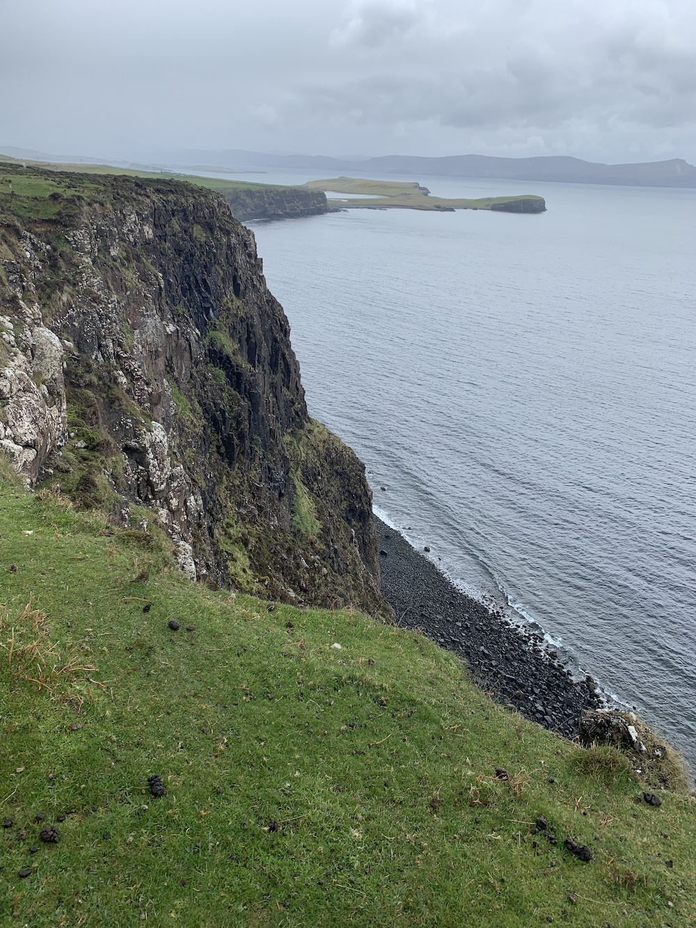
It had been quite a walk and I’d struggled a bit at times, mainly I think because of tiredness from the weekend’s adventures. It was so worth doing though and I would definitely recommend doing that coastal route to anyone visiting. It really is superb for impressive panoramic views. Just mind the gaping chasm! 🙂

A new mode of transport to Eilean a’Chait

In 2015 – almost exactly 6 years ago, in fact – we took a tour with Calum’s Seal Tours from Plockton for a closer look at Eilean a’Chait Lighthouse. Having done that trip it was one I thought I’d never manage to get a closer look at…

Fast forward to the week just gone when Bob said to me ‘Do you fancy going to Eilean a’Chait and landing?’ to which I obviously responded ‘Of course’. It was a few minutes later that he announced we’d be going by kayak. There have been a few occasions when Bob has made announcements like this and a wave of dread has swept over me. The first time it was skiing (which I didn’t enjoy so much), the second time was going up in a tiny helicopter to fly over Mew Island (which I thought was great fun in the end, Bob thought otherwise, especially when I took control of the steering!), and the last time was a skid control driving course, which was frightening. Nevertheless, each time I did them and accepted that I was being forced out of my comfort zone. This time I knew would be no different and I just had to get on with it.

We arrived in Plockton this morning ready to meet Willie from Sea to Skye and our fellow novice kayakers for an introduction to kayaking course. Bob had hired a double kayak for us and made Willie aware that our key priority was to get out to and landed on Eilean a’Chait.

One of many things I’ve learned from today is that kayaking takes preparation time. You don’t just turn up, jump into the kayak and go so there was plenty of time for me to stand around thinking ‘Can we just get this over with?’ After some really handy advice on how to get into the kayak, paddling techniques, and what to do if you capsize (terrifying!) we were ready to go and off we set.

Trying out the kayak

We spent a while in the harbour at Plockton just having a try before Bob and I were sent off with a couple of the guides to head straight for the lighthouse. It was actually really quite relaxing, apart from the occasions when Bob decided to paddle like there was no tomorrow and any attempt I made to paddle along was lost in the midst of his frantic oar-use.

After a while the lighthouse came into view as we neared the neighbouring island of Eilean-an-Duine, which is where the house for the former keepers’ family is located. The house can still be seen today and at low tide it is possible to wade between the two islands. This time we were aiming straight for the lighthouse though and we found a nice little seaweed pool to stop alongside the rocks and haul ourselves out of the kayak. It was a bit of a scramble to get up to the grass at the top of the island and there is actually very little grass there, but the barnacles on the rocks were great for grip even if they were a little rough on the skin.

Approaching Eilean a’chait Lighthouse

Eilean a’Chait Lighthouse, or Plockton Lighthouse as some call it, is looking a little worse for wear. It’s now privately owned and there is some evidence that work has been done here to renovate it, but maybe that the work has come to a bit of a standstill. I am told that it was open as a holiday let some years ago.

A closer view of the Eilean a’Chait lantern

The lighthouse actually had quite a short-lived period as an active aid to navigation. It was built around 1880, 10 years after the train connection between Dingwall and Stromeferry was introduced. From Stromeferry people could catch a steamer from the pier over to Skye and this light was deemed necessarily for the steamers to navigate the surrounding waters safely. There are varying accounts of when the light was deactivated, with one source citing 1904 and another the 1920s. Either way its discontinuation ties in with the further extension of the railway to Kyle of Lochalsh, which provided a much shorter ferry route to Skye.

Eilean a’Chait Lighthouse

The two of us explored the island for a while as our fellow kayakers glided across the calm sea surrounding it. It’s a really interesting island and was also great to see it from above with some Joe the Drone images, including one which clearly shows the shallow the sandbank between Eilean a’Chait and Eilean-an-Duine.

The sandbank leading from Eilean a’Chait to Eilean-an-Duine is visible here
Another angle from Joe the Drone

After a while I made my way back to the kayak while Bob quickly bagged the island high point. Once we were safely back in the kayak we set off to meet the others for lunch on a beach to the west. It was a good opportunity to have a chat with Willie, the other guides and others in the group. Willie explained that when he’d heard that a lighthouse bagger was coming along he thought I must be mad, but he actually admitted that having talked about lighthouses for a while he could understand the appeal.

Continuing further west it was getting quite choppy on the water and paddling was getting much harder. Turning back we were told to aim for the lighthouse, which was just fine with me. Bob and I returned to shore with Chris the guide while the others continued on for a bit longer. Frankly I was pretty tired by that point and felt the need to stretch my legs. It was an excellent adventure and I was nicely surprised that I felt very safe out in the kayak and that getting into and out of it during the day was actually not as challenging as I’d expected. Kayaking would certainly be something I’d be up for doing again – so well done to Willie and his team (and to Bob of course) for making it such an enjoyable day out.

This picture shows Eilean a’Chait in the foreground with the other islands we kayaked around today beyond

By the time we were back in the car and heading off I was pretty worn out, but there was still work to be done. We’d decided to use the afternoon to catch the turntable ferry from Glenelg to Kylerhea and then see if we could touch the little Kylerhea Lighthouse. We were looking forward to a cup of tea in the old Sandaig Islands Lighthouse, now positioned just at the top of the ferry slipway, but sadly the flasks were no longer there and it looks like a tea room has opened nearby instead.

The old Sandaig Islands Lighthouse – with it’s light on!

While we waited for the ferry Joe the Drone took another spin.

The Glenelg turntable ferry slipway and the old Sandaig Islands Lighthouse

Once in Kylerhea we headed for the car park for the bird/nature hide, which is a good (or probably the only) starting point for walking to the lighthouse. Last time we visited part of the path down to the shore had been washed away so we weren’t able to get so close. This time though we followed the little track down to the pebbly beach. It was only an hour after high tide so I couldn’t touch the lighthouse, but it was nice to see it much closer than before anyway.

Kyle Rhea Lighthouse
If I’d been willing to wait another hour I might have been able to touch Kyle Rhea Lighthouse

It was also another outing for Joe too.

Some very relaxed seals were quite happy on a rock near Kyle Rhea Lighthouse
A bird’s eye view of Kyle Rhea Lighthouse
Kyle Rhea Lighthouse seen from the south

It would have been rude not to have given Joe the chance to clap eyes on the beauty that is Ornsay lighthouse when we are staying so close to it, so we made one final stop on the way back.

It’s not possible to photograph Ornsay Lighthouse from a bad angle. I think the shape of the island is like a crocodile!
Ornsay Lighthouse with the wonderful mountainous backdrop

It’s been a thoroughly exhausting day, but also great fun. Don’t tell Bob, but I’m quite glad he organised the trip. 🙂

Birthday bagging on Skye

A few years ago Skye became the place to be on my birthday, but it’s now been a while since I spent any length of time there – and birthdays were taken up with other trips like 2019’s Sule Skerry extravaganza!

This meant I still had a couple of lighthouses left unvisited on Skye. A long-awaited return was in order and there was no way I was going to turn down a weekend there.

Today was the day to set off. Nana was in position to take over child management at home (thanks Nana!). There was the usual packing at the last minute, throwing stuff into the car and then saying ‘have we got everything?’ This is especially the case at the moment after not being away much at all over the past year.

The journey felt long today, but we finally made it to Skye. That’s always only part of the journey though. I always forget just how big the island is and sometime later we were still in the car heading towards Dunvegan.

I’d found a walk report on the Walkhighlands website that took in Dunvegan Lighthouse at Uiginish Point, just to the north west of Dunvegan. This was really handy as, although we had Bob’s GPS device with us, it told us a particular gate we needed to go through (climb over) to be on the right side of the fence for the lighthouse.

The view from the starting point, across the loch to Dunvegan Castle

Parking up just before Uiginish Farmhouse, we wrapped up warm as the northerly breeze was fairly strong and chilly. We set off through the farm, passing Uiginish Lodge, which is painted incredibly bright white. There’s a nice track along here and, while we were on the lookout for cattle making an appearance, we only encountered sheep.

The first part of the walk follows the track

The Walkhighlands report advised that when you reach two gates you should go through the one on the left. This was great advice as the lighthouse is one of those you can’t see until you are near enough at it, so being on the right side of the fence when it’s easy enough to do so is always helpful.

The point at which you leave the track and choose the gate on the left

Bob, as usual, took the high route with the excuse that he was looking out to see if there were any cattle about. I wandered along a much less resistant route and enjoyed the views to the west across to a little bay with some stunning cliffs beyond.

The beautiful view to the west

The lighthouse soon came into sight and we battled into the breeze to get to it. It is one of the flat-pack kind and, boy, was the wind whistling through it today! When you see it on a map it looks like it could be a nice sheltered spot nestled there in Loch Dunvegan, but don’t be fooled, especially when the wind is coming from the north. It was great to look across and see the entrance to Loch Dunvegan and The Minch beyond. To the east there are good views across to Dunvegan Castle. It’s a superb spot for panoramic views.

The first glimpse of Dunvegan Lighthouse
Made it to Dunvegan Lighthouse
There’s some quite dramatic scenery in the area
Dunvegan Lighthouse looking out towards the entrance to Loch Dunvegan

There’s not a lot of information out there about Dunvegan Lighthouse. A Google search brings up lots of links to, relatively, nearby Neist Point and a search for Uiginish Point instead doesn’t fare much better. It is clear that the lighthouse is used to help guide vessels safely out of the Minch and into Loch Dunvegan. It is also used by vessels negotiating the route between Uiginish Point itself and the nearby island of Gairbh Eilean. My research has shown that in the 1890s steamers bound for the Western Isles stopped off in Dunvegan and this continued until the 1950s, which would explain why a Northern Lighthouse Board light would be required in this area. The lighthouses installed by the NLB were generally those that provided some sort of national importance, such as ferry and general shipping routes, while the lighting of harbours for local fishing, for example, fell to the local harbour authorities.

The view from the top of the lump behind the lighthouse

The walk back from the lighthouse was rather more pleasant without the wind in our faces and there ended a rather nice little wander and a great new bag for me.

One final lovely view!

More adventures to come tomorrow… 🙂

A very fresh restart to the UK lighthouse tour

It’s been, and feels like it too, a long time since I posted on here about a lighthouse visit. What day could be better to get back up and running than May Day. A new month in mid-Spring and a brand new challenge. By brand new I mean it quite literally with a visit to a one-month old lighthouse. In March this year the Northern Lighthouse Board (NLB) switched on their first lighthouse built in almost 12 years on Rubha Cuil-cheanna in Onich, just to the south of Corran.

The need for a lighthouse here was recognised due to the increasing use of Corran Narrows by cruise ships arriving at and departing from Fort William. It was in 2009 that the Corran Narrows North East light was installed just to the north of Corran for this same purpose and to supplement the well-known light at Corran Point. The North East light previously held the title for youngest NLB lighthouse.

A drone shot Bob captured of the Corran Narrows North East lighthouse yesterday

On the way to Onich yesterday, I was keen to find out the meaning of the name Rubha Cuil-cheanna. I established that ‘rubha’ means ‘headland’ or ‘promontory’. This is a word I’d encountered before in lighthouse names, and understandably so. ‘Cuil’ means ‘recess’ or ‘nook’, and ‘cheanna’ is ‘head’. The hyphenation in the name indicates that ‘cuil’ is an adjective giving an indication of place to ‘cheanna’. Based on this my very rough translation is ‘nook head promontory’. That’s a very literal translation of course and if we look at Rubha nan Gall on Mull, which translates as ‘Stranger’s Point’ then ‘nook head point’ might be a bit more like it. Either way it’s a very good description of the geography of the area as you will see in this picture.

The very end of Rubha Cuil-cheanna, clearly showing the ‘nook’ at the bottom

I’d spent quite some time looking at maps prior to the trip to work out the best approach. It seemed over land probably wouldn’t be ideal as there looked to be houses about. I know the Scottish laws make many areas very accessible, but it’s usually best not to push it and risk being shouted at, especially when we had the kids with us. A coastal approach seemed best. Onich seemed the obvious starting point, but again it wasn’t clear where you could park without it becoming a long walk for the kids. I also looked at a Bunree start from the caravan site.

The map also suggested that it might be best visited at low tide as there wasn’t much room for manoeuvre around the coast at high tide. Our timing this morning didn’t really tie in with low tide, in fact it was only 90 minutes after high tide. Knowing that our chances of success were much better if we left it another two or three hours, we spent a while playing about on the rocky beach (having thankfully found a great place to park up just above the beach – there’s an area for those in camper vans to park by arrangement too). Joe the Drone went for a spin and was the first to catch a glimpse of the lighthouse we were aiming for. We decided to find a park for the kids to have a run about in to pass some time.

Onich beach at high tide
Joe the Drone’s first view of Rubha Cuil-Cheanna lighthouse with Corran Narrows beyond

En route we drove along to the caravan site at Bunree to check out access from that side, although the map suggested the tide would need to be even lower to get along parts of that stretch. A sign on the gate at the campsite said ‘No visitors’ so without trying to find a long way around the caravan site that didn’t seem a decent alternative.

I spent a couple of hours being very impatient, desperate to be heading to the lighthouse but realising the longer we waited the better. We arrived back at Onich about 2 and a half hours before low tide and it was clear that the route was looking much drier so off we set. These things always take so much longer with kids in tow, stopping to pick up shells and rocks or having a bit of a whinge about being tired.

The start of the walk at lower tide
At the ‘nook’

All seemed to be going relatively smoothly until we reached the far end of the promontory where the water was still quite high. Bob went off to check how wet it was while we waited. As he returned from inland I knew that he’d obviously found an alternative way that didn’t require wading.

Rubha Cuil-cheanna from above with the water still high around the very tip

We all set off up the grassy slope through the trees and followed a track to a certain point where Bob went off ahead again to check the route before continuing on.

Heading off the beach
The view from our first waiting point was particularly good

We made it to a point where we could catch sight of the lighthouse through the trees, but we were still above the beach with no really clear route down. Again Bob continued along the track while we waited and he then appeared on the beach below informing us that we needed to go down the rocks where we were instead. The rocks were all fairly grippy, just a bit steep and so Bob manhandled the kids down one at a time.

Continuing along at the higher level
A zoomed in view of the first glimpse of the lighthouse through the trees with Corran lighthouse in the background
The route down the rocks, which wasn’t so bad

Once we were down on the beach we knew it was plain sailing and a short time later we arrived at the lighthouse. It’s a stunning location with magnificent views up Corran Narrows and over to the hills on the opposite side of Loch Linnhe. The lighthouse is quite a standard flat-pack style, but (like the Corran Narrows North East light) with the solar panels mounted on one side of the structure rather than separate. The lighting arrangements are particularly interesting with an All Round Light for the benefit of vessels heading north and three directional lights helping navigation through the narrowest section near the main Corran lighthouse. The tower doesn’t have a NLB plaque on the door as yet, but hopefully it will soon.

Rubha Cuil-Cheanna lighthouse comes into view (the NLB capitalise the ‘c’ in ‘cheanna’
Rubha Cuil-Cheanna lighthouse
Rubha Cuil-Cheanna and Corran lighthouses will clearly work well together
The view down Loch Linnhe from the lighthouse
The All Round Light is visible here with the back of the directional lights
The Rubha Cuil-Cheanna directional lights

Joe the Drone had a fly around too and captured some beautiful shots before we began the walk back. By this point it was an hour before low tide and we were able to get back around the coast. It was still quite wet in places around the end of the headland, but it was fine to navigate along the seaweed section. Depending on the tides, I would say it’s only really going to be passable 90 minutes or so either side of low tide. Once we were a bit further around we headed out to the shingle bar from which the walk back to the car was nice and dry.

A Joe’s eye view showing the status of the tide around the point

It felt like a great achievement to have made it there while it’s still so new. It’s another example of a flat-pack being a real adventure to get to, and it was great to have the kids along this time. It’s the first flat-pack for them both and hopefully they will see many more in the years to come. When sharing a picture of the kids with the lighthouse with a friend earlier their response was ‘And your kids will think they just do the same as everyone else on a Saturday!’, and then going on to describe the adventures with the kids as ‘delightfully different’. It’s not something I’d thought about as it’s just what we’ve always done. Hopefully they’ll continue to embrace it as they grow older rather than rebelling and losing interest entirely. Time will tell.

On the way back, as shown earlier in the post, we stopped just up the A82 from the Corran Narrows North East lighthouse and Joe took a spin to get some pictures, including this great one showing the whole area lit along Corran Narrows.

Corran Narrows from above with the North East light in the bottom left, Corran Point on the right of the narrowest point and Rubha Cuil-cheanna in the distance

I would highly recommend this walk to others interested in exploring the area and it’s been a really good experience to check out access to this one which won’t have been visited so much just yet 🙂