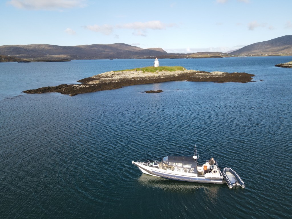
It’s been just over seven years since I visited my first lighthouse in the Western Isles and it’s taken six week-long trips there to have got as close as I possibly could to all 23 of the lights. The map below from my book shows where they all are. I’ve physically touched 20 of them and have been close to three others. Those are Milaid Point, Gasker and, today’s light Calvay.
Lighthouses of the Western Isles
This morning it was time to leave the Western Isles. We’d previously booked the ferry from Lochmaddy on North Uist to Uig on Skye. Once we became aware that we couldn’t get out on a chartered boat though, I suggested we change the booking to go out from Lochboisdale instead so we could at least pass Calvay and it’s little light as we left. With the booking changed, we poised ourselves on the outside deck of the ferry for departure.
The view from the ferry towards Gasay island
While we waited we could see the lights on both Gasay, which we visited on Sunday, and Calvay. By the time we set off the lights had gone out for the day. It was good to pass by Gasay having been there a few days ago and to see some of the rocks we had wandered about on submerged.
Gasay lighthouse
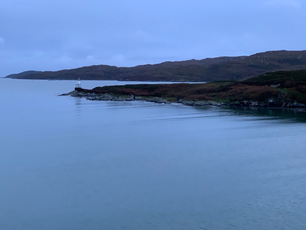
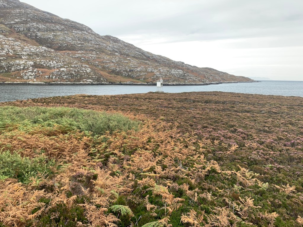
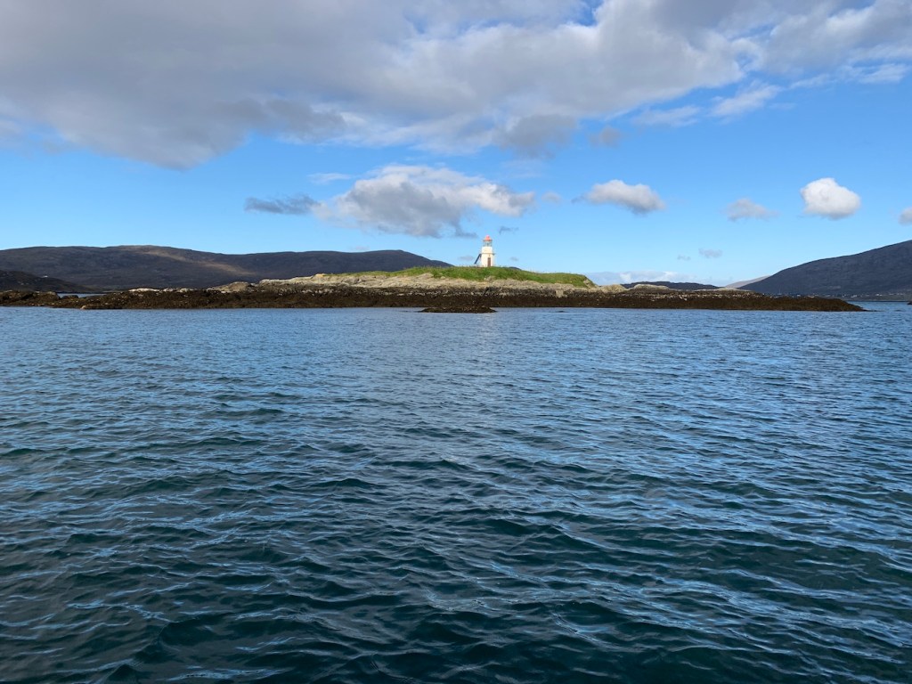
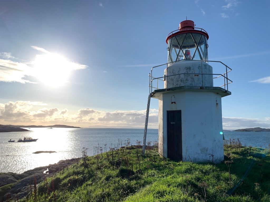
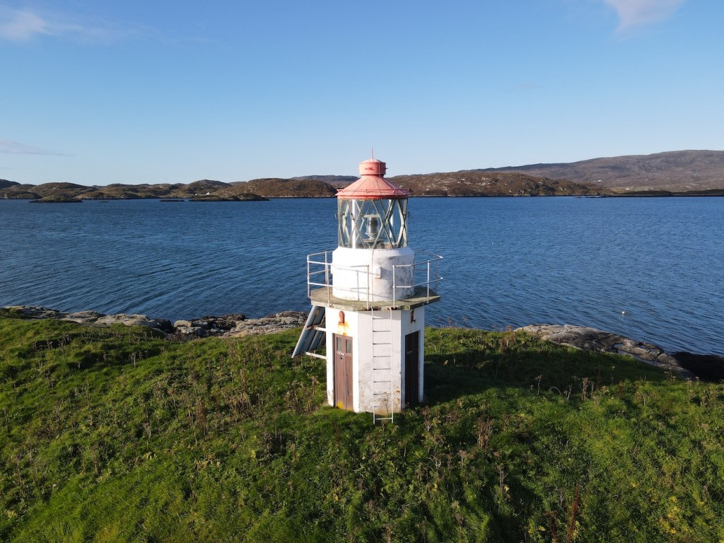
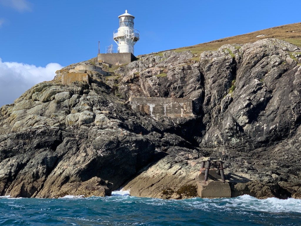
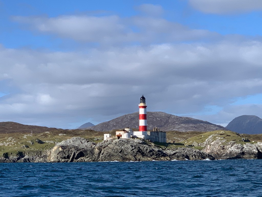
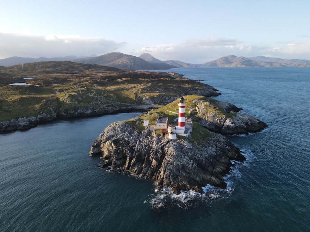
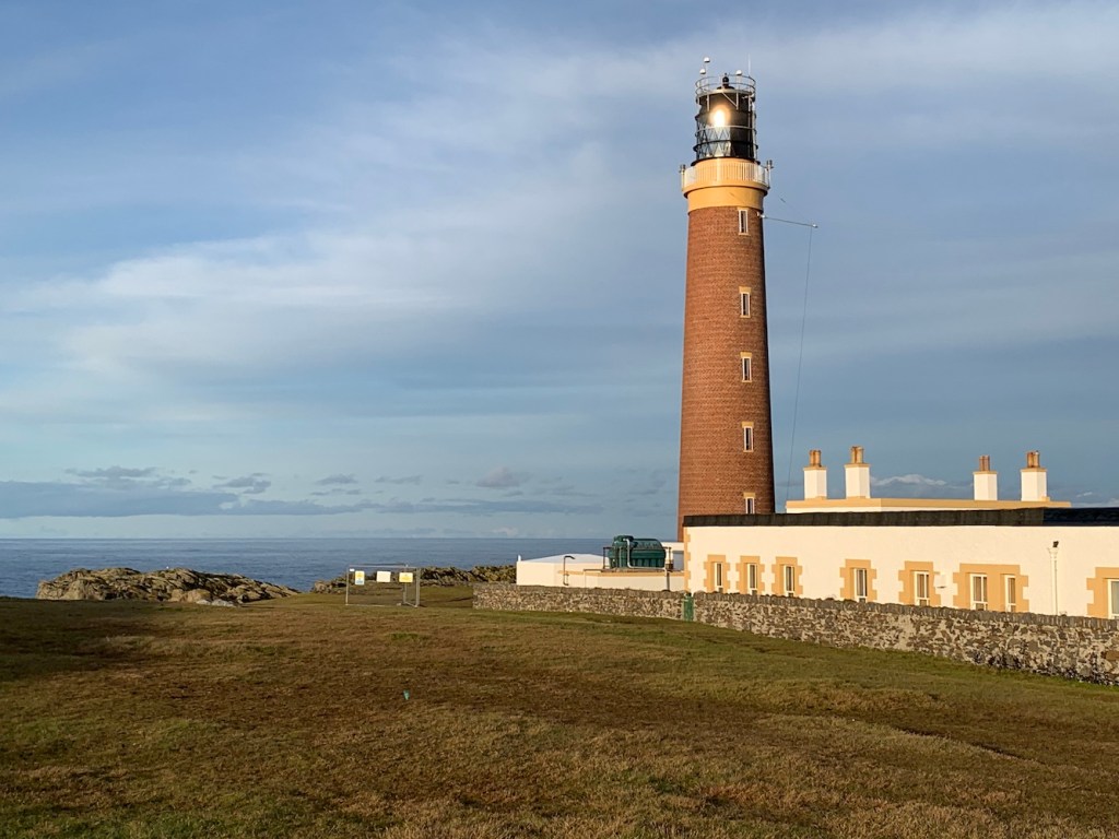
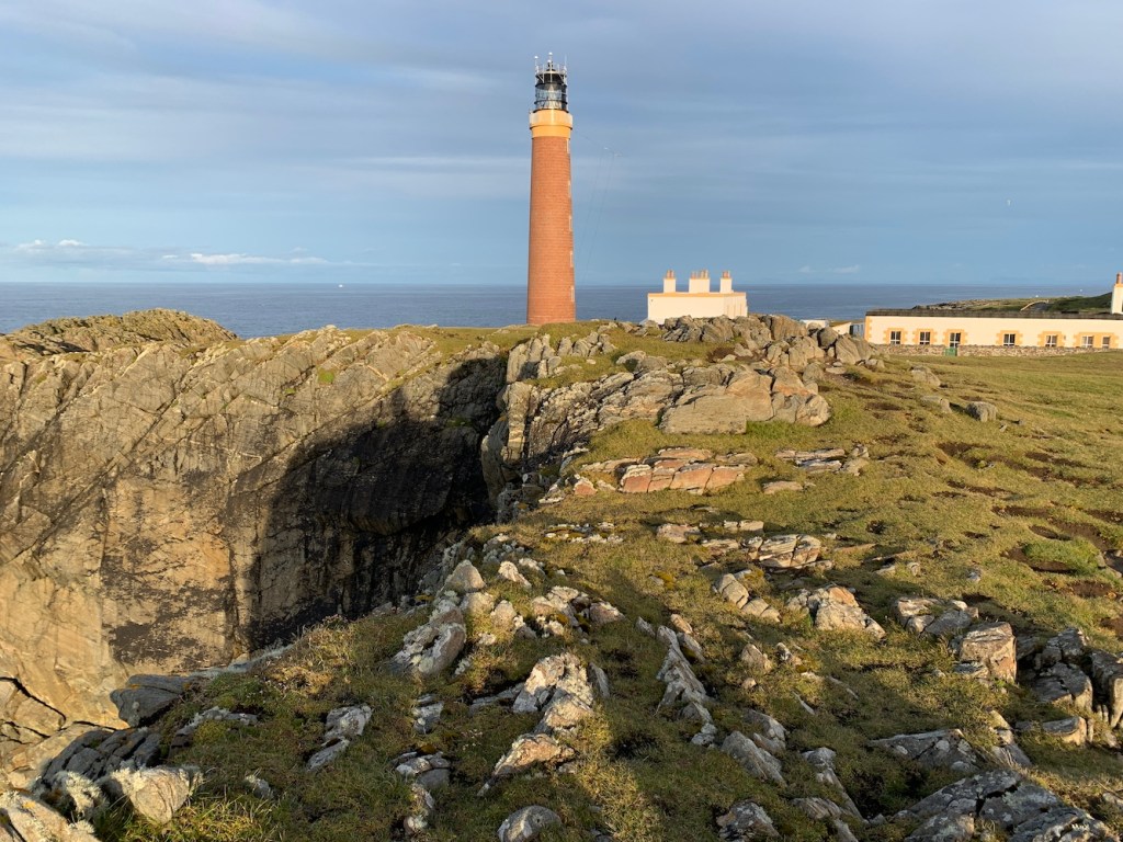
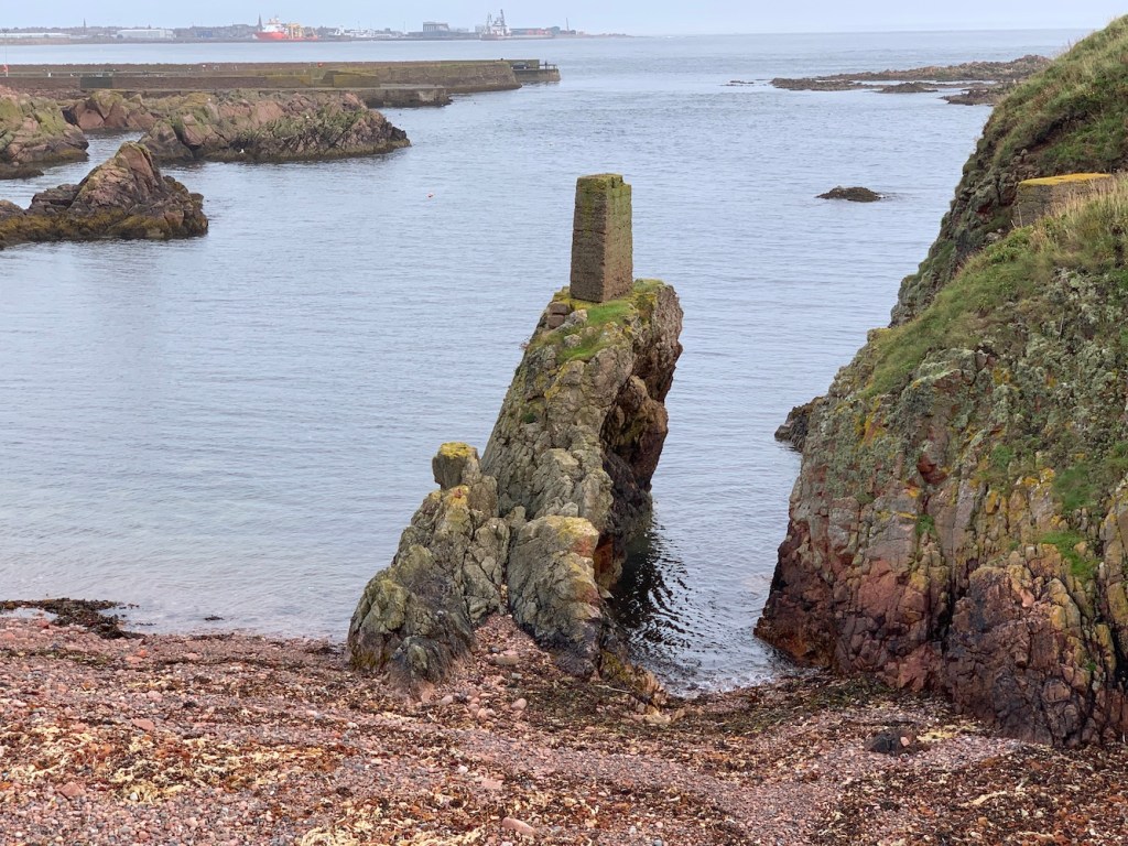
A little further on was Calvay. The light on Calvay is a twin of the one on Gasay and has the important role of guiding vessels safely into and out of Lochboisdale.
Calvay and its lighthouse with South Uist behind
Calvay is a relatively small island, but it has some history. In the 13th century a castle was built on a tidal section of the island and later Bonnie Prince Charlie used the castle, now in ruins, to hide.
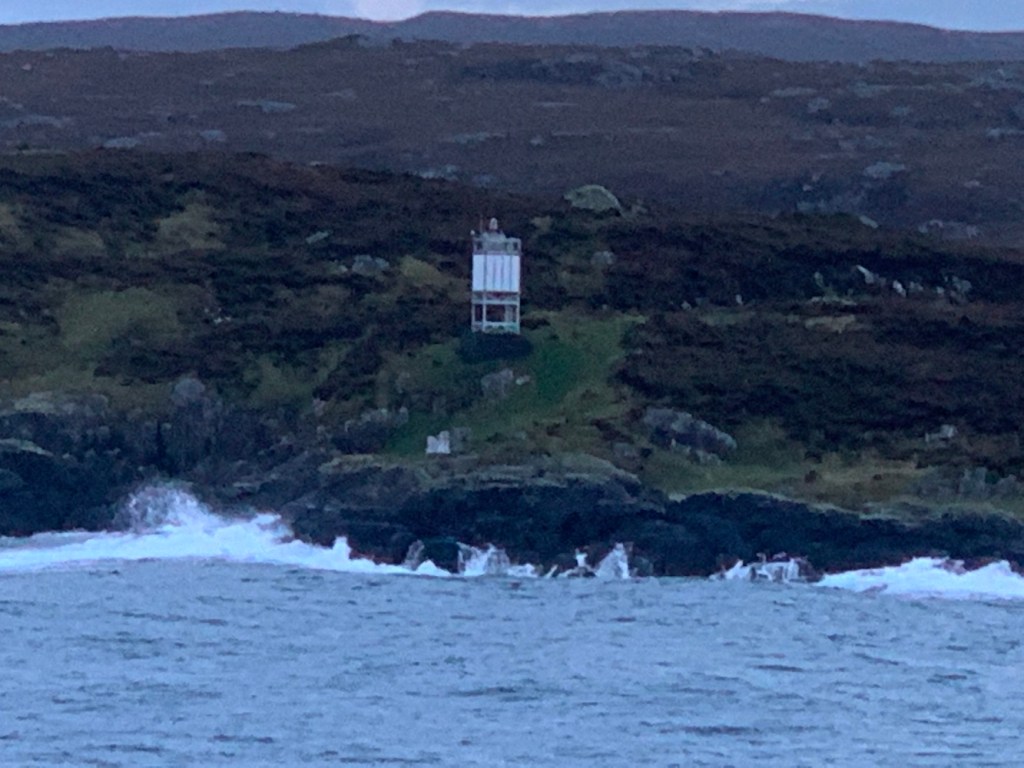
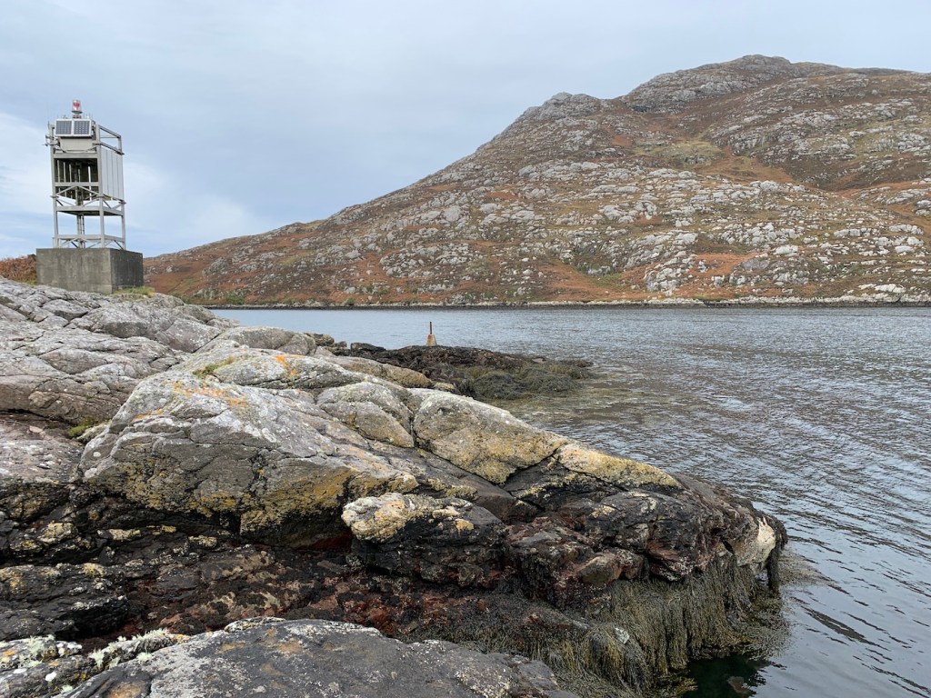
A Wikipedia entry for Calvay castle states that the island also has a lighthouse built by David Alan Stevenson in 1891, which is very clearly no longer the case. That does, however, suggest that it was the small white towers, like Sgeir Ghlas which I visited on Saturday, that stood here previously. I notice there is no mention of Gasay lighthouse on the Northern Lighthouse Board’s Stevenson’s engineers list, which suggests that the light on Gasay came later.
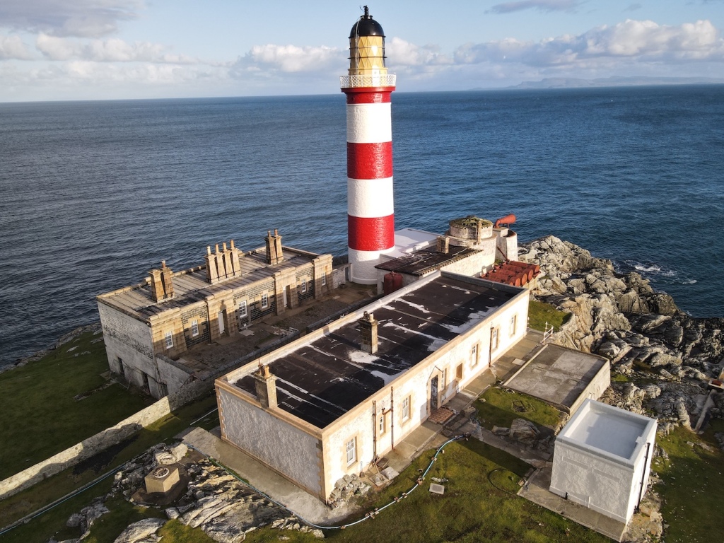
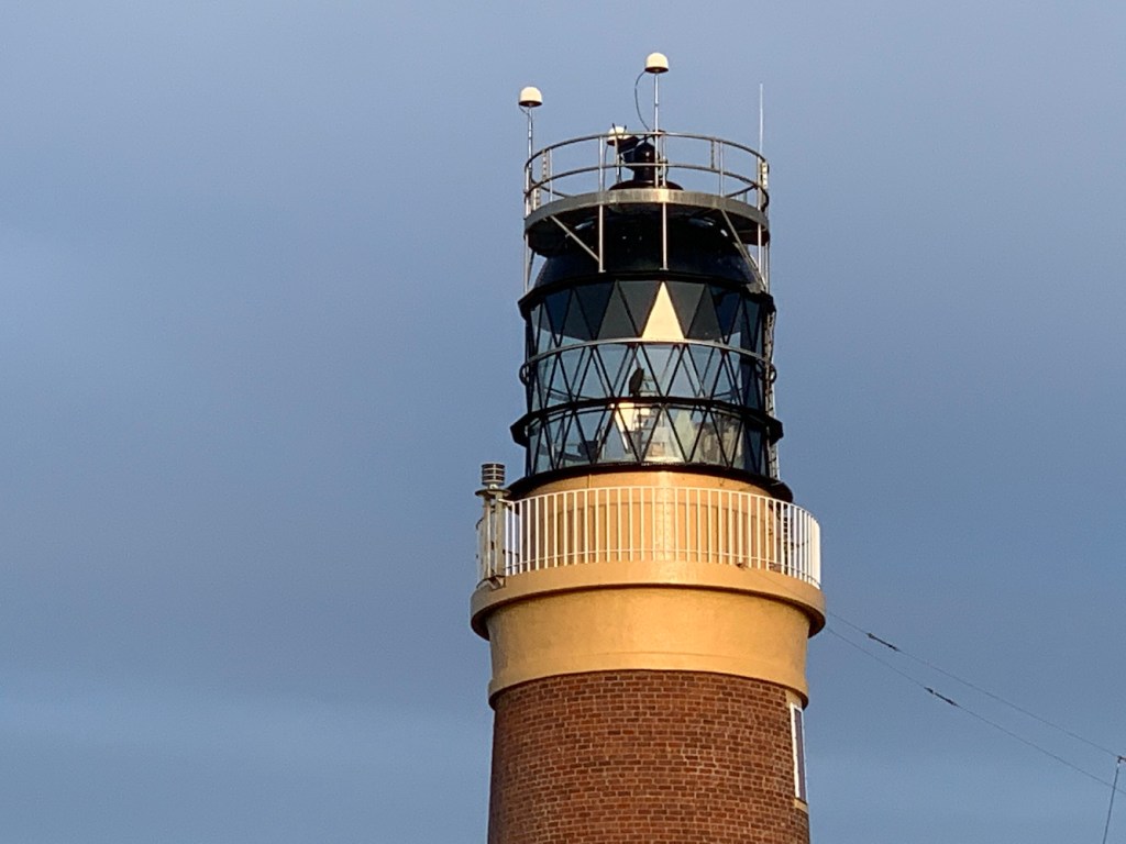
Calvay lighthouse
It may have just been a fleeting glance at Calvay’s little light, but hopefully at some point I will get to take a closer look.
So that’s me having visited all of the lighthouses in this area. I’ve had to try harder and been more persistent here than I have in any other region of the UK. I’ve had some fantastic days out with highlights being: visiting the unnerving Sula Sgeir and the beautiful North Rona on my very first visit to the Western Isles; walking up to Barra Head lighthouse and the incredible views from that most southerly point of the Outer Hebrides; two stunning days in a row wearing short sleeves in the sunshine when visiting the Flannans Isles and the Monach Islands followed by Haskeir lighthouse; to this trip where I reached some of the most remote lights.
Me at North Rona, 6 months pregnant, in 2014
I know I have three left I can improve upon and hopefully the opportunity will arise one day. I now feel more confident about landing on Gasker having had my little scrambling episode to get to Rubh Uisenis. I’d like to land at Milaid Point when conditions allow and visit Calvay when boats are back up and running again. Until then I will enjoy my wonderful memories of this stunning part of the country.
At Barra Head lighthouse in 2018
Before I finish this post I wanted to return to the topic of COVID-19 as mentioned in yesterday’s post. The pandemic has undoubtedly had an impact on the trips we have managed this year. While we have enjoyed the trips, they are not the same as they were pre-COVID.
In terms of visiting lighthouses using chartered boats we are now going alone or with one or two friends rather than with 10 or more others as we have done in the past. This, of course, increases the cost significantly.
In addition, we always book self-catering accommodation where we know we’ll not be mixing with others. Our choice in accommodation is also dictated by the cancellation policies as we realise that short notice cancellations may be required to ensure we comply with the government’s regulations. We don’t eat out, instead cooking dinner for ourselves at the accommodation or getting a takeaway. This trip has been the first where we have used public transport (the ferry) and we sat outside for the crossing with face masks on, and fortunately today’s crossing was very quiet so we sat indoors away from others with our face masks on for the entirety of the journey. Some of these things aren’t enjoyable, but the opportunity to visit these lighthouses, get outdoors and have a change of scene more than makes up for it. 🙂
Phew, where do I begin? I’m not sure I’ve ever put as much effort into visiting a single lighthouse as I did over the past few days with Ushenish. With a good view of Calvay lighthouse from the ferry tomorrow when we leave Lochboisdale, it only left this one lighthouse that I had not yet seen in the Western Isles.
The plan for the beginning of this week had been to go out with Uist Sea Tours from Lochboisdale, land on Calvay and then head around to the landing point for Ushenish as well as doing some islands for Bob along the way. All was well, and then COVID-19 arrived on South Uist. David who runs Uist Sea Tours contacted me at the end of last week to say that he may need to go into self-isolation and was then in regular contact over the weekend with updates and then final confirmation that he would not be able to take us out. I should say that David has been incredibly quick to respond to my messages in organising the trip and I hope one day we do manage to get out on his boat. A really professional company who are up for these mad lighthouse and island-related days out.
Then the fun of finding an alternative boatman began. During the course of Sunday I contacted five alternative boat companies, two based on the Uist, one on Barra and two others on Skye. We had also floated the idea with Seumas at Sea Harris on Saturday and he ended up offering us a really reasonable price to come all the way down from Scalpay just to take us to the landing for Ushenish and then drop us back off again. I really cannot recommend Sea Harris enough! Some companies weren’t available or weren’t running due to the pandemic, one got back to me with a quote and a couple didn’t respond. Needless to say it was a lot of effort.
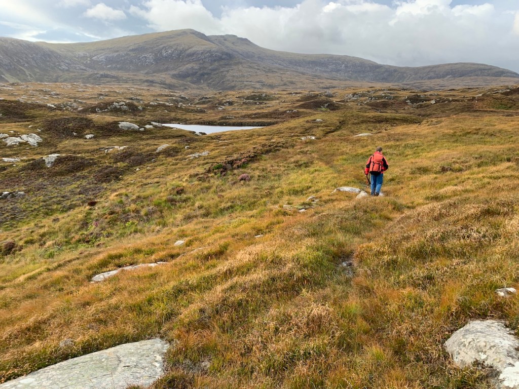
Bob made the suggestion that we could walk out to the lighthouse. Initially I was hesitant, thinking that it was a ridiculously long walk, but we looked at the map and I suddenly realised that this was the only way I could guarantee I would get there (boats are obviously weather dependent, although it was looking ok for today). I happily agreed to this plan and we chose today rather than yesterday as the weather was forecast to be considerably better.
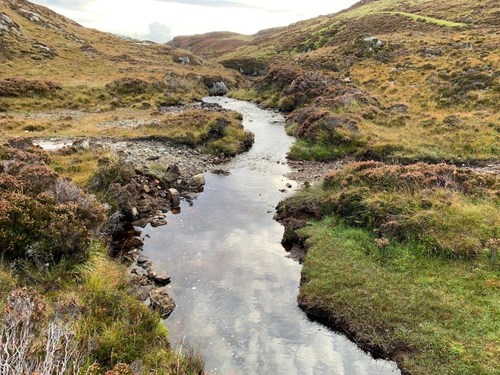
This morning we set off, parking at the starting point we’d found on a short recce the other day. The route was initially following a good path and across a couple of nice (although broken in places) bridges. There had been heavy rain early this morning, which meant the paths were fairly muddy in places.
The route finder leads the way
One of two little bridges that made crossing streams easy
Some very picturesque views early in the walk
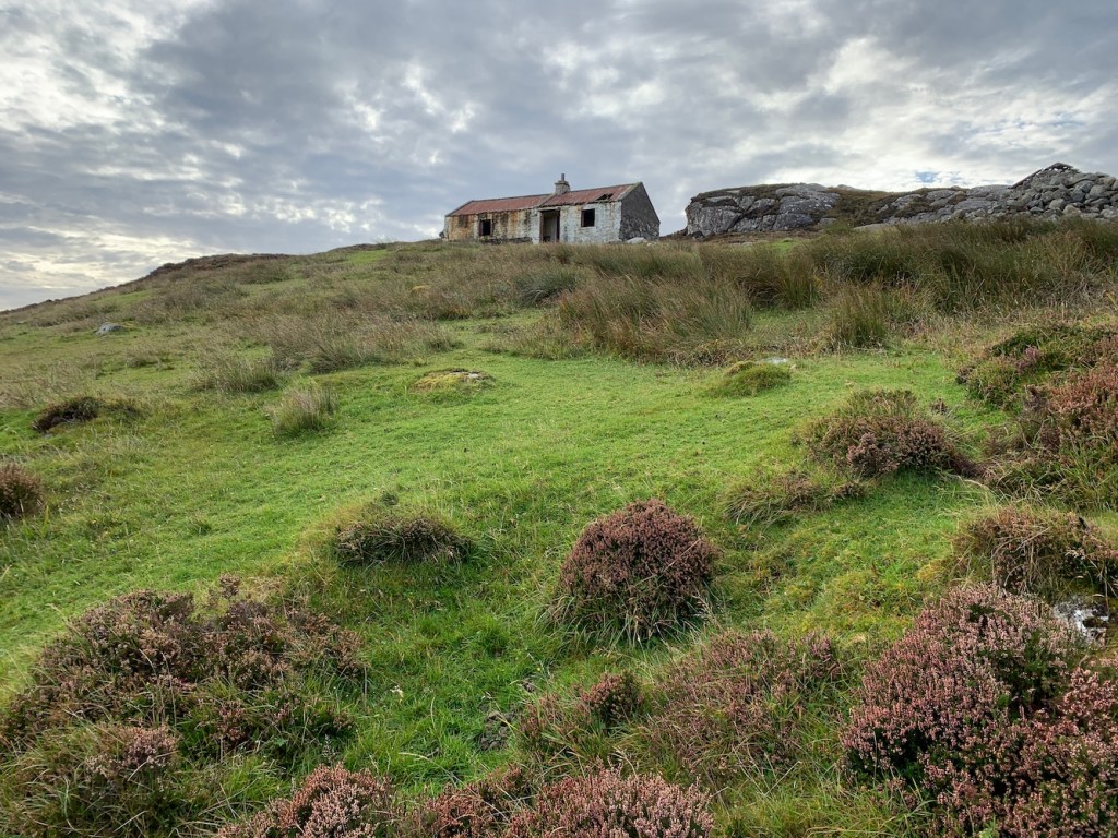
We encountered a number of ruined buildings along the way
The path follows alongside Loch Sgioport (or Skipport)
After around 1.5kms the path marked on the map ended, but for an extra half a kilometre an extended track continued. Between dodging mud and boggy sections I managed to stop and enjoy the views.
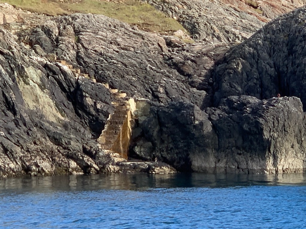
The extended path then came to an end and it was down to Bob to guide us through. One of the biggest challenges during the walk was crossing rivers. Some, such as the one pictured below, involved a bit of a leap of faith. Others weren’t so wide, but presented other challenges such as slippery rocks at crossing points which led to me getting very wet at one point!
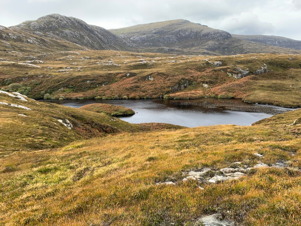
Approaching the beautiful Loch Bein
The terrain varied from muddy, boggy, rough to overgrown. There were plenty of up and downhills too, which kept me on my toes. Bob had chosen a higher route across the section between the end of the extended path and the lighthouse landing area to help avoid the longer undergrowth and even wetter ground further down. The section with no path was by far the trickiest and when we could we followed the deer tracks. Otherwise Bob navigated us professionally through whatever terrain we came upon.
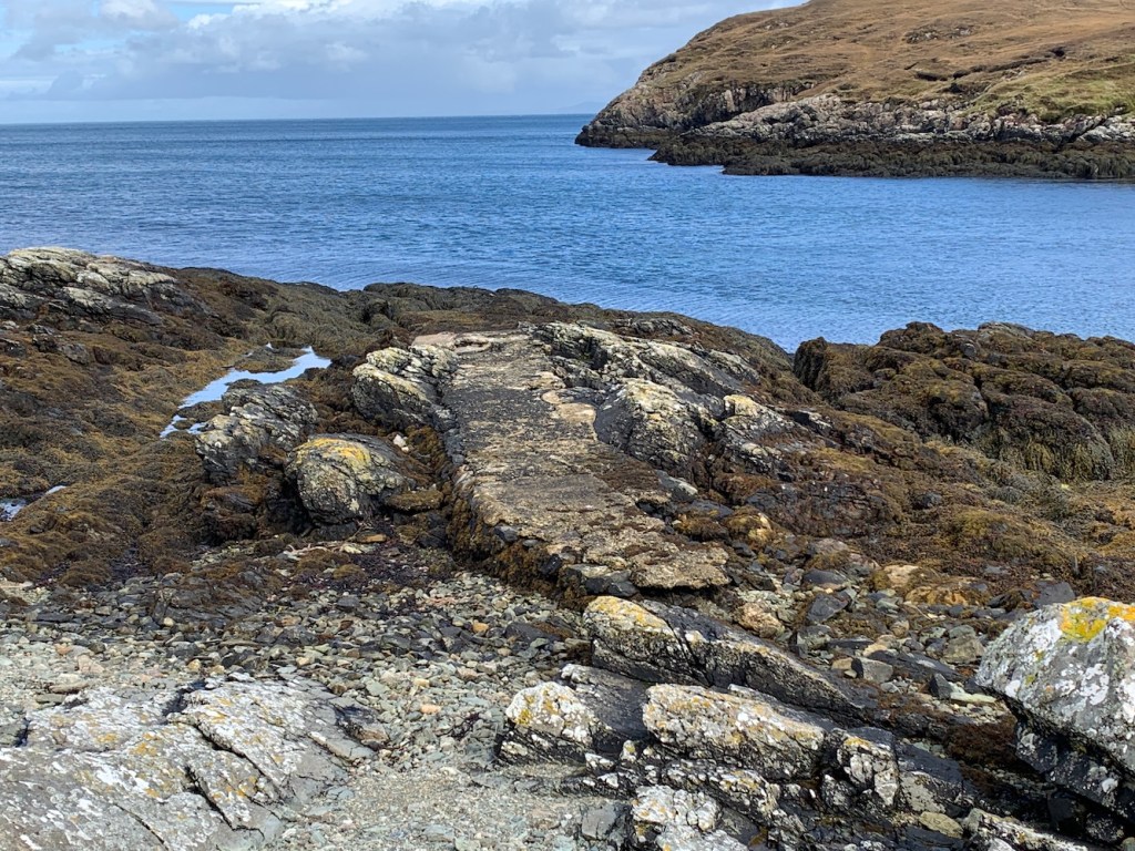
After what felt like a long time, the old lighthouse store at the boat landing area came into view and we followed a deer track along the coast.
The old concrete landing is now in a poor state.
The old lighthouse store at the start of the track to the lighthouse
The view looking back from the track to the lighthouse
We spotted the partially covered water storage hut alongside the track
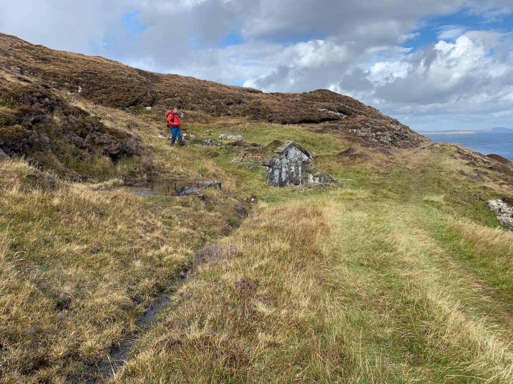
I knew it couldn’t be long before we reached the lighthouse and Bob stopped ahead of me, which is always a good sign that we are on the approach.
The approach to the lighthouse
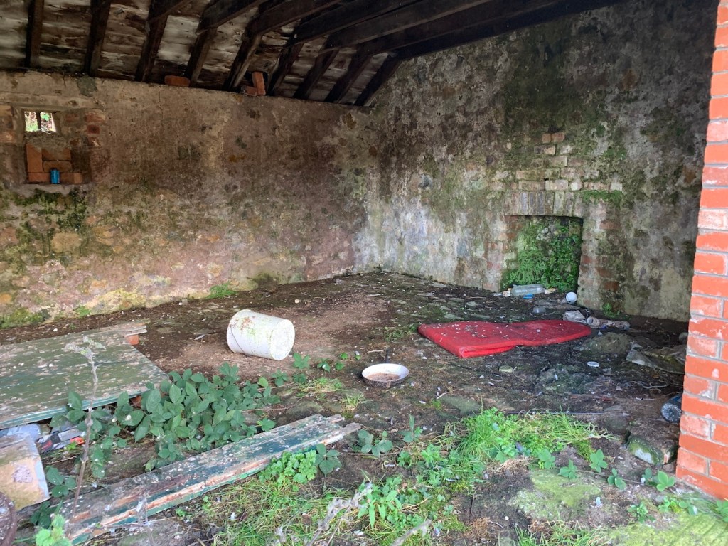
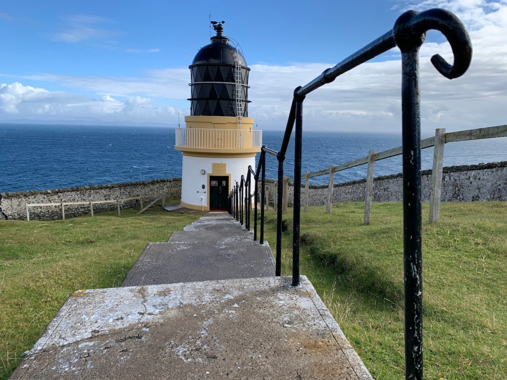
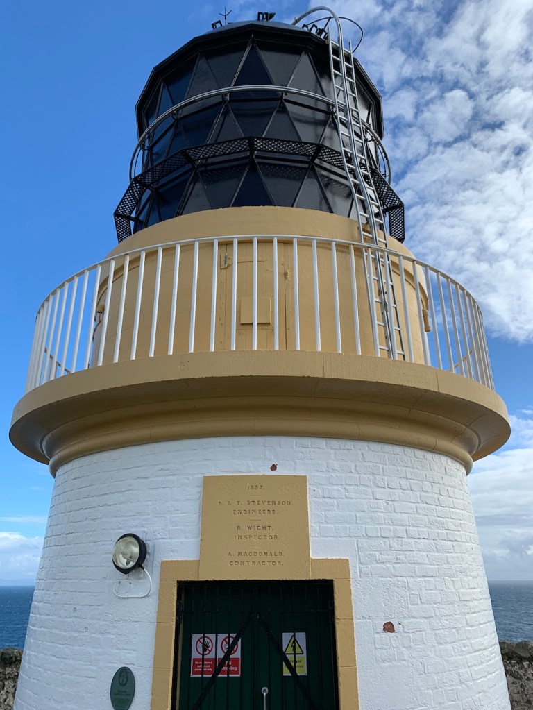
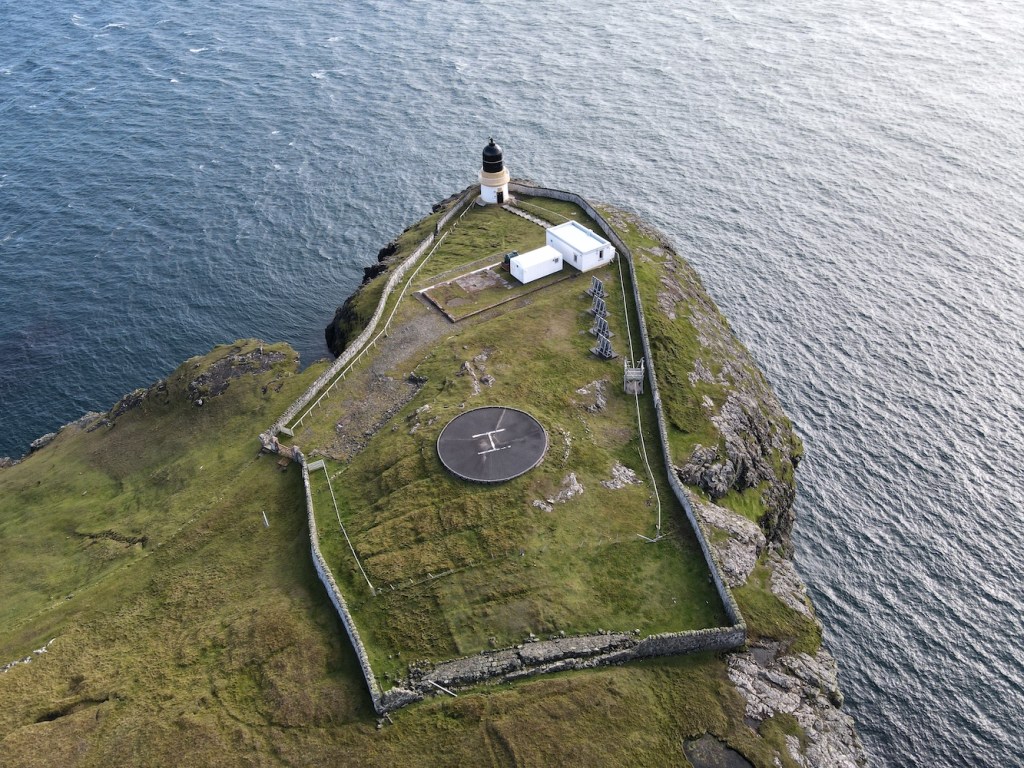
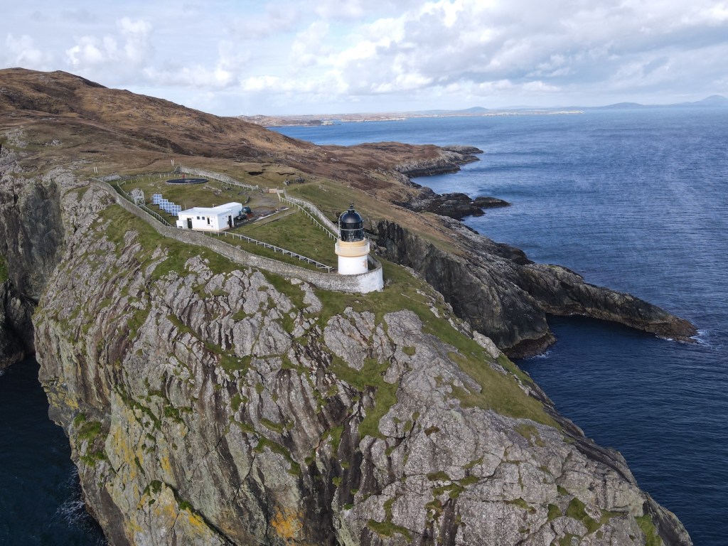
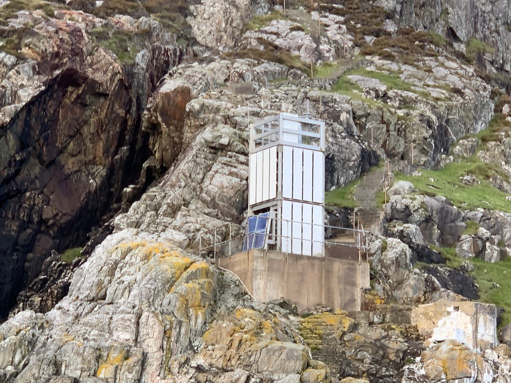
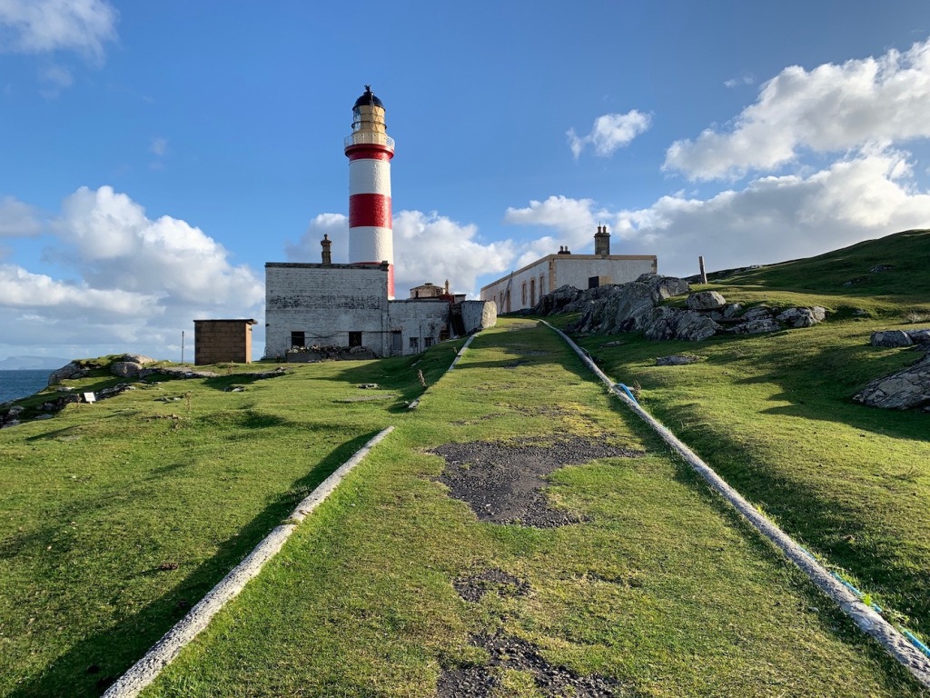
Ushenish lighthouse is a small tower, not needing to be high due to its position on a tall cliff. There are a couple of buildings within the complex, but originally there would have been the keepers’ houses here where they lived with their families – what a life that would have been! The houses have now been demolished, but you can still see their foundations.
The information panel is looking a little weather beaten, but is full of information
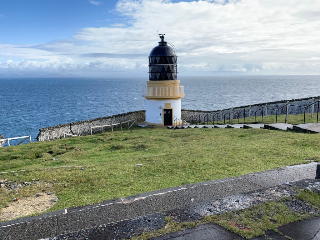
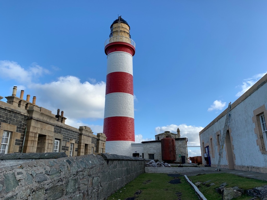
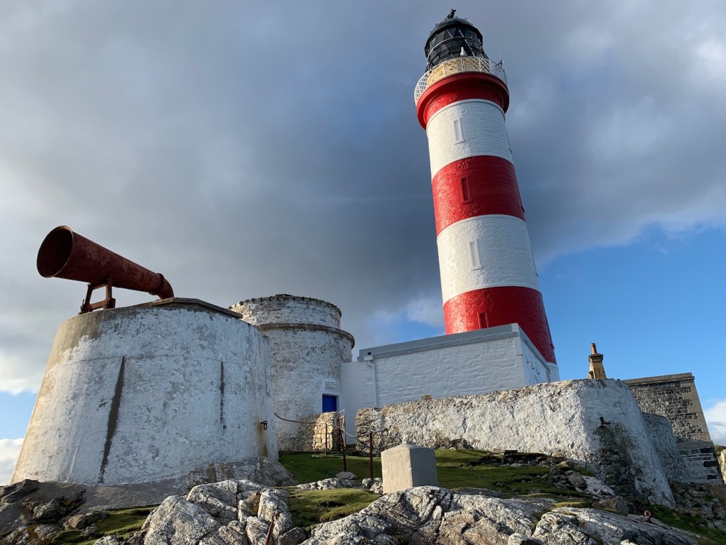
Ushenish lighthouse
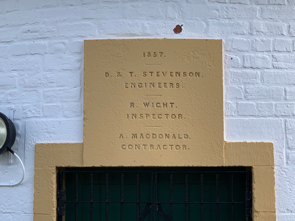
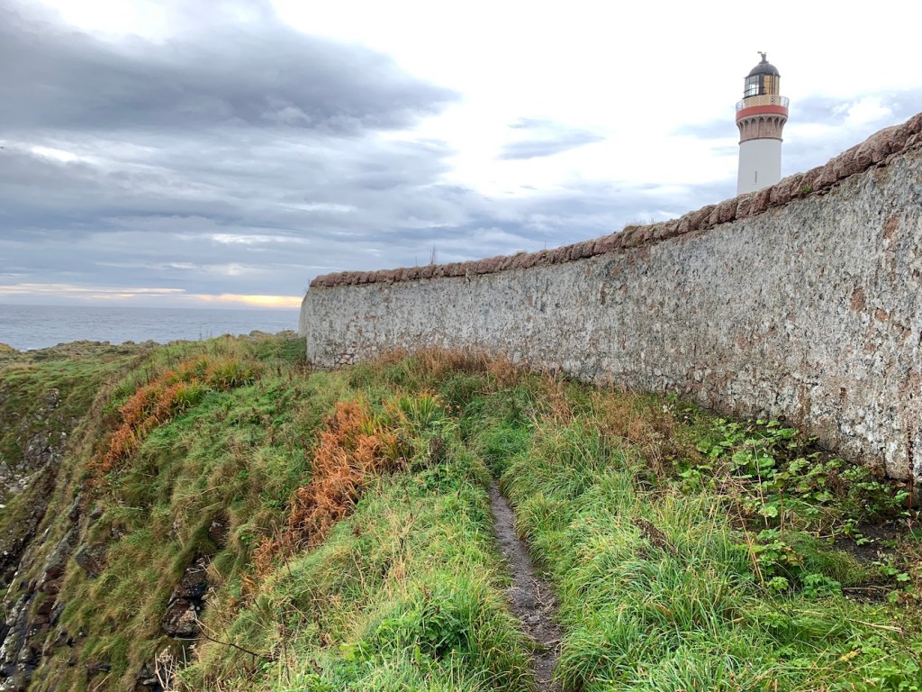
It was a real shame to see the wall around the lighthouse falling away in places. As with Tiumpan Head the other day, it reminds you of the hard work that would have gone into building it all those years ago, over 160 years in fact. It is sad to see, but I suppose the wall is no longer so important.
It was fairly windy at the lighthouse with some strong gusts, but Bob decided to try putting Joe the Drone up to see if he could manage to capture some images. Joe only went up for a short time due to the wind, but still managed some fantastic shots.
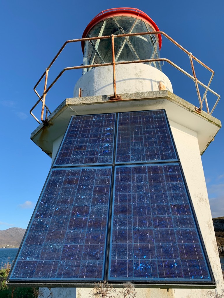
There was an interesting structure in the complex. I recalled seeing something very similar elsewhere, it may have been Auskerry in Orkney. I have since heard that the platform was used to house four small wind generators that the Northern Lighthouse Board were trailing to supplement the solar charging (many thanks to the reader who provided the answer to that).
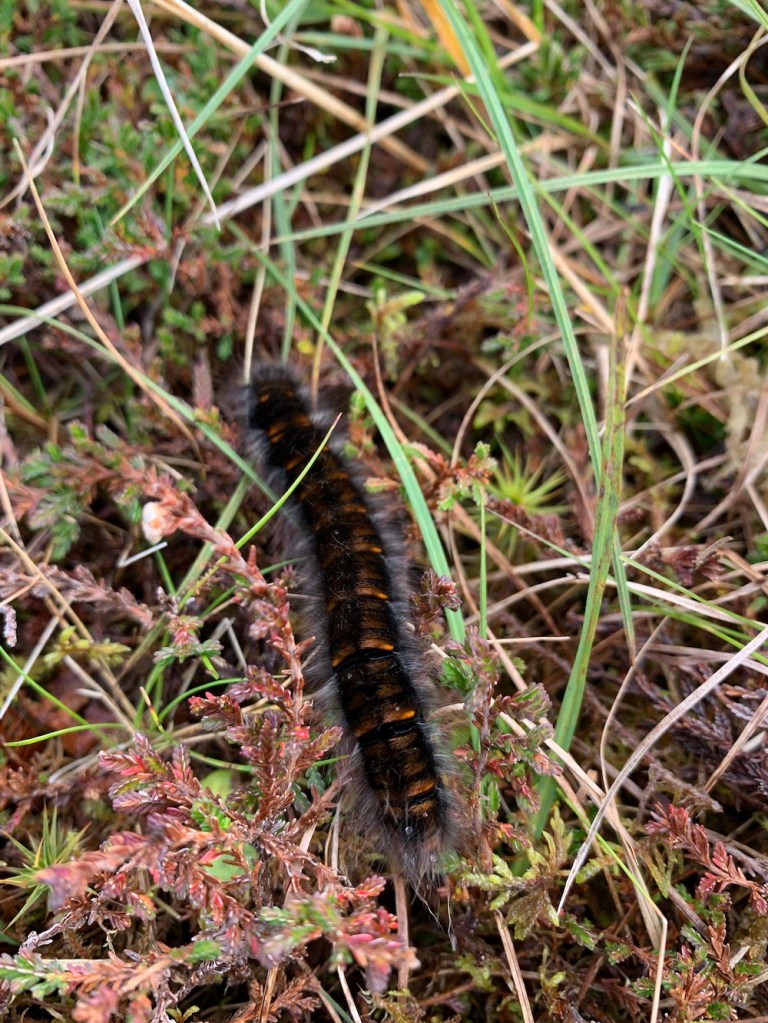
After having lunch at the lighthouse it was time to begin the long journey back. This was where we suddenly began to spot nature aplenty. Within the lighthouse complex there were a number of hairy caterpillars and it always amazes me how these small creatures that seem so delicate can survive in such harsh areas. I recalled visiting Eshaness lighthouse in Shetland last year and being fascinated by how many butterflies were there. They always look so small and easily damaged and yet seeing them in these locations proves that they are much more hardy than we give them credit for. All the way back to the car there were caterpillars littering the ground and I made a point of being careful to avoid stepping on them.
Further along the track we had a call from our little daughter who wanted to speak to us. As we were chatting Bob said “Is that an eagle?” and we watched as a sea eagle flew around close by and then landed near the edge of the cliff. We waited patiently to watch it fly off again, but it seemed quite happily settled on the ground. What a treat!
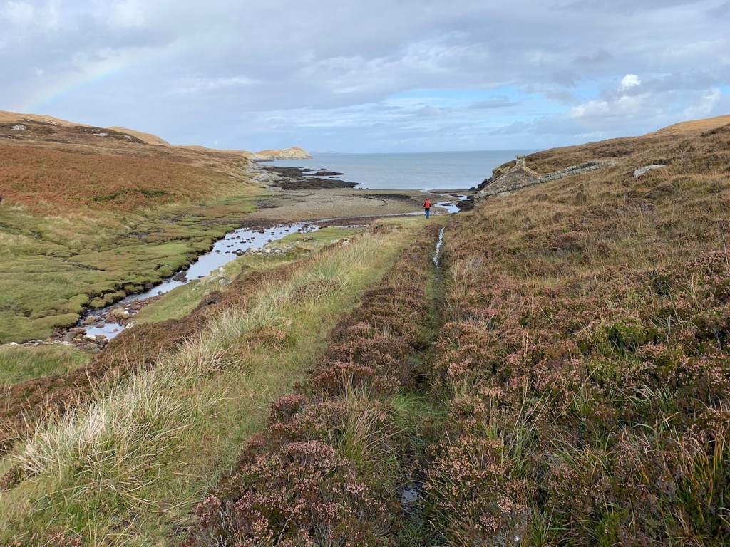
We reached the landing area again and braced ourselves for the off piste section again.
The walk back was tiring and we just kept walking. I felt that if I stopped I wouldn’t want to get going again so I put my head down, concentrated on one step at a time and waited patiently until we got to the easier section again.
A wonderful view looking down on Lochs Bein and Sgioport
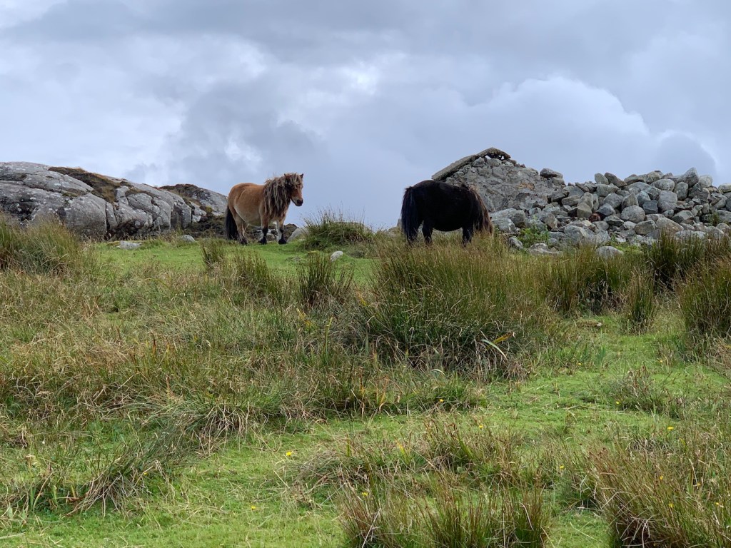
Some Eriskay ponies welcomed us back to the path
I was glad to be back on the path, but even happier to get back to the road. It had been a long walk, about 10 miles in total with the weaving around we did to make the going a little easier. Walking to Ushenish lighthouse is the furthest and most challenging walk I’ve ever done to a lighthouse and I am pleased that it involved more effort than many others. A reviewer of my book described my ‘tenacity’ and I’d not realised until reading that how determined I am to reach these places. I certainly am determined, even if it nearly breaks me. I certainly won’t be forgetting the walk to Ushenish in a hurry. A great day! 🙂
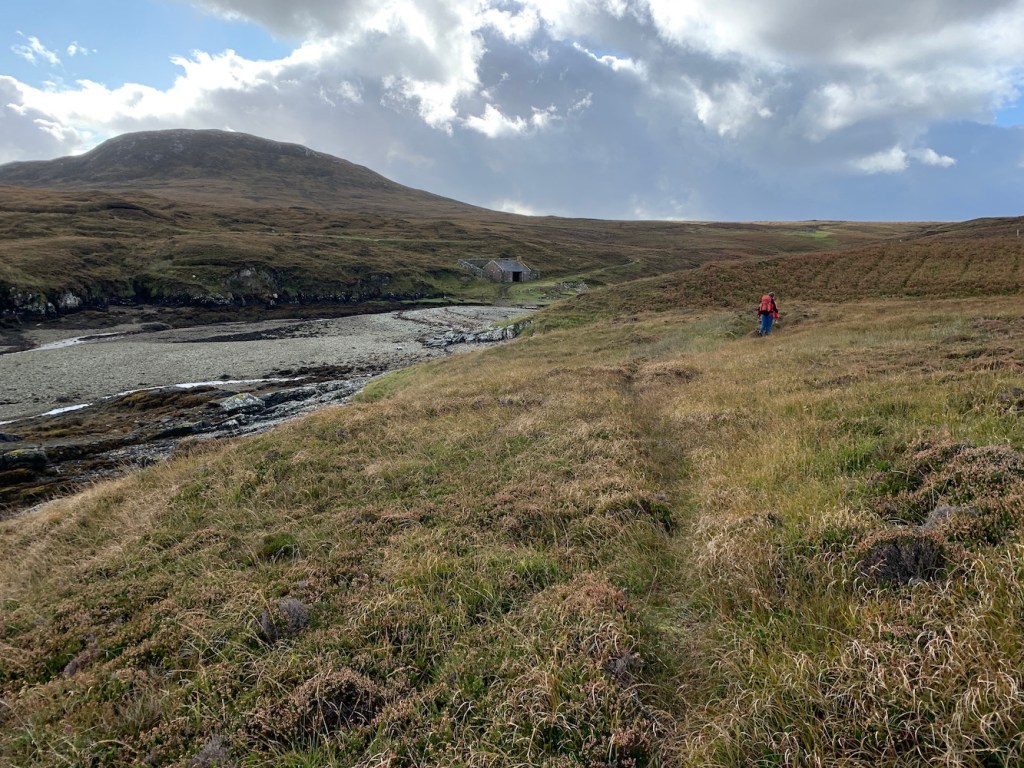
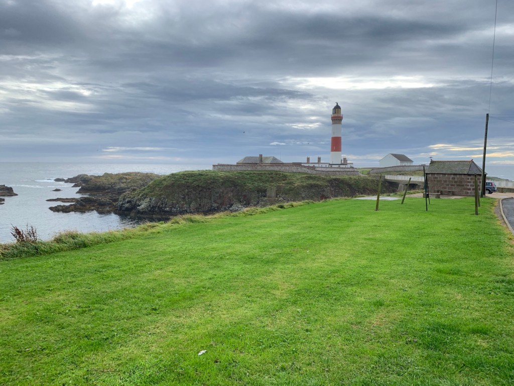
This morning we waved goodbye to Lewis and Harris after a great few days there, and hello to the Uists. This is my first time visiting this part of the Western Isles, excluding the brief visit to Weavers Point yesterday. A new place to explore!
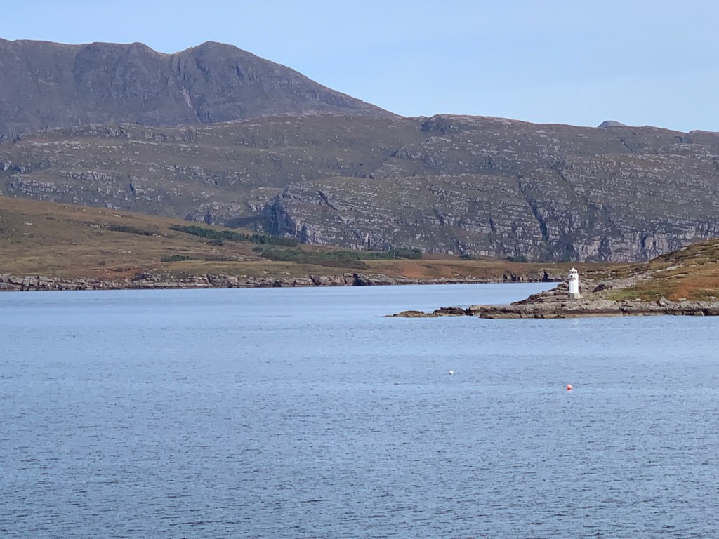
During the research process for my book I had looked into access to the lights on the small islands of Gasay and Calvay on the approach to Lochboisdale. Calvay was obvious, it would require a chartered boat or you could get a good view from the ferries into and out of Lochboisdale. Gasay was a bit more involved and this morning we decided to investigate for ourselves.
Lochboisdale harbour with Gasay and Calvay lights in the distance
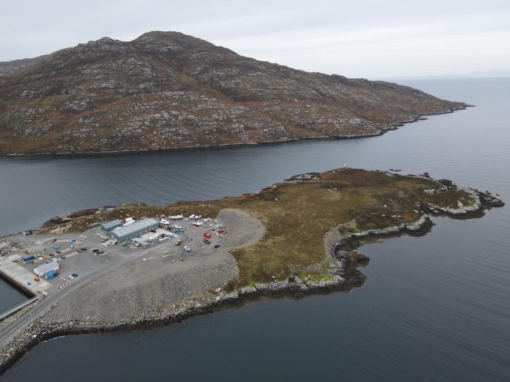
I was aware that Lochboisdale has fairly recently undergone a harbour development programme and my research suggested that the island of Gasay had become linked to South Uist as a result. Arriving in Lochboisdale we found this is exactly what had happened with the harbour development works completed in 2015.
Driving slowly around the harbour area we spotted a slope that looked like it would lead where we wanted to go. We parked up and set off. I was very pleasantly surprised to find a well trodden track leading up from the harbour. This track led up to a recently constructed cairn from which you had great views and could see the light from.
The cairn that marks where the path leads
Fortunately the track continued further until we reached a large gravelled area which gave some views looking back across the harbour.
Looking back at the harbour
This was where we had to go off piste and stomp our way through the heather. The island is peat moorland and there was evidence of peat being dug here in the past. This meant there were some banks to get up and down, but aside from that the walk wasn’t too bad – we’d both expected the ground to be a lot worse.
The light on Gasay and the heather we crossed to reach it
I was intrigued to see what the light looked like close up as it is so infrequently photographed. As you can see from the pictures it is one of the Northern Lighthouse Board‘s metal framework towers clad with white panels, except this light has the panels on the top level only and on one side there are no panels. It’s interesting to see another configuration of the white panels as they do differ on some of the flat-pack lighthouses.
As usual Joe the Drone had accompanied us and got some great images of the lighthouse, the island and the harbour too. These aerial images give a clearer view of Gasay as an island and the causeway that now connects it to Lochboisdale.
The aerial view showing the island more clearly
The Lochboisdale Harbour website suggests that a Phase 2 for the harbour development is being considered which could see the ferry terminal moved to the south side of Gasay. Whether this will impact on the position of the light on Gasay or not remains to be seen. Time will tell.
It may not be a big lighthouse, but Gasay was well worth a visit and also provided distant views of the Calvay light to the east. Hoping to get a bit of a closer look at that one later in the week. 🙂
With the wind shifting around to the north and the wind speed increasing it was touch and go as to whether or not we would make it out on the boat trip we had planned yesterday. Bob spoke to Seumas from Sea Harris the previous night and I was delighted when he confirmed that we would go ahead with the trip.
It was the first time I’ve been out on the water around the Western Isles visiting lighthouses for a couple of years and I must admit I had missed it’s wild ways and unpredictable nature, and also the boatmen who know it so well (well mainly Seumas as he has got me to near enough all of the offshore lights in the Western Isles).
Off we set from Scalpay and our first stop was one I was very excited about. Sgeir Ghlas is a bit different with the red top – and it’s one of those older towers introduced by the Northern Lighthouse Board around the turn of the 19th/20th centuries.
Sgeir Ghlas lighthouse
Landing on the island was fine as the sea was calm and the seaweed covering the rocks wasn’t too slippy. Being a very small and relatively flat piece of land it was only a short stroll to the lighthouse. It’s looking a little weather beaten, but apparently much better than when our skipper was last there. That time it didn’t have a door and there were birds nesting inside. It’s good to see that it now has both doors intact and reminds me of Rubh’an Eun on Bute which has also had a bit of improvement work done to it in recent years.
Bob flew Joe the Drone for a while and, as usual, got some great shots.
Sgeir Ghlas from above
Sgeir Ghlas with Sea Harris’s RIB Pabbay
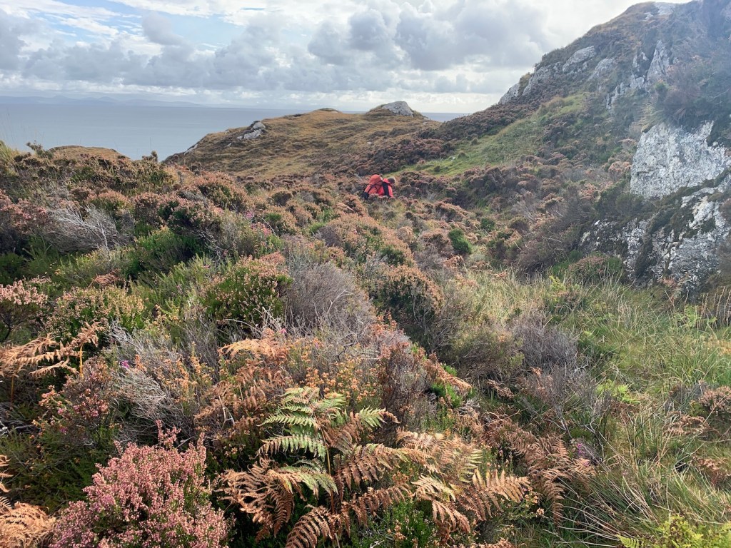
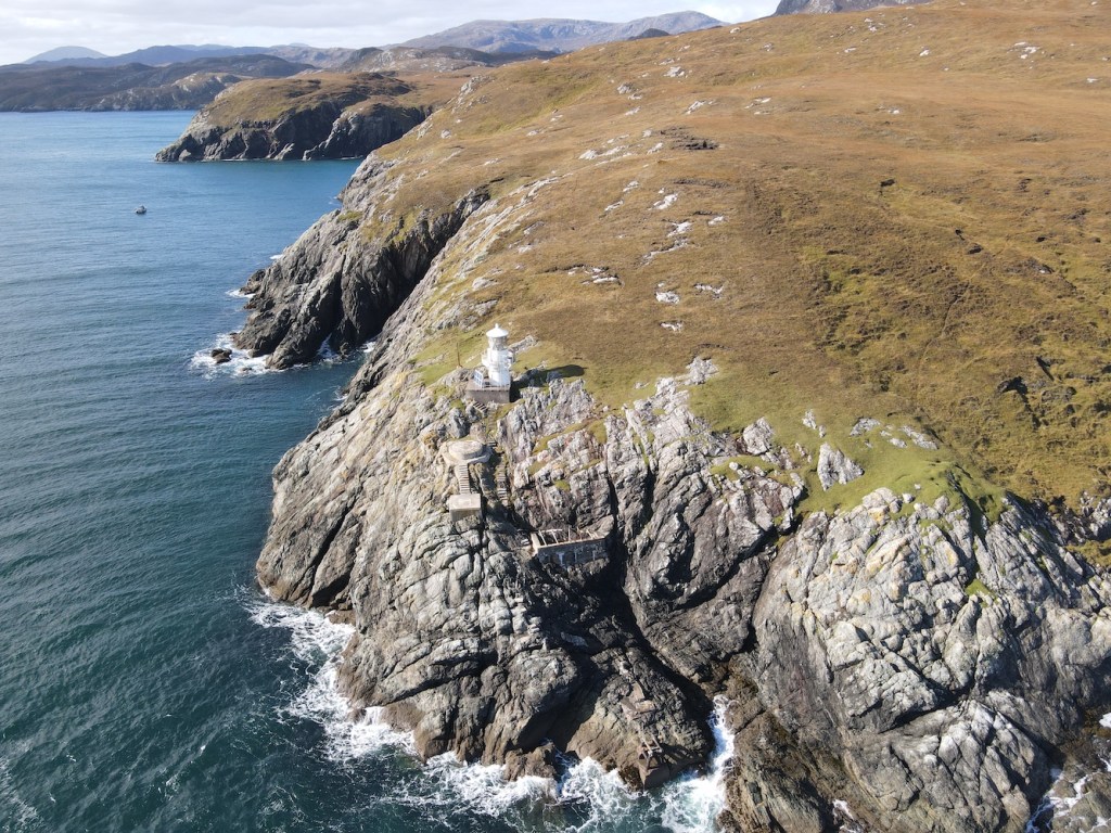
Leaving the island behind we headed out into The Minch and then northwards along the east coast. The change in sea conditions became very obvious as soon as we were out of the shelter of Harris. Up the coast we passed Rubh Uisenis lighthouse which I had previously only seen from a great distance on the way to Eilean Glas lighthouse. We decided to first tackle Milaid Point lighthouse, which we all knew would be the trickiest of the day and come back to Rubh Uisenis.
Milaid Point lighthouse is a flat-pack style and these are usually not the most interesting looking. This one is a bit different though and reminded me a little of the one on the Garvellachs which is also in a fantastic location. Milaid Point lighthouse is set down on the cliff with steps leading down to it from the cliff top. As a result it’s actually not so far above the sea. The view from the sea is great with the light, the steps and two old platforms, one of which was presumably where the previous lighthouse tower was located, and the skipper recalled there being some sort of radar station there at some point which probably explains the other platform.
Milaid Point lighthouse
It was fairly obvious that we weren’t going to be able to land near the lighthouse with the rise and fall of the swell so we sailed around the corner to the south to see if we could find somewhere to land and then walk up and along. Once we were in the tender we realised just how steep the cliffs in the area were. A couple of times we spotted sections we thought we might be able to make it up, but once we were in the small tender we realised just how steep it would be. Bob landed at one place and walked/scrambled up the sections of rock to see if it would be a suitable way up. He ended up descending back down one particular section, a flat slope, using a rope as it was so slippery. So that was not an option, but I was very grateful that he had tried to find a way that I could manage.
We took the tender back around to the rocks below the steps near the lighthouse, but we all agreed that it wasn’t going to be possible to land. It was a shame, but we’d got great views of it and Bob managed to fly Joe the Drone around it a bit too.
Milaid Point lighthouse from above
We’d spent longer than expected at Milaid Point and it was time to sail back down towards Rubh Uisenis lighthouse. Although there was a landing below the lighthouse here, again there was just too much swell. We anchored just to the south in a sheltered area and hopped into the tender to see if there was anywhere here that would make it slightly more accessible than Milaid Point.
Sailing back around to the landing area for a closer look we thought it was just too much of a risk with quite a significant rise and fall in the water level. We’d spotted a potential point around the corner and so went along to that. Thankfully we both managed to get ashore, but the hardest bit was to come. I am not a climber and never will be, or even a scrambler. I’ve just scrambled a bit on very few occasions when reaching a lighthouse requires it. I think the best way to describe the section of rocks we needed to climb up is with a picture so here is one.
Our route up the cliff
It was slow going getting up there, but we made it and then there was a short walk along to the lighthouse, although there was a hill in the way so we had to go over that. I was surprised not to be able to see the lighthouse once we reached the top of the hill, but it’s another one that’s set down a bit and so we had to walk a bit further before it came into view. Once we reached the top of the slope where the ground dropped down to the lighthouse the scrambling and uphill walk were forgotten. I know you are supposed to look up at lighthouses, but there’s always something special about looking down on them, particular when it’s one of these types of towers.
Looking down on Rubh Uisenis
These round white towers were introduced by the Northern Lighthouse Board to replace some of the older small lighthouses (like the one on Sgeir Ghlas shown above), but before they started to use the flat-pack type. The Shiants Isles in the background helped to make the view even more enjoyable. Also knowing that this was a place that very few people would have been added to my appreciation of it. Rubh Uisenis is believed to be the most remote land-based lighthouse in Britain with hours and hours of walking over hills and bog to endure if you attempt it from the land.
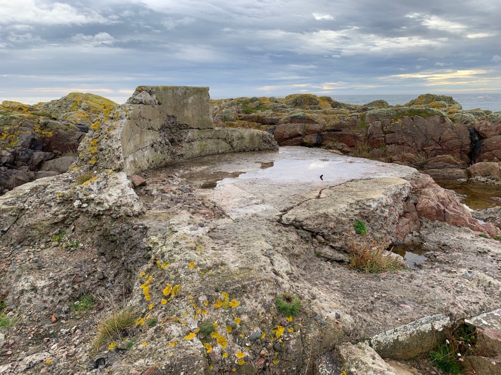
We wandered around for a while, down some of the steps, taking a look at the platform the old lighthouse (I assume) would have sat on. There is a wonderful picture online of the previous lighthouse located here.
Reaching Rubh Uisenis felt like a great achievement. It had seemed so inaccessible previously. I was very pleased, but I also realised we needed to get back down the rocks!
Bob had brought along his trusty rope and for the descent tied it around my waist and held on tight while I went down. We did this in three sections with me stopping on a ledge part way down, pulling the rope down and then waiting for Bob to come down to where I was before I carried on. It was pretty hard going, moreso because I was struggling at times to pull the rope to take the next step, but that was a good sign as if I’d fallen I would have been glad of the tension in the rope! I didn’t fall though and we made it safely back down and onto the boat. It’s fair to say I was very relieved and very happy!
Joe the Drone enjoyed Rubh Uisenis too
Again we’d spent longer there than planned. Whizzing on down the coast we sailed past Eilean Glas lighthouse which was looking just as wonderful as it did by land on Friday.
Eilean Glas from the sea
Onwards to North Uist and this next one marked my first visit to the Uists, and what a dignified one it was.
Weaver Point lighthouse
Weavers Point, or Weaver Point lighthouse, is another one that involved a fairly long walk across difficult terrain if approached by land so what better way to arrive than by boat, especially when there are some wonderful steps leading up the cliff. Quite a treat that was, especially after the last one!
The steps at Weavers Point
Weaver Point lighthouse is another flat-pack structure and a fairly standard one, but it was good to see it up close and enjoy the surrounding scenery too. I’m looking forward to spending more time on the Uists in the coming days.
Weaver Point lighthouse
At this point I was feeling like I was hogging all of the boat time so it was Bob’s turn to enjoy a couple of islands he’d not been to before. In true goat fashion he was up and down both in no time at all.
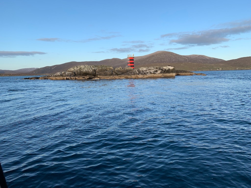
By now the sun was going down, but there was one more stop for the day. We’ve sailed out of Leverburgh a number of times and so regularly passed the red and black Dubh Sgeir light. We were both keen to investigate it a bit more so we landed on the rocks and slowly (because I am not a goat like Bob) made our way towards the tower. When Bob says “use these steps” or “walk on the path” you can almost guarantee that what is in front of you in no way resembles steps or a path. At one point we found a large long and fairly flat rock which Bob likened it to Sauchiehall Street (one of Glasgow’s main shopping streets)!
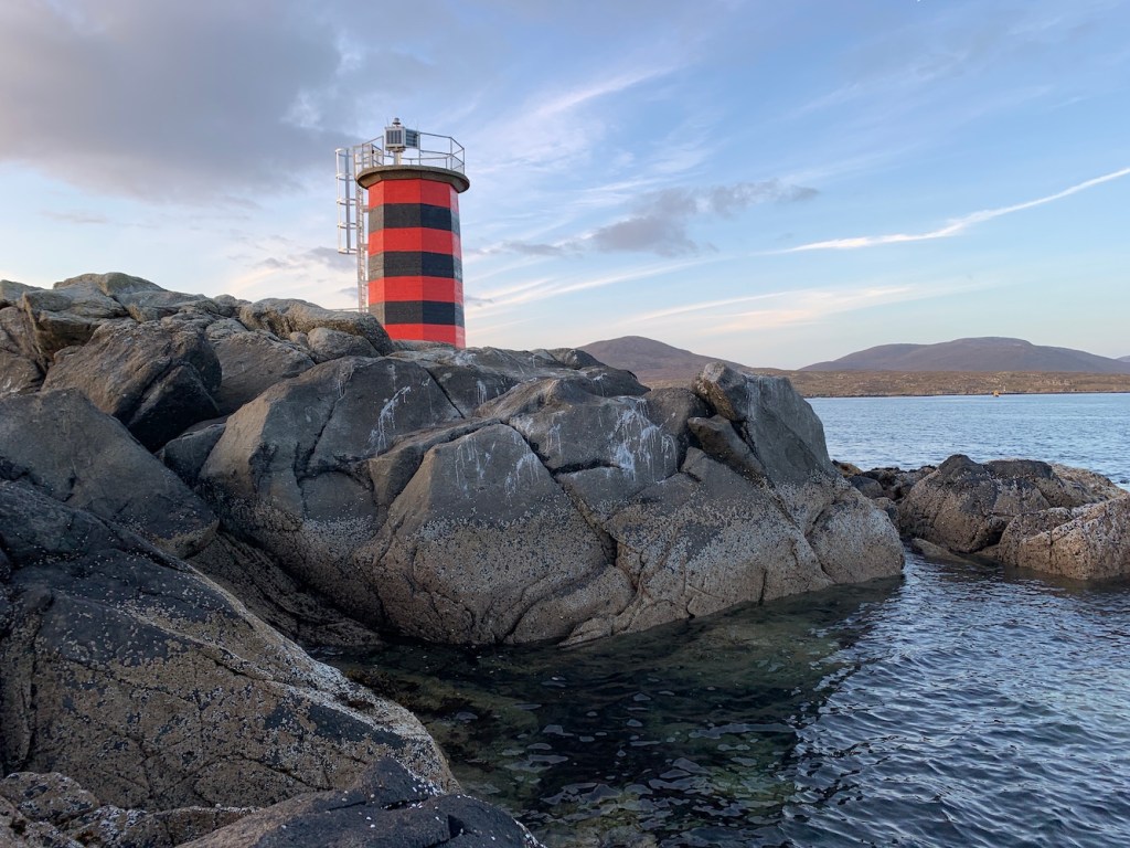
The light on Dubh Sgeir
Dubh Sgeir is an interesting light and though there’s not much to it, it was nice to visit. As I said to Bob it felt like the the Western Isles’ answer to Barrel of Butter (which is in Scapa Flow, Orkney – take a look at this post from last year to see that one).
The sun was setting so it was time to head back to Scalpay. We had a bit of an added bonus on the way back with some common dolphins leaping out of the water alongside the boat. Normally I’m not so excited when you see the occasional dolphin or whale fin sticking out of the sea, but to see them swimming and jumping alongside us was great. They obviously wanted to celebrate my successful day. As did a few of the lighthouses we’d seen as they were flashing away as we returned to Scalpay – always a delight to see.
The dolphins celebrating with me
It had been a very long day, with 11 hours on the boat, but a really successful one. I’d reached a few lights that had been bothering me for quite some time and also been as close as it was safe to get to all of the lighthouses on and around Lewis and Harris. Another fantastic day to add to the bank of memories I have of the area.
I hope to do at least one more post during this trip, but the second boat trip we had planned has had a rather large spanner thrown in the works. Fingers crossed plan B or Plan C will come together! 🙂
I’ve spent many a day out getting to the lighthouses on small islands off the coast of the Western Isles, but this means that I’ve somewhat abandoned the lights on the main islands of Lewis and Harris. With the exception of Butt of Lewis I’d not visited them since my first trip to the Western Isles in 2014. It felt like a good time to rectify that.
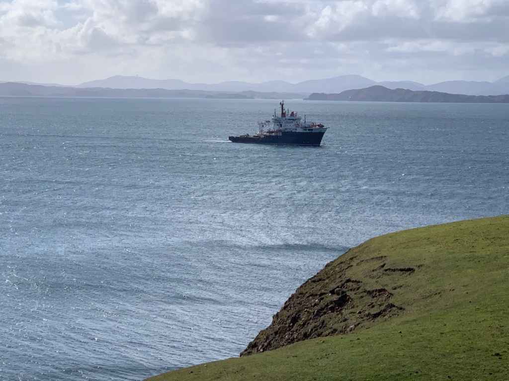
Having seen Tiumpan Head flashing last night I was keen to get a bit closer to it again. We set off and as we headed out of Stornoway I spotted a ship with a particularly recognisable shape just off the coast. I’ve seen the Northern Lighthouse Board’s maintenance vessel Pharos on many of my trips out and about, and was fortunate enough to have a look around her in Oban last year. The first time I saw her was at Bell Rock back in 2012, which was actually one of my first lighthouse boat trips.
I obviously wanted to get a closer view today if I could. Looking at the map I thought we’d be able to get the best view from Swordale. Luckily there was a nice gate with a “no dogs” sign on it leading to a field where we could get some nice views across to it. A bit of a bonus, although I did get wet feet as I walked across a rather boggy part of the field. No pain, no gain!
The Northern Lighthouse Board’s vessel Pharos
A short time later we arrived at Tiumpan Head. Last time we were there it was misty and overcast and the one lasting memory was of dogs barking and barking the whole time. This time the dog barks were still there, but the weather was much better, albeit quite windy.
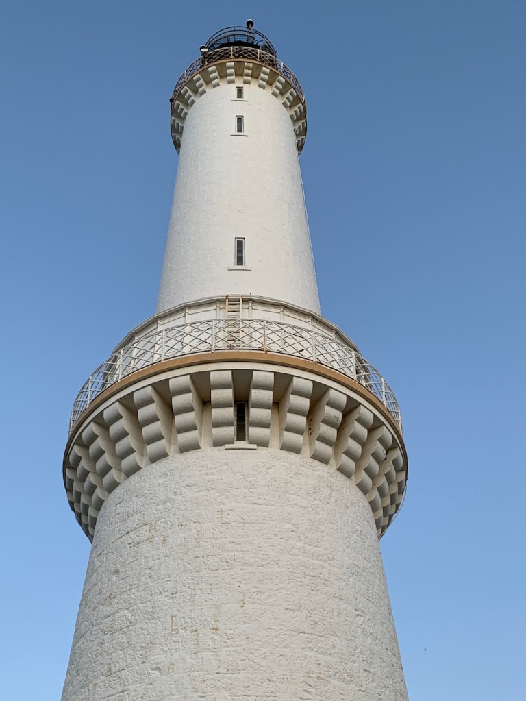
Tiumpan Head lighthouse
As well as the improved conditions my appreciation of the lighthouse was greater this time around. Much of the last few years of lighthouse visits has been spent dashing around like a headless chicken trying to do as much as possible in the limited time available. Now I find myself more and more spending longer at these places and enjoying them more, discovering more and letting them grow on me. In a message to a friend earlier I likened the lighthouses to people and how the more you see them and get to know them the more fond of them you become. Of course there are always exceptions!
The lighthouse tower at Tiumpan Head
The tower, which is maintained by the Northern Lighthouse Board is looking great, but it was sad to see that part of the outer wall of the complex has fallen away. It made me think of the builders all those years ago when the lighthouse was built making these wonderful solid structures. It is rare, in my experience, to see the walls falling down.
Tiumpan Head lighthouse was the damaged section of wall
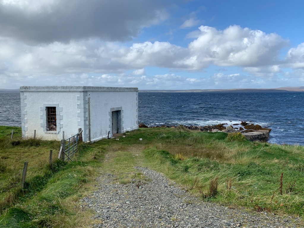
After I’d finished wandering around and taking some pictures, we drove west and discovered what looked remarkably like an old lighthouse building alongside a little slipway at Portnaguran. I got in touch with a friend who is knowledgeable on the history of the Northern Lighthouse Board and he agreed that it most likely was related to the lighthouse and used as an equipment or materials store coming in from, or going out by, boat from the slipway. I also checked with my friend and he confirmed that the grey colour of the quoins were what the Northern Lighthouse Board used before they introduced the yellow/beige colour, which goes by many names. These discoveries teach you that you really do need to keep your eyes open as you never know what you might discover.
The old Tiumpan Head store and slipway in Portnaguran
On the way to our next destination, we stopped by to check access to Arnish Point lighthouse for a friend of mine who plans to visit it next year. We found the road that we’d driven up 6 years ago and decided against going up there this time due to the large puddles/potholes on it. Thankfully it looked like access would still be fine, but we decided against the 1km walk to the lighthouse today as we had somewhere else to be. We did find a nice vantage point on the way out of the industrial estate though that offered wonderful views of the lighthouse and all the way over to where the Pharos was anchored.
Arnish Point lighthouse and the Pharos in the distance
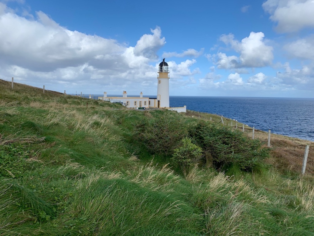
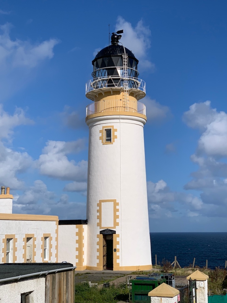
Our final destination of the day, and by chance we arrived there later than planned, was Eilean Glas on Scalpay. This one is so often photographed and you can really see why. For a start everyone loves a red and white lighthouse, and when it is located here with panoramic vistas in every direction what is not to like?
I had read a few days earlier that the improvement works to the cottages at Eilean Glas were now forging ahead and that a new guidebook about the lighthouse had just been published. The sign near the parking area also mentioned tea and coffee being available – there aren’t many lighthouses where you can get that!
The track out to the lighthouse is fantastic. Last time we visited we didn’t realise there was a track and so took the coastal route, which was nice but a bit more challenging – especially at 6 months pregnant! There’s obviously a considerable amount of work gone into the track and signposting. It certainly makes it a much more accessible place than it probably was previously.
The track that leads to the lighthouse
With the sun going down we had that wonderful warm glow on the lighthouse and we are both now converted to the idea of visiting lighthouses at sunset. Fortunately we weren’t there too late to see the lady who is coordinating the effort to renovate the cottages. Once we’d bought a copy of the guidebook and a cup of tea we got chatting to her about the work going on there. The work actually began in 1983 so the effort is as old as I am, but it’s been a little stop/start since then. The current push is sounding positive though and let’s hope it continues.
There’s a lot to see there and, as always, this is best shown in picture form, so here are a few from today.
Eilean Glas lighthouse
The old Eilean Glas lighthouse – one of the oldest in Scotland
Some of the more recently installed windows
Bob had taken Joe the Drone along with us, although we weren’t sure if it would be too windy to use it. He decided to give it a go anyway and Joe seemed to cope fine with any gusts. He had to come back down briefly as it began to rain, but the shower didn’t last long and he was back up again in no time. Often when you are taking pictures of something you can see if it’s going to make for a particularly good image. It’s slightly different with the drone though as you really just put it up, fly around and see what looks good once you are up there.
At first the drone was struggling with automatically flying in a circle around the lighthouse as the brightness of the white bands were causing the drone to lose its focus. After trying a few different angles, Bob flew it around the seaward side on the south east, looking back towards the lighthouse. Looking at the picture on the screen we knew that this was the angle it had to be taken from with the mountains of Harris in the background. Here are a few of Joe’s pictures.
My favourite picture of the day
I heard earlier today that a friend had shared some of Joe’s pictures from the Butt of Lewis yesterday with one of his friends. One of the comments that came back was that it was interesting how the lighthouse dominates when seen from the ground, but some of the drone images make it look so small in comparison to the landscape surrounding it. It is so true and one of the joys of the drone images is that it reminds you that no matter how big or tall manmade structures are, nature will always dwarf them. I think that’s a nice note to end on today. More to come tomorrow… 🙂
Today was the first day of a new adventure in the Western Isles. With our son now at school, we called upon Bob’s mum to take the childcare wheel while Bob and I have a week away exploring even more of the lighthouses and islands in the area. This will be our sixth week-long break over here and I’ve grown very fond on the Western Isles since I first visited in 2014. Many a day has been spent on the water here and there is no place like it.
This morning we set off early and quickly realised how cold it was. The sky had obviously been beautifully clear overnight leading to layers of frost on the trees. Very unexpected for September.
A chilly start
The first lighthouse we spotted today was Loch Eriboll. This little flat-pack lighthouse may not be much to look at, but I think it’s quite special and I’ve enjoyed a couple of great walks out there. As it was still early the light was on and I was pleasantly surprised to see it’s flash was a lovely warm white light rather than the harsh LEDs so often used these days. I am always intrigued by Loch Eriboll lighthouse as it seems like such an unlikely location for a light, bit I suppose if you consider that the loch is the only large safe haven to the west of Scrabster for ships passing along the north coast then it makes a lot of sense.
Loch Eriboll lighthouse
With a little time to spare before we needed to be in Ullapool for the ferry we swung into Rhue, just to get a view of the lighthouse there, which always looks good against the surrounding landscape.
Rhue lighthouse from land
We were grateful that the weather was calm and dry today as it meant our crossing on the ferry was much more enjoyable. We’d chosen to sit outside to avoid the extra risk that comes with being around people indoors these days. It was lovely to pass Rhue lighthouse again and then Cailleach Head lighthouse too and remember our walk out to that one last year in glorious weather. I’d been reliably informed that the Northern Lighthouse Board’s technicians had been out at the lighthouse just yesterday to fix a fence that had been damaged by livestock. What a varied job they must have!
Rhue lighthouse from the sea
After catching a glimpse of Tiumpan Head as we approached the Western Isles we were greeted, as always, by the small but perfectly formed Arnish Point lighthouse. It always reminds me that I am arriving at a place which I have so many wonderful memories of. Lots of laughs, friendships made and masses of fresh air.
Arnish Point lighthouse
As soon as we arrived we checked into our self-catering cottage. By this time I had already started to wonder whether or not it would be possible to see Tiumpan Head lighthouse flashing from the house and it didn’t take me long to discover that I had a problem with seeing it, if indeed I could, from the upstairs windows due to them being so high. Ever the resourceful one, Bob grabbed a chair for me to stand on and I discovered that, yes, peering out to the left you could make out the lighthouse tower in the distance. That was an added bonus I’d not expected, as were the freshly-baked scones the owner’s wife had made for us and the range of local goodies in the fridge too!
After Bob had popped up a hill (spotting the Flannans Islands in the distance from the top) we headed north in time to see the sun going down at Butt of Lewis. I’ve been to the Butt of Lewis a number of times, probably every time I’ve been to the Western Isles, but it’s always been a bit windy, wild and sometimes wet so we’ve never spent very long there. On previous trips the good weather days have been reserved for boat trips to exciting offshore islands and lighthouses. So in today’s calm conditions it was lovely to wander around a bit more and enjoy spending the extra time there. The parking area next to the lighthouse has clearly had some work done to it recently with new kerbs and some picnic benches. The setting sun always casts such wonderful colours over everything and it was no exception here. As with all lighthouses it is always best shown in pictures so here are a few.
Butt of Lewis lighthouse
The latest addition to the family, Joe the Drone, has also made the effort to join us and with there being barely any wind it wasn’t long before he was up and away capturing some fantastic images. I should thank Bob for his very important role in getting them. Here are a few of Joe’s pictures.
It was beginning to get cold as the sun was making its final descent below the horizon so I hopped into the car and waited for the light to come on. Sometimes the sun seems to set so quickly, but it all took a little longer at Butt of Lewis. I was a little disappointed to find that it’s just the back-up lights in operation at the moment as they don’t give the same effect, but it was still good to see it working.
The back-up light in action at Butt of Lewis
As we drove along the road away from the Butt of Lewis I kept my eyes on the horizon to the north east as we had been able to see the hills around Cape Wrath on the way out to the lighthouse. I thought I caught a glimpse of what could have been Cape Wrath lighthouse flashing. I mentioned it to Bob and he pulled over and confirmed that there definitely was a flashing light over that way. That was good to see.
On the way back to the cottage this evening I spotted Tiumpan Head flashing with it’s modern bright white on/off light and I wondered if I would be able to see it from the window at the cottage after all. I am delighted to confirm that I can. 🙂
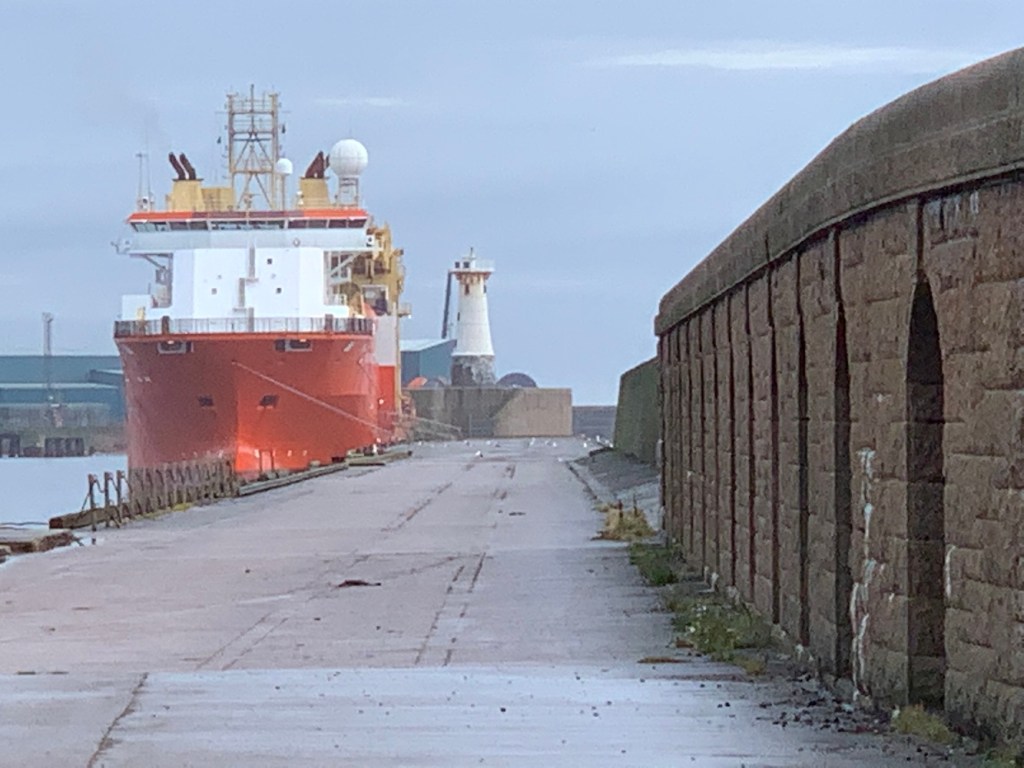
Having been to Peterhead on Saturday I had pointed out to Bob the lighthouse at the end of the South Breakwater. He asked if it was possible to get out onto the breakwater and I told him it wasn’t. I did, however, feel the need to do some research into access as these things can change. It seems that in recent years the owners of the breakwater closed it to fishermen and the locals who frequently fished there had been campaigning to have it opened again.
It felt worthy of being checked out so on Sunday morning we headed back north from Aberdeen to take a look. In Peterhead we easily found the entrance to the south breakwater and it was clear immediately that access would not be possible. The gates were closed and locked and a sign advised that the breakwater was currently closed due to Covid-19. It was still possible to see and take some distant pictures of it from the gate though.
Peterhead South Breakwater lighthouse
Just back a little way along the road there was a parking area, which also gave some good distant views of it.
The entrance to Peterhead’s Harbour of Refuge
While there isn’t a huge amount to say about the lighthouse itself which was introduced in 1906, the south breakwater as well as the north were a large part of Peterhead’s Harbour of Refuge. The harbour was built from the late 1800s through to the mid-1900s. Much of the manual labour carried out in the area was undertaken by convicts at the local HMP Peterhead. At that time this was the only prison in Scotland to include hard labour for prisoners. It has been suggested online that the prison was actually built here to provide labour for the new harbour. It’s an interesting history and has added to my appreciation of an area that I’d previously not thought much of.
The view from Peterhead towards Buchanness lighthouse
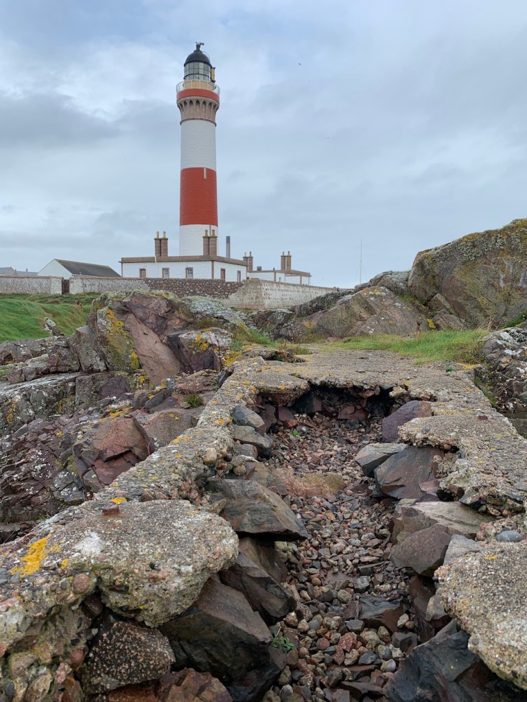
On the way to Peterhead that morning it was absolutely essential that I visit Boddam, home to Buchanness lighthouse. This lighthouse was one of my favourites on my original tour and I am still very fond of it. Although I’d been over to the island before and inside the gate I’d, rather foolishly, not taken the opportunity to walk around the outside of the wall where there is a well-trodden path. It’s a fascinating little island with lots of points of lighthouse history interest. These are always better shown in pictures, so here are a few.
It’s clear that the island receives quite a battering at times with nature trying to destroy anything man made that lies in its path, but to me that adds to the beauty. I’d love to spend more time there and I planted the seed of the idea after my visit by mentioning the keepers’ cottages are holiday accommodation and looking up the price. One day…
Buchanness lighthouse
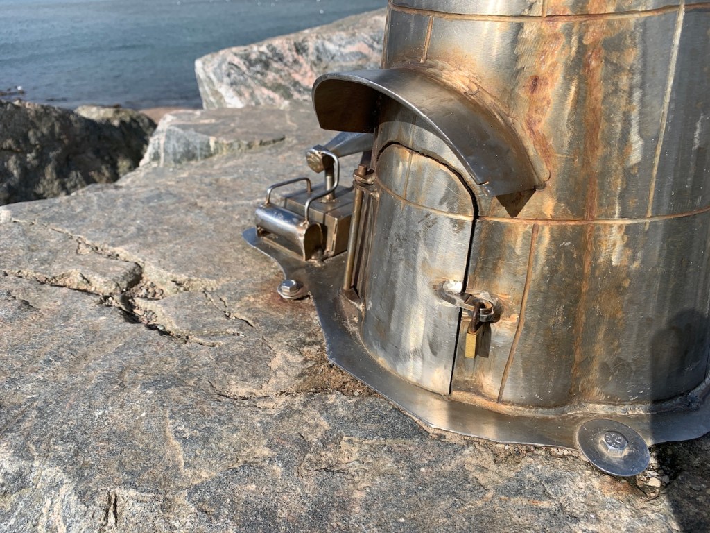
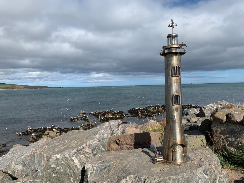
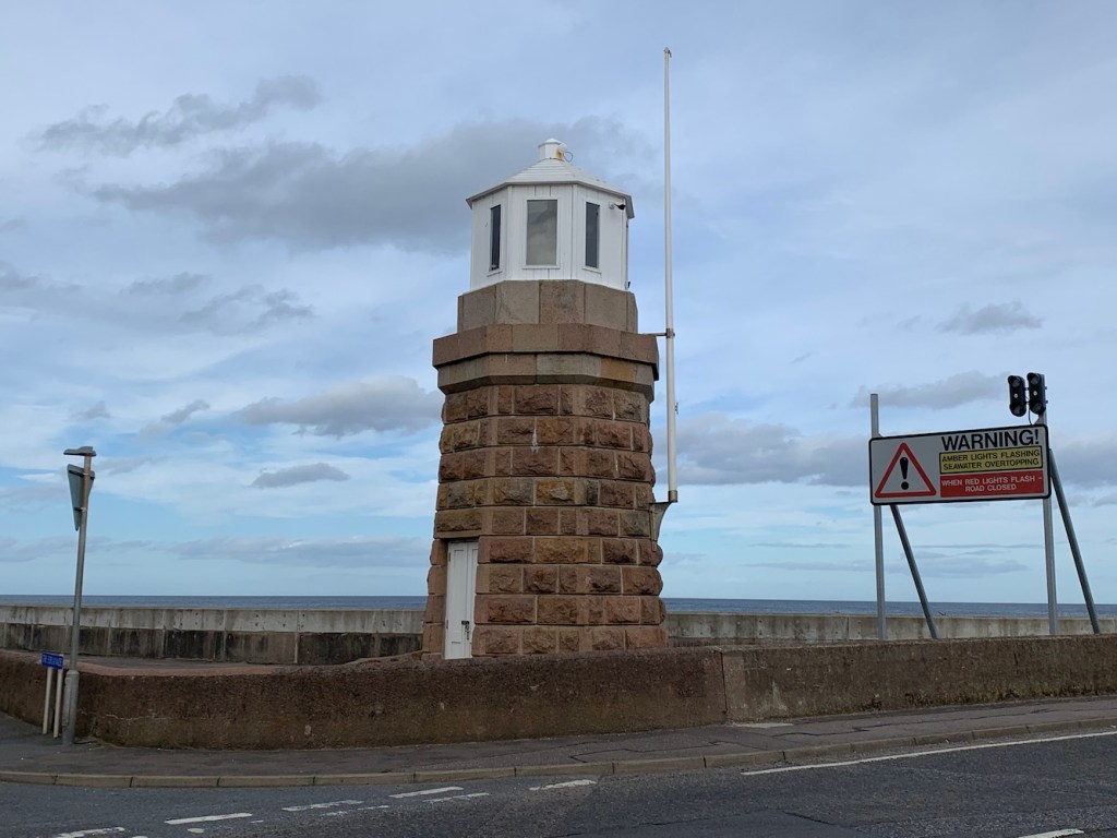
The rest of the day was lighthouse-free – or at least that’s what I thought. Bob had suggested that Stonehaven had a nice beach for the kids to play at so we headed down that way. As soon as we arrived it became very apparent that it was busy and we drove around the car park looking for a space to no avail. However we did find something else of great interest, a model lighthouse. I jumped out of the car to take a closer look while Bob continued the search for a parking space. The statue was fantastic, made of steel with such great attention to detail. It features a foghorn, birds flying around the lantern and even a tiny padlock on the door.
I looked into the statue a little more later that day and discovered that it was actually one of a number of steel statues that had been installed by an anonymous individual along the town’s coast since 2006. The lighthouse, installed in 2016, apparently also features keepers inside reading the paper and watching TV. I didn’t notice them so will need to go back for a closer look sometime. Among the other statues are a seal, a trawler and – most recently – a bi-plane. Earlier this year the artist was revealed as a local retired fisherman who had been building and installing the statues in private. It’s a wonderful story and you can read more about it here.
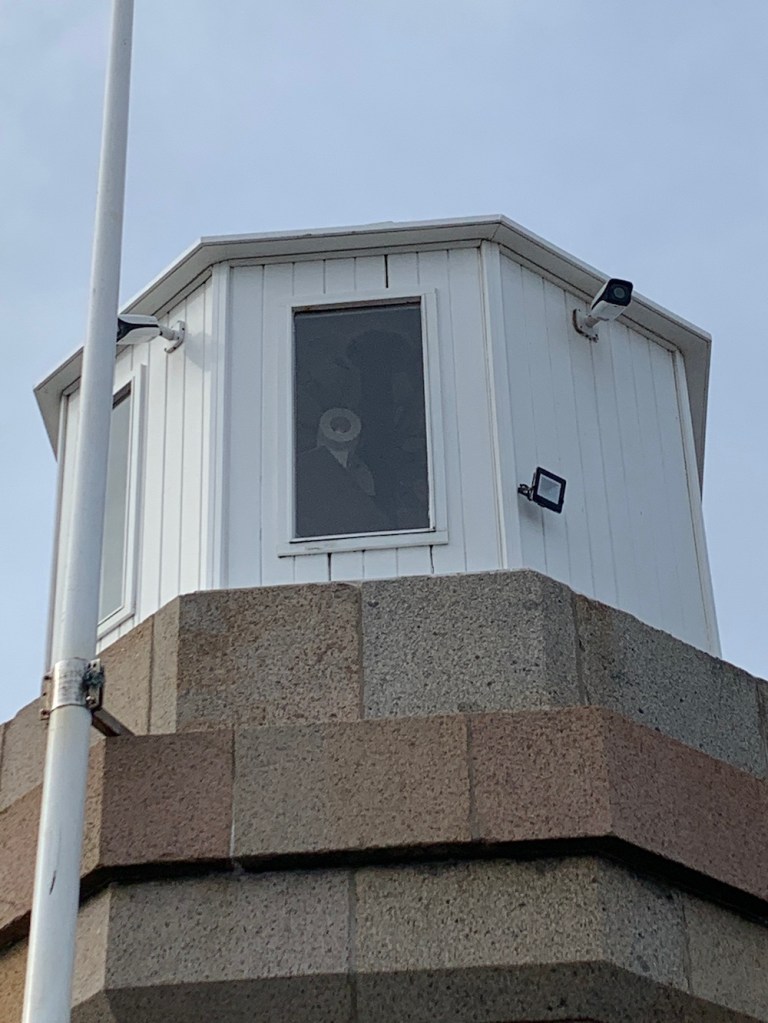
Stonehaven’s little lighthouse
Later that evening I was delighted when Bob suggested visiting Girdle Ness lighthouse at sunset. After a takeaway dinner in the hotel room we flung the kids in the car and set off. It was great to see the lights starting to come on and the green light from the north pier lighthouse was flashing away as were the lights from the south pier. We also spotted the front of the Torry range lights in action – the road is currently closed so we couldn’t see the rear light.
Aberdeen North Pier lighthouse
Aberdeen South Breakwater lighthouse
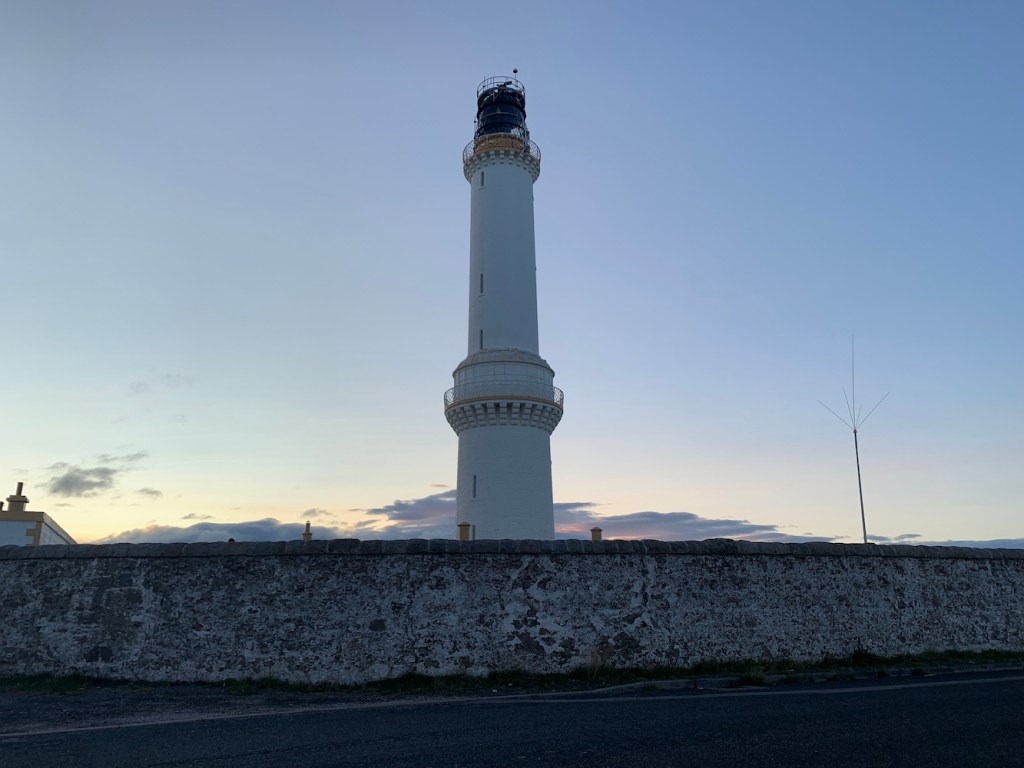
Then we got to her majesty, Girdle Ness. She does look, in my opinion, a bit like the queen piece from Chess with her decorative features. Initially we drove around to the furthest point and hopped out to see the foghorn and I took some pictures of the tower.
Girdle Ness lighthouse
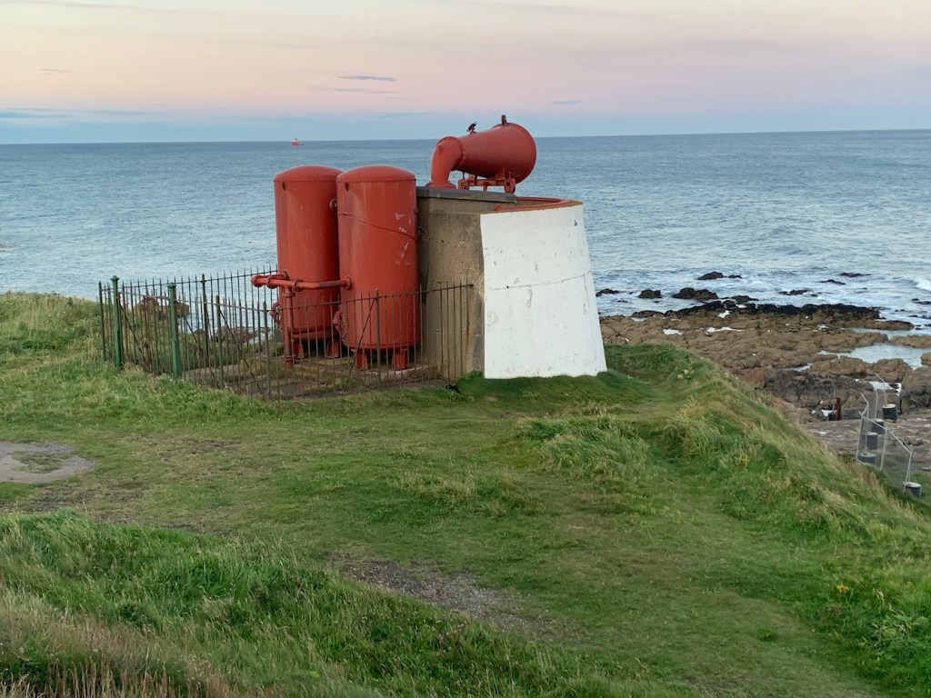
Girdle Ness foghorn
On the way back around (the road to the south of the lighthouse is currently closed due to the harbour extension) we stopped briefly near the gate to the lighthouse complex. The signs there were very clear – no one was allowed in and I had heard that this could be very strictly enforced. My luck was in though as a young couple wandered out and the man told me that I could go in and have a closer look. He explained that one of the residents there doesn’t like people going in, but I got this chap’s permission so in I popped. It’s probably not something I would recommend to the general passerby without permission though.
Girdle Ness lighthouse from the entrance to the courtyard
It was great to see the tower so close, take a picture of it’s plaque and see those lovely details a bit closer. It looked like there were a couple of lights on inside the tower, but I chose not to knock to see if anyone was in.
Girdle Ness lighthouse from below
I felt the need for a different angle on the tower, to capture the colours over the sea. We stopped at a parking area nearby and I strolled up alongside a wall and high fence to try and get a good vantage point with the sun setting behind my back. The high fence is linked to the harbour redevelopment and is currently home to a visitor centre where you can learn all about the work going on. Could be interesting.
Looking over the harbour extension materials
I just wanted a quick view of the tower from the foghorn again as it was growing increasingly dark. When I’d initially looked at it from that angle it looked like the little emergency LED light was flashing instead of the main light source, but this time it was clear that the main light (or sealed beam lamp array) was rotating nicely. I was very excited and could have stayed for another half an hour at least, but was aware that I had a waiting husband and children in the car so we set off.
Girdle Ness lighthouse in action
I’m glad we did though as we found a road heading south from Aberdeen and I was able to get out of the car and see the lighthouse in fully fleshed action from afar. I am useless as taking pictures at night so the resulting images aren’t so good, but I will include one anyway. It was beautiful to see it flashing and the wonderful reflection of the light on the water. A beautiful way to finish a lovely day, which was full of nice surprises. 🙂
Many of the trips I go on are well planned out weeks in advance, but every now and then it’s good to embrace the joy that comes with a spontaneous decision. Since having kids my definition of “spontaneous” has changed a bit and now means we’ll do something tomorrow rather than immediately. Well, that was what occurred on Friday when deciding how we should spend our son’s birthday weekend, especially as there was no school early the following week either.
Our boy is a big fan of Premier Inns and thankfully Bob had been to a couple recently and felt confident that their Covid measures were good enough for us all to go and stay. The destination, Aberdeen, was decided on Friday morning and the hotel booked.
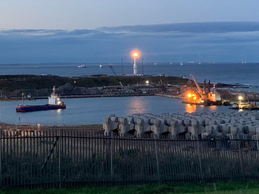
This wasn’t due to be a lighthouse trip at all, with the exception being Rattray Head so Joe the Drone could come along too. In fact, aside from that we had nothing planned, but I managed to do quite well out of it!
Leaving home on Saturday, we headed straight for Rattray Head (a 5+ hour drive) and hoped to time it right for getting there at low tide. We arrived about 50 minutes before low tide and it was very clear that the low tide was going to be nowhere near low enough, at 1.74 metres, for us to get anywhere near the lighthouse – something to do at a future during a low spring tide instead.
Not so low tide at Rattray Head
It was also windy and it was touch and go as to whether Joe the Drone would manage to get up and not get destroyed by filling with sand during take off and landing. The little portable helipad went down and off Joe went. Bob spent a little while establishing the wind conditions before capturing some aerials shots and footage.
Rattray Head from above
I was intrigued by the fact that the dome on top of the lighthouse looked white as I’d thought it was black. Looking at other images online it became clear, to me at least, that it was just reaching the end of nesting season for birds. I assume it will wash off with the winter weather. I shall leave it at that!
The “white” dome on Rattray Head lighthouse
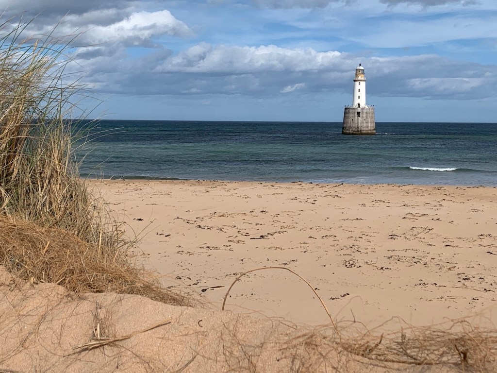
Rattray Head is a popular lighthouse, frequently visited and photographed, and I’m always a champion of the more obscure and less popular lights so I’d not paid much attention to it before beyond visiting it and finding out some key facts. It is an interesting one though. I always thought the access issue was an interesting one as it’s not so far out, but really tricky to actually reach, most often requiring the Northern Lighthouse Board staff to take a boat or later a tractor.
Rattray Head lighthouse
What I hadn’t realised, and perhaps foolishly, was that it used to have a foghorn standing on the stone base, next to the upper section of the lighthouse tower. I imagine the keepers there weren’t keen on the fog with the horn being in such close proximity to the tower! There’s a great picture online (originally from the Museum of Scottish Lighthouses) showing the foghorn in situ.
With our destination being Aberdeen and needing to pass through Peterhead anyway it would have been rude not to have stopped to see the twin harbour lights. I’d previously paid them a quick visit so they needed a little more time. The last time I was in the area I didn’t recall seeing the plaque on the side of the old North Harbour lighthouse, which contains some history. The plaque explains how the two lights were introduced by Thomas Stevenson in 1848 following a number of herring vessels being lost. It was believed that this was due to a lack of guiding lights in the area. Thomas Stevenson was also the founder of the Holophotal lens (prisms above and below the light source to reflect the light outwards) for use in lighthouses and these two towers became the first to have them installed.
Peterhead North Harbour lighthouse
The North light was removed from its original location, and then relocated and refurbished by CHAP Construction Aberdeen, Stonecraft of Elgin and Peterhead Port Authority. Although it was discontinued as an aid to navigation around 2004 it still features a light, but a much more modern type.
The Peterhead North lighthouse with the modern sector light inside
The South entrance light sits in a rather less frequented area (unless you work with the Port Authority or RNLI). This one isn’t quite as well kept as the North light, but you can still see the resemblance between the two. An image of the light while it was operational can be found here.
Peterhead Harbour South lighthouse
It was an interesting day, discovering a bit more about some of the lights in the area. There was plenty more to come the following day… 🙂