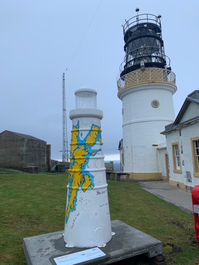
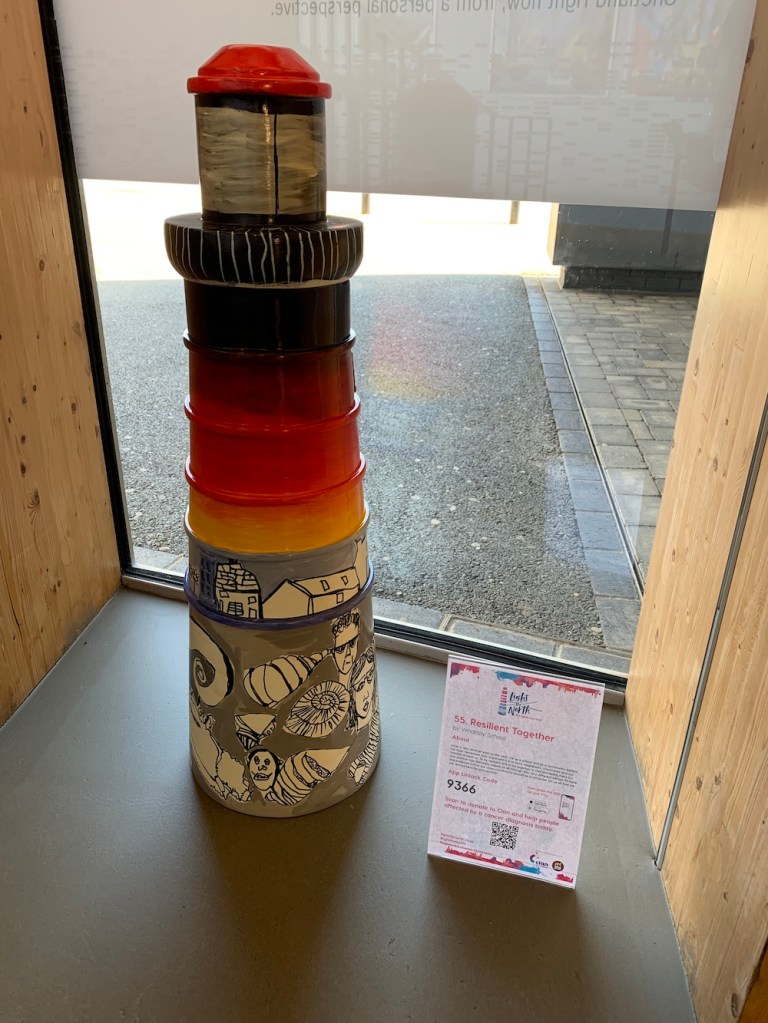
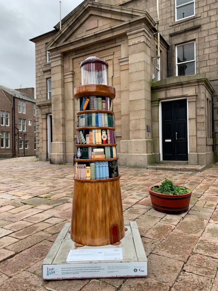
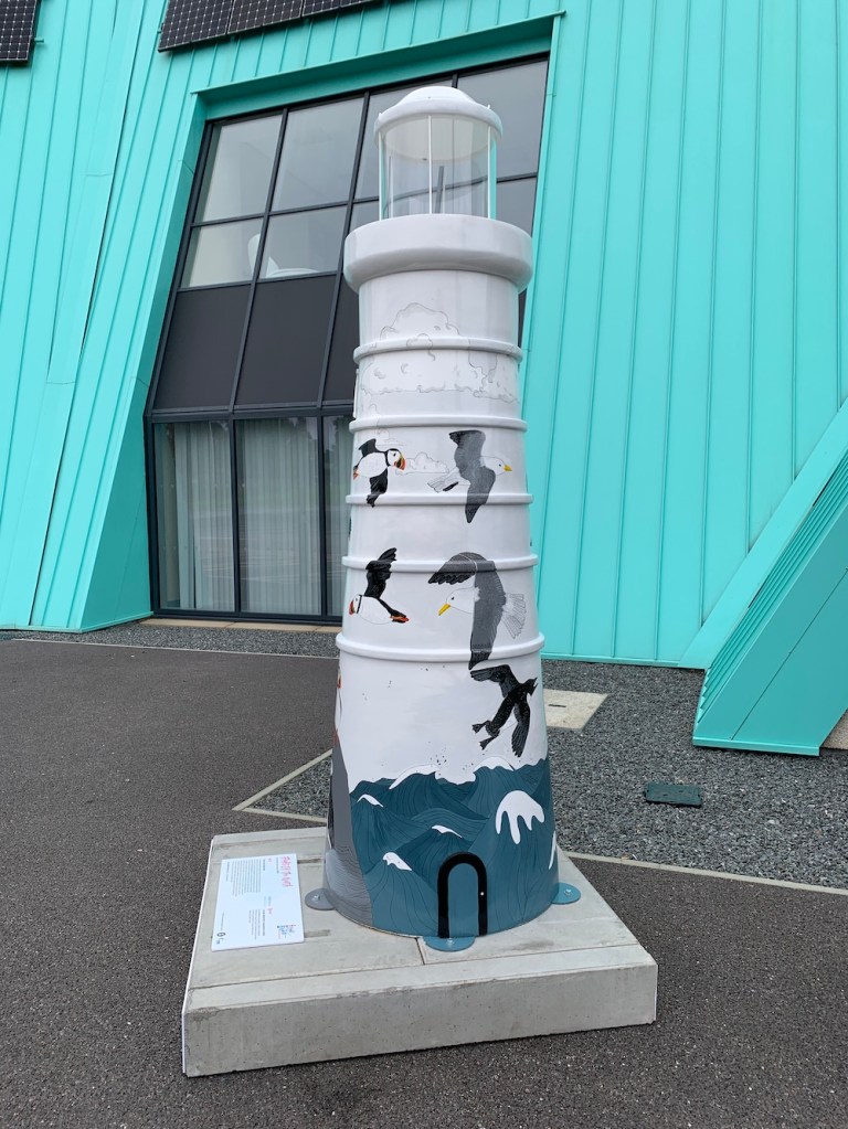
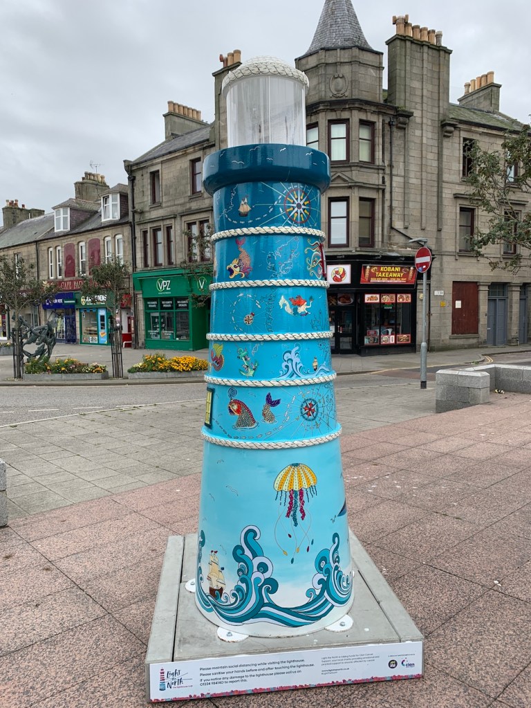
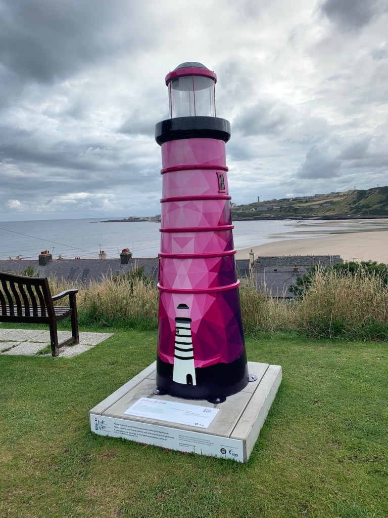
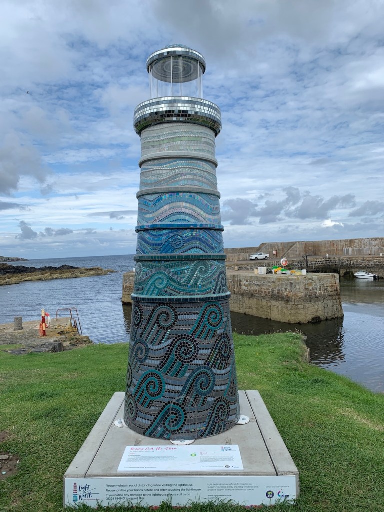
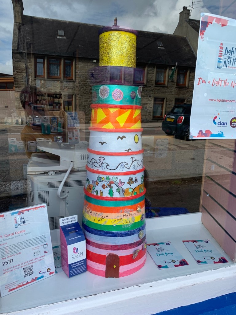
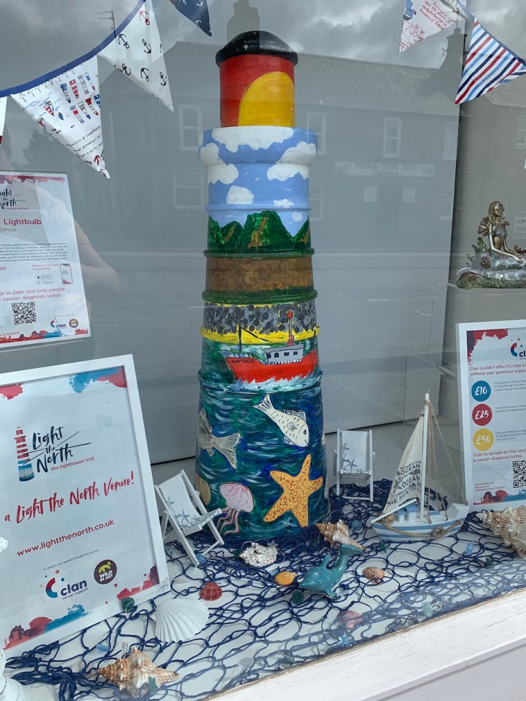
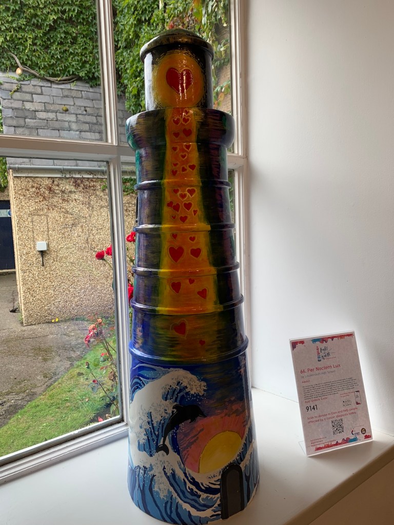
A week ago a brand new lighthouse trail was launched across Aberdeenshire, Moray, Orkney and Shetland. Light the North is a collection of 2.5 metre tall lighthouses designed/painted by artists, as well as a series of smaller lighthouses featuring designs from local schools.
Why is this happening, you may ask. Well it’s all for an excellent cause, Clan Cancer Support. Clan provides free support to those with cancer across the geographical area mentioned above. The outcome of the trail is that the lighthouses will be auctioned off in mid-November, raising funds for the charity.
The trail has an associated app, which features a map showing you where the lighthouses are, details about each lighthouse and also lets you collect the lighthouses by entering the individual code found on the plinth of each model. Trail maps with a suggested donation of £3 are available in various locations, or you can take a look at the website to find out more.
Anyone who knows me well will know that I can’t resist a list, especially when it is lighthouse-related. It worked out rather well us being in Shetland for the start as I was able to see those based there. Then travelling back via Aberdeen we followed the coast, picking off more as we went.
It’s great fun and I’m hoping to get a chance to see some more before the trail finishes at the end of October.
Here are some of the models I bagged over the past week. 🙂
It’s been the final full day in Shetland today, ending a 10-day period of absolute perfection in terms of achieving everything I wanted to. With only three days of no boat trips, plus an extra day for me to spend with the family, there was just enough time to get to the land-based lights I had left to visit.
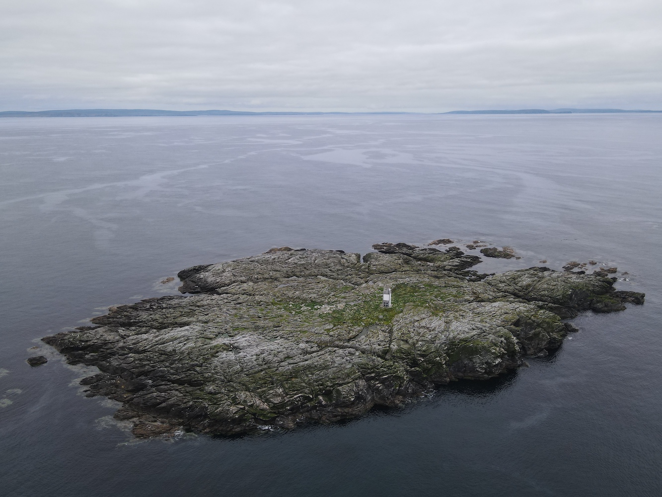
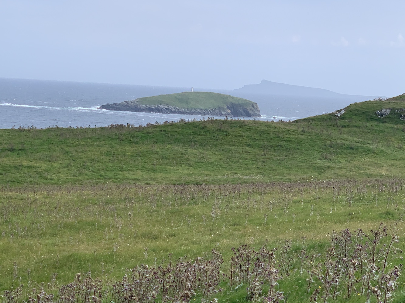
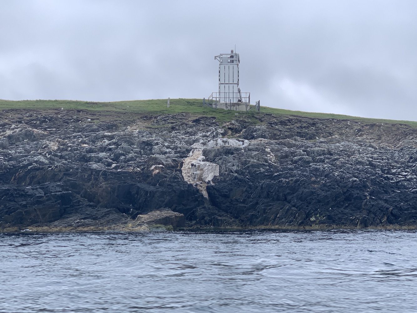
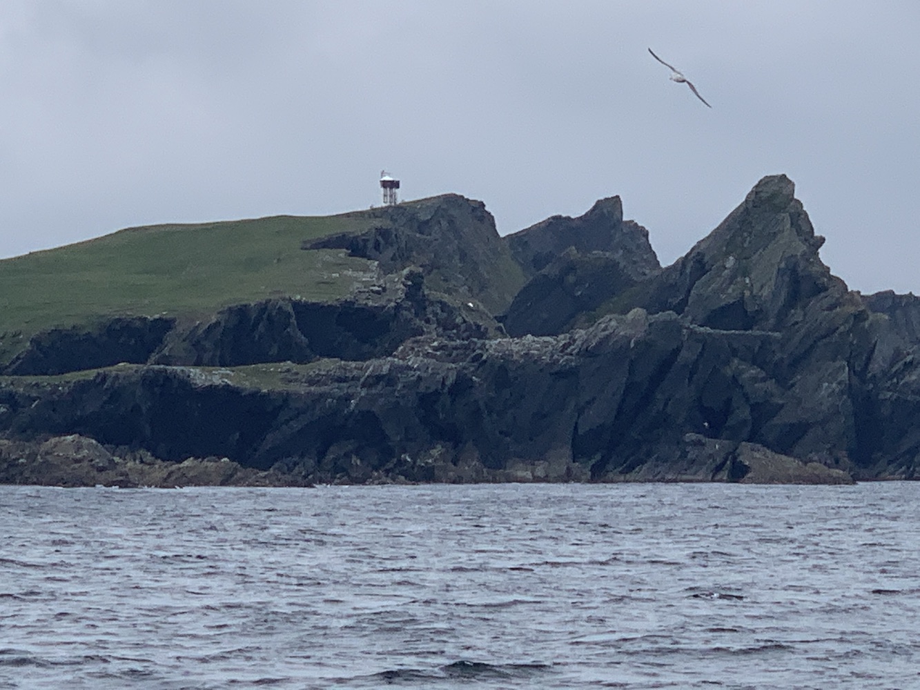
After the visit to Peerie Bard, home to Mousa Lighthouse, yesterday I have now visited all of the modern flat-pack (SPLAT) lighthouses in Scotland. There are a few I’ve not been close enough to touch yet, but have seen at very close range.
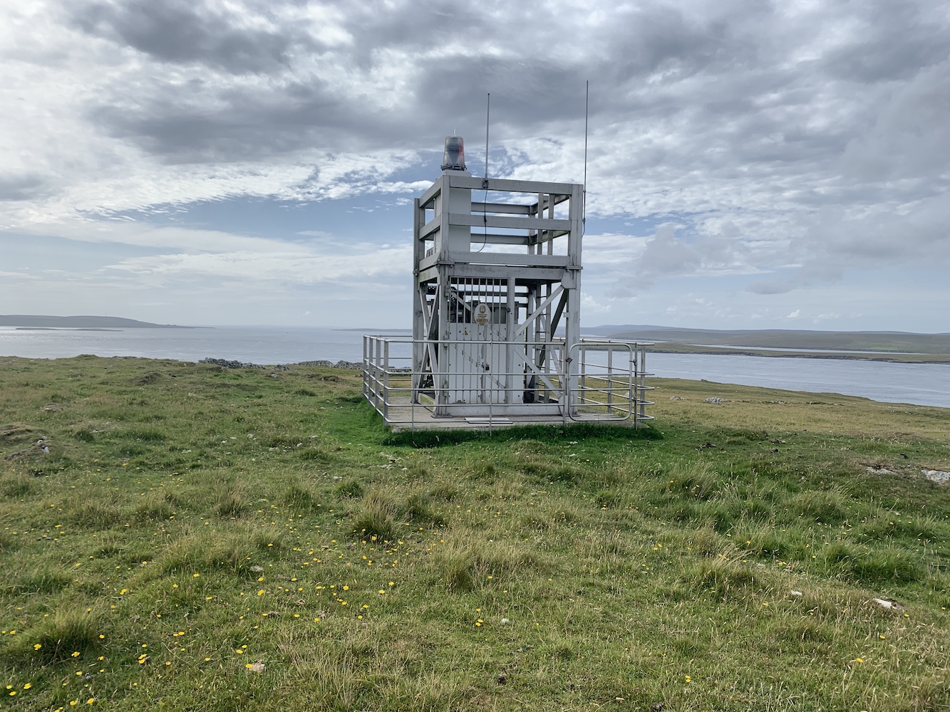
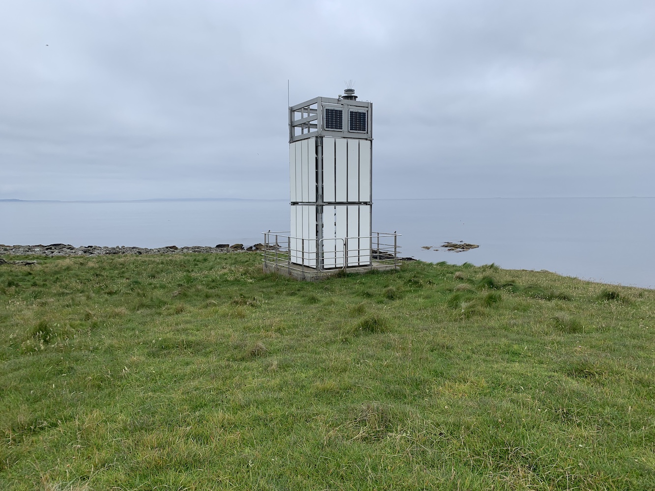
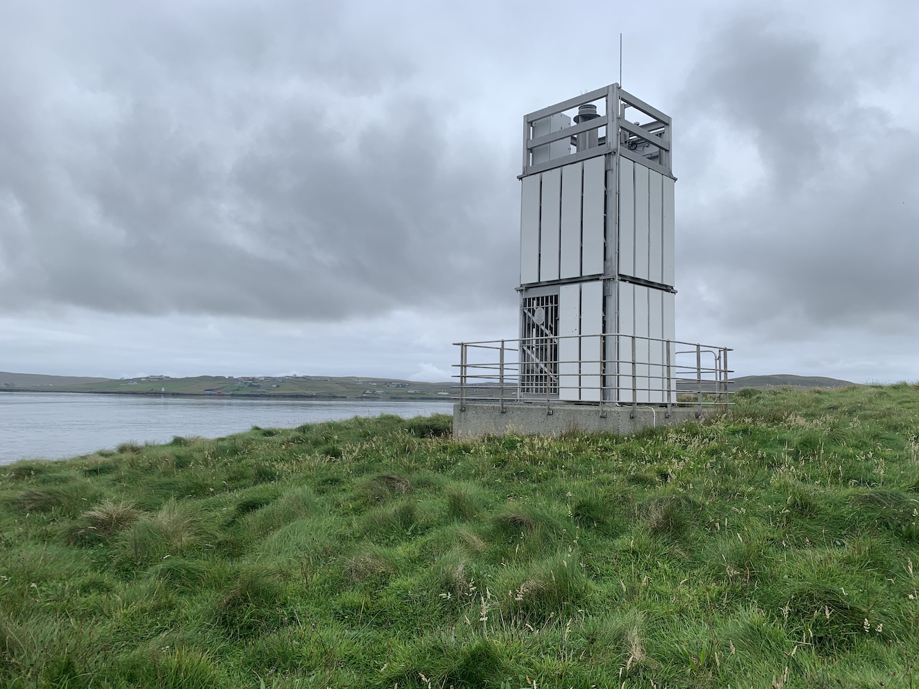
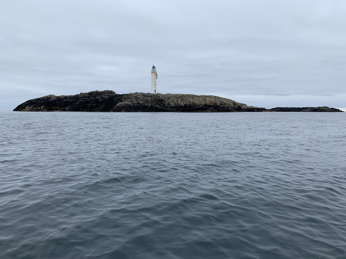
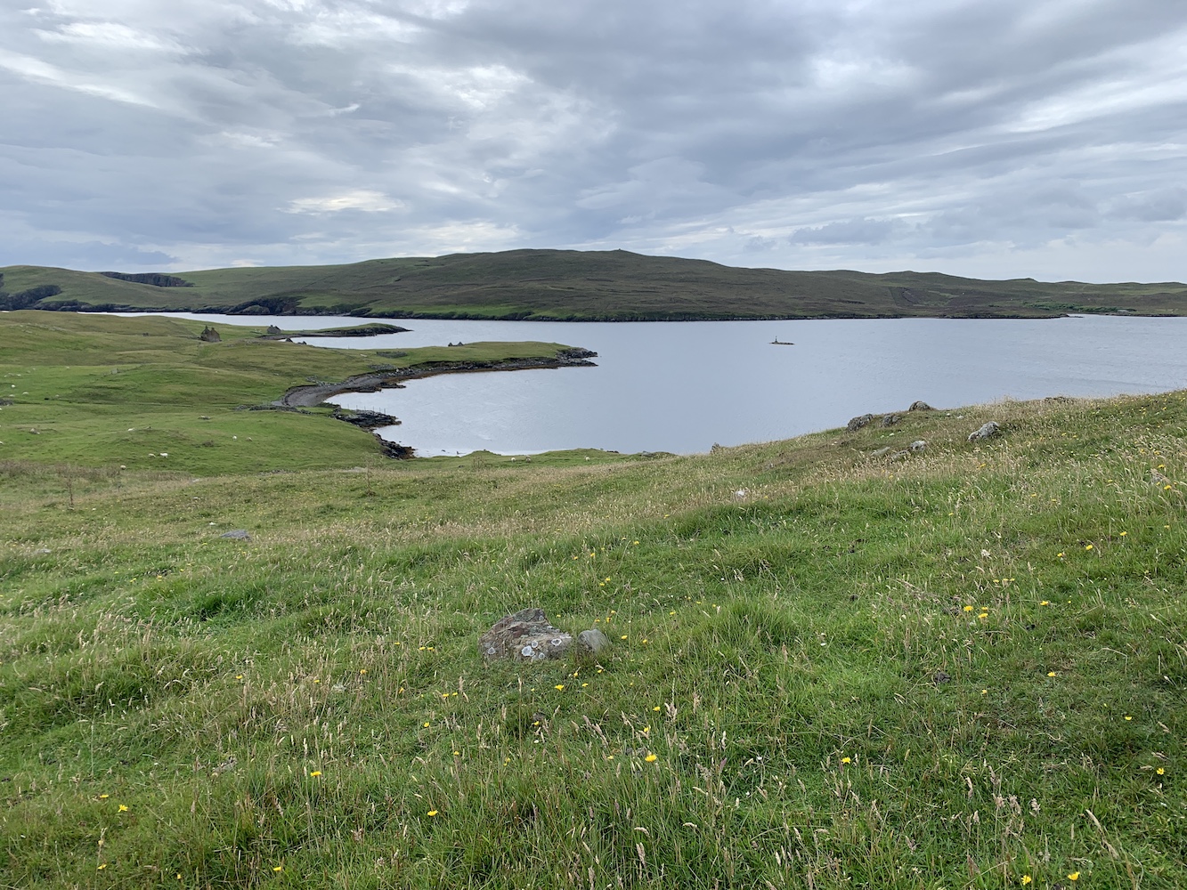
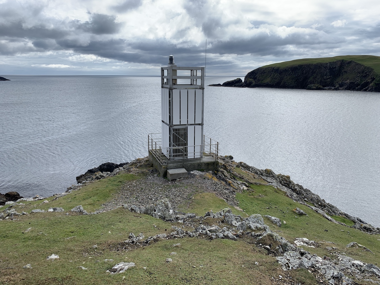
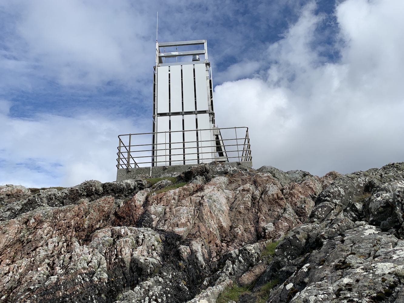
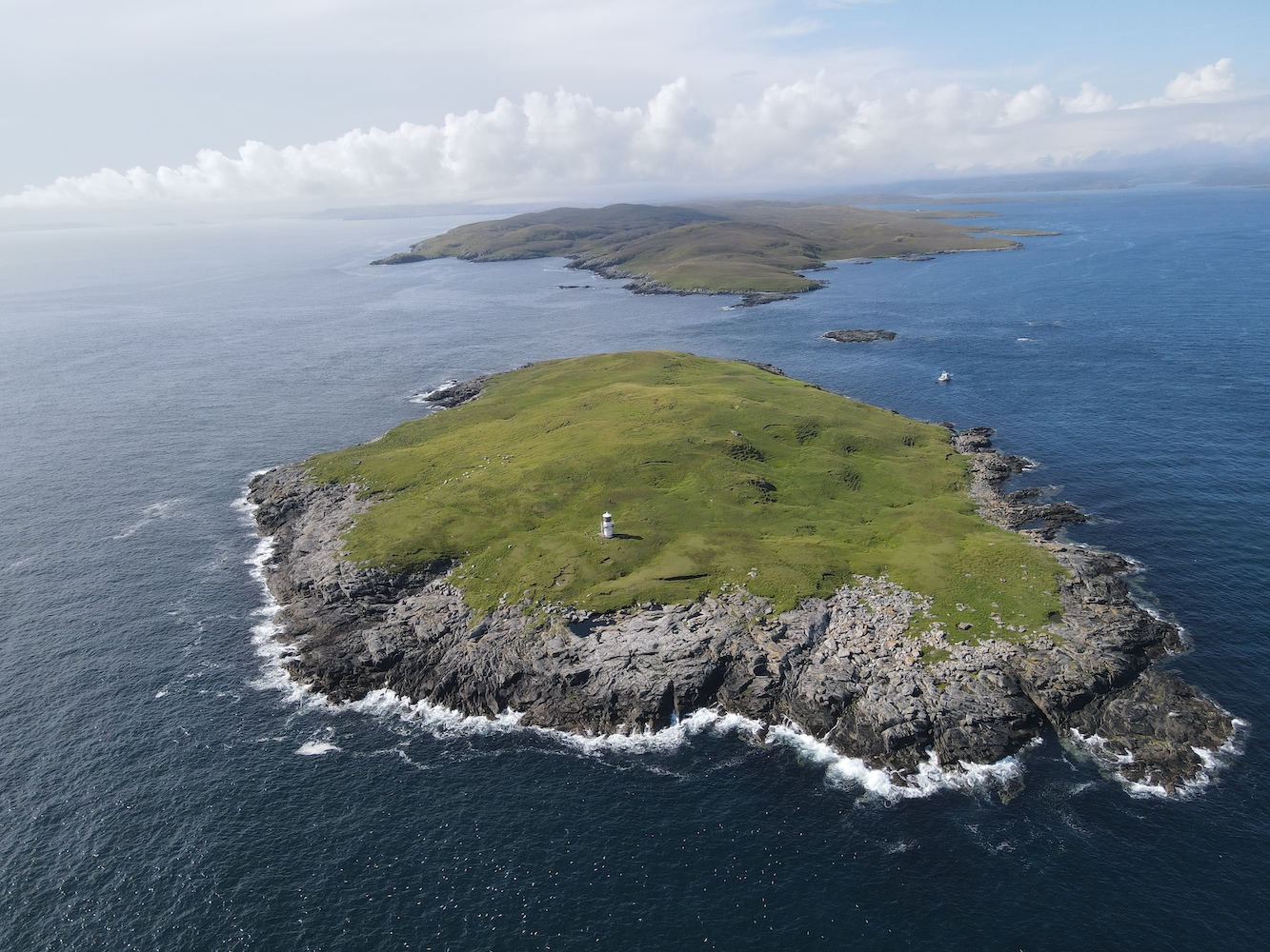
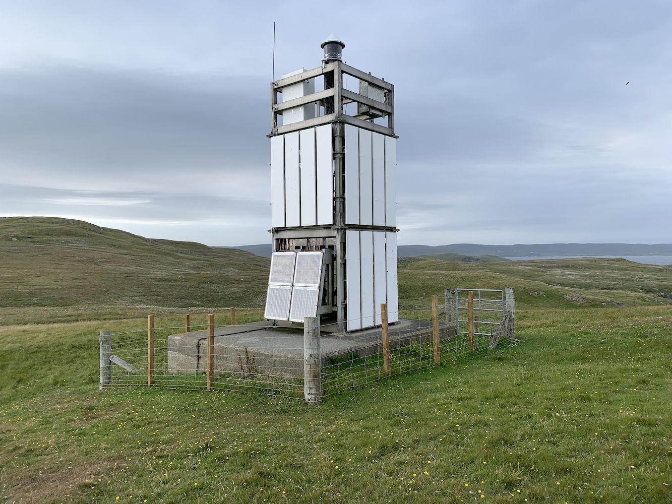
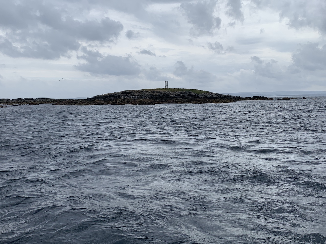
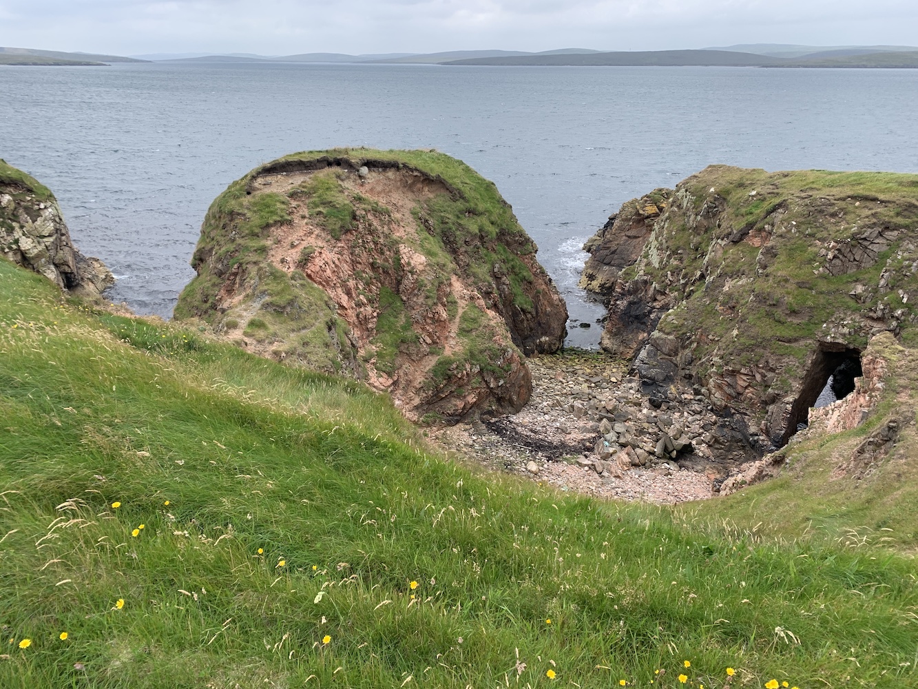
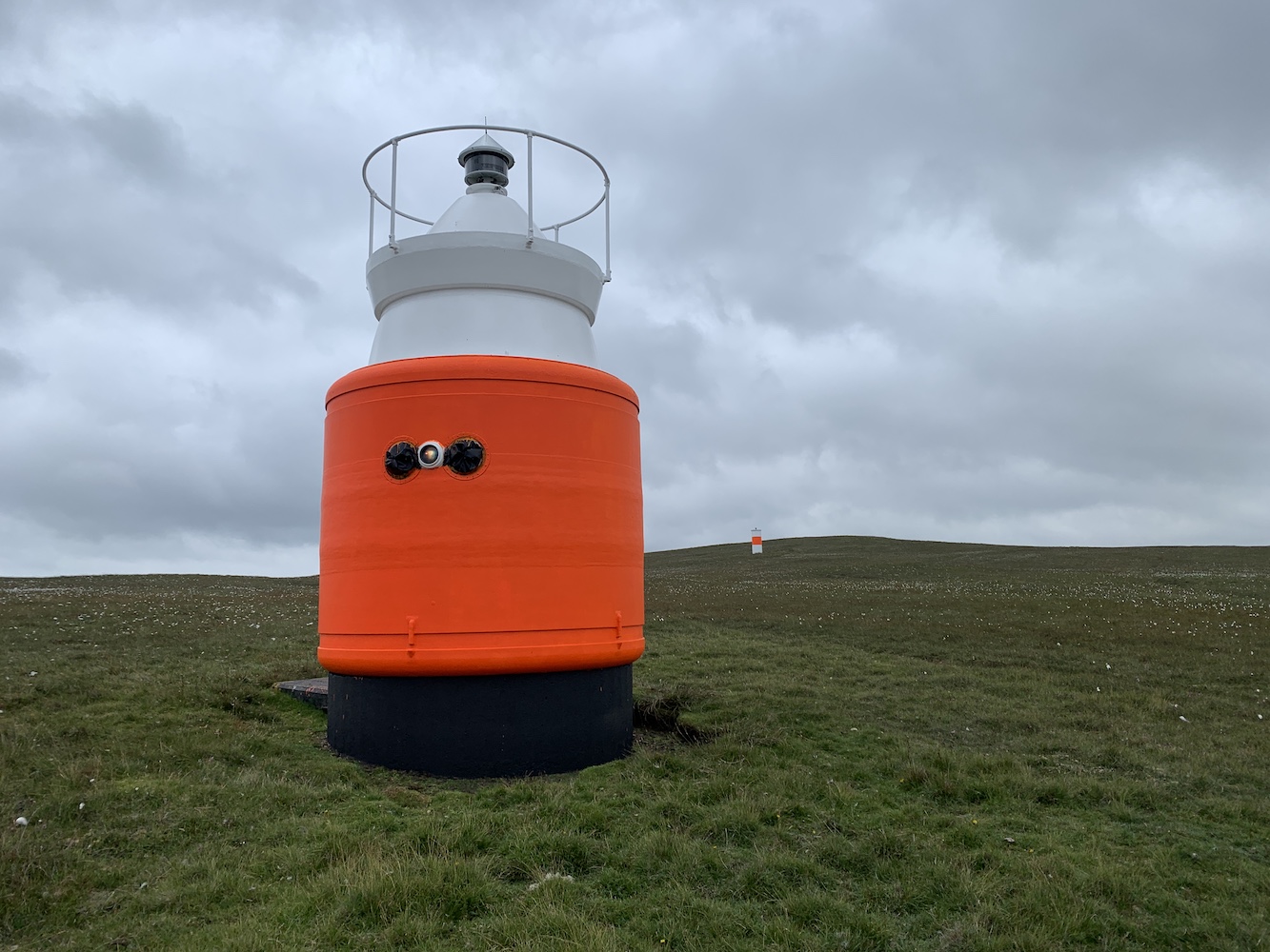
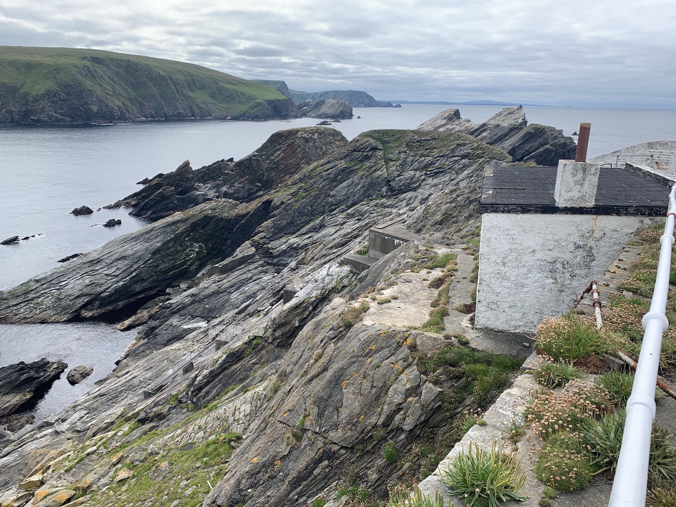
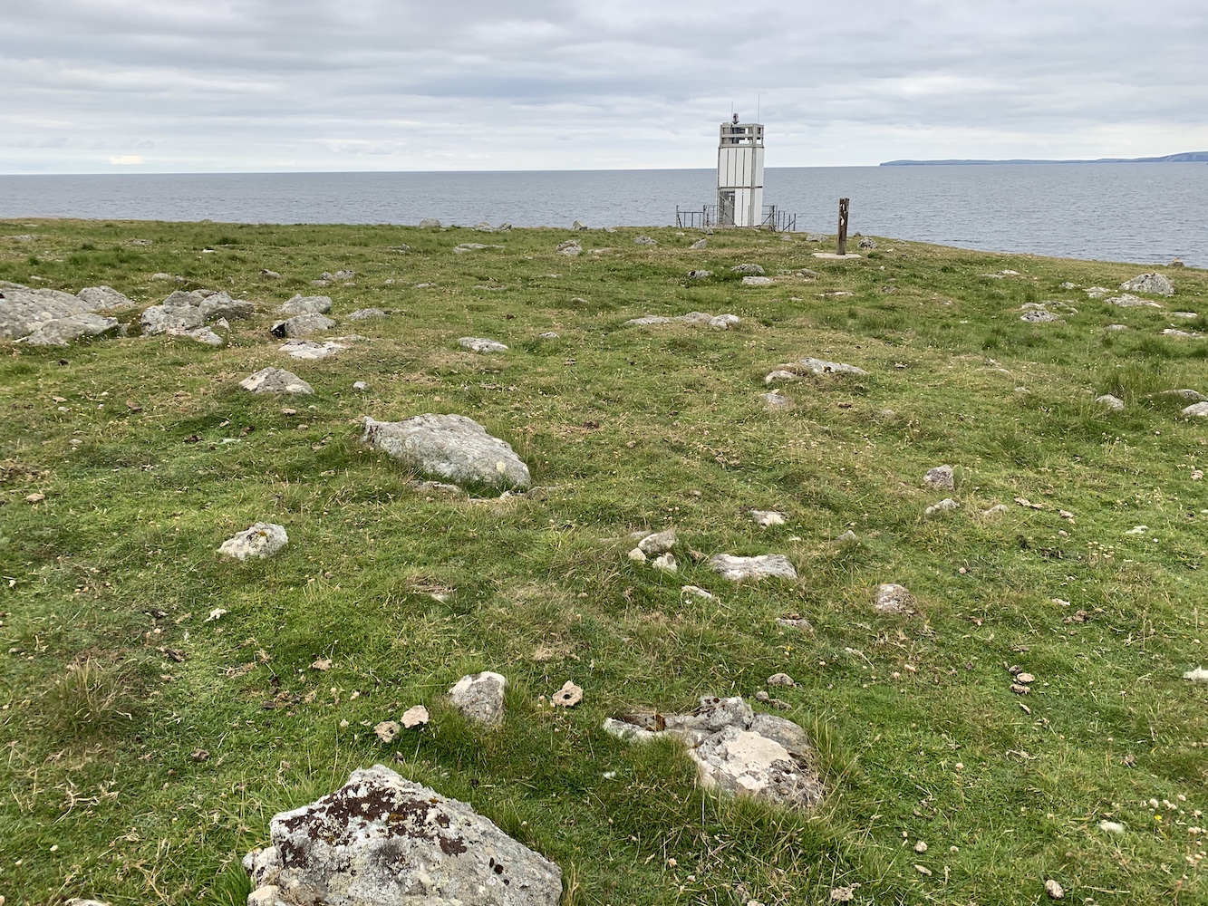
There was one, however, that had been mentioned to me and I’d not included on my list: Head of Mula. This one was built of the same aluminium framework as the flat-packs, but if didn’t have the white cladding on it, which to me is an open structure and therefore not meeting the criteria for inclusion on my list.
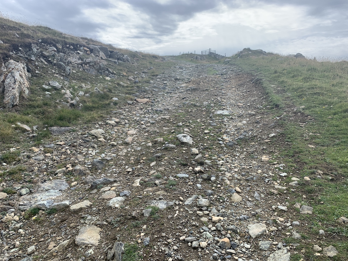
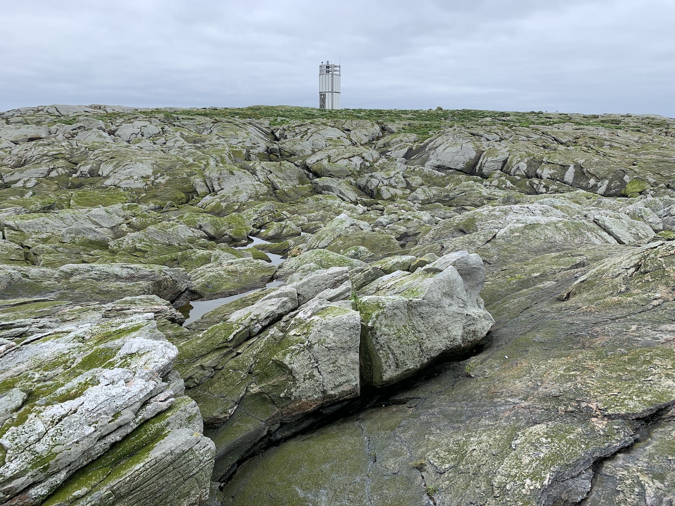
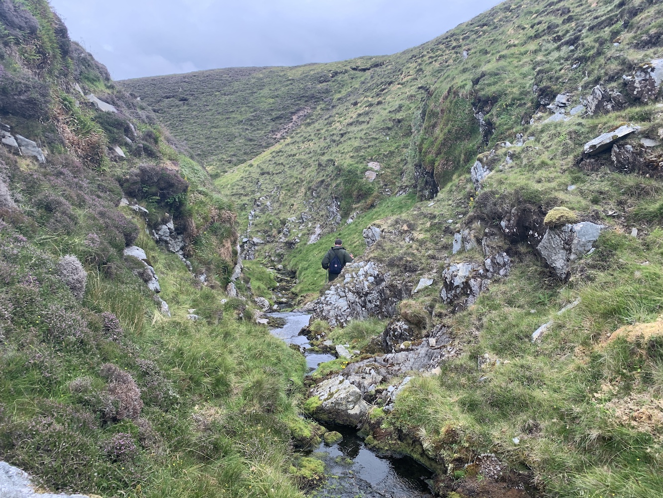
I mentioned Head of Mula to my lighthouse pal John and he was keen to see it. I thought it was definitely worth going along to check it out too, given that I am such a fan of the flat-pack type. It looked to be only a short walk from the ferry terminal on Unst. I wasn’t wrong. It is very easily accessed by following the main road north of the terminal for a short distance and then taking a right turn at a track heading uphill.
The track up to to Head of Mula
The track was great and after just a few minutes we spotted the top of the light just above an old wall ahead.
The light on Head of Mula
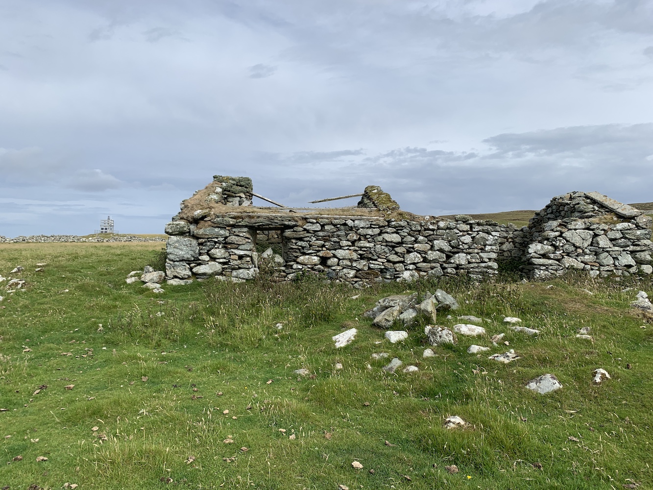
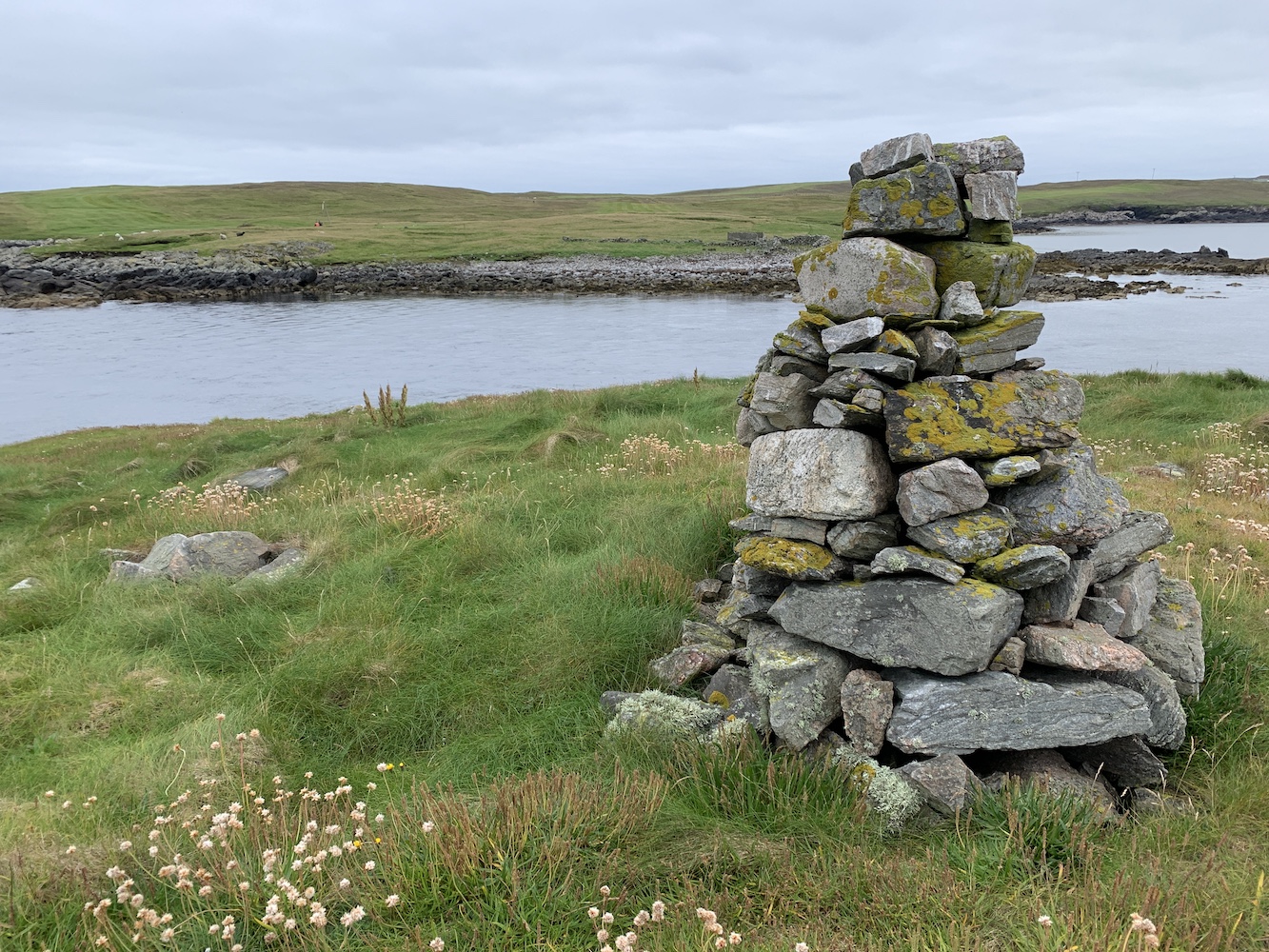
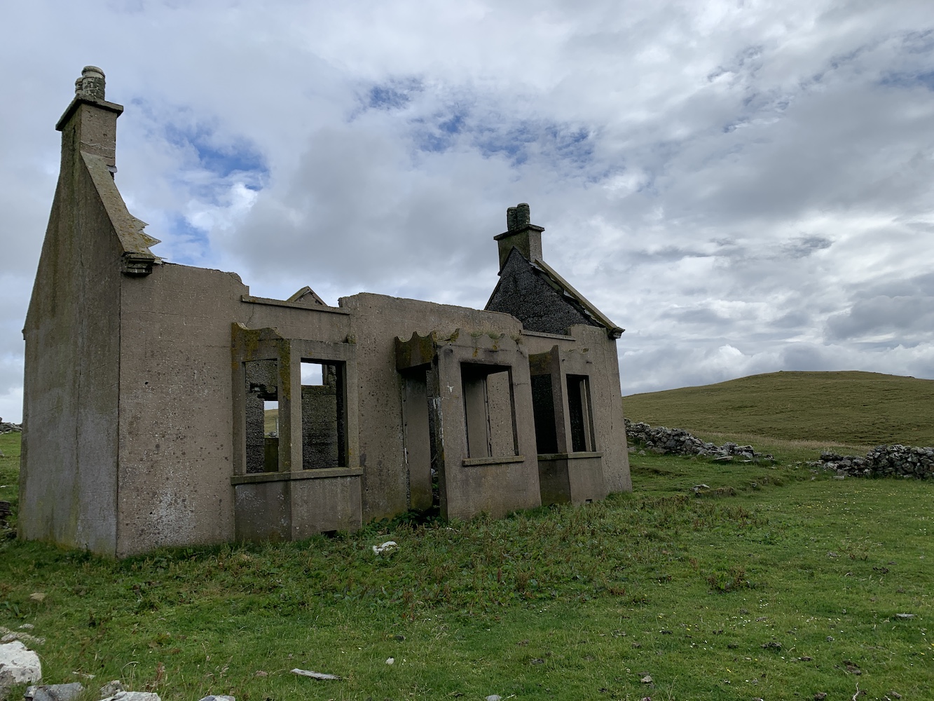
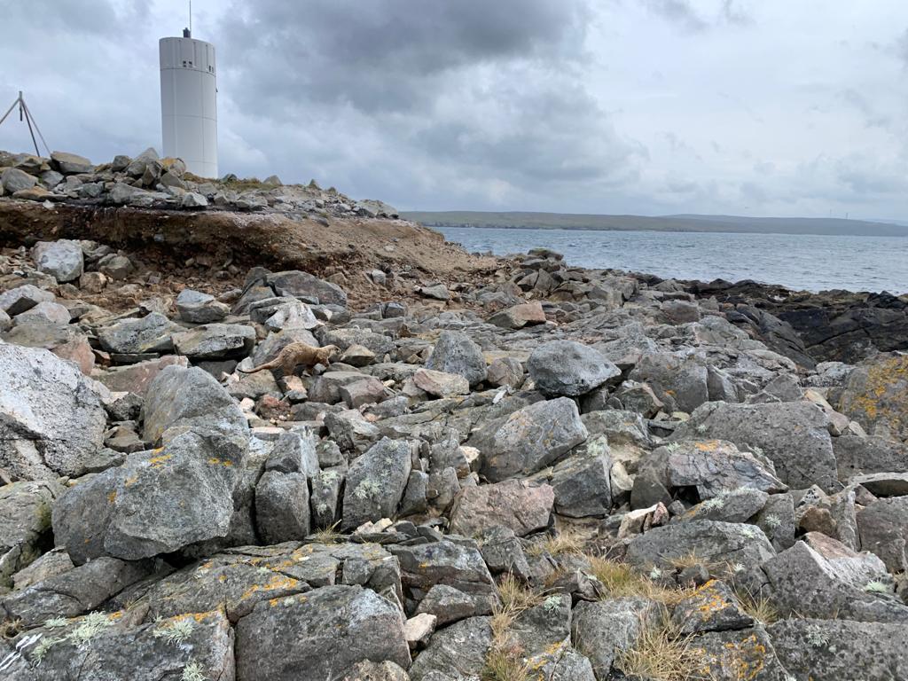
Beyond the lighthouse there were the remains of abandoned houses and it was really quite strange to be seeing such old buildings against the backdrop of a relatively new light structure.
The new light and the old building
The tower was exactly as had been described to me. This was where it got tricky though as the debate was then on as to whether or not it did qualify for my list. Is it possibly for someone to be enclosed within it? Not really. Someone could certainly step inside the frame, but they would still be completely exposed to the elements and visible to anyone on the outside. Therefore it doesn’t meet the criteria, but here is where the challenge has always been for me in preparing a definitive list of lighthouses.
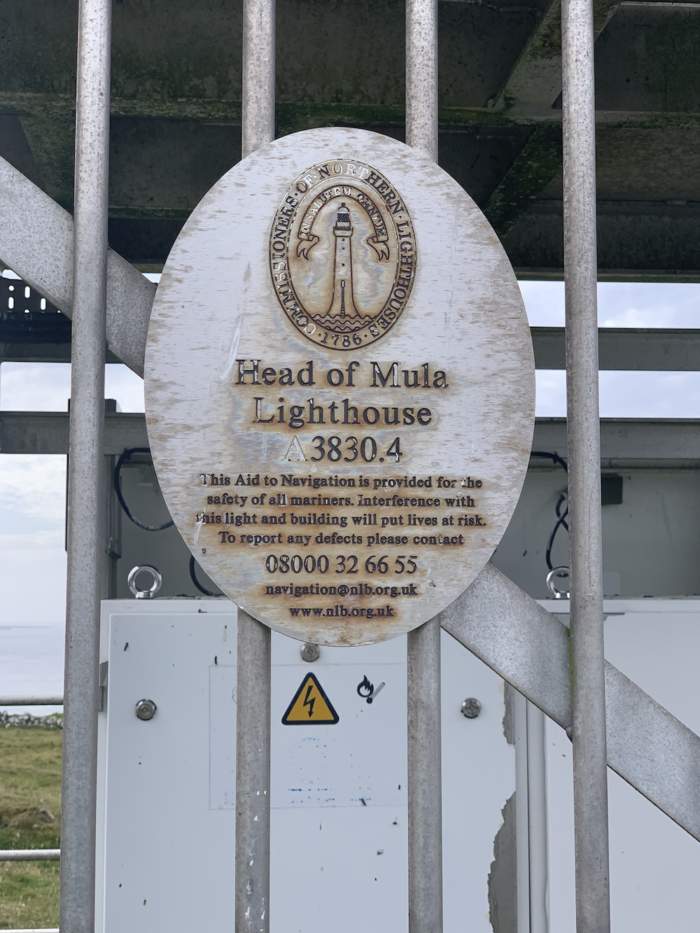
Head of Mula Lighthouse (as the Northern Lighthouse Board plaque on the door says)
I always wanted my list to be objective and based entirely on what did or didn’t meet the criteria. I am well aware that one lighthouse may mean a lot to one person and very little to another. I’ve seen plenty of subjective lighthouse lists for Scotland out there and they usually feature the biggest and most impressive of the Stevenson lighthouses, often leaving out the smaller lights that (in my option) are just as enjoyable to visit – if not more so in some cases – as the large ones.
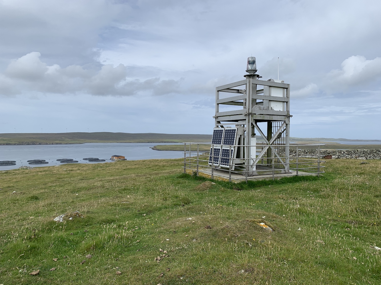
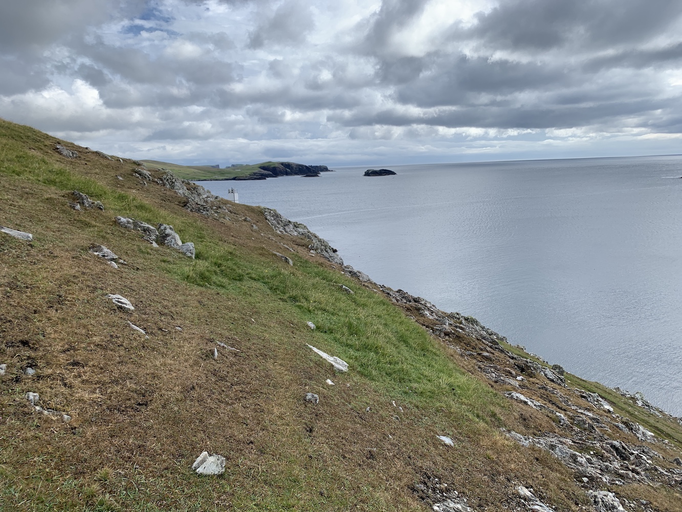
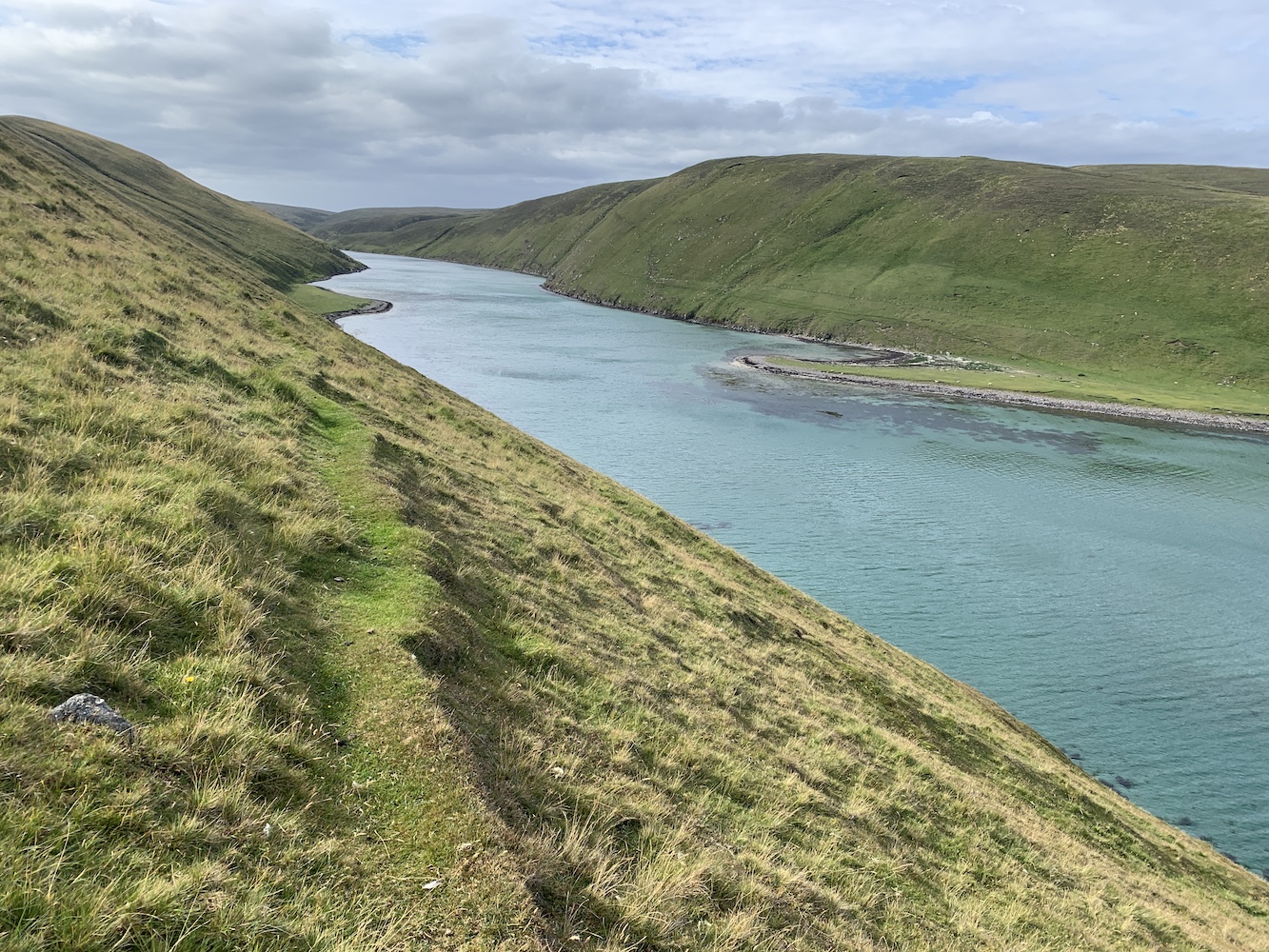
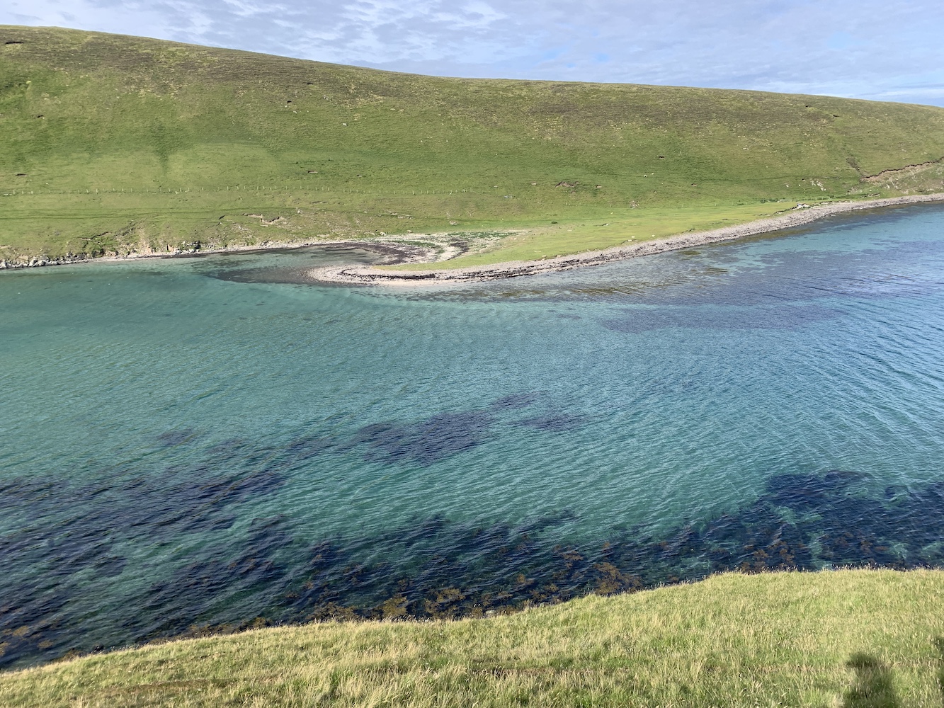
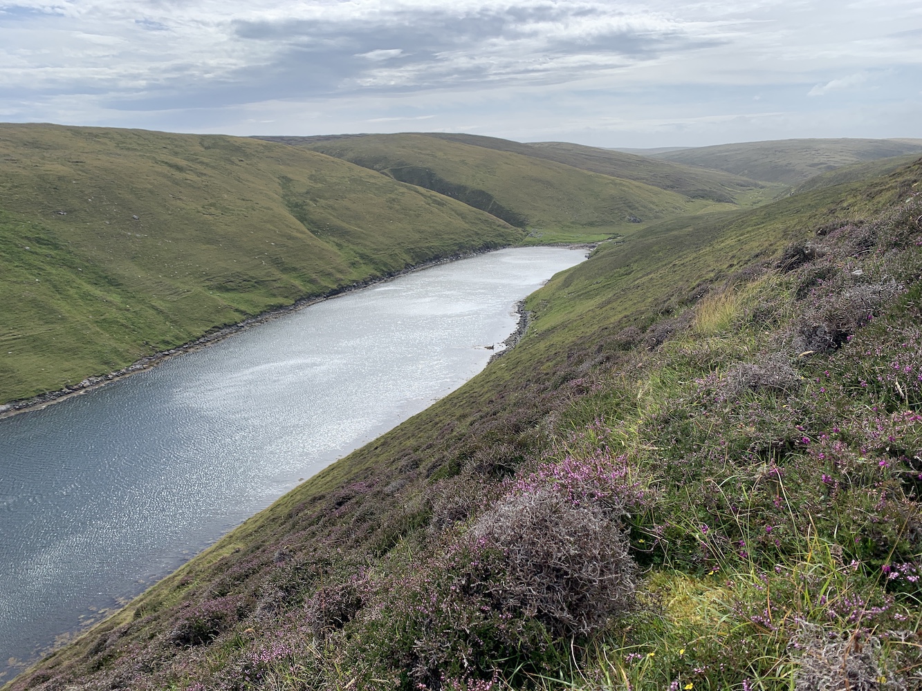
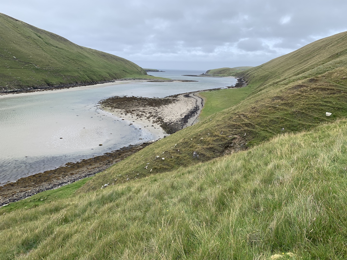
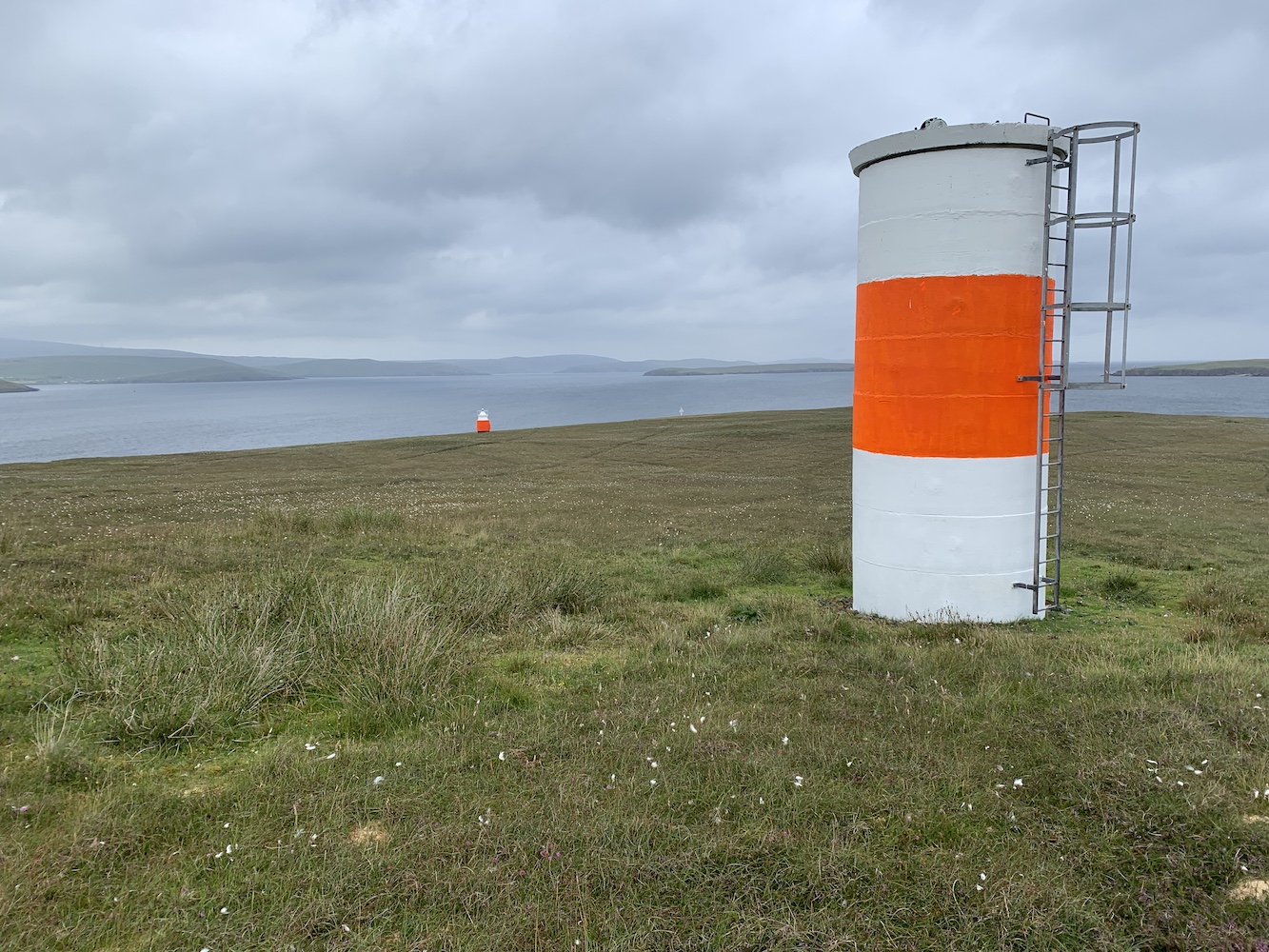
For me one of the big appeals of the flat-pack lighthouses has always been the beautiful places they take you to. Often places rarely explored by the masses and this too is the case at Head of Mula. The views here are fantastic, particular looking south/south east towards the Loch of Heogland and Holm of Heogland close in and then beyond to Fetlar.
The view to the south east
Looking west over Bluemull Sound was also excellent and the ferry moving back and forth between Yell and Unst was a regular reminder that civilisation was just down the track.
The view to the west
The light at Head of Mula has everything going for it that most flat-pack lighthouses have, except the white cladding. We jokingly referred to it all day as the ‘naked flat-pack’ due to its lack of white cladding “clothes”.
A closer look at Head of Mula
Thinking about my list, there are some lighthouses on there that I would be more than happy not to visit again, usually due to their location, but I’d happily stroll back up to Head of Mula again. This is where I feel a little envious of those who have their own personal list and can add/take away anything they please. From the point of view of The British Lighthouse Trail though, I need to be less subjective and not adjust it to become a list of lighthouses I personally think people should visit – although I do think that would make an excellent list.
The final decision on Head of Mula then? I’m going to have to say that the jury is still out. In terms of meeting the definition it’s a no. But if I think it’s important that people get to hear about it and visit it then absolutely yes. If any readers have any thoughts on this then do feel free to share these below in the comments.
The plaque on the lighthouse door
Back to Shetland though and, as mentioned in yesterday’s post, the past 10 days have really been made so successful by the crew on the two boats we have used. Kevin, Michael and Alan on Lysander and the wonderful aluminium tender were exceptional. Magnie and John on the Papa Stour and Ve Skerries trip were more than happy to get us wherever we wanted to go too. It makes such a difference to have boat crew who enjoy their time out with the baggers. It was a real pleasure to spend time with them all.
That’s it for another trip. I’m not sure where the next one will be yet, but I shall be sure to take my followers on here along wherever it is and report back. 🙂
It’s been another day onboard Lysander in Shetland today and it’s really starting to feel like home now. With Michael the fantastically knowledgeable and friendly skipper, and the equally knowledgeable and skilled tender skipper Alan, we have been in very good hands.
My first lighthouse stop of the day was Wether Holm. We were informed by Alan that ‘wether holm’ is the name given to islands where the sea gets shallower and breaks on the island. There are plenty of Wether Holms about in Shetland, but only one of them has a lighthouse. This is a flat-pack lighthouse and after we were dropped off it was just a quick stroll up to it. There were nice views across to Whalsay from the lighthouse including Suther Ness Lighthouse just across the water.
Wether Holm
Wether Holm Lighthouse
Wether Holm Lighthouse and you can just make out Suther Ness Lighthouse on Whalsay in the background
After we left the island Joe the Drone went for a fly and got some great aerial shots of the island and surrounding area.
Wether Holm from above
The tiny Wether Holm Lighthouse in a grand landscape
Next we landed on Inner Holm of Skaw. There’s no lighthouse here, but we were told that there were stories suggesting there was a human skull to be found near the cairn on the island. This intrigued us all so we took the opportunity to have a hunt for it, and with success too. Lying under a flat round rock close to the cairn were indeed bones. There was part of a skull, a jawbone still with some teeth in it and a few other bones too. It was very strange. Bob pointed out that there was a chapel marked on the map and when we looked back towards the cairn there was evidence of rows of stones that could well have been the walls of the old chapel. Our skipper looked into it a bit more and was informed that the remains are actually believed to be of the monk who built the chapel there.
The cairn on Inner Holm of Skaw
Onto my second new lighthouse of the day, Muckle Skerry. We’d considered landing on this one two years ago, but it had been raining and – given my experience of it today – I’m glad we didn’t. It’s a skerry so it’s rock really and although it looks from a distance like it has some nice grass on top it’s really just flora and fauna that thrives in wet environments combined with an occasional hard bit of soil and then random rocks in and around it all.
Muckle Skerry
It took us a little while to pick where we would land. The side of the island looked like any landing there would involve a scramble up rocks that looked green and potentially very slippery. We made our way around the island on the tender coming across another potential landing area where there turned out to be too many rocks just under the water. We then found a deeper section which got us onto some barnacle-covered rocks followed by a short section of slippy rock and then it was rock hopping all the way up to the mixed terrain described above.
Muckle Skerry Lighthouse
Muckle Skerry Lighthouse is another flat-pack and this time without a fence around it. There are great views all around which always make the less straightforward landings more worthwhile. It’s certainly somewhere you would struggle to land without the near perfect conditions we had today. We were very fortunate with sea conditions today.
Muckle Skerry Lighthouse, surrounded by the varied terrain
Joe was launched from the boat and caught some pictures which hopefully illustrate the tricky terrain of this one.
Muckle Skerry from Joe’s eye view
A very skerry-looking Muckle Skerry
We were bound for Out Skerries next. There are so many islands within this group that it wasn’t surprising that to save time we all dispersed a bit. Skipper Michael and I were dropped off on Bound Skerry, home to Out Skerries Lighthouse. Michael had never landed on the island before so we left the big boat moored up on the main island and Alan took us across.
Out Skerries Lighthouse on Bound Skerry
Although I’d been to Out Skerries Lighthouse before it was really nice to visit it with someone who was really looking forward to getting there. We had the island to ourselves for some time before the others arrived and we took a stroll around the rocks, getting as far to the east as possible so Michael could reach the most easterly he’s ever been in Shetland. One particular view from the highest point of the island was excellent with the lighthouse in the foreground and the shore station on neighbouring Grunay beyond.
The lighthouse on Bound Skerry
The walkway linking the lighthouse and the landing point
On a calm day it’s very hard to imagine how wild it must get there. Today is just seemed so tranquil and serene. For a while I sat at the base of the lighthouse and just enjoyed being there – that was until Bob came and asked me to move so I didn’t get in Joe the Drone’s pictures! However, I can’t complain as he did get some superb images. The blue sky appeared too!
Bound Skerry with its own lighthouse
A few hours – and a number of islands – later we arrived at Hoo Stack. John as well as Alan the boatman were keen to land here and I went ashore too, but stayed down on the rocks. I’d already been to this lighthouse back in 2019 and with the swell picking up I didn’t want to slow anyone down. The swell had picked up a fair amount by this point so landing wasn’t so easy, but we all did it and stayed dry, and John and Alan were happy.
Hoo Stack from above
Hoo Stack and its lighthouse
It’s been a long day, but another successful one. Mervyn has now set foot in one way or another on over 100 islands so far and I just have one lighthouse left to achieve my personal goal for this trip. That one is lined up for tomorrow. All fingers are crossed 🙂
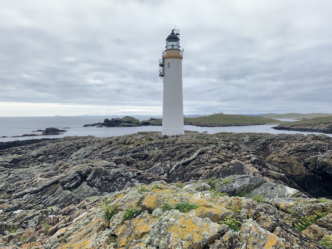
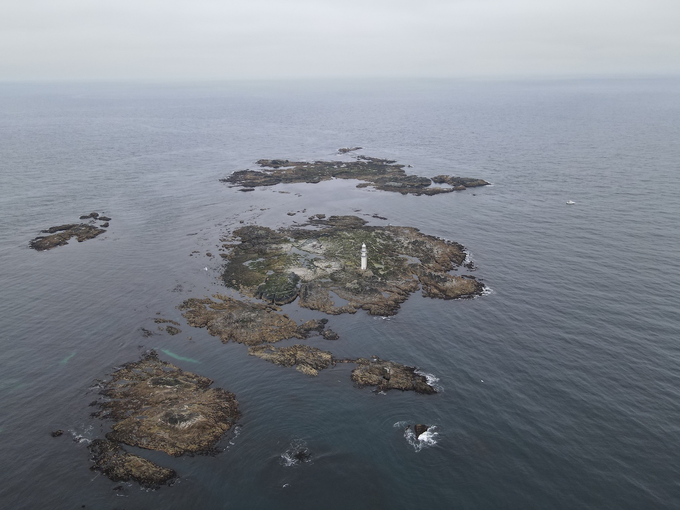
It’s been some day today and certainly varied, taking in two very different lighthouses in extremely different settings. It is the day I have been waiting for, to make it to the remote and challenging Ve Skerries Lighthouse.
Leaving from Aith this morning, we set off for Papa Stour with our skipper Magnus Scott and John Anderson from Simmer Dim Charters. All four of us baggers on board had something of interest on this island that’s not so easy to get to, with one ferry a day in each direction only three days a week. For me, or course, it was a lighthouse – or, as I call it, a lightbox.
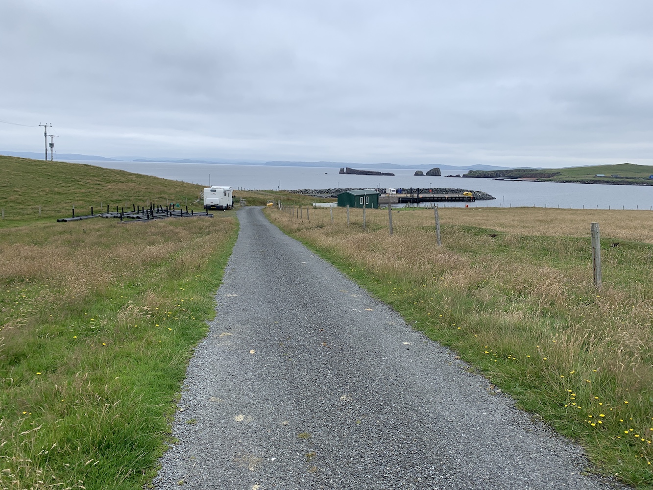
Upon arrival at the island Bob and John set off for the island high point and trig pillar while Mervyn and I took a stroll along the road, discovering quite a lot about the island community. For a start they have a great ferry terminal with tea and coffee making facilities, a book swap, a nice seating area and toilets.
Looking back at the pier on Papa Stour
There aren’t many houses on the island and those that are there are scattered alongside the road that runs from the pier to the airport landing strip. There’s a Primary School which has been closed now for around 8 years and the population of the island is just 6. A small community, but a really wonderful one which embraces its island and its history. This is very clear to see throughout Papa Stour.
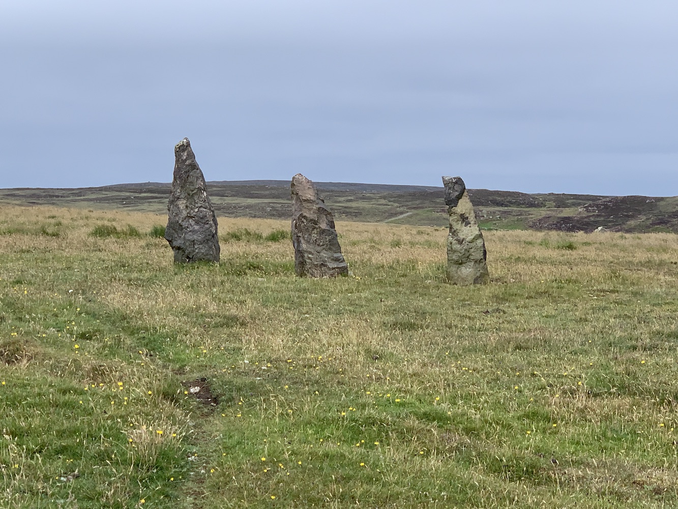
Standing stones on Papa Stour
There is a wonderful ‘stofa’, an old Norwegian-style house made from carved wood. This was built in the place of a former stofa, but part of the build project was to allow younger people to learn the traditional skills of Norwegian building. It is really quite beautiful to see how well-constructed it is.
The Norwegian stofa on Papa Stour
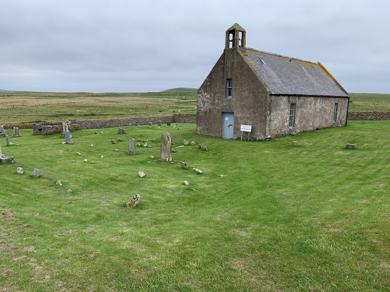
We also took a look inside the Kirk, which is perfect for a small community. The building features a stained glass window that was designed and made by the locals to commemorate the lives of the four men from Papa who lost their lives during the Great War. It also contains a prayer tree which people can hang messages on explaining who they are praying for. There is also a small room with local history information and some locally made products for sale.
Papa Stour Kirk
From the Kirk we walked around to East Biggings and then began the attempt to reach the lighthouse. It had been visible nearly all the way around the road, but we’d not spotted a clear way to reach it. On our return journey we found a gate and followed the edge of a field down towards Housa Voe. Through one more gate and another field and we were there.
The field we walked around the edge of to reach the lighthouse
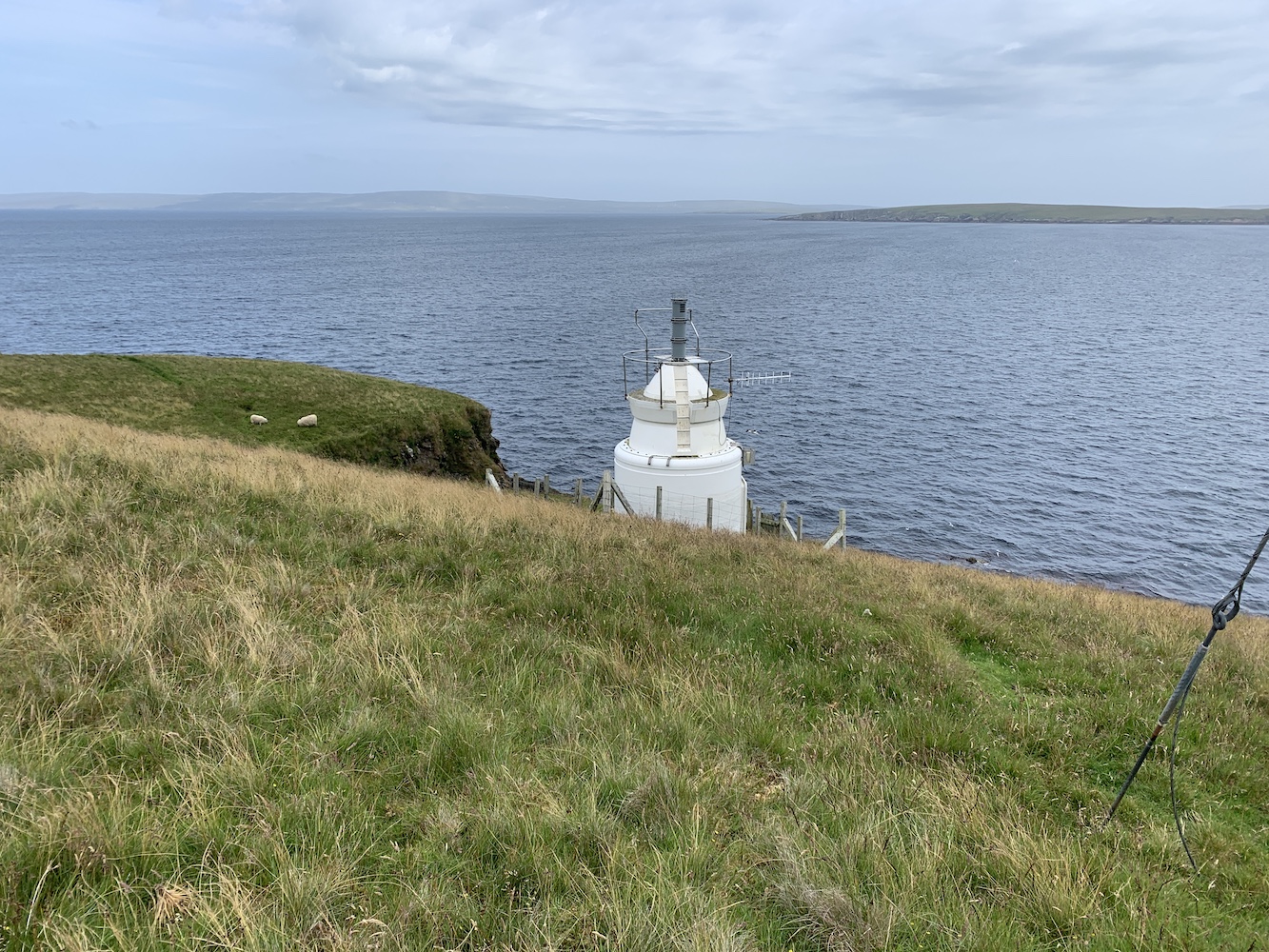
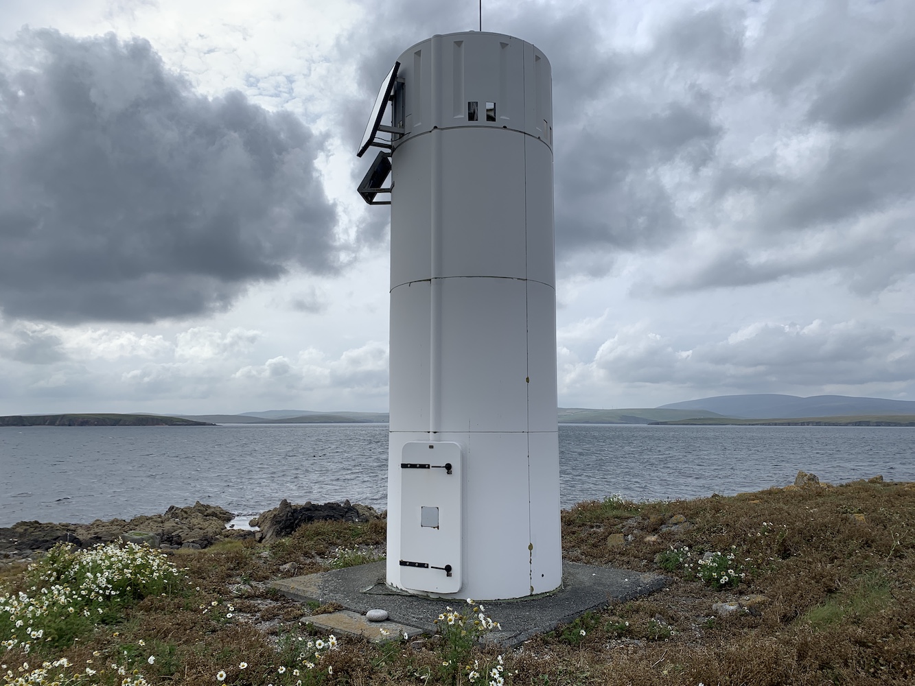
I would never say that these little lightboxes are anywhere near the most impressive, but they certainly do the job. The one here at Housa Voe is a similar type of structure to the two at West Burrafirth. It’s essentially a small square dry dashed building with a door at the back and a directional sector light shining out the front. There’s little more to it than that, but you can see when you step into the path of the light that it does it’s job very effectively. I had some fun for a few minutes walking back and forth in front of it and watching the red light change to white and then to green. This light is owned by Shetland Islands Council, which sort of explains its appearance. Clearly its purpose is to guide vessels safely into Housa Voe.
House Voe Lighthouse from the landward side
House Voe Lighthouse
House Voe light source
It was nice to introduce Mervyn to this type as well as they are very rarely visited. I’m not sure he was particularly impressed, but he pretended to be which was good of him. This is one of the delights of lighthouse bagging, discovering new places above and beyond just looking at the lighthouse.
The green light in House Voe Lighthouse
We left the lightbox behind and headed for the ferry terminal for a nice cup of tea. Even the waiting room is a trove of historical treasures relating to Papa Stour.
A little cove near the lighthouse
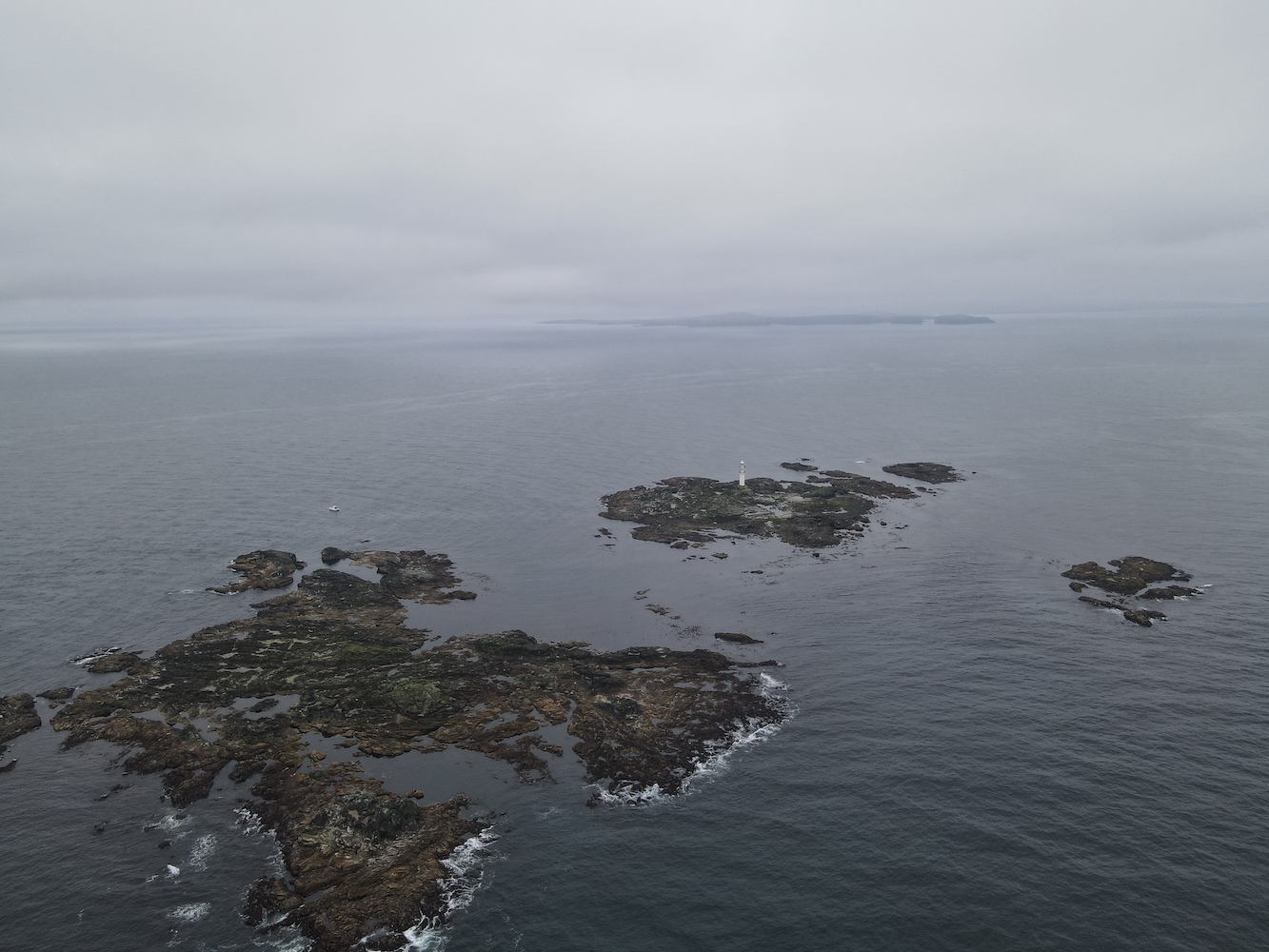
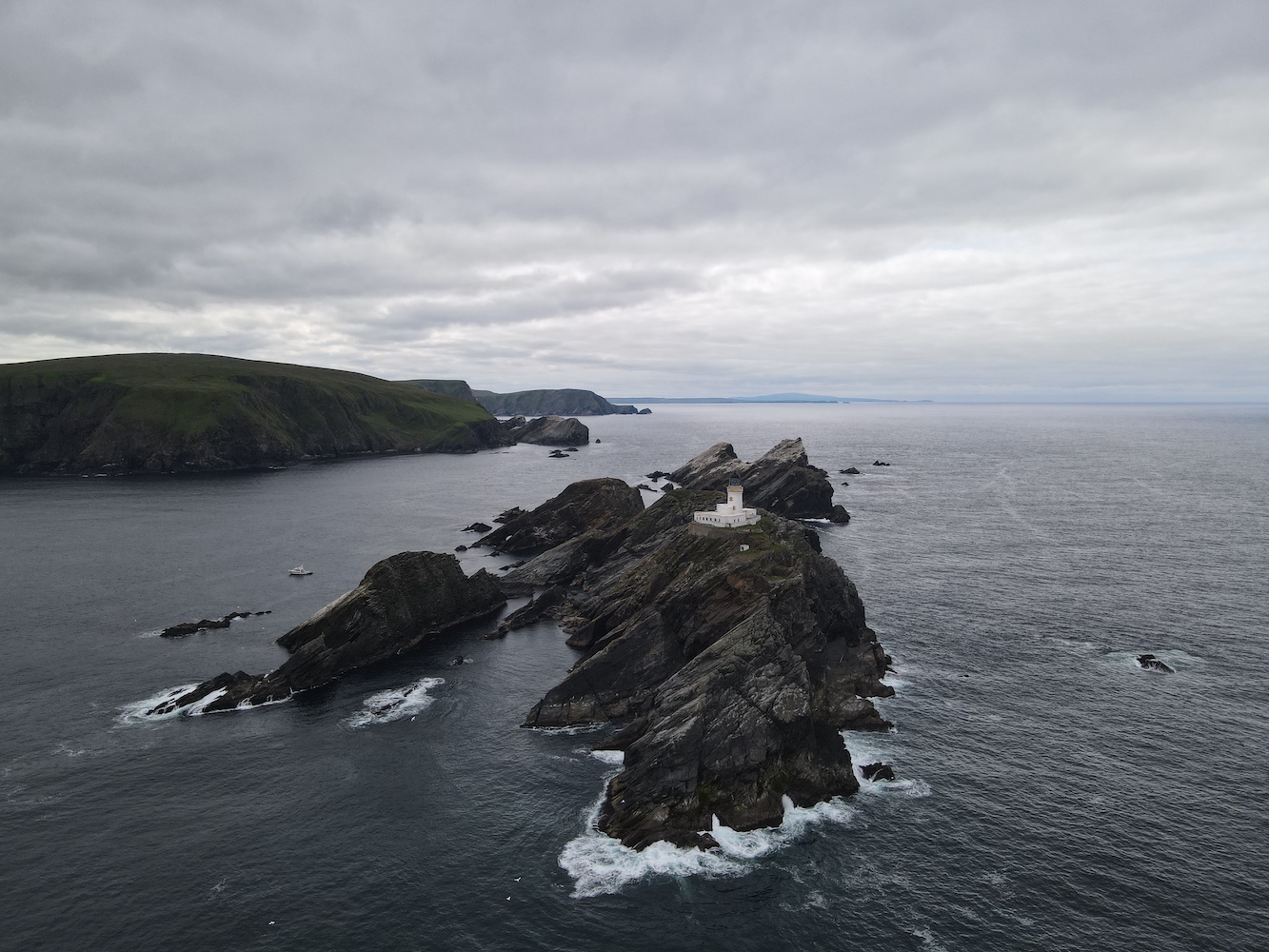
Once we were all back we set off to a few islands off of Papa Stour before we began to head north west towards a little collection of rocks called Ve Skerries. I’m not sure how well known Ve Skerries is in lighthouse circles. When you are as into lighthouses as I am you sort of lose any sense of what others do or don’t know. Anyway, for those who don’t know, Ve Skerries is a collection of very small islands/large rocks off the west coast of Mainland Shetland. They mark the most south westerly point of St Magnus Bay. On a clear day you can just make out the lighthouse in the distance from Eshaness. It is renowned for being a very dangerous area for ships with numerous wrecks occurring there. The most recent of which was the Corelleira in 2019 though thankfully there has been no loss of life there since the Ben Doran wrecked in 1930.
Ve Skerries
The sail out to Ve Skerries was actually not too bad at all and it was very encouraging to see hardly any swell around the islands. A fairly rare occurrence I think. I climbed into the tender with Bob and John and we set off to land on Ormal, the lighthouse island. We found somewhere to land and getting out of the boat was easy enough, but then the challenge began. Although the Ve Skerries are low-lying that doesn’t mean they are flat. The island is made up of tidal sections of rock and near enough all of these rocks seem to be jagged with no flat, horizontal edges. While some were covered in barnacles there was plenty of seaweed and slimy stuff about. Bob lent me his micro spikes which certainly made moving over the rocks much easier. It was a long section of rocks to cross though before we got to the helipad. Now whenever I think about Ve Skerries I remember those rocks and just have to laugh. It was quite an experience.
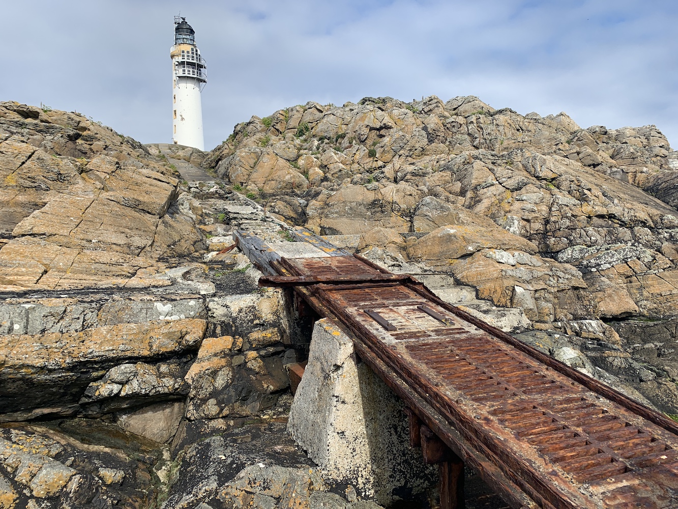
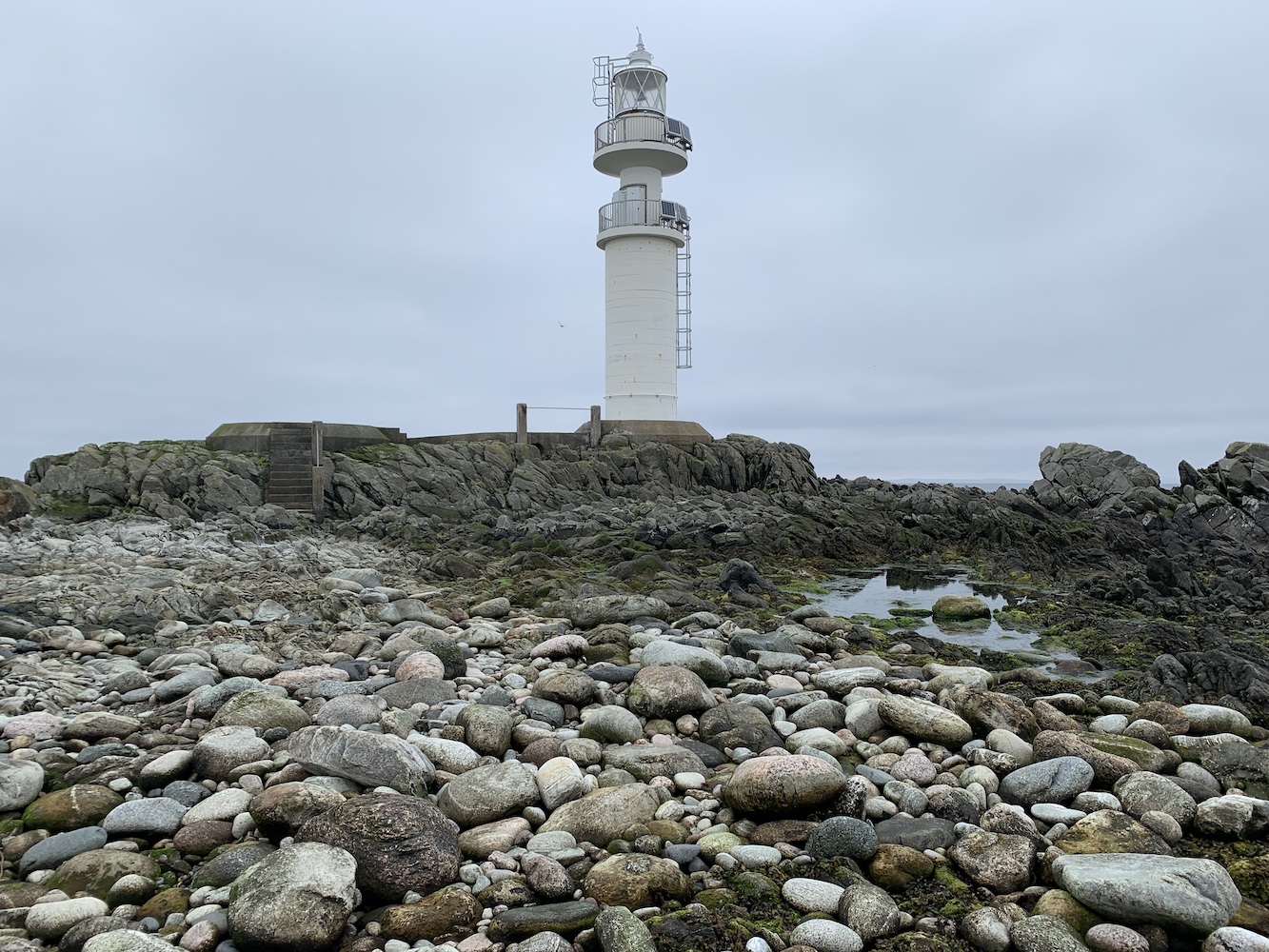
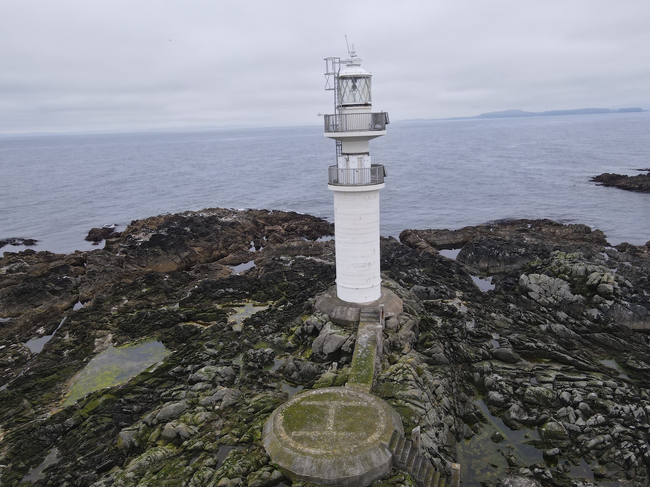
Ve Skerries Lighthouse
Relief set in when I finally got to the helipad which has a nice walkway across to the base of the lighthouse. There was a little stoney area down some steps from the helipad and John Anderson said it’s possible to find bits of ballast from the ships wrecked on the Skerries sometimes. I did have a look around, but couldn’t see anything.
Ve Skerries Lighthouse with a little of the stoney beach
Of course, we couldn’t have gone to Ve Skerries on a calm day without Joe the Drone coming along.
Ve Skerries Lighthouse and neighbouring islands
A Joe’s eye view of Ve Skerries Lighthouse
The lighthouse on Ve Skerries was first lit in 1979, built mainly to aid the large vessels moving around the area going to and from Sullom Voe. The wrecking of the Elinor Viking in December 1977 was also a deciding factor for the lighthouse which was already being spoken of at that point. After the lighthouse was built it received an award for its design and construction, and has very recently been granted listed status. It is a very unique structure, a real modern day rock lighthouse.
Getting back to the boat was slightly easier than the way we’d gone onto the island. However when I got towards the boat one of my feet slipped on some seaweed and my right foot ended up in the sea. Fortunately it was just my foot and I was able to get back into the boat safely before we had a quick stop in the very sheltered little harbour on North Isle, which was a great spot for watching the seals flopping on the rocks and swimming around.
Ve Skerries Lighthouse from North Skerry with plenty of seals keeping an eye on us
Reaching Ve Skerries Lighthouse felt like a great achievement. It is not frequently visited and probably for good reason.
Today was a great reminder to me of why I love doing this so much. That combination of straightforward, understated lighthouse trips and heading out into the wild extremes and creeping about over slippery rocks. Lighthouse bagging like this isn’t for everyone, but it certainly is for me – even if I do get a wet foot every now and then! 🙂
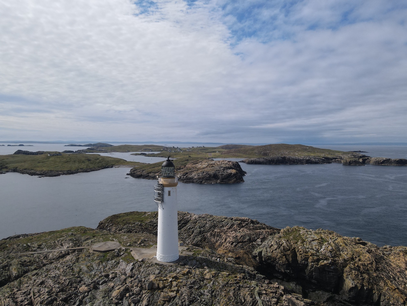
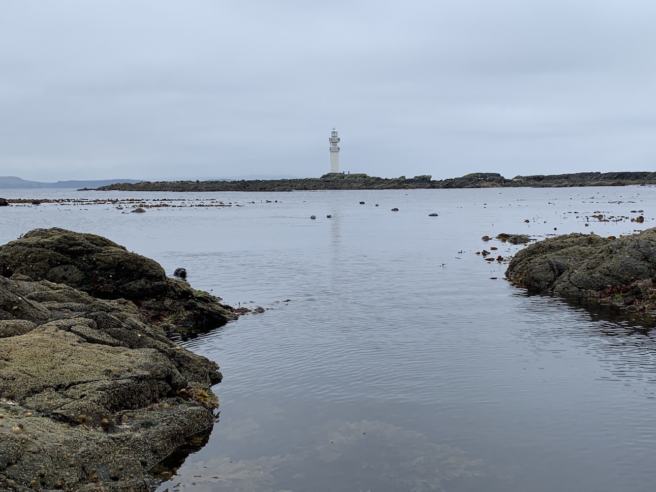
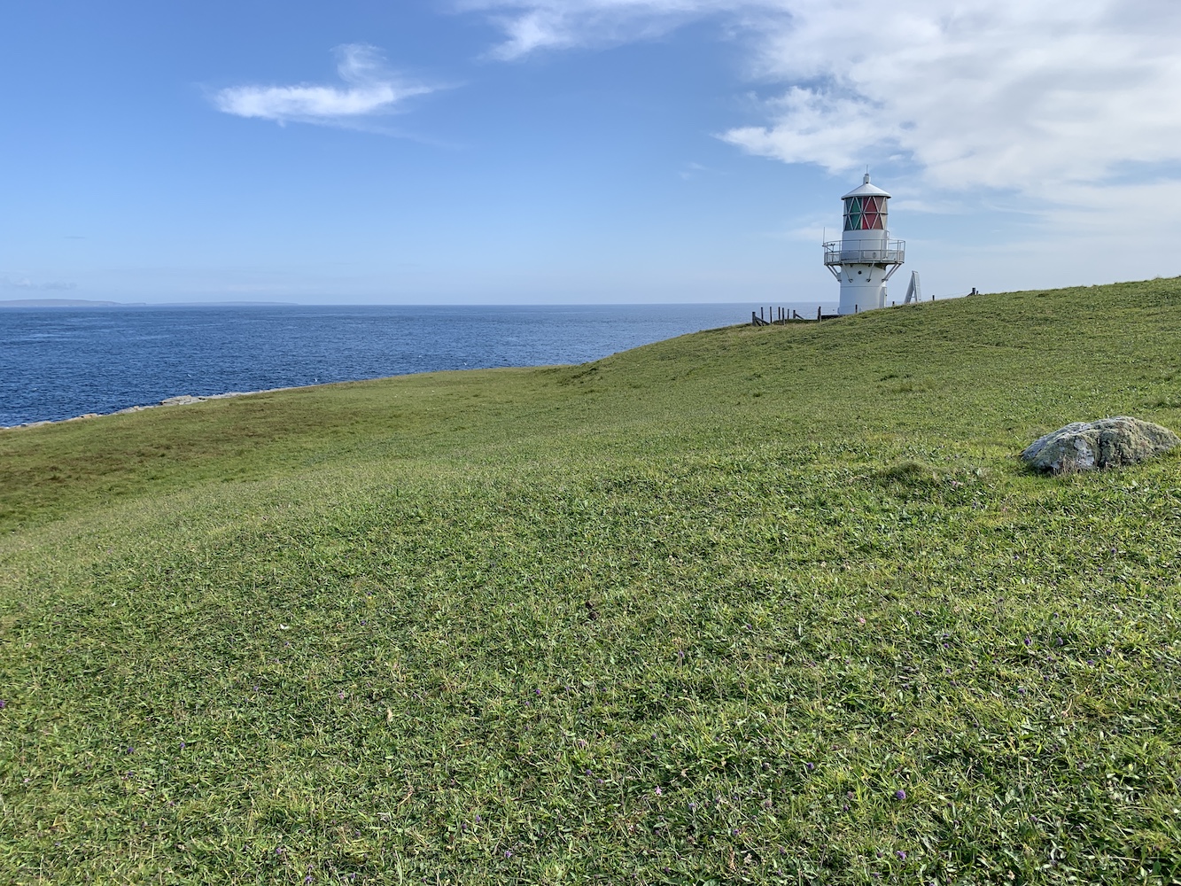
Contrary to what yesterday’s post suggested, today didn’t turn out to be as exciting as I’d mentioned (that’s now planned for tomorrow – fingers crossed). However, it did feature some success: the completion of the ‘walkable from the main islands of Shetland lighthouses’. This doesn’t actually sound like much of an achievement, but given that they aren’t necessarily the easiest or shortest of walks (see the recent Bagi Stack post for the most extreme example) it’s quite a good milestone. This completion took place at ‘the light with many names’, also known as Vaila Sound, Ram’s Head or Whites Ness Lighthouse – whichever takes your fancy. To be a bit more specific, the lighthouse is officially known as Vaila Sound Lighthouse by the Northern Lighthouse Board. It is located on Ram’s Head which is a part of the Whites Ness circular walk. Hence how it ends up with so many names.
Vaila Sound Lighthouse very much reminds me of this wonderful post I saw last year, which includes a beautiful sketch of the lighthouse – not a style that is very often sketched I’m sure! This is one of the Solar Powered Lattice Aluminium Towers and they grow on me more and more every time I see a new one. This is particularly the case when they involve a great and not too challenging walk. A couple I know through the Association of Lighthouse Keepers moved to Shetland last year and they have visited Vaila Sound Lighthouse a couple of times so we enlisted one of them, who I named Tour Guide Andrew, to lead the way.
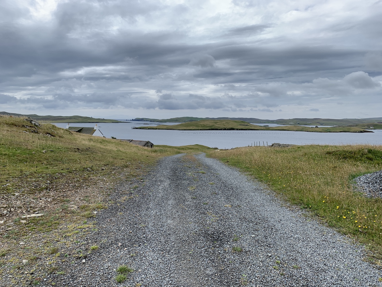
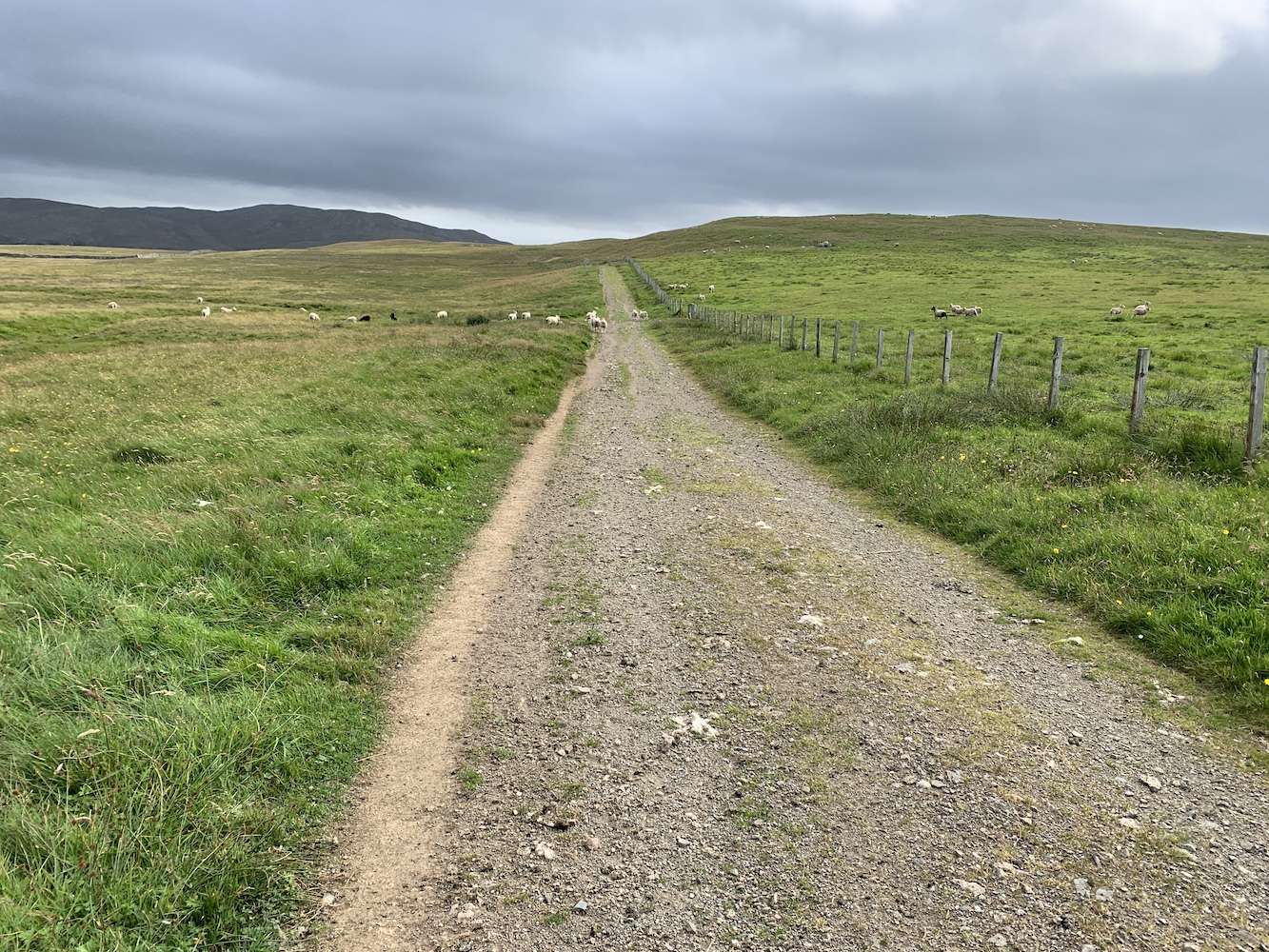
There’s a great area for parking just up the hill from the start of the walk at Whiteness and then it’s following a farm track signposted ‘Coastal walk’ for the first part. This track felt like luxury after some of the recent walks.
The starting point for the walk
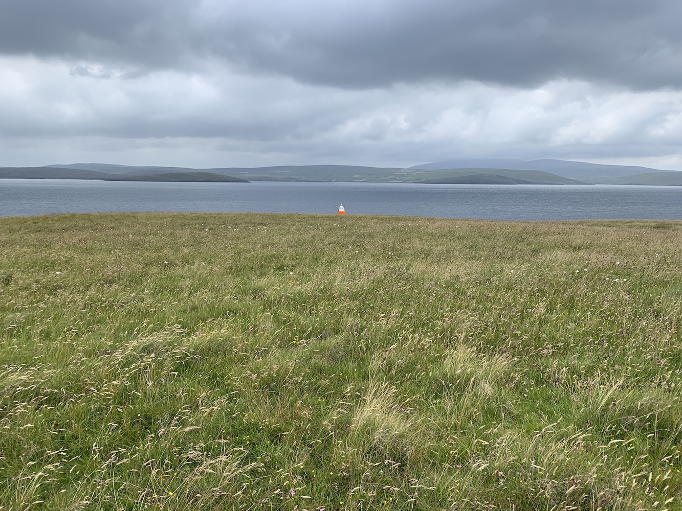
After passing a couple of buildings it’s not long before you get some stunning views of Vaila Sound and the island of Linga.
The first view across Vaila Sound
Beyond the mast the track continues and you begin to get views of the island of Vaila itself, which I have very fond memories of visiting a couple of years ago. It’s a beautiful island with a really interesting little garden to explore.
Vaila from across the sound
The track then ends at a farm gate and we walked through the field a short way, ending up closer to the coastline. The views looking back towards Walls from here with the yellow flowers in the foreground were excellent.
The view towards Walls
We then arrived at an area of old ruined houses near the shoreline. One of them didn’t look as old as the rest and I thought ‘what an amazing location to live’, but of course it’s relative remoteness would have its drawbacks.
The more modern-looking property
From here we then took a short walk along the small, pebbly beach and took a look at the little stone jetty beyond it.
The old stone jetty near the ruined houses
From here the terrain gets a bit more undulating and after a stile, there is some uphill followed by downhill, but the uphills are so worth it for the views from the top.
One of the wonderful views from a higher point on the peninsula
A little more up and down later and the lighthouse suddenly comes into sight – and what a sight it is.
Vaila Sound Lighthouse comes into view
Bob set about preparing Joe the Drone while Andrew, John and I made our way towards the lighthouse.
Tour Guide Andrew on the approach to Vaila Sound Lighthouse
Unlike Hillswick and Bagi Stack lighthouses, this one is set fairly low down near the water and so it was possible to stand on the rocks behind it and get a great view of it against the serene waters of the Sound.
Vaila Sound Lighthouse
While we were gazing at the lighthouse a little fishing catamaran sailed past and honked its horn at us. It’s not often you get an opportunity to see a boat moving near one of these little lights so it was a perfect picture opportunity.
The little boat passing the lighthouse
The rocky terrain in front of the lighthouse is lovely and the jagged rocks compared to the calm waters in the area were a striking, but great contrast. I imagine it’s not always so calm!
Vaila Sound Lighthouse from below
It was possible to see the old boat landing area nearby and it looks like a little leap may be required to get from the flat landing area to the surrounding rocks to avoid wet feet!
Looking west across Vaila Sound with the landing platform just visible in the dark brown rocky area
Joe the drone, as ever, got some super scenic shots from above, including this one, which I absolutely love. Little did I realise at that point what was around the corner!
Ram’s Head and the Whites Ness peninsula from above
Sometimes you come across a view that just makes you say ‘wow’ (or in my case ‘wowzers!’) and the fabulous promontory of Green Head was a perfect example of that – and yes, I did indeed say ‘wowzers’ out loud when I first saw it.
Green Head
As you walk further around the coast you see more and more of the promontory and realise it’s actually joined to the Whites Ness peninsula by a narrow section of land.
Green Head from a different angle
From here we headed inland across a slightly boggy section of land before returning to the field we passed through and then onto the track.
A little wet underfoot at this point
This felt like a stroll in the park in comparison to some of the other recent walks to see lights. If there is anyone who happens to be in the Shetland area who isn’t sure about whether or not to visit a flat-pack lighthouse then this one is a great one to start with. It has many of the benefits of a flat-pack lighthouse – with the main one being that it’s in a stunning location – but without the tough walk. Just brilliant, and a really enjoyable way to get those ‘walkable lights’ done.
I should also mention here that I went on a short trip to Sumburgh Head Lighthouse this morning with my kids. They were delighted to see the Light the North Shetland map lighthouse on display here and, of course, had a wonderful time pressing the button in the museum that blasts out a foghorn’s bellow. I’m not sure the museum staff were so delighted!
Sumburgh Head Lighthouse with the Light the North lighthouse
Another great day in Shetland, but what will tomorrow bring…! 🙂
The wind had dropped for us in Shetland overnight and, although we knew it may be a while before the sea recovered from 48 hours of strong wind, we decided to head out on Lysander again today and see what we could achieve.
Today’s trip started off at Ulsta on Yell and the agenda featured a number of islands including Lunna Holm which I’d been keen to get to for a while.
A few islands were visited and we got a closer look at the light on Rumble too. The tide in the area made it a very rocky little detour.
The Rumble light
A little while later we arrived at Lunna Holm. There was still plenty of movement in the water, but it didn’t prevent us landing thankfully. It‘s a nice little island and we wandered up towards the high point and then cut across in the direction of the lighthouse.
The first sighting of Lunna Holm lighthouse after landing
The lighthouse on Lunna Holm dates back to 1985 and it was introduced to mark the south eastern approaches to Sullom Voe during the hours of darkness. The foundations were prepared in the first half of 1985 and by the end of that year the structure was complete and the light operational.
Lunna Holm in the sunshine
The lighthouse, which is still the original 1985 tower, and it’s surrounding fence look like they could do with some attention so I was pleased to find that, in June this year, the Northern Lighthouse Board put out a tender for full refurbishment of the lighthouse. This is due to include not only a refurb of the tower and concrete base, but also replacement of the lighting system and the fence that surrounds the structure.
Lunna Holm Lighthouse
One of the crew on board informed us that a former inter-island ferries, The Earls, ran aground on Lunna Holm back in the 1980s, which may well have occurred before the lighthouse was installed.
The island reminded me a lot of Cava in Scapa Flow, Orkney. The lighthouse is the same type, the island has a similar sort of layout (for want of a better word), and the grassy terrain was the same. I always see Shetland and Orkney as being completely different, but there are definitely some similarities in certain areas, which geographically makes sense due to their relatively close proximity.
Joe the Drone went for a spin while we were there too.
Lunna Holm from above
Lunna Holm with Lunna Ness beyond
It was just the single lighthouse for me today, but I was happy. After a couple of busy walking days I was more than willing to spend a day on the boat and I even managed to fit in a nap, lying on the comfy seat, while the others ticked off another 6 islands in one go.
Tomorrow has the potential to be a very exciting day and I cannot wait! 🙂
In the effort to visit every lighthouse in Shetland at some point I was going to have to do the walk out to Bagi Stack on the north west point of Yell. There was no boat trip today due to crazy wind and, as a result, far too much swell. Though the wind might make walks in exposed locations a bit less pleasant, my lighthouse pal John and I decided to give it a try today, knowing full well from the very start that it wasn’t going to be easy.
The start point for the walk is at Gloup, beyond Cullivoe. There’s a memorial here to the 58 local fishermen who were lost just off the coast in July 1881. The loss had a massive impact on the community with so many women and children left behind and cleared from the area after the disaster.
The Gloup Disaster Memorial
From here we set off to the south, passing some ruined buildings, and then continuing straight on we went through a small gate. The reason for heading south was that you need to get around Gloup Voe and Mare’s Pool before you can begin heading towards the lighthouse. After the gate the path got very narrow and was barely more than a sheep track, which wasn’t too bad to begin with, but it quickly became a bit more worrying as the land was steep and if you were to lose your footing it was highly likely you’d end up sliding down the slope and into the water below. Concentration was key at this point and enjoying the views fully involved stopping to look around every now and then, which was well worth doing.
The view down Gloup Voe and Mare’s Pool
Looking across Gloup Voe
The path on the Easter Lee of Gloup
Reaching the end of the Easter Lee of Gloup it was time to turn the corner and work out which route we wanted to take from there. The Ordnance Survey map shows a small path running up the Wester Lee of Gloup and ending slightly inland near some old houses. I must admit I was tempted to head straight uphill from there, but we decided to follow what looked like a sheep track along the west side of Mare’s Pool. There was no doubt from quite early on that the west side was steeper and I was increasingly uncomfortable walking on such a tiny sheep track along it. The track, in places, was hard to follow too. After a while we established that the path marked on the map was actually further up than where we were. At this point we found a little ledge, had a sit down and chat, and agreed to begin heading up the slope towards the ridge line and then assess from there. Thank goodness for the heather as the grip it offers certainly helped to get to the top. To say I was relieved to get off that slope would be a bit of an understatement, but I also knew that there was some distance to go to get to the lighthouse.
The steep side – Wester Lee of Gloup
Trudging over the grass and heather wasn’t too bad, but there was plenty of spongey-looking ground and bog cotton about. Fortunately there has been a spell of dry weather in the area of late and so many of the little burns and pools were completely dry as were the extra boggy bits of terrain (which was nearly everywhere really). Having been there now it is not a walk I would even consider doing when the ground is wet. The walk was really just up and down, skirting around or going straight through dry bogs and was a fair amount of effort, but we had the wind blowing at 40mph behind us which probably helped.
Water was so rare here today that I had to photograph it
So much bog cotton around
A rare water-filled burn
At one point we began to spot some skuas flying about. I’ve seen quite a few already on this trip and thankfully, although they fly about when you go near them, they seem to have decided now their young have grown that they don’t need to attack people anymore. It’s still quite unnerving though.
Making it to the coast
After an age (or almost 5 miles) we finally spotted Bagi Stack Lighthouse ahead of us. It looked tiny in comparison to the vast surroundings and the beautifully dramatic coastline around it. There are stacks aplenty in the area and also views over to Point of Fethaland and Gruney (oh, we also spotted Muckle Flugga from a distance on the walk too). The lighthouse, unsurprisingly given its location, is looking a little weather beaten. Two sides of the white cladding on the tower have begun to turn yellow – and while I love yellow I recognise it’s not the best colour for a lighthouse with daymark requirements. The plaque on the door also looks like it’s seen some weather. Thankfully, although they have gaps between the white panels, these lighthouses offer a surprising amount of shelter from the wind. It was a great place to eat lunch and I also managed to make a phone call to Sumburgh Head Lighthouse while here too!
Finally catching sight of Bagi Stack Lighthouse
The lighthouse looks tiny next to the nearby coastline.
Bagi Stack Lighthouse
A picture showing the yellowing of some of the white panels
The return walk was never going to be easy, but given our experience of the landscape so far I felt comfortable suggesting we set the GPS device for the bottom end of Mare’s Pool and follow the direct route as much as we could. This seemed sensible based on the fact that it was so dry underfoot and so we wouldn’t need to worry so much about avoiding boggy areas. This was all prepared and off we set with the wind full in our faces, which I actually found rather refreshing if a bit much at times.
Evidence of former habitation in this remote spot
Looking back the way we’d been
It was mainly a slog to get back, but towards the end we spotted a lovely-looking glen that weaved left and right a bit before coming out at the bottom of Mare’s Pool. The burn that ran down the glen did have water in it, but thankfully wasn’t a raging torrent and was narrow enough to step over most of the time to avoid any narrow or difficult terrain. At one point we needed to cross at the top of a tiny waterfall, but this was straightforward enough and it didn’t feel like long at all until we could see some familiar ground at the bottom.
Approaching the glen
A little water in the burn, but evidence that much more flows at times
After a brief stop we just had the final section to go along the Easter Lee of Gloup. After the experience on the west side this felt so much easier a second time and I really rather enjoyed it. I still had to stop to take any pictures and look around, of course, but it was just as beautiful as it had been on the outward journey, but with the tide much lower so it all looked a little different.
A lower tide in Gloup Voe
Arriving back at John’s van was great and we had already begun to feel the need to celebrate successfully getting to and from the lighthouse without any major mishaps. A cup of tea seemed like a sensible celebratory drink at the time.
It was quite a walk – over 8 miles in total – and a good test of navigation skills, including making decisions about which route to take and realising that sometimes taking the high route gives you better perspective even if it does involve more effort to get up there, but also enjoying some of the lower routes where possible too. Maps can tell you a lot, but there’s nothing like being there and seeing the lie of the land for yourself at the time.
My advice for anyone looking to walk to Bagi Stack Lighthouse would be simply take whatever route you feel most comfortable with, but make sure you have a map and compass (that you know how to work with) or a GPS device – don’t rely on your mobile phone as signal is patchy once you are away from Gloup. It is best done after a period of dry weather as bog trotting is never fun if you can avoid it. Other than that I can’t offer much else in the way of directions. Oh, and it’s probably best avoided during skua attacking season! 🙂
The wind picked up during the day yesterday and overnight meaning there were no boat trips today. It seemed a perfect time to reach some of those lighthouses that involved a walk on Shetland Mainland.
Being based in Lerwick, with three particular lighthouses in mind, my lighthouse pal John and I decided to begin with those furthest from the accommodation and the longest walk, which took us to Hillswick on the west coast. Finding a place to park here wasn’t a problem with a nice little area close to the farm gate which marks the start of the walk, and what a walk it was.
Initially following a farm track, which though not the most direct route avoided going through fields and some pretty overgrown terrain.
The track made the first section of the walk very easy
After leaving the wide track there was a section with no clear route, but once down by the coast we found the route. This is clearly a popular walk and very understandably. The coastline around here is absolutely stunning. There are some fairly steep sections, but the effort is quickly rewarded by the views. I can’t do them justice by just describing them so will just add some pictures here instead.
It was a long time before we saw the flat-pack Hillswick Lighthouse. In fact we were relatively close to it before it appeared. As we arrived at the lighthouse a couple were just leaving and the man informed us that he had been involved in the building of the lighthouse when it was solarised.
The lighthouse comes into view
The lighthouse is in an incredible position with views of St Magnus Bay to the south, and some very dramatic coastal scenery to the west with views towards Esha Ness and its couple of islands. We even managed to spot part of The Drongs, that glorious collection of sea stacks, at one point during the walk.
Hillswick Lighthouse looking excellent
Saying goodbye to the lighthouse
I think we probably could have done the walk a bit faster if I hadn’t been quite so in awe of the views, stopping frequently to get pictures of the views. Typically we made it back slightly faster as I’d taken most of my pictures by that point.
One of the views on the return from Hillswick Lighthouse
The next stop saw us off to the east coast to walk to Ness of Queyfirth Lighthouse. After a bit of debating over where we should park we eventually stopped on a verge at the end of the public road. Fortunately a local man drove past and John spoke to him about walking over to the lighthouse. Apparently he was surprised we wanted to walk, but he said it would be fine to follow the fence around the outside of a field a cows, which looked to me like it avoided entering any fields.
The cows near the starting point for Ness of Queyfirth
Early on in the walk we spotted what looked like a quad track (one of the benefits of walking on farm land) so we followed this until it petered out. It was a bit of a slog up the hill, made harder by the terrain being very overgrown, but thankfully it was mainly grass and dry bog. I can imagine it would be a much less enjoyable walk after a prolonged period of rain, but the ground seems very dry at the moment.
The route towards Ness of Queyfirth lighthouse
This was another one that seemed to take a long time to catch sight of the lighthouse and we were almost upon it when we finally spotted the top of it emerging as the land went downhill. It is fairly steep in places on that peninsula and on the way out we were getting slightly sore ankles from walking on sloped ground. We found a power line which we thought would lead us to the lighthouse, and thankfully it did. In the meantime though we had some wonderful panoramic views, including Quey Firth itself, the hills to the west and out to Lamba and other islands in Yell Sound.
The view of Yell Sound from the walk to Queyfirth Lighthouse
The lighthouse is the same type as Gruney, or like Little Roe and Skaw Taing Front, which we saw yesterday, but without the orange section. They really are quite funny structures, but once you’ve seen a couple they really grow on you, as is the case with most of the smaller lighthouses – or it certainly is for me anyway. It was nice to have a sit down at the lighthouse and enjoy the views for a bit.
Ness of Queyfirth Lighthouse
The journey back was tough going but we made it and were very glad to meet the original track and see John’s van not too far away. The sky had cleared a bit which made for much brighter conditions.
The view to the west on our way back from Ness of Queyfirth
The timing was perfect here as it began to rain just after we go into the van. Fortunately it had stopped before we reached our final stop of the day, Eswick.
We weren’t sure if we would fit a walk to Moul of Eswick in today, but there was still enough time to give it a go. This was the shortest walk of the day, but parking was a bit of a problem as the only place at the end of the road we could have parked was already taken so we had to drive back along the road almost half a mile and set off from there. As with the other two, this one involved a walk over farmland initially and was actually quite straightforward. Passing through one field, we continued to follow the track which brought us out by the side of Muckle Loch, which is beautiful.
Muckle Loch at Eswick
I wasn’t sure how easy it would be to cross a burn that was showing on the map, but it was completely dry so we continued on our way. We then went over another gate only realising as we headed in the direction of the lighthouse that we were then on the wrong side of the fence. This was quickly rectified and with the lighthouse in sight we headed straight for it.
Approaching Moul of Eswick Lighthouse
The lighthouse is a flat-pack which I always think are nice to see, but one of the most enjoyable aspects of this visit were the views.
Moul of Eswick Lighthouse
With the wind really picking up there was plenty of swell around the islands to the east, one of which was Hoo Stack, which I very much enjoyed visiting back in 2019. Not only that, but there was the amazing 17 metre high Fru Stack just off the cliffs here, which was brilliant to watch with the waves breaking against it. A gorgeously dramatic scene.
Fru Stac just off the coast of Moul of Eswick
Hoo Stack, as seen from Ness of Queyfirth
The return journey, during which John did his celebratory dance at having achieved three new lighthouses today, was straightforward if a little slow after a long day. It was a great day though and really good to get to these ones which were always due to be on my back-up plan list should there be days without boat trips. One more tomorrow – hopefully! 🙂
Phew, what a day it’s been, out on a boat on Yell Sound picking up more lighthouses and islands.
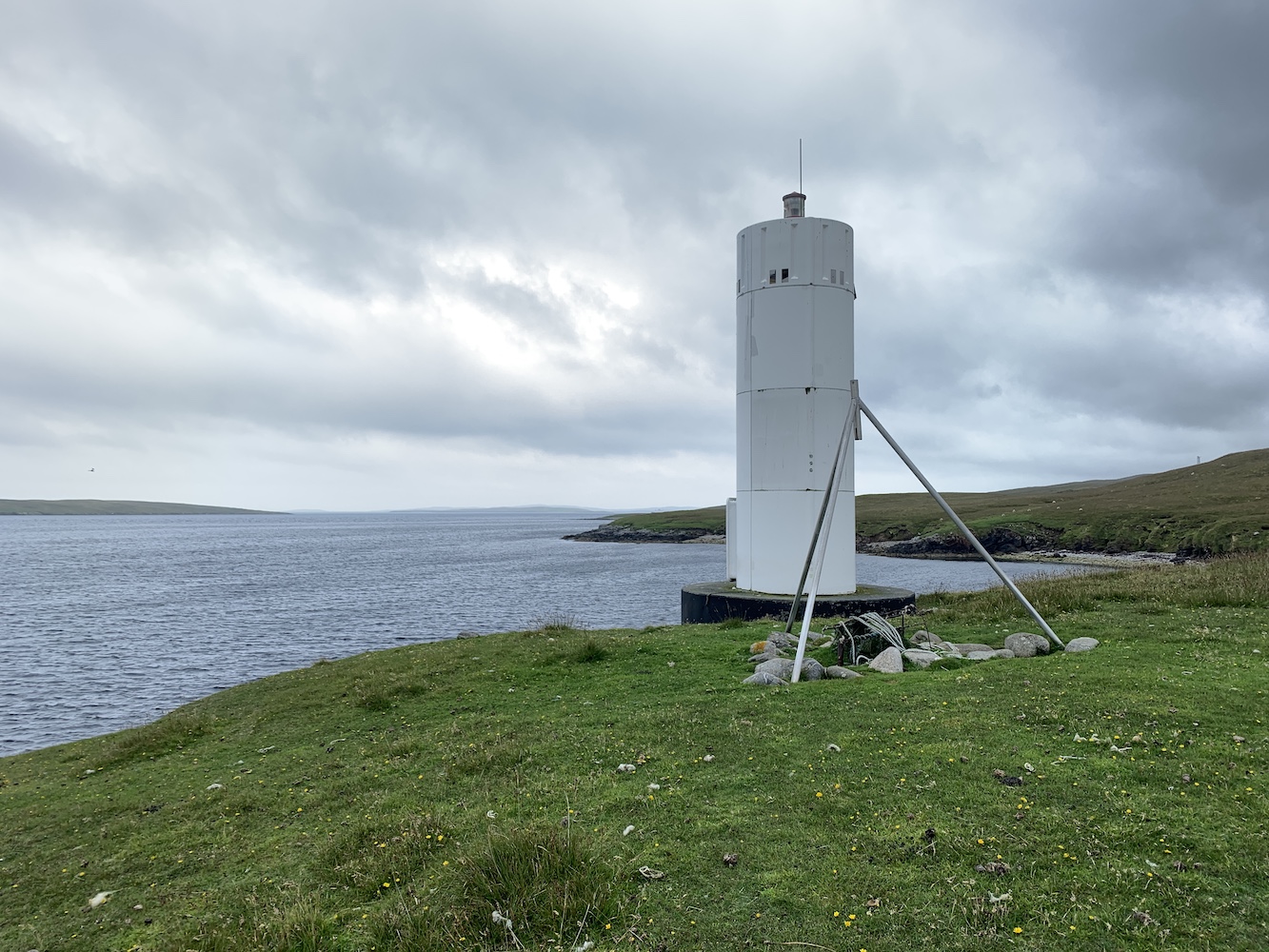
Leaving the cars at Toft we crossed to Yell on the ferry and met Michael the skipper and the boat just over the other side in Ulsta. We passed the very beautifully-located Ness of Sound Lighthouse as we journeyed up Yell Sound.
Ness of Sound Lighthouse
We made our way right up to the north entrance and around Point of Fethaland. This was a perfect chance to see this very unique lighthouse from the sea where it looks so small compared to the dramatic natural surroundings. On the return later this morning I thought it looked rather Faroese from a certain angle. It was particularly good to see from the north east with the jagged rocks in the foreground and lighthouse sticking up on the top of the cliff. I don’t know anyone who has been to Point of Fethaland that has anything bad to say about it. The walk is superb.
Point of Fethaland with its lighthouse
Joe the Drone also took a spin here too.
Point of Fethaland from above
Heading around also gave us a chance to see Gruney, which was a reminder of the scary landing on a flat, sloped rock there back in 2019. However it did also bring back memories of the stunning views from the island that day too.
Gruney island and lighthouse
After some island bagging around the corner from Point of Fethaland, including a tidal island which had proven to be rather tricky to reach by land, we returned to Yell Sound. We were heading into the wind now and it was clear from the water conditions that the sea was getting a little more interesting. The skippers weren’t sure what we would manage from this point and a couple of group members set off to set foot on three islands, but only managed one before the swell was getting too heavy causing them to return to the main boat.
Then it was well and truly onto the lighthouses. The first stop was Muckle Holm, which was one I’d visited in 2019, but my lighthouse pal John had yet to do. I decided to go ashore for a revisit and I’m so glad I did. I’d forgotten how fascinating the island is with some stunning geos in both the middle and the west side and a fairly narrow section of grass leading to the east section of the island. Of course it was good to see the flat-pack lighthouse again.
The calm landing area on Muckle Holm
The seaward end of the landing geo on Muckle Holm, which has been used by Sullom Voe pilot boats for shelter in the past
One of the amazing geos on Muckle Holm
And another
Muckle Holm Lighthouse
Saying goodbye to Muckle Holm
What I found upon returning from the island was that, while sitting to move down the rocks, I managed to tear my waterproof trousers in two places. Normally this would be a pain, but I actually didn’t mind it as it made me feel like a proper island bagger. So many of them have holes in clothing from their exploits!
I stood aside for the next two islands, Little Holm and Brother Isle, as – although they both have lights on them – I have been to them before and there were others who hadn’t. Due to the sea conditions we could only really take three in the tender at one time so I settled for a view from the main boat with these two.
Little Holm
Next we got to the really interesting bit, the lights I’d not been close to before. The first of these was on Tinga Skerry. I wasn’t sure what to expect here as I recalled when I last saw it from a distance that it was just very low-lying rock and I didn’t know if landing would be possible. I was nicely surprised to see it was actually far more substantial than I’d given it credit for. After wandering up towards the lighthouse we spotted a male otter dashing away across the rocks. It was fantastic to see and a great start to a small, but interesting little skerry. The lighthouse isn’t the most interesting of structures, really just practical, but as I’ve said many times before (and particularly in this post) it’s so often the places these lights take you to that makes visiting them so enjoyable.
Tinga Skerry
Tinga Skerry with the otter on the rocks (see if you can spot him)
Tinga Skerry Lighthouse
Tinga Skerry from the landing
Then it was something entirely different with a visit to Little Roe. I’d not known about Little Roe until my last visit to Shetland, which thankfully occurred before my book was published. This was also a little unexpected as, contrary to what its name suggests Little Roe isn’t very “little” and certainly not in comparison to many of the other islands in the area. From the landing area at the rocky beach it was quite a walk on ground that alternated between long grass and squidgy moss, which fortunately was dry today. As we reached the highest point of the island we spotted the top of the lighthouse appearing ahead of us and set off for it. This is the first one of this type that I’ve been too and it’s bright orange paint was a real contrast to the grey skies at that point. It’s a very strange light, similar in shape to the one on Gruney. I always enjoy seeing these different style of towers though as seeing the same thing all the time could get a bit tedious. Just to the south of the lighthouse was what I originally thought was a single geo with beautiful cliffs. Walking a bit further on though I discovered there were two geos next to each other, resulting in a wonderfully shaped promontory in the middle. I also spotted a great little arch in one of the geos. Walking back was slightly easier with much more downhill, and rather strangely the remains of a fence. There are ruins of a building on the island so my guess would be that it was once home to someone who dug the peat and may well have had a fence! Back at the landing it was nice to have a sit down and enjoy the area while the first pair were taken back to the main boat. I found a fun bit of sloped grass to slide down. With the Balta seesaw and Little Roe grass slide I really do seem to be behaving like a child while out bagging these days.
Approaching Little Roe Lighthouse
Little Roe Lighthouse
Little Roe geos and the arch on the right
The final two stops of the day I was very keen to get to as it would save a particularly long walk at another time. The reason there are so many lights in Yell Sound is because it is used as an entry/exit route for Sullom Voe oil terminal. To get to these next lights involves walking around the coastline to avoid Sullom Voe, which is surrounded by fencing anyway so there is no shortcut. There are two lights at Skaw Taing and the skippers were very pleased to find some relatively calm water for a change where the boats weren’t constantly drifting unless underway. After a smooth landing we made the short walk to the front light, which would have been a twin of Little Roe, except it had a directional sector light on the front as well as the light on the top, which was also different to Little Roe. The rear light was a bit of a slog, but a fairly short slog so not too bad. This is an entirely different type of structure, stone-built and with an entrance hatch on top rather than a door on the side. Again there was plenty of soft ground to walk on here, but that didn’t stop me from just being glad that I didn’t need to undertake the very long and boggy walk around the coast.
Skaw Taing Front light with the rear in the background
Skaw Taing Rear looking up Yell Sound
There was one final stopping point and that was Mio Ness. Very similar to the light on Tinga Skerry, it wasn’t the most beautiful, but it was easy enough to land nearby with an even shorter walk than Skaw Taing to reach the lighthouse. I’d seen this one from the ferry before as well as a chartered boat in 2019, plus from the coastal road on Yell – it’s very easy to see from a distance, but not so easy to get a closer look. It seemed like a very successful end to today’s trip for me which involved achieving more than we thought we might given the gusting wind.
On the approach to Mio Ness Lighthouse
Mio Ness Lighthouse
It was just great to have seen these ones closer now and spent some time exploring some of these very different islands and skerries 🙂
Yesterday marked the first day of a holiday in Shetland and it certainly got off to an excellent start with a chartered boat trip around Unst.
It was all a bit of a rush in the morning with a fairly short window of opportunity for getting off the ferry, offloading the kids with my parents at our amazing accommodation, and then getting to the ferry at Toft to head to Yell by 8.45am. It was a tall order, but we made it and our small group gathered at Cullivoe to head out on board Lysander, the new boat owned by the same company as the Compass Rose which took us to Muckle Flugga and numerous islands in the area in 2019.
We climbed on board and off we set. It was very good to be back out with bagging friends after such a long time without being part of a group beyond just a few people. The plan was to sail clockwise around Unst and visit a number of islands on the way. We got off to a good start and after a few members of the group had set foot on some islands it was time to head for the main event of the day, an attempt to land on Muckle Flugga. The skipper reported the conditions up there the previous day had been very rough and so he didn’t hold out much hope of landing. Ever the optimist I was willing to withhold judgement until we got closer. The further north we got the more surprised we became at how calm it still seemed. Finally Muckle Flugga with its majestic lighthouse came into view and us lighthouse baggers waited patiently – well, not actually very patiently at all.
Approaching Muckle Flugga
As we edged closer it became more obvious that landing was likely to be possible, although we still needed to check out the landing area a bit closer as there was still a little bit of swell running in there. A few of us keen beans hopped into the brilliant ‘tin bath’ tender and set off for the landing. There was quite a bit of movement in the water, but thankfully not enough to stop us getting safely onto the rocks.
Looking up on the approach to the landing
After a brief celebration we were keen to get going up those historical steps. It was a real delight to see so many puffins around and although many were scared off as we made our way up the steps, we were still able to see them at fairly close range. There were some fulmar chicks around too threatening to spit at us, but we left them in peace and moved on.
Puffins on Muckle Flugga
Out Stack and the puffins
Although I’d been before and so knew the lie of the land there, it was still a real pleasure to see the stunning views towards Out Stack and to the east. Added to this was the pure joy emanating from those I was with who felt just as awe-inspired as I had the first time around, enjoying the combination of getting to this so rarely visited corner of the British Isles and seeing the incredible lighthouse and landscape of the area.
The view south from Muckle Flugga
Muckle Flugga Lighthouse
The lighthouse from the helipad
There was no way we could have gone to Muckle Flugga without Joe the Drone coming along. I’ll let those pictures speak for themselves.
Muckle Flugga and its neighbouring rocks
A Joe the Drone view of Muckle Flugga Lighthouse
Muckle Flugga Lighthouse and Out Stack
Knowing our work was not done for the day, we enjoyed the last moments of exploring before descending back down to the boat. After leaving Muckle Flugga we headed down Burra Firth for a few of the group to set foot on another island. This was rather fortuitous as it gave us a chance to see the Muckle Flugga Shore Station from the sea.
Muckle Flugga Shore Station at Burrafirth
I was particularly excited about our next stop as it was an island I knew wouldn’t be easy to get to. Holm of Skaw is home to the lighthouse that replaced an old sector light which was within the Muckle Flugga complex. The structure here is a flat-pack lighthouse and very much a standard one. There was a bit of swell at the landing point we went for on the west side of the island. The rocks were covered in barnacles, which certainly helped to prevent slipping, but wasn’t too easy on the hands. Once up on the grass it was actually quite a surprising island, which reminded me a lot of some of the islands in Yell Sound, like Little Holm and Muckle Holm with some really surprising flora and fauna about. The island is fairly flat and grass-covered, but there are some reminders of its harsh location with some impressive geology on the east side. I found this particularly interesting as I always expect the west side of islands to be the more rugged, but I suppose its location gives it a little protection from the west.
Approaching Holm of Skaw Lighthouse
Holm of Skaw Lighthouse
A geo on the east side of Holm of Skaw
Joe the Drone refuses to miss an opportunity so got some excellent images of the island.
Holm of Skaw from above
Holm of Skaw
After the challenges of landing on the west, we used a calmer spot on the south of the island for returning to the tender. I had missed getting a bit wet on a tender so was actually quite pleased, sitting at the very front of the tender, to get a bit of a splashing. You don’t get the fully experience if you aren’t splashed along the way on these boat days.
Down the east side of Unst we had our final stop of the day, which was Balta island. I’d visited this one and its lighthouse in 2019, but it was great to approach the island from the north this time and see how just long it is. It’s a pretty special island and somehow stands out from many others. It boasts some very impressive little beaches and it was only from seeing the drone shots later on that day that I appreciated just how rugged it is on the east side. Again it surprised me, but this one is very much more sheltered on the west side with Balta Sound being only a relatively narrow channel between the island and Unst.
Balta island from the north
Balta from the south
We landed on the rocks below the little breakwater and set off, heading south to the lighthouse for the lighthouse baggers to visit Balta Sound Lighthouse. This is another easy island to walk about on and the sheep have left some nice little tracks all over the place. There are remains of old buildings on the island and I imagine there is plenty of history there and it once was home to a fairly good-sized population.
On the approach to Balta Sound Lighthouse
Balta Sound Lighthouse
It was great to see the lighthouse again and to be joined by the rest of the lighthouse bagging group there too. It’s another standard flat-pack, but it’s a really lovely location. I could spend a lot longer on the island just walking around its coastline.
Balta island
It was then time to head back to Cullivoe and rest after an enjoyable but tiring day 🙂