The Association of Lighthouse Keepers’ Cornwall event continued on Thursday and it kicked off with a return to the National Maritime Museum in Falmouth.
This time we’d hired a meeting room so the ALK’s South West Regional Rep, Ken Trethewey, who is also the author of ‘The Lighthouses of Cornwall and Devon: A Narrative’ among other books, could share his knowledge and personal experience of lighthouses in Cornwall and some further afield too.
Ken kicking off his excellent talk
It was a great presentation, starting off with a picture of St Catherine’s Point Lighthouse in Fowey. I was banned from answering the ‘where is this lighthouse?’ question! Ken then went on to talk about Wolf Rock Lighthouse and the amazing opportunity he’d had to fly by helicopter to the lighthouse and take a look inside.
Ken is one of the original lighthouse baggers and so was part of the very lucky – and much smaller – group who would have actually visited the lights while there were still keepers working in them.
Ken also speaks very fondly of Eddystone Lighthouse and the lesser known Plymouth Breakwater Lighthouse, which he was able to organise an ALK trip to see a couple of months ago. Hopefully we can do a re-run of that next year and I’ll make sure I can join next time too. I call it a perk of the job!
The second part of Ken’s talk was fascinating when he delved into his family history and the discovery that three of his ancestors were lighthouse keepers with a particularly close connection to South Foreland Lighthouse. Working alongside his brother, he has released a new book, ‘Light on the Forelands’ which details their findings.
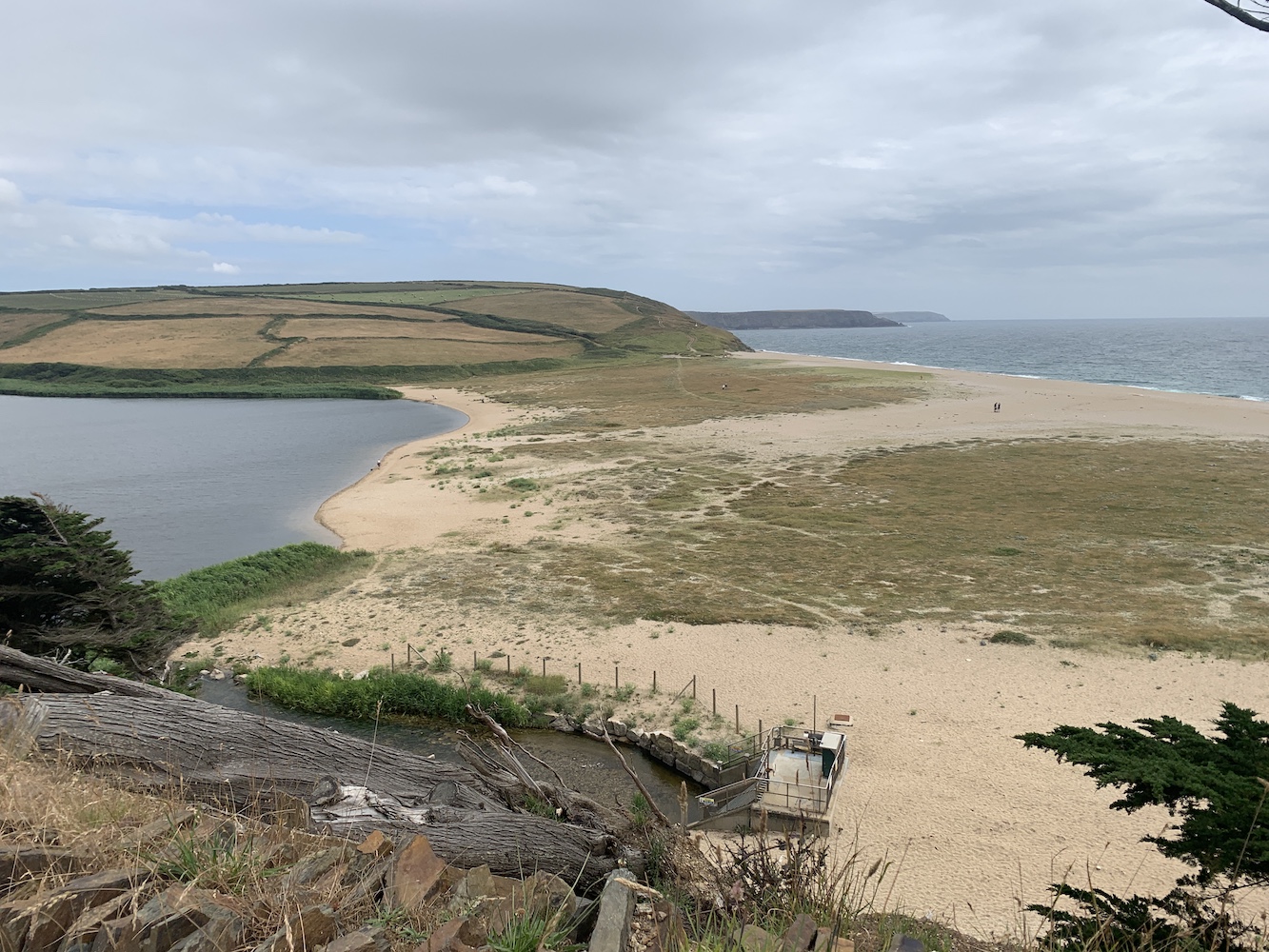
After an enlightening morning it was time for me to get some fresh air so I headed to Helston on the bus for a walk around The Loe, Cornwall’s largest natural freshwater lake. The Loe is only separated from the sea by a sand bar which forms part of the circular walk. No lighthouses there, but still some great views nonetheless.
The Loe Bar which separates The Loe from the sea
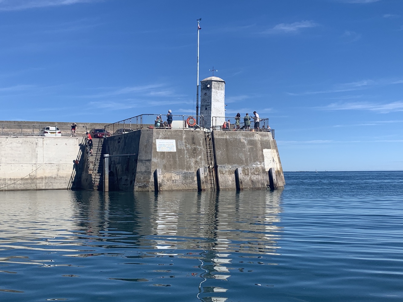
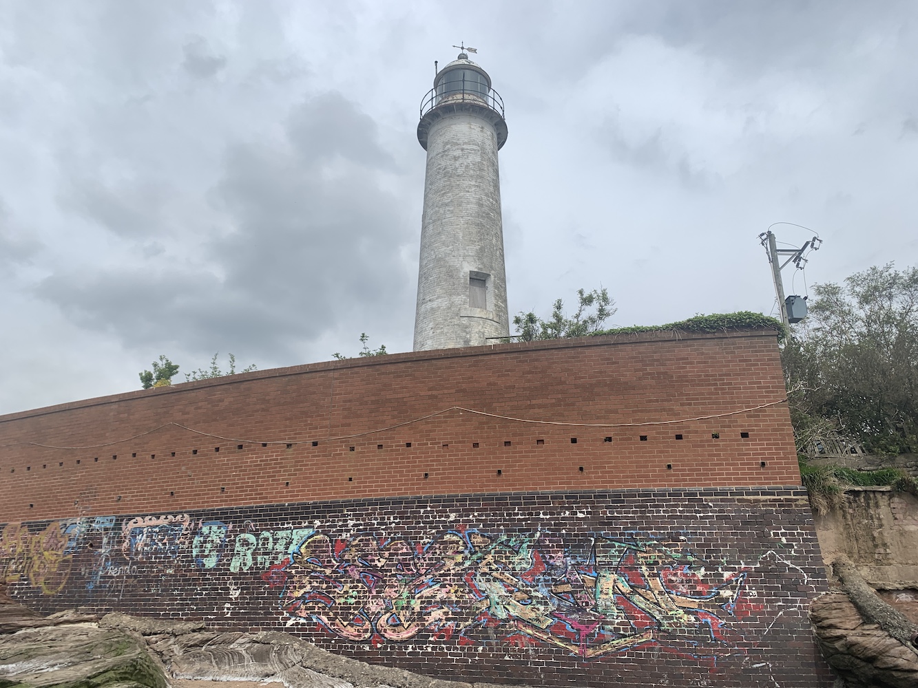
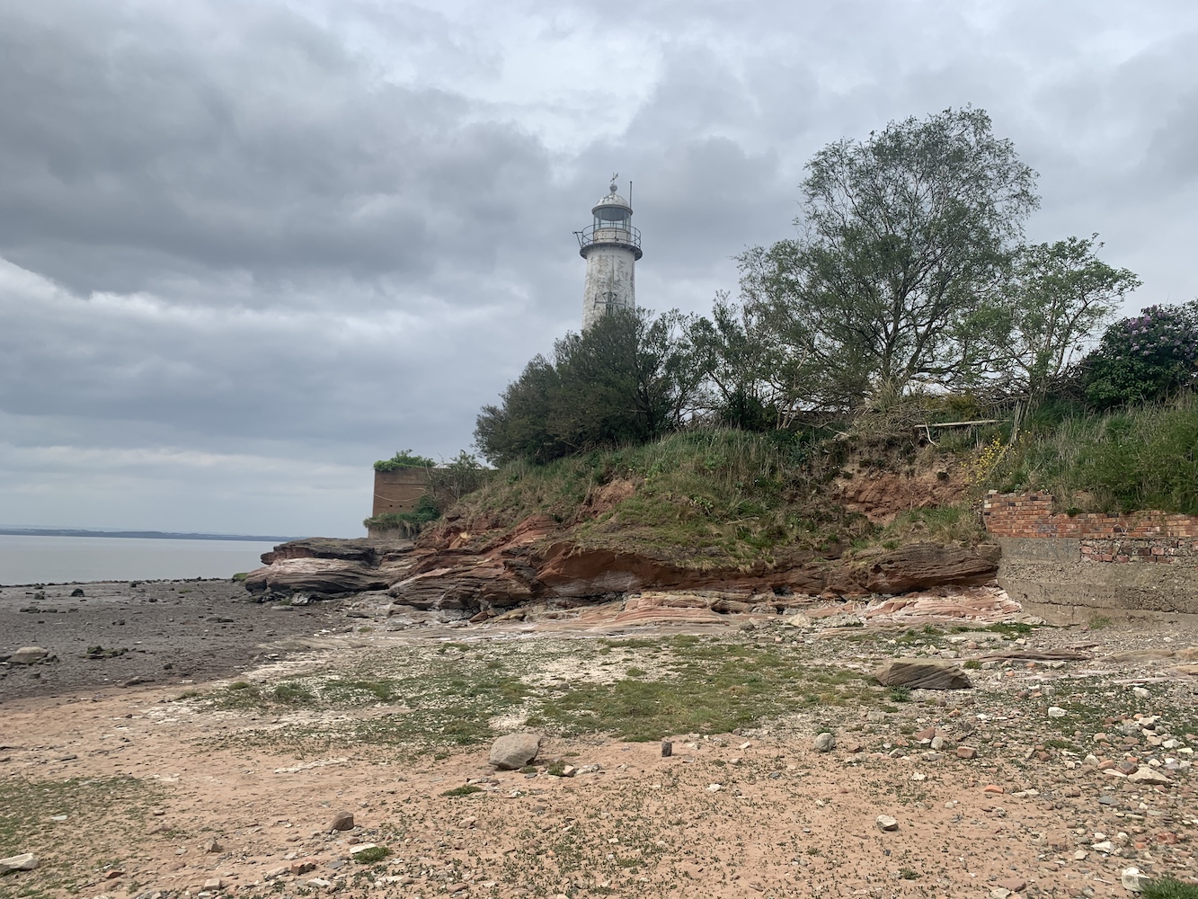
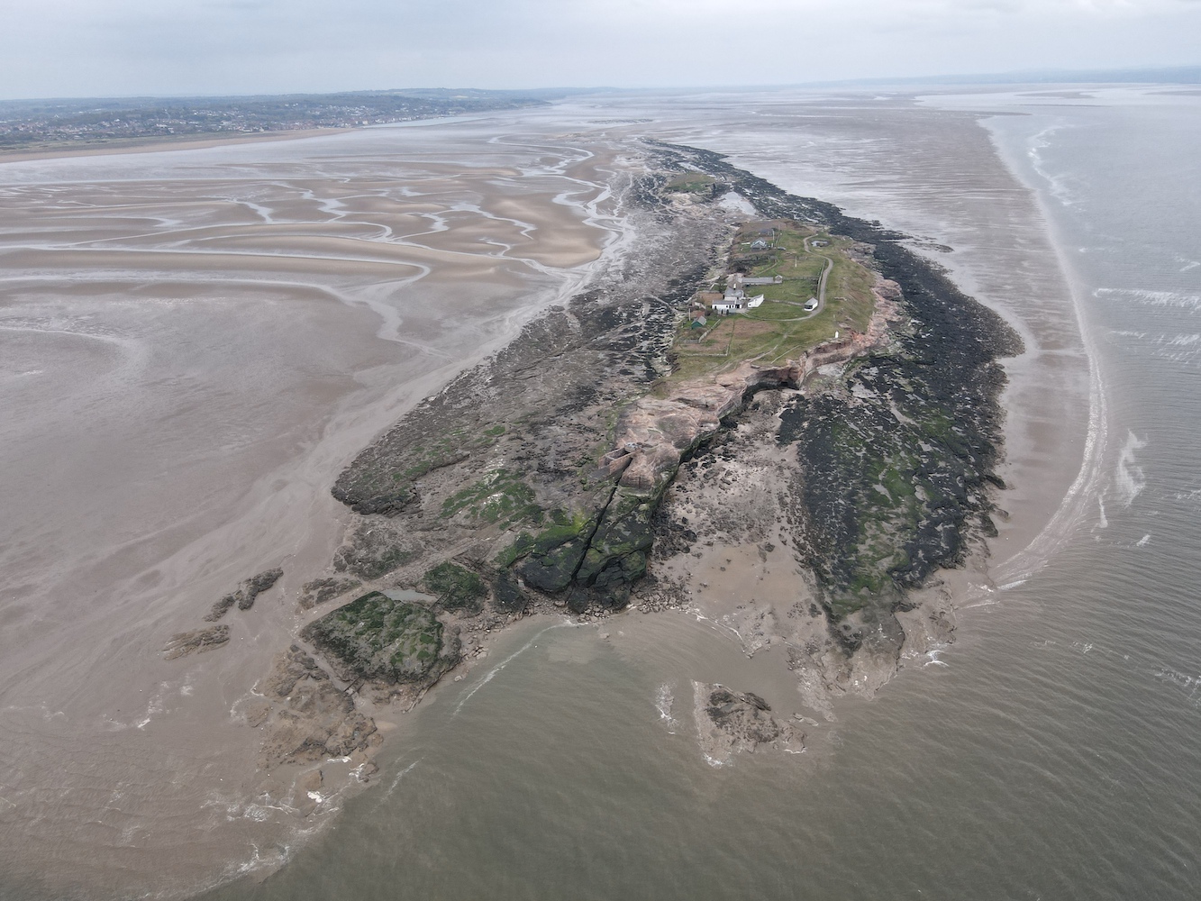
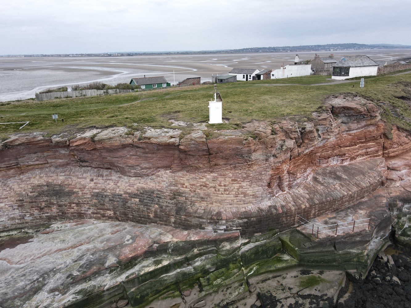
Arriving back in Helstan just in time, it was then a matter of journeying south to the Lizard Lighthouse. Unfortunately the Lizard Lighthouse Visitor Centre is currently closed with no signs of it reopening. This obviously caused us a problem for getting in, but once again Nick from Trinity House offered to help out and we got permission for access to the lighthouse only, not the Visitor Centre.
Lizard Lighthouse
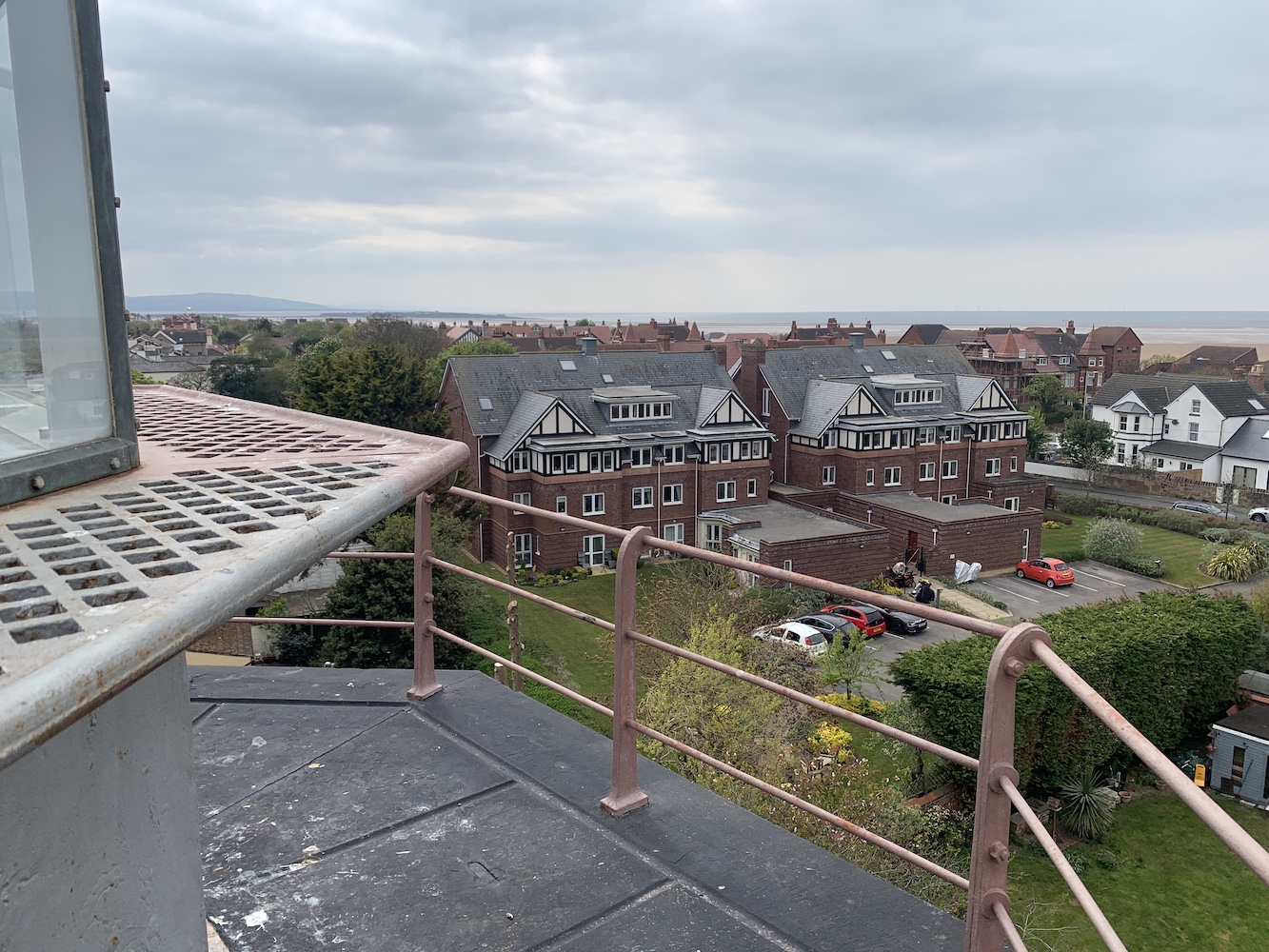
There’s something about lighthouses that are frequently visited and very popular. I’m sure I’ve mentioned in at least one blog post before that my affections generally always lie with those that are often overlooked, usually because you can’t just drive to them and it takes more than a short walk. Lizard is, dare I say it, one of those that I just find too popular, but it was actually nice to get inside the tower knowing that it would only be our group in there and it wouldn’t be a matter of battling past numerous others.
The view across the keepers’ houses to the second tower
It certainly is a nice-looking lighthouse though and the addition of the second tower as well adds more visual interest. Perhaps as evidence of its popularity, Nick showed us a cupboard on the ground floor where they store a range of sizes of plimsolls as they had people turning up wearing completely inappropriate footwear.
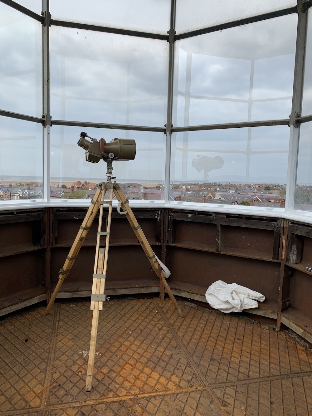
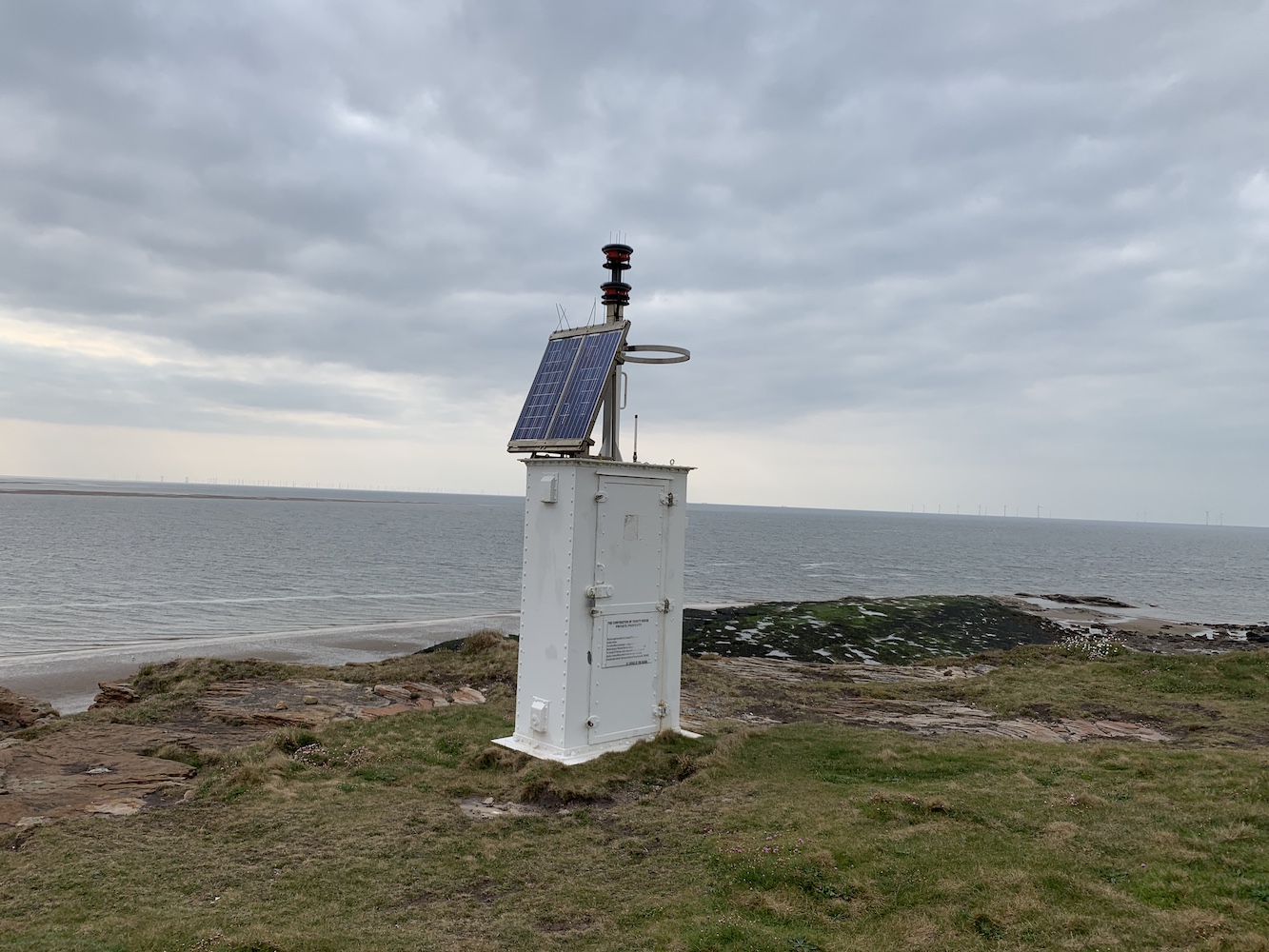
The lens in Lizard Lighthouse is fantastic and rotates incredibly fast. It gives off an incredibly powerful light, which can be seen for an impressive 26 nautical miles, which will presumably be largely to do with it being on the most southerly point of the UK and aiding navigation of both the English Channel and vessels arriving from the wider Atlantic to the west.
Lizard’s impressive lens
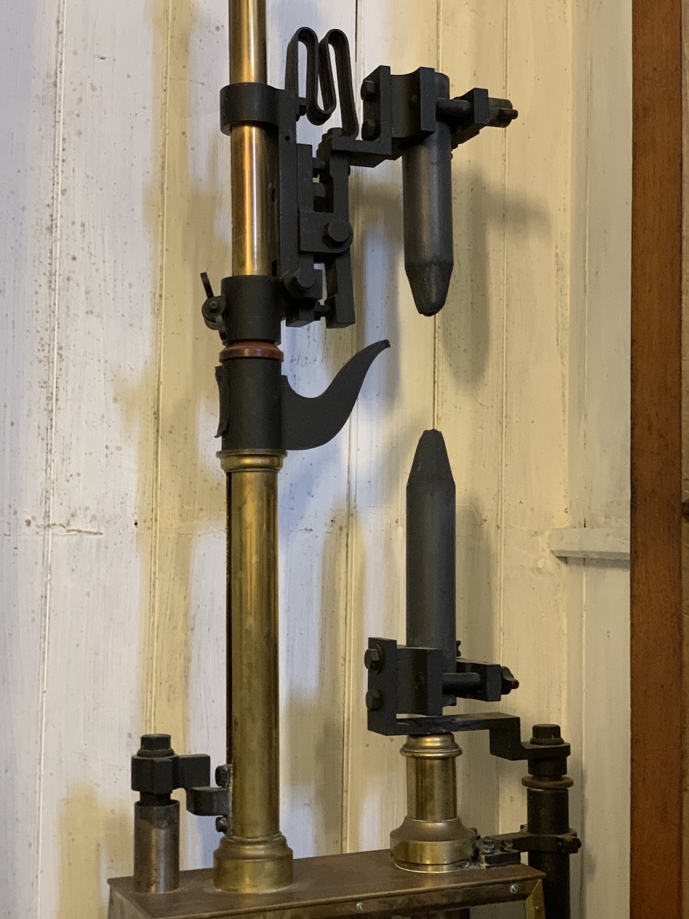
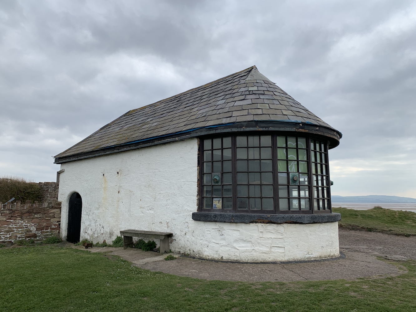
Ken actually stepped in again at one point to describe in more detail an old light mechanism that is contained in one of the cupboards at the lighthouse. This was the old Carbon Arc Lamp used in the lighthouse from 1903 to 1936. Lizard was one of the first lighthouses to have electricity and this method of powering the lighthouse involved applying a high voltage of electricity to the two carbon rods, which created a permanent spark between them. I’d never seen one of these before.
The Carbon Arc Lamp previously used at Lizard Lighthouse
Of course Joe the Drone was up to his usual tricks.
A Joe’s eye view of Lizard Lighthouse
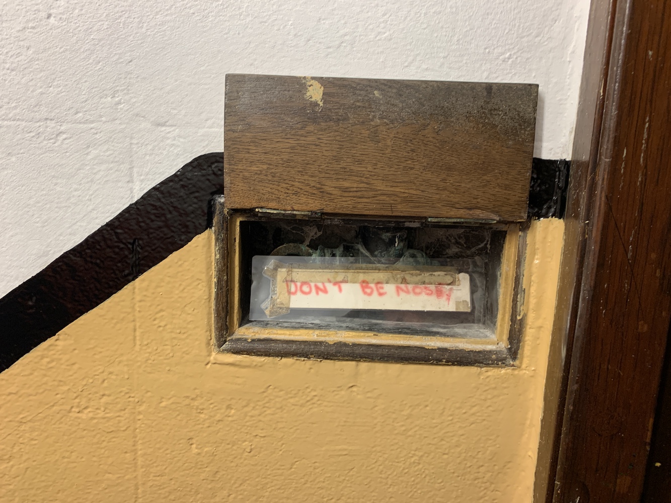
One extra little gem that we discovered while coming back down the ladder from the lamp room was a tiny hatch. When you lifted the little door you were greeted with a sign saying ‘Don’t be nosey’.
Sometimes these little touches can help make a visit more memorable – and enjoyable too 🙂
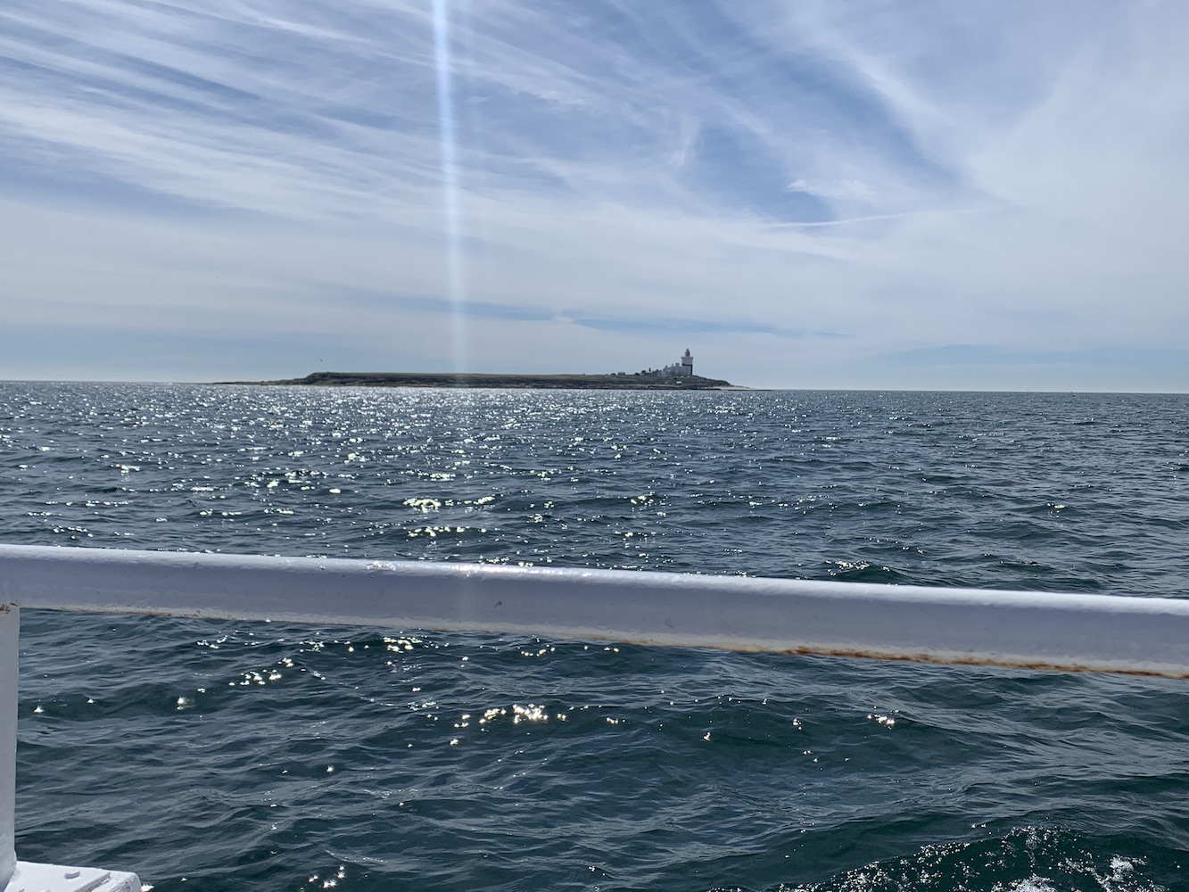
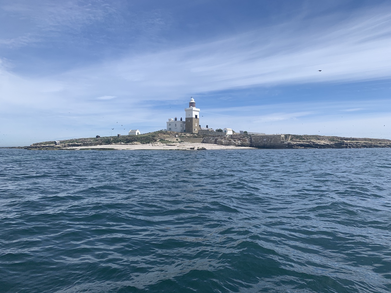
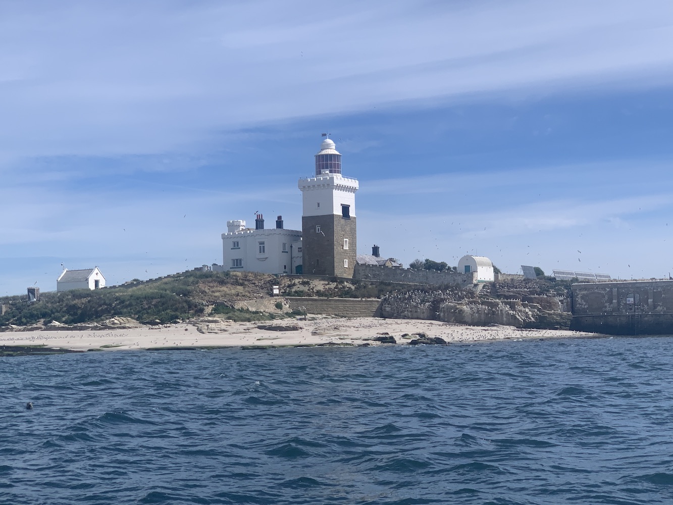
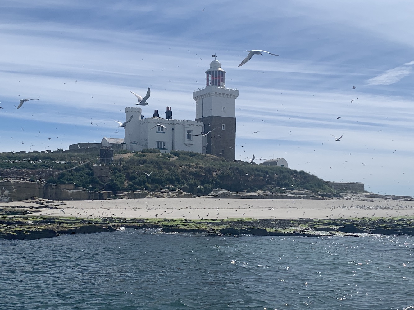
It’s been a long time since I’ve had a chance to spend some quality time on the Northumberland coast and one target for this trip was to get a closer look at Coquet Island, a mile off the coast of Amble. I was aware that only wardens were allowed to land on the island so the boat trip with Puffin Cruises seemed the best way to get as close as I could.
Approaching Coquet Island
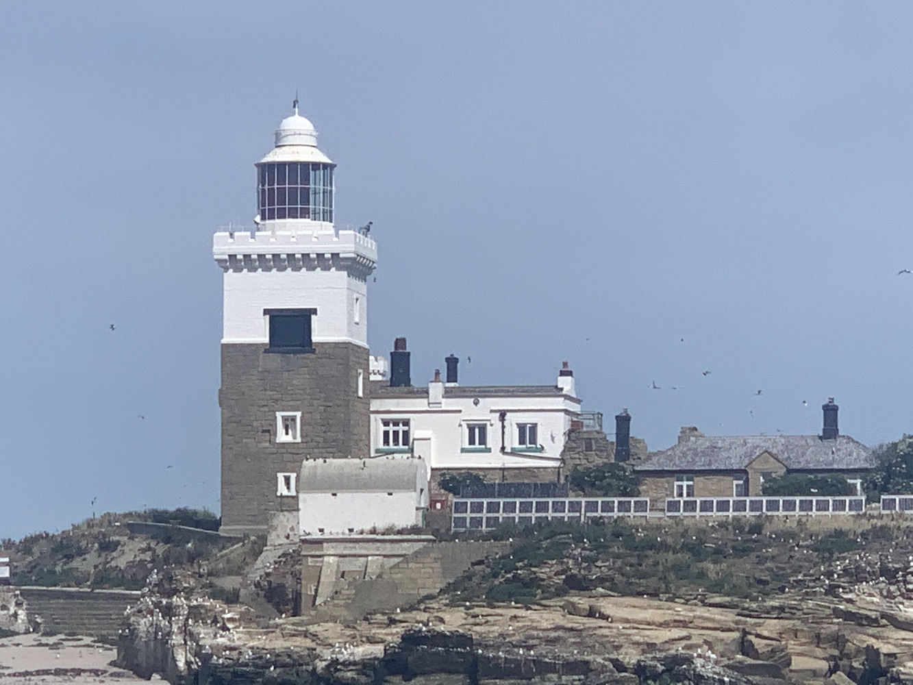
The trip also gave a really interesting insight into the history of the island’s lighthouse and the ownership in general. The island has been owned by the Duke of Northumberland since 1753 after changing hands between the church, and various local earls and others with titles over the centuries. When the lighthouse was originally being proposed on the island the Duke at that time stipulated that he wished for it to resemble a castle, hence the castellated tops to the towers of the structure.
Coquet Island and its lighthouse
There is evidence to suggest that the foundations of the lighthouse and some lower sections predate the lighthouse and are actually the foundations of what was a Benedictine monastery, which was completed in 1841. The lighthouse contains a sector light facing to the south, warning of the hazards of rocks lying just under the water between the south of the island and the mainland.
Although the island is no longer occupied throughout the winter months, it has a long history of occupation and a strong religious connection. Henry of Coquet, a Dane, wished to escape an arranged marriage after experiencing some sort of vision that told him to do so. Arriving in Tynemouth, he gained permission to build himself a small “cell” on Coquet island and lived there until his death in 1127. This is just one example of strange uses and habitation on the island. The Amble and District Local History website features a far more in depth history for anyone interested.
The restrictions on people landing on the island I had originally assumed was due to it being a site for nesting birds. It turns out it is instead that the island’s owner does not wish anyone to land on the island, with the exception of the RSPB wardens and Trinity House staff (though it was suggested that he’s not keen on the latter landing either, but the maintenance of the lighthouse is essential). As with the nearby Farne Islands, I expect that if Coquet was set up to accept visitors it would currently be closed due to Avian flu as its bird population has been very badly affected.
It was a good boat trip with very knowledgeable crew. I was quite nicely surprised at how close it actually got us to the island. It’s certainly worth doing the trip to get a closer look at the island and lighthouse. It’s also a great way to get a better look at the little light on the end of the pier in Amble.
The lighthouse on Amble Pier
We followed the boat trip with a visit to the beach to the south of Amble where we had great views across to Coquet 🙂
On Sunday we decided to make the most of the good weather and set off from St Abbs for Seahouses. My dad was keen to go and see the puffins, the Farne islands being best place for them in the area. Sadly last weekend due to the ongoing devastation avian flu is causing, they announced that there would be no landing on either Inner Farne or Staple Island. This was a shame as I’ve been wanting to take a closer look at their respective lighthouses, but the bird-focussed boat trip took us around both as well as close to Brownsman Island and Longstone too.
The obligatory pictures of the lighthouse at Seahouses
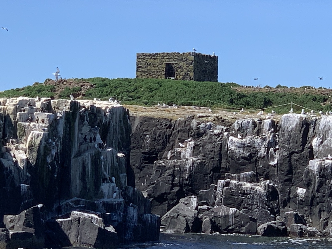
The Farne islands are quite a special place if you are into lighthouses. There is plenty of history with 7 lighthouses in total gracing these small islands over time. The oldest was introduced on Staple Island in 1776, 100 years after permission was first granted for lights to be built on the Farne islands. Prior to this attempts at lighting the islands for navigation were limited to two fire baskets on Inner Farne. The Great Storm of 1784 unfortunately claimed the Staple Island tower, and it is believed that a second tower was then constructed to replace it. The remains of what could well be one of these towers can still be seen on the island, although I am unable to find confirmation that this is definitely the case.
This could be the remains of one of the first lighthouses in the Farne Islands
Fast forward eleven years and the first tower on Brownsman Island had been constructed. The remains of this tower are still visible as the tallest structure on the island.
The square tower of the first lighthouse on Brownsman Island
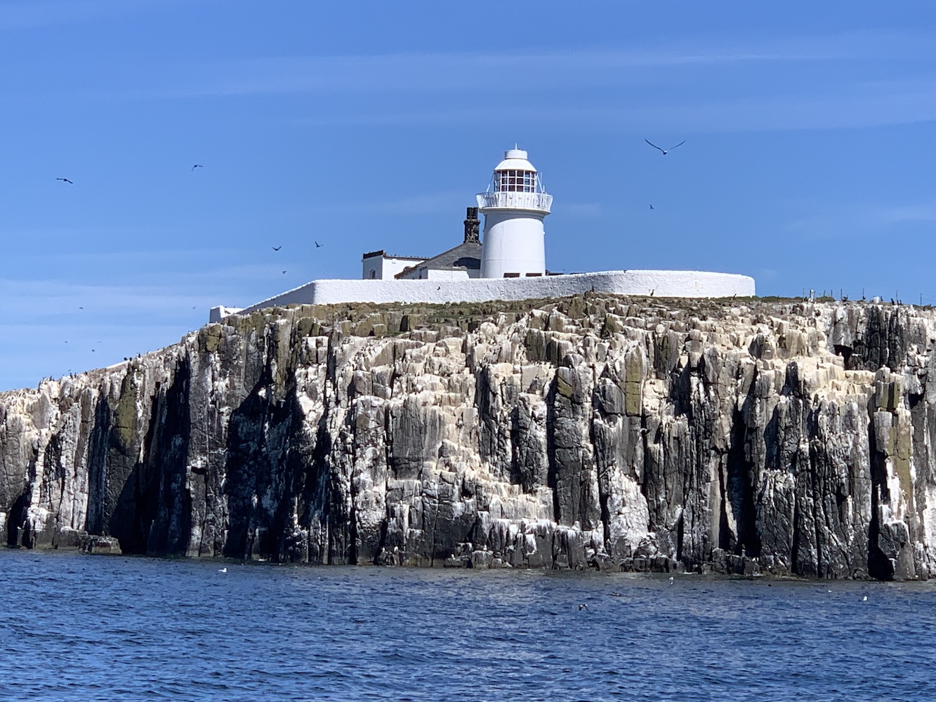
In 1809 Trinity House built the lighthouse on Inner Farne, which is still in operation today. Just two years later this became the High Light after a lower light was added to warn ships away from the nearby Megstone island. This low light was removed in 1911 when the high lighthouse was automated.
Inner Farne Lighthouse
Meanwhile there was navigational development on Brownsman Island too with the introduction of a new lighthouse and attached building in 1810. This tower shared the same design as the Inner Farne light and contained a revolving reflector which burned paraffin oil.
The remains of the round lighthouse and attached building on Brownsman Island
By 1825 it had become clear that the lighthouse on Brownstone wasn’t preventing shipwrecks and the decision was taken to construct a lighthouse on Longstone.
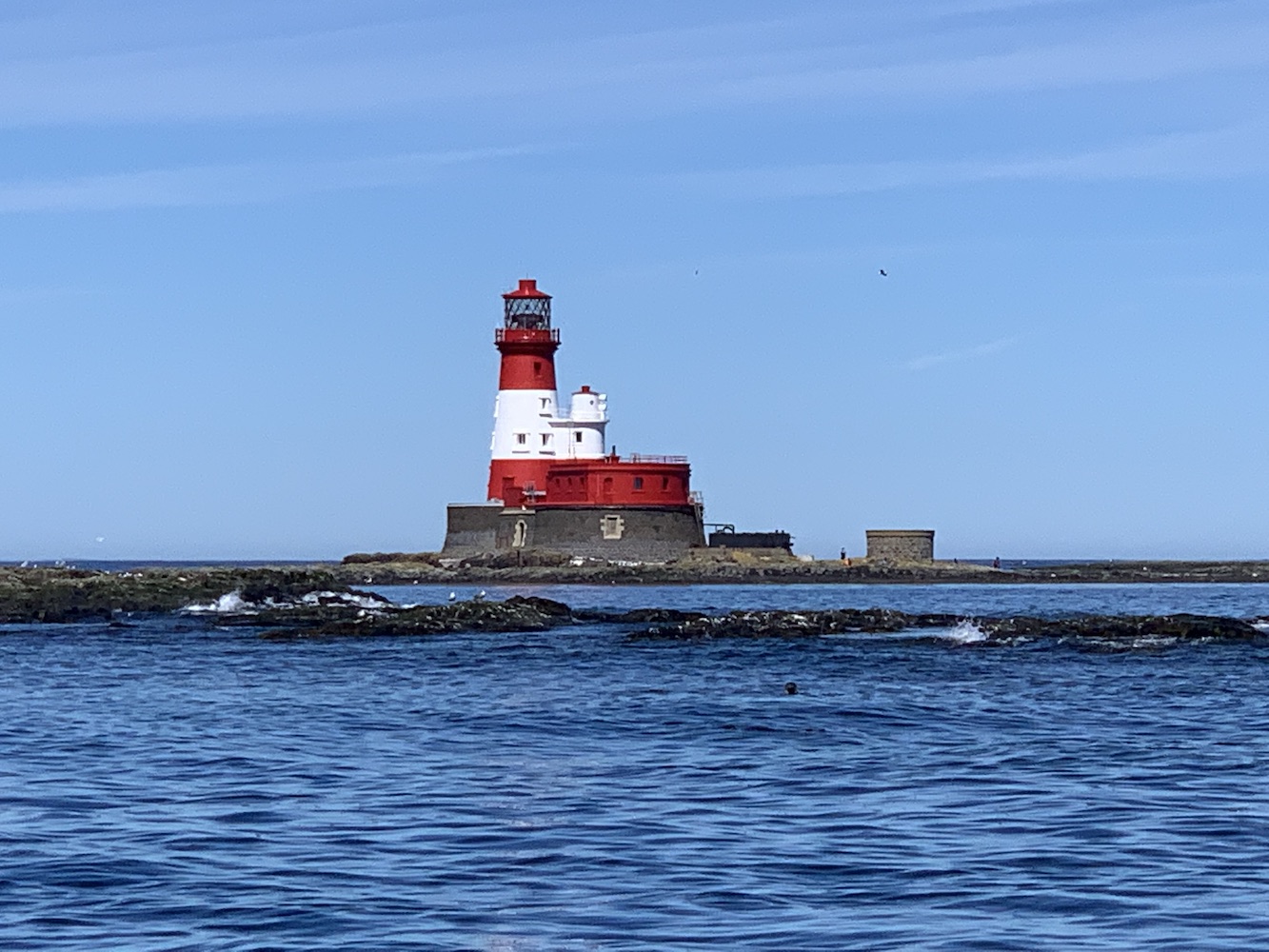
Longstone Lighthouse
Today Longstone and Inner Farne are the only two lighthouses still operating on the islands. The trip was a good opportunity to see these two again. Landing on Staple Island and Inner Farne will wait for another time 🙂
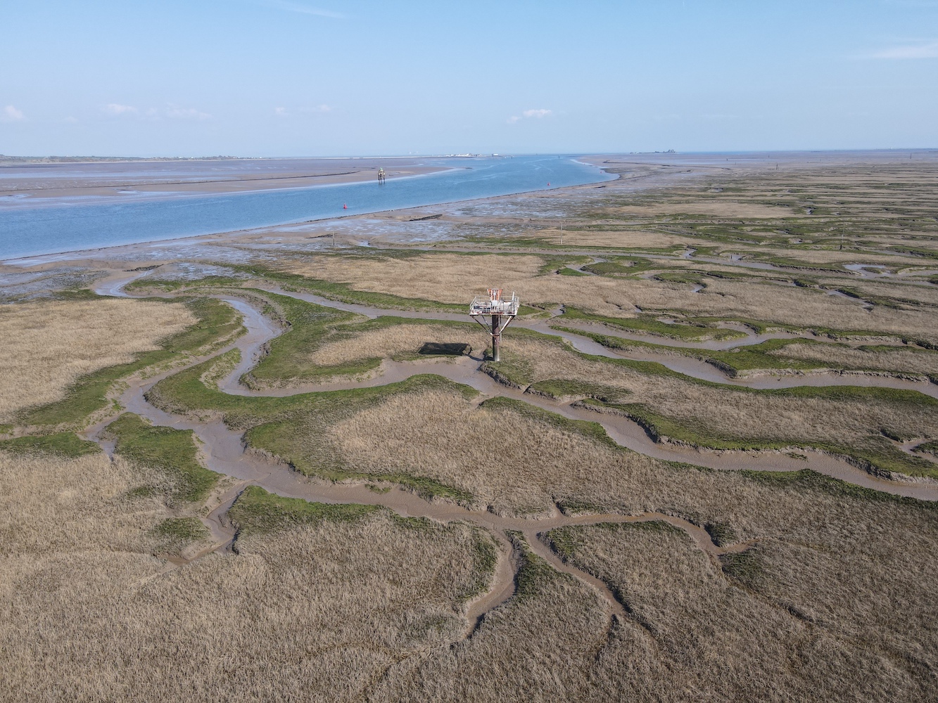
With a day to get home from Preston, a bit of a detour en route felt necessary to clear up a few things lighthouse-related. I had yet to see a couple of the lights along the south coast of Cumbria, along the north bank of Morecambe Bay as well as the Walney Channel.
Living where I do in the far north of Scotland, and the vast amounts of time I have spent in areas with big, wave-battered cliffs, the relatively flat landscape and the resulting fast-moving tides of this area fascinates me. To me it somehow seems more dangerous than spending time on coastal routes in areas with more dramatic scenery, and this is all to do with those tides. To spend a second day in an area where lighthouse bagging is so impacted by the tide is a really interesting experience.
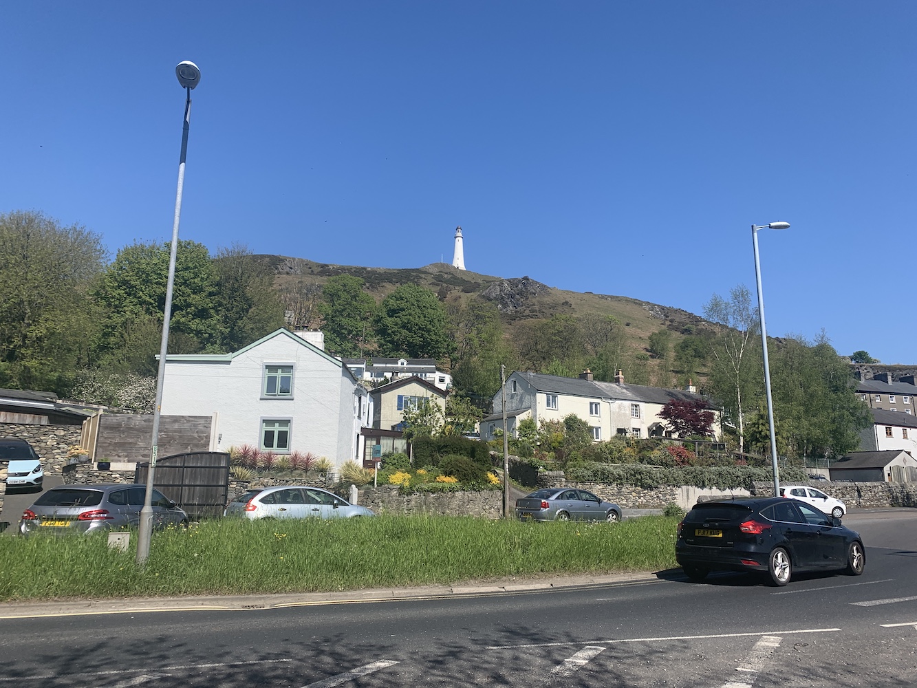
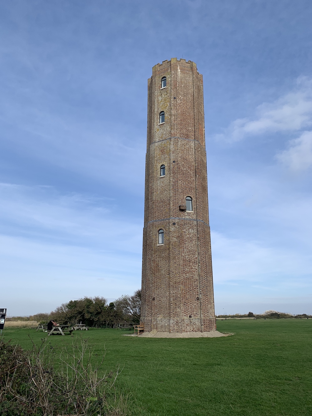
Before we get to that though, our first stop of the day was Ulverston. I’d stopped here briefly during my 2012 lighthouse tour and the reason any lighthouse bagger visits the town is surely for the Sir John Barrow Monument. Generally monuments aren’t lighthouses (although I can think of a few), but this one in Ulverston has a couple of interesting connections.
The Sir John Barrow Monument is clearly visible from the centre of Ulverston
When it was built in 1850 its construction costs totalling £1,250 were mostly paid for by donations from the public. However, £100 was paid for by Trinity House (the lighthouse authority for England and Wales) and the reason for this was it would be used as a seamark. There are conflicting stories related to this with some sources stating that Trinity House contributed based on it it being a seamark alone – though the original plans included a room in the basement that would act as the ‘lighthouse keeper’s’ living quarters. Others suggest that the funds from Trinity House were given in case the tower ever needed to bear a light for navigation purposes, and another that the donation from Trinity House was to ensure that the tower would never bear a light. It is all rather confusing.
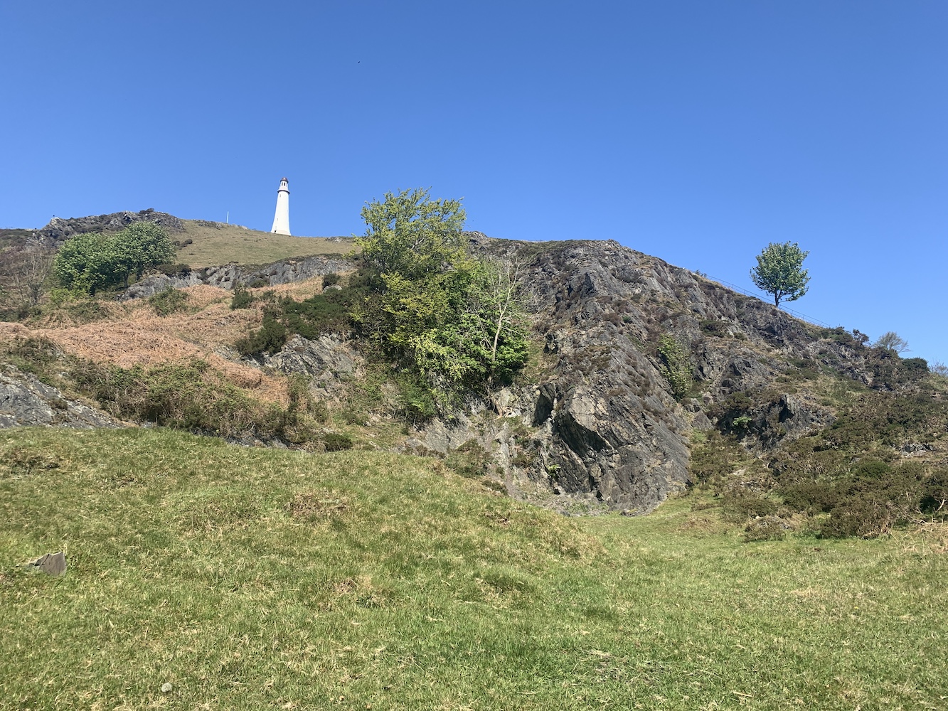
On the way up Hoad Hill
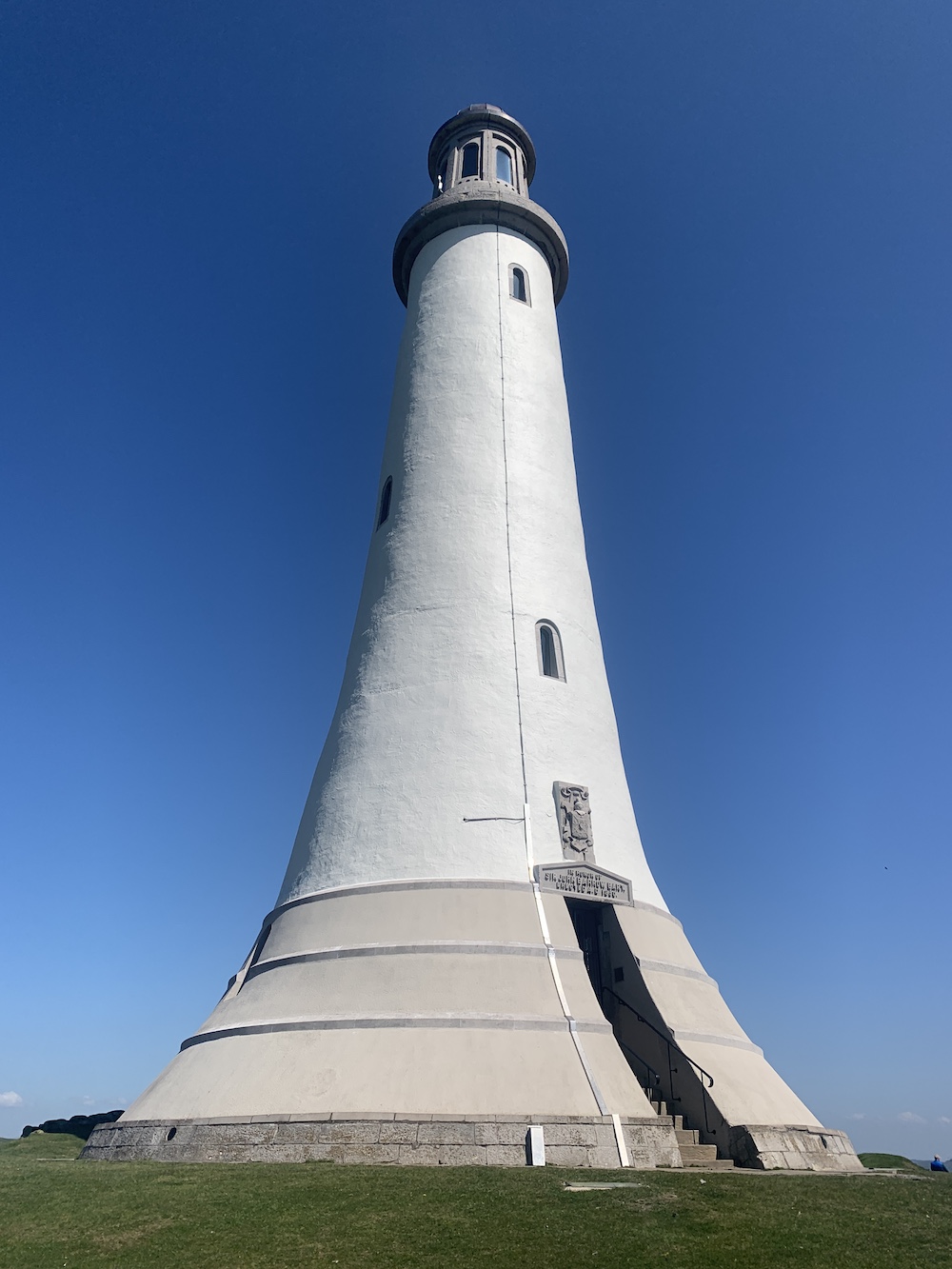
That is not the only link though between the monument and lighthouses. The tower design is based on that of John Smeaton’s Eddystone lighthouse, which can now be seen on Plymouth Hoe. So, in a way, when you visit it does feel a little like you are visiting a lighthouse. I should add at this point that you may well be wondering who Sir John Barrow was, which is exactly what I was asking too. Sir John Barrow was born and raised in Ulverston and went on to become an explorer, a writer and – perhaps most relevant – Second Secretary to the Admiralty for 41 years. He passed away two years before the monument was constructed.
The Sir John Barrow Monument up close
It was a pretty hot morning actually and so the walk up Hoad Hill to the monument, especially given that Bob insisted on using the steepest paths, was a good way to work off the remnants of alcohol left in my system from the previous day. The views were great as you got higher though, with those looking out towards the sea being of most interest to me. Chapel Island stood out for me as this big rock in the middle of the sea. I have since discovered that it is possible to access it at low tides, but with real care and from the east bank of the River Leven.
Chapel Island can be seen on the far right out to sea
The monument is really impressive and quite beautiful actually. It does have a lighthouse vibe about it, which probably has a lot to do with the original design inspiration. It is possible to climb the tower on certain days between Easter and October. A good sign that the tower is open is if the flag is flying, but it is well worth walking up even if it’s not.
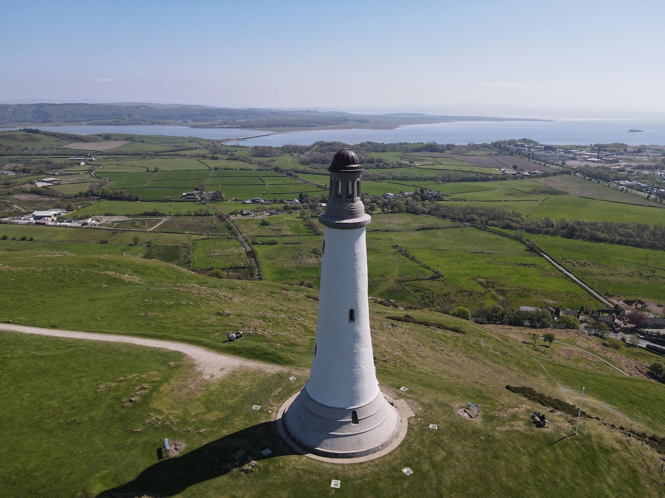
Joe the Drone had a wonderful time flying around the monument, pictured here with some glorious Cumbrian hills in the distance
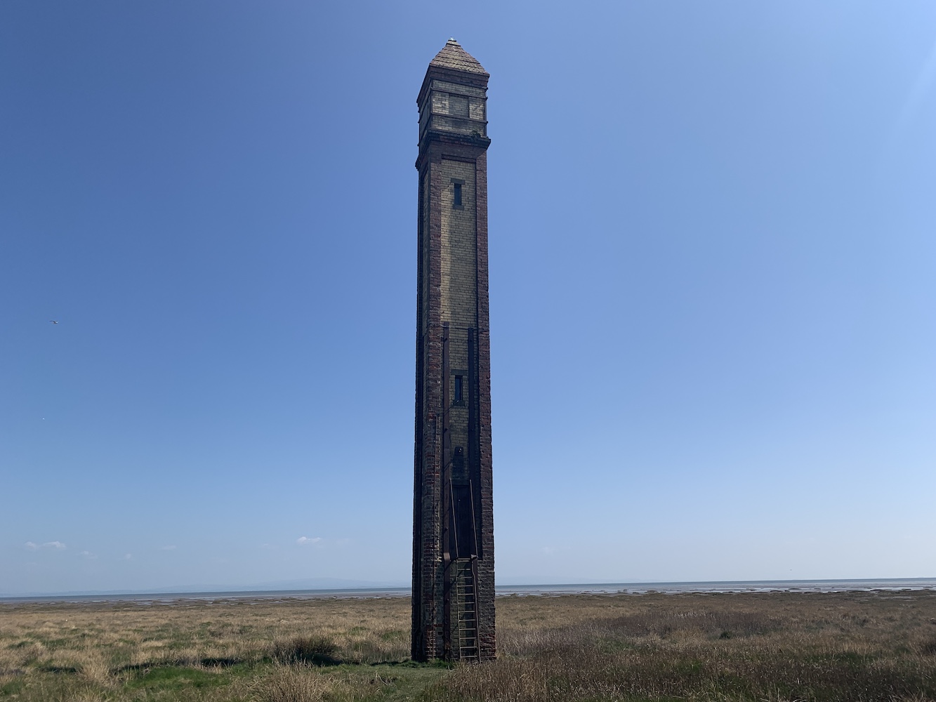
Back down off the hill, it was time to head for some lighthouses with lights! The first of these was Rampside, a wonderful skinny little brick tower known locally as ‘The Needle’. This tower, built in 1875 to guide ships into Barrow-in-Furness, is the last remaining one of thirteen of this same type.
Rampside Lighthouse, also known as The Needle
The lighthouse is really easy to spot, sitting just off the road at Rampside on the way to Roa Island. Though it is close to the road, it is another one to be careful near due to those tides. The tide was pretty low while we were there, but there were still little puddles of unknown depth around that you need to watch out for. The fact that it has a ladder up to the door also is a good indication that the sea can impact access to it.
The ladder leading up to the door is visible here
It’s a sweet tower and with most of it being red brick I was imagining it wouldn’t really be a very useful daymark, but seeing it later on from a different angle, it really is quite noticeable. This is another one with great views across to Foulney, Roa, Piel and Walney islands.
Rampside Lighthouse’s daymark features are more obvious from the seaward side
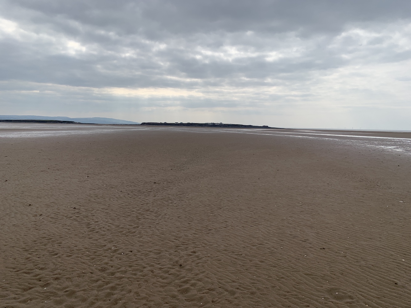
Speaking of Foulney Island, this was the next destination. Thankfully the tide times worked in our favour that day as this one really is tidal. Foulney Island is a shingle spit (with some grass) that reaches out 2 miles into Morecambe Bay. It is a nature reserve and an important area for birds during nesting season so some areas of the spit are cordoned off at certain times of the year.
The first part of the walk to Foulney Island is easy enough
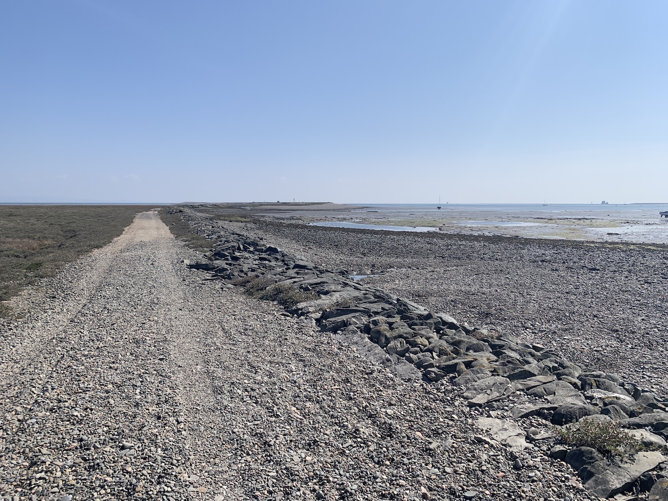
It wasn’t necessary to walk the full 2 miles to reach the lighthouse here and it is clearly visible from the parking area at the entrance to the island. The walk out here was initially a little wet with many (thankfully successful) attempt at avoiding get our feet wet in the muddy puddles presumably caused by the area being flooded at high tide. Then it was onto the shingle, which gets a bit tough going after a while. There are the remains of a 19th century stone causeway here, which was constructed to prevent the silting up of the Walney Channel. With the state of some sections of this causeway now though it would be more like boulder hopping to walk along it.
Here you can see the rocky causeway leading out to Foulney Island
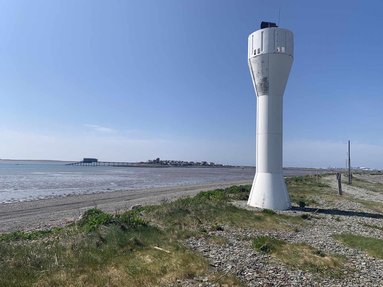
The lighthouse here is a funny thing, even I will admit that. It’s an oddly shaped white glass reinforced plastic tower, which is very much a different coloured version of the light at Cardiff Barrage. Probably understandably there’s not a lot of information out there about it.
Foulney Island light with Roa Island and its Lifeboat station in the distance
This turned out to be an excellent area for Joe the Drone to stretch his blades and grab some great shots with the tidal sections of the islands all around exposed at that point. There are the remains of an old stone building just beyond the lighthouse. It’s not clear what purpose this would have served. Beyond that, although we didn’t venture that far, you can begin to see the first of many pile lights in the area just off the end of Foulney Island. It was one of these type of lights I was keen to see next.
Foulney Island from above
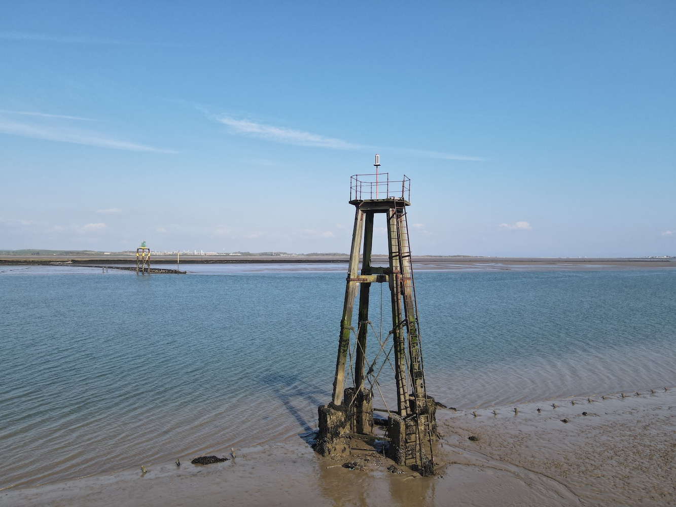
In researching my book, one of the resources I’d used was the fantastic Online List of Lights website. The owner of this site aims to have a picture of every active aid to navigation listed in the Admiralty List of Lights. This is quite an undertaking as it is ever-changing and covers the whole world. I could, and have, spent hours scanning through this site taking a look at the lights of all shapes and sizes. It was on this site that I came across the Walney Channel West Pile light and you can see its entry here. It doesn’t look like much, but the little white hut on top of the pile structure was what caught my attention. It was time for me to take a look at it for myself.
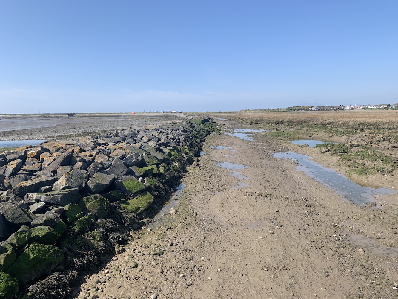
Passing through Barrow-in-Furness we arrived on Walney Island and found somewhere relatively sensible to abandon the car in Biggar. The OS map showed a footpath running down to the east coast of the island from here and this was really straightforward to find, passing along a narrow grassy area between two fields. Initially the walk was easy enough once we got to the coast, heading north and then east. After a while it began to get a bit wetter underfoot and I was very grateful to have had my wellies available for this walk. Again, it’s another area that becomes flooded at high tide. We stuck to fence line though to try and avoid, as much as possible, the wettest areas. At one point we needed to cross a stream about a metre wide and Bob checked it out first to test how deep it was. Fortunately it wasn’t high enough to go over the top of our wellies so we carefully waded through it and then continued on our way.
The area combines grass with lots of salt marsh
Rounding the corner we spotted a whole range of pile lights ahead of us. Quickly recognising that, even at low tide, the land between us and any of these lights was pretty saturated in many places, we decided to send Joe in to investigate from the sky. It was unclear which light I was actually looking for here, which was the first sign that something had changed in terms of the light structure.
Walney Channel and the surrounding area look great from above
After inspecting both Joe’s photos and the grid reference against the map, I was a little sad to have to confess that this one was a lighthouse demotion. The light being investigated is now possibly the most unimpressive of all of them. Some have some very fancy coloured daymark triangles on them, but this one was just a pile structure with a light on a stick coming up out of the top.
The somewhat disappointing Walney Channel West Pile light
It wasn’t the most exciting or joyful end to the day’s bagging, but to go to these places to check things out always feels worthwhile whatever the outcome is. It was also quite fun to wander around to which is really a big part of the adventure of lighthouse bagging.
This marked the final day of a week’s worth of lighthouse visits. It really was quite a week and one that saw me visit those lights I had left to see on the Isle of Man and in North West England, so I returned home with a nice sense of achievement having reached this goal and explored yet more of our amazing country’s (and the Manx) coastline. 🙂
Although the day I’m about to write about wasn’t all about the tidal island and not all about being tipsy either, I just couldn’t resist the title.
I arrived back on the ferry from the Isle of Man following the recent lighthouse bonanza over there, and was met by Bob at Heysham. I’d made some lighthouse plans for later that day and we had a little time to kill beforehand.
While in the area we decided to pay Hale Lighthouse a visit. I’d not been here since my 2012 tour and I felt I hadn’t really explored the area properly on that occasion. Hale Lighthouse was built in 1906, replacing an 1838 light in the same location. The light was introduced to help guide ships safely around Hale Head as they approached the Mersey. This area is renowned for its fast moving tides and the ever changing sandbanks that can sit just below the water level, a hidden danger to shipping.
Approaching Hale Lighthouse
When the original lighthouse here was built there was already a private bathing house in this location and with the introduction of the first lighthouse, this house was converted into the keepers cottage. This cottage was demolished shortly after the lighthouse was decommissioned in 1958 when the need for the light was no longer essential owing to the reduction in trade in the area and the use of that particular shipping channel.
Hale Lighthouse with the modern bungalow coming into view
The cottage has now been replaced with a new property and this, along with the lighthouse, is now in private ownership. There is plenty in the area to suggest that, although a public bridleway runs along here, visitors to the area aren’t necessarily welcome. However, you can see why this might be the case judging by the amount of graffiti on the wall to the seaward side of the lighthouse.
Signs that the coast near Hale lighthouse is a popular spot for some
Getting around down here involved a little hop over a bit of fencing (we later found the actual way down), wandering around on some rocks, and then trying to avoid getting stuck in the mud just below the lighthouse. Our shoes didn’t thank us for that that bit!
Hale lighthouse with clear signs of erosion nearby
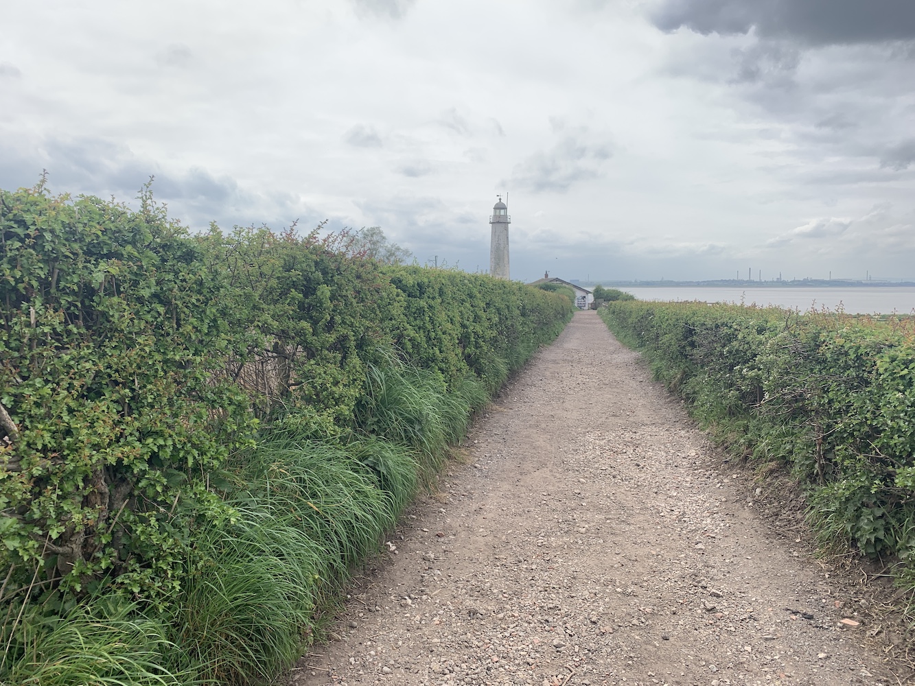
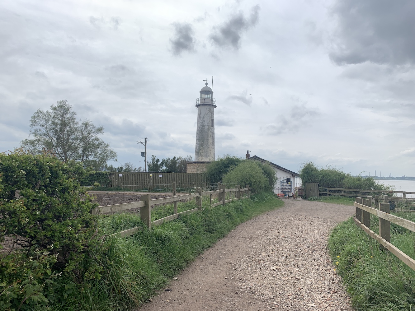
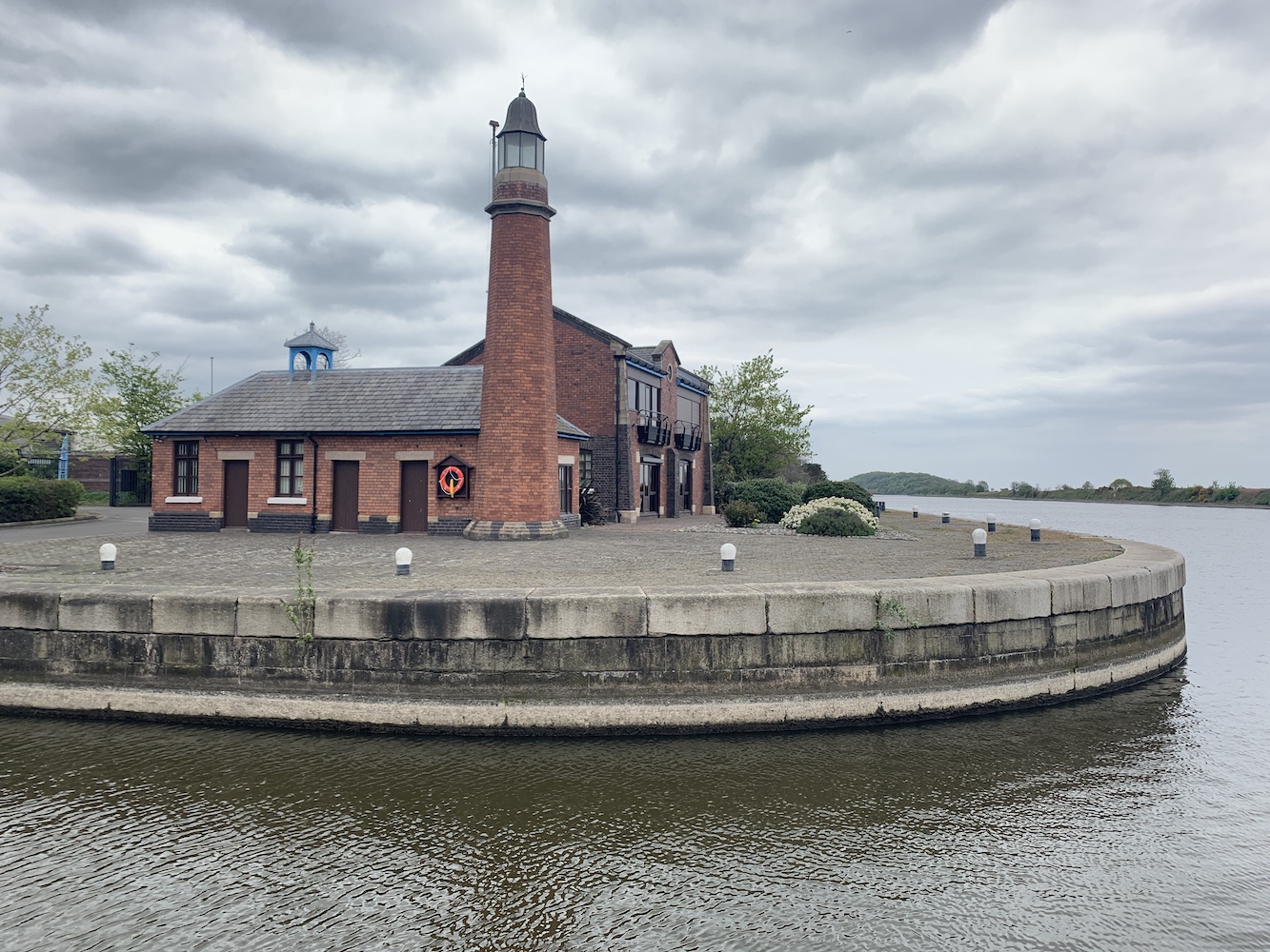
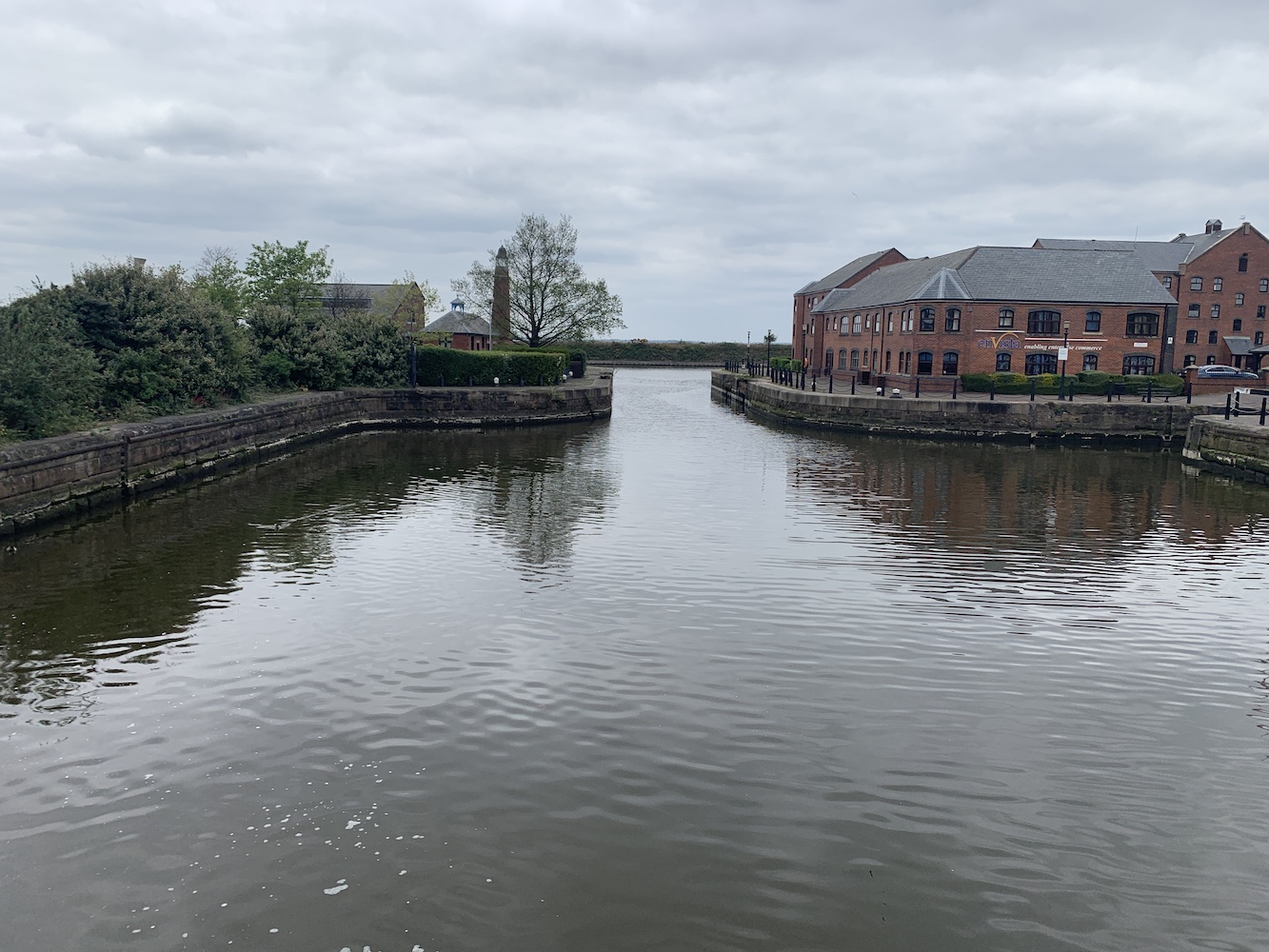
With the big plans still ahead for the day it was time to get a shift on down towards the Wirral. Thankfully there was a little time to spare which allowed us to take a swing by Ellesmere Port. On my original 2012 lighthouse tour I’d not managed to get to this one and I recall reading that it was part of the National Waterways Museum, so I’d assumed that I could turn up there and get to see it. I am not sure to what extent it is a part of the museum, but the land it is on is now private with the building owned by a fire brigade union. Having done my research though I knew where we needed to go to get the best view of it and so it was a relatively straightforward visit.
The best publicly accessible view of Whitby Lighthouse at Ellesmere Port
This lighthouse, built in 1880, is also (rather confusingly to my mind) known as Whitby Lighthouse. The village of Whitby in the area has, in more recent years, merged with other neighbouring villages to form Ellesmere Port. There is a wonderfully detailed explanation around why the lighthouse was originally built and its relationship to the waterways in this area on the excellent Lighthouse Accommodation website.
There is a fantastic old picture on the Ships Nostalgia website showing the lighthouse when it marked the entrance to the Shropshire Union Docks and Canal. Sadly the introduction of the Manchester Ship Canal in 1894 meant the lighthouse became surplus to requirement after only 14 years.
Ellesmere Port, or Whitby, Lighthouse can be seen behind the tree in this view from a nearby loch on the canal
It was time to head for the exciting afternoon we had planned. In my role as Events Coordinator for the Association of Lighthouse Keepers I’d come into contact with the owner of the lighthouse in Hoylake, which is now a private home. I’d made contact with him ahead of this trip and had also mentioned our intention of heading over to Hilbre Island while in the area. He very kindly offered to walk over to Hilbre with us and show us around the Hilbre Island Canoe Club’s base there, which seemed like an opportunity not to be missed.
First though he (Charlie) had invited us to meet him at his home and, of course, I couldn’t resist the chance to take a look inside such a beautiful building and lighthouse. For a start the garden is just glorious and so well kept. To see the lighthouse towering out of the top of the very grand looking house makes for such a fantastic scene. Charlie explained to us which parts of the house would have been there when the lighthouse was operational and how the building was split into two with a shared access hall when it housed the keepers and their families.
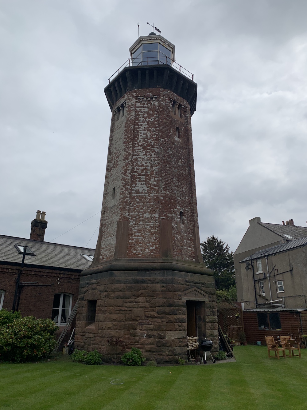
The magnificent Hoylake (High) Lighthouse
Hoylake Lighthouse was originally the high light, working in partnership with a low light that has since been demolished. Charlie has a wonderful map on his wall showing the area and you can clearly see how these lights, which appear relatively inland, would have helped to guide ships. The navigation on the Wirral is particularly interesting as running through a series of lining up lights was necessary for safe passage.
The view of Hoylake Lighthouse tower from the back of the property
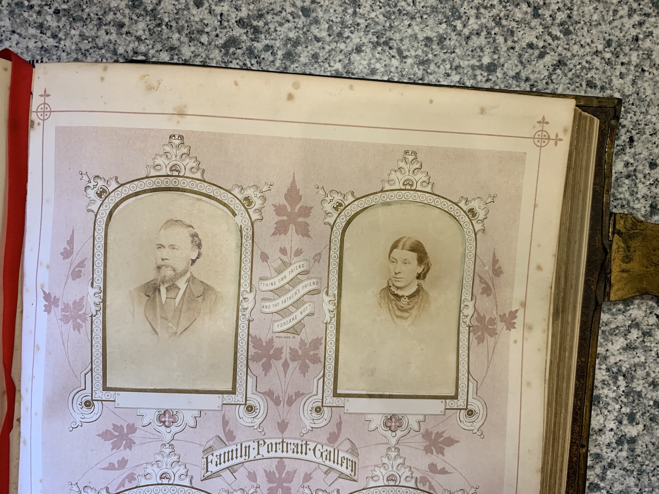
The existing lighthouse was completed in 1866, replacing its predecessor which had been operating for just over 100 years by that point. The light was discontinued in 1886. When Charlie purchased the house he also inherited the old lighthouse log book which, as you can probably imagine, is a wonderful thick tome just full of history.
The old log book offers a fascinating insight into the history of the lighthouse and the people who lived there
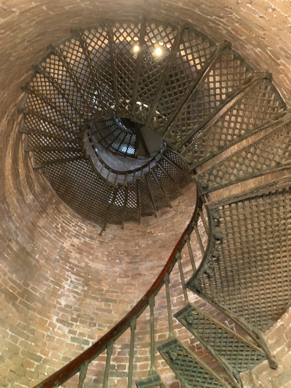
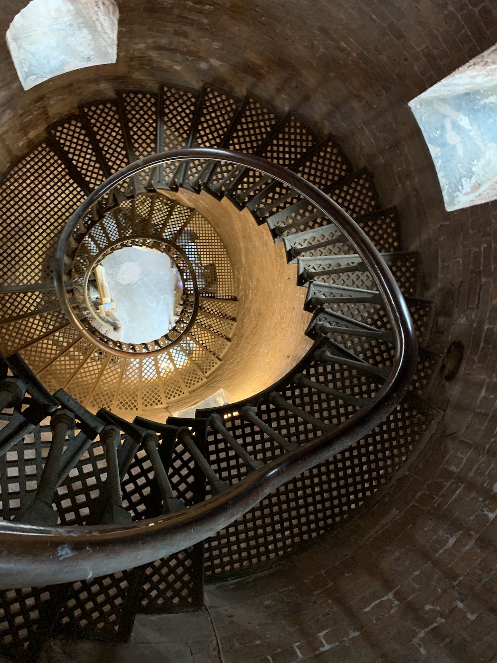
I won’t say too much about the house itself as it is a (beautifully decorated) private home, so I will skip ahead to the tower. It’s a really unique tower, very open and the type that those without a head for heights would really struggle with. There is no central column, just open space, and the spiral staircase is made up of fantastic lattice metal stairs which allow you to see right through them to the area both below and above. There is definitely nothing enclosed about this lighthouse tower.
Looking up the tower. The stairs in the lighthouse almost create an optical illusion.
And the view back down Hoylake lighthouse
Just below the lantern there is the usual small room where, these days, operational lighthouses would have a couple of boxes that keep the light going. Then it’s just a climb up a ladder to get to the lamp room. What a space that is! Again it’s very open and bright with 360 degree views. What amazed me most up the top though was the width of the gallery. The railings around the gallery are pretty low so you do need to be a bit careful, but it is such a wide space compared to those I have been to before that I was quite impressed. Again, it’s all about the space at Hoylake.
The wide gallery at Hoylake Lighthouse with the view over the houses towards Hilbre Island, and Wales beyond
Charlie had very kindly carried his wonderful and heavy old binoculars up the stairs (no mean feat) and set them up so we could see a number of the other lighthouses in the area, including Talacre (Point of Ayr), Bidston and Leasowe, the latter of which could be seen quite clearly with the naked eye that day. We could also see across to Hilbre Island and this served as a reminder that we should probably start heading that way to ensure we caught the tides right.
Charlie’s wonderful binoculars in the lamp room at Hoylake lighthouse
Hilbre Island, or the Hilbre Islands (actually three tidal islands, with Hilbre being the biggest) sit just off the coast at Hoylake. Although it is recommended to go from West Kirby at low tide, Charlie said that walking from Hoylake was fine as long as you knew which way to go. The timing for Hilbre is key as there is plenty to see on the island and you definitely don’t want to be only just starting the walk back with the tide already coming in.
Hilbre, here we come
Considering it’s a small island it has a really interesting history. There’s a great piece on the Hilbre Island website that gives masses of information on various aspects of its past. My interest in visiting was largely a result of the light over there, but I got somewhat waylaid when Charlie showed us the Hilbre Island Canoe Club building. He is a member of the club and the building is full of a variety of pictures from past and present.
Arriving at Hilbre Island and one of its many very interesting areas
While Bob flew Joe the Drone around the island, Charlie showed me a photo album which gives a wonderful overview of the club’s past – oh, and the wine came out!
The Hilbre Canoe Club and lighthouse from above
A bird’s (or Joe’s) eye view of HIlbre Island
There was so much conversation about the Club and other topics that I almost forgot what I was there for, but we did eventually make it to the lighthouse. I’d had a couple of discussions before with my lighthouse pal John about whether or not the light on Hilbre met the criteria for inclusion in my book. As a result, my first priority was to check that it did and that it was actually big enough for a person to be able to get inside. As you will see from the picture, the door is considerably taller than me. There may not be room to swing a cat in there, but it could fit a person inside. I would give it a good go!
The size comparison between me and Hilbre Island Lighthouse
Around 1810, two wooden markers were installed at the north end of Hilbre to help guide ships into the Hilbre Swash at the entrance to the River Dee. In 1840 these were replaced by new markers on Little Eye (the middle of the three Hilbre Islands) and just offshore at Hoylake. After being replaced at some point they were eventually demolished during WWII to avoid the enemy using them as landmarks.
A navigation light, an acetylene gas-powered light on a lattice tower initially, was first introduced by the Mersey Docks and Harbour Board Authority in 1927 to mark the Hilbre Swash. It was later replaced by the existing steel structure and ownership of the light changed to Trinity House in 1973.
Hilbre Island Lighthouse
Joe the Drone’s view of the north end of Hilbre Island with Hoylake in the background
Close to the lighthouse is the old telegraph station, which was the second station on the island (the original was a wooden structure). This was one in a long chain of stations used to communicate messages from as far as Holyhead to Liverpool. A couple of other lighthouse locations were involved in this process, those being Great Orme and Bidston Hill. The telegraph station on Hilbre was completed in 1841 with the system continuing to be used until 1860.
Hilbre Island telegraph station
We then had a great walk around the island.
The beautiful west coast of Hilbre Island
Then it was back to the Canoe Club where I proceeded to gulp down another glass of wine. When you are on a tidal island you can’t be hanging around for too long sipping on a glass of wine! The walk back across to Hoylake was thankfully very refreshing. On arrival back at Charlie’s we discovered his lovely wife Ali was back so we popped in and I enjoyed even more wine.
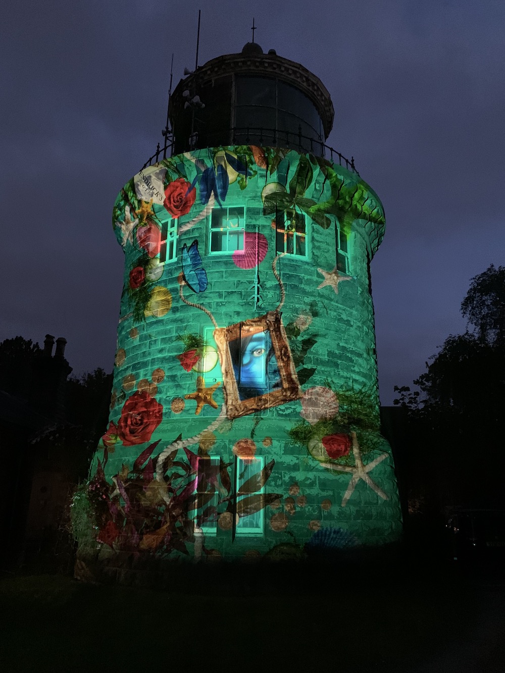
I had arranged to stop off at Bidston Lighthouse that evening to collect something and poor Stephen and Mandy ended up waiting very patiently for our arrival only for me to turn up a little worse for wear. As far as I could tell they didn’t seem to mind too much though and very kindly gave me coffee. The visit to Bidston was actually very well timed as it is currently one of four lighthouses currently lit up with beautiful moving light designs by Hendrick’s Gin, which seems like a wonderful image to leave you with at the end of this long and crazy day 🙂
The Hendrick’s Gin light display on Bidston Lighthouse
After our short boat trip out to see Gunfleet lighthouse on Tuesday morning it seemed a good opportunity to revisit some of the Essex lighthouses – and introduce Bob and Joe the Drone to them as well.
Back in 2012 the Naze Tower had been my first stop on my lighthouse tour and I’d not been back since. Some may argue that the Naze Tower might not have been a lit aid to navigation, but it also may have been – and, more importantly, it’s a lovely place to visit.
The Naze Tower
Due to Covid-19 the tower is currently closed, but that didn’t matter as the sun was shining and it was dry. My lighthouse pal John had joined us and we were all pleased to be able to spot Gunfleet lighthouse in the far distance having been closer to it that very morning.
The Naze Tower is quite impressive and is clearly very well looked after. The beautiful brickwork is looking excellent when you consider that the tower was built in 1720. The tower had been somewhat neglected in the past, but the owners did some extensive renovation and, in 2004, it opened to the public for the first time. Presumably it needed, and will continue to need, some repairs and maintenance done on it – it is 300 years old after all.
When it does reopen, hopefully next year, you can see it’s 8 floors which feature an art gallery with exhibitions, and a museum about the tower and surrounding area. On top of that, quite literally, you get the panoramic views.
Joe took to the sky and, as usual, captured the glorious coastline. Seeing this coastline is always tinged with a little bit of sadness though as it really does suffer from erosion. There is evidence on the beach here that some measures have been taken to try to reduce the erosion in the area as you can see in the picture below.
The sea defences were clear in one of Joe’s shots
The view from above looking towards the south
There’s a lovely little tea room nearby too and we chose to have lunch outside on a bench before waving goodbye to John and continuing on our way.
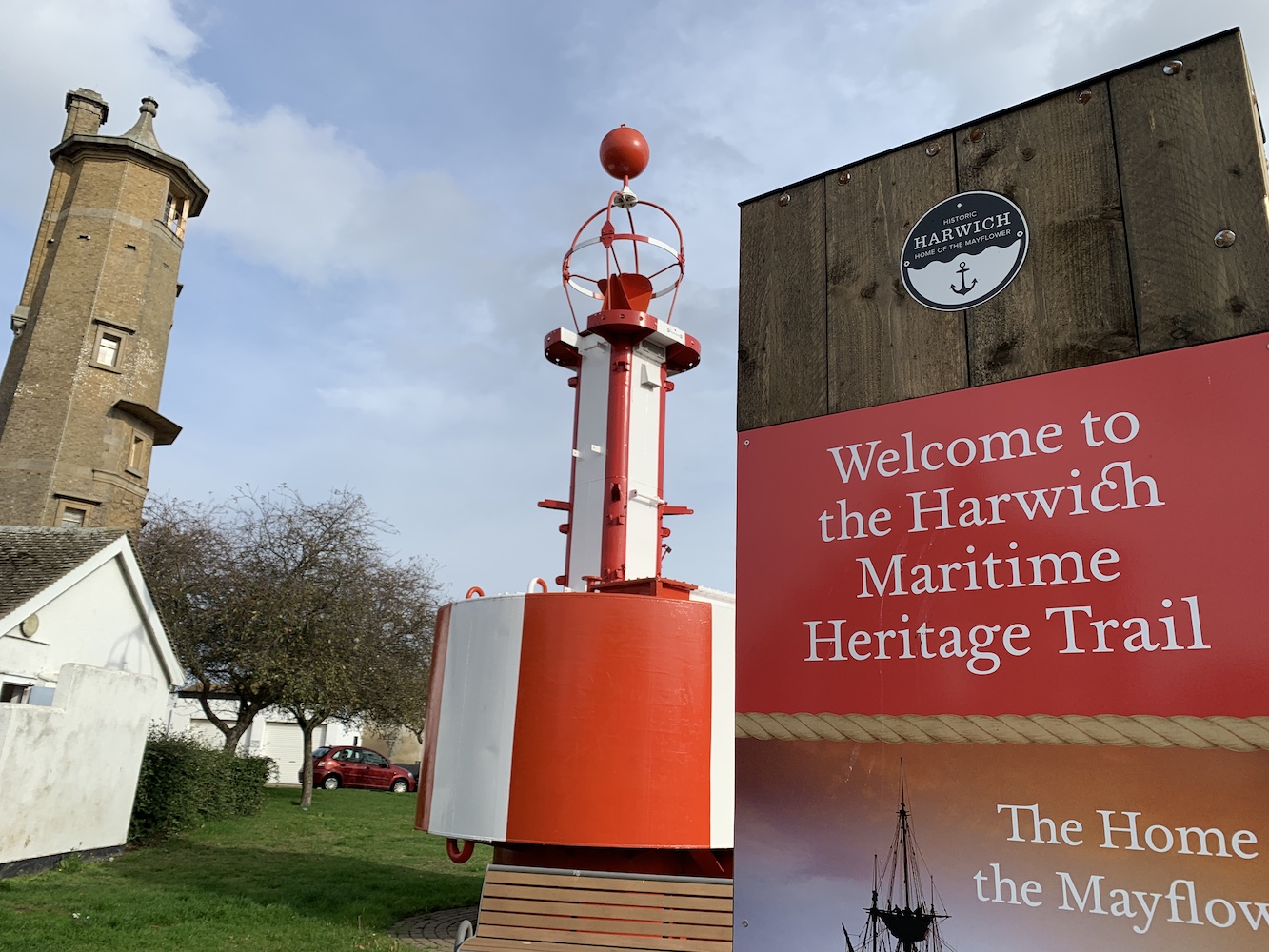
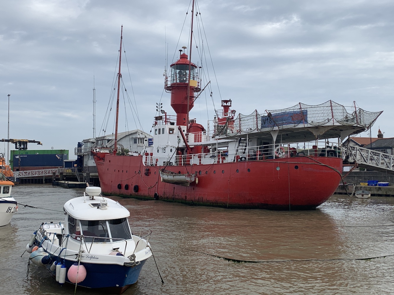
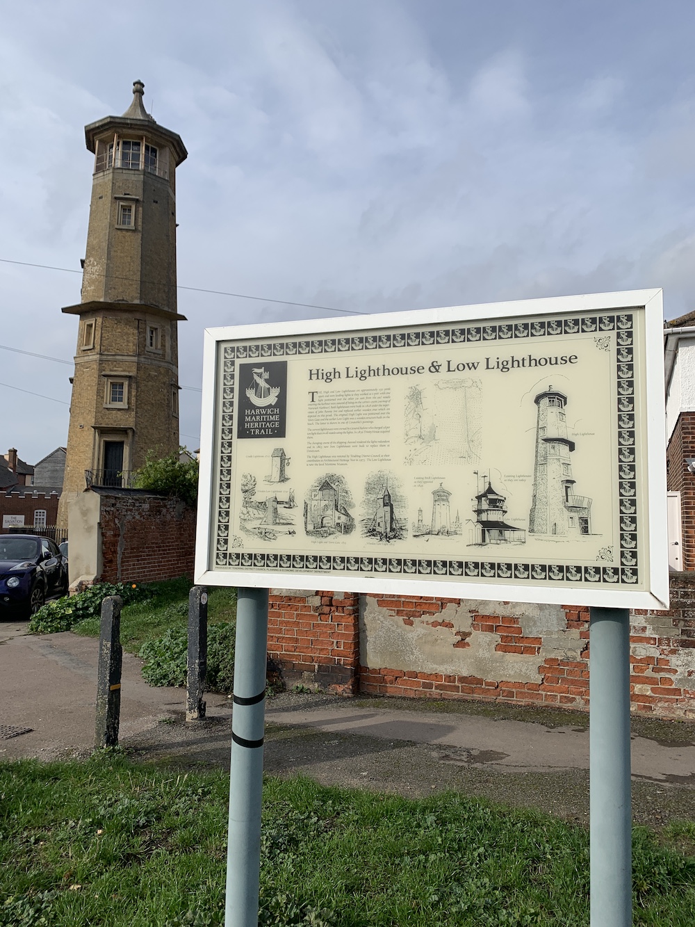
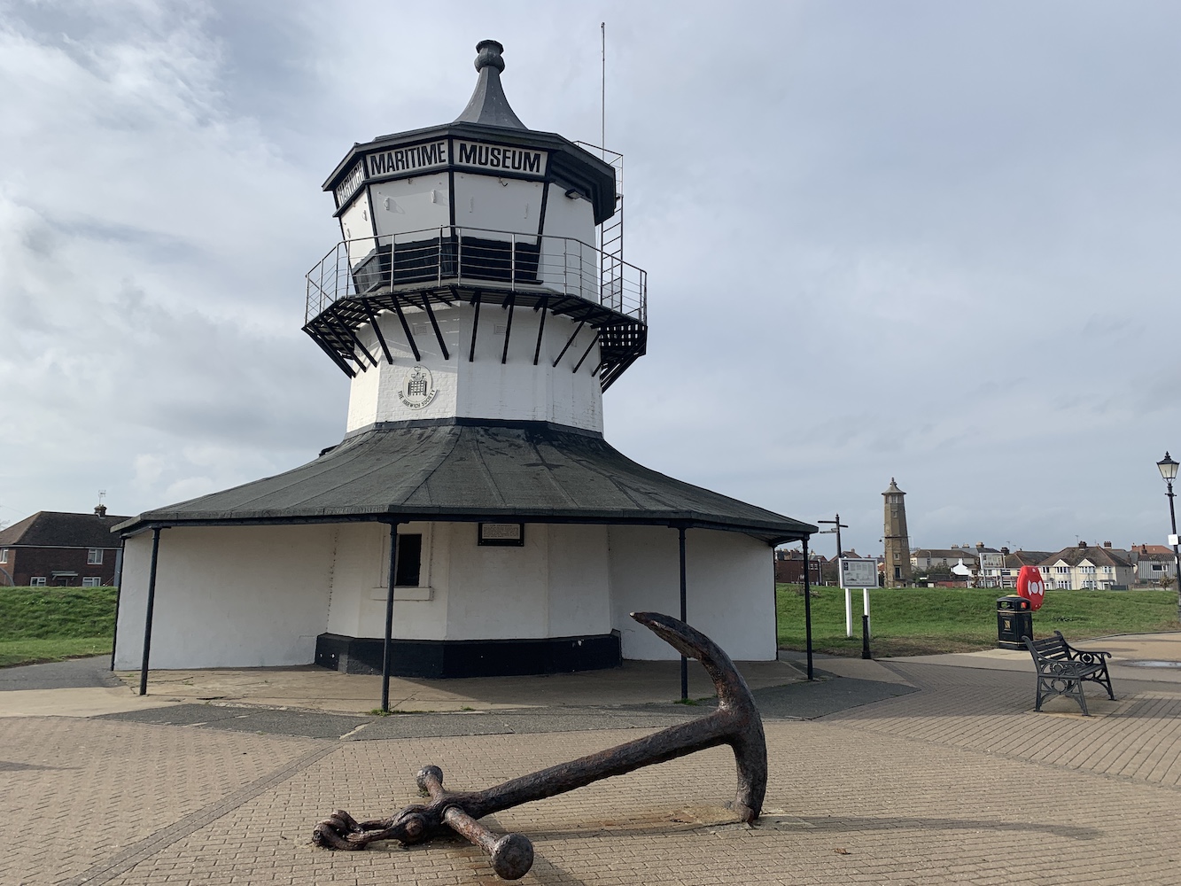
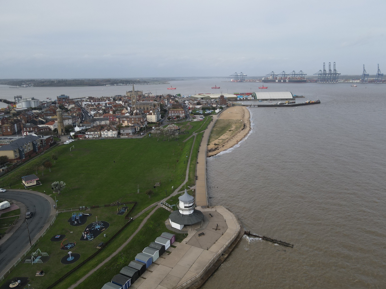
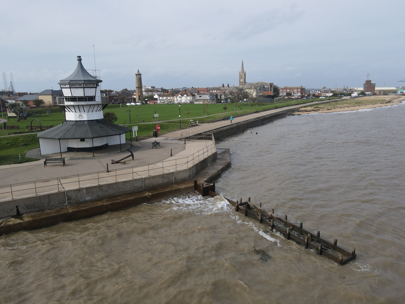
Harwich awaited our arrival and this is quite a special place for those with any maritime interest. It is where Trinity House monitor their lighthouses from – as well as the Northern Lighthouse Board lights during evenings and weekends. Trinity House also has a depot and buoy yard here. It has its own two old lighthouses, a Light Vessel you can (under normal circumstances) look around, the Lifeboat Museum and an array of other points of interest that make up the town’s Maritime Heritage Trail. In addition we were able to see three more light vessels anchored off shore in the area.
Harwich High Light and the Harwich Town Buoy at the start of the Maritime Heritage Trail
Light Vessel 18 which is usually open to visitors
The two lighthouses here are no longer active and haven’t been since 1863 when they were replaced by the two Dovercourt lights (more on those in a bit). The low light has housed the Maritime Museum since 1980 and the high light is now run by Harwich Society as a local interest museum.
Harwich High Light
The existing towers replaced the town’s original leading lights. All of these lights were intended to work in pairs to guide ships safely into the harbour.
Harwich Low Light with the High Light visible in the background
Joe had a little fly around the area too, which is actually how we realised the light vessels were offshore.
An aerial view of Harwich’s harbour area with the three light vessels visible
The lighthouses in Harwich
Harwich is a fascinating place and it would be nice to spend some more time here getting stuck into the maritime history.
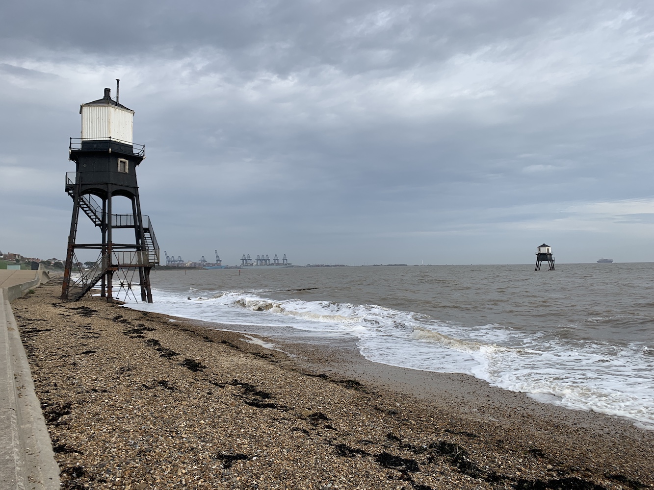
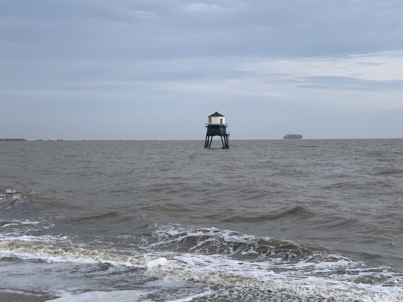
Just a short drive to the south we found the two Dovercourt lighthouses. On my original tour I’d seen these two at low tide and with high tide now approaching it was interesting to see the bottom of the outer light under water and the rapidly heightening waves splashing around the base of the inner light.
The lighthouses at Dovercourt
As mentioned, these lighthouses were introduced in 1863 to replace the Harwich lights. At the time they were built they were believed to have been fairly revolutionary in that they were of the new screw pile design and were prefabricated. A ‘causeway’ was introduced between the two lighthouses which can be walked with care at low tide.
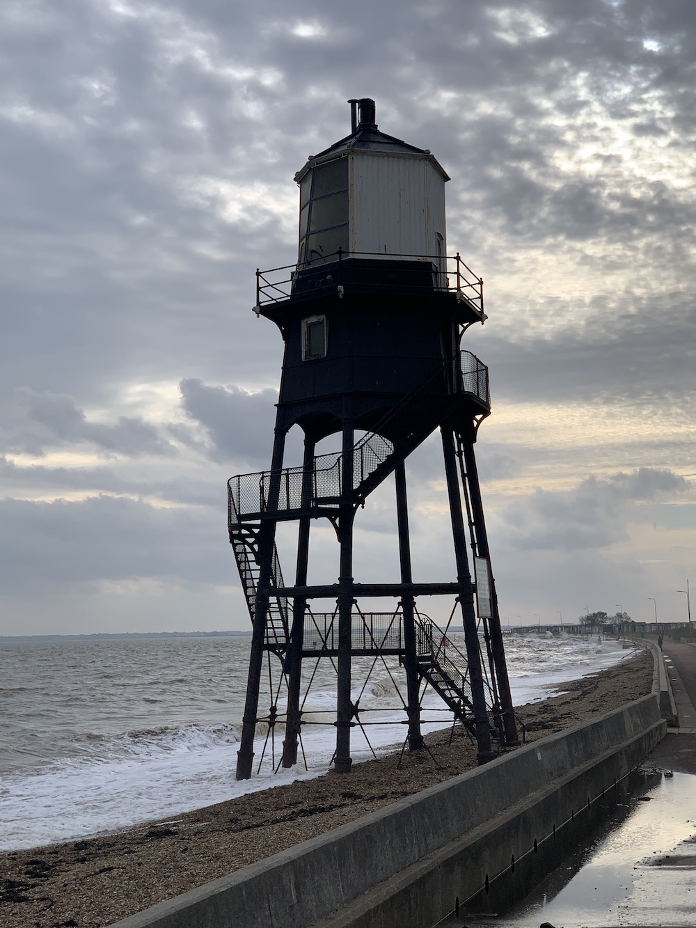
Dovercourt Inner lighthouse
The lights were decommissioned in 1917 when buoy markers were installed to mark the approach to Harwich and since then have been through a period of restoration in the 1980s. Recent investigations have found that further restoration work is required to secure their future and it looks like this is in hand, which is always good to hear.
Dovercourt Outer lighthouse
They are quite unique structures and it was good to also see them from a different angle with the help of Joe the Drone.
Dovercourt Inner light from the seaward side
Dovercourt Outer lighthouse from above
Yet another day of doing a little more exploring and revisiting had come to an end. A very good day it had been and with it also being the last planned lighthouse trip of the year I was glad it had been a success and undertaken with great company.
Let’s hope even a little lighthouse visit can occur at some point before the year is out. Finger crossed 🙂
What inspired me to go on my 2012 tour of lighthouses? Well, I loved lighthouses for a start, but I also had a taste of just how great it can be to go on a trip specifically to see multiple lighthouses back in July 2010. Thanks to my flatmate at the time and my sister, I was treated to a few beauties on the south coast of England over a long weekend.
Visiting multiple lighthouses wasn’t the only similarity to my later tour, as we also camped too. Camping wasn’t something any of us had done much of at all and I recall plenty of laughter and confusion when putting the tent up. It turned out to be good practice for me.
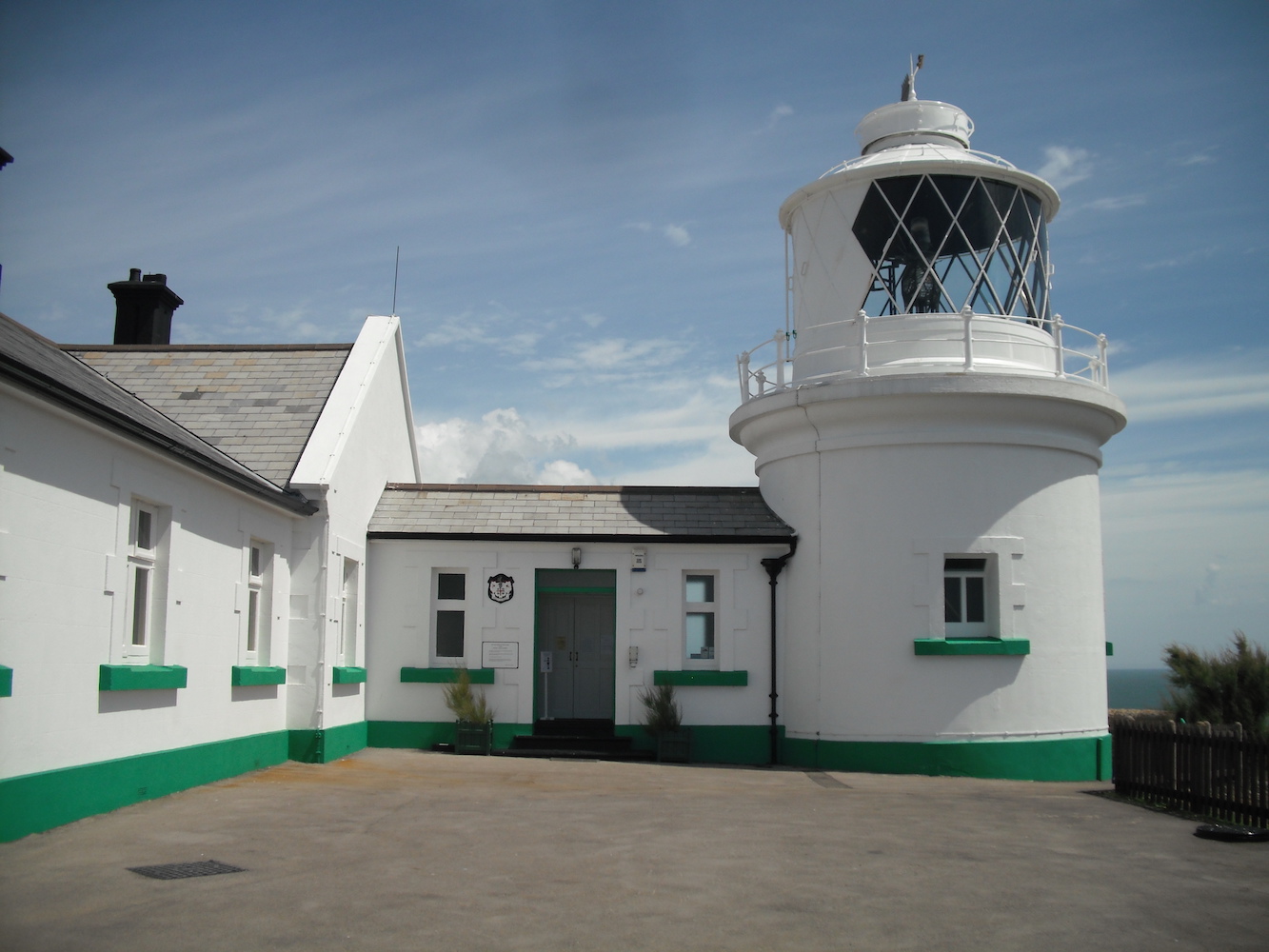
Our first lighthouse of the trip was the small but beautifully located Anvil Point. Thankfully we had excellent weather all weekend which made the walk from the Durlston car park to the lighthouse all the more enjoyable – and I remember the walk which is always a good sign!
Anvil Point lighthouse
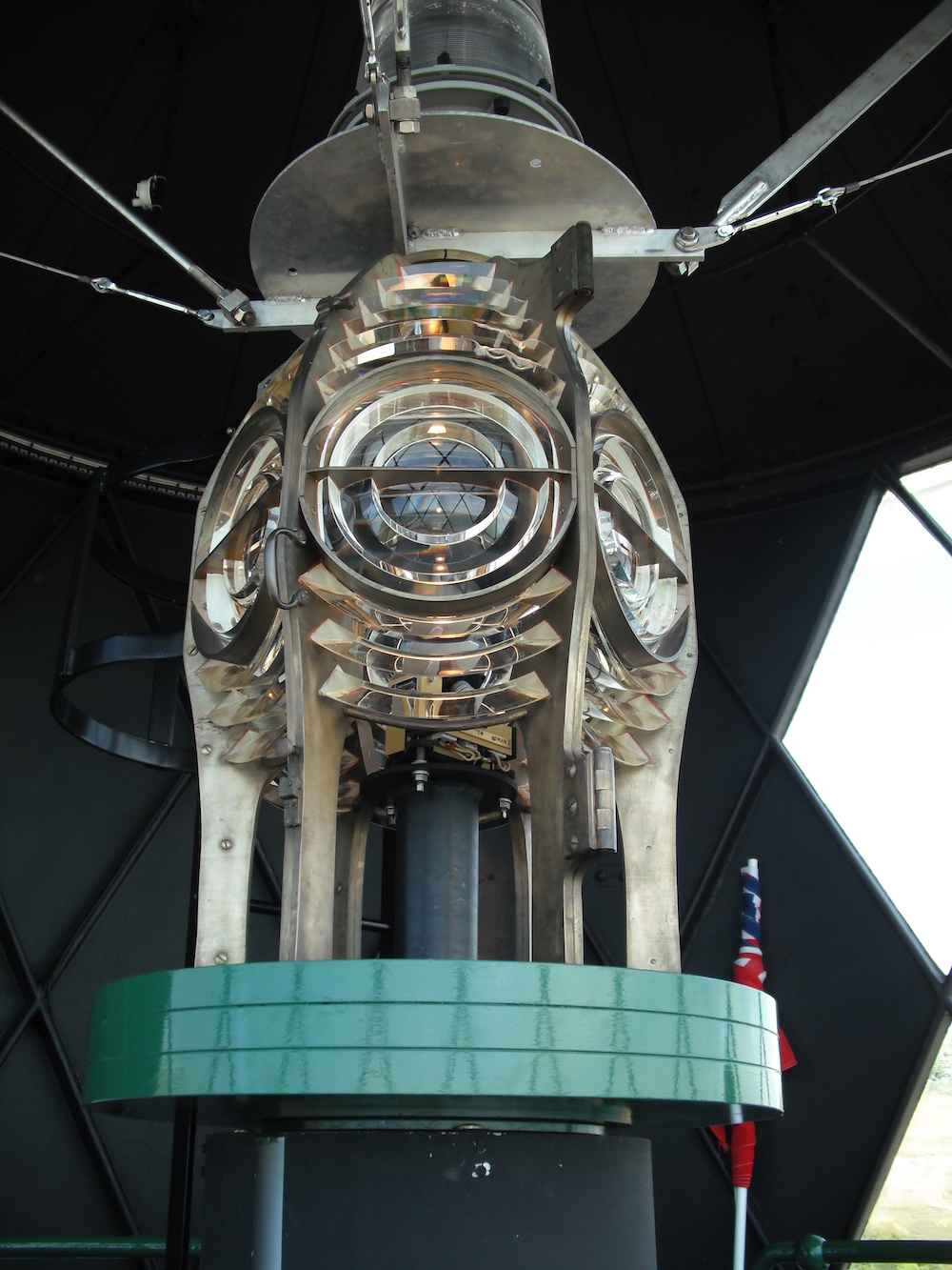
Rather fortunately the lighthouse was open for tours on that particular day, although these are sadly no longer running, so I’m even more glad to have done it when I did. I remember the tour guide being really friendly and pleased to meet someone else who had a genuine interest in lighthouses. I look back now at pictures of the tour and it brings back memories of being in awe of it all, which is a feeling I often still get when I reach the top of a lighthouse. I suppose you never lose that feeling of wonder – or I hope I never do anyway.
The lens inside Anvil Point lighthouse
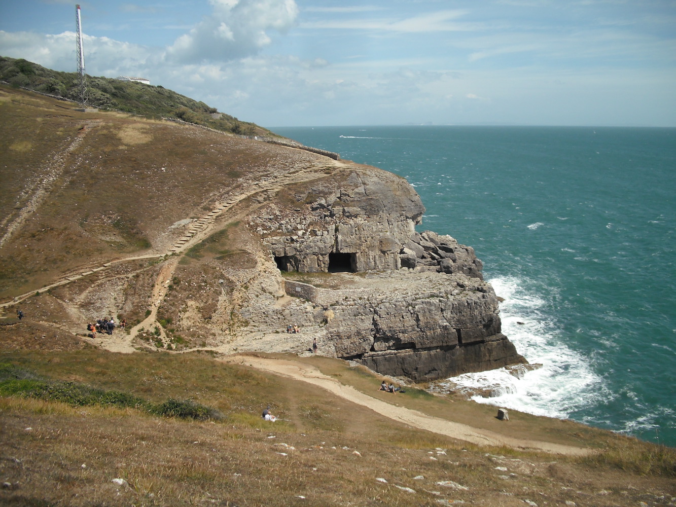
The views from the top of the tower were amazing, with the turquoise sea and the various tracks littered along the coastline around the lighthouse. We wandered a little further around to the east after we’d left the lighthouse and read up on the Tilly Whim Caves.
Looking towards the Tilly Whim Caves
We then continued on to our next destination: Swanage. No more lighthouses on that particular day, but we did have a nice ride on the Swanage Railway Steam Train to Corfe Castle. The Castle wasn’t open for long after we arrived so we settled for a wander around the outside and dinner in a pub nearby. We finished off the day with a visit to Swanage beach before heading back to the tents.
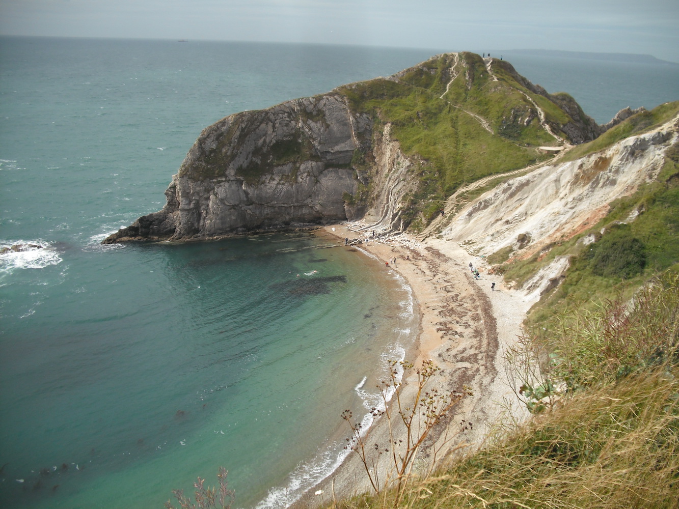
Day two was to bring back lots of memories for me and certainly made some wonderful new ones too. As a student I was based in Weymouth for a couple of years so Weymouth itself, Portland, and the coast around Lulworth Cove and Durdle Door became my playground and I am still very fond of the area to this day. I’ve obviously seen a lot of coastline since then, but it’s never dampened my appreciation of that area. Just looking at the pictures makes me want to go back. Lulworth Cove and Durdle Door were our first stopping points that day, followed by lunch and cider in Weymouth (for old times’ sake, of course).
One of the many great views at Lulworth
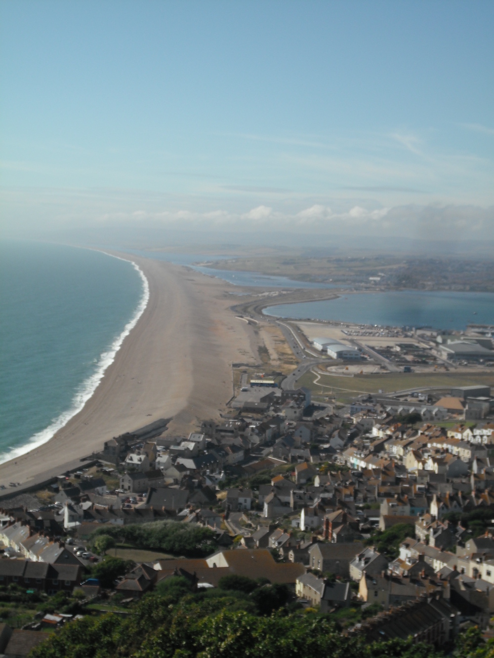
Continuing onwards to Portland, we set off to see its three lighthouses. Portland Bill is a pretty famous lighthouse and you can see why it attracts a lot of people, it makes for a nice day out. It’s another scenic area, particularly the views looking down on Chesil Beach as you climb higher and higher up Portland itself. It is incredible what nature does, and I could happily spent hours researching barrier beaches and tombolos, which I fell in love with in Shetland last yet, (put extremely simply, it’s an island attached to the mainland by the narrow spit). It’s truly incredible what nature does and we are so lucky to be able to witness it, either in a single moment or (if we are really lucky) to see how it changes over the years. Of course not all of the change is good of course as we are seeing at Orfordness now.
Looking back at Chesil Beach from Portland
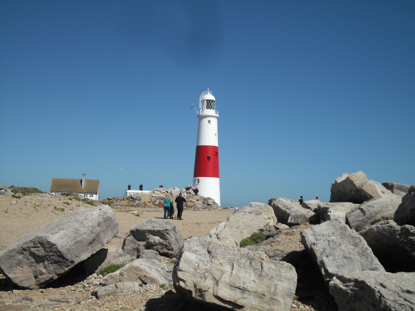
The lighthouse at Portland offered another chance to climb some steps – plenty more this time than at Anvil Point. Even more lovely views of the Dorset coastline were to be had from the top of the tower and it was great to see the big lens in there too, although this has recently been removed. Back down on the ground we strolled around for a while and I captured a couple of pictures of the other two lights before we returned to camp.
Portland Bill lighthouse
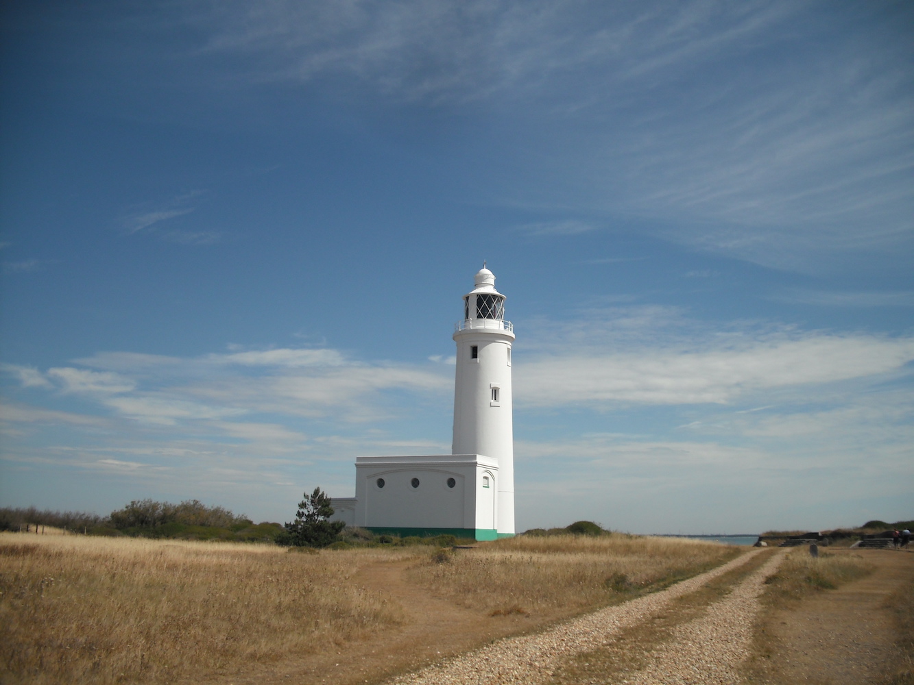
Our final day began and great adventure awaited us, this time in the form of a boat trip which would take us out to Hurst Point. It was another beautiful day and I gave the big white lighthouse at Hurst a hug as that was as close as I could get to going inside. For some unknown reason we didn’t go into Hurst Castle itself, which with hindsight was rather foolish of me as there would have been the other two lighthouses in there and I may well have discovered the Association of Lighthouse Keepers sooner as they have some excellent rooms there, which I finally got to see last year.
Hurst Point lighthouse
It’s interesting looking back at my pictures from that visit to see how the area around the Castle looked then compared to how it is now, although there was clear evidence then that the movement of the shingle was a problem. Again, it’s nature doing its wild and wonderful thing.
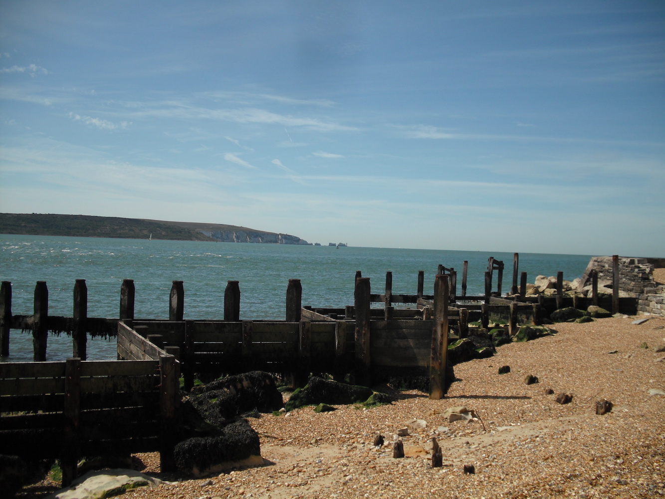
The view towards the Needles from Hurst and some of the sea defences in place at the time
Only a short visit to Hurst that time, but it was a perfect end to an inspiring trip. It was only a few months after this that I began learning to drive. The weekend had given me a taste of what could be done, and I knew I needed a car and a licence to be able to do it. The rest, as they so often say, is history! 🙂
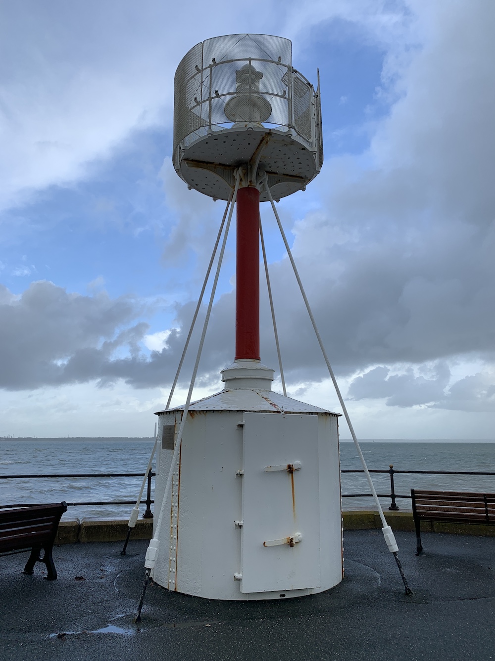
I was informed by a regular, and probably the most eagle-eyed, reader that I had missed a blog post covering a lighthouse I had visited last week. He is indeed correct. I confess, I visited Egypt Point lighthouse without writing about it here. Now there are times when I quickly stop off at a lighthouse and don’t mention it on here, but as a fan of the little lights I do now feel it would be wrong of me not to promote them whenever I get an opportunity.
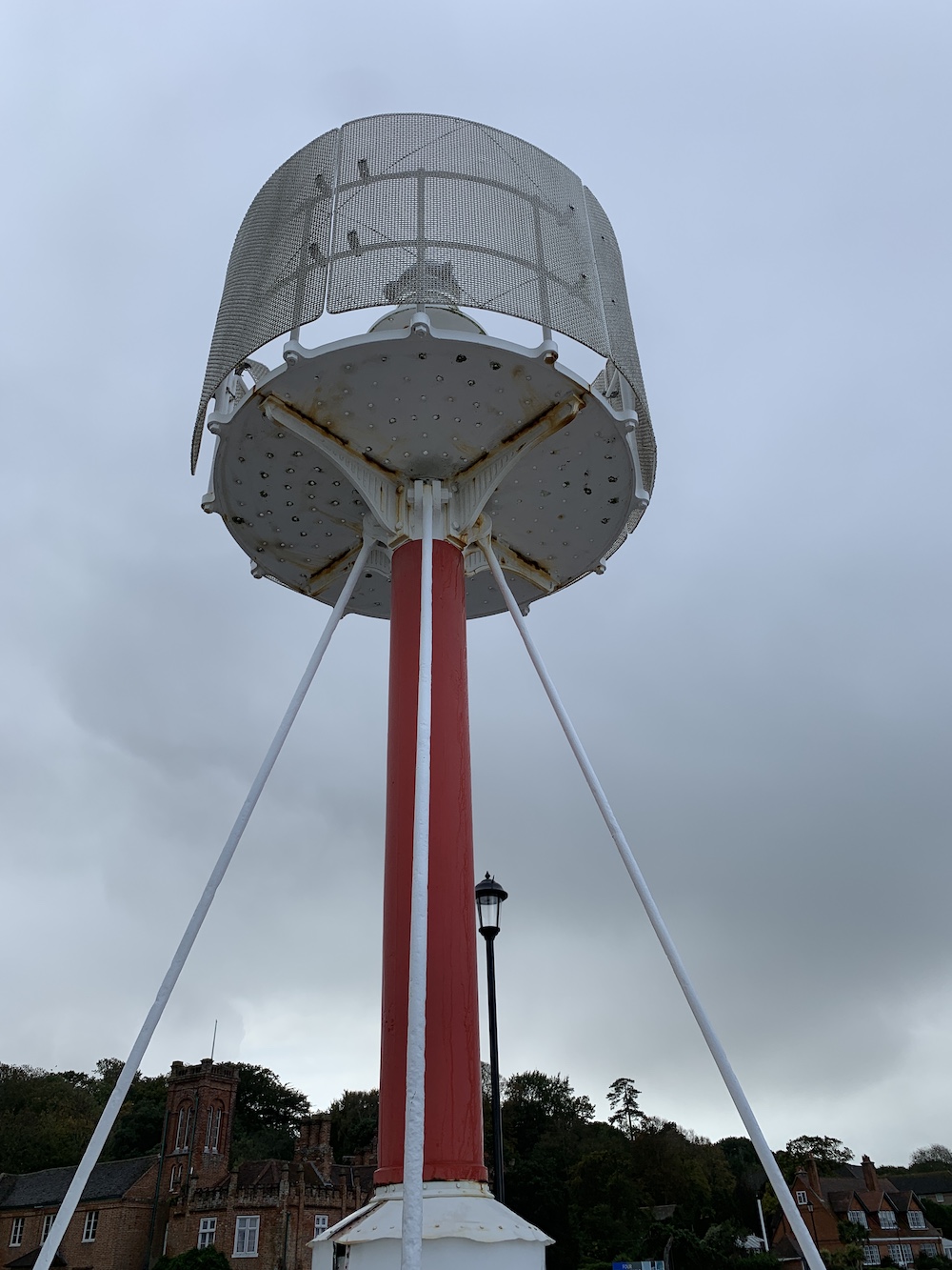
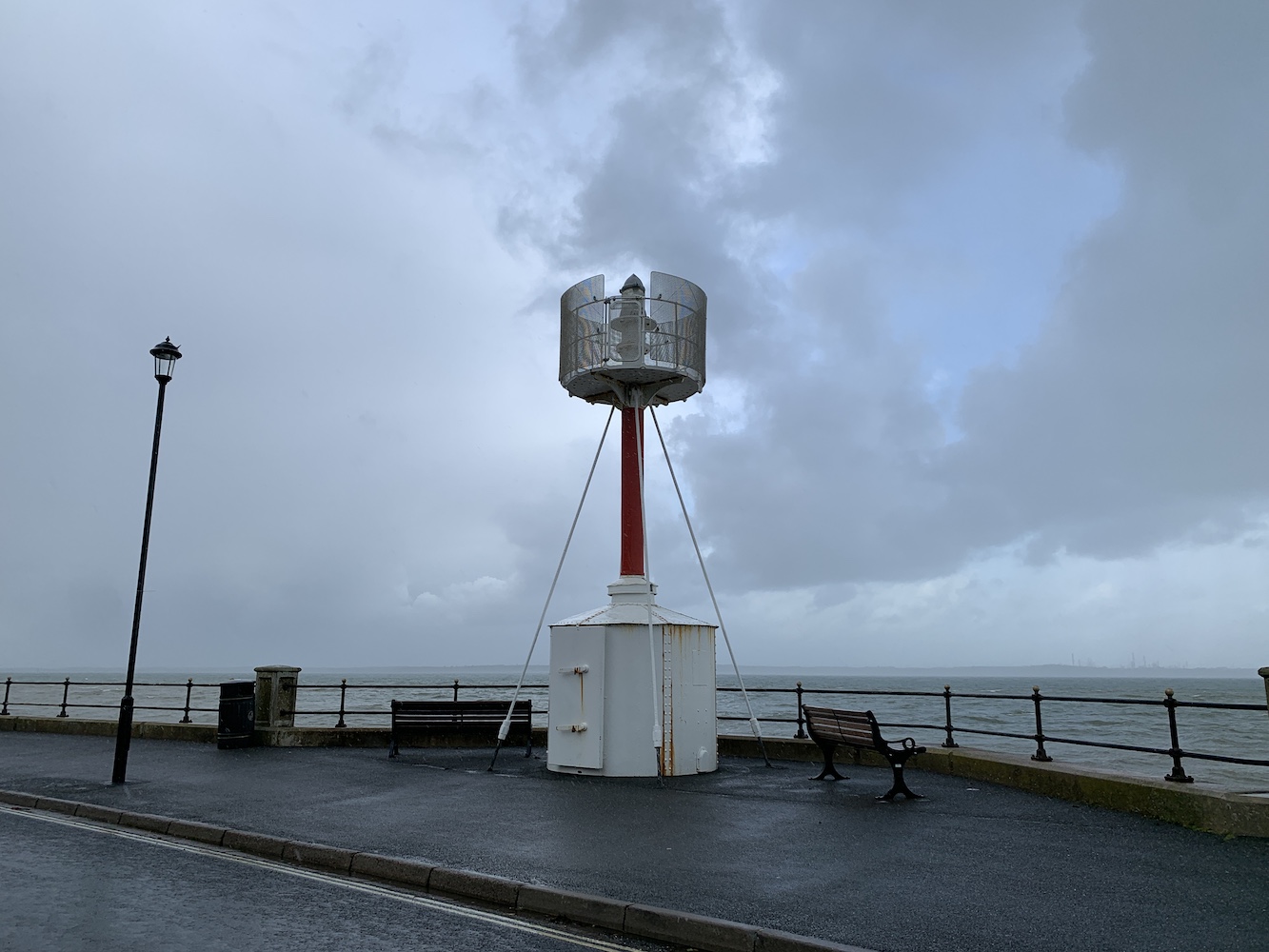
Egypt Point lighthouse
My first intentional visit to Egypt Point lighthouse was in August last year, which seems crazy as I am from the Isle of Wight and lived in Cowes itself for a couple of years. As I said in that earlier post, I’d passed the lighthouse here numerous times in the days before I became seriously interested in lighthouses, and not paid it any attention.
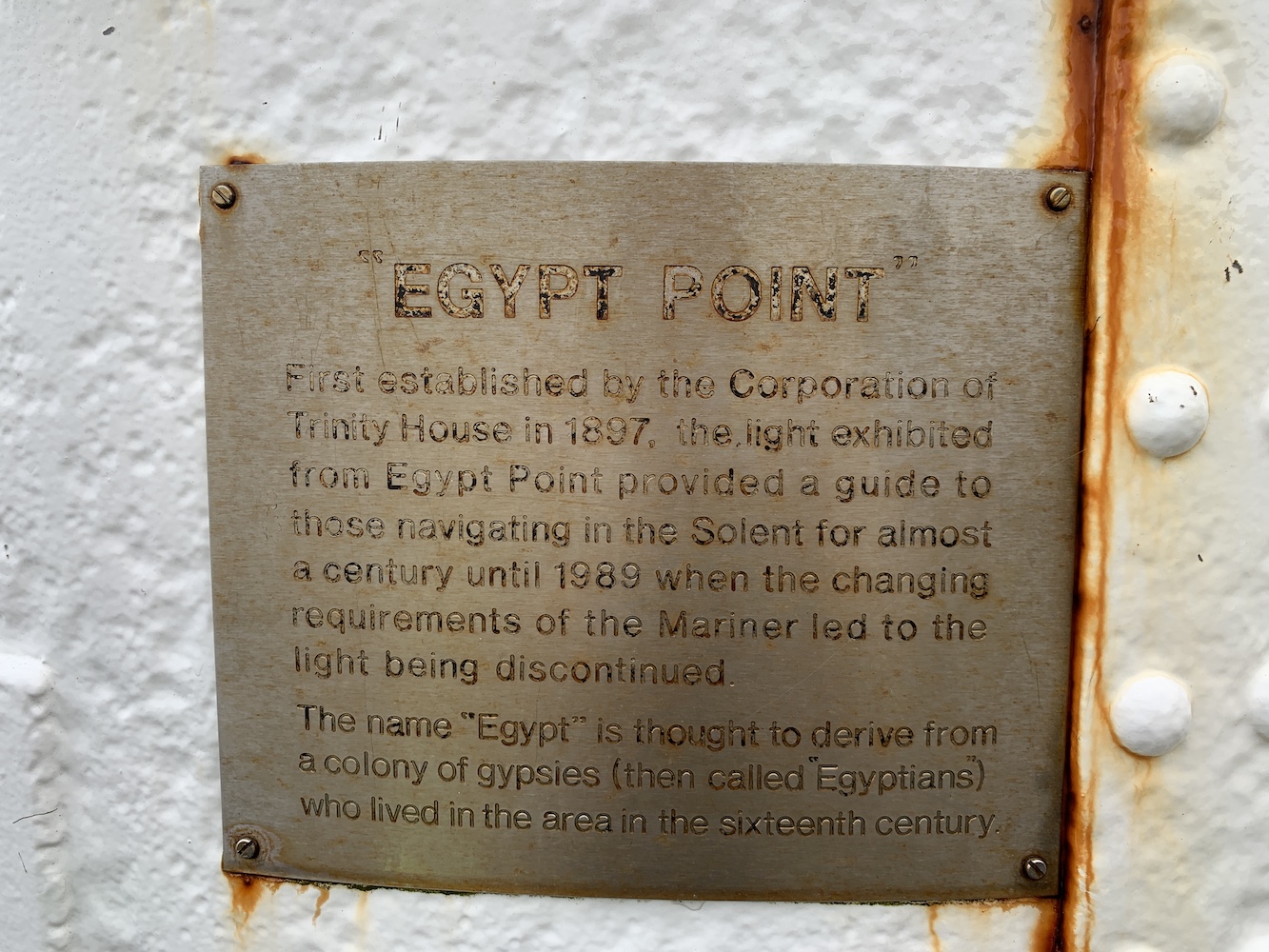
Egypt Point lighthouse is unique, there isn’t another one like it (as far as I recall). It can be found on the most northerly point of the Isle of Wight at the side of Egypt Esplanade, at the bottom of Egypt Hill. All very Egyptian you may be thinking. Well, it turns out that the “Egypt” in Egypt Point apparently takes it name from the fact that a colony of gypsies lived in the area in the sixteenth century. That’s another thing I’d not questioned before.
The plaque on the base of the tower
The tower is actually quite old, 122 years old to be precise, although you wouldn’t think it. It was built by Trinity House and, in 1969, the original lantern was removed and replaced by a new light powered by electricity. The old lantern can now be found at Hurst Castle as part of the Association of Lighthouse Keepers Museum. The added bonus of going to Hurst Castle to see the lantern is that you can see three lighthouses, plus the old Nab Tower lighthouse.
The light at Egypt Point was switched off for good in 1989 and, in 2007, ownership passed over to the Isle of Wight Council after a couple of local councillors campaigned for it to be kept. Just last month it was reported that Cowes Town Council are being urged by Cowes Heritage to take over maintenance of the tower.
This has to be among the easiest lighthouses to get to with it being right at the side of the road. Only the double yellow lines are there to stop you parking right next to it. Let’s hope it gets the care and attention it needs so people can just carrying on walking straight past it with only the occasional lighthouse bagger stopping to enjoy its existence.
Oh, and while I’m confessing, I did briefly see St Catherine’s lighthouse on the Isle of Wight last week too, but that was so brief I didn’t even get a picture. 🙂
It was a little over seven years ago that I last got a closer view of the Needles lighthouse off of the most westerly point of the Isle of Wight, the island I still consider to be home in many respects. It’s the sort of place you never lose a connection with, which I suppose could be said for any place where you were born and brought up.
The is a picture on the wall at home of the Needles, taken back in 2012, and so it’s a lighthouse that my son, in particular, is quite familiar with. He’d mentioned it a few times since we had arrived on the Isle of Wight earlier this week so we thought we’d take a drive out there to see if the boat trips that take you close to the lighthouse were running.
The picture of the Needles on the wall at home
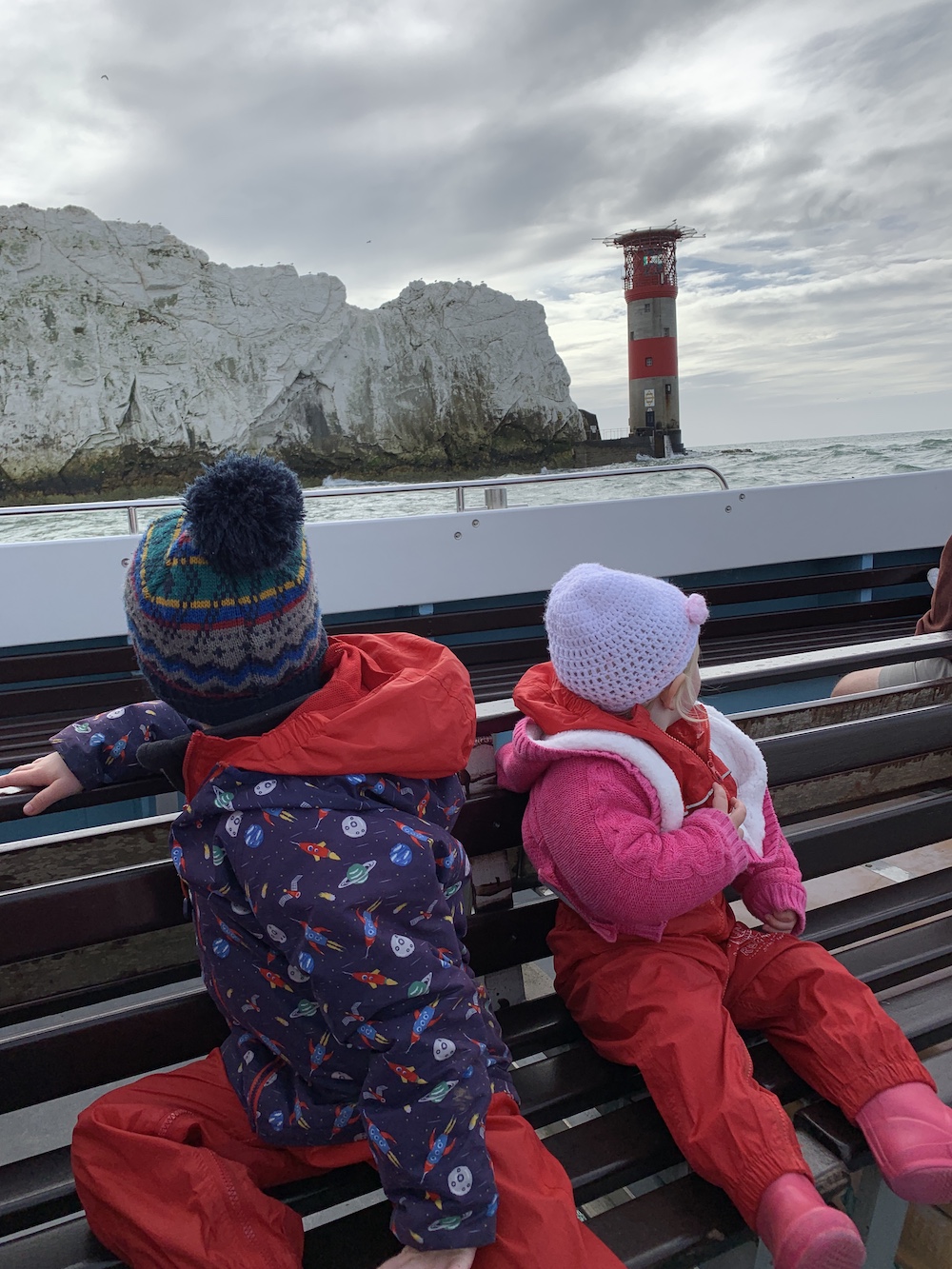
The chairlift was clearly moving when we arrived so we were hopeful of getting out in a boat. We asked the lady at the kiosk and she said that they were due to start running the trips soon so we quickly bought tickets and rushed off towards the chairlift. On the way down to the beach my little boy asked if we were going to go inside the lighthouse and I had to break it to him that we weren’t. His response was “But I want to go inside” and all I could say back to that was: “So do I”!
We hopped off of the chairlift and looked across at the boat rolling about in the sea with a couple of men on board. The kids were quite content throwing stones into the sea so we thought we would wait there to see if the boat started to move.
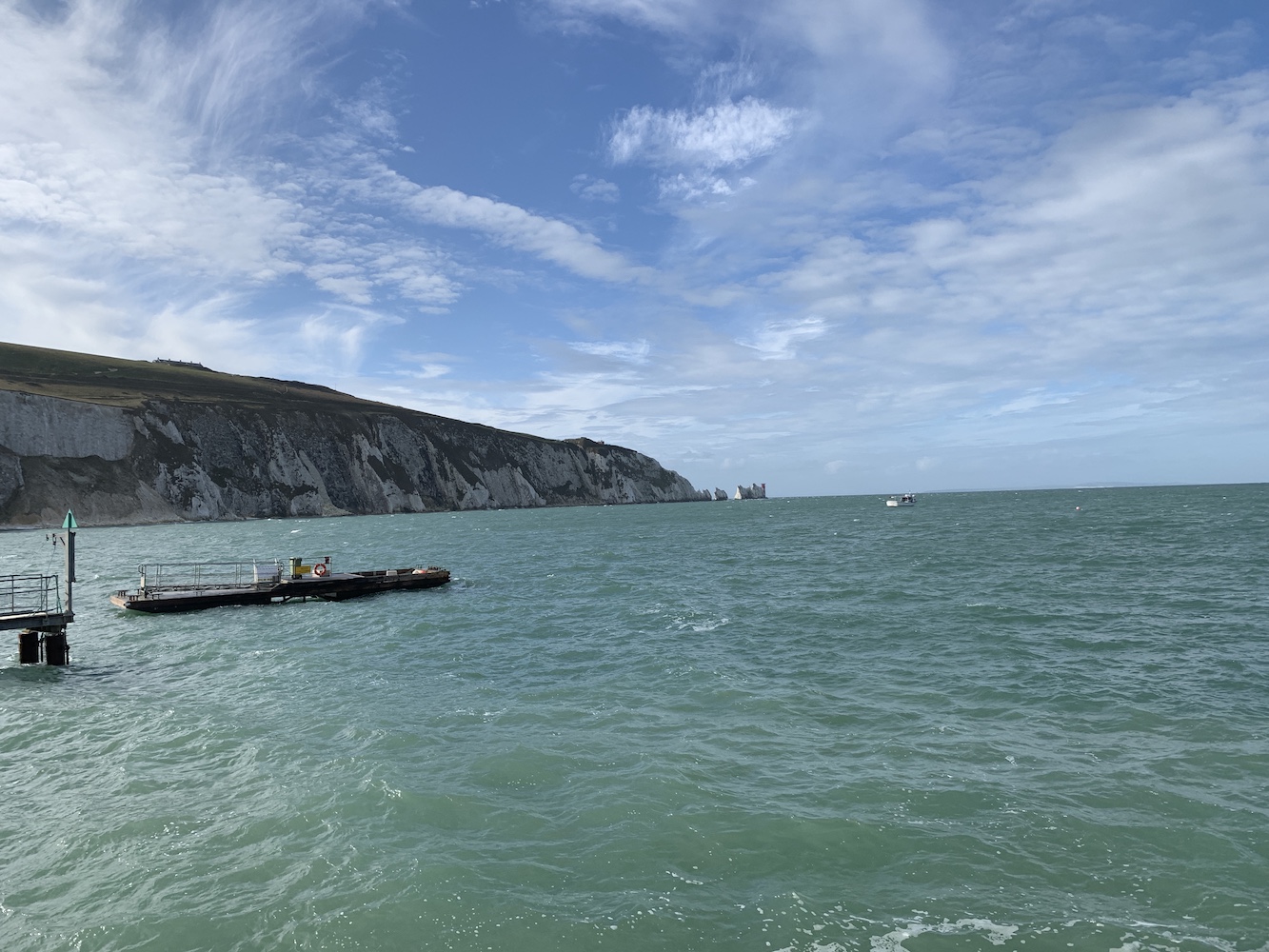
The Needles seen in the distance from the beach
Unfortunately that plan was scuppered when the chairlift operators announced that they would shortly be closing the chairlift for technical reasons and that those who had tickets should make their way back up. We reluctantly followed these instructions, but decided we would go for lunch and try again later. It was slightly irritating to hear as we were heading to the cafe that the chairlift had re-opened, but you can’t dwell on these things.
A little while later we checked with the chairlift staff who reported that the boats were indeed due to start running very soon. Back on the chairlifts we went and wandered on over to the little jetty which the boat was moving about quite a bit at the end of. Last time we’d taken the RIB, but fortunately the only option today was the slower boat. I say fortunately as there appeared to be a fair amount of swell once you got out past the lighthouse, and the RIB takes you right around to the other side of the Needles.
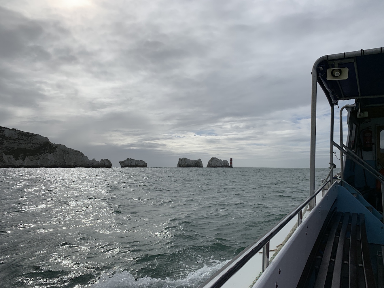
Closing in on the Needles
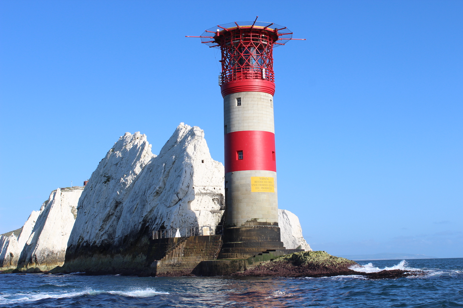
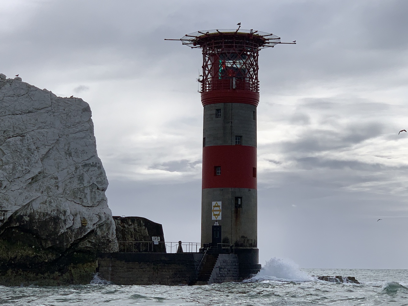
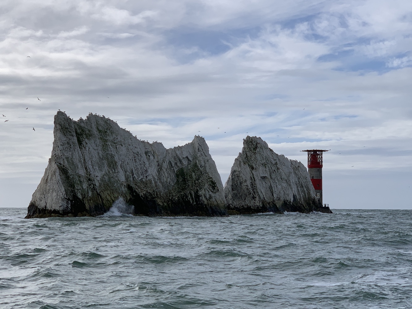
It was quite a pleasant little cruise and a real pleasure to see the lighthouse again. The tower, at 31 metres, has got some height to it, but it appears slightly dwarfed almost by the actual “Needles” between it and the island. I sometimes think the helipads on top of the towers take away from the beauty of the structure, but what they take away in beauty they make up for in the “bring it on” exterior. The metal bars sticking out from around the helipad appear almost as arms spread wide, saying “Throw whatever you can at me. I can withstand anything”. I usually picture lighthouses as females. It’s just something I do, often singing “Isn’t She Lovely” at them, but I would struggle to do so with these rock lights boasting helipads. That’s possibly a little old-fashioned (and also quite strange) of me to think of it like that, but there you go.
Needles lighthouse
The colour on the tower wasn’t as vivid today as it was when I’d seen it before against brilliant blue skies, but it’s nice to have different views each time you visit. We also had to contend with kids this time and while one of them held on to his seat the whole time and only moved when he was helped, the smaller one wanted to run free along the benches or lay on them singing away to herself. A natural at this boat malarkey she is, which is scary and encouraging in equal measure.
Looking back at the lighthouse
Once back on dry land and at the top of the cliff, the little man was repeatedly informing us that he didn’t have a Needles lighthouse toy – there was clearly a Needles lighthouse gap in his toy box! He chose, rather than a toy, a little ornament depicting the Needles lighthouse and the stacks. We also read up a bit in the shop, via an information panel on the wall, on the old lighthouse that was built upon the headland above the Needles in 1785. As is so often the case, this old lighthouse was frequently obscured by sea mist and therefore did not serve its purpose, hence the replacement tower being built at a lower level.
Today was a reminder of the variety of experiences you have when visiting lighthouses is your favourite thing to do. Some days are about the big adventure, hopping (or cautiously stepping in my case) onto and off of boats a number of times. Other days are for the enjoyment of the little ones when you take a step back, hold your hand out towards the lighthouse and say “kids, this is what it’s all about.” 🙂
Those who have been following my blog over the last few days will know that we spent the weekend in South Wales at the Association of Lighthouse Keepers (ALK) AGM in Cardiff. During the planning for the weekend I was aware that Saturday morning was free and, feeling ambitious, I proposed heading over to Caldey Island for the morning, and Bob agreed – not entirely knowing at the time just how long it takes to get from Cardiff to the boat at Tenby. I looked at the timings and then considered them again numerous times. Would we really have enough time?! The difficulty was that it didn’t seem possible to find out what time the first boat left Tenby in advance. A couple of days before I called the number I found online and the recorded message said that the boats would run from 10am. We would be fine, I thought.
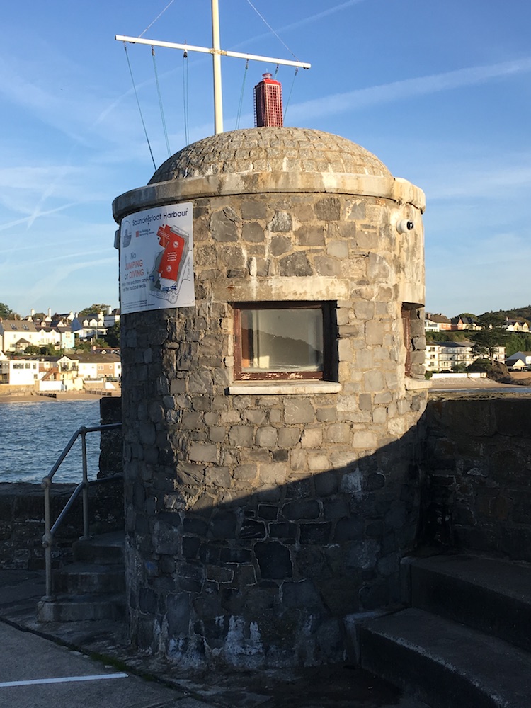
Saundersfoot lighthouse
We got up super early on Saturday morning to allow plenty of time to get across to Tenby. Our journey was going well so we stopped off in Saundersfoot briefly to visit the lighthouse on the end of the pier. It’s not the most inspiring, and I actually preferred the “pretend” lighthouse inside the harbour, but we’ve been there now and you never really know what to expect until you’ve been there.
Arriving in Tenby there appeared to be little in the way of activity. It was then that we were informed that the boat wouldn’t be leaving until 10.30am (I probably could have found that out if I’d phoned the number again that morning), eating even further into the precious time we had to bag the lighthouse (and the island high point for Bob).
However, the coastline at Tenby is actually quite interesting to wander around, with the tidal St Catherine’s island just off of the beach, the old Tenby Castle and the very modern Lifeboat Station. While we waited for the boat a couple of ladies waiting behind us informed us that the boats had been cancelled the day before and it became very clear as time went by that a number of people must have been waiting to get over to the island, as they just kept on coming!
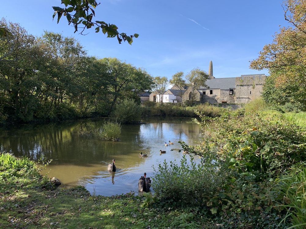
The old Priory on Caldey Island
We were the first passengers on the boat and it was a very pleasant ride across to the island. The sun and blue skies were out in preparation for some wonderful picture opportunities. Once we were on the island we hurtled off ahead, stopping occasionally to take pictures. The island is stunning, not in the rugged way that most of the islands we visit are (partly because they are in Scotland), but in the same way as the Isles of Scilly (Tresco to be more precise). The island seemed very quiet and peaceful as we walked up the main road that took us to the lighthouse. Aside from a man in a van giving a lady a lift into the village we saw nobody else on the way there. The village is perfectly picturesque with the monastery sitting above it. A little further on there is the old Priory, possibly the most beautiful view on the island (excluding the coastline and the lighthouse, of course). There is a large pond bordered by trees in front of the Priory, and it would be easy to forget at this point that you are in Carmarthen Bay just off of the Bristol Channel. If someone passed you there and greeted you in Italian or Spanish it wouldn’t seem at all odd. There’s something quite Mediterranean about the island.
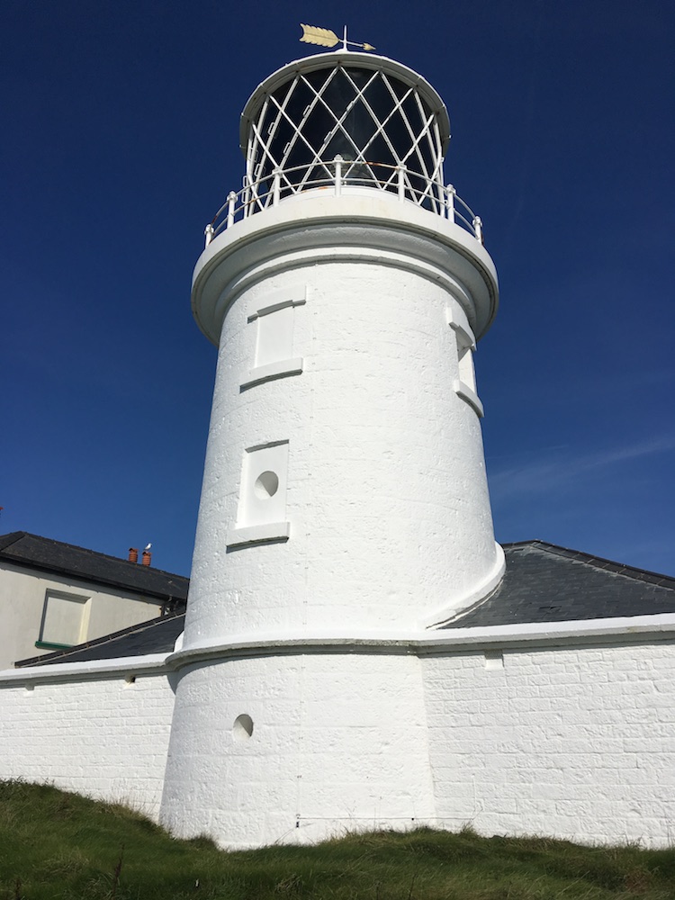
Caldey Island lighthouse
Not long after passing the Priory I spotted the top of the lighthouse appearing. As the lamp room came into view the optic sparkled as the sunlight shone through it. It is one of those towers that looks amazing from every angle – or at least it does when the sun is shining! The lighthouse is still in operation, and has been under the control of Trinity House since it was built in 1829. It was rather late to the old electricity game, being the last of Trinity House’s lighthouses to begin using mains electricity when it was converted in 1997. It’s a great tower, made even better by its location. If we hadn’t been so short on time then I would have happily wandered around the area enjoying the isolation and tranquility. But the need to get back to the boat was there in the back of our minds, so Bob ran off to the island high point (contrary to what it reported online, the actual high point is not where the lighthouse is located) while I started the journey back down the road.
Upon returning to the village it seemed like an entirely different place to the one I had passed through only a short time before. Everything was open, people were milling around and it suddenly felt more like the tourist destination that it is during Summer days (excluding Sundays when the boats don’t run). There were too many people about in my opinion (again, I’m used to smaller Scottish islands on my lighthouse bagging trips) and I had a deadline. Arriving back at the pier just as the boat was leaving I waited around in the sunshine and a short time later Bob turned up. We were privileged to have the boat to ourselves on the way back – although there were still plenty of people heading in the other direction.
I am pleased to report that we did indeed make it back in time for the start of the ALK AGM and even managed to fit in a cup of tea and chats with a number of people before the meeting started. We had about 1 hour on the island in total. A very enjoyable day, and Caldey is certainly somewhere I would like to re-visit at some point to explore a bit more. I made it to the lighthouse though and that was the aim this time so all is well 🙂