
With the wind shifting around to the north and the wind speed increasing it was touch and go as to whether or not we would make it out on the boat trip we had planned yesterday. Bob spoke to Seumas from Sea Harris the previous night and I was delighted when he confirmed that we would go ahead with the trip.
It was the first time I’ve been out on the water around the Western Isles visiting lighthouses for a couple of years and I must admit I had missed it’s wild ways and unpredictable nature, and also the boatmen who know it so well (well mainly Seumas as he has got me to near enough all of the offshore lights in the Western Isles).
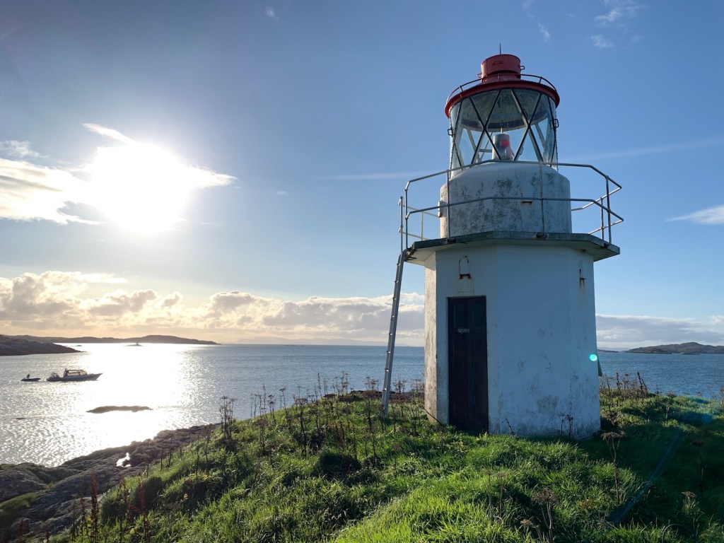
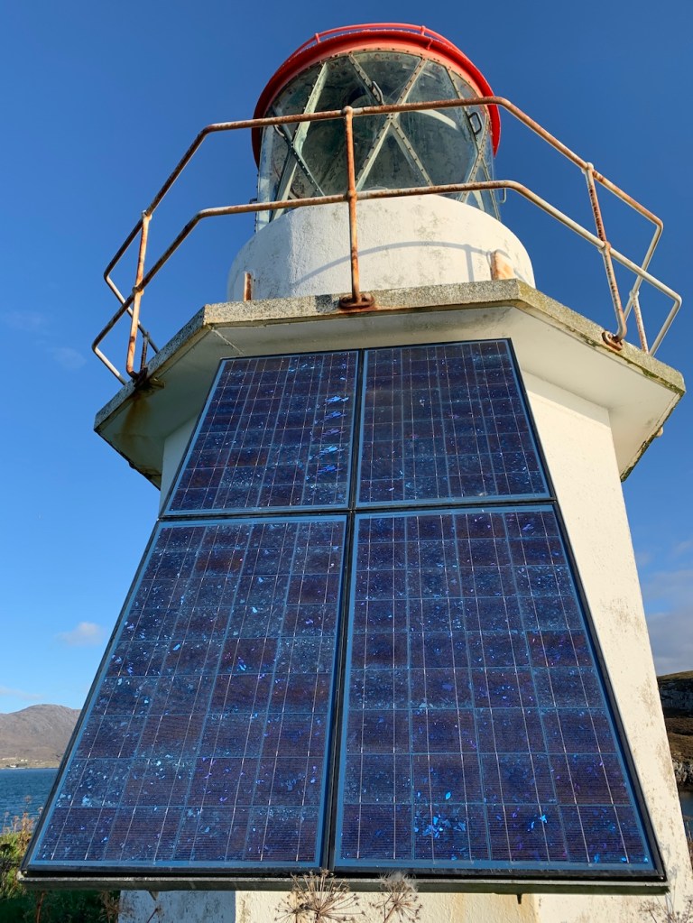
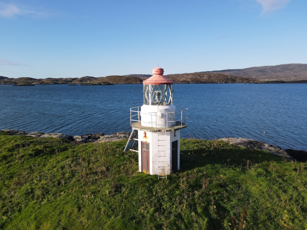
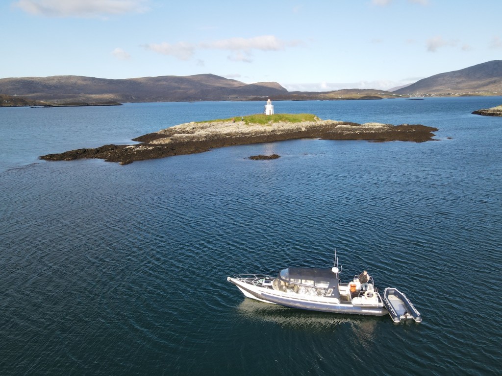
Off we set from Scalpay and our first stop was one I was very excited about. Sgeir Ghlas is a bit different with the red top – and it’s one of those older towers introduced by the Northern Lighthouse Board around the turn of the 19th/20th centuries.
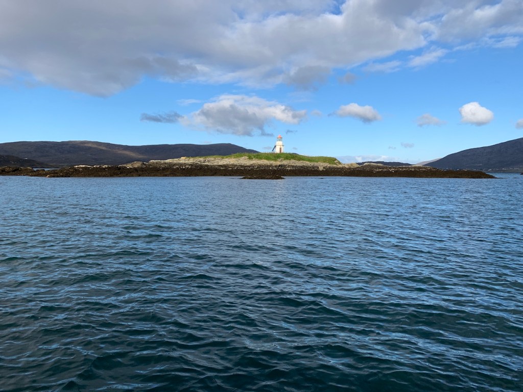
Landing on the island was fine as the sea was calm and the seaweed covering the rocks wasn’t too slippy. Being a very small and relatively flat piece of land it was only a short stroll to the lighthouse. It’s looking a little weather beaten, but apparently much better than when our skipper was last there. That time it didn’t have a door and there were birds nesting inside. It’s good to see that it now has both doors intact and reminds me of Rubh’an Eun on Bute which has also had a bit of improvement work done to it in recent years.

Bob flew Joe the Drone for a while and, as usual, got some great shots.

Leaving the island behind we headed out into The Minch and then northwards along the east coast. The change in sea conditions became very obvious as soon as we were out of the shelter of Harris. Up the coast we passed Rubh Uisenis lighthouse which I had previously only seen from a great distance on the way to Eilean Glas lighthouse. We decided to first tackle Milaid Point lighthouse, which we all knew would be the trickiest of the day and come back to Rubh Uisenis.
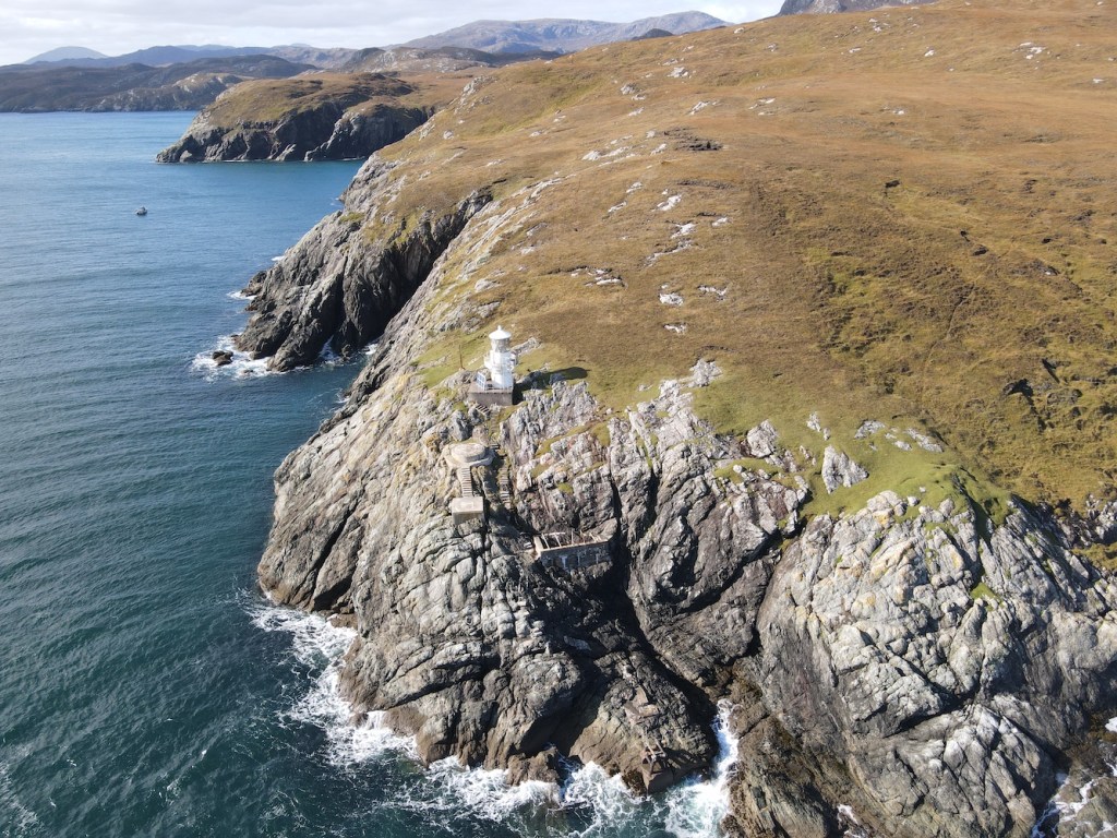
Milaid Point lighthouse is a flat-pack style and these are usually not the most interesting looking. This one is a bit different though and reminded me a little of the one on the Garvellachs which is also in a fantastic location. Milaid Point lighthouse is set down on the cliff with steps leading down to it from the cliff top. As a result it’s actually not so far above the sea. The view from the sea is great with the light, the steps and two old platforms, one of which was presumably where the previous lighthouse tower was located, and the skipper recalled there being some sort of radar station there at some point which probably explains the other platform.

It was fairly obvious that we weren’t going to be able to land near the lighthouse with the rise and fall of the swell so we sailed around the corner to the south to see if we could find somewhere to land and then walk up and along. Once we were in the tender we realised just how steep the cliffs in the area were. A couple of times we spotted sections we thought we might be able to make it up, but once we were in the small tender we realised just how steep it would be. Bob landed at one place and walked/scrambled up the sections of rock to see if it would be a suitable way up. He ended up descending back down one particular section, a flat slope, using a rope as it was so slippery. So that was not an option, but I was very grateful that he had tried to find a way that I could manage.
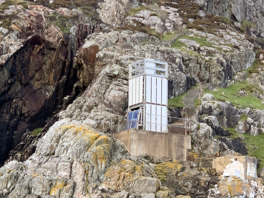
We took the tender back around to the rocks below the steps near the lighthouse, but we all agreed that it wasn’t going to be possible to land. It was a shame, but we’d got great views of it and Bob managed to fly Joe the Drone around it a bit too.


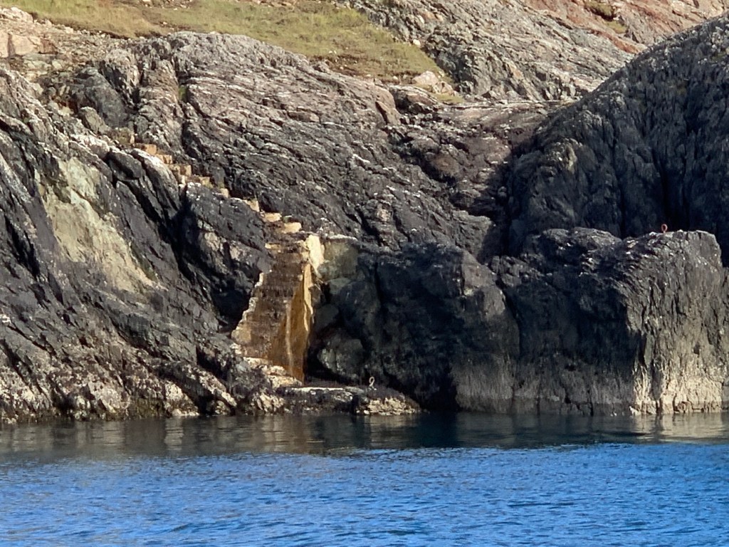
We’d spent longer than expected at Milaid Point and it was time to sail back down towards Rubh Uisenis lighthouse. Although there was a landing below the lighthouse here, again there was just too much swell. We anchored just to the south in a sheltered area and hopped into the tender to see if there was anywhere here that would make it slightly more accessible than Milaid Point.
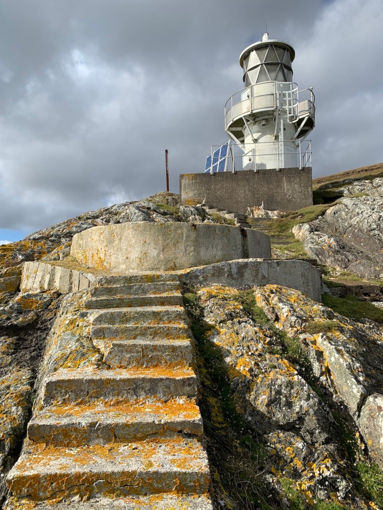
Sailing back around to the landing area for a closer look we thought it was just too much of a risk with quite a significant rise and fall in the water level. We’d spotted a potential point around the corner and so went along to that. Thankfully we both managed to get ashore, but the hardest bit was to come. I am not a climber and never will be, or even a scrambler. I’ve just scrambled a bit on very few occasions when reaching a lighthouse requires it. I think the best way to describe the section of rocks we needed to climb up is with a picture so here is one.

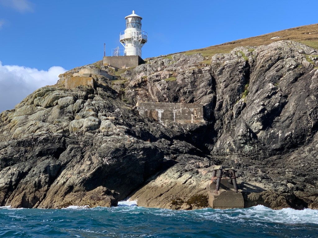
It was slow going getting up there, but we made it and then there was a short walk along to the lighthouse, although there was a hill in the way so we had to go over that. I was surprised not to be able to see the lighthouse once we reached the top of the hill, but it’s another one that’s set down a bit and so we had to walk a bit further before it came into view. Once we reached the top of the slope where the ground dropped down to the lighthouse the scrambling and uphill walk were forgotten. I know you are supposed to look up at lighthouses, but there’s always something special about looking down on them, particular when it’s one of these types of towers.

These round white towers were introduced by the Northern Lighthouse Board to replace some of the older small lighthouses (like the one on Sgeir Ghlas shown above), but before they started to use the flat-pack type. The Shiants Isles in the background helped to make the view even more enjoyable. Also knowing that this was a place that very few people would have been added to my appreciation of it. Rubh Uisenis is believed to be the most remote land-based lighthouse in Britain with hours and hours of walking over hills and bog to endure if you attempt it from the land.

We wandered around for a while, down some of the steps, taking a look at the platform the old lighthouse (I assume) would have sat on. There is a wonderful picture online of the previous lighthouse located here.
Reaching Rubh Uisenis felt like a great achievement. It had seemed so inaccessible previously. I was very pleased, but I also realised we needed to get back down the rocks!
Bob had brought along his trusty rope and for the descent tied it around my waist and held on tight while I went down. We did this in three sections with me stopping on a ledge part way down, pulling the rope down and then waiting for Bob to come down to where I was before I carried on. It was pretty hard going, moreso because I was struggling at times to pull the rope to take the next step, but that was a good sign as if I’d fallen I would have been glad of the tension in the rope! I didn’t fall though and we made it safely back down and onto the boat. It’s fair to say I was very relieved and very happy!
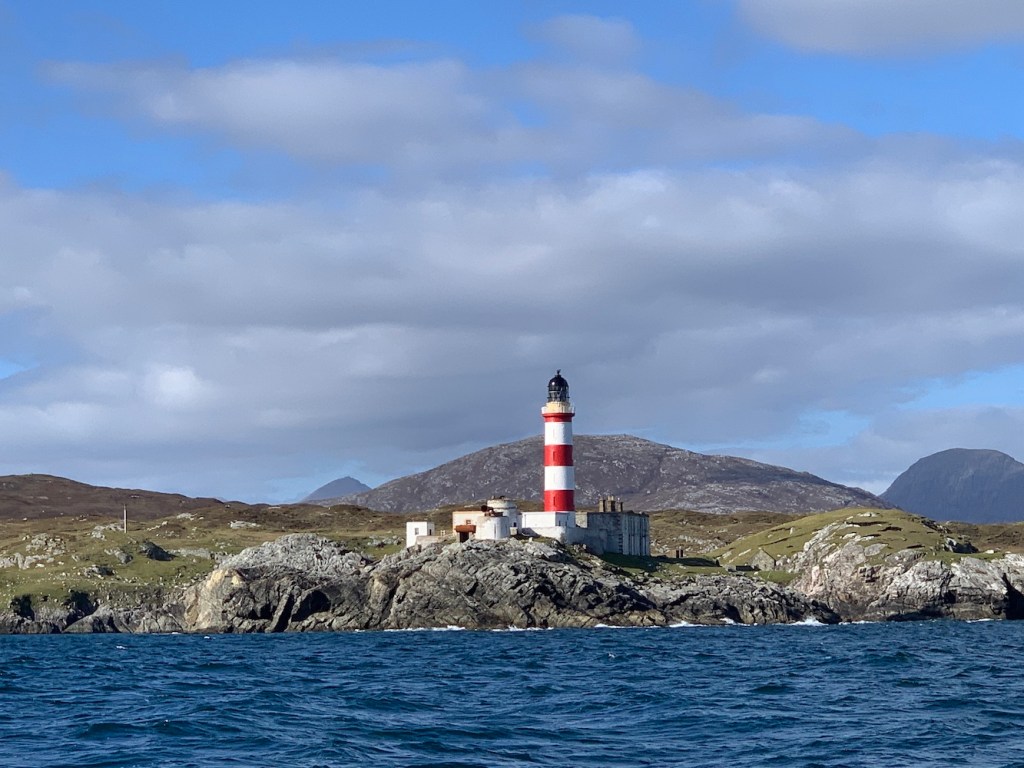
Again we’d spent longer there than planned. Whizzing on down the coast we sailed past Eilean Glas lighthouse which was looking just as wonderful as it did by land on Friday.
Onwards to North Uist and this next one marked my first visit to the Uists, and what a dignified one it was.

Weavers Point, or Weaver Point lighthouse, is another one that involved a fairly long walk across difficult terrain if approached by land so what better way to arrive than by boat, especially when there are some wonderful steps leading up the cliff. Quite a treat that was, especially after the last one!
Weaver Point lighthouse is another flat-pack structure and a fairly standard one, but it was good to see it up close and enjoy the surrounding scenery too. I’m looking forward to spending more time on the Uists in the coming days.

At this point I was feeling like I was hogging all of the boat time so it was Bob’s turn to enjoy a couple of islands he’d not been to before. In true goat fashion he was up and down both in no time at all.
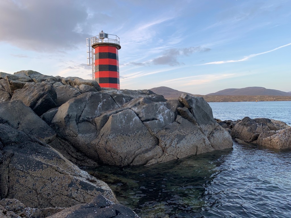
By now the sun was going down, but there was one more stop for the day. We’ve sailed out of Leverburgh a number of times and so regularly passed the red and black Dubh Sgeir light. We were both keen to investigate it a bit more so we landed on the rocks and slowly (because I am not a goat like Bob) made our way towards the tower. When Bob says “use these steps” or “walk on the path” you can almost guarantee that what is in front of you in no way resembles steps or a path. At one point we found a large long and fairly flat rock which Bob likened it to Sauchiehall Street (one of Glasgow’s main shopping streets)!
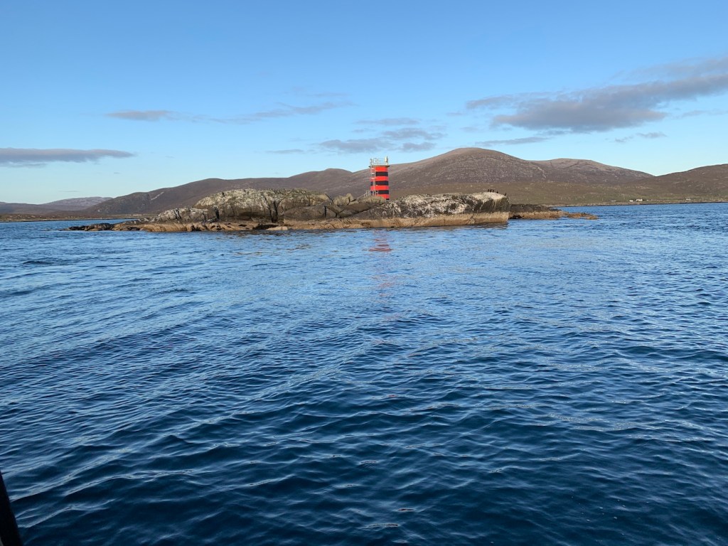
Dubh Sgeir is an interesting light and though there’s not much to it, it was nice to visit. As I said to Bob it felt like the the Western Isles’ answer to Barrel of Butter (which is in Scapa Flow, Orkney – take a look at this post from last year to see that one).

The sun was setting so it was time to head back to Scalpay. We had a bit of an added bonus on the way back with some common dolphins leaping out of the water alongside the boat. Normally I’m not so excited when you see the occasional dolphin or whale fin sticking out of the sea, but to see them swimming and jumping alongside us was great. They obviously wanted to celebrate my successful day. As did a few of the lighthouses we’d seen as they were flashing away as we returned to Scalpay – always a delight to see.

It had been a very long day, with 11 hours on the boat, but a really successful one. I’d reached a few lights that had been bothering me for quite some time and also been as close as it was safe to get to all of the lighthouses on and around Lewis and Harris. Another fantastic day to add to the bank of memories I have of the area.
I hope to do at least one more post during this trip, but the second boat trip we had planned has had a rather large spanner thrown in the works. Fingers crossed plan B or Plan C will come together! 🙂
