A cloudy day on Mull

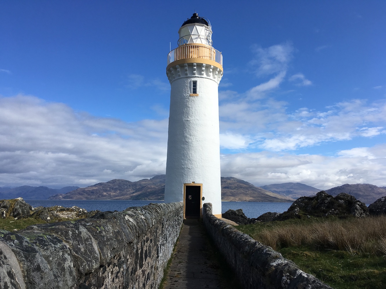
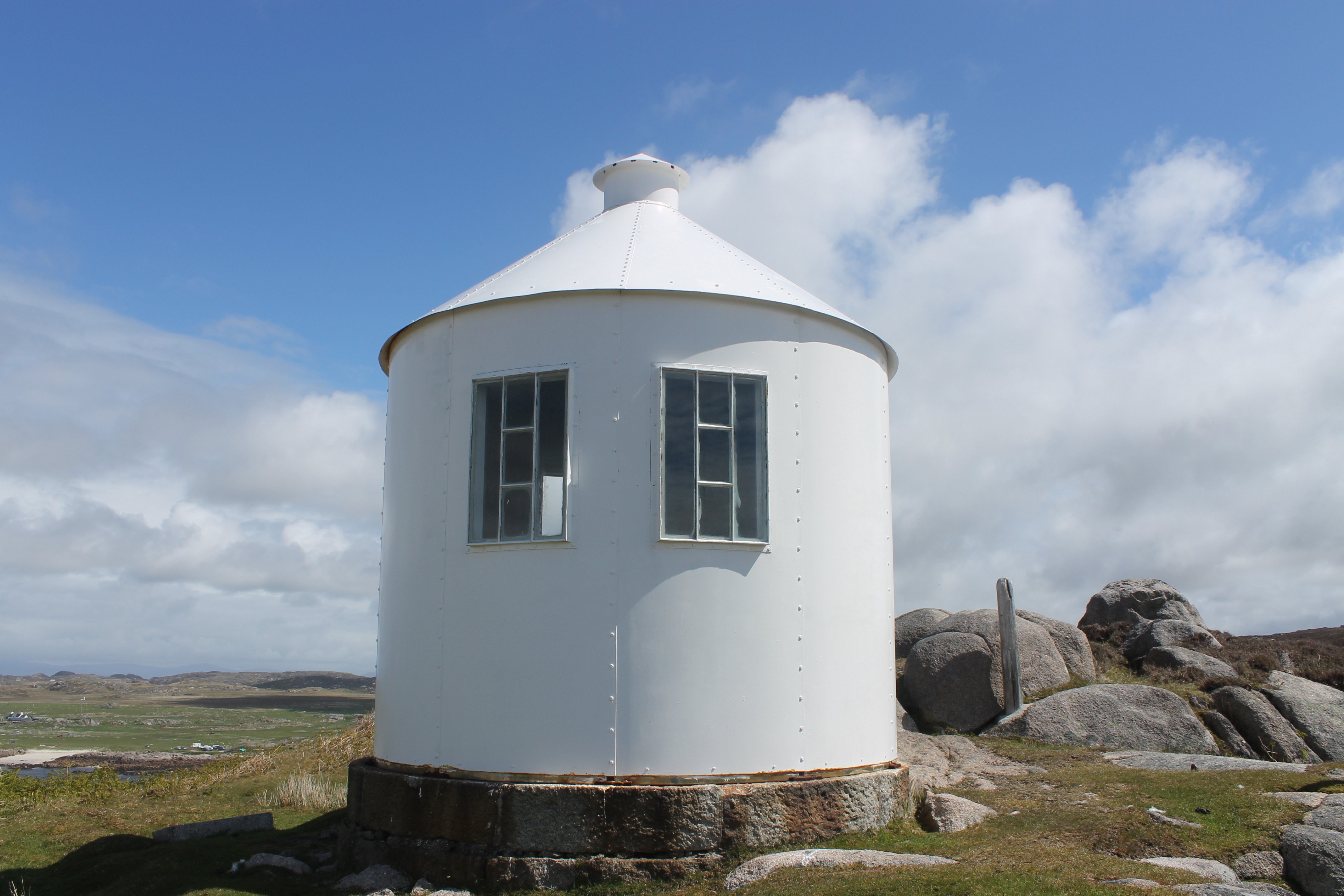
Contrary to what the title of this post suggests, we actually started yesterday in Oban with a short visit to Dunollie lighthouse. This little lighthouse, made up of a stone tower and lantern with gallery placed on top of it, is quite understated and that’s one of the things I like about it. I also like the fact that it’s still standing as actually, close up, it looks like it’s just made of a big pile of rocks – the sort of thing my 6-year-old might make, just on a larger scale. But standing it is and it has been for over 100 years.

Dunollie lighthouse
Looking up at Dunollie Lighthouse

Joe the Drone had a little flight around the area.

Dunollie lighthouse from the seaward side

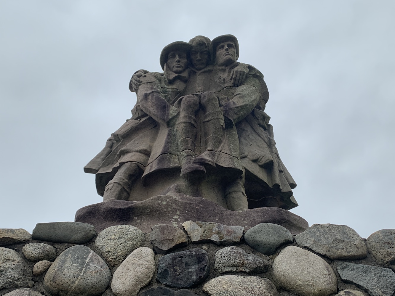
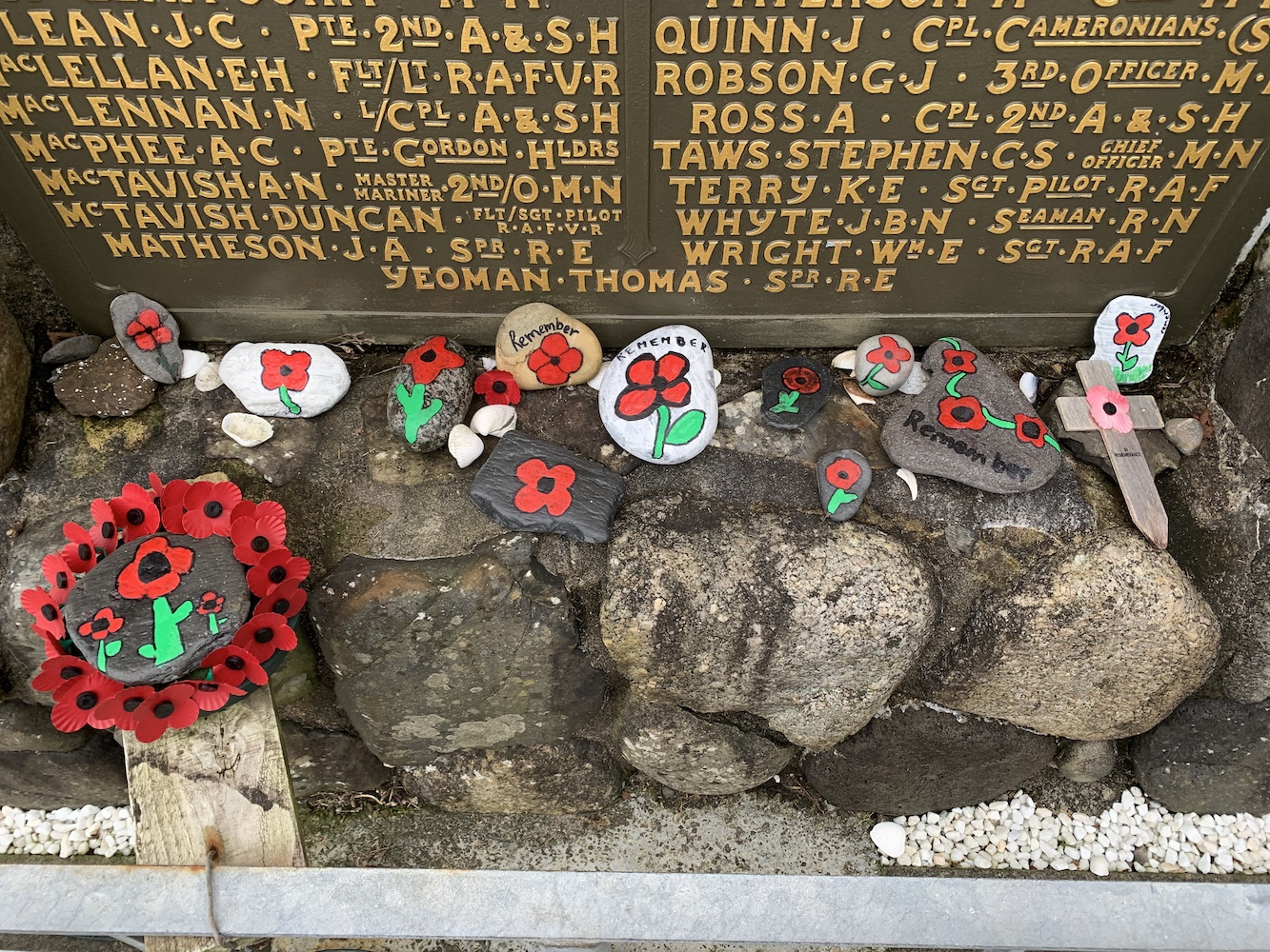
Meanwhile I spent a while at the nearby War Memorial to mark an early 2-minute silence for Remembrance Sunday.

War Memorial at Dunollie

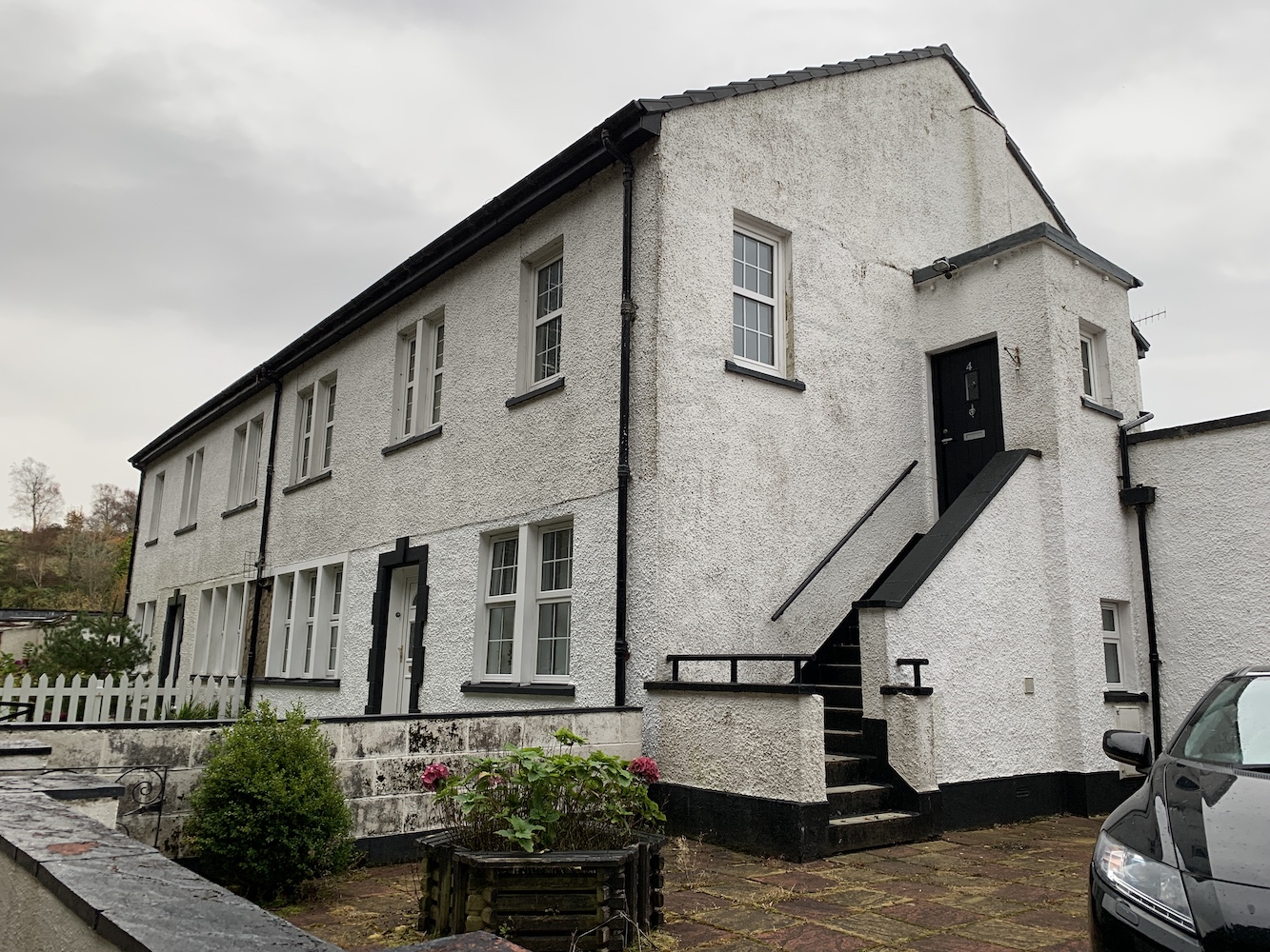
We had a little time before we had to be at the ferry and I mentioned the old Northern Lighthouse Board houses on Pulpit Hill so we took a drive up to find them. I took a guess at which they were and the series of 5 large buildings with four front doors each seemed most likely. This has since been confirmed by my former keeper friend Ian. He actually stayed in one of them while off duty during his time serving on Skerryvore.

The old Northern Lighthouse Board buildings on Pulpit Hill

The houses were built to house the families of those keepers (and the keepers themselves when off duty) while they were based at some of the major rock stations off the west coast.

After taking a look at the buildings I contacted Ian again as I wasn’t sure how it had worked with the families. I knew the families of the keepers on Skerryvore, Dubh Artach, Barra Head and Hyskeir lived there, but I wasn’t sure if there were any others. Ian explained that initially each block was for each lighthouse, so Dubh Artach, Skerryvore, Ushenish, Barra Head and Lismore. The families of the Hyskeir keepers stayed in a separate house (Glenmore House) which is still on the other side of Pulpit Hill.

It changed when Lismore was automated in 1965 though and the Hyskeir families moved to the blocks. He added though that, as time passed and more of the lights were automated, the blocks began to house families and keepers from other lighthouses. Ian himself stayed in one of them while off duty from Pladda, for example. It was good to see these buildings and Ian has said before that it was quite a community up there with, I imagine, anything up to 20 families there at any one time.

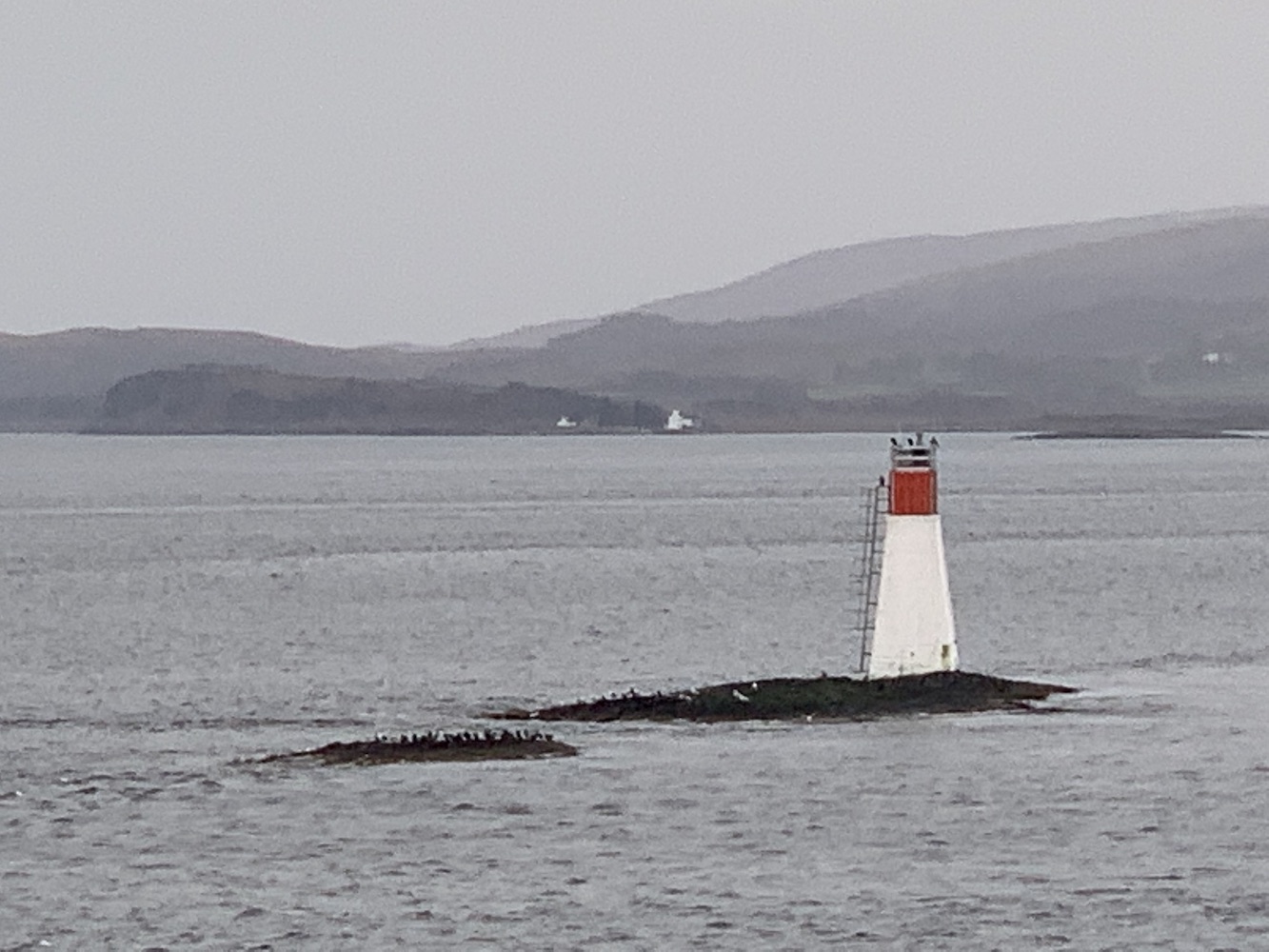
It was time to hop on the ferry to Mull, which was thankfully very quiet. The sailing to Mull (or in fact a lot of sailings out of Oban) are always enjoyable as you pass a number of lights including Dunollie followed by Lismore and Lady Rock. It was good to see Lismore with the main island in the background thinking “I was there yesterday” and then looking over to Lady Rock thinking “I landed there last year”!

Lismore lighthouse with the island of Lismore to the right
Lismore lighthouse
Lady Rock lighthouse

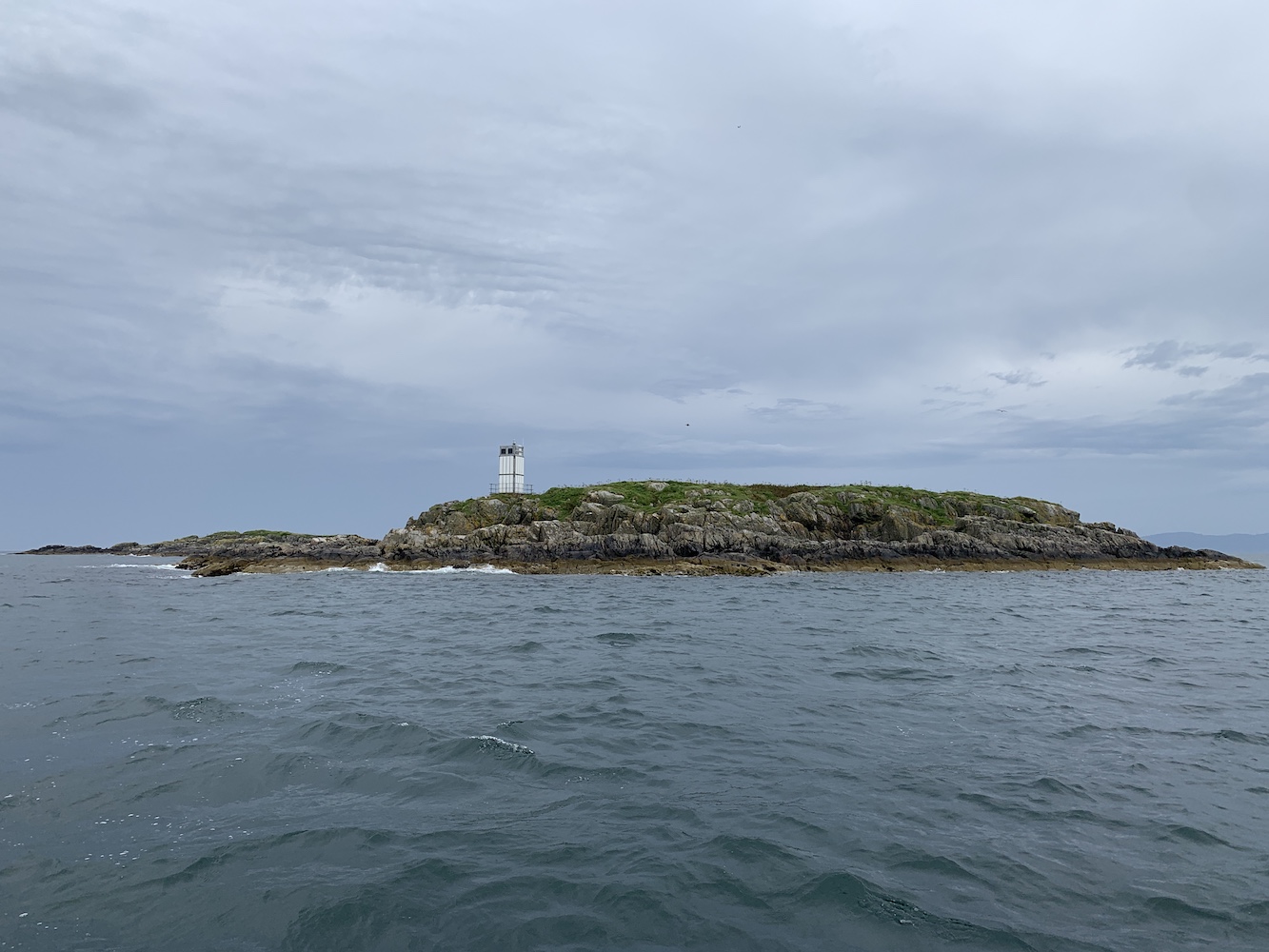
Almost immediately Duart Point was next to us and to this one I thought “I’ll be there shortly – hopefully”. We weren’t sure how easy it would be to get to as we knew there was a big craggy Rock behind it and it wasn’t clear how easily we would get around that. There was only one way to find out.

We headed straight for Duart Castle, which is currently closed, but the car park is a good starting point for the walk to the Point. Bob had managed to find some directions on his GPS device for reaching a geocache very close to the lighthouse and this was a great help. I will try to include them as best I can here for anyone wanting to walk out to it.

The view from the approach road to Duart Castle

Walking back along the road we found the gate on the left just after a row of trees. Once through the gate (remembering to leave it as we found it, of course) I spotted another gate on the skyline at the top of the field as the instructions suggested.

Setting off for Duart Point
This gate marks the starting point from the road
Looking back at the second gate

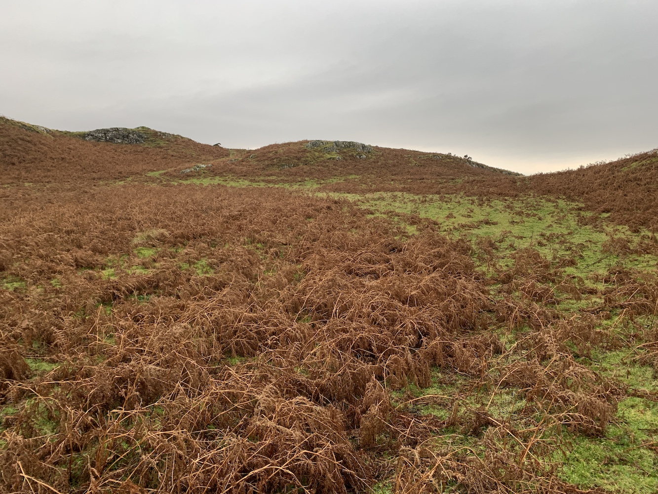
Passing through that gate we turned left immediately and followed the fence and wall along. There are rough paths through the vegetation and I would actually recommend this time of year to visit if you can as the ferns have all died back exposing the grassy paths. I imagine they would be harder to see in Spring/Summer.

The landscape begins to open up – you want to head just to the right of the tree and then onwards between the two raised sections of ground

Where the wall ends the landscape opens up and we headed “straight on to the left” as Bob calls it (which basically means somewhere between straight on and left!) This route zigzags as you go downhill and once you are on a flatter section you have two options, you can either stay up high and view the tower from above first or continue around and down to the right. The tower is tucked away just to the left of the trees at the coast. As you go down you should then spot the tower as you follow the grassy track down.

Looking back up at the zig zag section
The final approach to the lighthouse

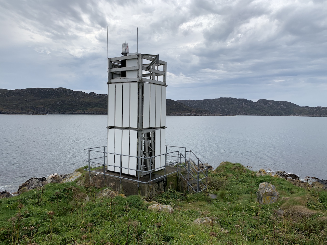
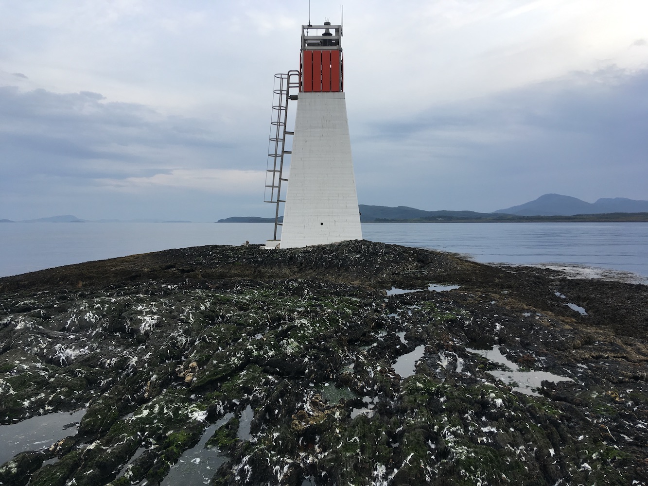
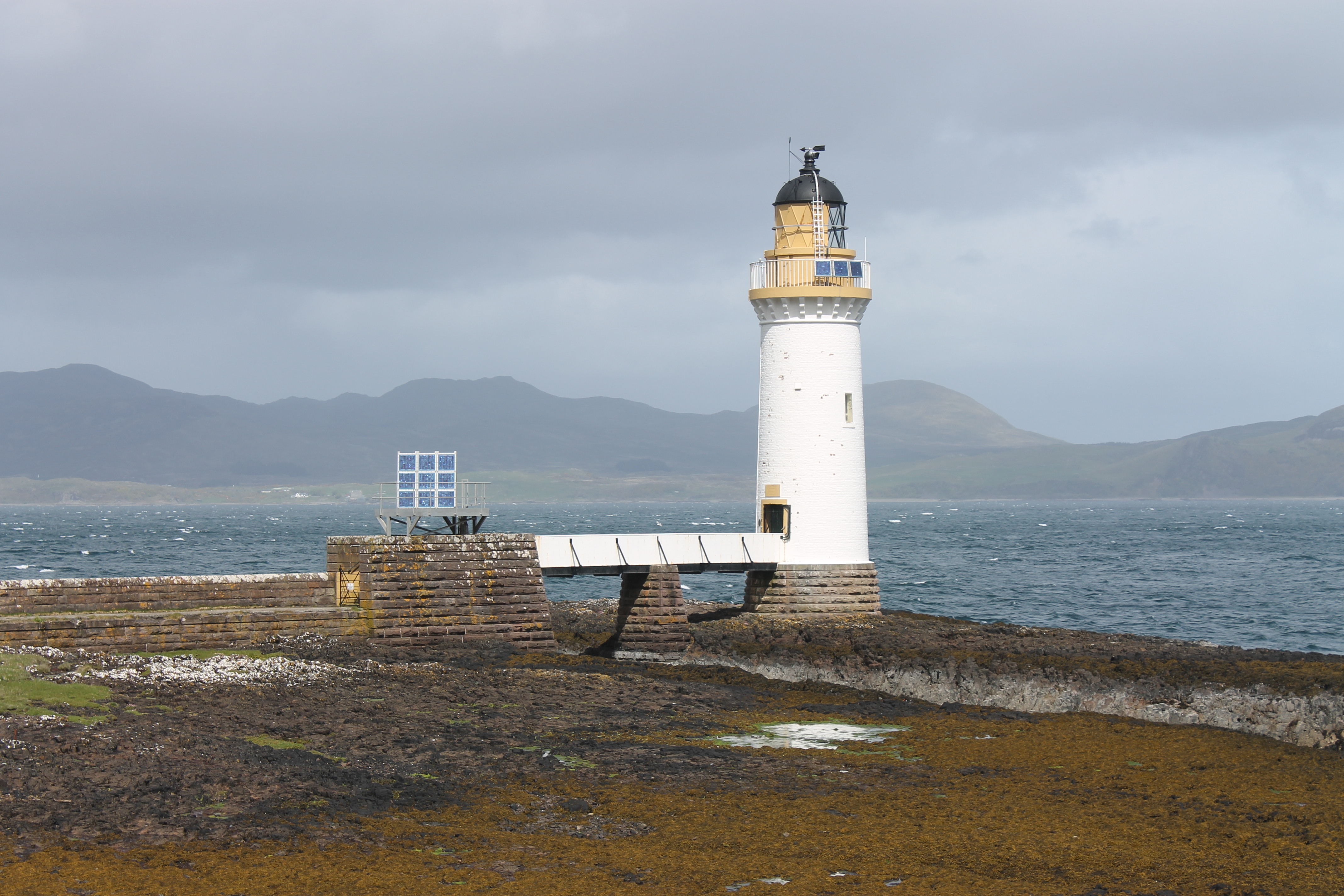
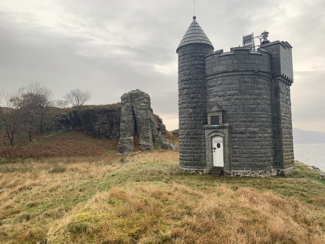
It was raining today so it was quite wet underfoot and a lot of the ground was covered in leaves, understandable as Autumn draws to a close. It was great to spot the tower through the threes and craggy rocks though. It’s a beautiful tower, originally built as a memorial of the Scottish author William Black who died in 1898 and always enjoyed Duart Point. The cost of the tower was partially covered by Black’s family and friends and there is a lovely plaque above the door explaining this.

Duart Point lighthouse

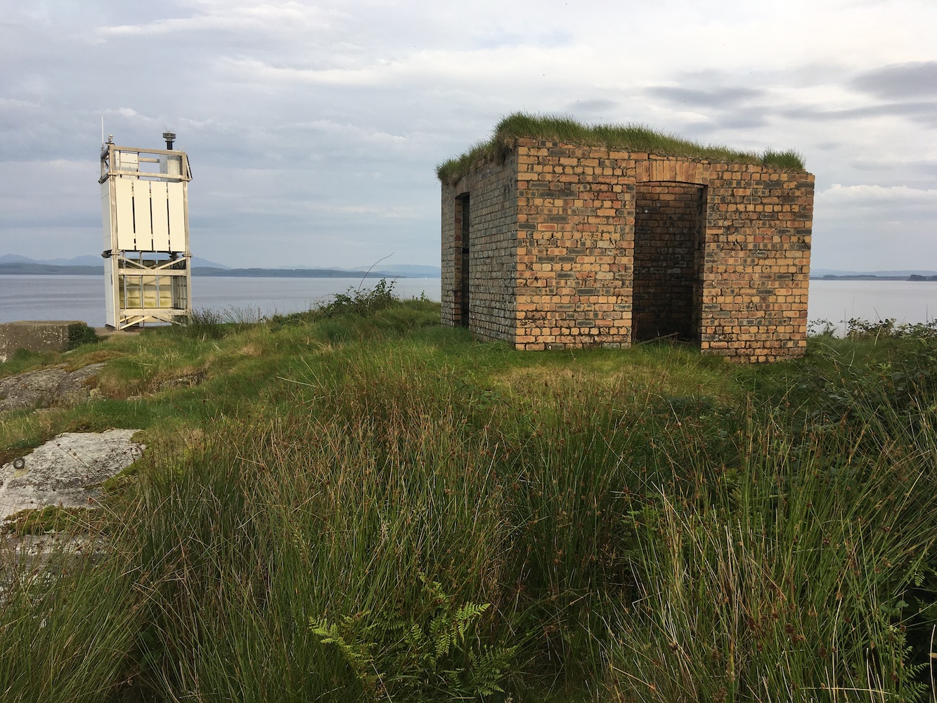
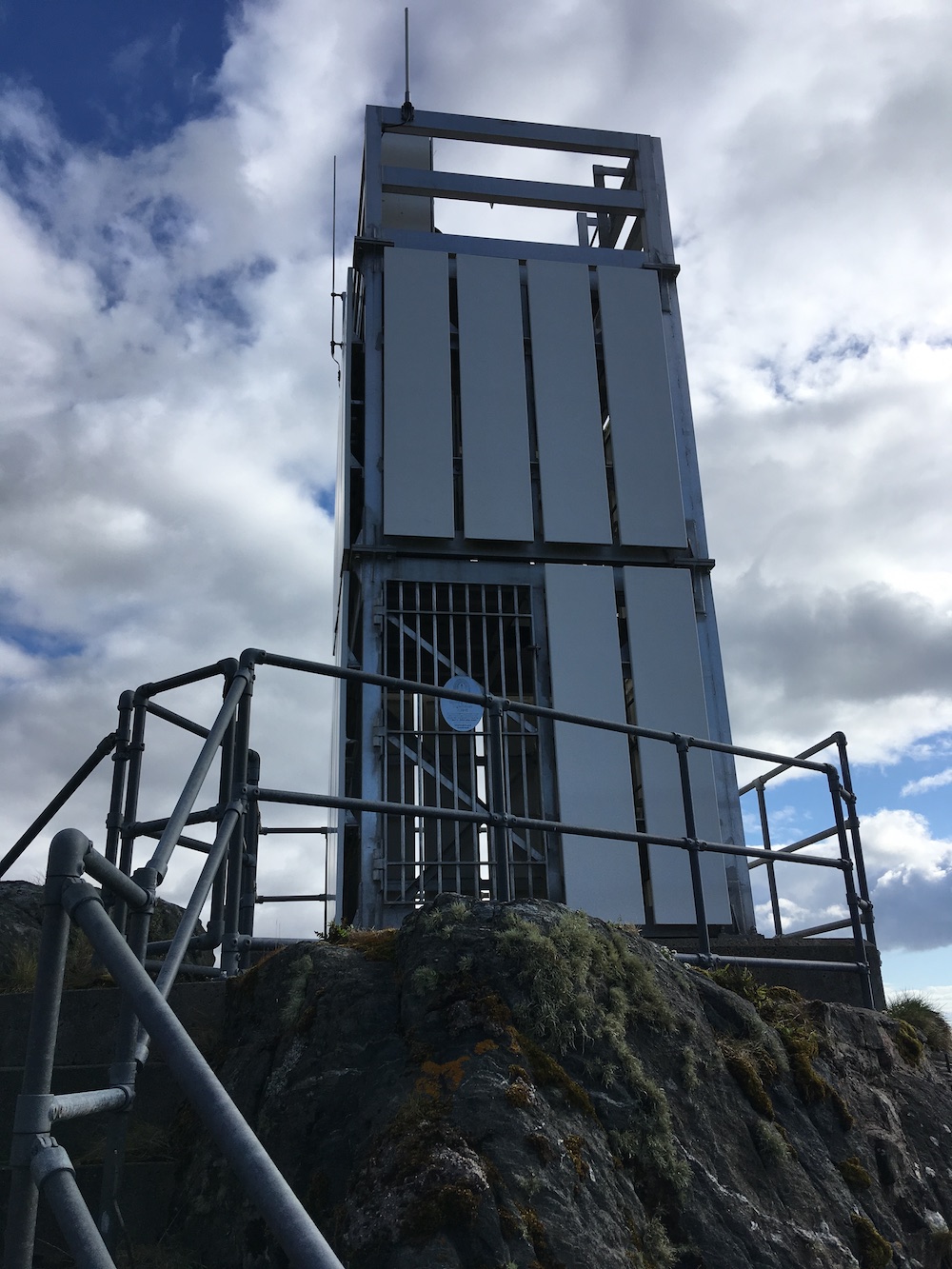
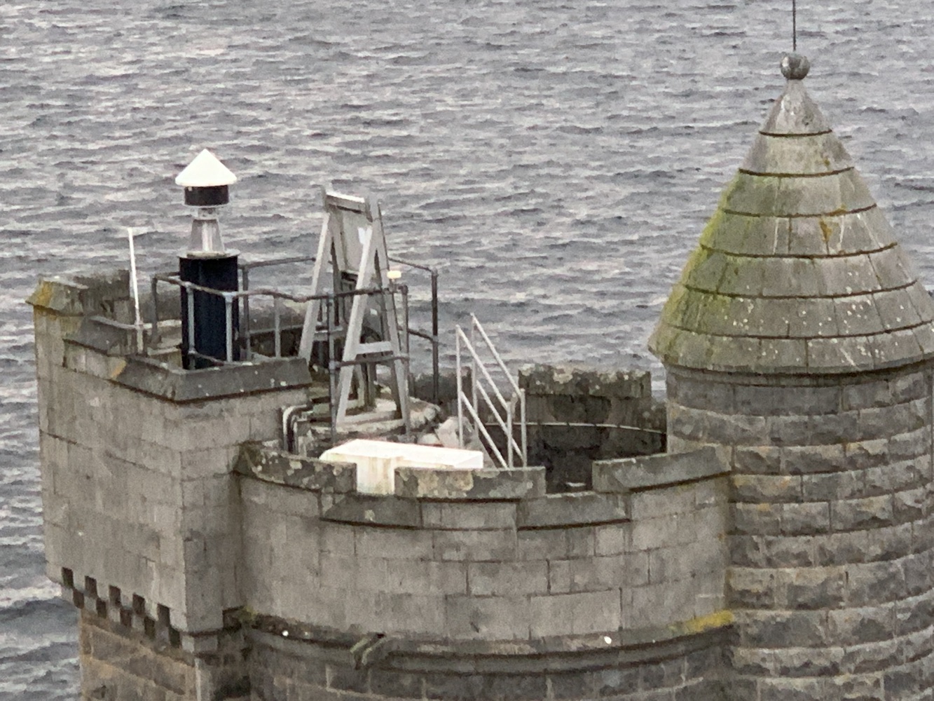
The only real indications of this being a lighthouse are the Northern Lighthouse Board plaque on the door and the modern little light and solar panel on top of the tower. There is a little platform nearby that looked like it may once have accommodated some sort of derrick.

The platform in front of the tower

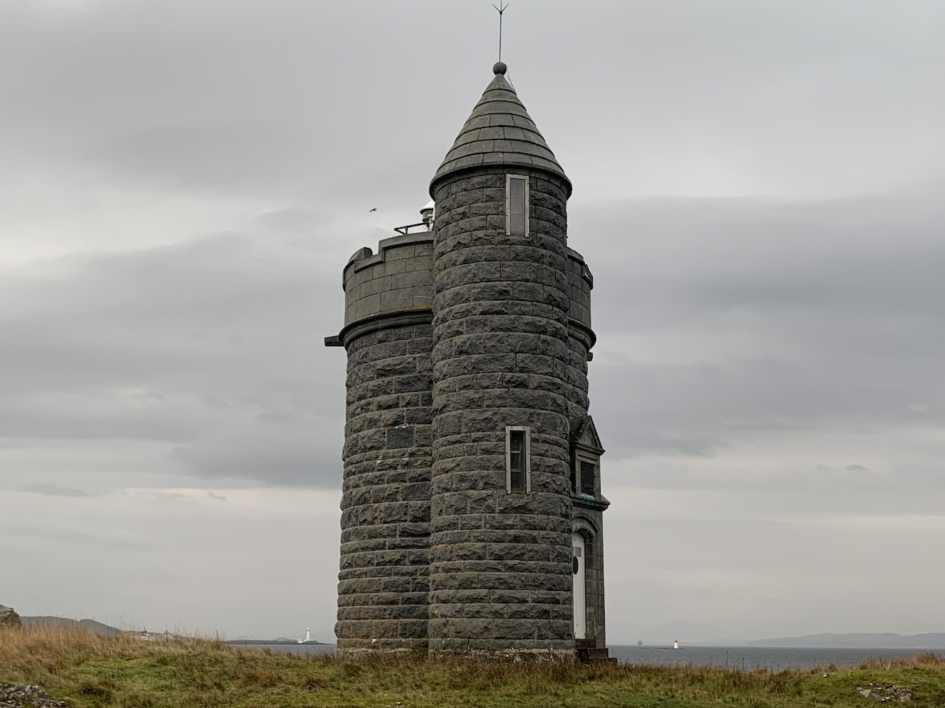
The tower has enough variety in its shape to make pictures from every angle look quite different. My favourite view was of the lighthouse in the foreground with the big rock behind it.

A picturesque angle on Duart Point lighthouse

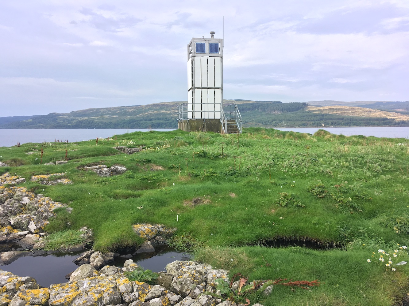
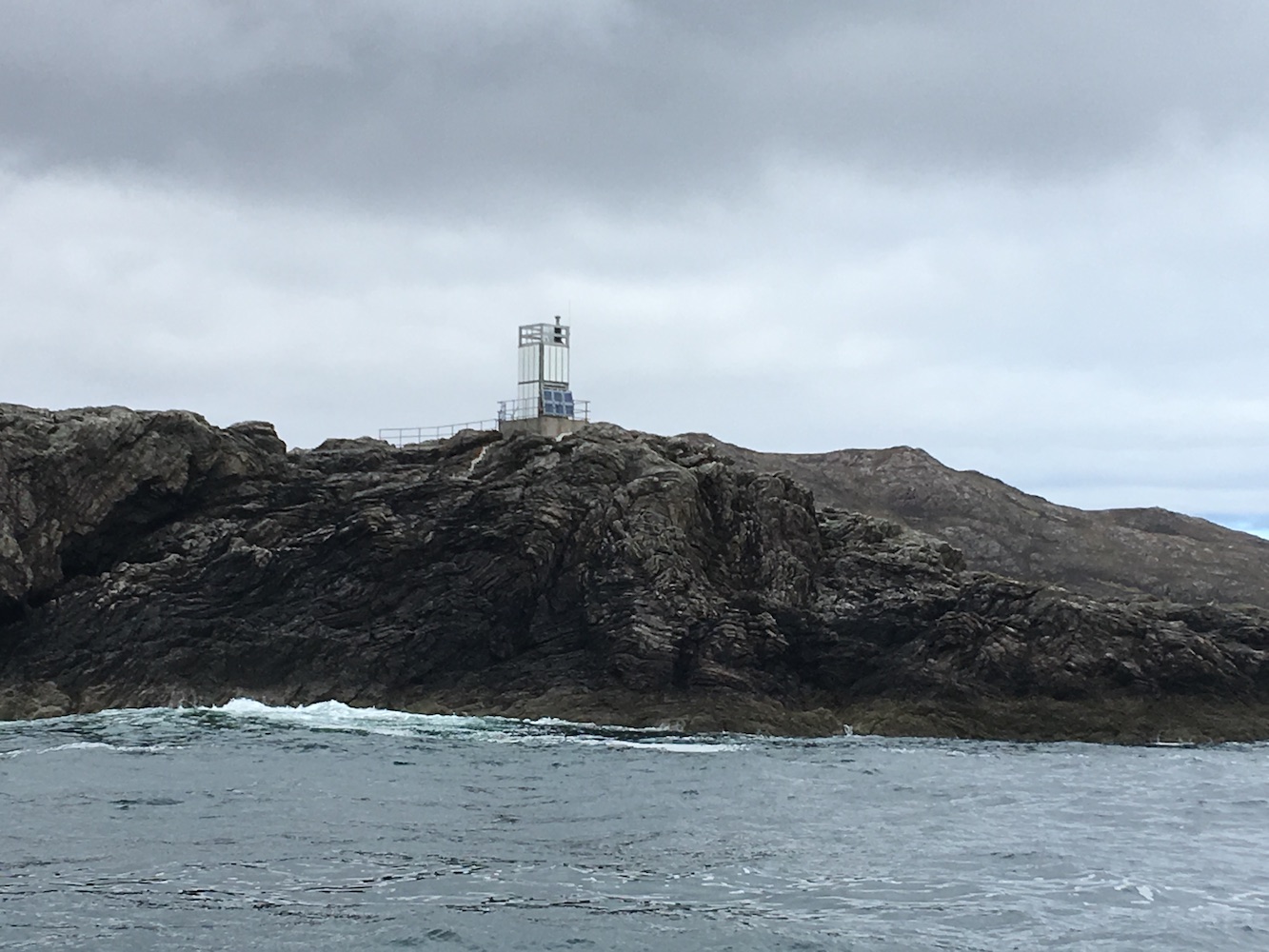
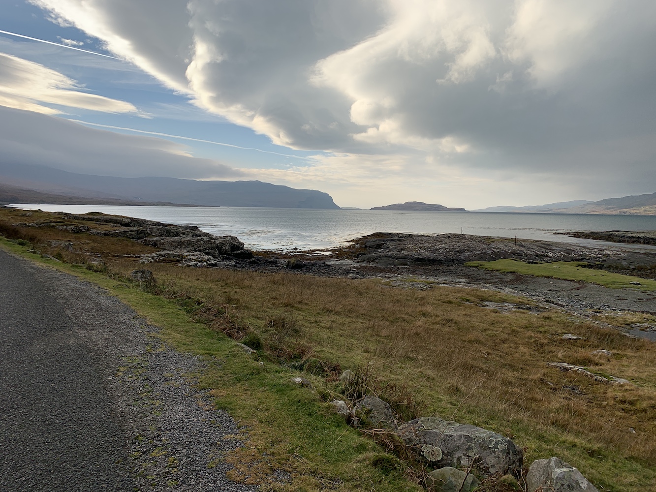
Another great angle was from the fence around the trees. This angle gave you a view of the Duart Point tower with Lismore to its left and Lady Rock to its right. It’s not often you get that kind of view.

A view of three lighthouses: Lismore in the distance, Duart Point and Lady Rock

Joe the Drone had come along and, although it was slightly wet, Bob thought he’d give him a fly anyway and he got a few great shots.

Duart Point from above
One of Joe’s great shots of Duart Point

Following the path back up we then wandered along to the top of the craggy rock to look down on the tower. This is an excellent angle on it, particularly if you want to get a better view of the lighting equipment. The viewpoint allowed us to get some Joe-type images without needing to use Joe. I would highly recommend including a stop here in your walk if you go (just be careful near the edge).

Duart Point lighthouse as seen from the top of the craggy rock
The lighting equipment on top of the William Black memorial

Annoyingly the weather started to clear up as we walked back, but we’d still enjoyed the visit to the light and the nice walk to get to it.

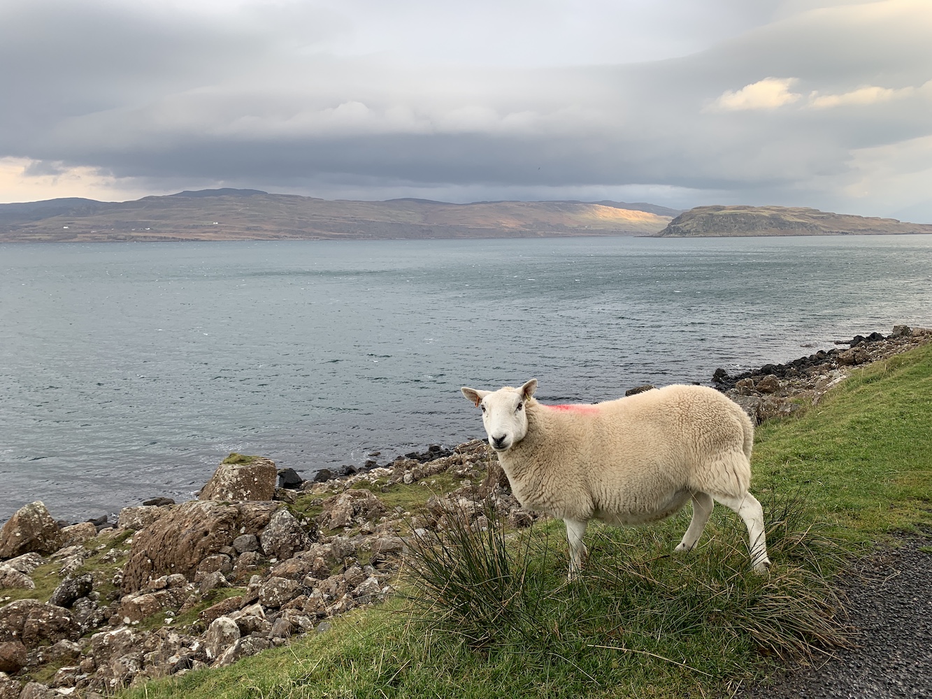
With no ferry leaving the island until after 4pm we had a few hours to kill. Unfortunately we didn’t have long enough for Bob to do a hill or for the walk out to Rubha nan Gall so we went for a drive. Mull seemed very unfamiliar to me, particularly the southern part, and it’s no surprise really as I worked out I’d only been once before (if you exclude the quick stop off at Ardmore Point from a chartered boat last year). It was beautiful to see it though, especially with the clearing skies and the sun eventually deciding to make an appearance.

A lone sheep on the banks of Loch na Keal on the west coast of Mull
The change on weather conditions was evident at a number of points
Looking back at Loch na Keal

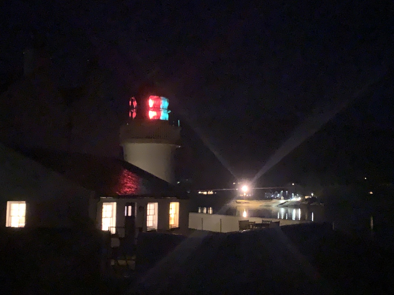
After a fair wait at the terminal at Fishnish we boarded the ferry for the short crossing to Lochaline. By this point it was beginning to get dark and so I enjoyed the outline of the landscape as Bob drove us along to Corran. I always find Corran lighthouse just seems to suddenly appear when you aren’t expecting it and that was exactly what happened yesterday evening as we arrived suddenly at the Corran ferry at Ardgour. The joy of seeing lighthouses at night is, of course, seeing them in action. Corran is a good one as it has the red and green sectors which make for a more colourful view. This was another one I could look at and think “I was at the top of that tower last year”.

Corran lighthouse

Across the water I could also see the little Corran Narrows light flashing away and I remembered the unnecessarily tricky walk down to that one!

After crossing the channel on the Corran ferry we began the journey northwards and home. It had been great to get another weekend away this year, while we could. Who knows what the coming weeks and months will bring. Stay safe everyone and, if I don’t manage another post then have a restful Christmas time. Let’s hope 2021 can be an improvement upon this year. 🙂

Circumnavigating Mull

If there was one light that had been bothering me for a while then it would have been Bunessan, which is on an island just north of the village of Bunessan on the Ross of Mull. It was the last one in the area from Mull to Islay that I had left to visit, or even see. Fortunately it tied in quite nicely with some islands off of the south west of Mull that had been bothering some island-baggers for a while too. Our good friend Mervyn got in touch to say that he was organising a trip there with Coastal Connection (a great boat operator based in Oban who got me out to see Dubh Artach and Hyskeir among others a few years ago). Of course we jumped at the chance.

Yesterday was the day that we’d set. We’d been warned that the trip was expected to last 12 hours. That’s quite a long day for one lighthouse, but when they’re bothering you then you do what it takes. Heading out from Oban we saw the Pharos berthed at the Northern Lighthouse Board Depot and a short while later we passed the lighthouse on Sgeirean Dubha in the Sound of Kerrera. We were aware that it might be choppy going out, but should calm down as the day progressed. Arriving towards the south west of Mull the lads began their bagging while I watched, read and slept mostly.

Bunessan approach
Approaching Eilean na Liathanaich island with Bunessan lighthouse

After nine hours it was finally time to conquer that troublesome lighthouse once and for all. There was still a bit of movement in the water around the island and a few people got wet feet because of it, but landing on the rocks on the north east corner wasn’t too bad. Fortunately Bob took a leap of faith, as he tends to do, onto the island to help get us on. Once we were beyond the rocks we were in some of my least favourite terrain, vegetation of all shapes and sizes and you have no idea where you are putting your feet – the random holes don’t help either. There was also a section where you had to go down a sloped section and then back up the other side. I’m not ashamed to say that using my bottom did the trick!

Bunessan
Bunessan lighthouse

We were greeted by a standard flat-pack lighthouse at the end and we decided to attempt to establish how many people we could fit around the lighthouse with arms outstretched – a game played formerly on Rona and the Crowlin Islands. Although I didn’t check everyone’s positioning I was led to believe that it was 8. Following that we appeared to play a brief game of Ring a Ring o’ Roses around the tower, although I’m not entirely sure why! It was nice to finally be there and everyone else had got off of the boat too, so there was plenty of good company. The walk back was uneventful and the bottom was utilised again. We celebrated me finally reaching that one with cake once we were all back on board.

I heard that we were bound for the Sound of Mull and assumed that there were some islands there that others had left to do. I’ve just been informed that it was actually to make up some time as the sea was expected to be calmer around that way, so off we set. As we sailed up along the northern side of Mull I could see Ardnamurchan lighthouse from a distance and then the lighthouse at Ardmore Point, the most northerly tip of Mull, came into view. Once we were around the corner there was Rubha nan Gall looking as lovely as ever.

Rubha nan Gall
Rubha nan Gall lighthouse

I discovered around this time that a plan had been formulated between Mervyn and Bob to land on both Eileanan Glasa and Glas Eileanan in the Sound. Both of these boast lighthouses (known as Green Islands and Grey Rocks respectively) in case you were wondering. The first one we came to was Green Islands and you can see where it gets its name. All of the islands in the Eileanan Glasa group have two different colours of rock topped with lovely green grass. It struck me as a bit like Little Holm in Shetland which we visited back in June. They are all small, but perfectly formed. Again the landing was easy and it was another flat-pack lighthouse, one that’d only seen from the sea previously. It’s always good to get closer to these ones, especially when the sea had calmed down as much as it had. There was no swell at all by this point.

Green Islands
Green Islands lighthouse

Onwards we went to Grey Rocks lighthouse. I was really pleased to be getting onto this one as, again, I’d seen it from the sea, but never landed. This one has a neighbouring building that we’ve not been able to find out any information about. There were plenty of barnacles on the rocks to cling to as we made our way from the tender to the lighthouse. At one point the vegetation got a bit thick, but it calmed down once you reached the little building and the lighthouse. The building appears to be split into two parts. It is brick built with a couple of doors and windows. The actual windows and doors had long since disappeared as had the roof, but it was just nice to see a different building in the area.  It also creates quite a nice image of an old, ruined building next to a very modern looking lighthouse.

Grey Rocks
Grey Rock lighthouse

As far as I was aware that was it for the day and we would then be heading straight back to Oban. However something caught our eye on the way so we got a little waylaid and decided to go for a quick ad hoc stop on Lady Rock which features a rather unique lighthouse. The tapered white base with a standard flat-pack section of framework on top, but that framework was covered in red rather than white panels. There was a lot of seaweed about near where we landed, but it didn’t seem too slippy. There was also a lot of bird “waste” on the rocks, but we made it to the tower just fine. It’s only when you are standing next to it that you realise how much bigger the lighthouse is than you think. There’s a ladder going up the side, which looks significantly taller than most other lighthouse ladders!

Lady Rock
Lady Rock lighthouse

As it was getting late and we’d already been out for over 12 hours it was time to get back on dry land. What a fantastic day it’s been with one successful bag that I’d hoped for plus three bonus bags. Huge thanks to Mervyn for such a brilliant day and to the guys at Coastal Connection too! 🙂

West Coast Adventure: day three

I have got a little behind with these posts due to having too much fun on the West Coast Adventure. On Saturday, day three of the adventure, we had another lighthouse and island-filled time. Setting off from Kilchoan it was only a short journey to our first stop, Ardmore Point on the north coast of Mull. The sun was already shining bright and the sea was fairly calm, which made landing on the rocks below the lighthouse straightforward. The lighthouse sits a little way up from the sea so we needed to find an appropriate route up, which was a bit of a struggle for me – although Bob was leading the way so I really just needed to follow him. John joined us too and it was only after we’d spent a while clambering up onto the rough grass that we spotted the skipper hopping across the rocks and taking what looked like a much more direct route. I didn’t enjoy the walk to the lighthouse, but as usual the lighthouse managed to cheer me up. Although the tower itself is a standard flat-pack (with multitudes of solar panels), it differs from most others in that it is accompanied by an extra little building.

Ardmore Point
Ardmore Point lighthouse

Returning to the ‘mothership’ we set off again. We’d planned to head out to the Cairns of Coll, but a storm was forecast for the afternoon so we weren’t sure if it would be worthwhile. As it turned out the storm never reached us (or passed over the night before), so we decided to attempt it. Waving to Ardnamurchan on the way, we began the journey out to the north end of Coll. On our trip last year, we had been to the Cairns of Coll, but had not been able to land on the lighthouse island, Suil Ghorm, from the RIB we had been on due to the shallowness of the water. As we arrived at the island group it became fairly clear that we would be unsuccessful again. A couple of members of the group attempted a landing on a neighbouring island, which didn’t go particularly well so the decision was taken to abandon any attempt to land. Skipper Derek from North Coast Seatours did sail as far around the lighthouse as he was able to though so we could get some good pictures. It was nice to see it again even if it wasn’t as closely as we’d hoped.

Cairns of Coll
Cairns of Coll lighthouse

The Small Isles were our next destination. I was looking forward to this as it included a stop at Eilean Chathastail, home to Eigg lighthouse. I’d been here with Bob and a group of island baggers back in 2015 and absolutely loved it. It’s the type of lighthouse I am very fond of and the opportunity to revisit was one I jumped at the chance of. It was also one that John had been wanting to visit too as he’d previously only seen it from the sea. With the storm nowhere to be seen and  the sea calm, there was no problem at all with landing on the north west of the island. This was a little different to last time when we landed on the east coast of the island, closer to the lighthouse. This did mean we’d need to walk a bit further and I was glad that Bob had offered the use of his GPS device as it kept us on track for getting to the lighthouse. As it is set down a little from the highest ground on the island it is difficult to see from the north of the island until you are almost at it. The walk wasn’t too bad and we were rewarded with some fantastic views when we got to the lighthouse. We could see across to the pencil-looking Ardnamurchan lighthouse, this time to the south west, standing tall. I was reminded again of how calm the place feels and I enjoyed the visit as much, if not more, than the first one.

Eigg.JPG
Eigg lighthouse

After lunch at the cafe on Eigg, we continued our journey north. We were soon approaching Skye and we sailed close to the flat-pack lighthouse at the Point of Sleat. It’s quite a walk to the lighthouse, but an interesting one as explained in my post from 2016. Certainly much easier to visit/see from the sea!

Point of Sleat2
Point of Sleat lighthouse


I’d been looking forward to our next stop and I felt a little bit like a child in the back of a car as we sailed up the east coast of Skye. I had to stop myself a few times from asking “Are we nearly there yet?” On my original tour I’d seen Ornsay lighthouse from the village of Isleornsay when the tide had been in. On the second visit, Bob and I had walked out to it at low tide, and a last visit a few weeks ago was again just a quick stop looking across the water to the island of Ornsay and it’s tiny neighbour Eilean Sionnach, the island with the lighthouse. I wrote a fair amount about the beauty of the lighthouse in a recent post so I won’t go into too much detail in that respect this time. However, I was intrigued to see whether the lighthouse would lose any of its beauty for other angles. With the mountains as the backdrop from the general viewing area, I was concerned that it was just that view that made it so stunning. I am happy to confirm that there was no need for concern. I’m not sure what it is about the lighthouse, but it is amazing whichever side you see it from. Of course, with conditions being so calm, we had to land on the island for another opportunity to see it close up. While the sky at Ornsay lighthouse always seems to have been blue when I have visited, it was bluer than ever this time with a few clouds for added effect. I could have happily stayed there for hours and if the cottages ever come up for sale, well… I think the picture below says it all really.

Ornsay2
Ornsay lighthouse

I’ve got a bit carried away and not yet mentioned the Ornsay Beacon Lighthouse, which we actually visit in the small tender before landing at the big lighthouse. Although, from a distance, it doesn’t look like there is much to this one, when you see it close up it’s far more substantial. It is a solid round stone tower topped with one level of the flat-pack arrangement. Of particular note though is that, everywhere else, the flat-pack has a square footprint, but this one has rounded edges. It’s a good structure and really nice to get a chance to see it at close range. This is why I enjoy getting closer to this type as it is difficult to appreciate them from a distance when they all look pretty much the same. You also don’t get a true feel for the location unless you are on the island they sit on or very close to it. This one was great to see.

Ornsay Beacon
Ornsay Beacon lighthouse

Once the island baggers had bashed their way to the high points of a number of islands as we moved further north, we arrived at the Sandaig Islands. The Sandaig lighthouse is on Eilean Mor which, unlike most of the other islands within the group, is not accessible from the mainland at low tide. As the group were all looking to achieve different things on these islands, only a few of us were dropped off on Eilean Mor. With Bob joining us a little later, John took on the role of lead navigator, establishing whether attempting to walk along the rocks or across the island was the better route. Opting for the more foliage-filled option it wasn’t too long before John spotted a series of wooden posts sticking out of the ground that seemed to lead in the direction of the lighthouse. The path that these posts followed was quite good in places and a little rougher in others, but we were definitely glad to have found it. As we approached the lighthouse John joked that Bob was likely to just turn up around the corner at any moment and then, as if by magic, he appeared strolling across the rocks. I’ve taken to referring to Bob fondly as ‘Goat Legs’ on these trips due to his ability to make any walk across any terrain like like a stroll in the park. This is another brilliant island and so it was a pleasure to visit the flat-pack structure. I must admit though that it would have been nice to have seen the old lighthouse (now located at Glenelg pier – see my earlier post for more information on that one) in place, but still a great place to visit. Once we’d finished at the lighthouse we followed the posts across the island and to a little sheltered rocky bay. The three of us sat, chatting in the sunshine surrounded by beautiful views, while we waited to be collected.

Sandaig
Sandaig Island lighthouse

That was the end of our lighthouse adventures for the day. Glenelg was where we based ourselves that night. What a wonderful day we all had. While a large percentage of the UK was experiencing the wrath of Storm Hannah, we had avoided it entirely. What a lucky bunch we were 🙂

A week on Mull

Two weeks ago we spent some time on Mull, staying in Tobermory. As soon as we left Oban on the ferry the lighthouse viewings began, with a glimpse of Dunollie beacon, just north of Oban, and the stunning Lismore lighthouse (more on that one in the next post).

Rubha nan Gall lighthouse

On our first full day we decided to risk getting a soaking by walking to Rubha nan Gall lighthouse to the north of Tobermory. Shortly after leaving the road and heading through the trees, we came across a sign telling us that the path ahead was closed. It was clear that no one had really taken much notice of the sign, so we pretended we hadn’t seen it and continued along the coastal route, which proved to be particularly muddy and narrow in places. It was quite a picturesque walk and we were fortunate not to be rained on. As we approached the lighthouse I remarked on how similar it looked to Eilean Ban lighthouse where we had stayed just a few weeks before. It’s not only the lighthouse that’s similar, but the access bridge as well. Unfortunately a high locked gate prevented us from reaching the tower, but we got some great views anyway from the pier leading to it. We spent a while sitting on the pier and enjoyed the emerging sun while we could, with views across to the Ardnamurchan peninsula. The walk back was equally enjoyable.

When we returned to Tobermory we stopped off at the town’s museum, where we found out about the story of Neptune II that set off on a 100 mile overnight journey from one port to another in Newfoundland in 1929. The ship was caught in a storm which caused them to endure a 48 day, 3,000 mile journey, during which they came across the lighthouses at Skerryvore, Dubh Artach and Ardnamurchan before setting foot on land again. We also found a little more information about the Rubha nan Gall lighthouse at the aquarium in Tobermory.

The observation tower on Erraid, with windows looking out towards Dubh Artach and Skerryvore

We spent an afternoon walking across to Erraid, a tidal island, and exploring the island. Erraid was used as a base for construction of the Dubh Artach lighthouse, including the quarrying of the granite for the tower. While the lighthouse was in operation, the keepers and their families lived on Erraid and the observation tower was also constructed. We visited the tower and were able to get a distance glance of Dubh Artach lighthouse (more on this one too in another post coming soon). Robert Louis Stevenson visited the island while his father was involved in constructing the lighthouse and set his novella ‘The Merry Men’ there as well as a chapter in ‘Kidnapped’. It’s a fantastic little island and even more enjoyable with the knowledge that you need to get back before the tide turns!

The beacon at Dunollie

Our final day on Mull was spent visiting Iona. On our return journey to Oban we noticed the Northern Lighthouse Board’s maintenance vessel, Pharos (which we had previously seen at Bell Rock and on our way out to St Kilda), parked up a short distance from the Oban ferry terminal. We took a drive up and noticed that the Northern Lighthouse Board have a terminal there, which is a base for their vessels, but also where passengers for the Hebridean Princess alight. On our way north to Appin, our base for the following week, we stopped to look at the Dunollie beacon a bit closer up.

The following week was a blur of boat trips, remote lighthouses and sunshine. More on this to follow soon! 🙂