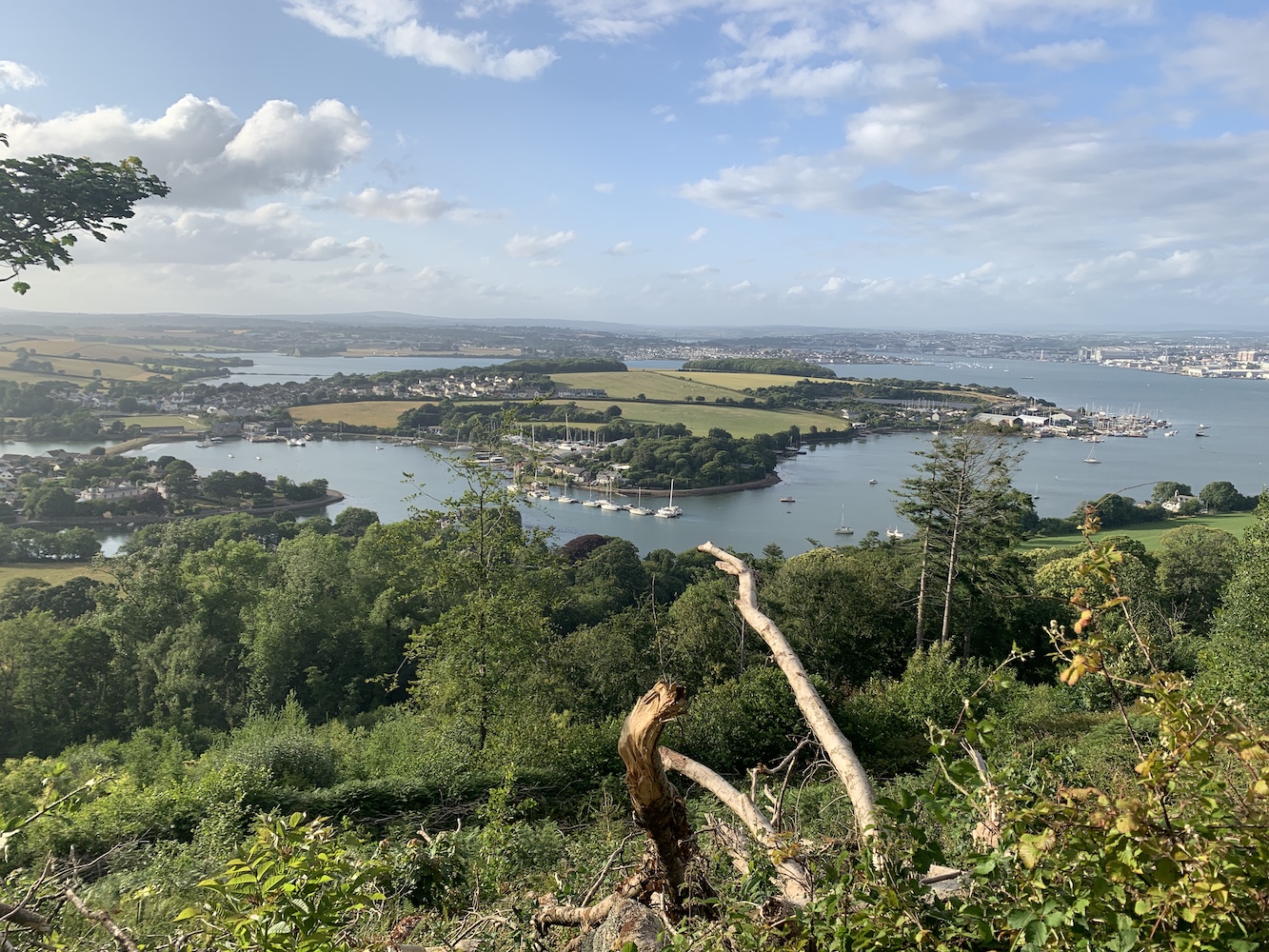
The Association of Lighthouse Keepers’ Cornwall event continued on Thursday and it kicked off with a return to the National Maritime Museum in Falmouth.
This time we’d hired a meeting room so the ALK’s South West Regional Rep, Ken Trethewey, who is also the author of ‘The Lighthouses of Cornwall and Devon: A Narrative’ among other books, could share his knowledge and personal experience of lighthouses in Cornwall and some further afield too.
Ken kicking off his excellent talk
It was a great presentation, starting off with a picture of St Catherine’s Point Lighthouse in Fowey. I was banned from answering the ‘where is this lighthouse?’ question! Ken then went on to talk about Wolf Rock Lighthouse and the amazing opportunity he’d had to fly by helicopter to the lighthouse and take a look inside.
Ken is one of the original lighthouse baggers and so was part of the very lucky – and much smaller – group who would have actually visited the lights while there were still keepers working in them.
Ken also speaks very fondly of Eddystone Lighthouse and the lesser known Plymouth Breakwater Lighthouse, which he was able to organise an ALK trip to see a couple of months ago. Hopefully we can do a re-run of that next year and I’ll make sure I can join next time too. I call it a perk of the job!
The second part of Ken’s talk was fascinating when he delved into his family history and the discovery that three of his ancestors were lighthouse keepers with a particularly close connection to South Foreland Lighthouse. Working alongside his brother, he has released a new book, ‘Light on the Forelands’ which details their findings.
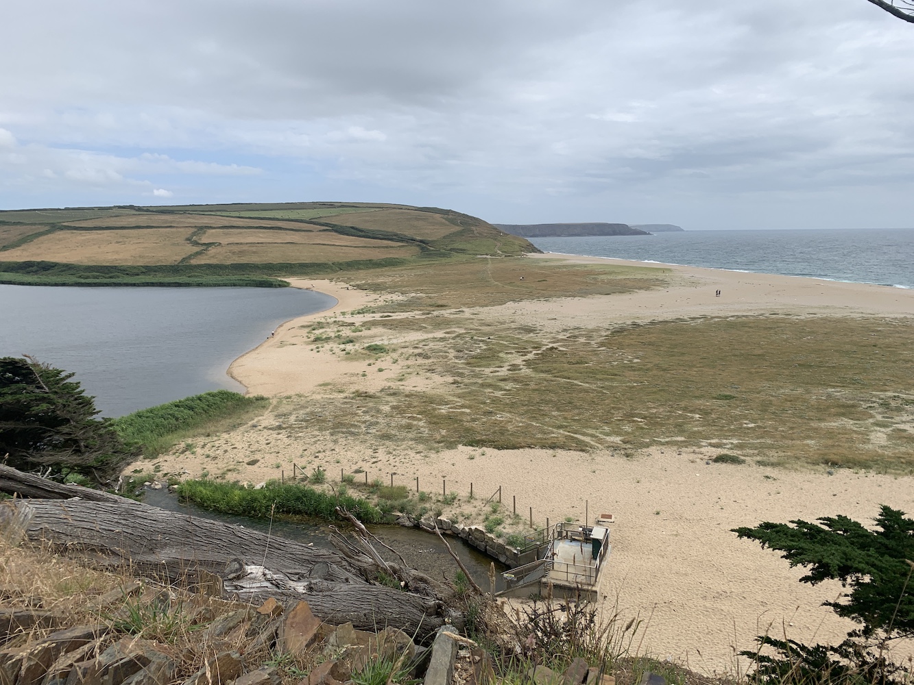
After an enlightening morning it was time for me to get some fresh air so I headed to Helston on the bus for a walk around The Loe, Cornwall’s largest natural freshwater lake. The Loe is only separated from the sea by a sand bar which forms part of the circular walk. No lighthouses there, but still some great views nonetheless.
The Loe Bar which separates The Loe from the sea
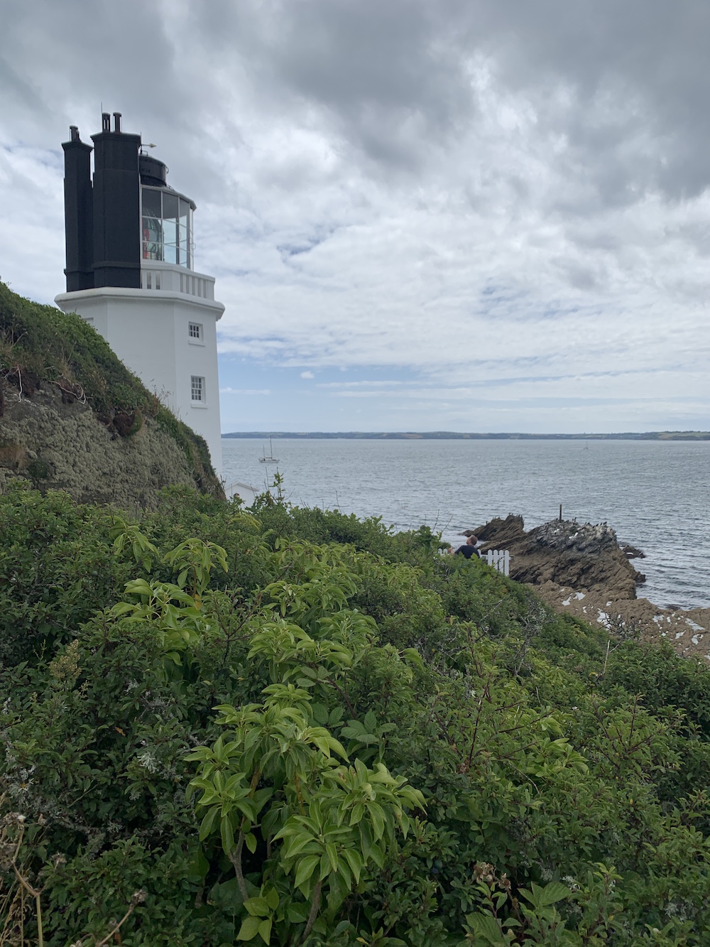
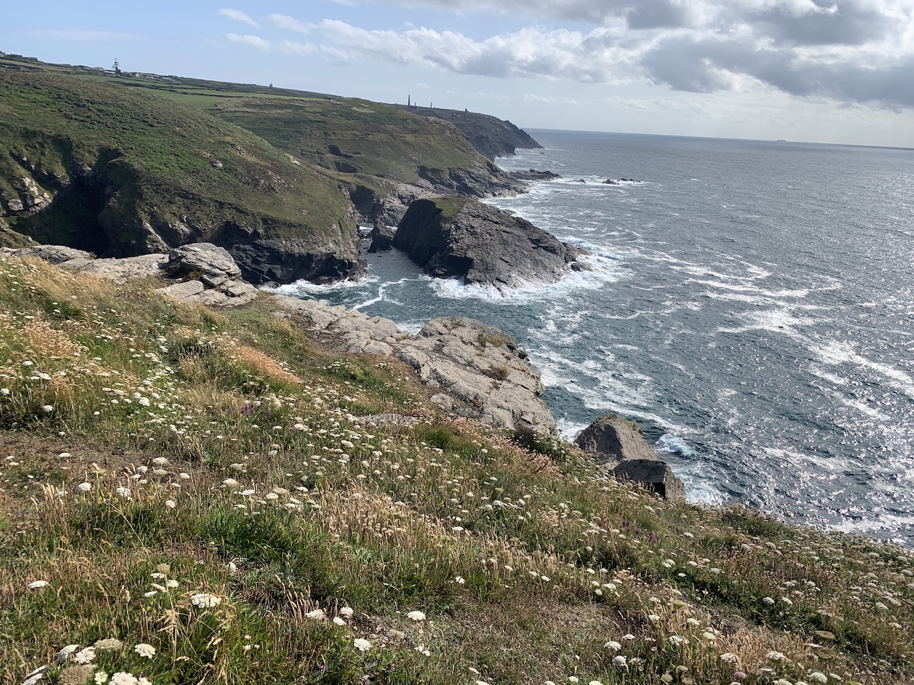
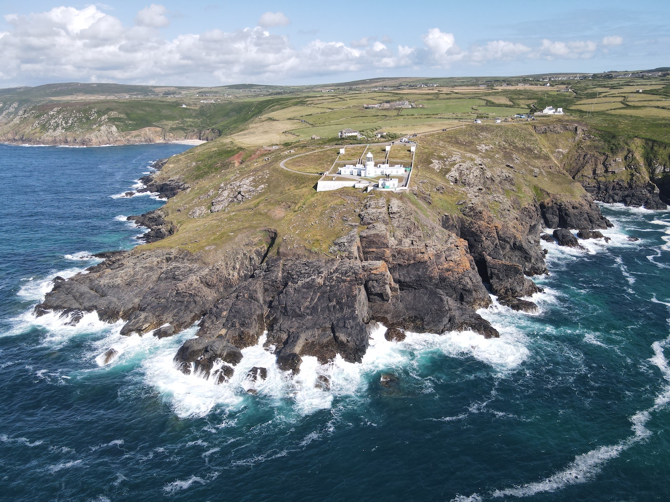
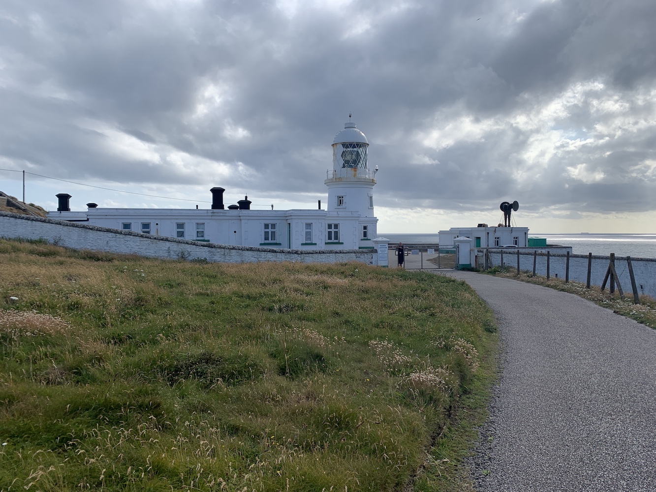
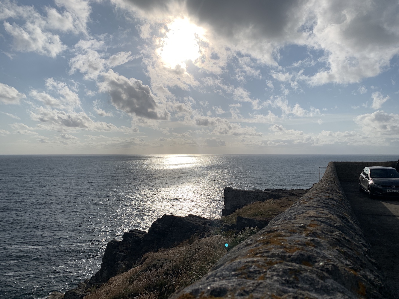
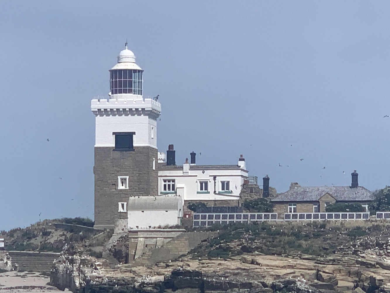
Arriving back in Helstan just in time, it was then a matter of journeying south to the Lizard Lighthouse. Unfortunately the Lizard Lighthouse Visitor Centre is currently closed with no signs of it reopening. This obviously caused us a problem for getting in, but once again Nick from Trinity House offered to help out and we got permission for access to the lighthouse only, not the Visitor Centre.
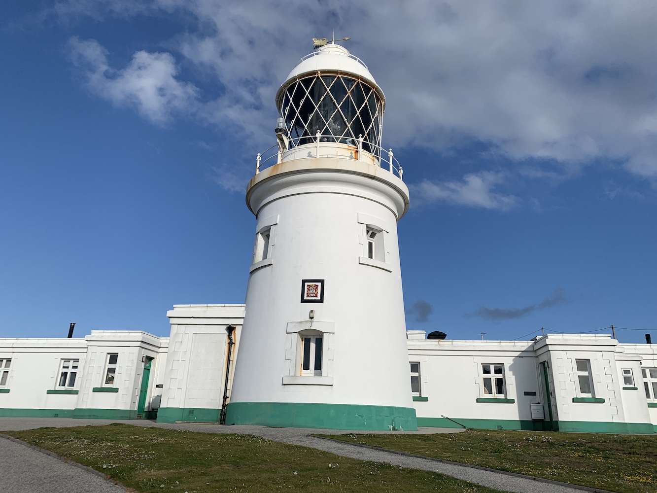
Lizard Lighthouse
There’s something about lighthouses that are frequently visited and very popular. I’m sure I’ve mentioned in at least one blog post before that my affections generally always lie with those that are often overlooked, usually because you can’t just drive to them and it takes more than a short walk. Lizard is, dare I say it, one of those that I just find too popular, but it was actually nice to get inside the tower knowing that it would only be our group in there and it wouldn’t be a matter of battling past numerous others.
The view across the keepers’ houses to the second tower
It certainly is a nice-looking lighthouse though and the addition of the second tower as well adds more visual interest. Perhaps as evidence of its popularity, Nick showed us a cupboard on the ground floor where they store a range of sizes of plimsolls as they had people turning up wearing completely inappropriate footwear.
The lens in Lizard Lighthouse is fantastic and rotates incredibly fast. It gives off an incredibly powerful light, which can be seen for an impressive 26 nautical miles, which will presumably be largely to do with it being on the most southerly point of the UK and aiding navigation of both the English Channel and vessels arriving from the wider Atlantic to the west.
Lizard’s impressive lens
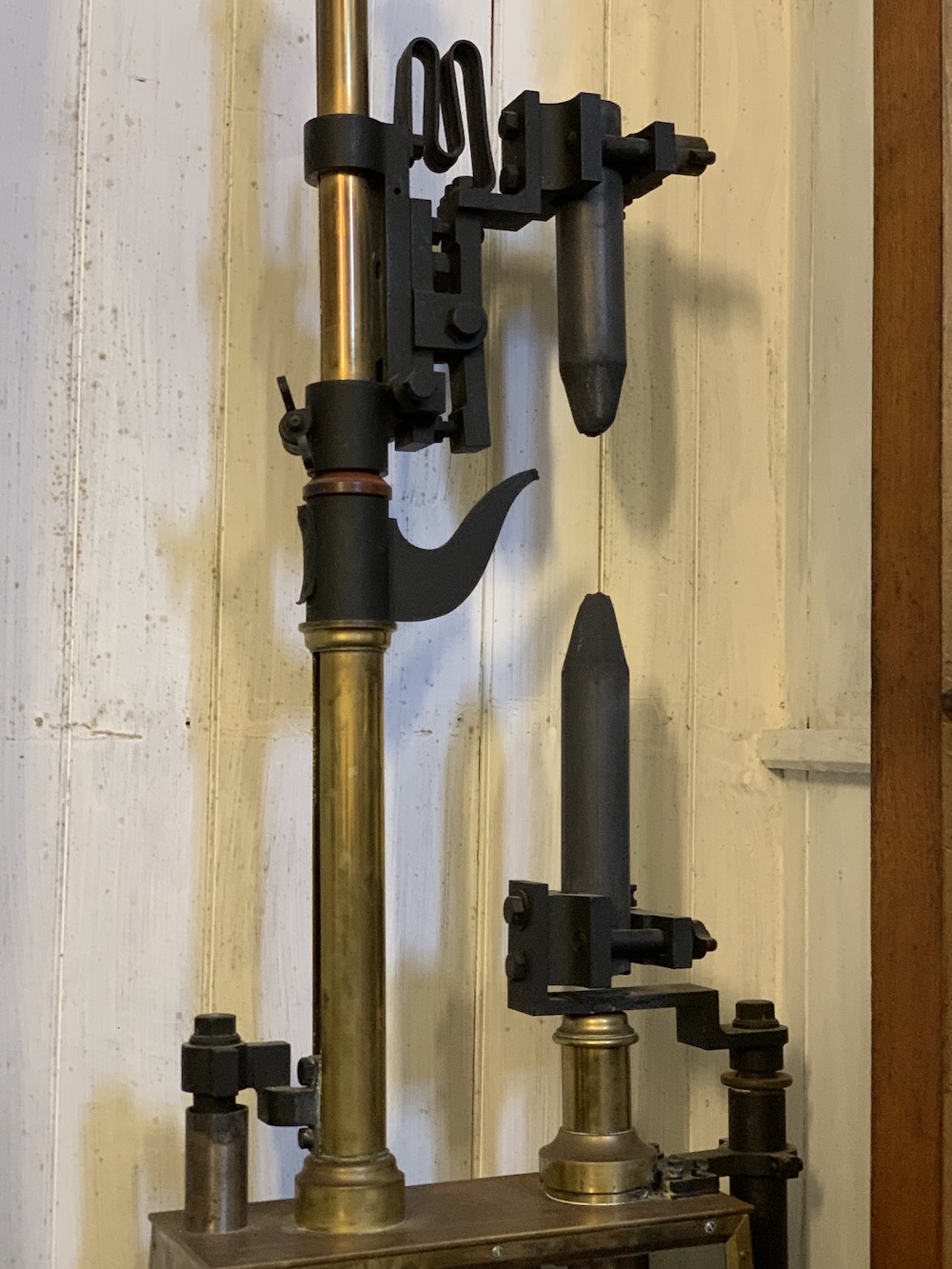
Ken actually stepped in again at one point to describe in more detail an old light mechanism that is contained in one of the cupboards at the lighthouse. This was the old Carbon Arc Lamp used in the lighthouse from 1903 to 1936. Lizard was one of the first lighthouses to have electricity and this method of powering the lighthouse involved applying a high voltage of electricity to the two carbon rods, which created a permanent spark between them. I’d never seen one of these before.
The Carbon Arc Lamp previously used at Lizard Lighthouse
Of course Joe the Drone was up to his usual tricks.
A Joe’s eye view of Lizard Lighthouse
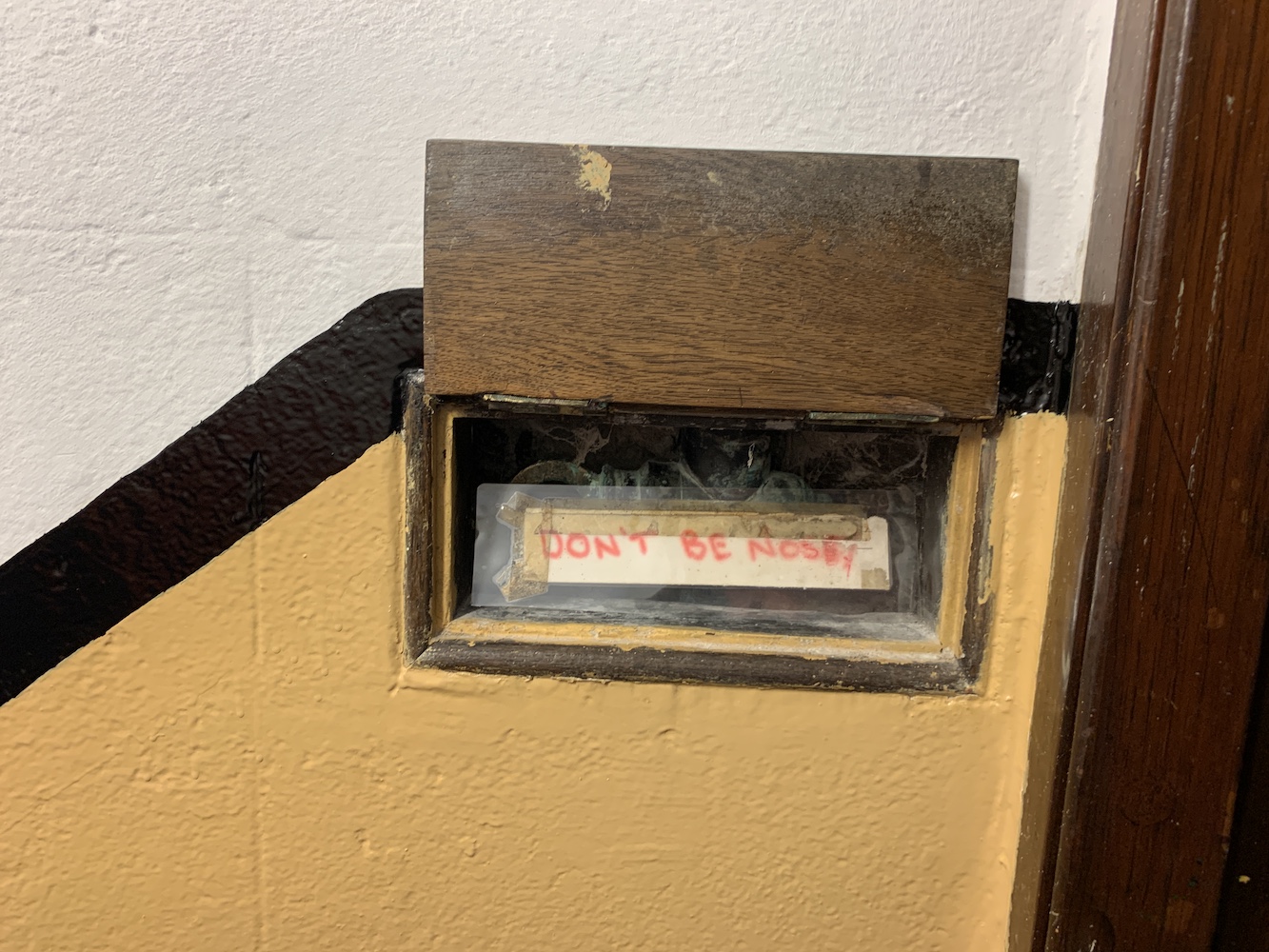
One extra little gem that we discovered while coming back down the ladder from the lamp room was a tiny hatch. When you lifted the little door you were greeted with a sign saying ‘Don’t be nosey’.
Sometimes these little touches can help make a visit more memorable – and enjoyable too 🙂
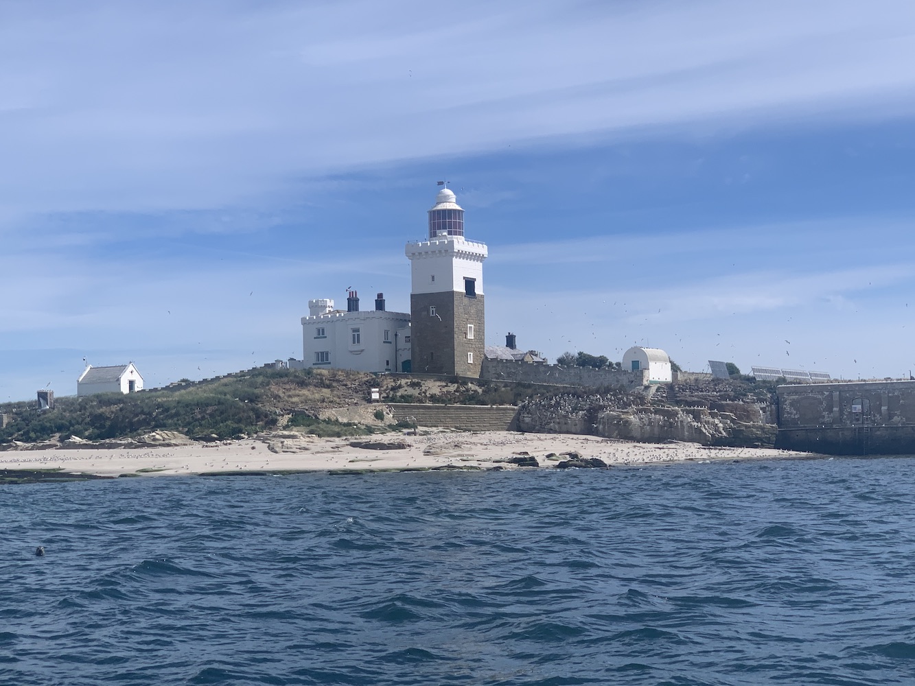
Continuing the lighthouse-related fun alongside 21 other Association of Lighthouse Keepers members, there was plenty to do on Wednesday, starting out in Falmouth.
With any potential for internal access to St Anthony Lighthouse ruled out, I’d followed the lead of those who had organised the first ALK trip to Cornwall and arranged a boat to sail around the lighthouse. We’d chartered a fairly small boat with Cornish Pleasure Cruises that would be more than big enough to take the whole group, but we were delighted to be upgraded to their wonderful Dixie Belle which could accommodate up to 100 people so there was masses of space for us to spread out.
On the boat trip we were joined by Chris Nicholson and his wife. Chris is the author of one of the very first lighthouse books I owned, The Rock Lighthouses of Britain. It’s a fantastic book that’s recently been updated and even includes a few pictures taken by yours truly. He’s made my already pretty good (if I do say so myself) picture of Longstone Lighthouse with seals in the foreground look stunning!
The charter was due to only last an hour, but after setting off it seemed the skipper George was in no hurry at all, which was even better. We got a closer look at some of the massive military ships moored up there, and we poked our heads (or the boat) around towards Falmouth Bay too with it’s various beaches. There was some rather amusing commentary happening too, which seemed to make my ALK friend Anne and I chuckle far more than it did anyone else. Clearly we are very easily pleased!
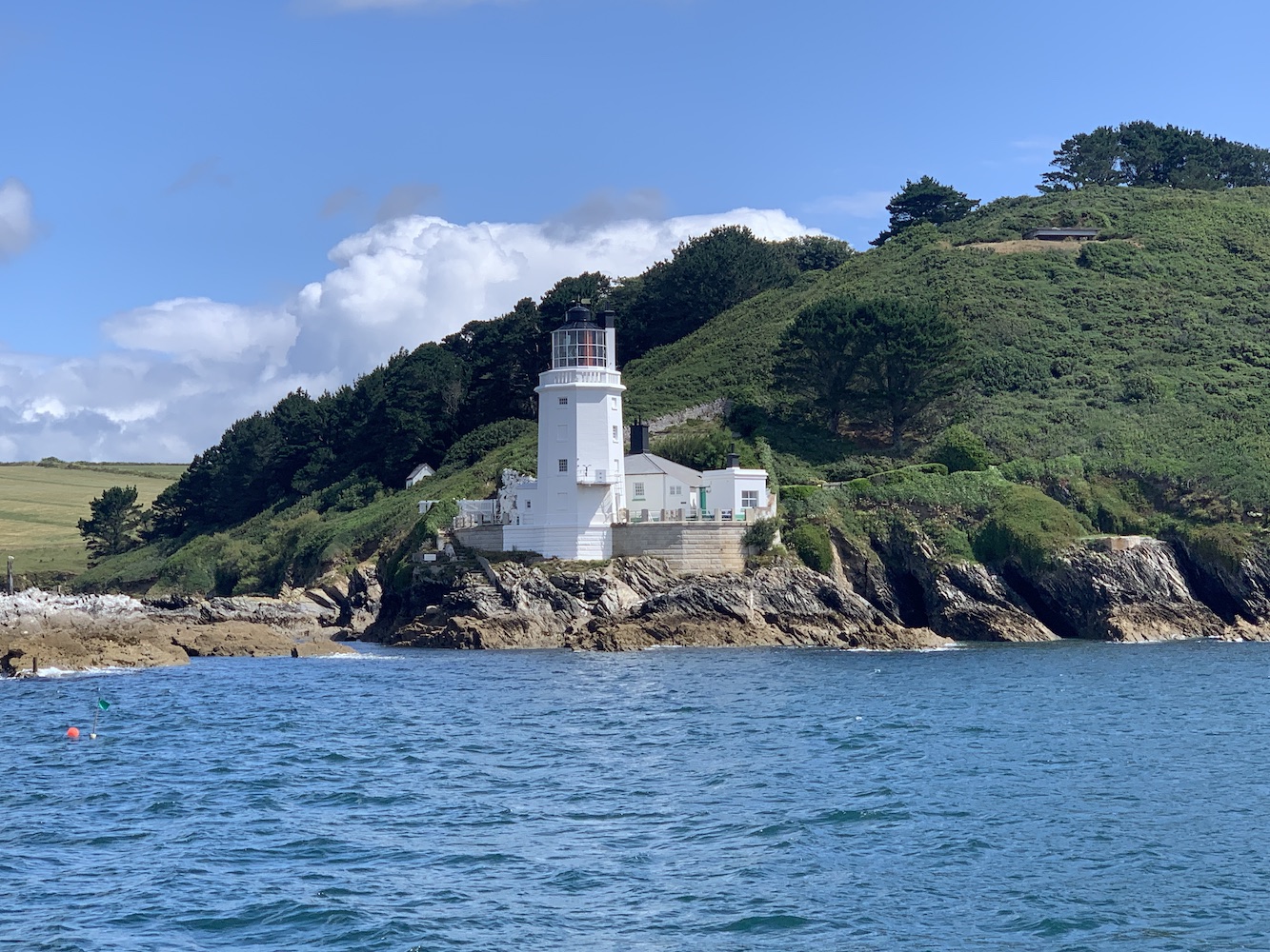
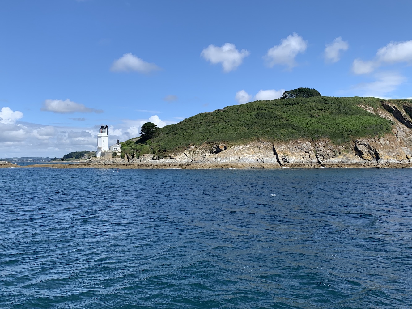
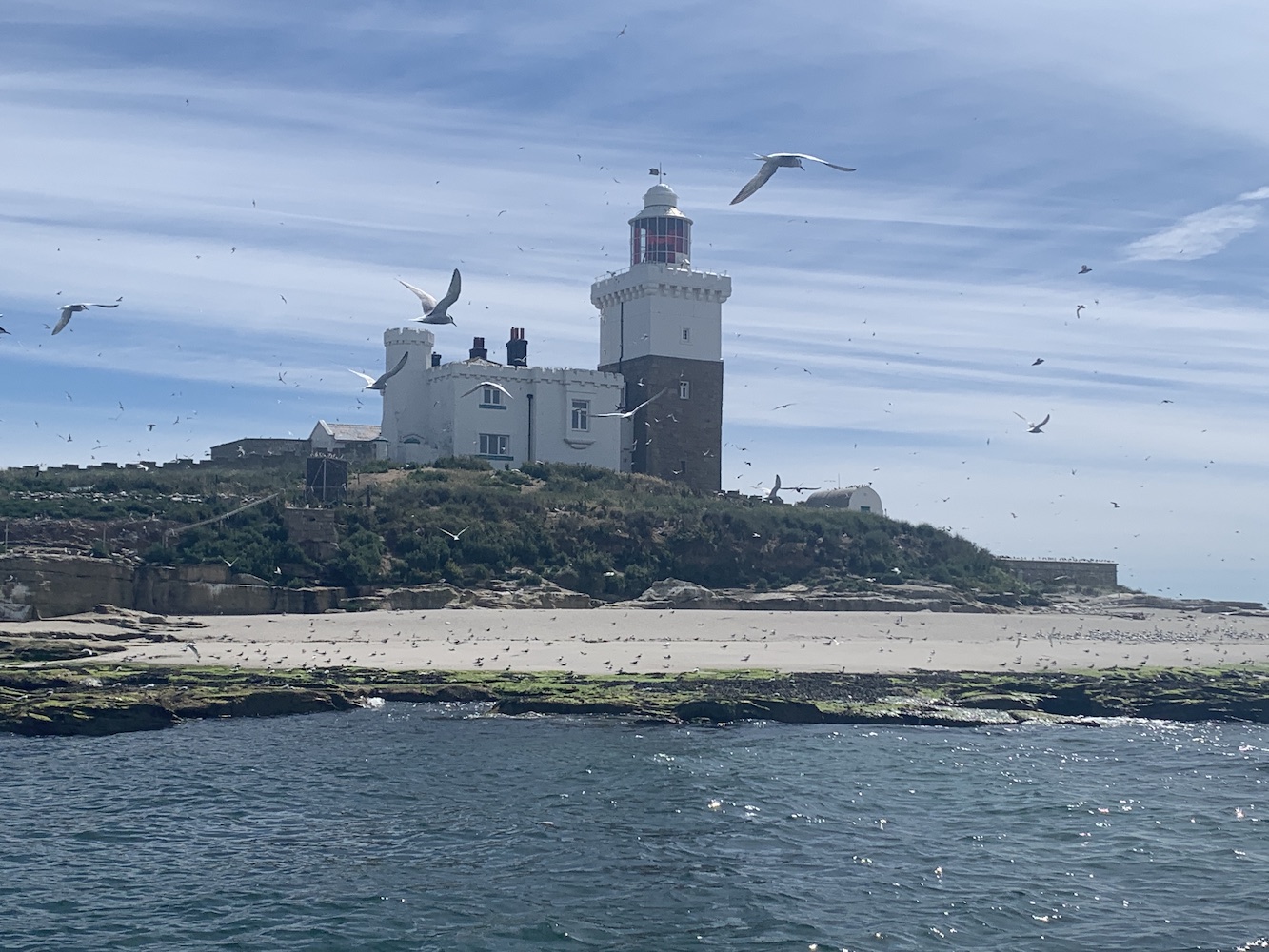
This little detour gave us a longer run up to St Anthony which was no problem at all. The skipper pointed out The Manacles to the south. These are a series of rocks that ships entering Falmouth, travelling from the west, really need to watch out for. St Anthony Lighthouse assists with exactly that by displaying a flashing red sector light (as well as it’s normal white light) 24 hours a day to ensure ships take the safe course around the Manacles.
Approaching St Anthony Lighthouse
St Anthony really is a beautiful lighthouse and the view from the sea is definitely the best angle to capture that from. When the sun shines on the brilliant white tower with it’s black detail at the top and all the lush green vegetation behind it, it’s just like a little piece of paradise.
St Anthony Lighthouse
We had plenty of time to gaze at the lighthouse, chat amongst ourselves, buy tea or coffee on board, and generally enjoy the sunshine before we set off back for Falmouth. More funny commentary followed, much to mine and Anne’s delight.
Bidding farewell to the Dixie Belle and her crew, we set off for the National Maritime Museum. The museum doesn’t contain a huge amount of lighthouse-specific information, but the thing I found most interesting about it is that the bottom two floors of the building are actually underwater at high tide. It was around mid-tide when we arrived so we could look through the really tall windows and see that some was under water at that point.
The window showing the height of the tide at the National Maritime Museum
What I liked most about it was that it reminded me a bit of a rock lighthouse. It’s a circular building that’s got lower sections that are often underwater. It’s really very interesting – or at least I thought so!
With Joe the Drone missing out on this boat trip, he was obviously keen to get his little blades out and about to take a look too. Leaving Falmouth behind it was time to go for the land-based approach to St Anthony. After the long drive (and ferry ride) to get there, you are rewarded with a really beautiful short walk to reach the lighthouse gate. Along the walk there are some fabulous views. My favourite was probably looking north towards St Mawes with the nearby Little and Great Molunan beaches looking perfect.
At the end of the path you reach the gate to the lighthouse, which is really very close, but at the same time so inaccessible. The cottage here is available to rent through Rural Retreats, but it is rather expensive. At Anthony Lighthouse is, of course, the one that appears in the title sequence of the very enjoyable TV series Fraggle Rock. If only the Fraggles and Doozers were seen wandering about outside the lighthouse, it would be sure to make for quite an attraction!
St Anthony Lighthouse from the land
Joe the Drone went for his long-awaited spin.
St Anthony Lighthouse and the Manacle rocks in the distance
The joy of Cornwall lies in many sights and other things, but not really in the time it takes to get between places. Living on the north coast of Scotland, I should really be used to long distances, but the roads in Cornwall (and the number of cars) puts it on a whole different level. The evening was reserved for a visit to Pendeen Lighthouse and it took a good amount of time to get there from St Anthony. Fortunately though there was a little time to spare after arriving so aside from chatting to some of the other early arrivers, I spent some time making myself comfy on the grass with views along the glorious coastline to the south west.
My view while relaxing at Pendeen
Meanwhile Joe the Drone had a fly about.
A Joe’s eye view of Pendeen Lighthouse
When the time arrived we wandered down to the lighthouse and were greeted by Nick who had been a huge help in getting us access to a few lighthouses on this trip, and the one we’d run last year too. Nick is a Senior Technician for Trinity House and without his help getting into Pendeen and the others to follow just wouldn’t have happened. I should add at this point that getting access isn’t as simple as asking Nick. The final decision lies with Trinity House and the ALK’s insurance is a requirement of this – just in case anyone thought it was easy!
On the wonderfully sweeping approach to Pendeen Lighthouse
It was a wonderfully calm evening with sunshine and very little wind. Apparently that’s unusual for Pendeen which is quite frequently shrouded in fog.
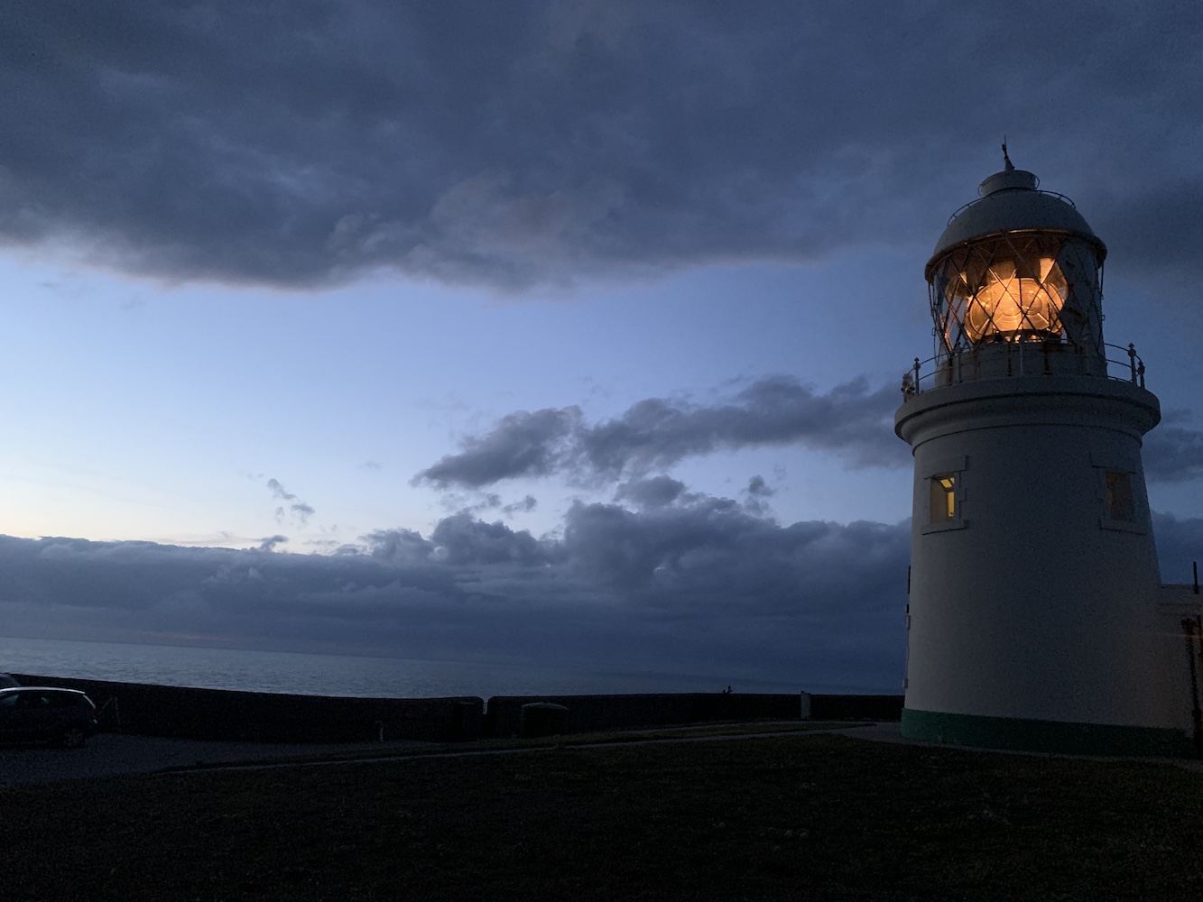
Pendeen Lighthouse
Pendeen Lighthouse will shortly be undergoing some changes with the lens being removed and the light source being replaced by a LED. This is becoming a widespread activity as part of the lighthouse authorities’ obligation to remove mercury from their lighthouses in the next few years. There are other ways around removing the lenses with a LED being installed inside the lens instead, but the decision of what to do with each lighthouse is entirely up to Trinity House. There have been, and no doubt will continue to be, arguments over this, and it’s not something I want to get caught up on. In this case I’m just glad I was able to see the lens in situ.
Pendeen Lighthouse lens
I actually really enjoyed visiting the lighthouse in the evening. This was arranged purely for practical reasons around Nick’s availability, but it was quieter by that point and the lower sunlight makes everything feel a lot more chilled out.
Alongside Nick we had Bill and Dan so we were split into two groups for looking around. I was very amused at the display of lamps that Nick was able to show us from the big, old ones getting progressively smaller and smaller until it was just the tiny LEDs. It was amusing because the group insisted on taking pictures of every single one with Nick doing his best to attempt to keep out of the pictures.
We had plenty of time to look around and once we were all done we headed along to Pendeen village for a big group meal. I’d phoned ahead and thankfully the North Inn were able to accommodate us. It’s always a really important part of ALK events, I find. Following the meal we popped back to Pendeen to get some pictures of the light in action.
Pendeen Lighthouse in the late evening
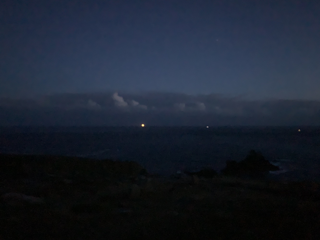
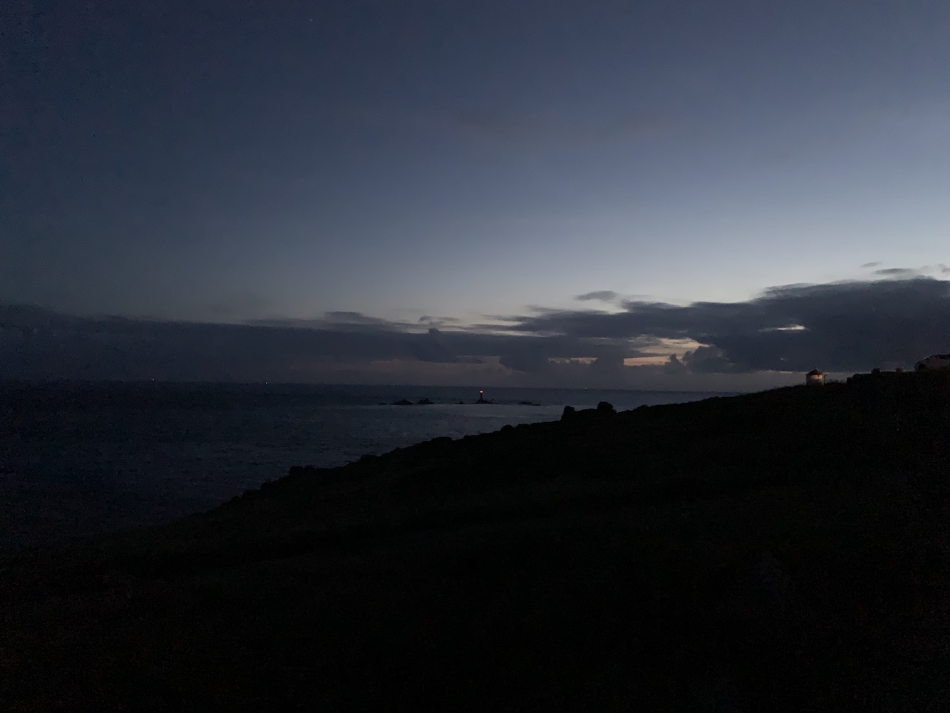
While in the Land’s End area we also stopped off there to see which lights we could see. Wolf Rock’s light is far more visible from that point at night than it is by day, and of course the light on Longships could be seen as well as a couple of buoys.
The impressively bright light of Wolf Rock Lighthouse as seen from Land’s End
The red light of Longships Lighthouse
It had been a busy but good day with some excellent variety, and some laughs along the way too 🙂
With any trip that involves a boat there is always the risk that it just won’t happen because of poor sea conditions. It’s just the way it is and something you grow accustomed to accepting. It’s just never guaranteed and, for some reason, it seems this is often the case moreso for visiting rock lighthouses than any others in my experience. I recall preparing the post ‘To Skerryvore or not to Skerryvore‘ as that really was touch and go as to whether we would make it there or not.
The beginning of this week was almost a repeat of that, although actually this time the boatman wasn’t even sure that we should attempt it. For the first day of the Association of Lighthouse Keepers‘ Cornwall event I’d organised a trip to see Wolf Rock Lighthouse with the same boat going out twice to make sure the whole group got a chance to see it.
Then Sunday came and I received the news from Mark at MJ Marine in Penzance to say that the weather wasn’t looking good for Monday, but he did suggest merging the Wolf Rock Lighthouse trip with the Longships Lighthouse boat trip we were due to do on Tuesday. It seemed like a sensible plan so we went with that. I was tempted to call this post ‘Wolfie Longships’ to reflect the merging of the two into one trip, but resisted as I know not everyone ‘gets’ my odd ways, so I’ve buried it in here!
However, more bad news came on Monday afternoon when Mark reported that the conditions weren’t looking good for Tuesday or for the rest of the week for reaching the lighthouses. He offered a sail around Tater Du Lighthouse instead which was just a short 30-minute trip to the west of Penzance. This was all going to happen and then, just after 10pm on Monday night, I hear from Mark again to say that the forecast had improved and it might be possible to run the Wolf Rock and Longships trips after all. He suggested we meet at 8am in the morning and make a decision.
Gathering at the boat the following day, Mark seemed fairly confident the first group could make it to both rock lighthouses, but wasn’t sure if the second group would. As someone due to be on the first trip I would normally have been delighted, but as the event organiser it is always different and one of the worst situations is when half a group get to do something and the other half don’t.
Anyway, we set off on the first trip and it was a bit bumpy in places and quite wet too, but it wasn’t awful by any means. I certainly didn’t feel unsafe at any point. It took a long time to get around to Land’s End where Longships Lighthouse came into view, but we had a more remote fish to fry prior to that. Rather amusingly, one of the group members spotted what he thought was Wolf Rock Lighthouse, and although he was convinced it was the tower it turned out to be just a buoy. It’s unlikely he’ll live that down anytime soon!
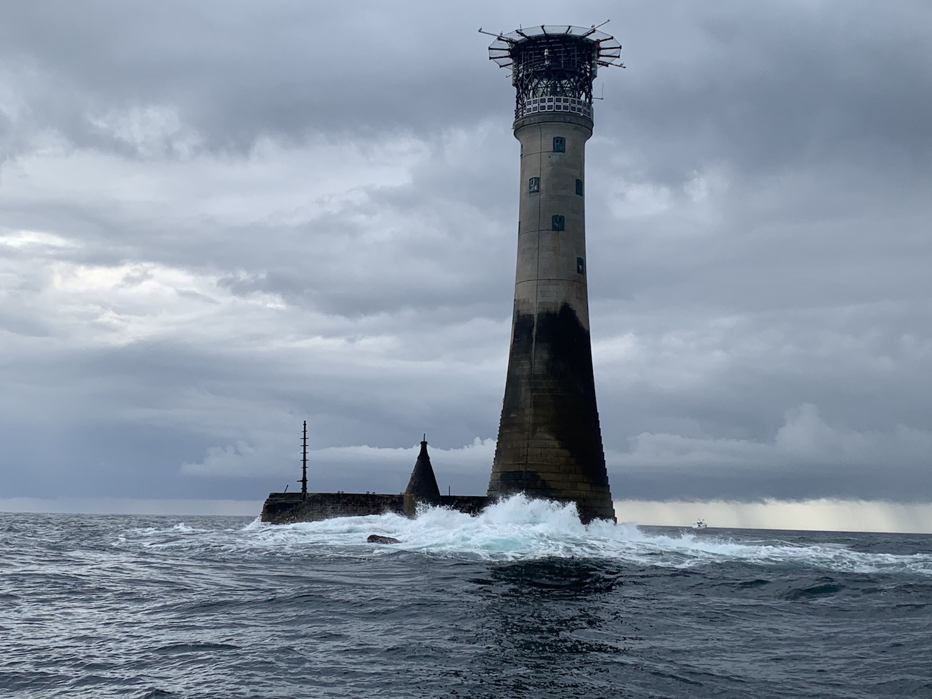
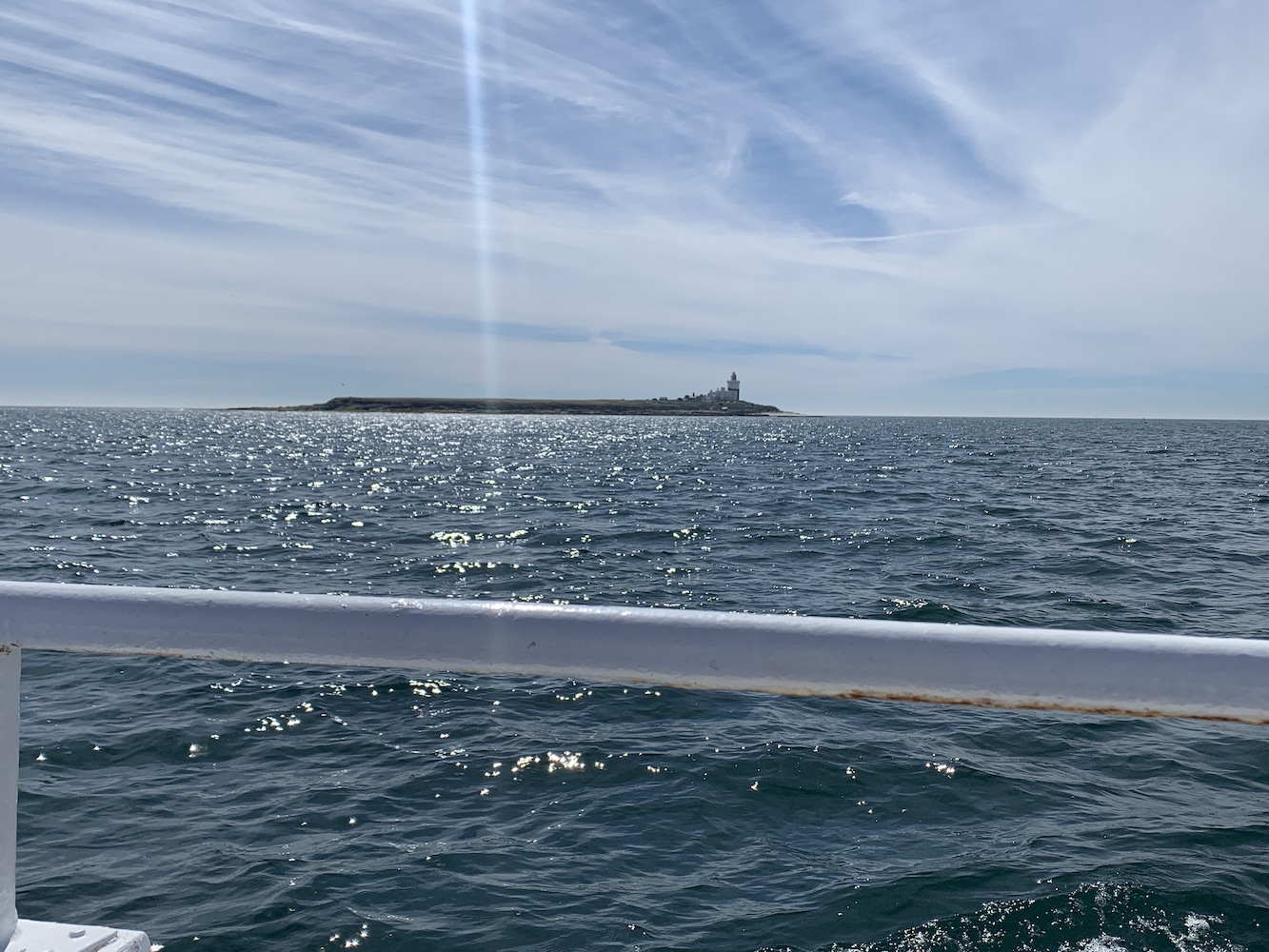
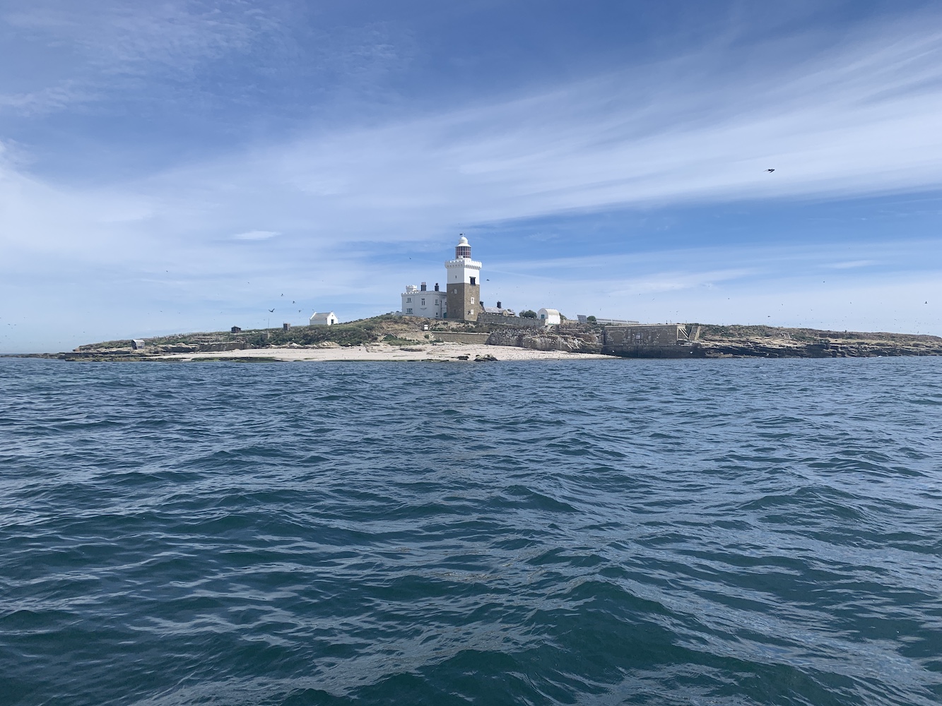
More time passed and then Wolf Rock was there, slowly getting closer and closer until we arrived. What a sight it was to see. I recall a couple of other ALK members mentioning that although it was very overcast that morning the sky suited these amazingly remote rock lighthouses, giving them a far more dramatic look.
Getting closer to Wolf Rock Lighthouse
The conical beacon that sits next to Wolf Rock Lighthouse was the lighthouse’s predecessor and is actually what makes this one more recognisable at Wolf Rock. Now that the Trinity House-owned rock lighthouses feature a helideck on top, it can be hard to tell the difference between them.
Never one to miss out on a bit of excitement, Joe the Drone went for a fly around too and put the rest of our pictures to shame with the results as usual!
A Joe the Drone capture
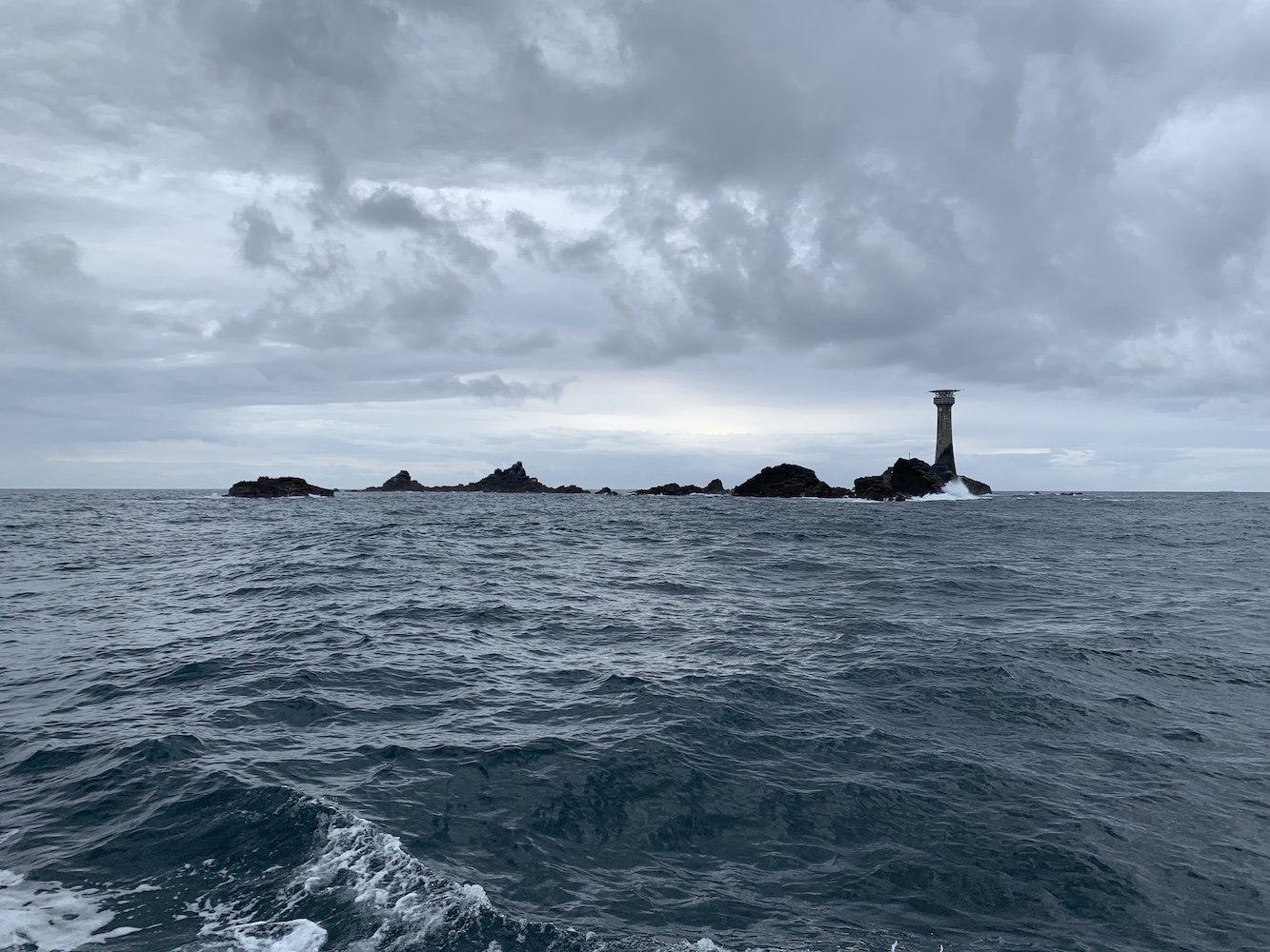
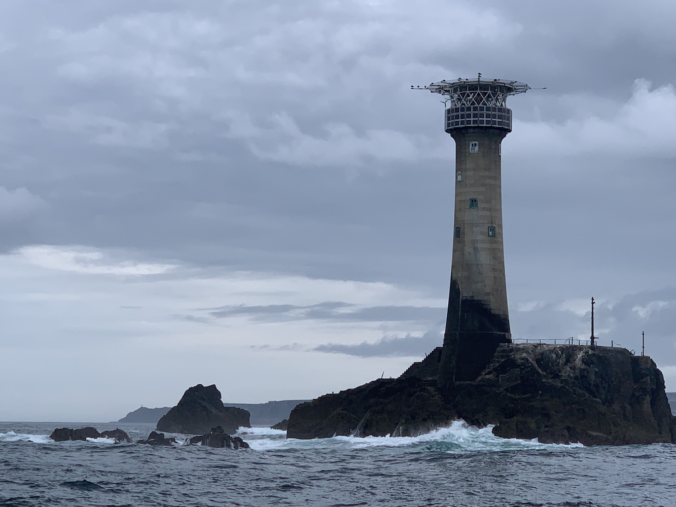
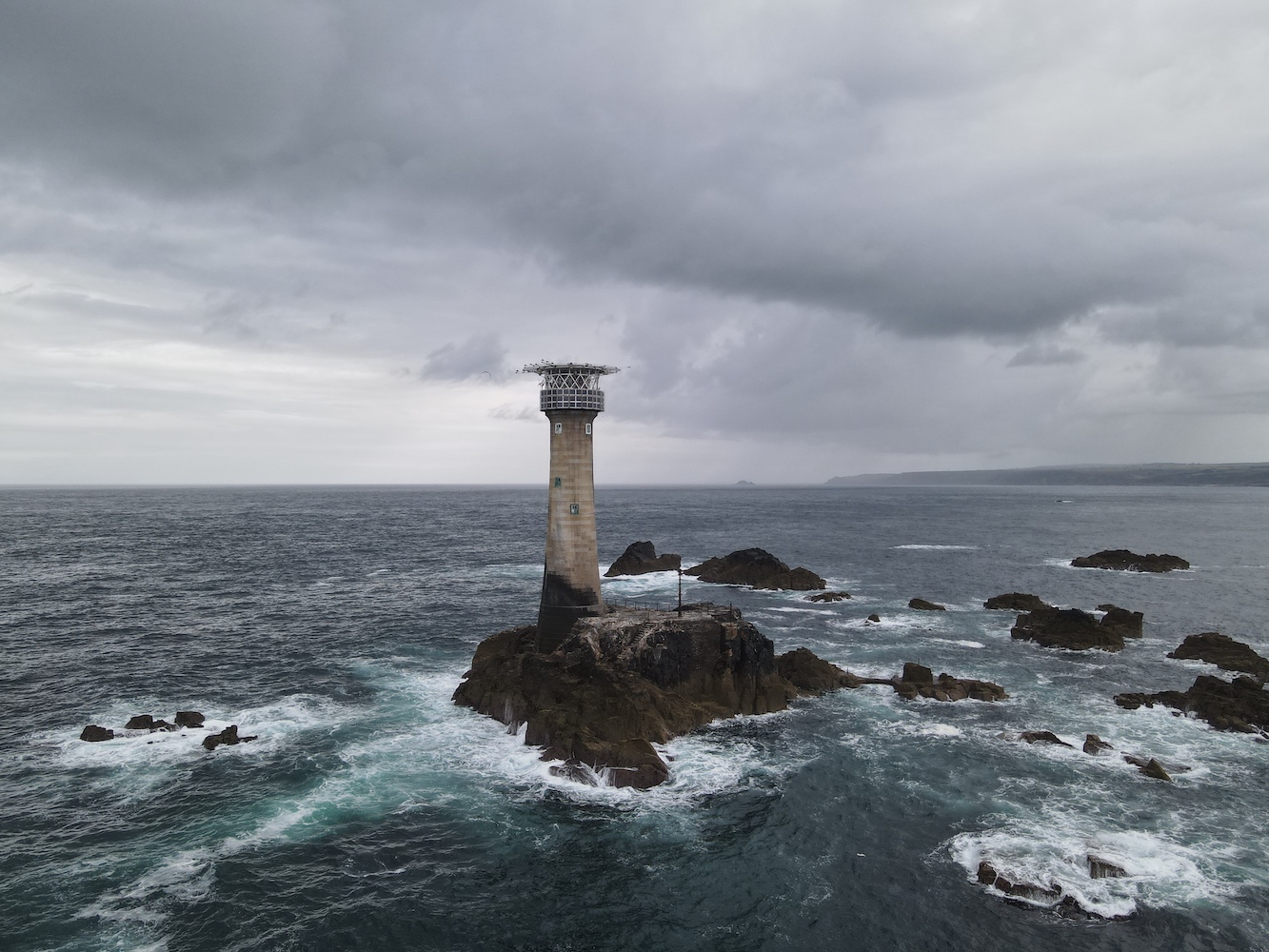
Next we were off to Longships Lighthouse. This one is visible from Land’s End so doesn’t quite have the remote feel about it that Wolf Rock has. What it lacks in relative remoteness it certainly makes up for in coastal geology though. From Land’s End it looks like it is surrounded by some rocks, but when you get a closer look you realise just how many rocks there are littered around. It’s quite beautiful to see.
Longships Lighthouse
Longships Lighthouse with Cape Cornwall in the distance
Joe the Drone had a quick fly around here too, grabbing even more fantastic pictures.
Longships Lighthouse with Land’s End and Gwennap Head beyond
There was a bit of a divide in opinion between ‘which rock lighthouse we had seen that day was the best’. I would have chosen Wolf Rock, absolutely, because of its remoteness. The remoter the better in my opinion. Others, quite understandably, chose Longships because there was more to see around it. There’s no real right answer with these things, it’s just opinions, and different opinions are what makes the world a more interesting place.
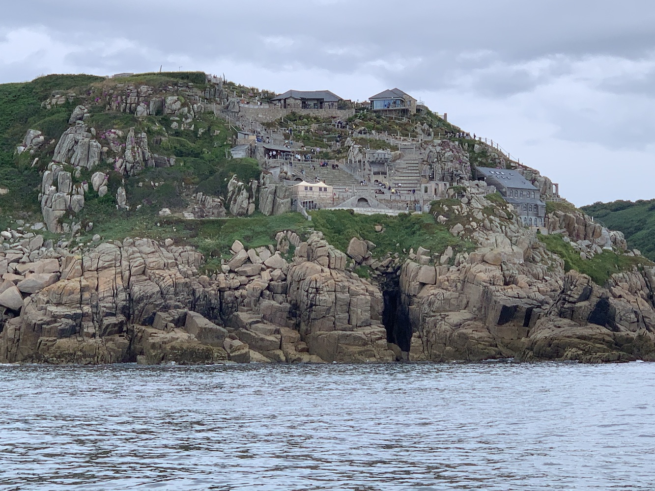
We needed to get back in time for the second boat load to have a chance of getting out and back before the forecast bad weather arrived. Shooting along the coastline to Penzance, we took a brief stop at the Minack Theatre. I’d first become aware of this when I was into writing plays (and was actually working on one to be performed in the open air as part of my university course) and it looked amazing with that fantastic clifftop location. It was interesting to see it from the sea too as you get a view of the modern building that’s been constructed there that is apparently the changing rooms for the actors.
The Minack Theatre
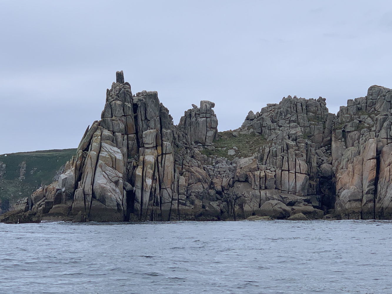
The spectacular Logan Rock just to the east of the Minack Theatre
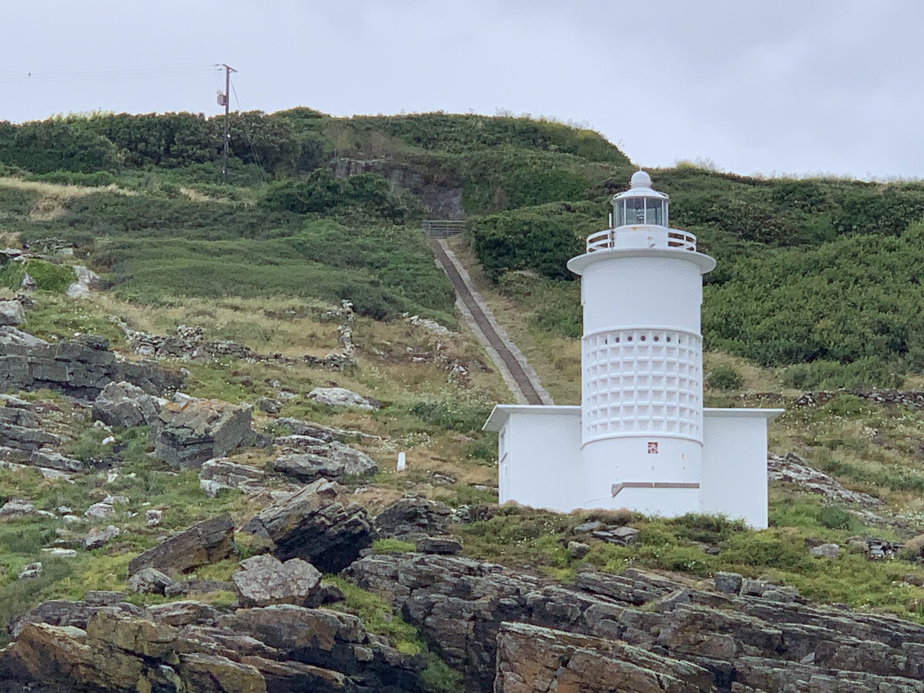
Nearing Newlyn, we stopped for a little longer on the way back to get some pictures of Tater Du Lighthouse. This one is quite impressive from the land, but it’s definitely better from the sea. The wonderful design of the lighthouse really stands out and the location at the bottom of the long flight of steps is just perfect. I appreciate this one a lot more now that I’ve seen it from this angle. It was also nice to see the walking route from Lamorna Cove which is a good route to take to it by land.
Tater Du Lighthouse
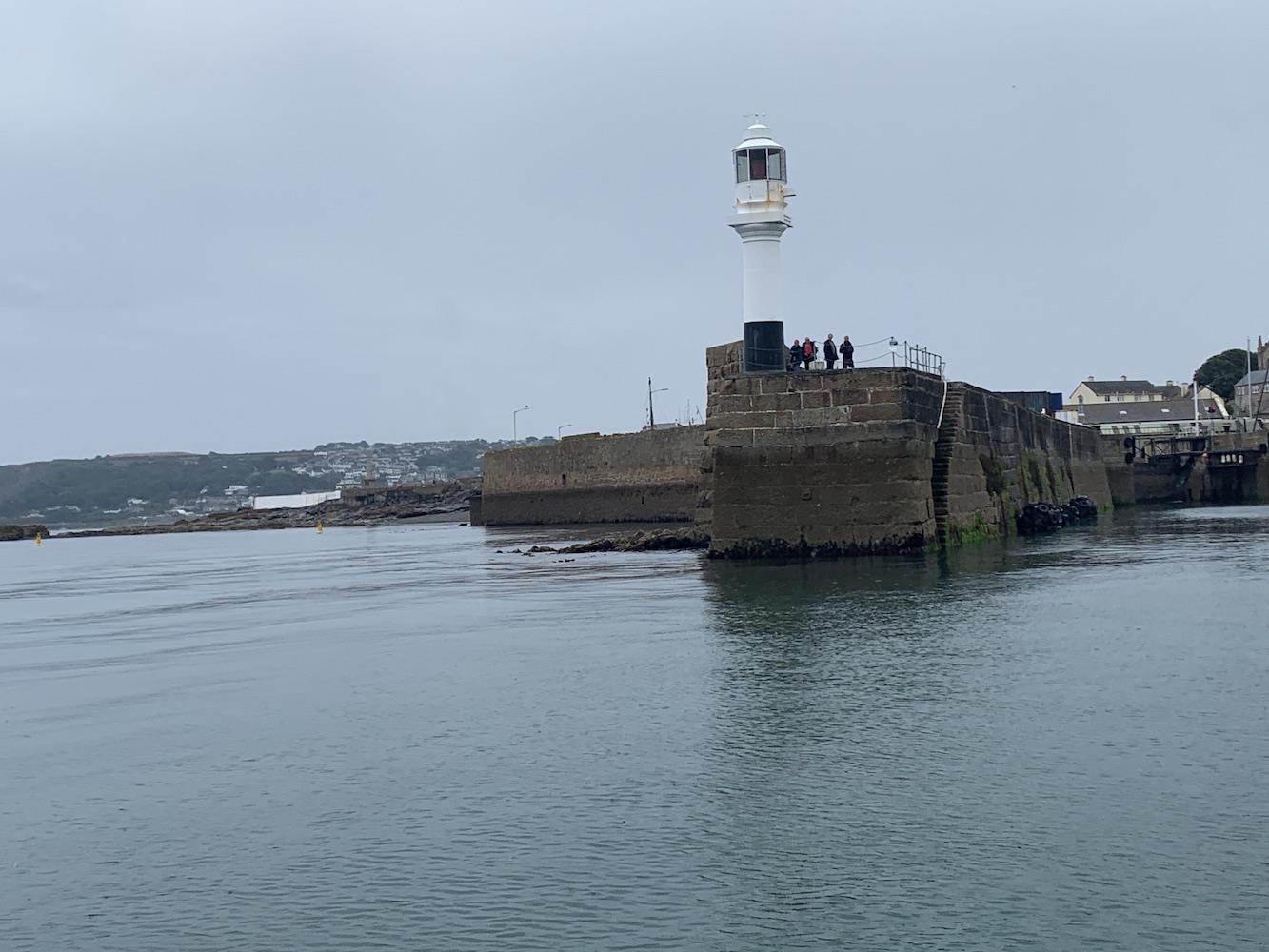
When you get back to Penzance by boat it’s very obvious where you are heading for as the lovely little white lighthouse sits on the end of the pier. It was a nice one to finish the trip with.
Penzance Lighthouse
Moments later we were alongside the pier and ready to swap with the second group. I’m pleased to report that they all made it out to both Wolf Rock and Longships too. Phew! 🙂
I often find that for a long time many clusters of lighthouses I’ve not visited in a particular area remain fairly low on my priority list. It becomes one of those areas where I still have a fair amount to do, and I don’t go to any great lengths to remedy that. But then an opportunity arises and suddenly you see the possibility of actually being able to complete the list in a particular region, which is a very exciting prospect for someone as prone to ticking stuff off a list as I am.
This has certainly been the case with Cornwall on this trip. For many years my progress in the region has been at a standstill. It really doesn’t help when it’s at the opposite end of the country, of course. With life going at 100mph recently I’d not even had the time to look at what I had left to do in the region until I was on my way here. That was when I realised the potential for completion, if only things went to plan for the week…
With a boat trip postponed on Monday, it left a free day to make a start on what was left on my list. Unfortunately I awoke feeling rather unwell and hauling myself out of bed and getting ready for the day was far more of an effort than it should have been. For a while after that task was complete I felt ok, but it wasn’t long into the car journey that I began regretting my decision to leave the hotel.
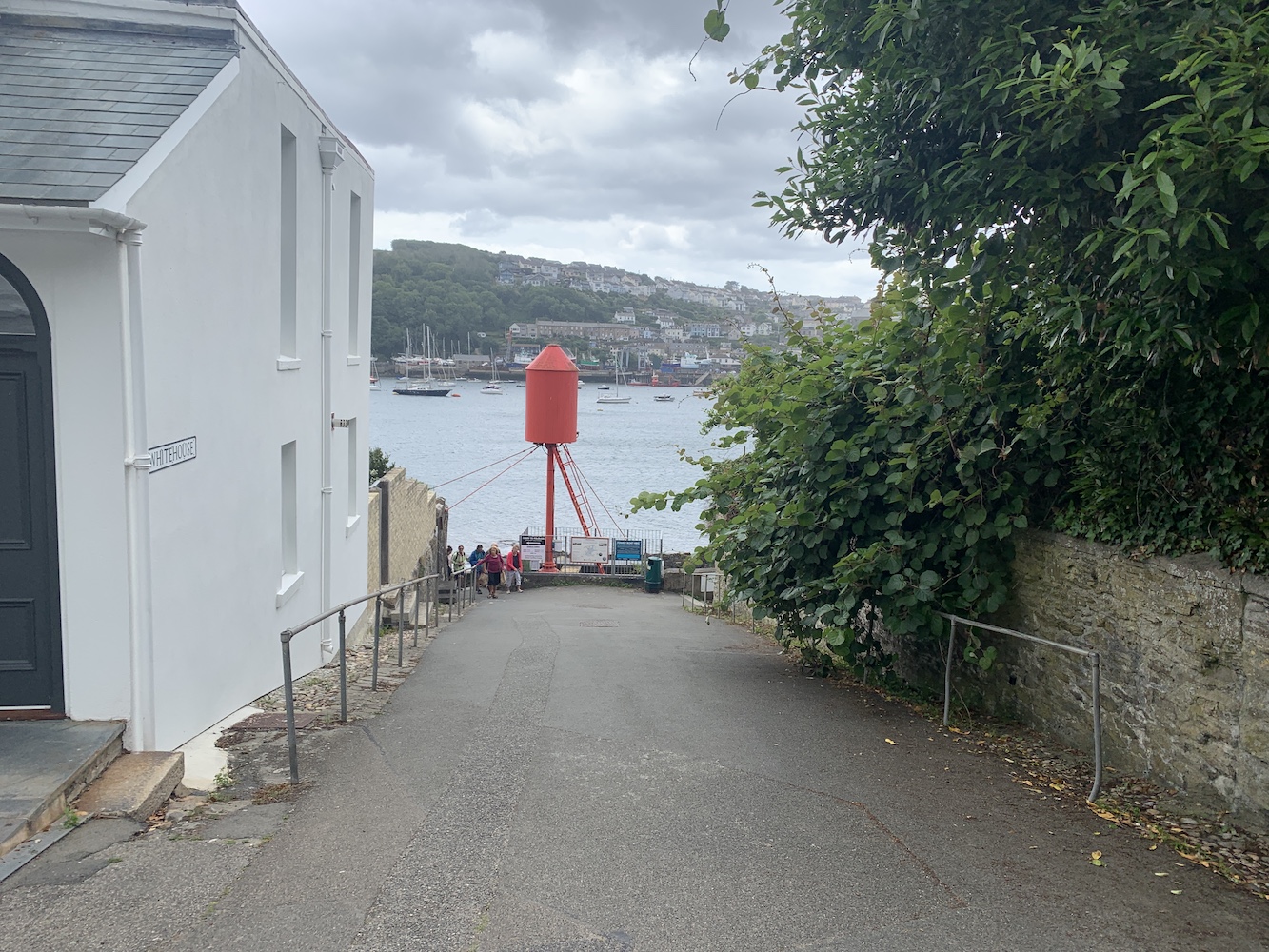
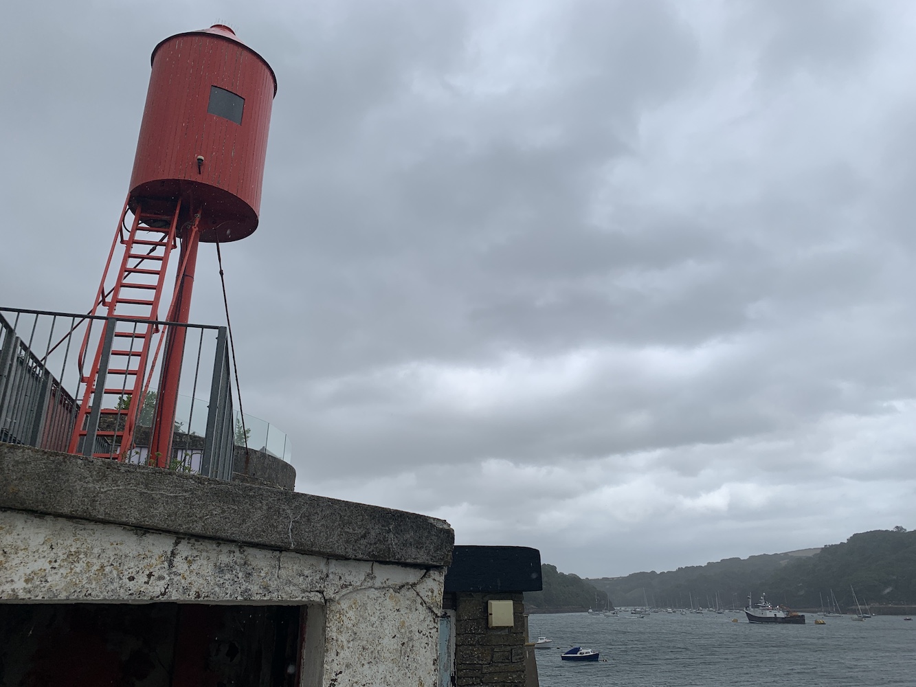
It felt like an eternity in the car, heading east to get to Fowey, which was home to one of my remaining lights to visit. Prior to doing my proper research I’d been to Fowey and visited the lantern on a platform at St Catherine’s Point, but I’d missed the little Whitehouse Point light, also known as the ‘red rocket’.
Fowey Whitehouse Point Lighthouse, or the ‘red rocket’
Recognising that I wasn’t at my best, Bob did a great job of getting me as close as he could to the light, which was at the top of the short alleyway called Whitehouse, so it was just the shortest of walks to get there. Unfortunately though it just happened to coincide with a rather heavy rain shower. It was all fine though and was good to see this one up close.
The red rocket overlooking Fowey harbour
Fowey Whitehouse Point Lighthouse is bigger than it looks
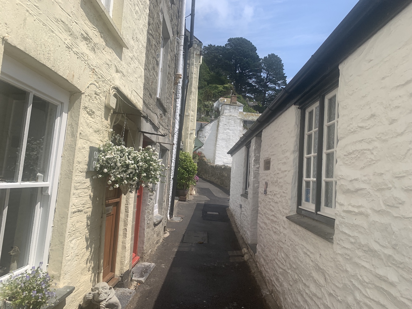
At this point I was still longing for sleep, but being over halfway to Polperro I agreed to stick with the original plan or visiting the little lighthouse there. Another ferry beckoned – there seem to be so many of them – and a short while later we arrived in Polperro. With this one involving a bit more walking than at Fowey, Bob kindly offered to drive me as far as he could along the winding little streets of Polperro before I then proceeded on foot.
It was a very warm afternoon when sheltered by the houses so closely positioned on either side of the road, but as I emerged from the bustling streets and made my way up onto the coastal path, the views became much more open with some fantastic rock formations and clear, calm sea. It looks like a great place, when viewed from a distance, but is certainly popular judging by the number of people about.
A narrow street in Polperro once it had quietened down a bit
And finally out into much quieter surroundings
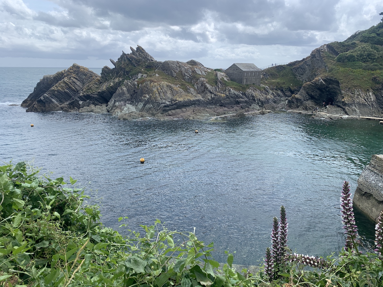
The wonderful views to the west at the entrance to Polperro harbour
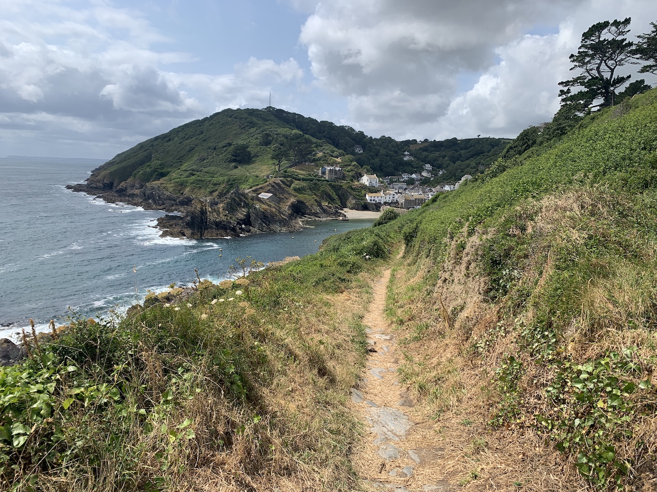
There are plenty of opportunities for emerging scenic views as you wander up the coastal path. At one point a path looked to be heading off closer to the coast, but I carried on straight ahead as the map showed a loop I could take and views from higher up quite often are very rewarding. This was certainly the case at Polperro.
Looking down at Polperro Lighthouse
I spotted the path down towards the coast easily enough and then it didn’t take long before the lighthouse came into view. Zigzagging my way down, I reached the lighthouse.
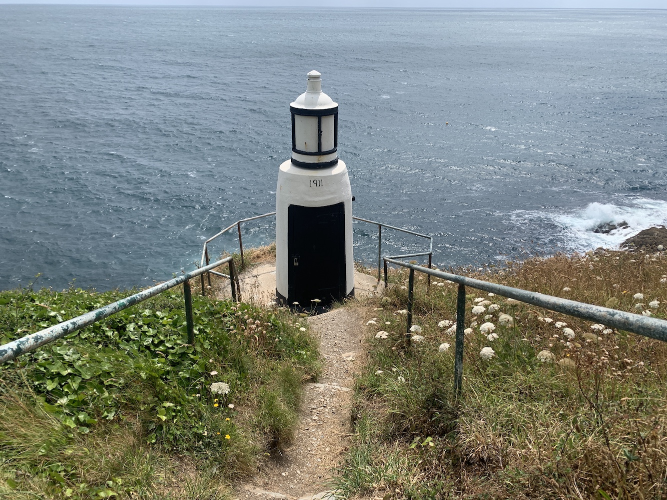
Polperro Lighthouse
It’s a funny one as the look of it implies it’s petite and really quite sweet, but it is actually more substantial than that. When you are standing next to it you realise it’s not so small after all. It is a really unique design though and would be very difficult to confuse with any others in the UK once you had been there. It’s also incredibly old, in the nicest possible way, but in a very well maintained kind of way. As you can see from the picture, the structures dates back to 1911.
A great view of, and from, Polperro Lighthouse
Polperro Lighthouse up close
I took the direct route back which also offered slightly different views of the entrance to Polperro harbour.
The return view
Polperro harbour
Two lighthouses was definitely my limit for the day so it was back to the hotel room for me after that to get some sleep and hopefully recover enough for what was planned the following day 🙂
Living on the north coast of Scotland means I very rarely find myself travelling down to the West Country and so an Association of Lighthouse Keepers trip to Cornwall seemed a perfect opportunity to visit some of those not yet seen smaller lighthouses en route.
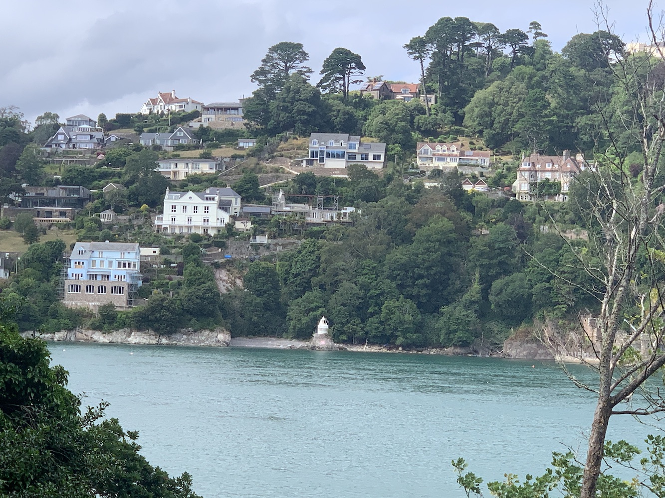
The first one was always going to be a tricky one. I’d heard that access to Lighthouse Beach at Kingswear was restricted, but I wanted to check to see if there was any change in the situation. I’d done a little bit of Googling and discovered that access to the beach had been closed to the public by the person building a house on the adjacent land. Their argument was that the beach was their private land and access has been restricted now for over 20 years, which has also been partly due to land slips in the area. There is a long document detailing the history of access to the beach and land ownership here. A local news story last September said it had been agreed by the local Council that public access to the land should be permitted, so I was keen to see if this had happened since.
A first view of Kingswear looking up the River Dart from Dartmouth Harbour
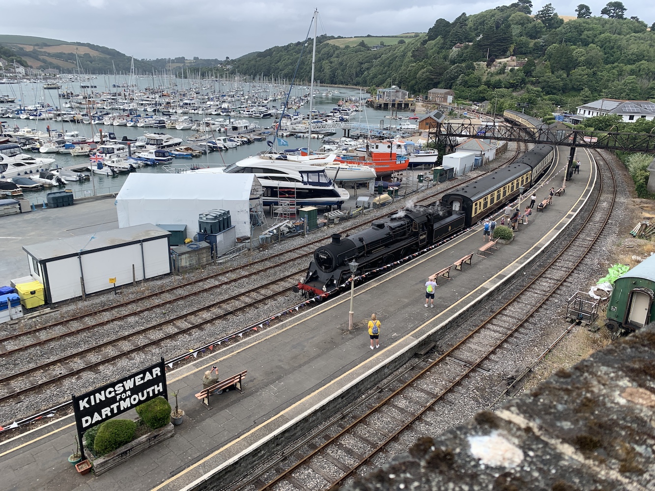
Kingswear is a very picturesque place to visit with lots of your typical West Country narrow streets and lovely little (and sometimes very big) houses lined along them. There are some great views of Dartmouth Harbour near the public car park and then you get some nice panoramic views over to Dartmouth with the coastal train line running into Kingswear as its final stop on the line from Dartmouth. The timing was rather good as a steam train appeared in the distance and pulled into the station as we were heading back to the car.
The steam train arriving
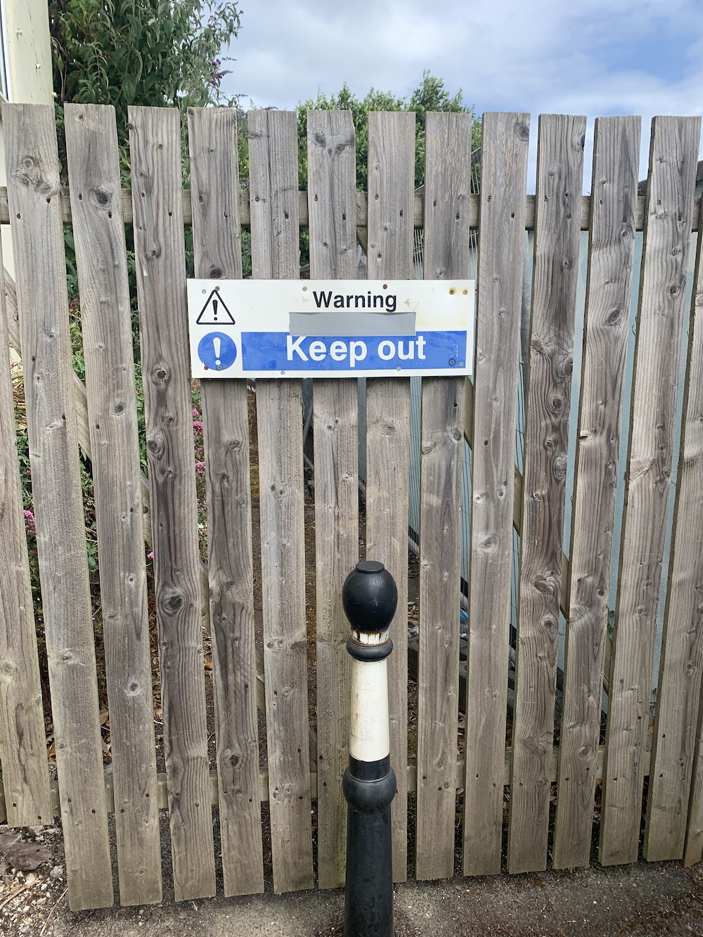
After traipsing the winding streets among expensive-looking houses and walled gardens (which I loved), I finally got the answer I was looking for. I think the picture below is the best way to describe it.
No luck at Kingswear
I was, of course, a bit disappointed, but actually surprised that it wasn’t possible to get any closer. My lighthouse friend John had previously been there and managed to get a distant picture through the trees, but there was no chance of that with the position of the fence – and definitely no way of getting around it.
The view beyond the barrier
All was not lost though as Joe the Drone was on hand and swung into action after dusting off his blades.
Kingswear Lighthouse, bottom left, from above
I knew our next stop of the day was likely to offer some distant views of the Kingswear Lighthouse anyway so I settled for that.
Ferry one of the day went between Kingswear and Dartmouth where we parked up and walked a fairly short coastal route along to Dartmouth Castle. As expected it did give some views of the light on the beach at Kingswear.
A wonky view of Kingswear Lighthouse from Dartmouth
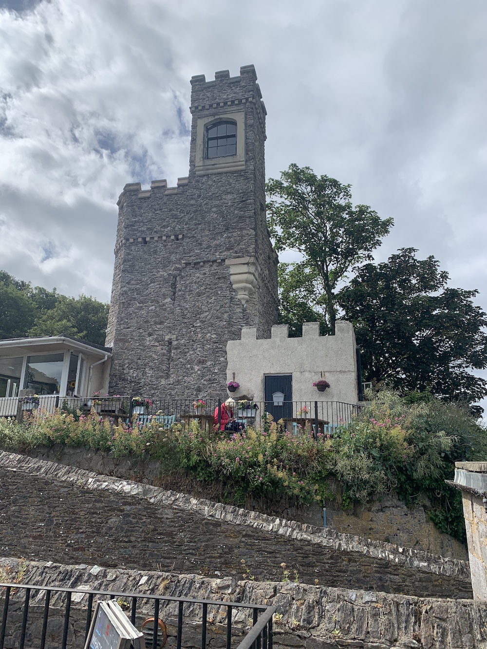
Dartmouth Castle had been a bit of a puzzling one when I’d been working on my book. There was very limited information available to suggest that there once had been a lighthouse within the grounds of the castle and that the building still stands today. Luckily a knowledgable chap working at the castle was able to explain where it was. There is no access to the tower now and it’s current use is a store room, but it is attached to the back of the little cafe there. Although there was very limited time to explore, it was still good to wander around the castle buildings for a while and see which angle looked the best for getting views of the old lighthouse tower.
The best view of the old lighthouse tower at Dartmouth Castle
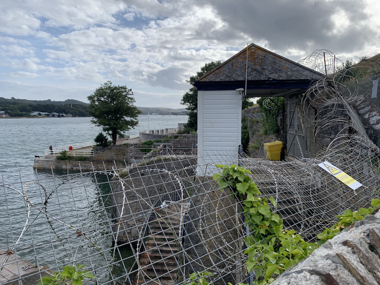
The next was, I’ll be honest, not the most exciting, but luckily didn’t involve much effort. My research had told me that the light at Mount Wise Pier in Devonport was the property of the MOD, but that it was still possible to get close to it. To see it properly meant heading down the spiral staircase to get a view from below.
Mount Wise Pier light from the side
I’d say the only interesting thing about this one is the remains of an old building and arches near the entrance to the pier.
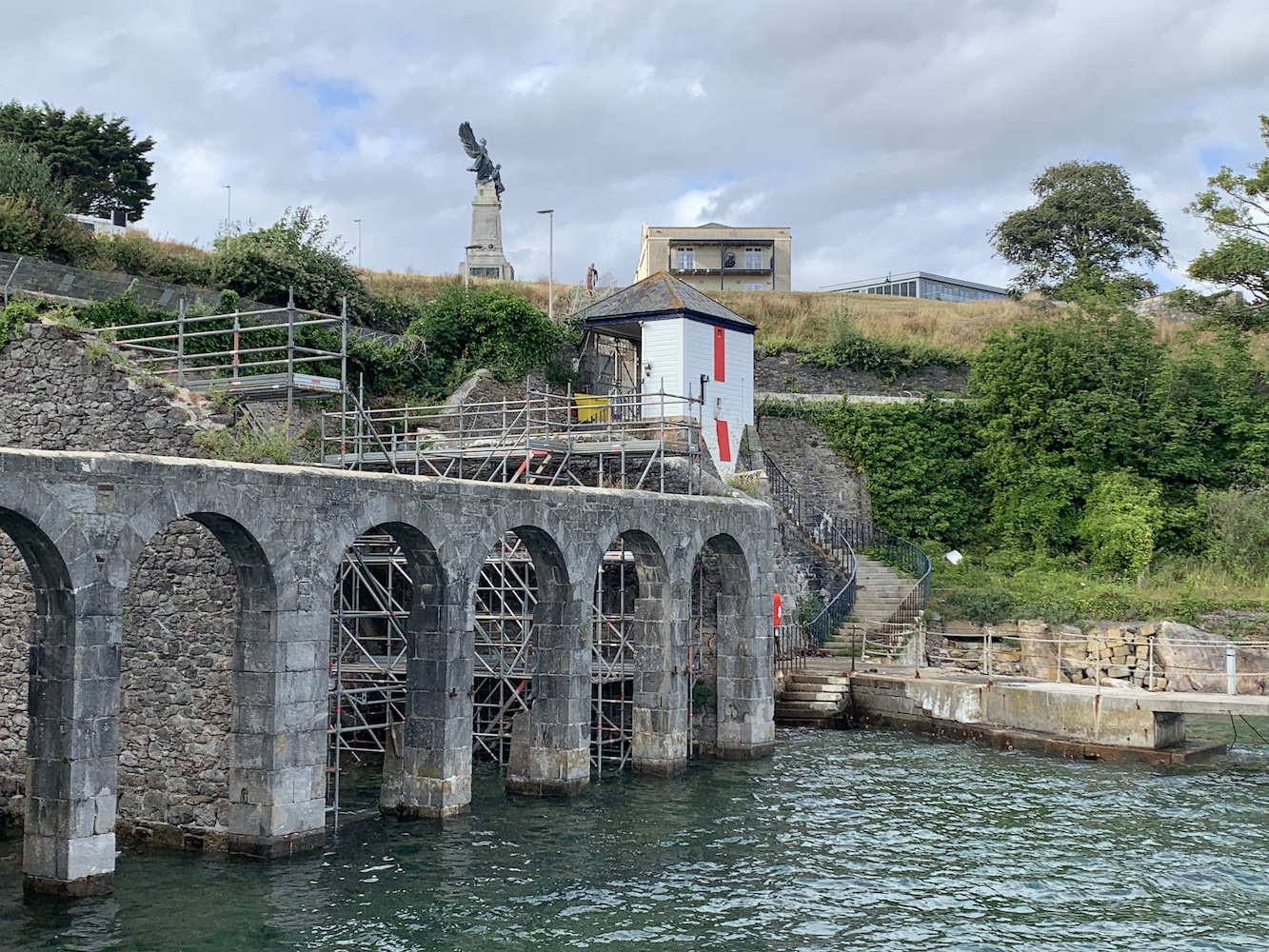
Mount Wise Pier Lighthouse with the Scott Memorial behind
There’s a really nice memorial nearby to Devonport-born Robert Scott who led the British Antarctic Expedition to find the South Pole which led to Scott and the entire crew perishing on the return journey. It’s far more visually appealing that the light, I must say.
Reaching the final lighthouse of the day involved ferry number two, crossing the Hamoaze from Devon into Cornwall. After that there was one tiny narrow road after another to navigate to get to the Mount Edgcumbe area. One of these roads though provided points with stunning views looking down over Sango Island with Torpoint and Devonport beyond and the stretches of water separating all three.
Sango Island with Torpoint and Devonport beyond
The lighthouse at Hooe Lake Point, just to the east of Mount Edgcumbe Country Park, isn’t very well known and it is a little odd. It sits at the bottom end of a Scout campsite and required a quick hop over the gate.
Hooe Lake Point Lighthouse
This is probably one of the best vantage points for seeing the Plymouth Breakwater Lighthouse too, which always seems so far away from Plymouth when you spot it from the Hoe. It’s not exactly close to this point, but closer.
Hooe Lake Point Lighthouse with Plymouth Breakwater Lighthouse visible in the distance
It had been a busy day of bagging little and lesser known lights, but still a good one and one day hopefully I will make it to that tricky little Kingswear light 🙂
It’s been a long time since I’ve had a chance to spend some quality time on the Northumberland coast and one target for this trip was to get a closer look at Coquet Island, a mile off the coast of Amble. I was aware that only wardens were allowed to land on the island so the boat trip with Puffin Cruises seemed the best way to get as close as I could.
Approaching Coquet Island
The trip also gave a really interesting insight into the history of the island’s lighthouse and the ownership in general. The island has been owned by the Duke of Northumberland since 1753 after changing hands between the church, and various local earls and others with titles over the centuries. When the lighthouse was originally being proposed on the island the Duke at that time stipulated that he wished for it to resemble a castle, hence the castellated tops to the towers of the structure.
Coquet Island and its lighthouse
There is evidence to suggest that the foundations of the lighthouse and some lower sections predate the lighthouse and are actually the foundations of what was a Benedictine monastery, which was completed in 1841. The lighthouse contains a sector light facing to the south, warning of the hazards of rocks lying just under the water between the south of the island and the mainland.
Although the island is no longer occupied throughout the winter months, it has a long history of occupation and a strong religious connection. Henry of Coquet, a Dane, wished to escape an arranged marriage after experiencing some sort of vision that told him to do so. Arriving in Tynemouth, he gained permission to build himself a small “cell” on Coquet island and lived there until his death in 1127. This is just one example of strange uses and habitation on the island. The Amble and District Local History website features a far more in depth history for anyone interested.
The restrictions on people landing on the island I had originally assumed was due to it being a site for nesting birds. It turns out it is instead that the island’s owner does not wish anyone to land on the island, with the exception of the RSPB wardens and Trinity House staff (though it was suggested that he’s not keen on the latter landing either, but the maintenance of the lighthouse is essential). As with the nearby Farne Islands, I expect that if Coquet was set up to accept visitors it would currently be closed due to Avian flu as its bird population has been very badly affected.
It was a good boat trip with very knowledgeable crew. I was quite nicely surprised at how close it actually got us to the island. It’s certainly worth doing the trip to get a closer look at the island and lighthouse. It’s also a great way to get a better look at the little light on the end of the pier in Amble.
The lighthouse on Amble Pier
We followed the boat trip with a visit to the beach to the south of Amble where we had great views across to Coquet 🙂
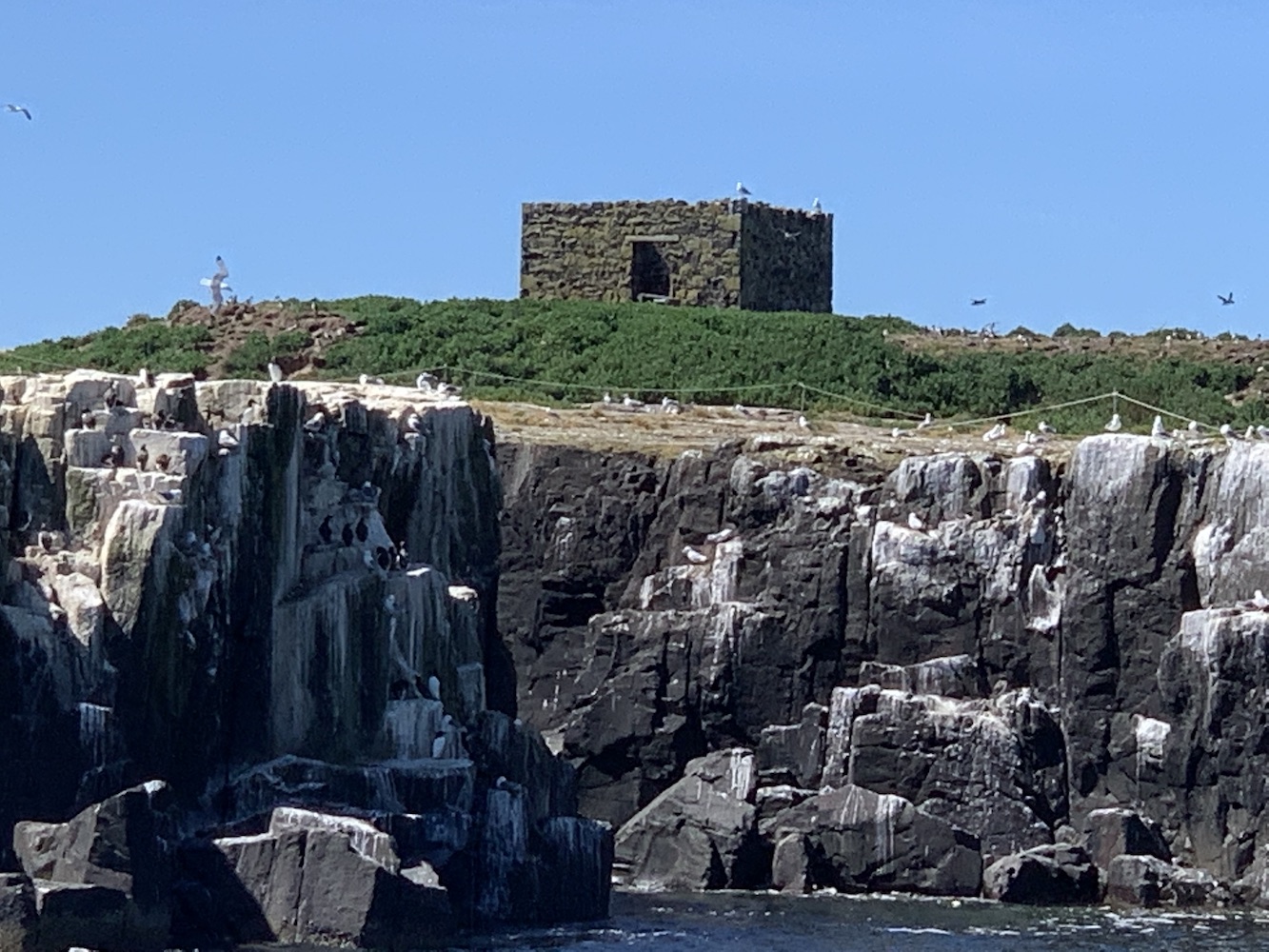
On Sunday we decided to make the most of the good weather and set off from St Abbs for Seahouses. My dad was keen to go and see the puffins, the Farne islands being best place for them in the area. Sadly last weekend due to the ongoing devastation avian flu is causing, they announced that there would be no landing on either Inner Farne or Staple Island. This was a shame as I’ve been wanting to take a closer look at their respective lighthouses, but the bird-focussed boat trip took us around both as well as close to Brownsman Island and Longstone too.
The obligatory pictures of the lighthouse at Seahouses
The Farne islands are quite a special place if you are into lighthouses. There is plenty of history with 7 lighthouses in total gracing these small islands over time. The oldest was introduced on Staple Island in 1776, 100 years after permission was first granted for lights to be built on the Farne islands. Prior to this attempts at lighting the islands for navigation were limited to two fire baskets on Inner Farne. The Great Storm of 1784 unfortunately claimed the Staple Island tower, and it is believed that a second tower was then constructed to replace it. The remains of what could well be one of these towers can still be seen on the island, although I am unable to find confirmation that this is definitely the case.
This could be the remains of one of the first lighthouses in the Farne Islands
Fast forward eleven years and the first tower on Brownsman Island had been constructed. The remains of this tower are still visible as the tallest structure on the island.
The square tower of the first lighthouse on Brownsman Island
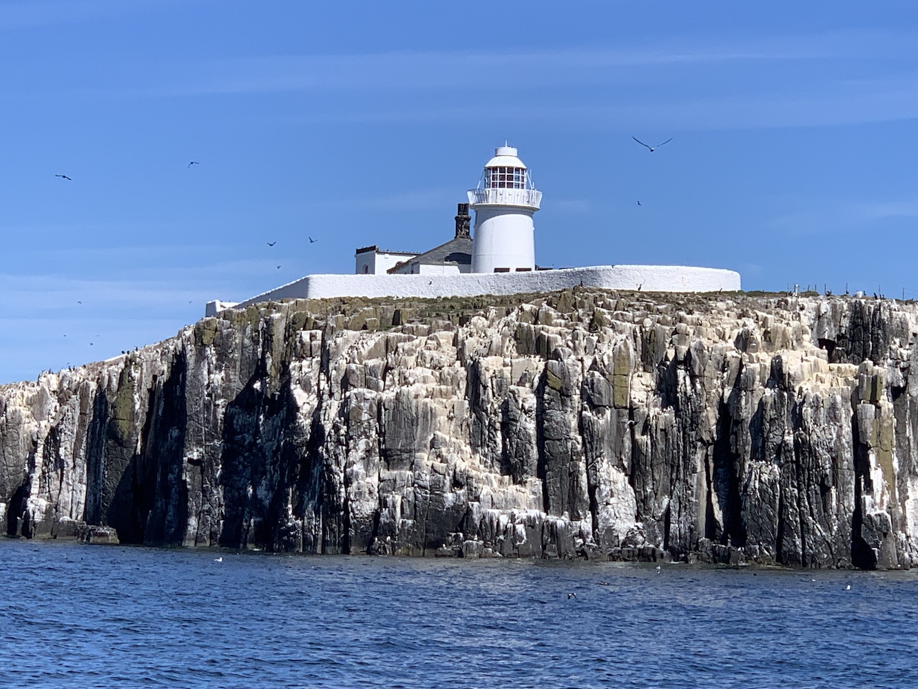
In 1809 Trinity House built the lighthouse on Inner Farne, which is still in operation today. Just two years later this became the High Light after a lower light was added to warn ships away from the nearby Megstone island. This low light was removed in 1911 when the high lighthouse was automated.
Inner Farne Lighthouse
Meanwhile there was navigational development on Brownsman Island too with the introduction of a new lighthouse and attached building in 1810. This tower shared the same design as the Inner Farne light and contained a revolving reflector which burned paraffin oil.
The remains of the round lighthouse and attached building on Brownsman Island
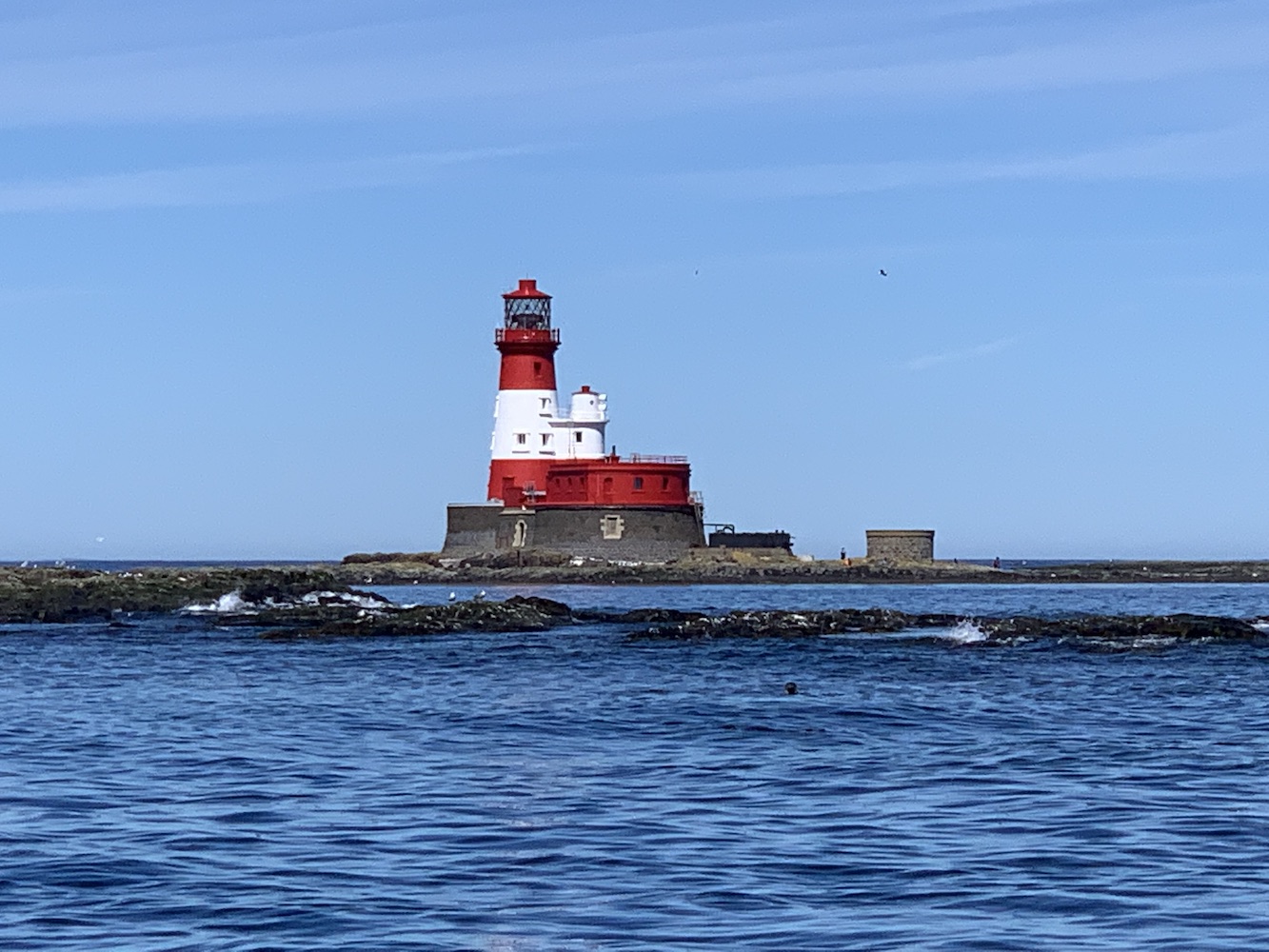
By 1825 it had become clear that the lighthouse on Brownstone wasn’t preventing shipwrecks and the decision was taken to construct a lighthouse on Longstone.
Longstone Lighthouse
Today Longstone and Inner Farne are the only two lighthouses still operating on the islands. The trip was a good opportunity to see these two again. Landing on Staple Island and Inner Farne will wait for another time 🙂
With a day to get home from Preston, a bit of a detour en route felt necessary to clear up a few things lighthouse-related. I had yet to see a couple of the lights along the south coast of Cumbria, along the north bank of Morecambe Bay as well as the Walney Channel.
Living where I do in the far north of Scotland, and the vast amounts of time I have spent in areas with big, wave-battered cliffs, the relatively flat landscape and the resulting fast-moving tides of this area fascinates me. To me it somehow seems more dangerous than spending time on coastal routes in areas with more dramatic scenery, and this is all to do with those tides. To spend a second day in an area where lighthouse bagging is so impacted by the tide is a really interesting experience.
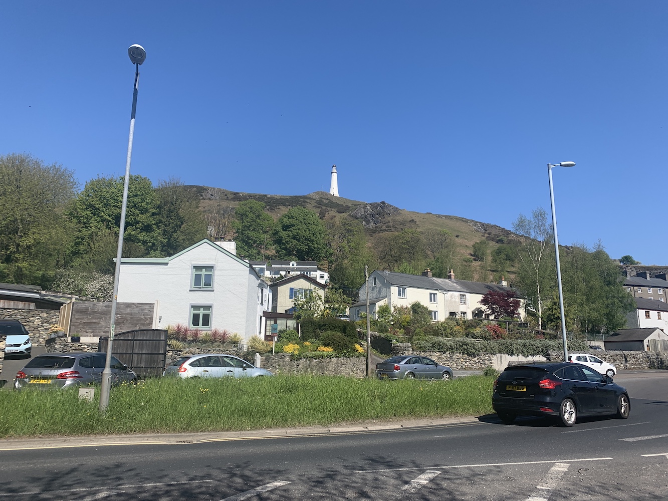
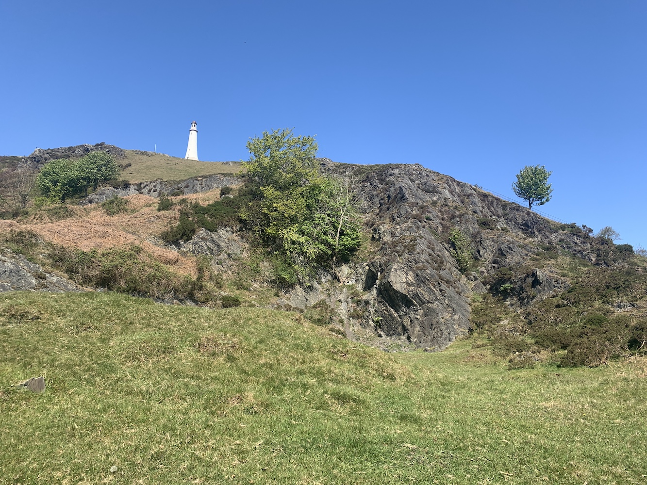
Before we get to that though, our first stop of the day was Ulverston. I’d stopped here briefly during my 2012 lighthouse tour and the reason any lighthouse bagger visits the town is surely for the Sir John Barrow Monument. Generally monuments aren’t lighthouses (although I can think of a few), but this one in Ulverston has a couple of interesting connections.
The Sir John Barrow Monument is clearly visible from the centre of Ulverston
When it was built in 1850 its construction costs totalling £1,250 were mostly paid for by donations from the public. However, £100 was paid for by Trinity House (the lighthouse authority for England and Wales) and the reason for this was it would be used as a seamark. There are conflicting stories related to this with some sources stating that Trinity House contributed based on it it being a seamark alone – though the original plans included a room in the basement that would act as the ‘lighthouse keeper’s’ living quarters. Others suggest that the funds from Trinity House were given in case the tower ever needed to bear a light for navigation purposes, and another that the donation from Trinity House was to ensure that the tower would never bear a light. It is all rather confusing.
On the way up Hoad Hill
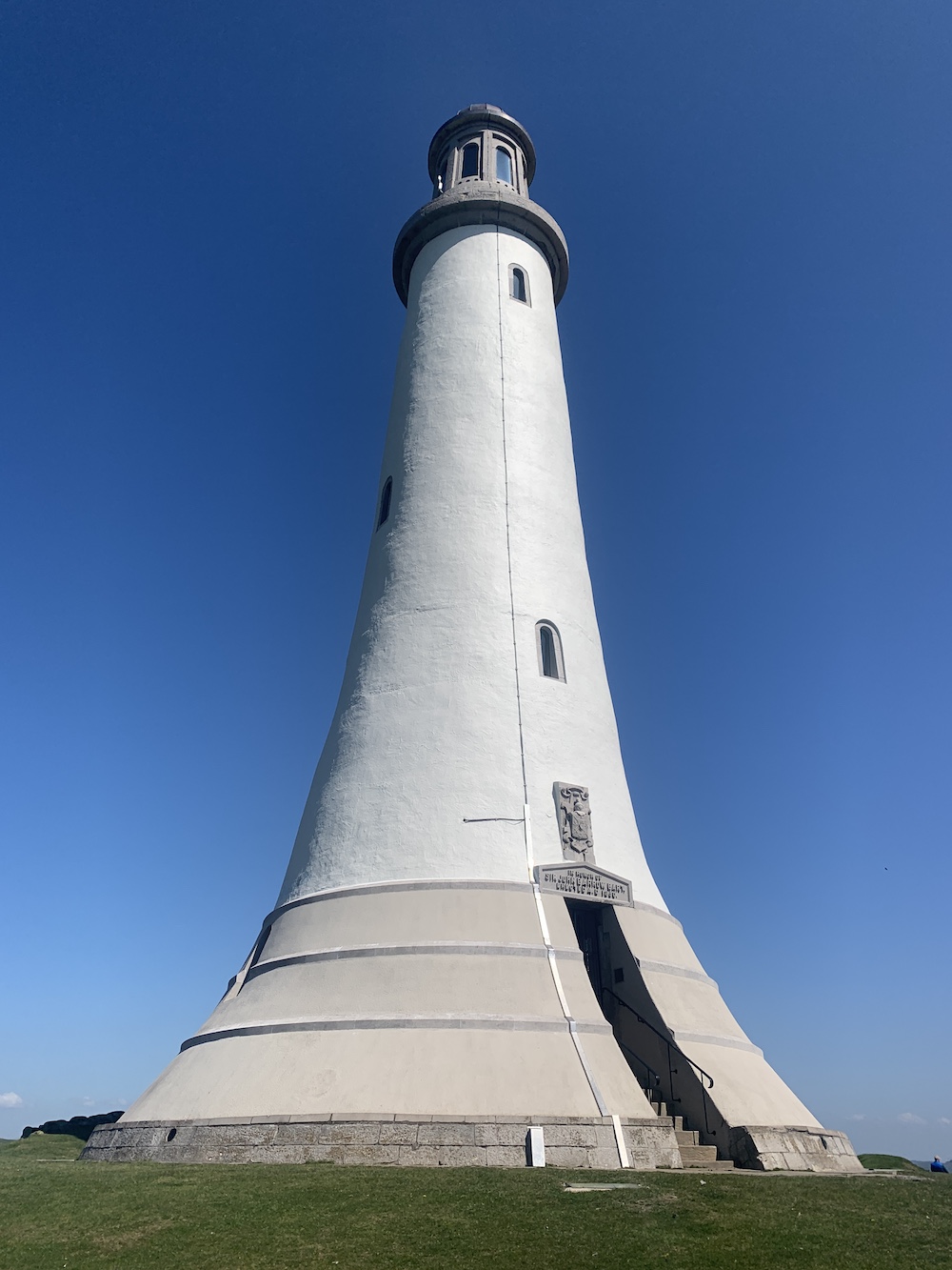
That is not the only link though between the monument and lighthouses. The tower design is based on that of John Smeaton’s Eddystone lighthouse, which can now be seen on Plymouth Hoe. So, in a way, when you visit it does feel a little like you are visiting a lighthouse. I should add at this point that you may well be wondering who Sir John Barrow was, which is exactly what I was asking too. Sir John Barrow was born and raised in Ulverston and went on to become an explorer, a writer and – perhaps most relevant – Second Secretary to the Admiralty for 41 years. He passed away two years before the monument was constructed.
The Sir John Barrow Monument up close
It was a pretty hot morning actually and so the walk up Hoad Hill to the monument, especially given that Bob insisted on using the steepest paths, was a good way to work off the remnants of alcohol left in my system from the previous day. The views were great as you got higher though, with those looking out towards the sea being of most interest to me. Chapel Island stood out for me as this big rock in the middle of the sea. I have since discovered that it is possible to access it at low tides, but with real care and from the east bank of the River Leven.
Chapel Island can be seen on the far right out to sea
The monument is really impressive and quite beautiful actually. It does have a lighthouse vibe about it, which probably has a lot to do with the original design inspiration. It is possible to climb the tower on certain days between Easter and October. A good sign that the tower is open is if the flag is flying, but it is well worth walking up even if it’s not.
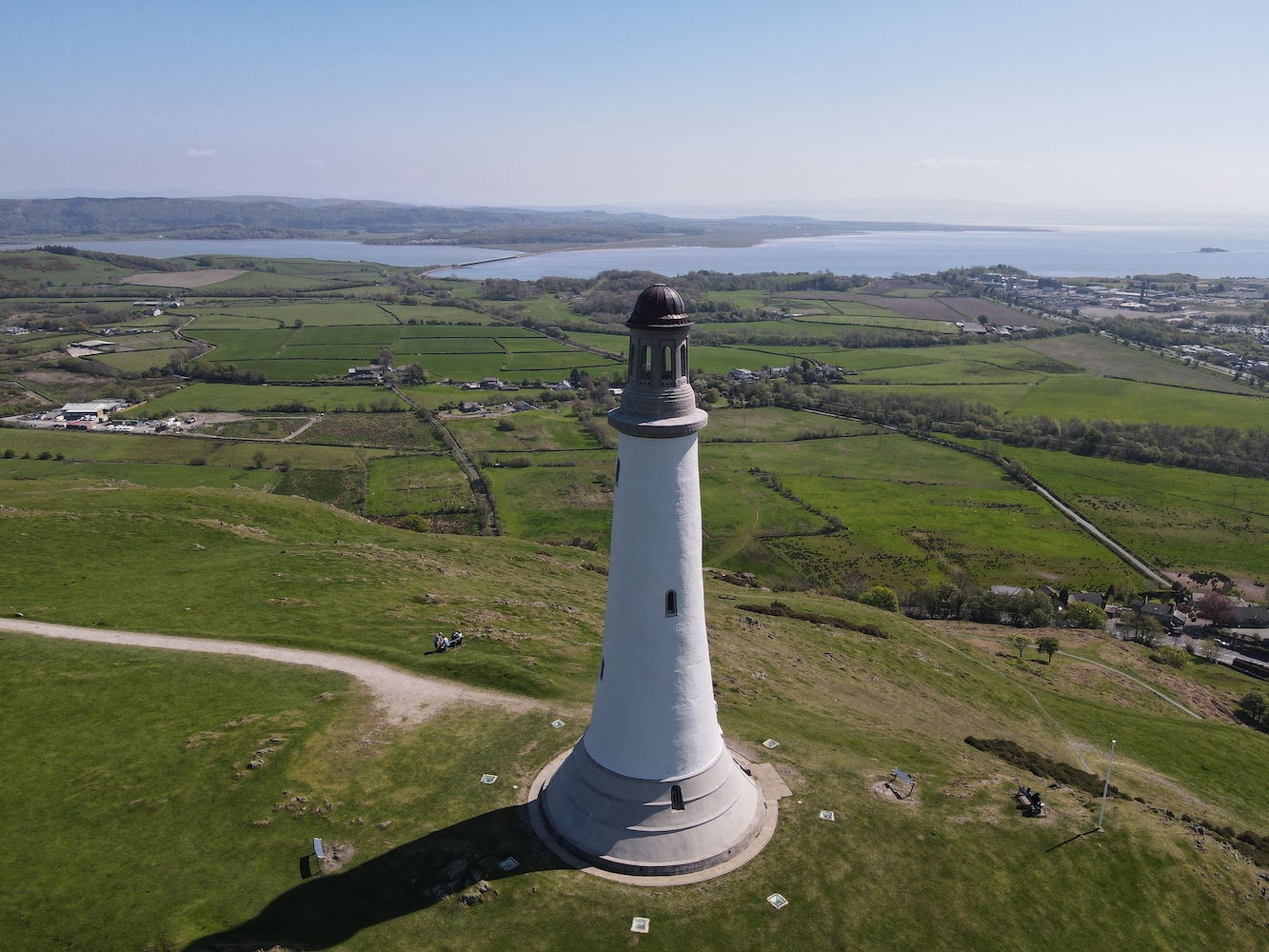
Joe the Drone had a wonderful time flying around the monument, pictured here with some glorious Cumbrian hills in the distance
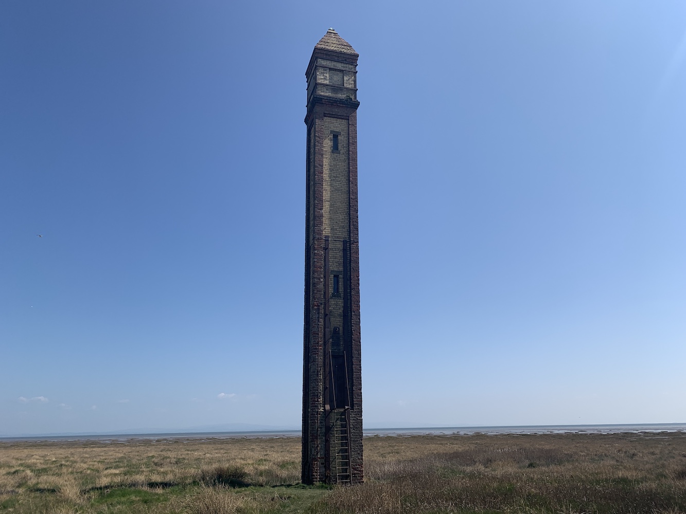
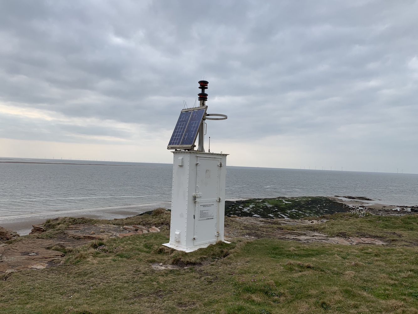
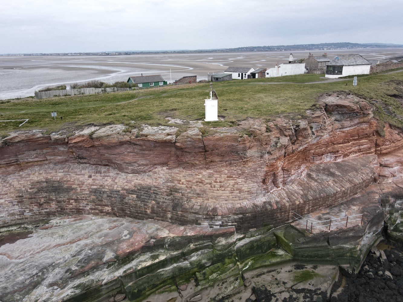
Back down off the hill, it was time to head for some lighthouses with lights! The first of these was Rampside, a wonderful skinny little brick tower known locally as ‘The Needle’. This tower, built in 1875 to guide ships into Barrow-in-Furness, is the last remaining one of thirteen of this same type.
Rampside Lighthouse, also known as The Needle
The lighthouse is really easy to spot, sitting just off the road at Rampside on the way to Roa Island. Though it is close to the road, it is another one to be careful near due to those tides. The tide was pretty low while we were there, but there were still little puddles of unknown depth around that you need to watch out for. The fact that it has a ladder up to the door also is a good indication that the sea can impact access to it.
The ladder leading up to the door is visible here
It’s a sweet tower and with most of it being red brick I was imagining it wouldn’t really be a very useful daymark, but seeing it later on from a different angle, it really is quite noticeable. This is another one with great views across to Foulney, Roa, Piel and Walney islands.
Rampside Lighthouse’s daymark features are more obvious from the seaward side
Speaking of Foulney Island, this was the next destination. Thankfully the tide times worked in our favour that day as this one really is tidal. Foulney Island is a shingle spit (with some grass) that reaches out 2 miles into Morecambe Bay. It is a nature reserve and an important area for birds during nesting season so some areas of the spit are cordoned off at certain times of the year.
The first part of the walk to Foulney Island is easy enough
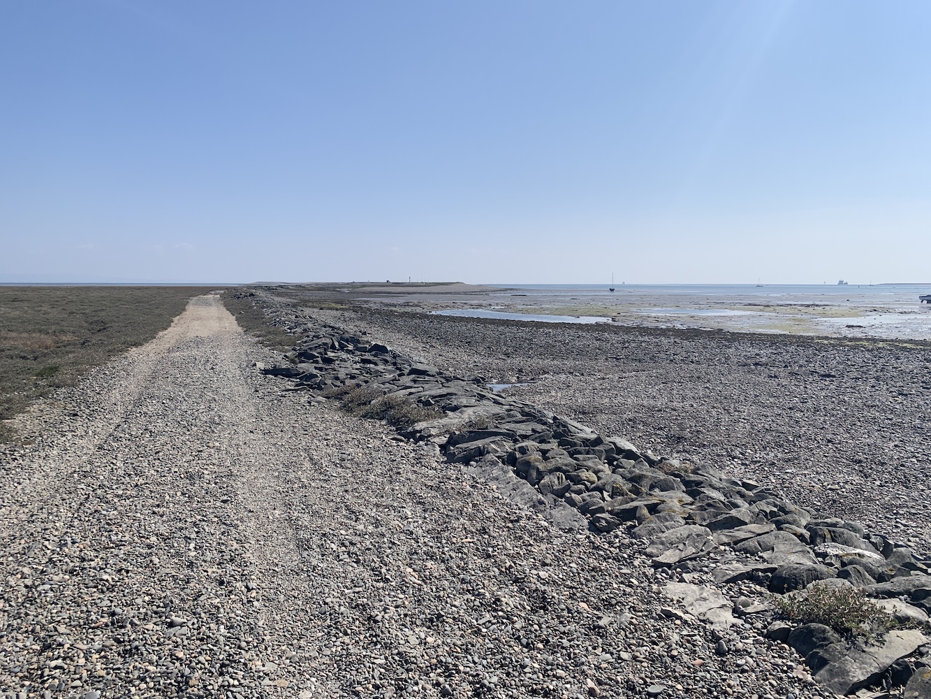
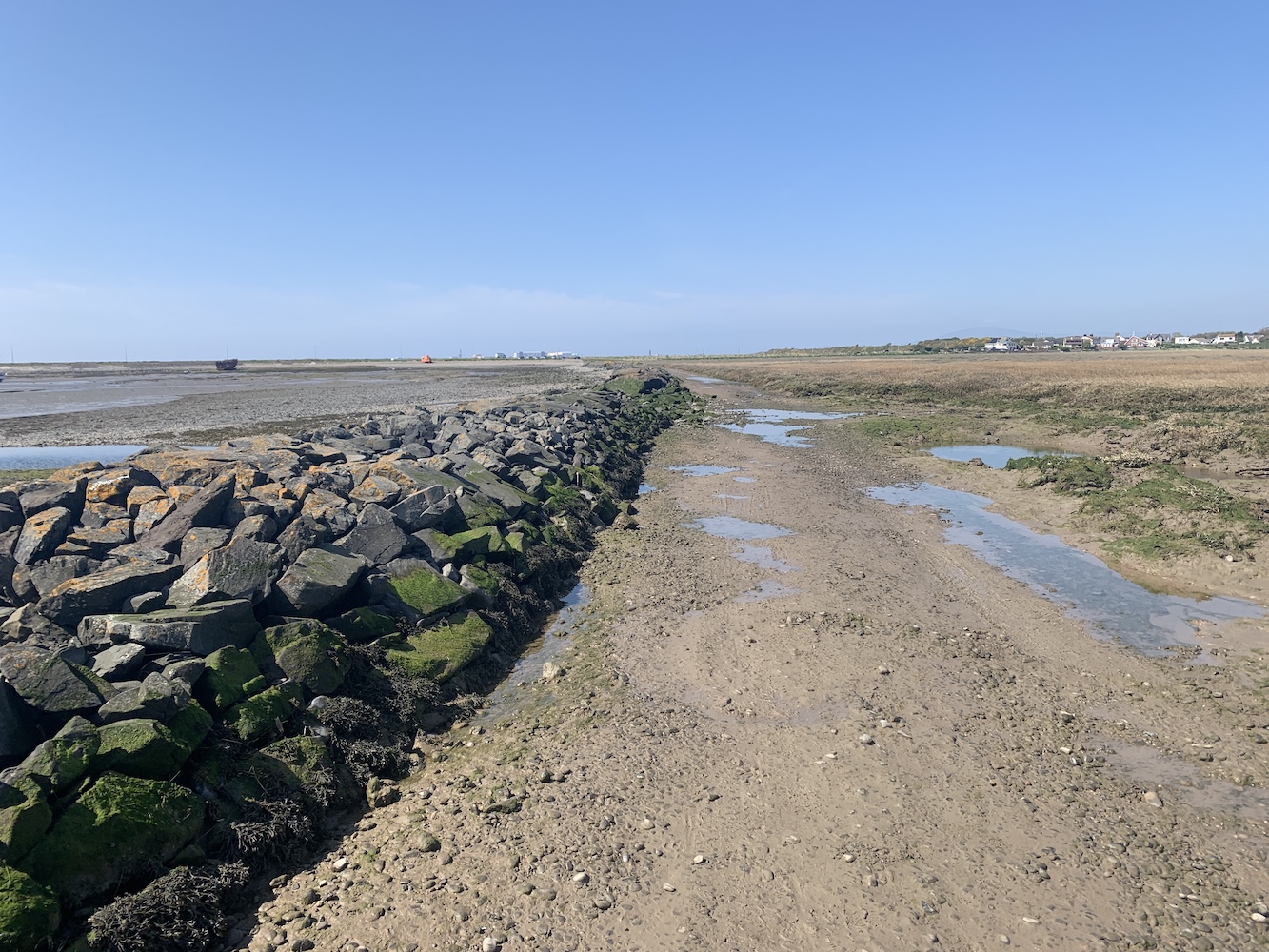
It wasn’t necessary to walk the full 2 miles to reach the lighthouse here and it is clearly visible from the parking area at the entrance to the island. The walk out here was initially a little wet with many (thankfully successful) attempt at avoiding get our feet wet in the muddy puddles presumably caused by the area being flooded at high tide. Then it was onto the shingle, which gets a bit tough going after a while. There are the remains of a 19th century stone causeway here, which was constructed to prevent the silting up of the Walney Channel. With the state of some sections of this causeway now though it would be more like boulder hopping to walk along it.
Here you can see the rocky causeway leading out to Foulney Island
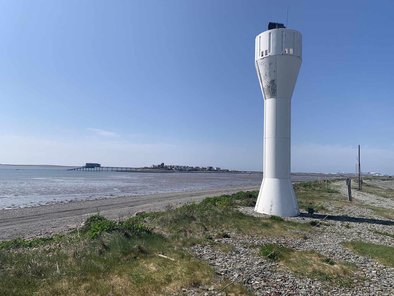
The lighthouse here is a funny thing, even I will admit that. It’s an oddly shaped white glass reinforced plastic tower, which is very much a different coloured version of the light at Cardiff Barrage. Probably understandably there’s not a lot of information out there about it.
Foulney Island light with Roa Island and its Lifeboat station in the distance
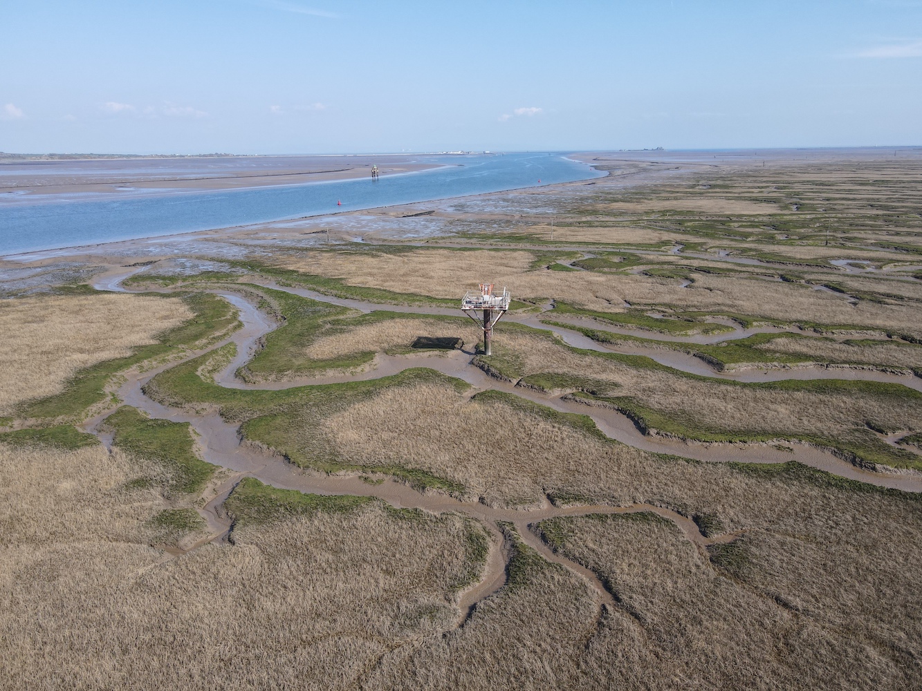
This turned out to be an excellent area for Joe the Drone to stretch his blades and grab some great shots with the tidal sections of the islands all around exposed at that point. There are the remains of an old stone building just beyond the lighthouse. It’s not clear what purpose this would have served. Beyond that, although we didn’t venture that far, you can begin to see the first of many pile lights in the area just off the end of Foulney Island. It was one of these type of lights I was keen to see next.
Foulney Island from above
In researching my book, one of the resources I’d used was the fantastic Online List of Lights website. The owner of this site aims to have a picture of every active aid to navigation listed in the Admiralty List of Lights. This is quite an undertaking as it is ever-changing and covers the whole world. I could, and have, spent hours scanning through this site taking a look at the lights of all shapes and sizes. It was on this site that I came across the Walney Channel West Pile light and you can see its entry here. It doesn’t look like much, but the little white hut on top of the pile structure was what caught my attention. It was time for me to take a look at it for myself.
Passing through Barrow-in-Furness we arrived on Walney Island and found somewhere relatively sensible to abandon the car in Biggar. The OS map showed a footpath running down to the east coast of the island from here and this was really straightforward to find, passing along a narrow grassy area between two fields. Initially the walk was easy enough once we got to the coast, heading north and then east. After a while it began to get a bit wetter underfoot and I was very grateful to have had my wellies available for this walk. Again, it’s another area that becomes flooded at high tide. We stuck to fence line though to try and avoid, as much as possible, the wettest areas. At one point we needed to cross a stream about a metre wide and Bob checked it out first to test how deep it was. Fortunately it wasn’t high enough to go over the top of our wellies so we carefully waded through it and then continued on our way.
The area combines grass with lots of salt marsh
Rounding the corner we spotted a whole range of pile lights ahead of us. Quickly recognising that, even at low tide, the land between us and any of these lights was pretty saturated in many places, we decided to send Joe in to investigate from the sky. It was unclear which light I was actually looking for here, which was the first sign that something had changed in terms of the light structure.
Walney Channel and the surrounding area look great from above
After inspecting both Joe’s photos and the grid reference against the map, I was a little sad to have to confess that this one was a lighthouse demotion. The light being investigated is now possibly the most unimpressive of all of them. Some have some very fancy coloured daymark triangles on them, but this one was just a pile structure with a light on a stick coming up out of the top.
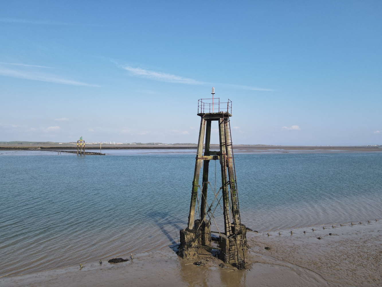
The somewhat disappointing Walney Channel West Pile light
It wasn’t the most exciting or joyful end to the day’s bagging, but to go to these places to check things out always feels worthwhile whatever the outcome is. It was also quite fun to wander around to which is really a big part of the adventure of lighthouse bagging.
This marked the final day of a week’s worth of lighthouse visits. It really was quite a week and one that saw me visit those lights I had left to see on the Isle of Man and in North West England, so I returned home with a nice sense of achievement having reached this goal and explored yet more of our amazing country’s (and the Manx) coastline. 🙂
Although the day I’m about to write about wasn’t all about the tidal island and not all about being tipsy either, I just couldn’t resist the title.
I arrived back on the ferry from the Isle of Man following the recent lighthouse bonanza over there, and was met by Bob at Heysham. I’d made some lighthouse plans for later that day and we had a little time to kill beforehand.
While in the area we decided to pay Hale Lighthouse a visit. I’d not been here since my 2012 tour and I felt I hadn’t really explored the area properly on that occasion. Hale Lighthouse was built in 1906, replacing an 1838 light in the same location. The light was introduced to help guide ships safely around Hale Head as they approached the Mersey. This area is renowned for its fast moving tides and the ever changing sandbanks that can sit just below the water level, a hidden danger to shipping.
Approaching Hale Lighthouse
When the original lighthouse here was built there was already a private bathing house in this location and with the introduction of the first lighthouse, this house was converted into the keepers cottage. This cottage was demolished shortly after the lighthouse was decommissioned in 1958 when the need for the light was no longer essential owing to the reduction in trade in the area and the use of that particular shipping channel.
Hale Lighthouse with the modern bungalow coming into view
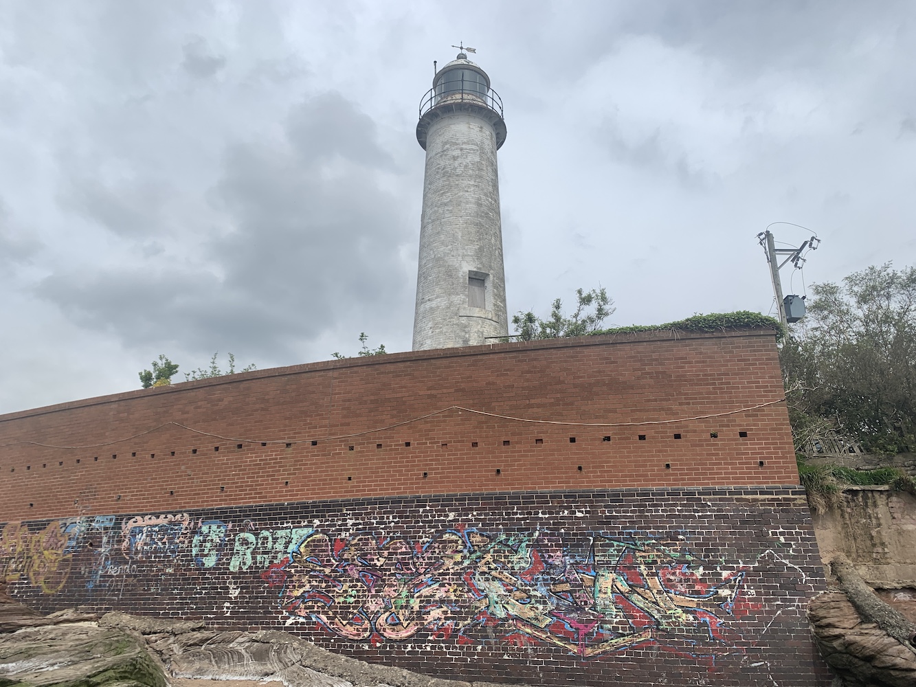
The cottage has now been replaced with a new property and this, along with the lighthouse, is now in private ownership. There is plenty in the area to suggest that, although a public bridleway runs along here, visitors to the area aren’t necessarily welcome. However, you can see why this might be the case judging by the amount of graffiti on the wall to the seaward side of the lighthouse.
Signs that the coast near Hale lighthouse is a popular spot for some
Getting around down here involved a little hop over a bit of fencing (we later found the actual way down), wandering around on some rocks, and then trying to avoid getting stuck in the mud just below the lighthouse. Our shoes didn’t thank us for that that bit!
Hale lighthouse with clear signs of erosion nearby
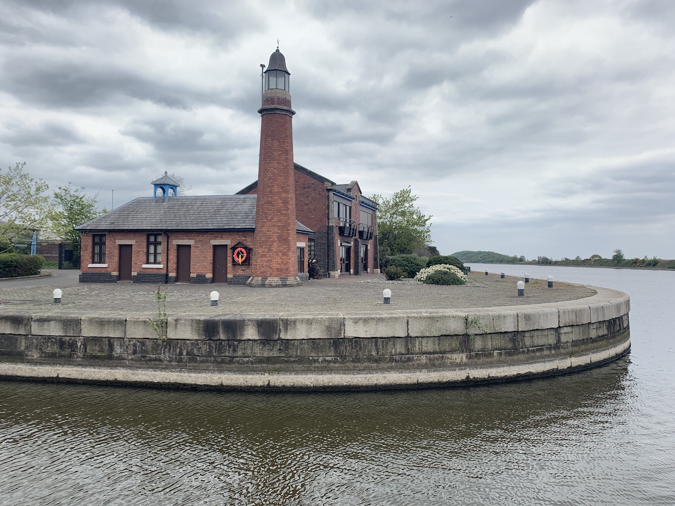
With the big plans still ahead for the day it was time to get a shift on down towards the Wirral. Thankfully there was a little time to spare which allowed us to take a swing by Ellesmere Port. On my original 2012 lighthouse tour I’d not managed to get to this one and I recall reading that it was part of the National Waterways Museum, so I’d assumed that I could turn up there and get to see it. I am not sure to what extent it is a part of the museum, but the land it is on is now private with the building owned by a fire brigade union. Having done my research though I knew where we needed to go to get the best view of it and so it was a relatively straightforward visit.
The best publicly accessible view of Whitby Lighthouse at Ellesmere Port
This lighthouse, built in 1880, is also (rather confusingly to my mind) known as Whitby Lighthouse. The village of Whitby in the area has, in more recent years, merged with other neighbouring villages to form Ellesmere Port. There is a wonderfully detailed explanation around why the lighthouse was originally built and its relationship to the waterways in this area on the excellent Lighthouse Accommodation website.
There is a fantastic old picture on the Ships Nostalgia website showing the lighthouse when it marked the entrance to the Shropshire Union Docks and Canal. Sadly the introduction of the Manchester Ship Canal in 1894 meant the lighthouse became surplus to requirement after only 14 years.
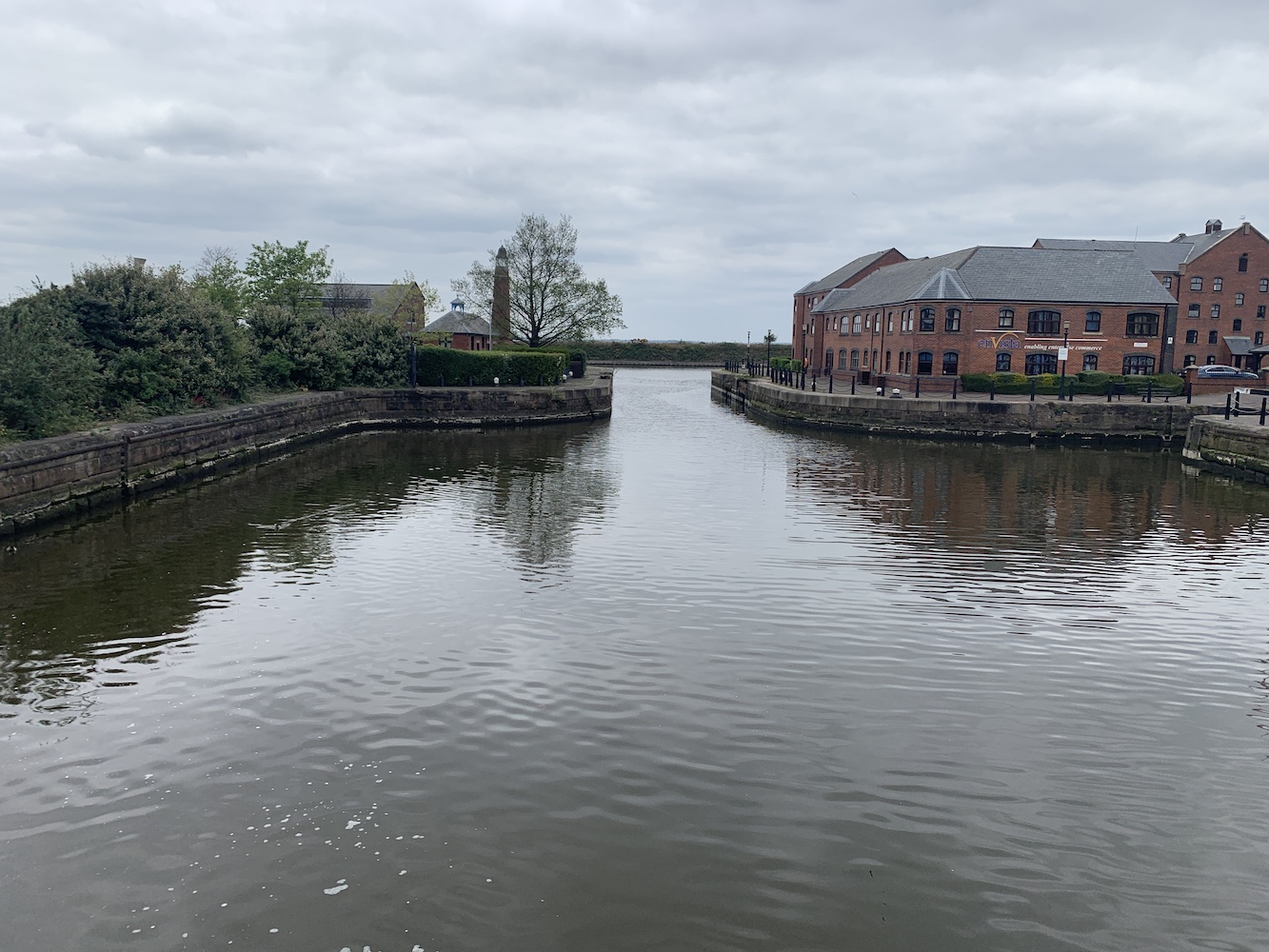
Ellesmere Port, or Whitby, Lighthouse can be seen behind the tree in this view from a nearby loch on the canal
It was time to head for the exciting afternoon we had planned. In my role as Events Coordinator for the Association of Lighthouse Keepers I’d come into contact with the owner of the lighthouse in Hoylake, which is now a private home. I’d made contact with him ahead of this trip and had also mentioned our intention of heading over to Hilbre Island while in the area. He very kindly offered to walk over to Hilbre with us and show us around the Hilbre Island Canoe Club’s base there, which seemed like an opportunity not to be missed.
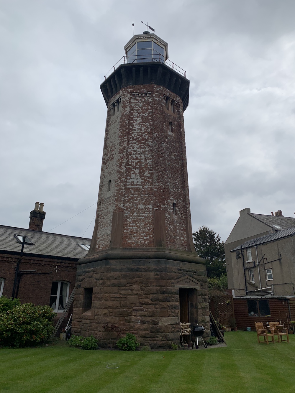
First though he (Charlie) had invited us to meet him at his home and, of course, I couldn’t resist the chance to take a look inside such a beautiful building and lighthouse. For a start the garden is just glorious and so well kept. To see the lighthouse towering out of the top of the very grand looking house makes for such a fantastic scene. Charlie explained to us which parts of the house would have been there when the lighthouse was operational and how the building was split into two with a shared access hall when it housed the keepers and their families.
The magnificent Hoylake (High) Lighthouse
Hoylake Lighthouse was originally the high light, working in partnership with a low light that has since been demolished. Charlie has a wonderful map on his wall showing the area and you can clearly see how these lights, which appear relatively inland, would have helped to guide ships. The navigation on the Wirral is particularly interesting as running through a series of lining up lights was necessary for safe passage.
The view of Hoylake Lighthouse tower from the back of the property
The existing lighthouse was completed in 1866, replacing its predecessor which had been operating for just over 100 years by that point. The light was discontinued in 1886. When Charlie purchased the house he also inherited the old lighthouse log book which, as you can probably imagine, is a wonderful thick tome just full of history.
The old log book offers a fascinating insight into the history of the lighthouse and the people who lived there
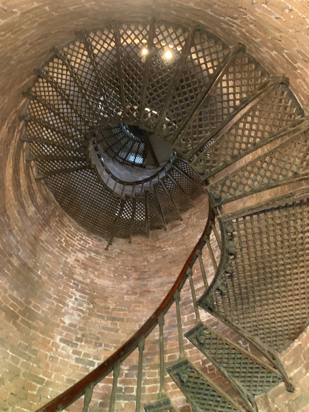
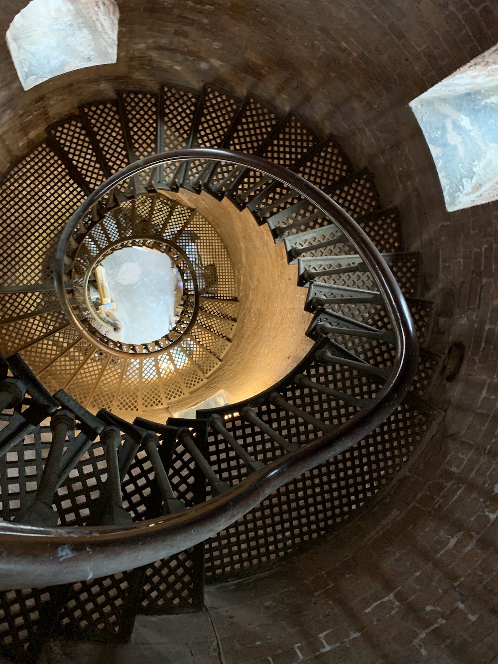
I won’t say too much about the house itself as it is a (beautifully decorated) private home, so I will skip ahead to the tower. It’s a really unique tower, very open and the type that those without a head for heights would really struggle with. There is no central column, just open space, and the spiral staircase is made up of fantastic lattice metal stairs which allow you to see right through them to the area both below and above. There is definitely nothing enclosed about this lighthouse tower.
Looking up the tower. The stairs in the lighthouse almost create an optical illusion.
And the view back down Hoylake lighthouse
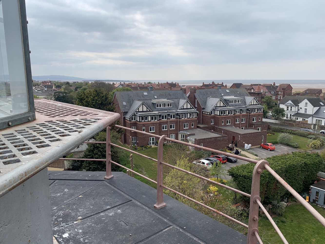
Just below the lantern there is the usual small room where, these days, operational lighthouses would have a couple of boxes that keep the light going. Then it’s just a climb up a ladder to get to the lamp room. What a space that is! Again it’s very open and bright with 360 degree views. What amazed me most up the top though was the width of the gallery. The railings around the gallery are pretty low so you do need to be a bit careful, but it is such a wide space compared to those I have been to before that I was quite impressed. Again, it’s all about the space at Hoylake.
The wide gallery at Hoylake Lighthouse with the view over the houses towards Hilbre Island, and Wales beyond
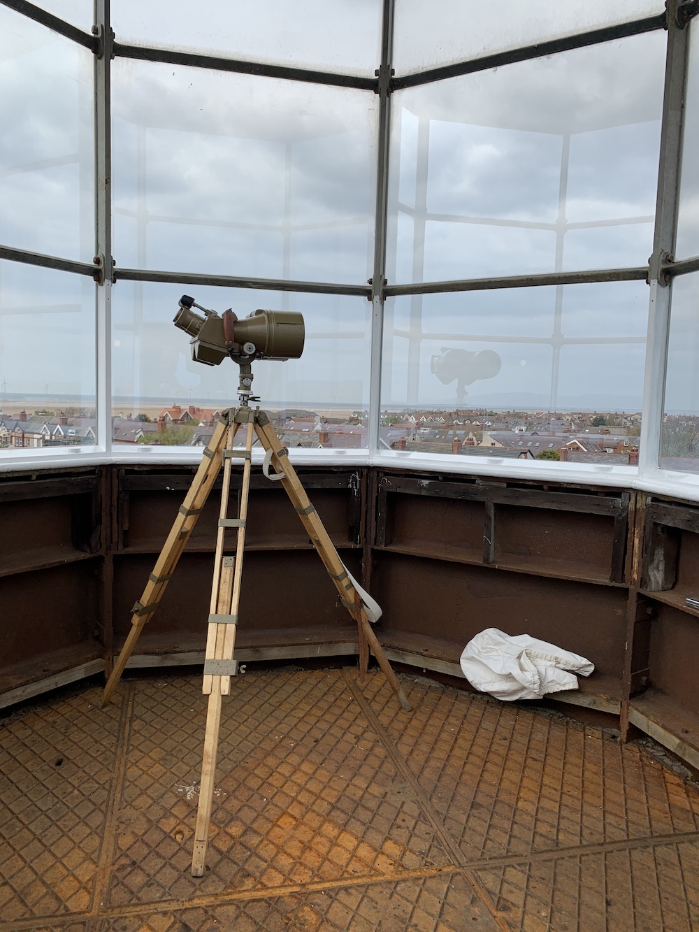
Charlie had very kindly carried his wonderful and heavy old binoculars up the stairs (no mean feat) and set them up so we could see a number of the other lighthouses in the area, including Talacre (Point of Ayr), Bidston and Leasowe, the latter of which could be seen quite clearly with the naked eye that day. We could also see across to Hilbre Island and this served as a reminder that we should probably start heading that way to ensure we caught the tides right.
Charlie’s wonderful binoculars in the lamp room at Hoylake lighthouse
Hilbre Island, or the Hilbre Islands (actually three tidal islands, with Hilbre being the biggest) sit just off the coast at Hoylake. Although it is recommended to go from West Kirby at low tide, Charlie said that walking from Hoylake was fine as long as you knew which way to go. The timing for Hilbre is key as there is plenty to see on the island and you definitely don’t want to be only just starting the walk back with the tide already coming in.
Hilbre, here we come
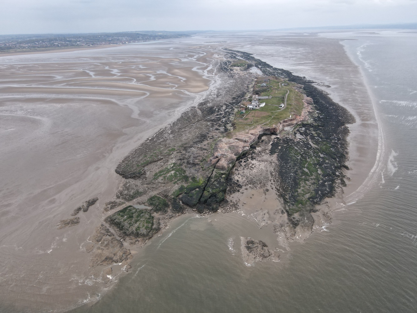
Considering it’s a small island it has a really interesting history. There’s a great piece on the Hilbre Island website that gives masses of information on various aspects of its past. My interest in visiting was largely a result of the light over there, but I got somewhat waylaid when Charlie showed us the Hilbre Island Canoe Club building. He is a member of the club and the building is full of a variety of pictures from past and present.
Arriving at Hilbre Island and one of its many very interesting areas
While Bob flew Joe the Drone around the island, Charlie showed me a photo album which gives a wonderful overview of the club’s past – oh, and the wine came out!
The Hilbre Canoe Club and lighthouse from above
A bird’s (or Joe’s) eye view of HIlbre Island
There was so much conversation about the Club and other topics that I almost forgot what I was there for, but we did eventually make it to the lighthouse. I’d had a couple of discussions before with my lighthouse pal John about whether or not the light on Hilbre met the criteria for inclusion in my book. As a result, my first priority was to check that it did and that it was actually big enough for a person to be able to get inside. As you will see from the picture, the door is considerably taller than me. There may not be room to swing a cat in there, but it could fit a person inside. I would give it a good go!
The size comparison between me and Hilbre Island Lighthouse
Around 1810, two wooden markers were installed at the north end of Hilbre to help guide ships into the Hilbre Swash at the entrance to the River Dee. In 1840 these were replaced by new markers on Little Eye (the middle of the three Hilbre Islands) and just offshore at Hoylake. After being replaced at some point they were eventually demolished during WWII to avoid the enemy using them as landmarks.
A navigation light, an acetylene gas-powered light on a lattice tower initially, was first introduced by the Mersey Docks and Harbour Board Authority in 1927 to mark the Hilbre Swash. It was later replaced by the existing steel structure and ownership of the light changed to Trinity House in 1973.
Hilbre Island Lighthouse
Joe the Drone’s view of the north end of Hilbre Island with Hoylake in the background
Close to the lighthouse is the old telegraph station, which was the second station on the island (the original was a wooden structure). This was one in a long chain of stations used to communicate messages from as far as Holyhead to Liverpool. A couple of other lighthouse locations were involved in this process, those being Great Orme and Bidston Hill. The telegraph station on Hilbre was completed in 1841 with the system continuing to be used until 1860.
Hilbre Island telegraph station
We then had a great walk around the island.
The beautiful west coast of Hilbre Island
Then it was back to the Canoe Club where I proceeded to gulp down another glass of wine. When you are on a tidal island you can’t be hanging around for too long sipping on a glass of wine! The walk back across to Hoylake was thankfully very refreshing. On arrival back at Charlie’s we discovered his lovely wife Ali was back so we popped in and I enjoyed even more wine.
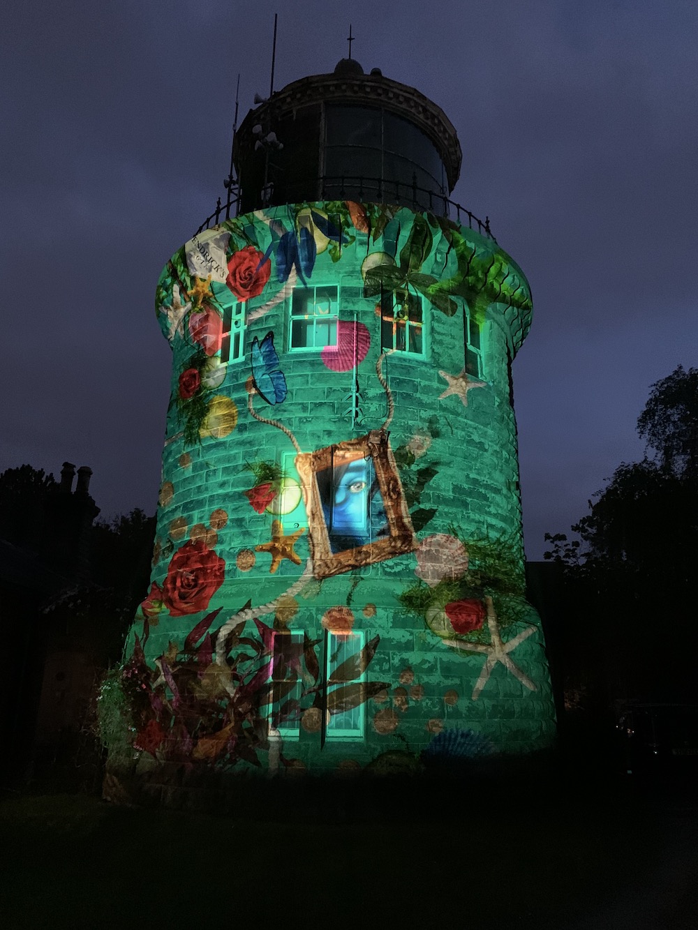
I had arranged to stop off at Bidston Lighthouse that evening to collect something and poor Stephen and Mandy ended up waiting very patiently for our arrival only for me to turn up a little worse for wear. As far as I could tell they didn’t seem to mind too much though and very kindly gave me coffee. The visit to Bidston was actually very well timed as it is currently one of four lighthouses currently lit up with beautiful moving light designs by Hendrick’s Gin, which seems like a wonderful image to leave you with at the end of this long and crazy day 🙂
The Hendrick’s Gin light display on Bidston Lighthouse
As well as being something really handy to refer back to if I’m wondering when I visited a particular lighthouse, this blog has brought me into contact with some really helpful folk. Earlier this month I heard from a follower who had previously contacted me about access to the lighthouse on the south pier in Heysham, which I had previously only seen from the ferry to the Isle of Man.
Heysham South Pier Lighthouse as seen from the ferry in 2015
I’d been informed by this follower in late 2020 that it was no longer possible to view the lighthouse from the north side of the harbour as the road had been blocked off. Fast forward 17 months to early April this year and he very kindly sent me an email saying that he’d found another way to get to it.
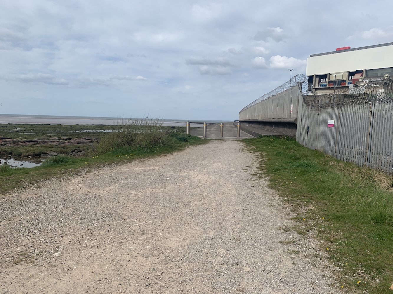
With a ferry booked from Heysham for the forthcoming Association of Lighthouse Keepers’ Isle of Man event, it seemed the perfect opportunity to check out the route for myself. Thanks to his excellent directions it was easy enough, approaching from close to the holiday park to the south of the harbour, first using a footpath from the end of Money Close Lane to reach the coast and then heading north, following the sea wall around the outside of Heysham Power Station.
The route follows the coast northbound from this point, alongside the Power Station fence
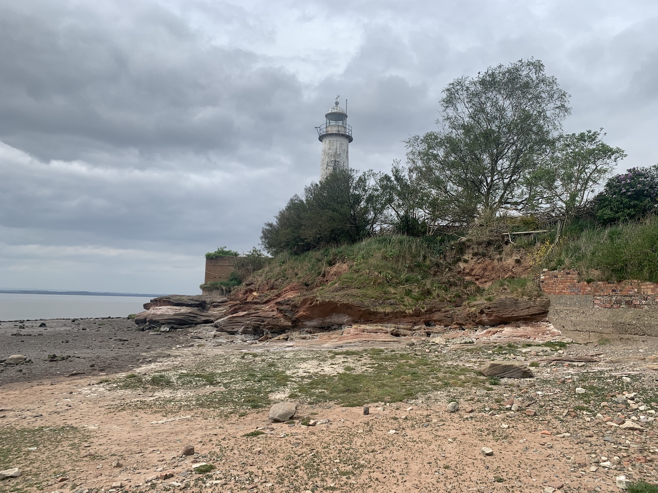
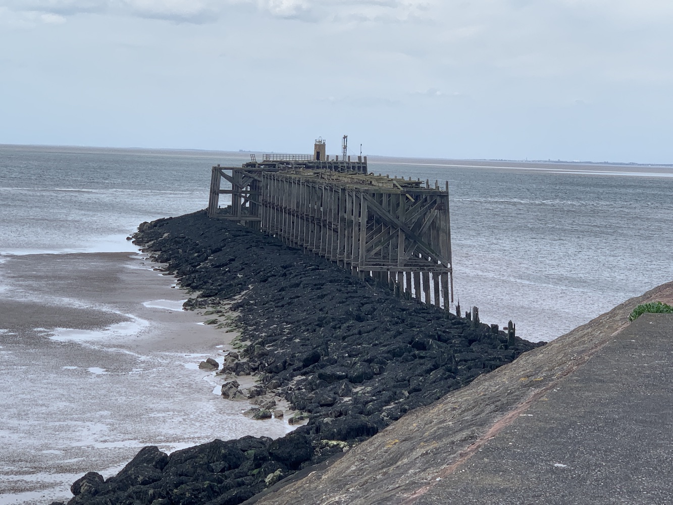
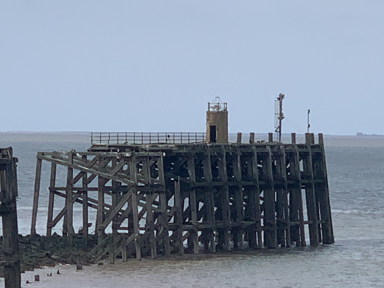
On the way there I spotted an old pier ahead looking like it had seen far better days. Towards the end of what remained of this pier was a small round tower with an access door. Obviously this kind of structure on the end of an old pier is always going to pique my interest. I did some research and discovered that it’s actually an old fog signal tower. In my experience, this is quite an unusual location for a fog signal. The old breakwater was part of the original harbour which opened in September 1904.
The remains of the old pier with the small, round fog signal tower visible
A closer (and much poorer quality) view of the old fog signal tower
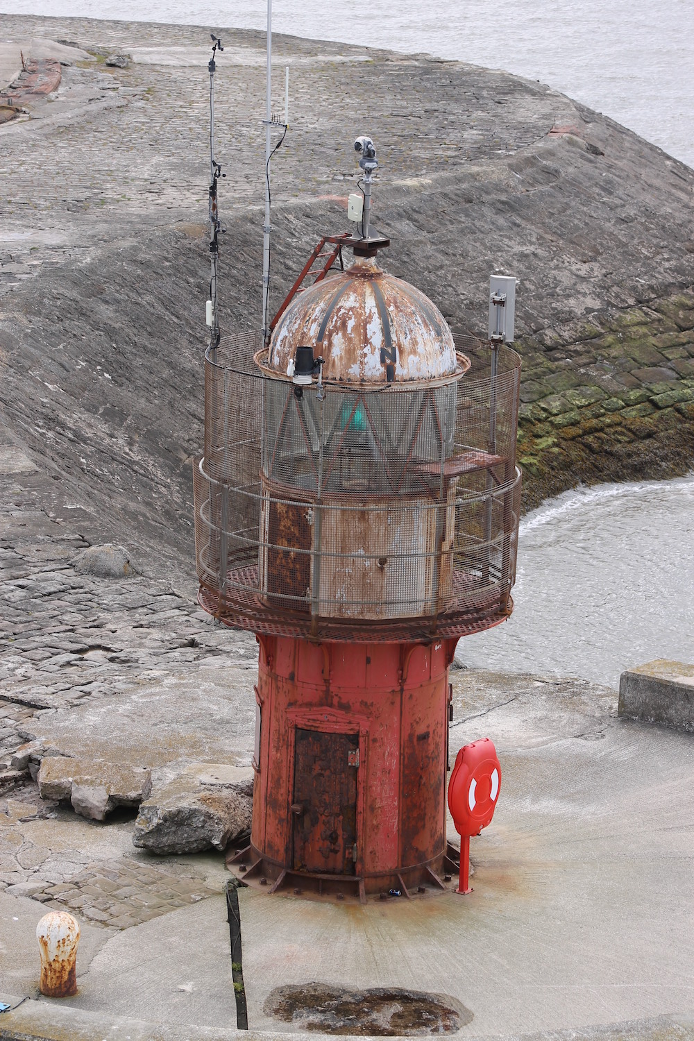
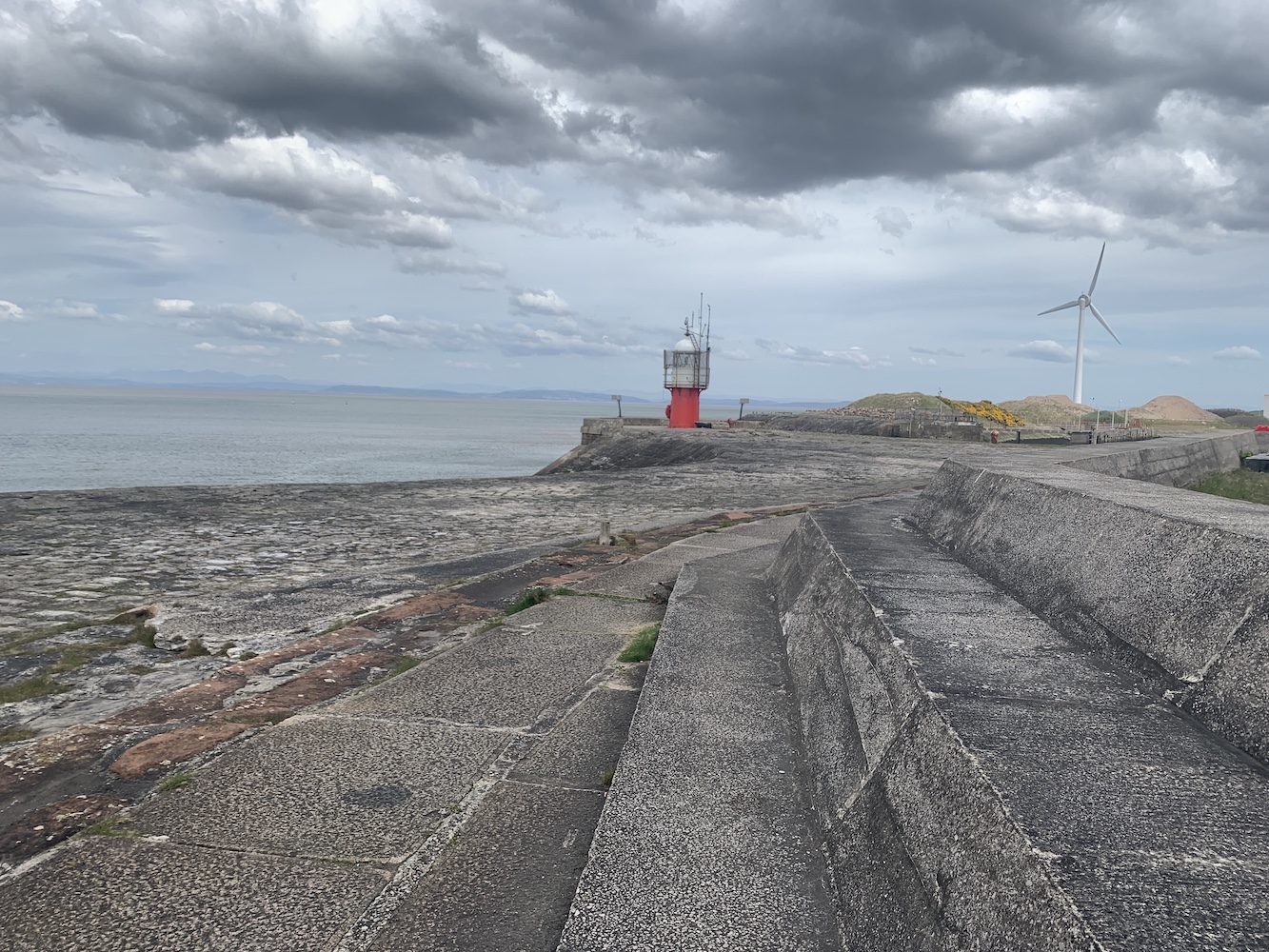
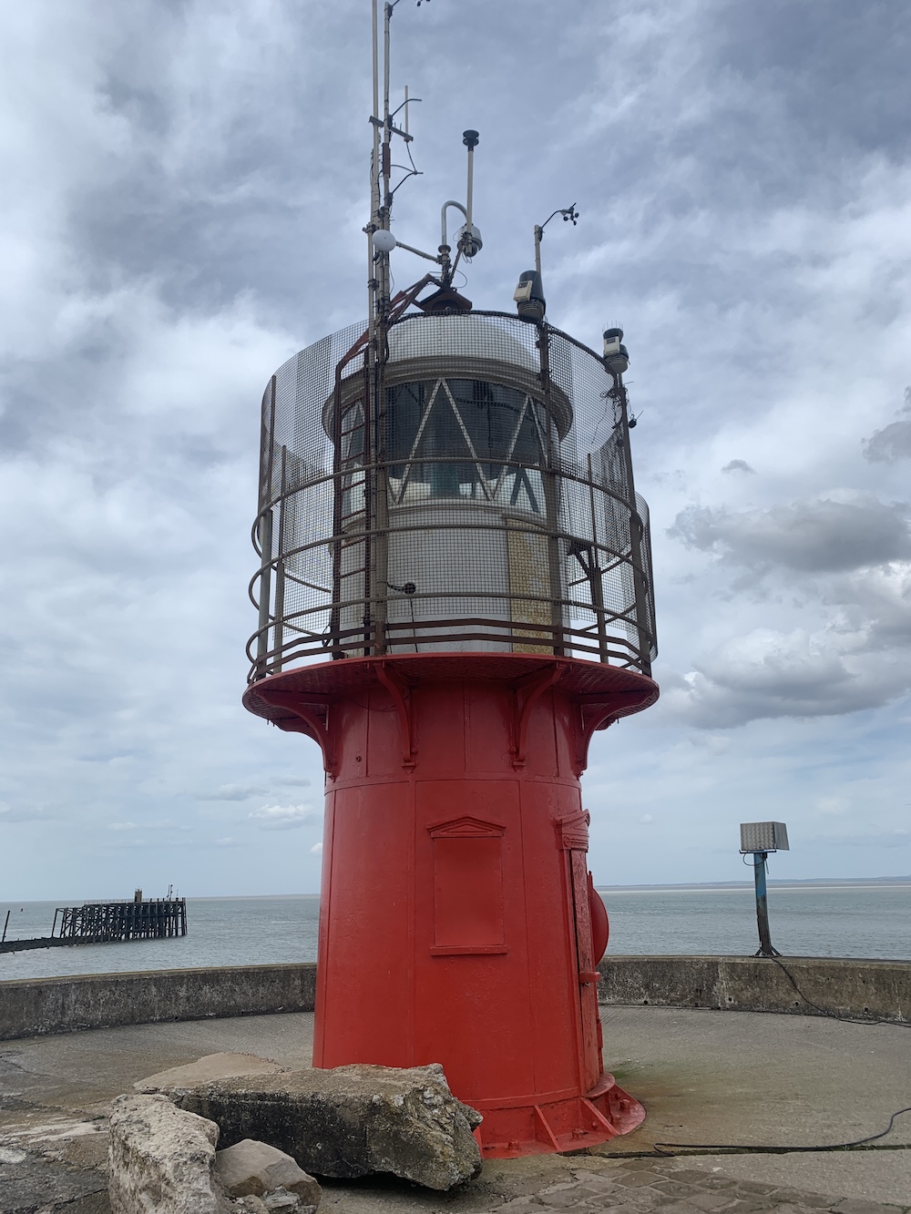
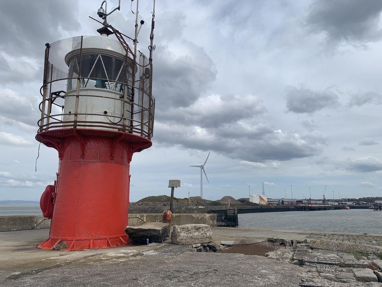
The South Pier light soon came into view, the top of its lantern appearing above the upper level of the sea wall. I was really pleased to see it looking in considerably better nick than when I’d viewed it before and in others’ pictures. This occasionally happens and it really does make you feel very grateful to the local harbour authorities who, in most cases, are responsible for these smaller harbour lights.
Approaching the lighthouse
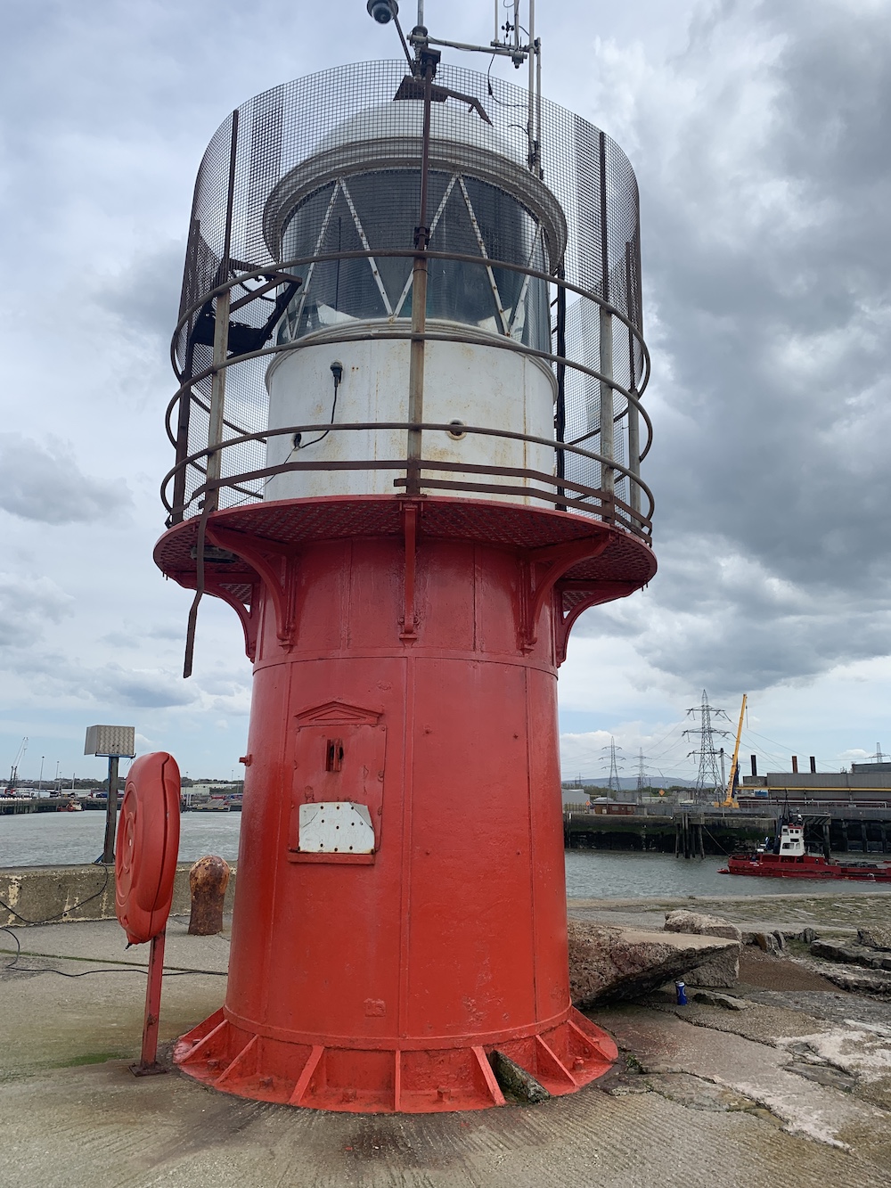
Heysham South Pier Lighthouse with the old pier remains in the background
Heysham South Pier Lighthouse looking much improved
The lighthouse marks the southern entrance to Heysham Docks
It’s clearly a well trodden route for locals. It may not be the most picturesque (although the power station buildings are quite colourful in comparison to most others – I feel like I’m rather unwillingly beginning to bag power stations after this one and the recent Bristol Channel and River Severn outing), but it’s great to have had a closer look at this small but important tower. Many thanks go to Howard who considerably reduced the time it took me to find it with his very clear directions 🙂