It had been a long 4 years since I’d last joined any Relative Hills Society (RHSoc) trips and with this year’s AGM a mere hop, skip and a jump away in Kintail in late May it would have been rude not to pop along and catch up with some good old friends from the 2014-2019 period covered in this previous reflections post of mine.
For me, the spare time during the few days in the area was reserved for exploring some nice walking routes both in Kintail and on Skye. There was also a couple of very successful boat trips to the Bracadale Islands and Soay from Elgol as well as an evening trip to Iosaigh on Loch Dunvegan. It was great to be back out on the water again with the chilled out ‘baggers of all things’ as a boatman once referred to them.
Rather fortunately one of the baggers, Jonathan, had purchased an inflatable boat with an outboard engine and, as the days progressed he was off out shipping people to otherwise inaccessible islands.
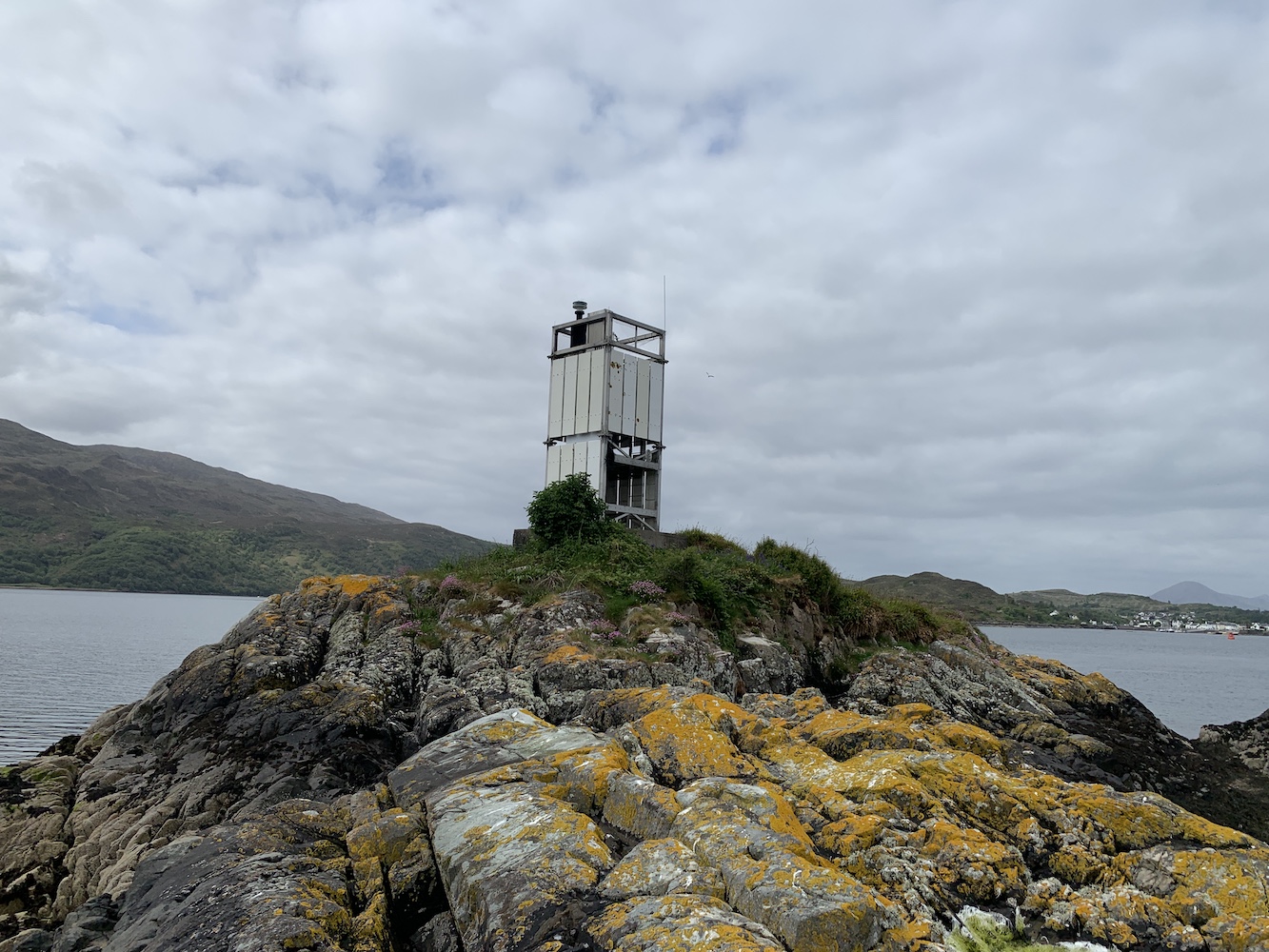
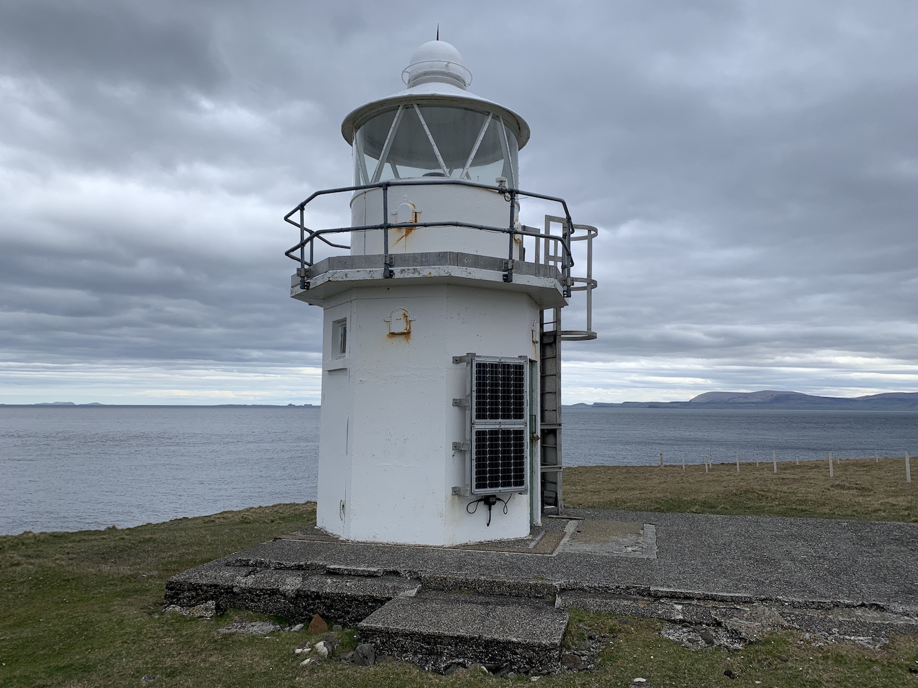
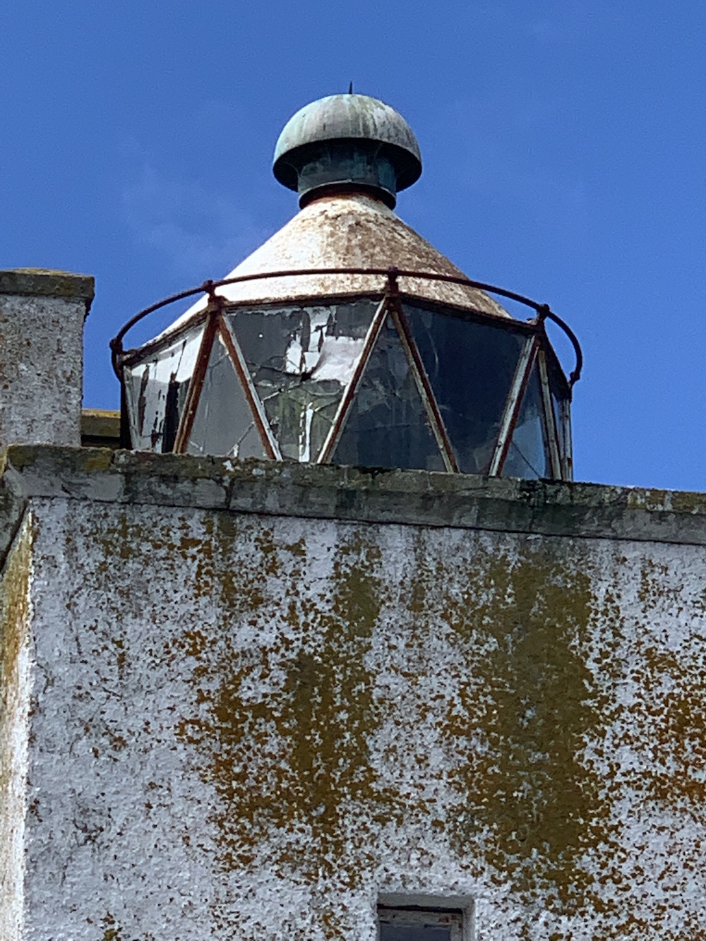
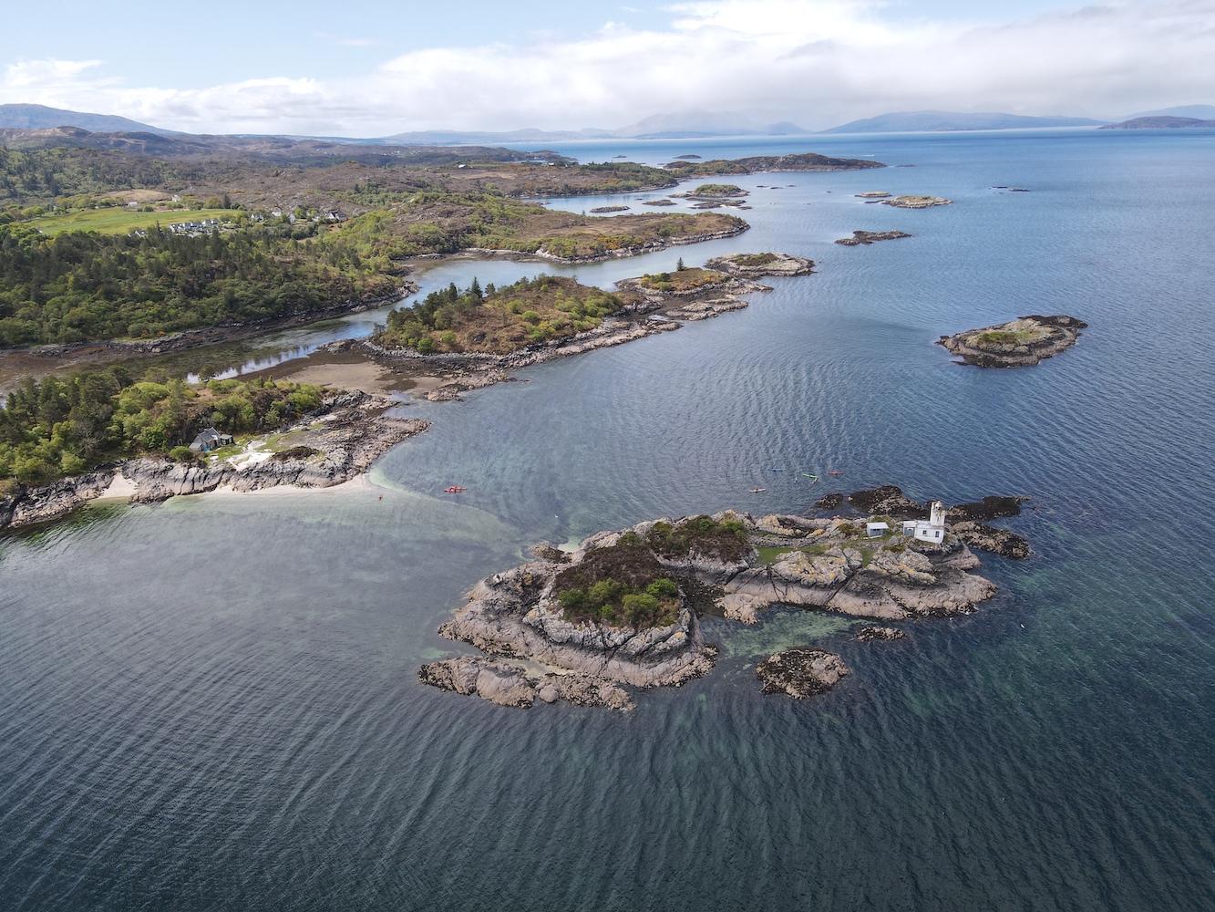
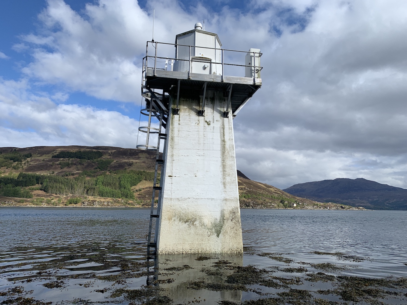
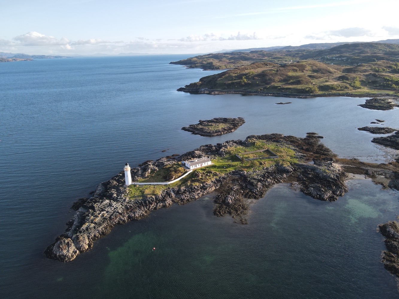
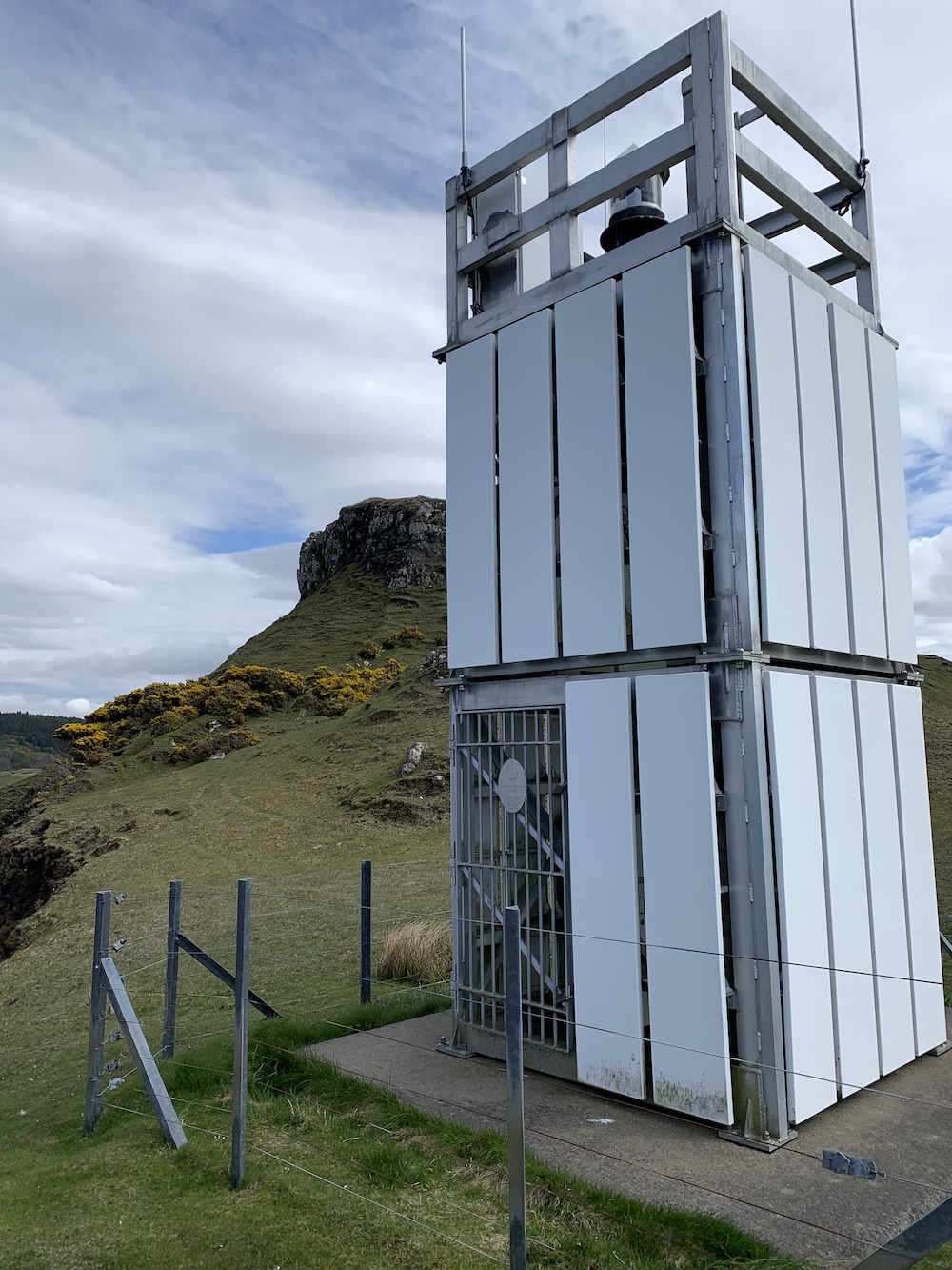
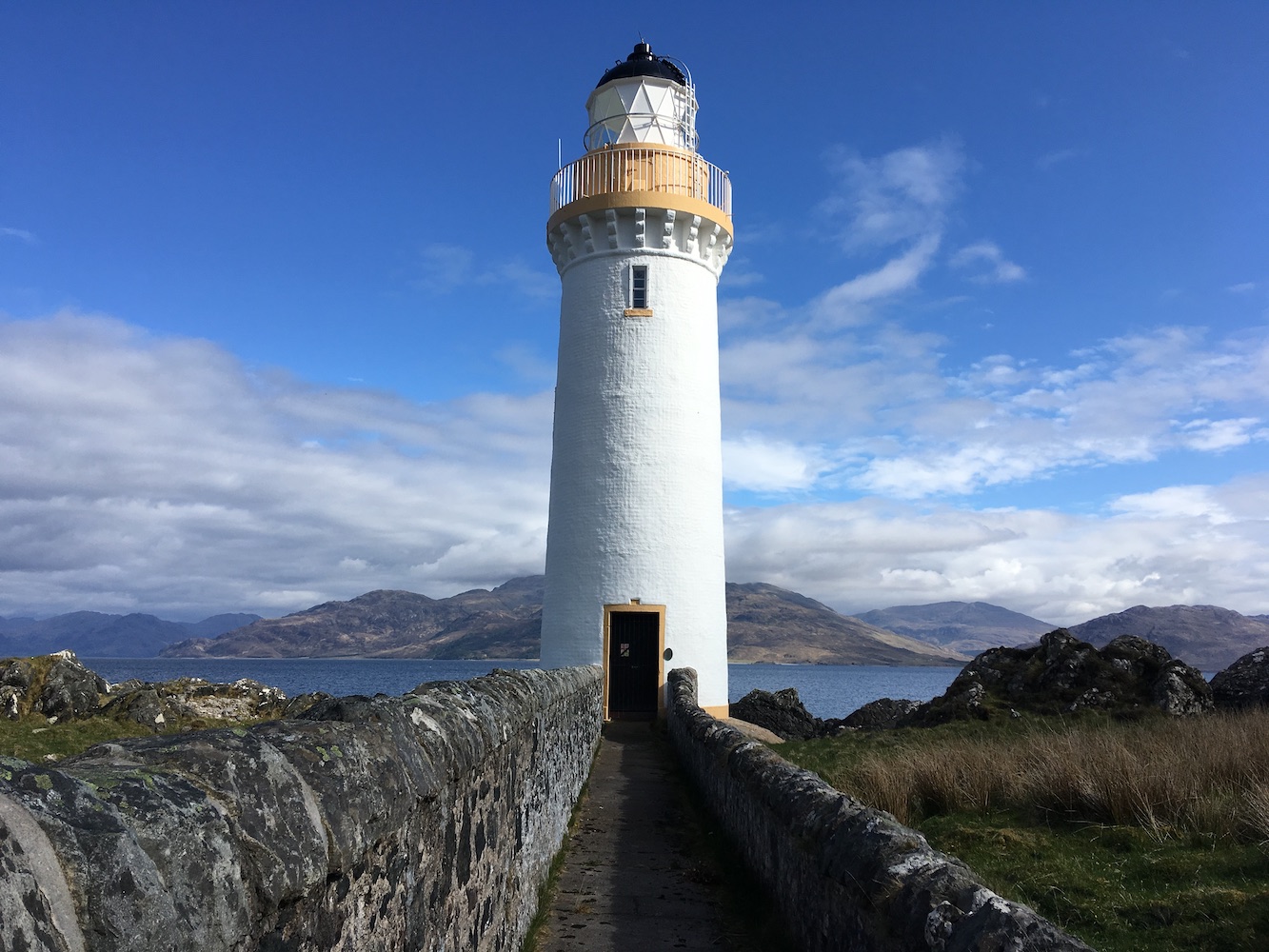
After passing through the Kyle of Lochalsh a good few times that week, the idea of getting a closer look at the little flat pack lighthouse on Eileanan Dubha East to the east of the Skye bridge crept into my mind. I approached Jonathan with this opportunity and he was happy to help out so I gathered interest from others wishing to head out during the RHSoc AGM and evening meal.
A merry band of us (or not so merry as was the case for myself and one or two others after one – or five – too many drinks the night before) gathered at Kyle of Lochalsh on the Sunday morning and Jonathan prepared our chariot for the short ride across to Eileanan Dubha East.
The skipper preparing the vessel
Off we set, two at a time, and the calm water and fresh air did wonders at bringing me closer to some sort of sensible state. It didn’t do a huge amount for my energy levels though as, once I’d navigated my way across the rocks to the lighthouse, that was where I stayed for the duration of the visit. I had to borrow pictures to help populate this post!
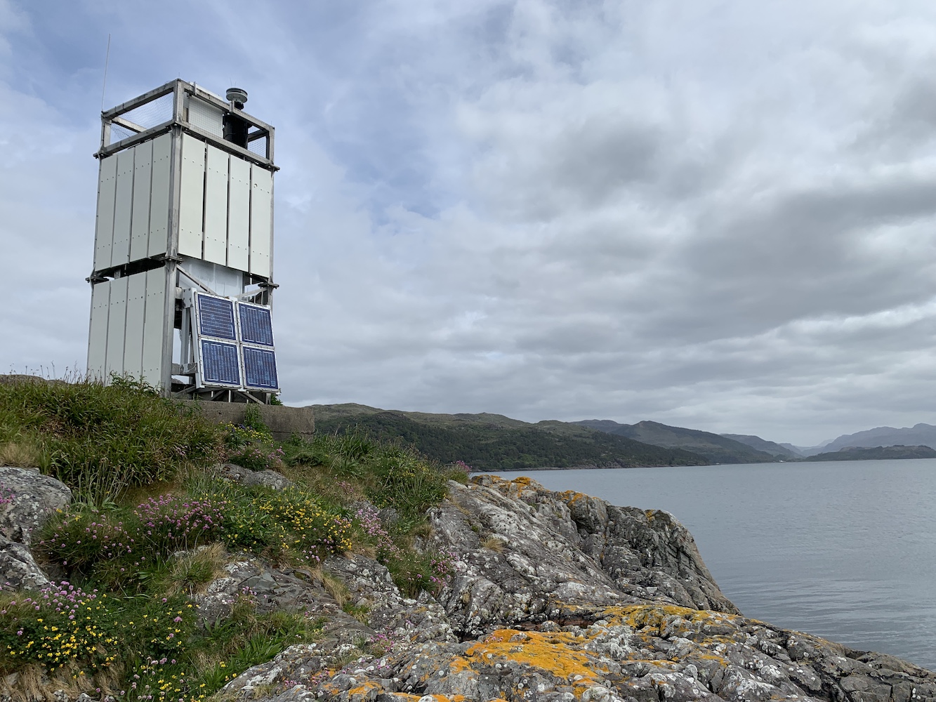
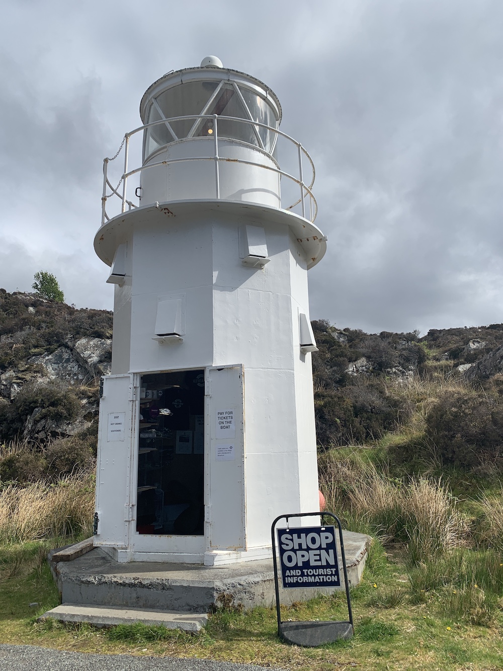
Eileanan Dubha Lighthouse
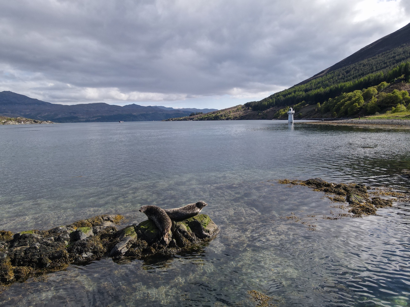
It was an excellent spot to just sit and watch as others made their way over and went off exploring whether the tide was low enough to get to one of the neighbouring islands in the Eileanan Dubha group. The glass-bottomed boat from Kyleakin went past at one point, with passengers enjoying watching the seals on another island – and probably wondering what we were up to as well.
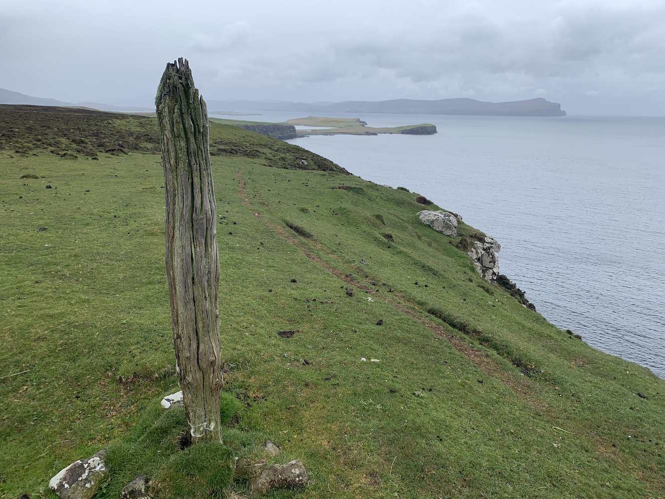
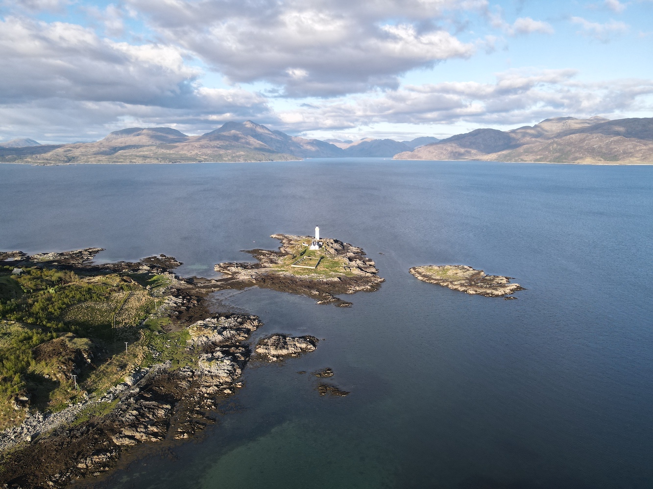
Skye provides a dramatic backdrop to this little island
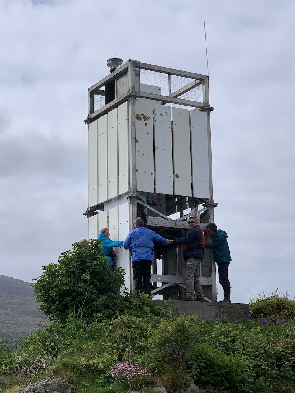
I clearly wasn’t the only one enjoying watching the world go by from that tiny island as the others, rather unusually, also took to sitting around, chatting and just generally enjoying that Sunday morning chilled feeling. Once we (or I) had mustered up some energy we used the opportunity to give the light a group hug, which went rather well. It’s always a fun activity to introduce people to and makes for some great pictures too, even if it is impossible to get everyone in the picture.
The lighthouse hug in action
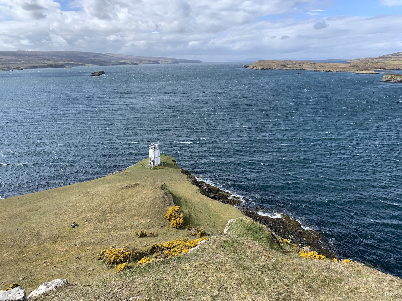
Eileanan Dubha marks the east entrance to Kyle Akin, the relatively short stretch of water separating Skye from the mainland. At the west end of the Kyle is the now inactive Eilean Ban, or Kyleakin, Lighthouse which is very much overshadowed now by the bridge.
The lighthouse and Loch Alsh
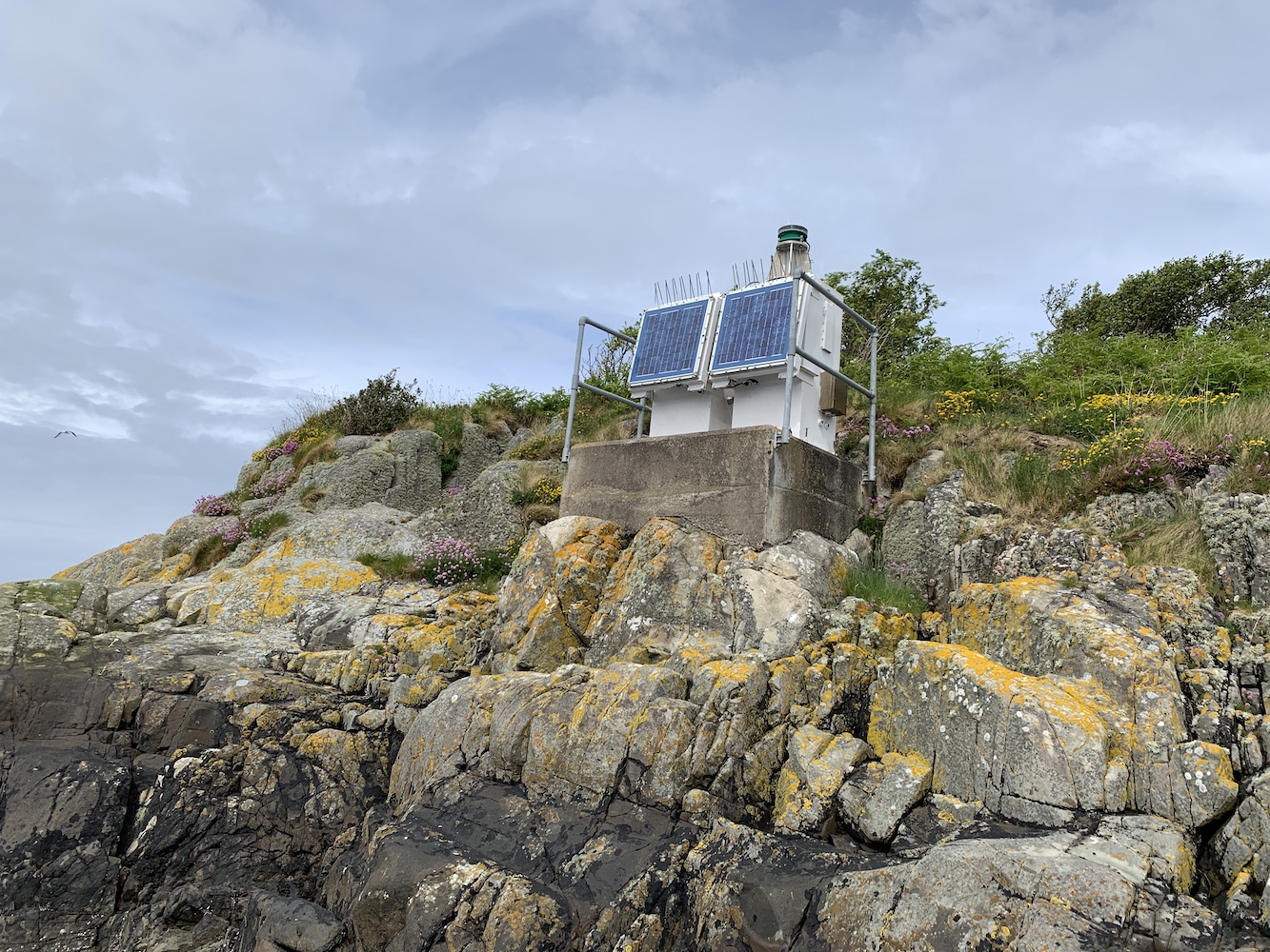
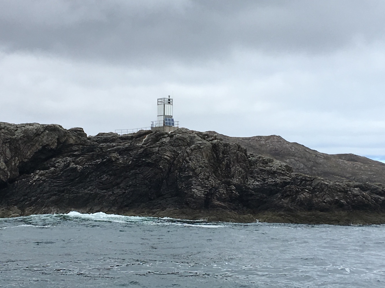
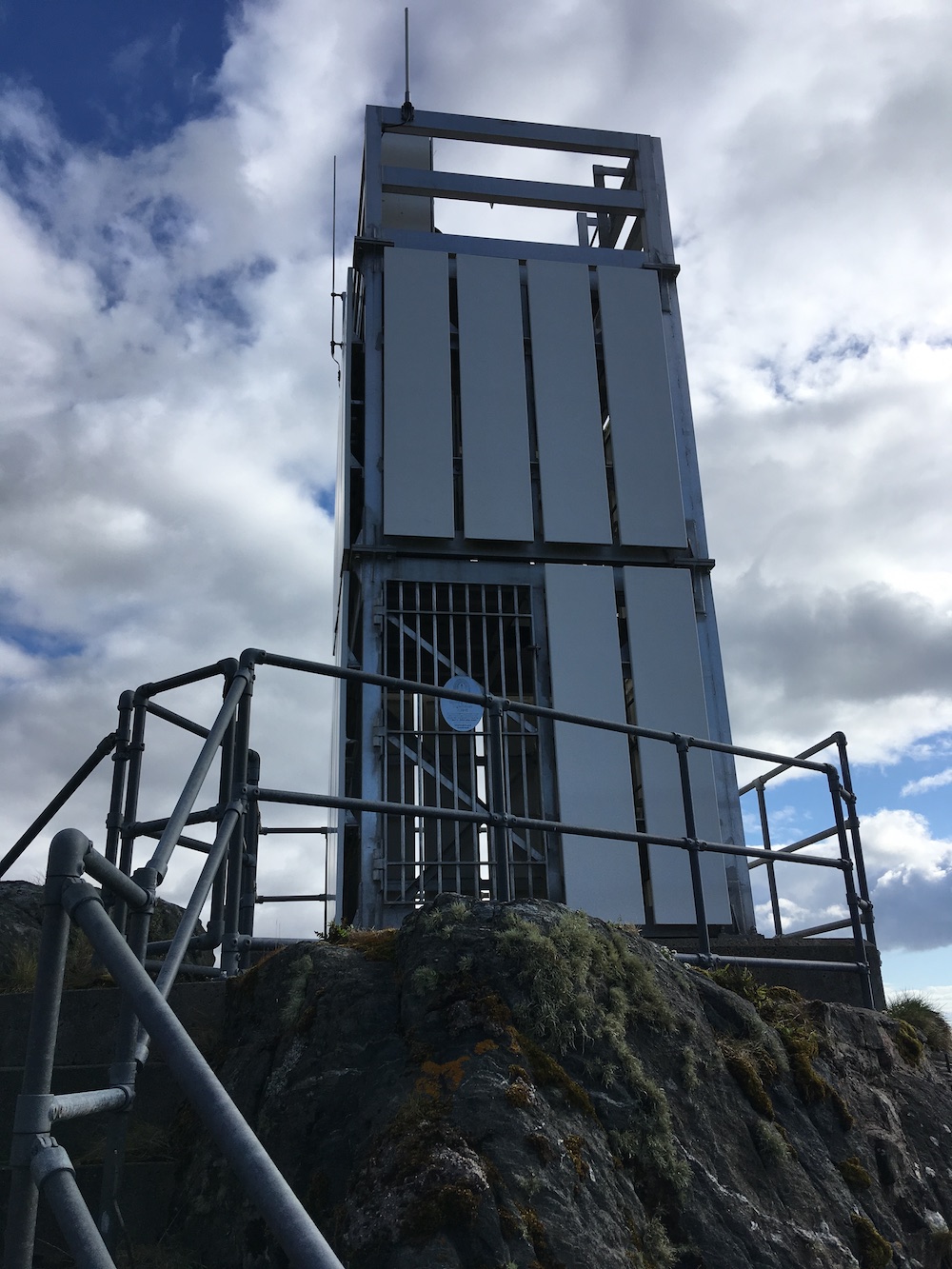
Further along the Eileanan Dubh group is the teeny tiny Eight Metre Rock Lighthouse, or so it says anyway. In my view it’s a couple of little cabinets with a light on top of one of them, so doesn’t hold anywhere near as much interest.
Eight Metre Rock Lighthouse
With a journey back home ahead that day it was time to head back and bid a fond farewell to Eileanan Dubha East which had provided a little piece of calm and quiet on a day where it was very much needed 🙂
As I mentioned in Friday’s post, I had just two lighthouses on Skye left to visit before this weekend. With Dunvegan Lighthouse bagged that just left one more: Waternish Point.
With rain forecast for this afternoon – and the need to get home today – a fairly early start was required. After the kayaking and then the added extras from yesterday it was a balance between setting off at a decent time and getting enough sleep.
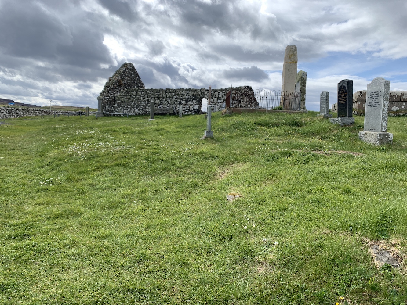
It was nice and dry when we set off and quite some time later we arrived in Trumpan (I’ve said it before, Skye is big). Spotting the starting point for the walk as we drove past we then parked up opposite the old church. This church was the scene of a particularly nasty episode in the long-running battles between the MacLeods of Skye and the MacDonalds of Uist. In revenge for an equally sinister event on the island of Eigg, the MacDonalds made their way to Trumpan and burned the church while it was full of local worshippers. The churchyard surrounding the ruins contains a number of graves, including some quite recent ones.
The remains of Trumpan church
There’s also a Dark Skies area next to the car park and I can imagine it gets very interesting there at night with the lack of light in almost every direction.
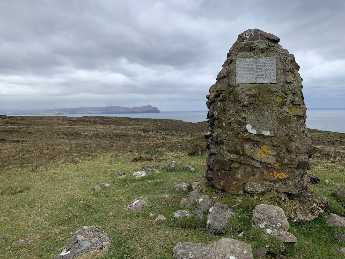
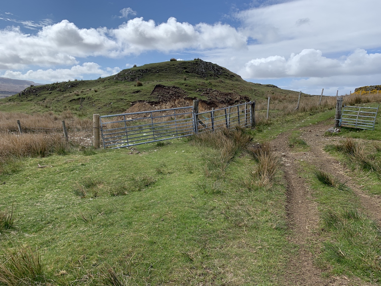
Once we were ready we set off along the road and through the gate. We were very much aware that cows could play a part in the day’s adventure, which is always enough to put Bob on edge certainly. He adopted the role of ‘cow lookout’ and went on ahead a little way, scanning the track and surrounding area. We reached a little mound featuring a cairn and Bob headed on up and ushered me up once he’s got to the top. He’d spotted the cows which had young with them and a couple had stood up when they spotted Bob. They weren’t far at all from the track so a bit of off-piste was required just to be sure we didn’t spook them.
The cairn from which Bob spotted the cows (not shown in this picture)
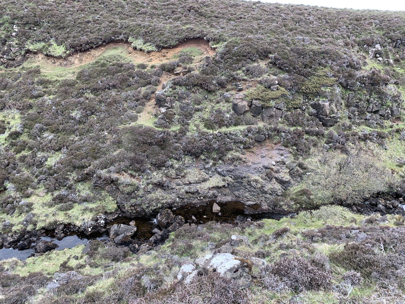
We headed for the coast across the heather and after a very short time encountered a gaping chasm (Bob called it a gully, but it was definitely a chasm). ‘Follow the sheep track’ Bob advised me as we started to scramble down into the chasm. My response was ‘But I’m not a sheep.’ Sheep manage to balance their way about on all sorts of skinny ledges – which isn’t so easy for me as a human. ‘Follow the staircase’ was another one of his comments and I didn’t even dignify that one with an answer.
This picture doesn’t show very well just how gaping the chasm really was!
We made it safely and slowly to the bottom of the chasm and, of course, then there was a burn to cross. I am rubbish at crossing rivers or streams, but thankfully this time I managed not to get wet. Then it was up the other side, which actually was much easier. More sheep must have been up that side of the chasm prior to my visit.
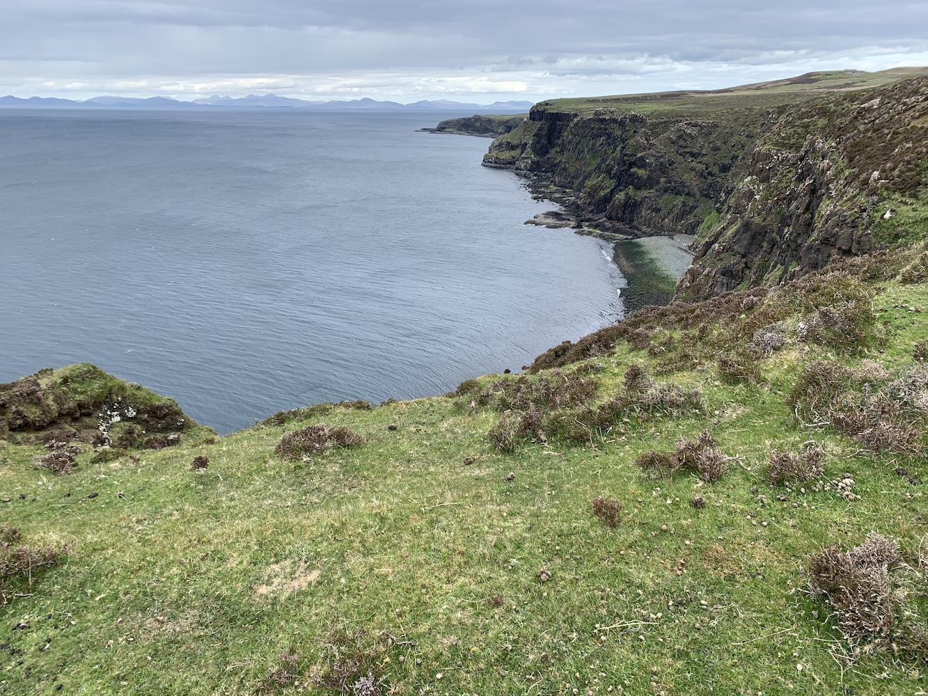
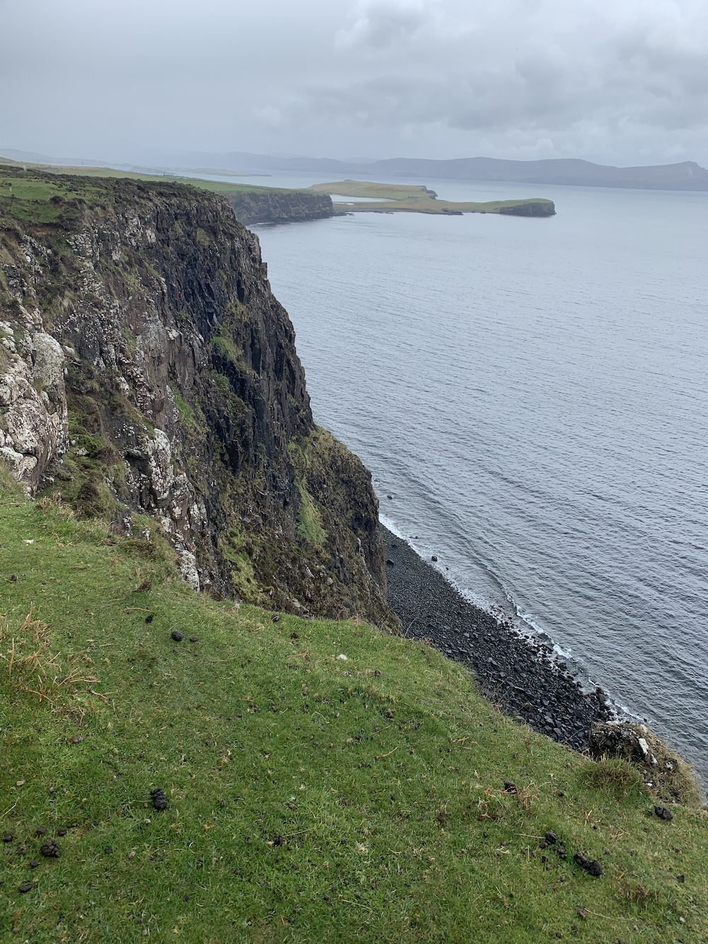
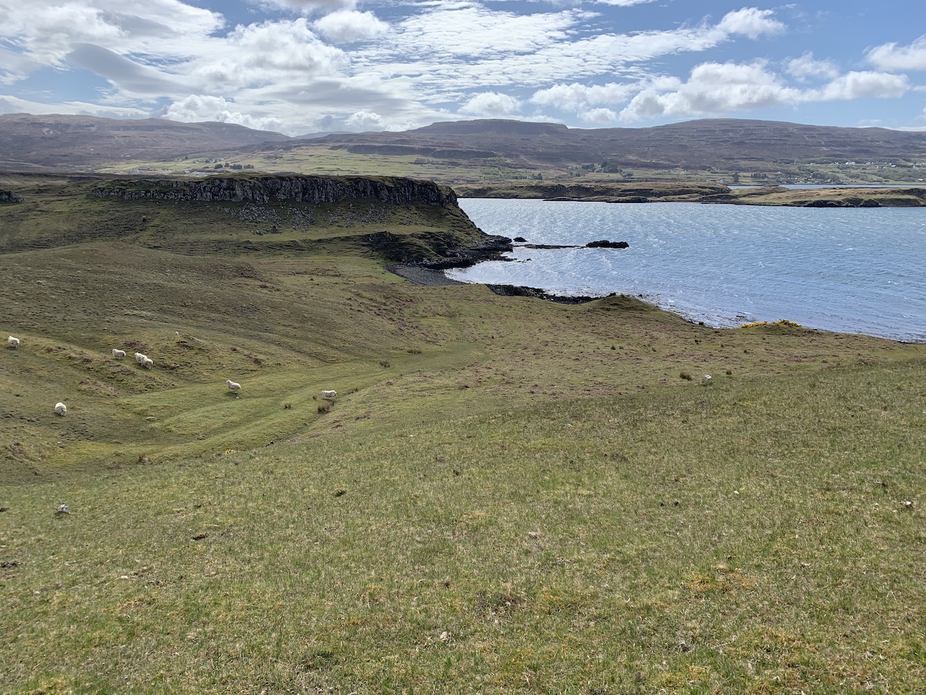
From here we followed the coast for a while to make sure we were out of sight of the cows. I’m usually always on the look out for silver linings when things don’t quite go to plan. I certainly wasn’t while in the chasm (although it did look nice), but once we were back on the well-trodden sheep track along the coast there were some spectacular views both to the west and onwards in our direction of travel to the north.
The view to the north with the hills of Harris in the distance
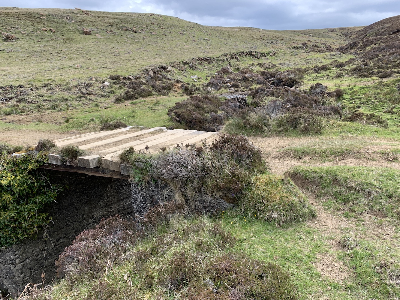
We ended up following the coast for far longer than I expected and our 1km off-piste detour came to an end as we joined the track again at a nice little bridge. From here it was just trudging on, passing sheep and their lambs occasionally.
The bridge where we rejoined the track
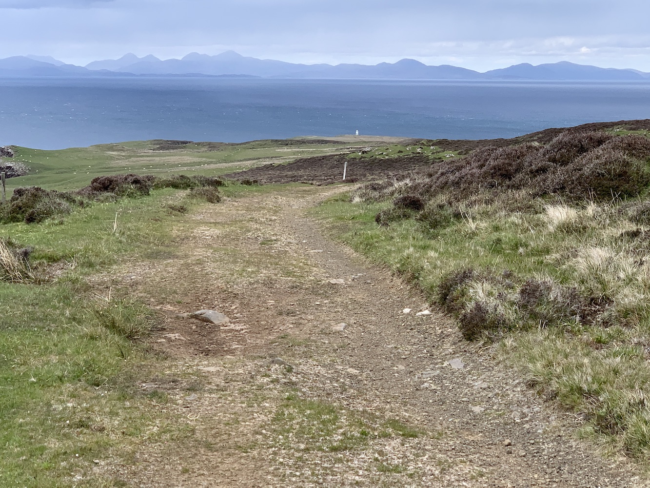
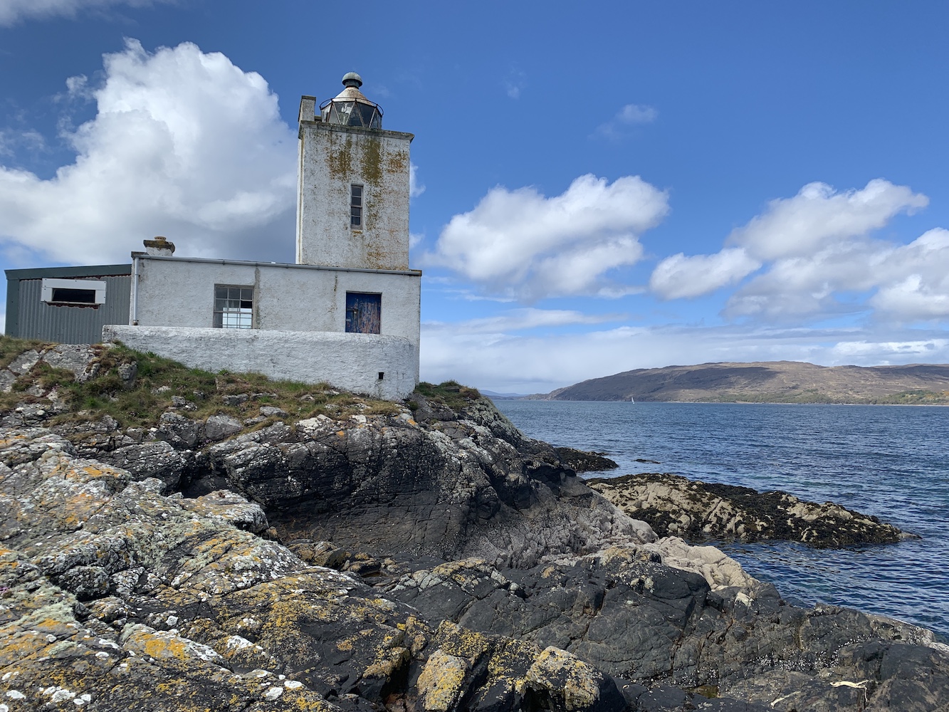
Eventually I got my first glimpse of our destination, Waternish Point Lighthouse. It did look about 500 miles away (I exaggerate), but it was a positive sign. We passed a couple of chaps who were just on their way back from the lighthouse and chatted to them for a few minutes before continuing on our way.
My very first glimpse of Waternish Point Lighthouse
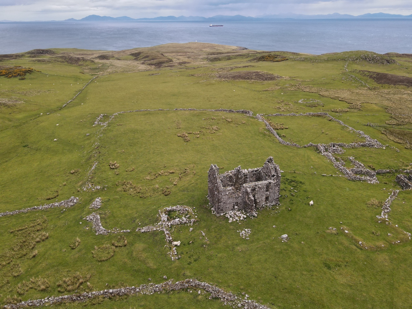
Reaching the end of the track we encountered the remains of walls and most notably the ruins of a house, which Joe had a fly over.
The remains of the old house at Unish
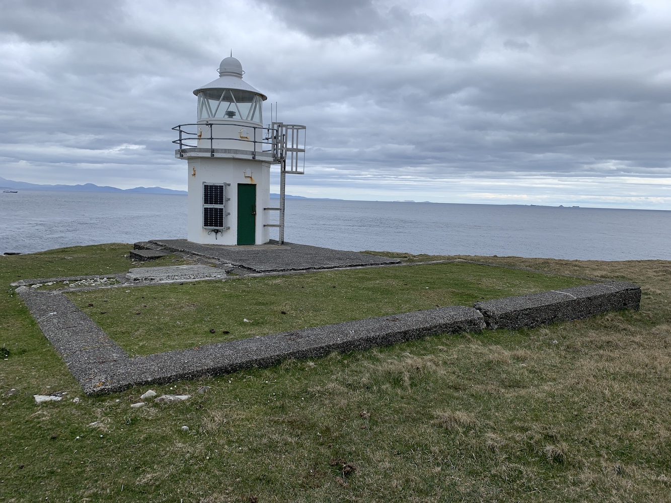
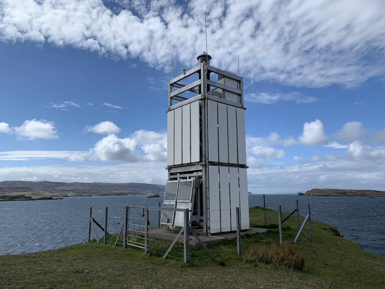
From here it was all downhill to the lighthouse and the lower you got the boggier it became, but thankfully the ground wasn’t too wet today. The lighthouse gradually got closer and then finally I was there at my final lighthouse on Skye!
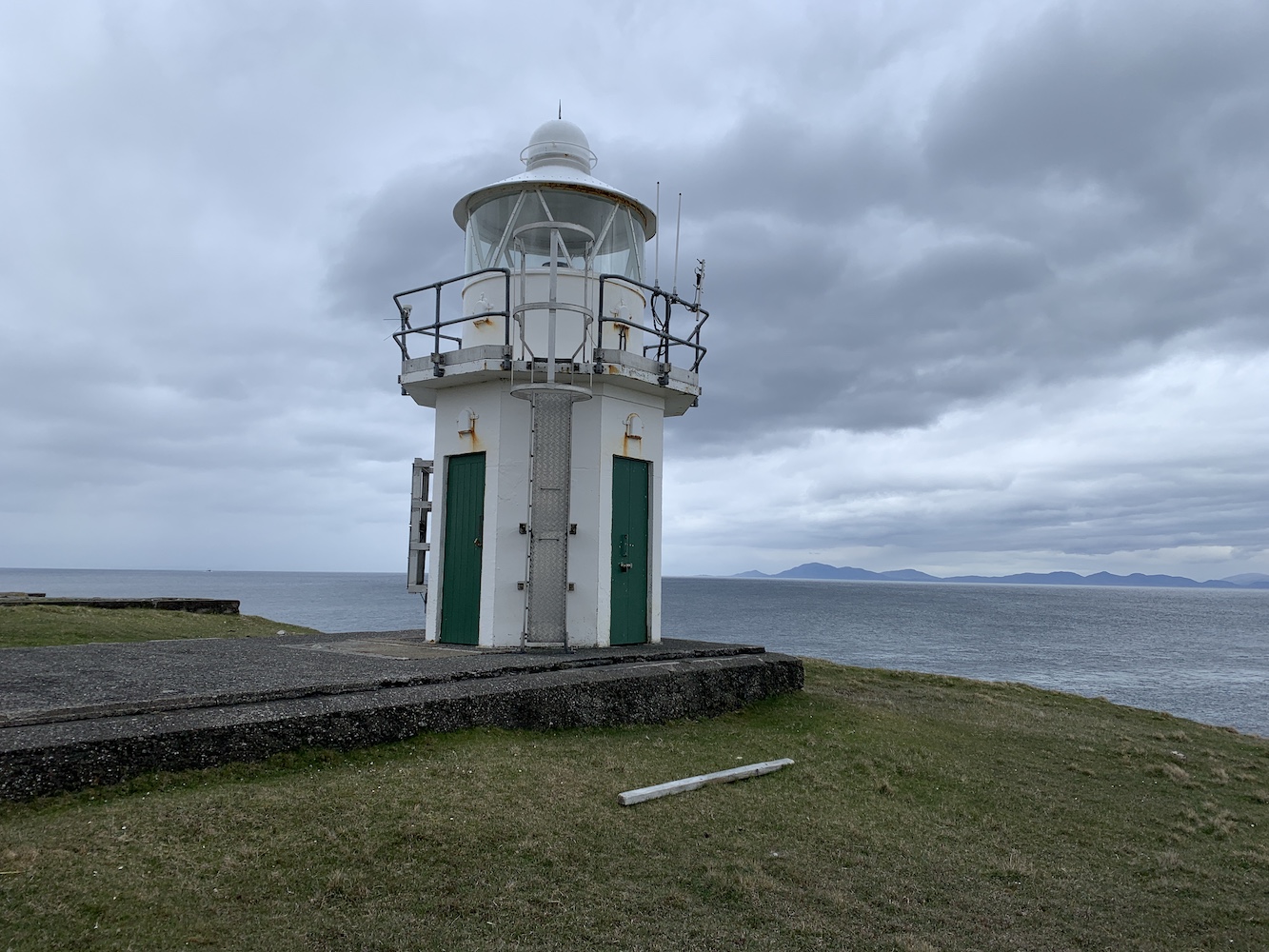
Waternish Point Lighthouse
What can I say about Waternish? Immediately you notice the stunning views across to the Outer Hebrides with the incredible hills of Harris on display and then a flurry of islands (I’m not sure at all that’s the correct name for a group of islands, but we’ll go with it) including the Shiants and the interestingly shaped and very appropriately named Lord Macdonald’s Table. Sadly the Uists had disappeared into the distance by then, but there was plenty to keep you occupied. Apparently it’s a great place for spotting whales and dolphins, but we didn’t see any of them, but we did see a Calmac ferry passing en route to Uig and the men we met on the way there had seen a submarine come up above the surface. Who needs whales and dolphins, eh!?
Waternish Point Lighthouse with the Shiants and other islands visible to its left
Onto the lighthouse. The current structure was built in 1980 and like just a few others has more than one door – presumably this is so you can access the inside of the tower safely without the door flying off in the wind and you would use the appropriate door based on the wind direction. This tower replaced the 1924 tower, designed by David and Charles Stevenson. It’s clear when you are there that there must originally have been a fair number of buildings on the site and now all that remains of them are the foundations. I really like the current tower as it is. There are very few like it left standing now so it’s always a pleasure to see one.
Waternish Point Lighthouse and the Harris hills beyond
Of course Joe the Drone had to have another little fly around.
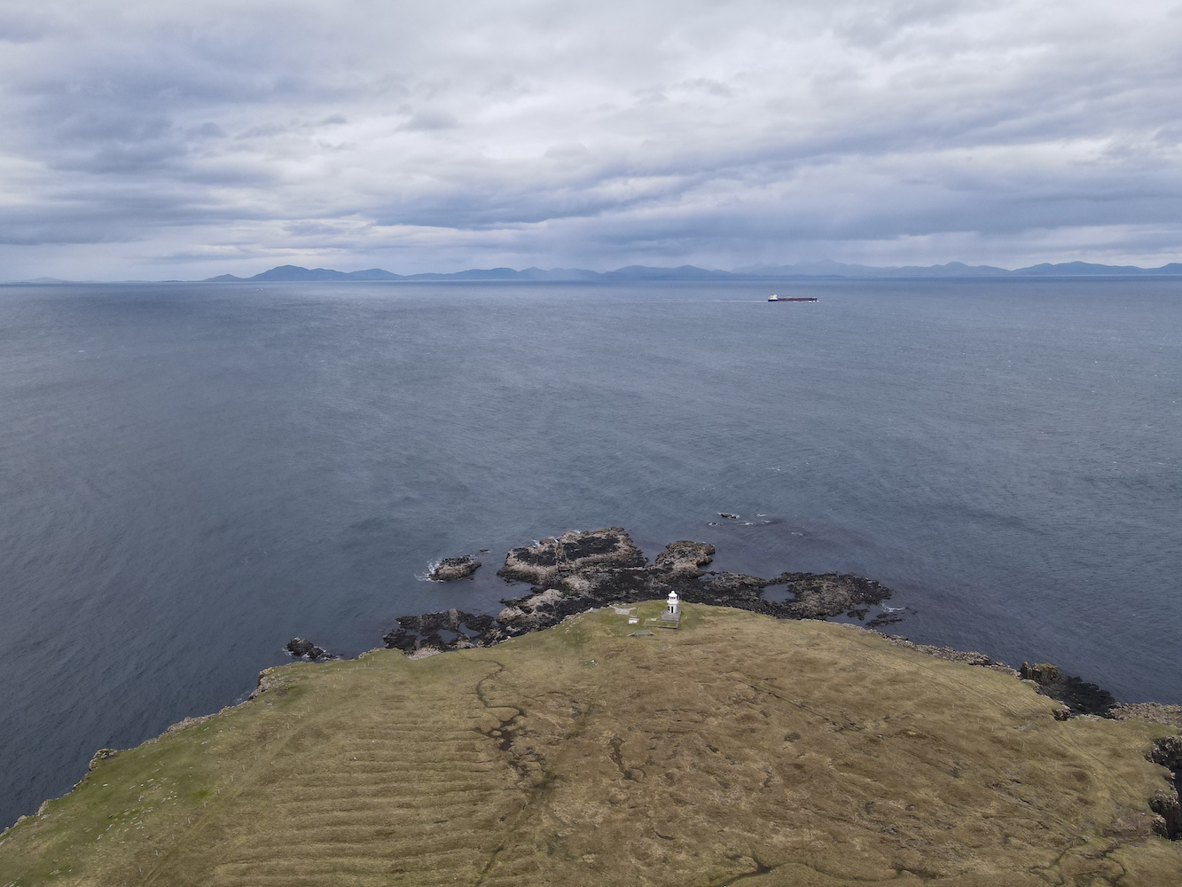
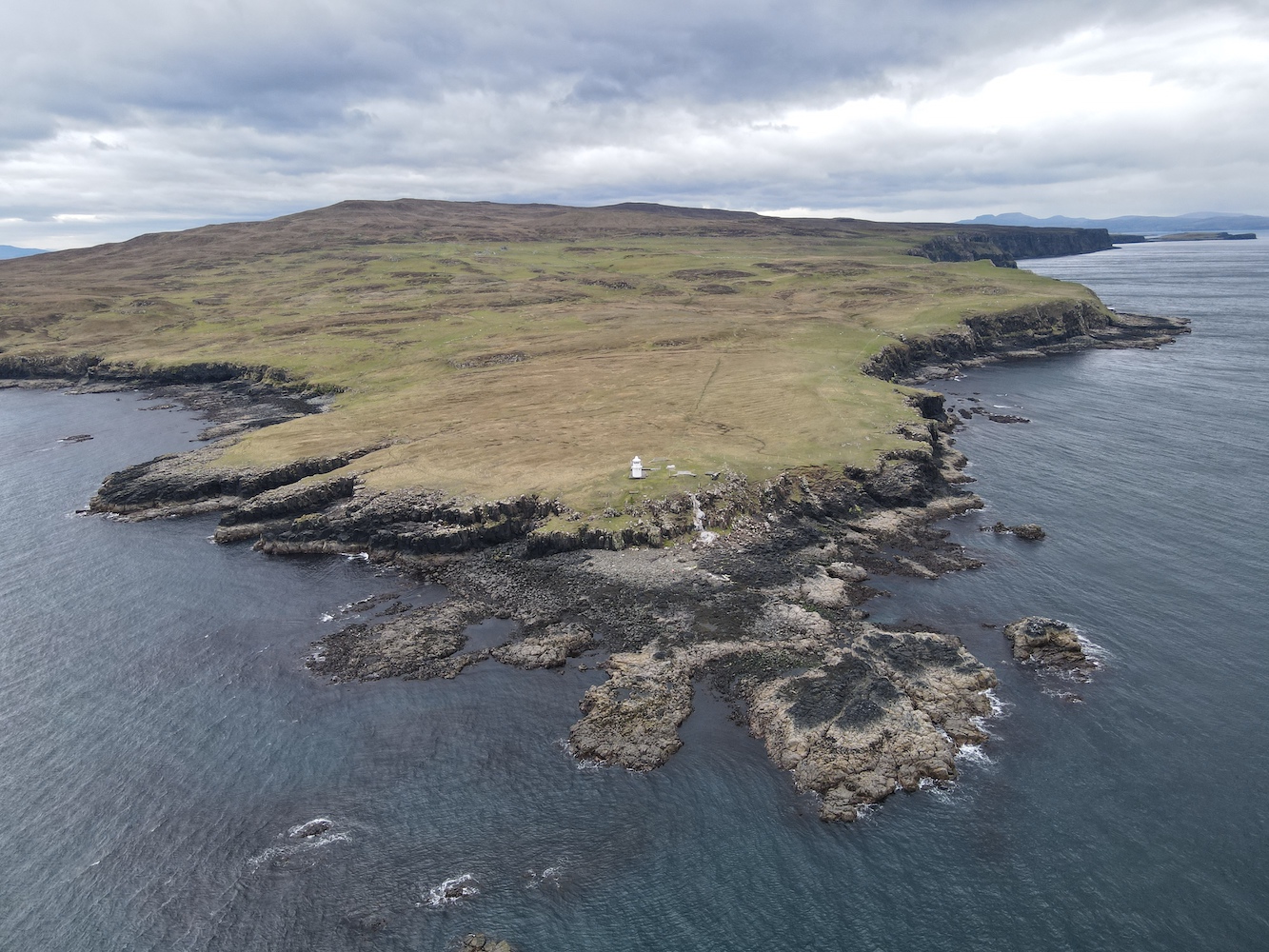
Waternish Point from above
A fabulous view of the Waternish (or Vaternish) peninsula
Just before we left I decided, for no apparent reason, to give the lighthouse a ‘high five’. Even as I was doing it I said ‘Can you give a lighthouse a high five?’ Anyway, I did. I even added a bonus ‘on the side’ high five! Then it was time to head back. The slog back up to the ruined house was tough. The energy from my lunch hadn’t quite kicked in at that point so I was slow and tired, and incredibly glad to get to the track when we eventually did. On the way we spotted a white-tailed eagle soaring around and being chased off by a smaller bird, who we imagined was defending its nest. There were also the remains of a small sheep and tiny lamb in the area, further evidence that we were on eagle hunting ground.
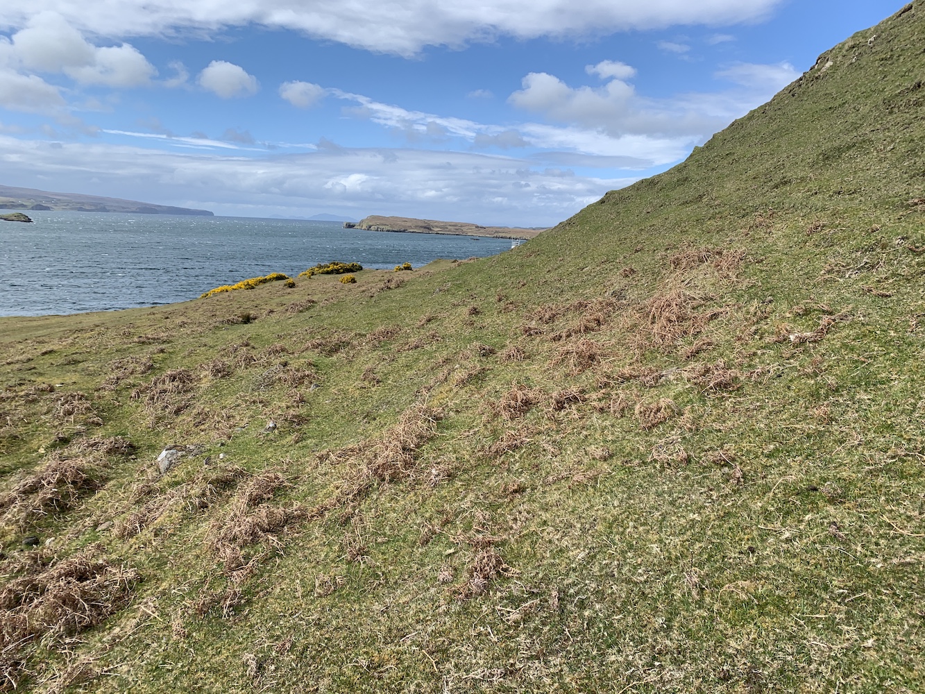
Back on the track we retraced our steps, with the wind and rain in our faces, we got to the bridge and left the track again. The cows were in roughly the same place as before, but had moved even closer to the track and so we strolled on quickly while we were in sight of them. The gaping chasm wasn’t quite so gaping on the way back (still a chasm though – and wet this time too). I had expected us to head for the track again once we were past the cows, but Bob thought we should continue to follow the coastal route. Imagining even more gaping chasms opening up in front of me, I reluctantly followed. I’m actually very glad we did as there were even more wonderful views to behold in the final section. We followed the coast as far as we could before heading slightly inland and following a fence line which took us directly to the gate. Just a bit more track to go, one more gate and then we were back at the car.
The view to the south west
A great combination of towering cliffs and low lying land
It had been quite a walk and I’d struggled a bit at times, mainly I think because of tiredness from the weekend’s adventures. It was so worth doing though and I would definitely recommend doing that coastal route to anyone visiting. It really is superb for impressive panoramic views. Just mind the gaping chasm! 🙂
In 2015 – almost exactly 6 years ago, in fact – we took a tour with Calum’s Seal Tours from Plockton for a closer look at Eilean a’Chait Lighthouse. Having done that trip it was one I thought I’d never manage to get a closer look at…
Fast forward to the week just gone when Bob said to me ‘Do you fancy going to Eilean a’Chait and landing?’ to which I obviously responded ‘Of course’. It was a few minutes later that he announced we’d be going by kayak. There have been a few occasions when Bob has made announcements like this and a wave of dread has swept over me. The first time it was skiing (which I didn’t enjoy so much), the second time was going up in a tiny helicopter to fly over Mew Island (which I thought was great fun in the end, Bob thought otherwise, especially when I took control of the steering!), and the last time was a skid control driving course, which was frightening. Nevertheless, each time I did them and accepted that I was being forced out of my comfort zone. This time I knew would be no different and I just had to get on with it.
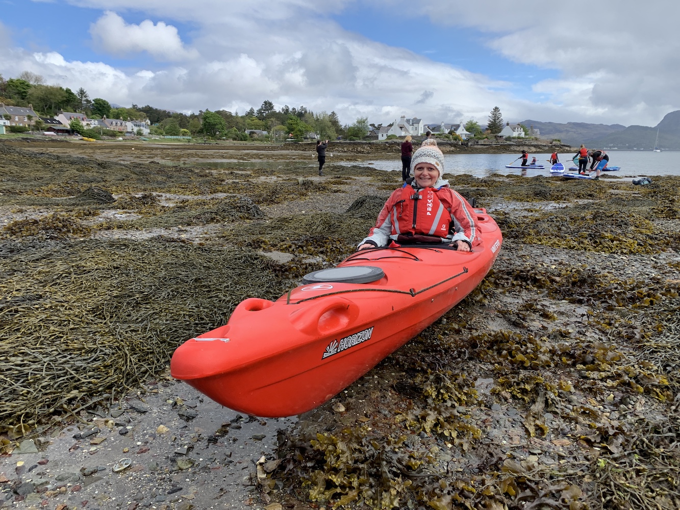
We arrived in Plockton this morning ready to meet Willie from Sea to Skye and our fellow novice kayakers for an introduction to kayaking course. Bob had hired a double kayak for us and made Willie aware that our key priority was to get out to and landed on Eilean a’Chait.
One of many things I’ve learned from today is that kayaking takes preparation time. You don’t just turn up, jump into the kayak and go so there was plenty of time for me to stand around thinking ‘Can we just get this over with?’ After some really handy advice on how to get into the kayak, paddling techniques, and what to do if you capsize (terrifying!) we were ready to go and off we set.
Trying out the kayak
We spent a while in the harbour at Plockton just having a try before Bob and I were sent off with a couple of the guides to head straight for the lighthouse. It was actually really quite relaxing, apart from the occasions when Bob decided to paddle like there was no tomorrow and any attempt I made to paddle along was lost in the midst of his frantic oar-use.
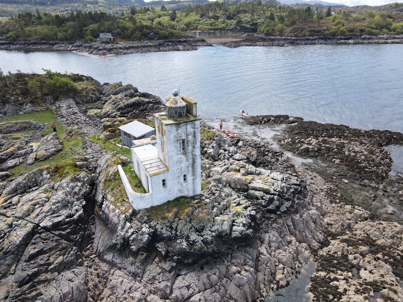
After a while the lighthouse came into view as we neared the neighbouring island of Eilean-an-Duine, which is where the house for the former keepers’ family is located. The house can still be seen today and at low tide it is possible to wade between the two islands. This time we were aiming straight for the lighthouse though and we found a nice little seaweed pool to stop alongside the rocks and haul ourselves out of the kayak. It was a bit of a scramble to get up to the grass at the top of the island and there is actually very little grass there, but the barnacles on the rocks were great for grip even if they were a little rough on the skin.
Approaching Eilean a’chait Lighthouse
Eilean a’Chait Lighthouse, or Plockton Lighthouse as some call it, is looking a little worse for wear. It’s now privately owned and there is some evidence that work has been done here to renovate it, but maybe that the work has come to a bit of a standstill. I am told that it was open as a holiday let some years ago.
A closer view of the Eilean a’Chait lantern
The lighthouse actually had quite a short-lived period as an active aid to navigation. It was built around 1880, 10 years after the train connection between Dingwall and Stromeferry was introduced. From Stromeferry people could catch a steamer from the pier over to Skye and this light was deemed necessarily for the steamers to navigate the surrounding waters safely. There are varying accounts of when the light was deactivated, with one source citing 1904 and another the 1920s. Either way its discontinuation ties in with the further extension of the railway to Kyle of Lochalsh, which provided a much shorter ferry route to Skye.
Eilean a’Chait Lighthouse
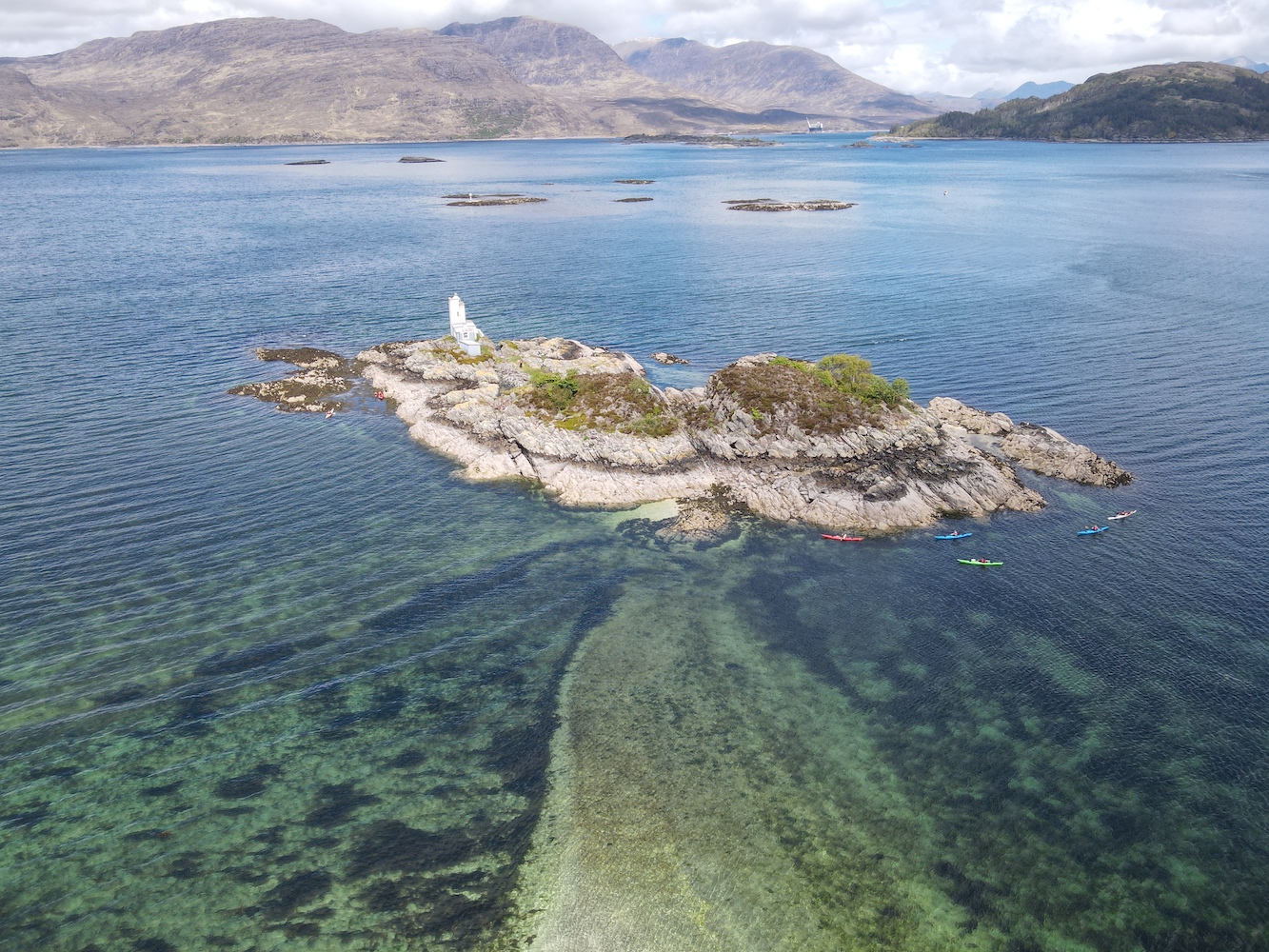
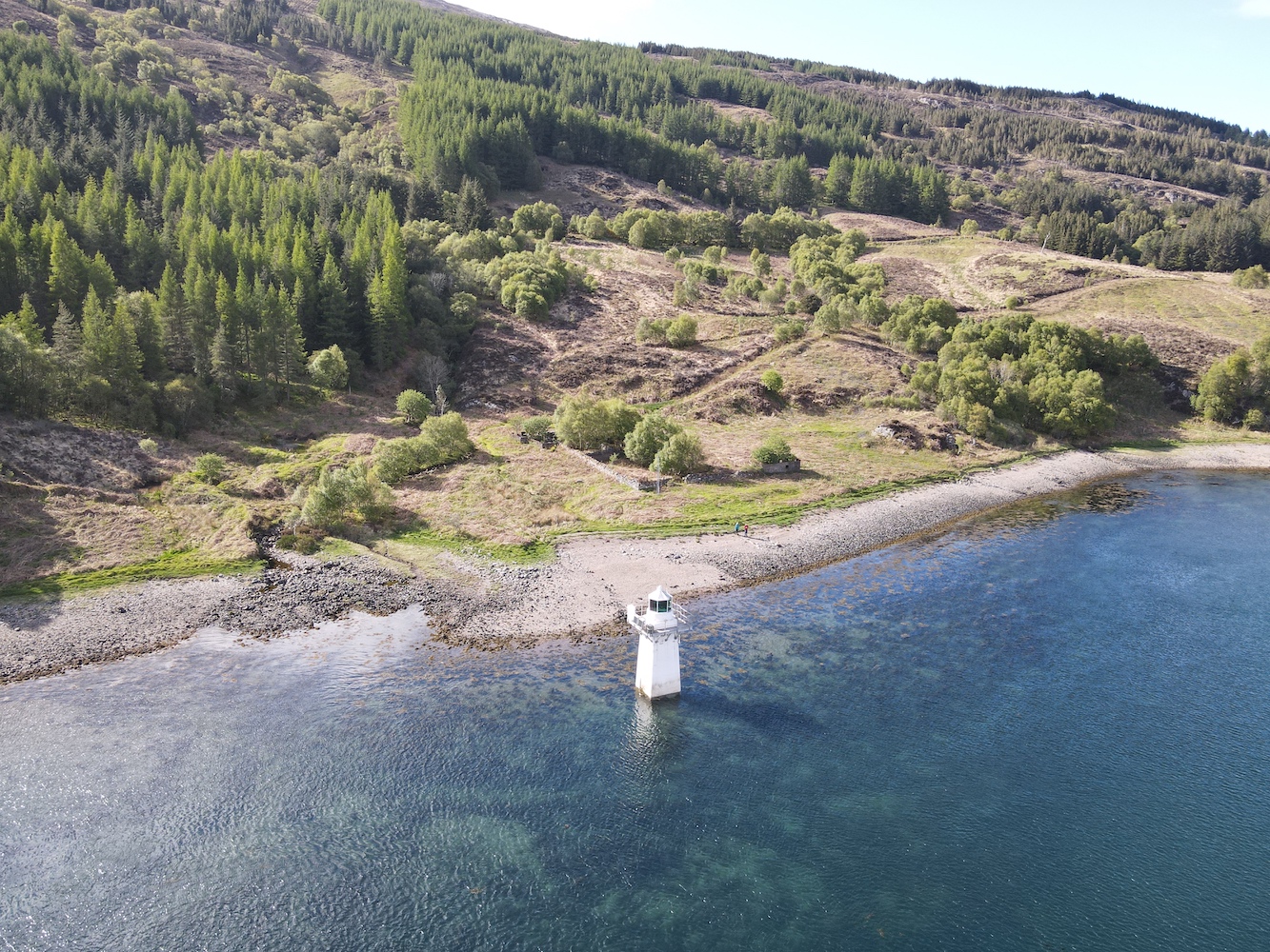
The two of us explored the island for a while as our fellow kayakers glided across the calm sea surrounding it. It’s a really interesting island and was also great to see it from above with some Joe the Drone images, including one which clearly shows the shallow the sandbank between Eilean a’Chait and Eilean-an-Duine.
The sandbank leading from Eilean a’Chait to Eilean-an-Duine is visible here
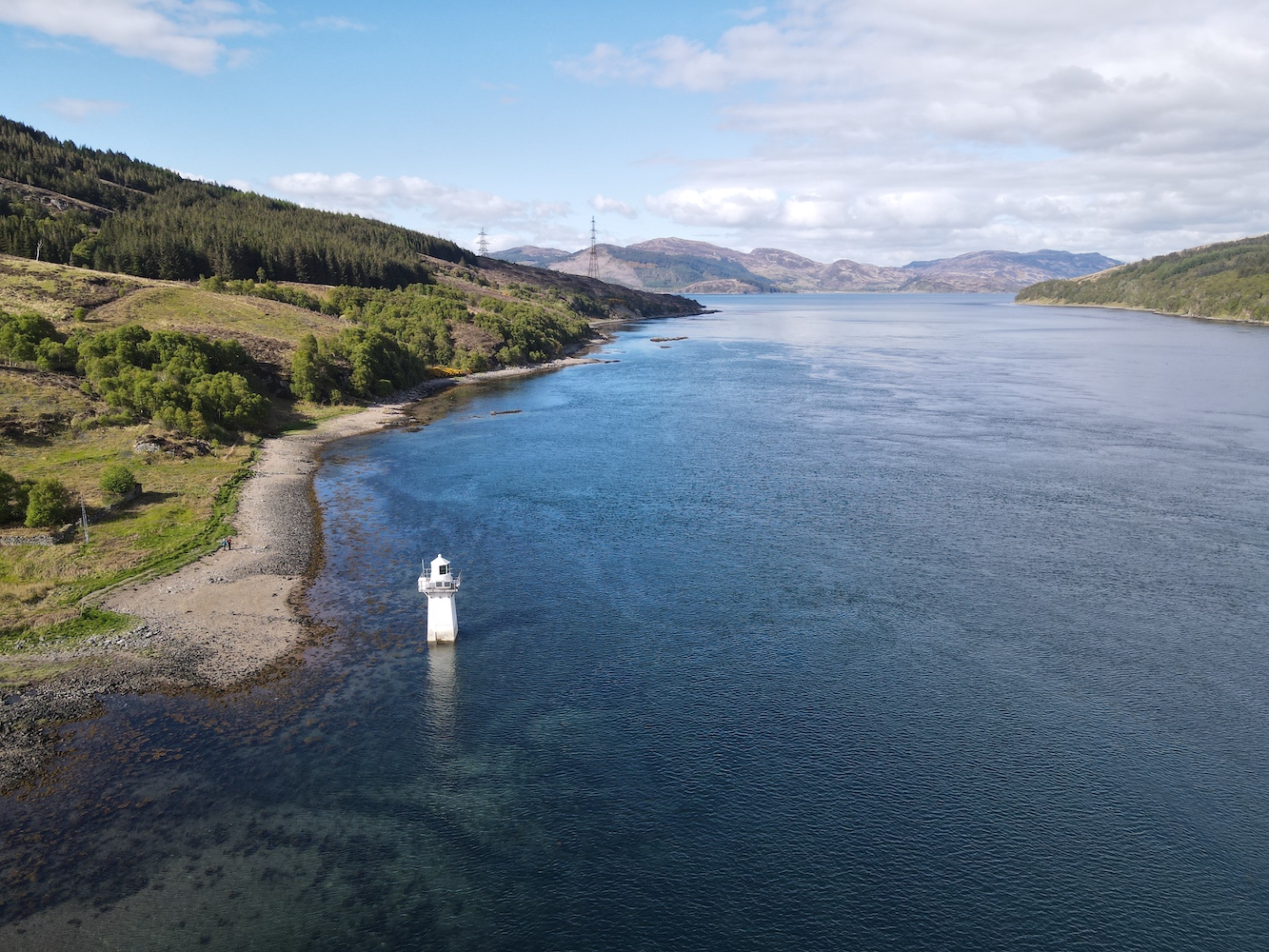
Another angle from Joe the Drone
After a while I made my way back to the kayak while Bob quickly bagged the island high point. Once we were safely back in the kayak we set off to meet the others for lunch on a beach to the west. It was a good opportunity to have a chat with Willie, the other guides and others in the group. Willie explained that when he’d heard that a lighthouse bagger was coming along he thought I must be mad, but he actually admitted that having talked about lighthouses for a while he could understand the appeal.
Continuing further west it was getting quite choppy on the water and paddling was getting much harder. Turning back we were told to aim for the lighthouse, which was just fine with me. Bob and I returned to shore with Chris the guide while the others continued on for a bit longer. Frankly I was pretty tired by that point and felt the need to stretch my legs. It was an excellent adventure and I was nicely surprised that I felt very safe out in the kayak and that getting into and out of it during the day was actually not as challenging as I’d expected. Kayaking would certainly be something I’d be up for doing again – so well done to Willie and his team (and to Bob of course) for making it such an enjoyable day out.
This picture shows Eilean a’Chait in the foreground with the other islands we kayaked around today beyond
By the time we were back in the car and heading off I was pretty worn out, but there was still work to be done. We’d decided to use the afternoon to catch the turntable ferry from Glenelg to Kylerhea and then see if we could touch the little Kylerhea Lighthouse. We were looking forward to a cup of tea in the old Sandaig Islands Lighthouse, now positioned just at the top of the ferry slipway, but sadly the flasks were no longer there and it looks like a tea room has opened nearby instead.
The old Sandaig Islands Lighthouse – with it’s light on!
While we waited for the ferry Joe the Drone took another spin.
The Glenelg turntable ferry slipway and the old Sandaig Islands Lighthouse
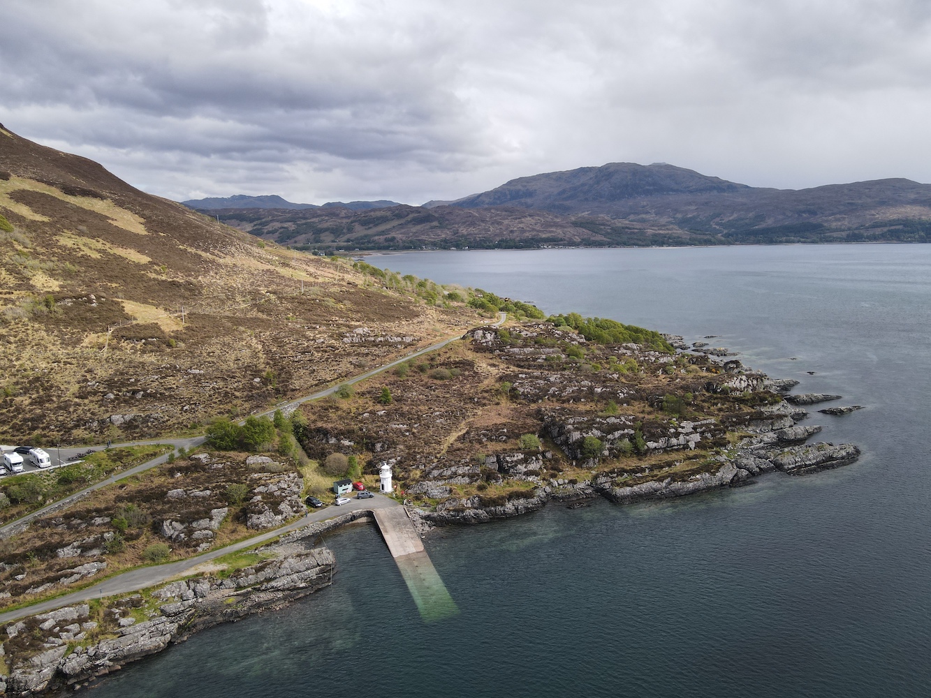
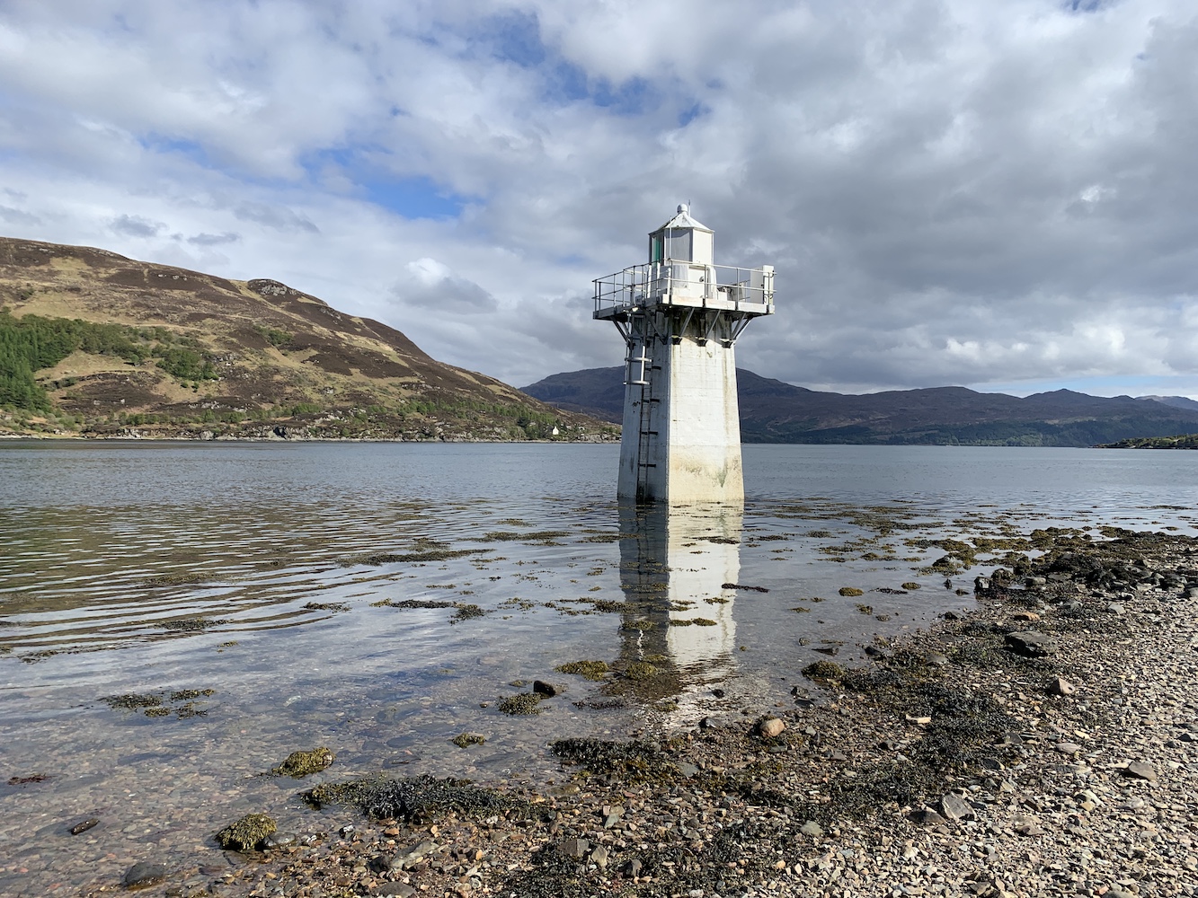
Once in Kylerhea we headed for the car park for the bird/nature hide, which is a good (or probably the only) starting point for walking to the lighthouse. Last time we visited part of the path down to the shore had been washed away so we weren’t able to get so close. This time though we followed the little track down to the pebbly beach. It was only an hour after high tide so I couldn’t touch the lighthouse, but it was nice to see it much closer than before anyway.
Kyle Rhea Lighthouse
If I’d been willing to wait another hour I might have been able to touch Kyle Rhea Lighthouse
It was also another outing for Joe too.
Some very relaxed seals were quite happy on a rock near Kyle Rhea Lighthouse
A bird’s eye view of Kyle Rhea Lighthouse
Kyle Rhea Lighthouse seen from the south
It would have been rude not to have given Joe the chance to clap eyes on the beauty that is Ornsay lighthouse when we are staying so close to it, so we made one final stop on the way back.
It’s not possible to photograph Ornsay Lighthouse from a bad angle. I think the shape of the island is like a crocodile!
Ornsay Lighthouse with the wonderful mountainous backdrop
It’s been a thoroughly exhausting day, but also great fun. Don’t tell Bob, but I’m quite glad he organised the trip. 🙂
A few years ago Skye became the place to be on my birthday, but it’s now been a while since I spent any length of time there – and birthdays were taken up with other trips like 2019’s Sule Skerry extravaganza!
This meant I still had a couple of lighthouses left unvisited on Skye. A long-awaited return was in order and there was no way I was going to turn down a weekend there.
Today was the day to set off. Nana was in position to take over child management at home (thanks Nana!). There was the usual packing at the last minute, throwing stuff into the car and then saying ‘have we got everything?’ This is especially the case at the moment after not being away much at all over the past year.
The journey felt long today, but we finally made it to Skye. That’s always only part of the journey though. I always forget just how big the island is and sometime later we were still in the car heading towards Dunvegan.
I’d found a walk report on the Walkhighlands website that took in Dunvegan Lighthouse at Uiginish Point, just to the north west of Dunvegan. This was really handy as, although we had Bob’s GPS device with us, it told us a particular gate we needed to go through (climb over) to be on the right side of the fence for the lighthouse.
The view from the starting point, across the loch to Dunvegan Castle
Parking up just before Uiginish Farmhouse, we wrapped up warm as the northerly breeze was fairly strong and chilly. We set off through the farm, passing Uiginish Lodge, which is painted incredibly bright white. There’s a nice track along here and, while we were on the lookout for cattle making an appearance, we only encountered sheep.
The first part of the walk follows the track
The Walkhighlands report advised that when you reach two gates you should go through the one on the left. This was great advice as the lighthouse is one of those you can’t see until you are near enough at it, so being on the right side of the fence when it’s easy enough to do so is always helpful.
The point at which you leave the track and choose the gate on the left
Bob, as usual, took the high route with the excuse that he was looking out to see if there were any cattle about. I wandered along a much less resistant route and enjoyed the views to the west across to a little bay with some stunning cliffs beyond.
The beautiful view to the west
The lighthouse soon came into sight and we battled into the breeze to get to it. It is one of the flat-pack kind and, boy, was the wind whistling through it today! When you see it on a map it looks like it could be a nice sheltered spot nestled there in Loch Dunvegan, but don’t be fooled, especially when the wind is coming from the north. It was great to look across and see the entrance to Loch Dunvegan and The Minch beyond. To the east there are good views across to Dunvegan Castle. It’s a superb spot for panoramic views.
The first glimpse of Dunvegan Lighthouse
Made it to Dunvegan Lighthouse
There’s some quite dramatic scenery in the area
Dunvegan Lighthouse looking out towards the entrance to Loch Dunvegan
There’s not a lot of information out there about Dunvegan Lighthouse. A Google search brings up lots of links to, relatively, nearby Neist Point and a search for Uiginish Point instead doesn’t fare much better. It is clear that the lighthouse is used to help guide vessels safely out of the Minch and into Loch Dunvegan. It is also used by vessels negotiating the route between Uiginish Point itself and the nearby island of Gairbh Eilean. My research has shown that in the 1890s steamers bound for the Western Isles stopped off in Dunvegan and this continued until the 1950s, which would explain why a Northern Lighthouse Board light would be required in this area. The lighthouses installed by the NLB were generally those that provided some sort of national importance, such as ferry and general shipping routes, while the lighting of harbours for local fishing, for example, fell to the local harbour authorities.
The view from the top of the lump behind the lighthouse
The walk back from the lighthouse was rather more pleasant without the wind in our faces and there ended a rather nice little wander and a great new bag for me.
I have got a little behind with these posts due to having too much fun on the West Coast Adventure. On Saturday, day three of the adventure, we had another lighthouse and island-filled time. Setting off from Kilchoan it was only a short journey to our first stop, Ardmore Point on the north coast of Mull. The sun was already shining bright and the sea was fairly calm, which made landing on the rocks below the lighthouse straightforward. The lighthouse sits a little way up from the sea so we needed to find an appropriate route up, which was a bit of a struggle for me – although Bob was leading the way so I really just needed to follow him. John joined us too and it was only after we’d spent a while clambering up onto the rough grass that we spotted the skipper hopping across the rocks and taking what looked like a much more direct route. I didn’t enjoy the walk to the lighthouse, but as usual the lighthouse managed to cheer me up. Although the tower itself is a standard flat-pack (with multitudes of solar panels), it differs from most others in that it is accompanied by an extra little building.
Ardmore Point lighthouse
Returning to the ‘mothership’ we set off again. We’d planned to head out to the Cairns of Coll, but a storm was forecast for the afternoon so we weren’t sure if it would be worthwhile. As it turned out the storm never reached us (or passed over the night before), so we decided to attempt it. Waving to Ardnamurchan on the way, we began the journey out to the north end of Coll. On our trip last year, we had been to the Cairns of Coll, but had not been able to land on the lighthouse island, Suil Ghorm, from the RIB we had been on due to the shallowness of the water. As we arrived at the island group it became fairly clear that we would be unsuccessful again. A couple of members of the group attempted a landing on a neighbouring island, which didn’t go particularly well so the decision was taken to abandon any attempt to land. Skipper Derek from North Coast Seatours did sail as far around the lighthouse as he was able to though so we could get some good pictures. It was nice to see it again even if it wasn’t as closely as we’d hoped.
Cairns of Coll lighthouse
The Small Isles were our next destination. I was looking forward to this as it included a stop at Eilean Chathastail, home to Eigg lighthouse. I’d been here with Bob and a group of island baggers back in 2015 and absolutely loved it. It’s the type of lighthouse I am very fond of and the opportunity to revisit was one I jumped at the chance of. It was also one that John had been wanting to visit too as he’d previously only seen it from the sea. With the storm nowhere to be seen and the sea calm, there was no problem at all with landing on the north west of the island. This was a little different to last time when we landed on the east coast of the island, closer to the lighthouse. This did mean we’d need to walk a bit further and I was glad that Bob had offered the use of his GPS device as it kept us on track for getting to the lighthouse. As it is set down a little from the highest ground on the island it is difficult to see from the north of the island until you are almost at it. The walk wasn’t too bad and we were rewarded with some fantastic views when we got to the lighthouse. We could see across to the pencil-looking Ardnamurchan lighthouse, this time to the south west, standing tall. I was reminded again of how calm the place feels and I enjoyed the visit as much, if not more, than the first one.
Eigg lighthouse
After lunch at the cafe on Eigg, we continued our journey north. We were soon approaching Skye and we sailed close to the flat-pack lighthouse at the Point of Sleat. It’s quite a walk to the lighthouse, but an interesting one as explained in my post from 2016. Certainly much easier to visit/see from the sea!
Point of Sleat lighthouse
I’d been looking forward to our next stop and I felt a little bit like a child in the back of a car as we sailed up the east coast of Skye. I had to stop myself a few times from asking “Are we nearly there yet?” On my original tour I’d seen Ornsay lighthouse from the village of Isleornsay when the tide had been in. On the second visit, Bob and I had walked out to it at low tide, and a last visit a few weeks ago was again just a quick stop looking across the water to the island of Ornsay and it’s tiny neighbour Eilean Sionnach, the island with the lighthouse. I wrote a fair amount about the beauty of the lighthouse in a recent post so I won’t go into too much detail in that respect this time. However, I was intrigued to see whether the lighthouse would lose any of its beauty for other angles. With the mountains as the backdrop from the general viewing area, I was concerned that it was just that view that made it so stunning. I am happy to confirm that there was no need for concern. I’m not sure what it is about the lighthouse, but it is amazing whichever side you see it from. Of course, with conditions being so calm, we had to land on the island for another opportunity to see it close up. While the sky at Ornsay lighthouse always seems to have been blue when I have visited, it was bluer than ever this time with a few clouds for added effect. I could have happily stayed there for hours and if the cottages ever come up for sale, well… I think the picture below says it all really.
Ornsay lighthouse
I’ve got a bit carried away and not yet mentioned the Ornsay Beacon Lighthouse, which we actually visit in the small tender before landing at the big lighthouse. Although, from a distance, it doesn’t look like there is much to this one, when you see it close up it’s far more substantial. It is a solid round stone tower topped with one level of the flat-pack arrangement. Of particular note though is that, everywhere else, the flat-pack has a square footprint, but this one has rounded edges. It’s a good structure and really nice to get a chance to see it at close range. This is why I enjoy getting closer to this type as it is difficult to appreciate them from a distance when they all look pretty much the same. You also don’t get a true feel for the location unless you are on the island they sit on or very close to it. This one was great to see.
Ornsay Beacon lighthouse
Once the island baggers had bashed their way to the high points of a number of islands as we moved further north, we arrived at the Sandaig Islands. The Sandaig lighthouse is on Eilean Mor which, unlike most of the other islands within the group, is not accessible from the mainland at low tide. As the group were all looking to achieve different things on these islands, only a few of us were dropped off on Eilean Mor. With Bob joining us a little later, John took on the role of lead navigator, establishing whether attempting to walk along the rocks or across the island was the better route. Opting for the more foliage-filled option it wasn’t too long before John spotted a series of wooden posts sticking out of the ground that seemed to lead in the direction of the lighthouse. The path that these posts followed was quite good in places and a little rougher in others, but we were definitely glad to have found it. As we approached the lighthouse John joked that Bob was likely to just turn up around the corner at any moment and then, as if by magic, he appeared strolling across the rocks. I’ve taken to referring to Bob fondly as ‘Goat Legs’ on these trips due to his ability to make any walk across any terrain like like a stroll in the park. This is another brilliant island and so it was a pleasure to visit the flat-pack structure. I must admit though that it would have been nice to have seen the old lighthouse (now located at Glenelg pier – see my earlier post for more information on that one) in place, but still a great place to visit. Once we’d finished at the lighthouse we followed the posts across the island and to a little sheltered rocky bay. The three of us sat, chatting in the sunshine surrounded by beautiful views, while we waited to be collected.
Sandaig Island lighthouse
That was the end of our lighthouse adventures for the day. Glenelg was where we based ourselves that night. What a wonderful day we all had. While a large percentage of the UK was experiencing the wrath of Storm Hannah, we had avoided it entirely. What a lucky bunch we were 🙂
If you were based on the north coast and travelling home from Fort William which way would you go? Probably the A82 and then the A9 I would imagine. We’ve done that route many times and there’s nothing wrong with it at all, it’s quite beautiful in places, although it can get quite busy in the summer months. There may be other slightly more convoluted routes available, but one you’d possibly not choose to take would be via Skye.
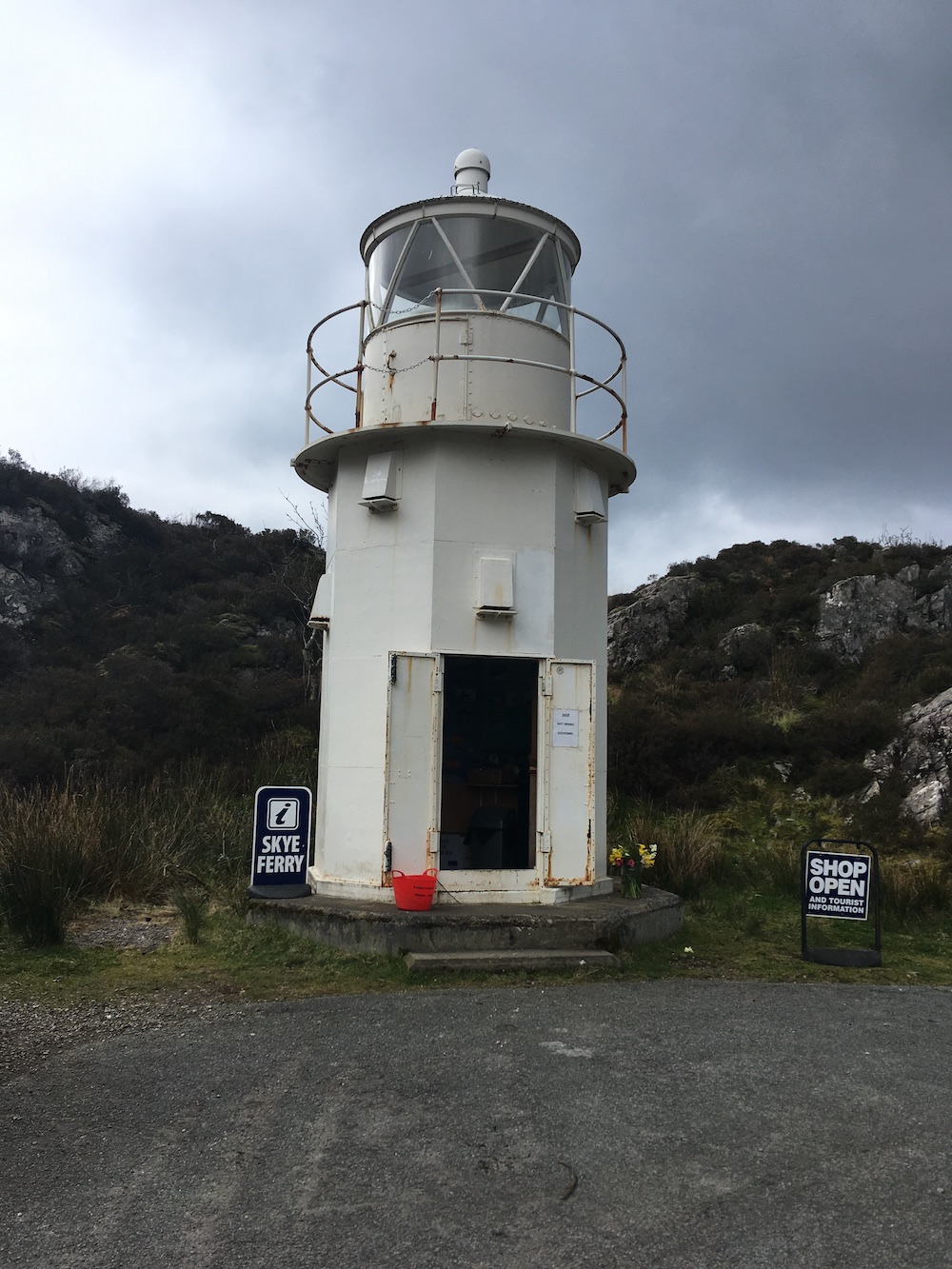
Anyone who knows Bob will know that he rarely takes the path of least resistance, and today was a perfect example of that. But it was all fine because the reason for going that way was to pay a visit to the old Sandaig lighthouse, which is now located near the Glenelg-Kylerhea ferry. The lighthouse is really quite easy to access, you can either drive right up to it or take the ferry across from Kylerhea to see it. I had done neither and had just seen it from the other side of the water at Kylerhea a couple of times.
Setting off from Fort William, the first leg of the trip involved getting across to Mallaig for the ferry to Armadale. I booked it on the way there to avoid getting all of the way there to find it was fully booked. The joy of technology! We managed to get on an earlier ferry and in just over half an hour we were on Skye.
I think Skye is a wonderful place, but it is vast. While many might think that it’s just an island it can’t take that long to visit everything, I have found that no matter how many times I’ve been, there is still something left to see ‘next time’. It really is a massive island. Today though, we were just spending a short time on it, but fortunately that short time involved passing by the village of Isleornsay. Anyone who has spent any length of time visiting Scottish lighthouses will know the lighthouse on (and this is where it gets complicated) the islet of Eilean Sionnach, a tidal island off of the island of Ornsay which itself is a tidal island off of Isleornsay. Now, whoever decided to put a lighthouse in that particular location – I’m going for David and/or Thomas Stevenson – must have known that they were about to create what is, in my opinion, one of the most beautiful views in Scotland. Some might say they wouldn’t have thought of that, but I think they must have done. Or even if they hadn’t they would have stood back at the end and said to each other “Well that was definitely worth the effort”!
Ornsay lighthouse
Continuing back up the main road we spotted the Ornsay East Rock light, which I hope to get a closer view of later this month – a very exciting trip coming up so look out for reports of that in a few weeks’ time!
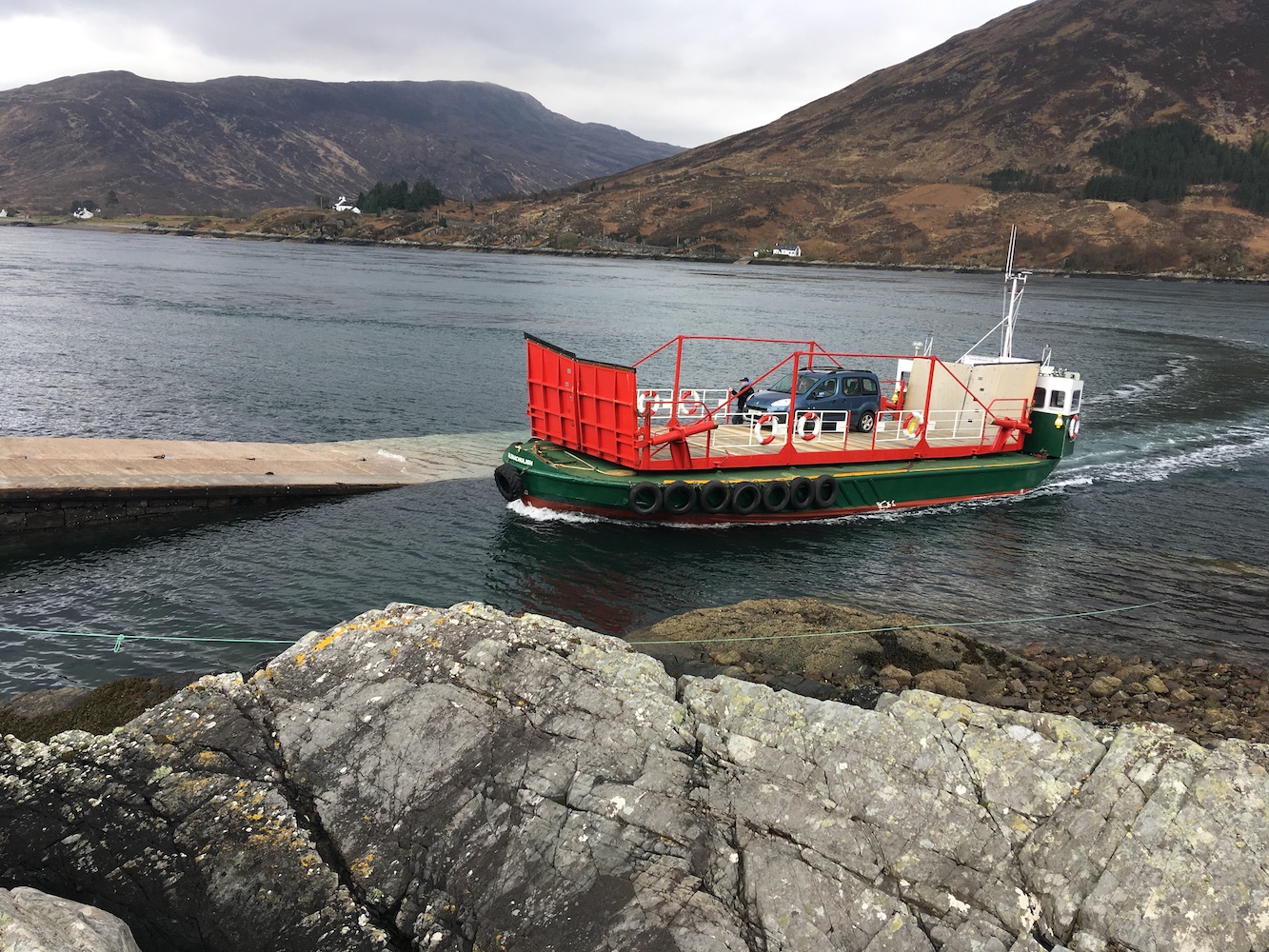
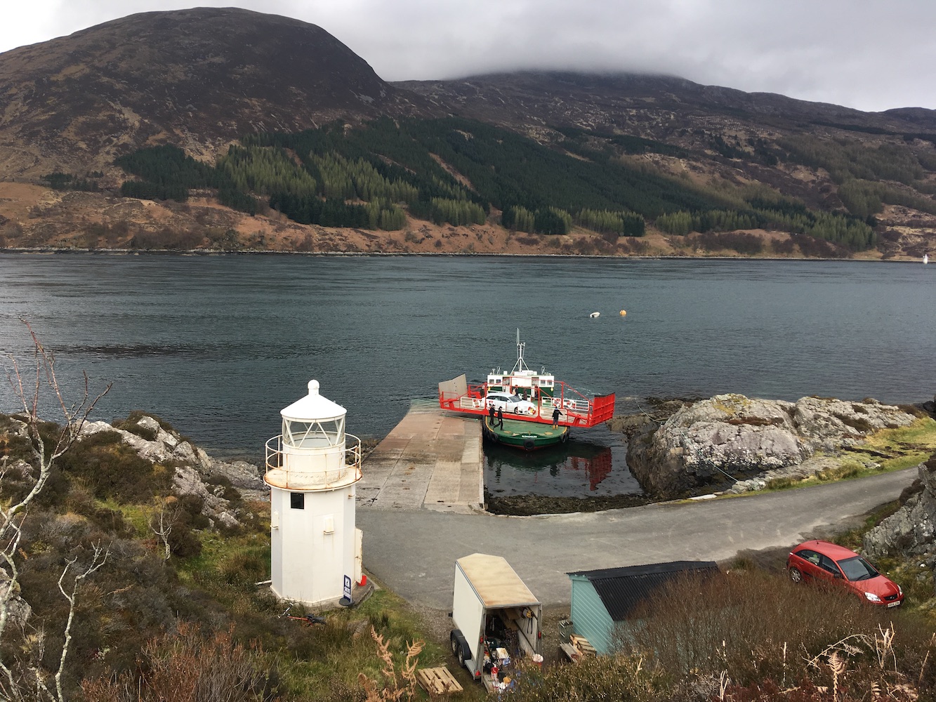
A while later we arrived at the ferry at Kylerhea. From here it is possible to see the Kylerhea light to the north and the object of my attention today, the old Sandaig light, just across the water. The Glenelg ferry, a turntable ferry, is fascinating to watch, such a clever invention and not one I’d seen in action before. The ferry only started running for the season yesterday so that was lucky!
The turntable Glenelg-Kylerhea ferry
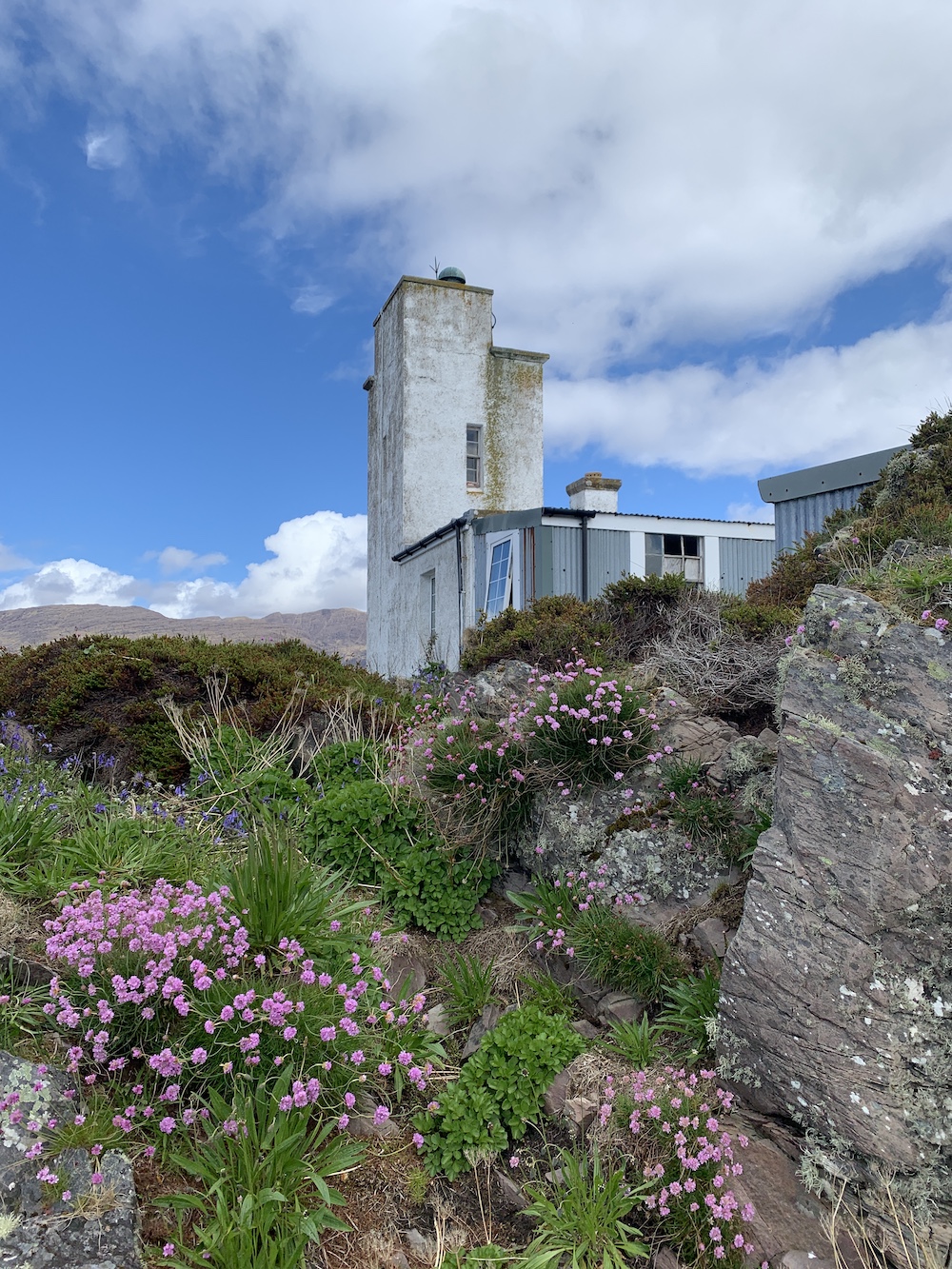
As we approached Glenelg on the ferry I got particularly excited as the lighthouse doors were open. I’d heard that it was possible to go inside and I’d had my fingers crossed that it was still the case, which it certainly is.
The old Sandaig lighthouse, now at Glenelg ferry
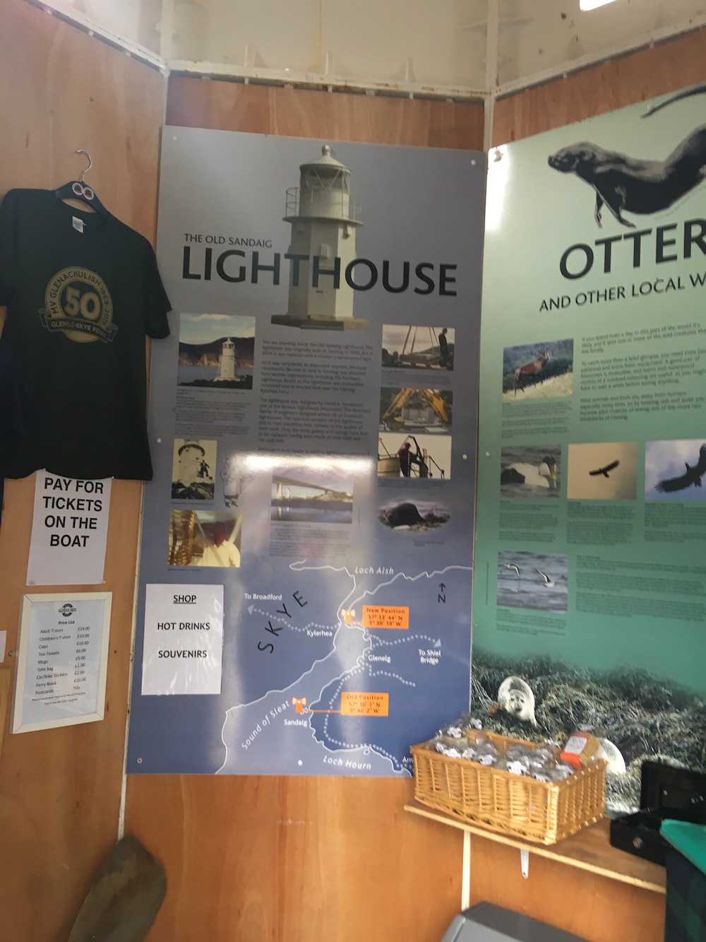
Now for the history bit and how the lighthouse came to be in it’s new home. The cast iron tower, designed by David A Stevenson, was constructed on one of the islands off of Sandaig around 5 miles to the south west of Glenelg in 1909. As is often the way, as technology progresses organisations are always looking at ways to reduce costs and replacing these structures was one of the ways the Northern Lighthouse Board (NLB) did this. The tower was replaced in 2004 and this is where the local community stepped in and said they wanted to keep the lighthouse and move it to is current location. The NLB were very helpful, firstly giving some money towards the project along with a number of other funders, and then supporting the relocation itself. After the light had been dismantled it was taken by the NLB to it’s Oban depot to be renovated before being delivered to Glenelg.
Inside the lighthouse
The lighthouse now contains the details of this process as well as information about the local area, including the turntable ferry. Various items are for sale there too, but of equal importance is the fact that you can get a cup of tea or coffee! It all works on an honesty box system. What a great place and a wonderful community effort.
The old Sandaig lighthouse with the turntable ferry in action
It is another picturesque location and the place has a good feel about it. Unfortunately not quite accessible enough to stop by for a cup of tea in passing regularly, but definitely somewhere I’d like to return to. Needless to say, I was very glad of our detour today 🙂