Two weeks ago we spent some time on Mull, staying in Tobermory. As soon as we left Oban on the ferry the lighthouse viewings began, with a glimpse of Dunollie beacon, just north of Oban, and the stunning Lismore lighthouse (more on that one in the next post).
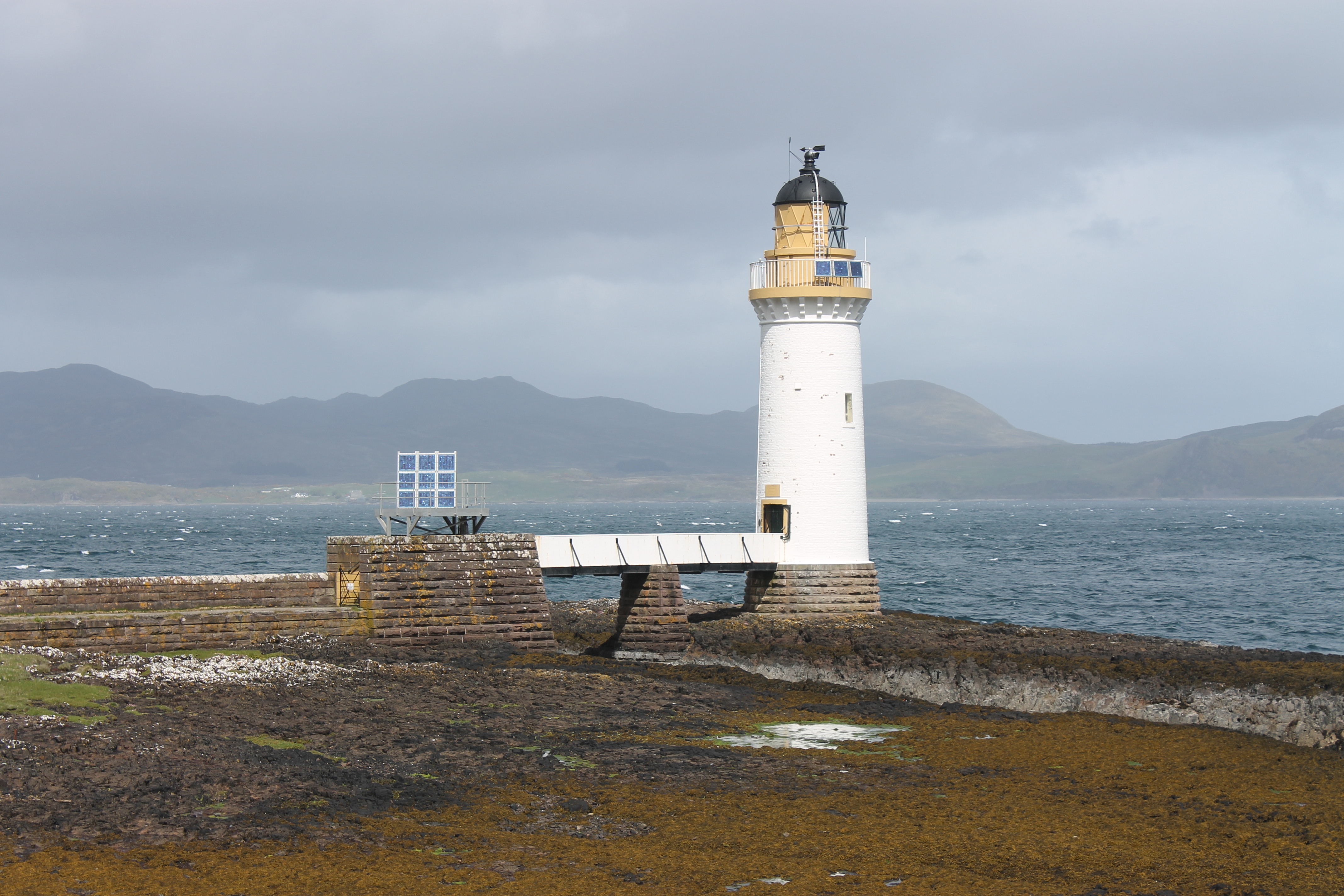
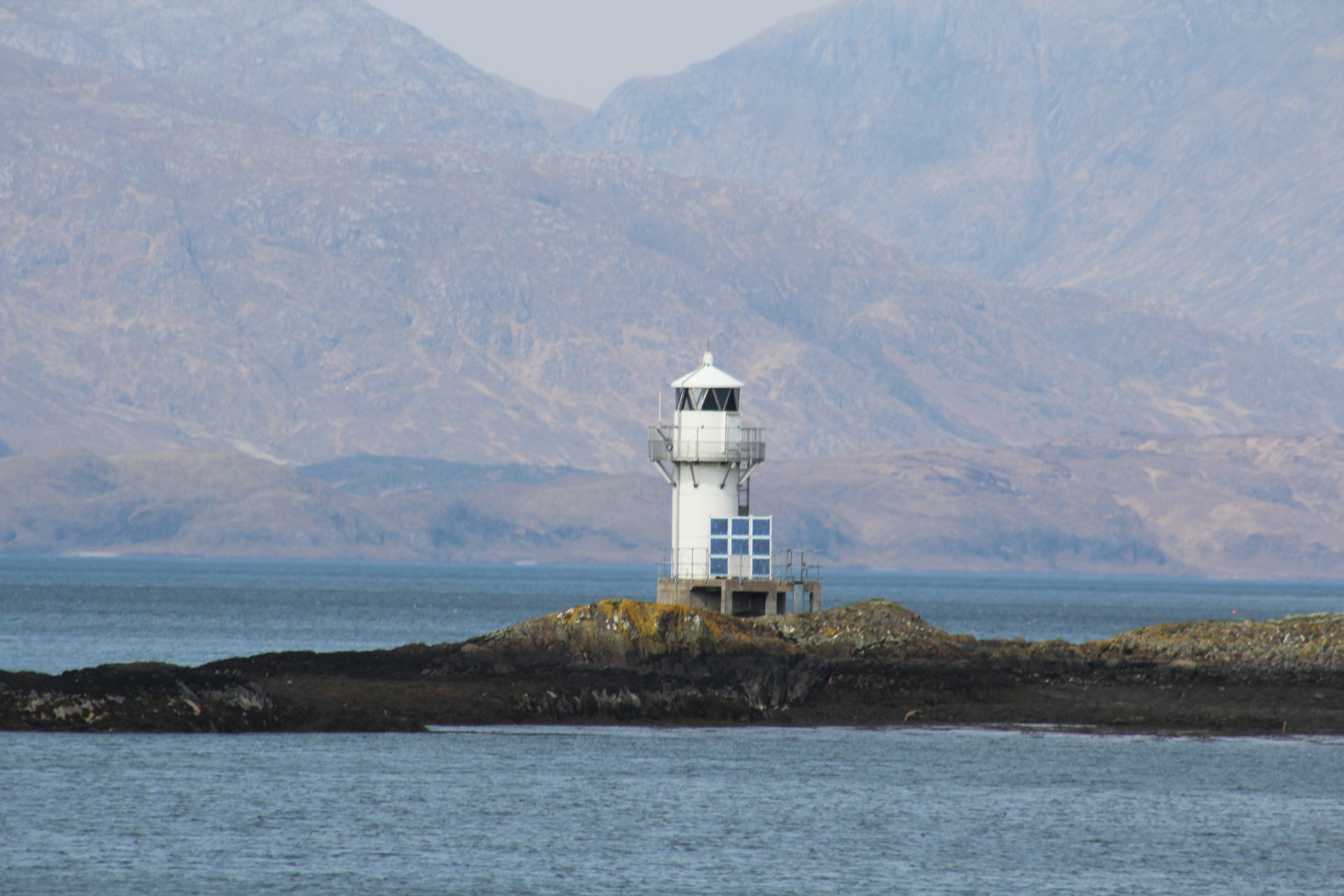
Rubha nan Gall lighthouse
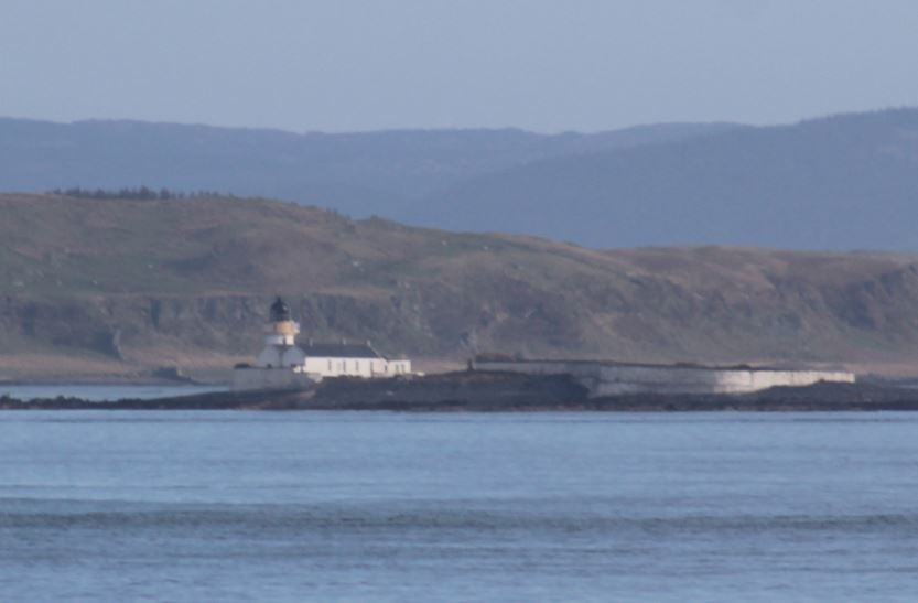
On our first full day we decided to risk getting a soaking by walking to Rubha nan Gall lighthouse to the north of Tobermory. Shortly after leaving the road and heading through the trees, we came across a sign telling us that the path ahead was closed. It was clear that no one had really taken much notice of the sign, so we pretended we hadn’t seen it and continued along the coastal route, which proved to be particularly muddy and narrow in places. It was quite a picturesque walk and we were fortunate not to be rained on. As we approached the lighthouse I remarked on how similar it looked to Eilean Ban lighthouse where we had stayed just a few weeks before. It’s not only the lighthouse that’s similar, but the access bridge as well. Unfortunately a high locked gate prevented us from reaching the tower, but we got some great views anyway from the pier leading to it. We spent a while sitting on the pier and enjoyed the emerging sun while we could, with views across to the Ardnamurchan peninsula. The walk back was equally enjoyable.
When we returned to Tobermory we stopped off at the town’s museum, where we found out about the story of Neptune II that set off on a 100 mile overnight journey from one port to another in Newfoundland in 1929. The ship was caught in a storm which caused them to endure a 48 day, 3,000 mile journey, during which they came across the lighthouses at Skerryvore, Dubh Artach and Ardnamurchan before setting foot on land again. We also found a little more information about the Rubha nan Gall lighthouse at the aquarium in Tobermory.
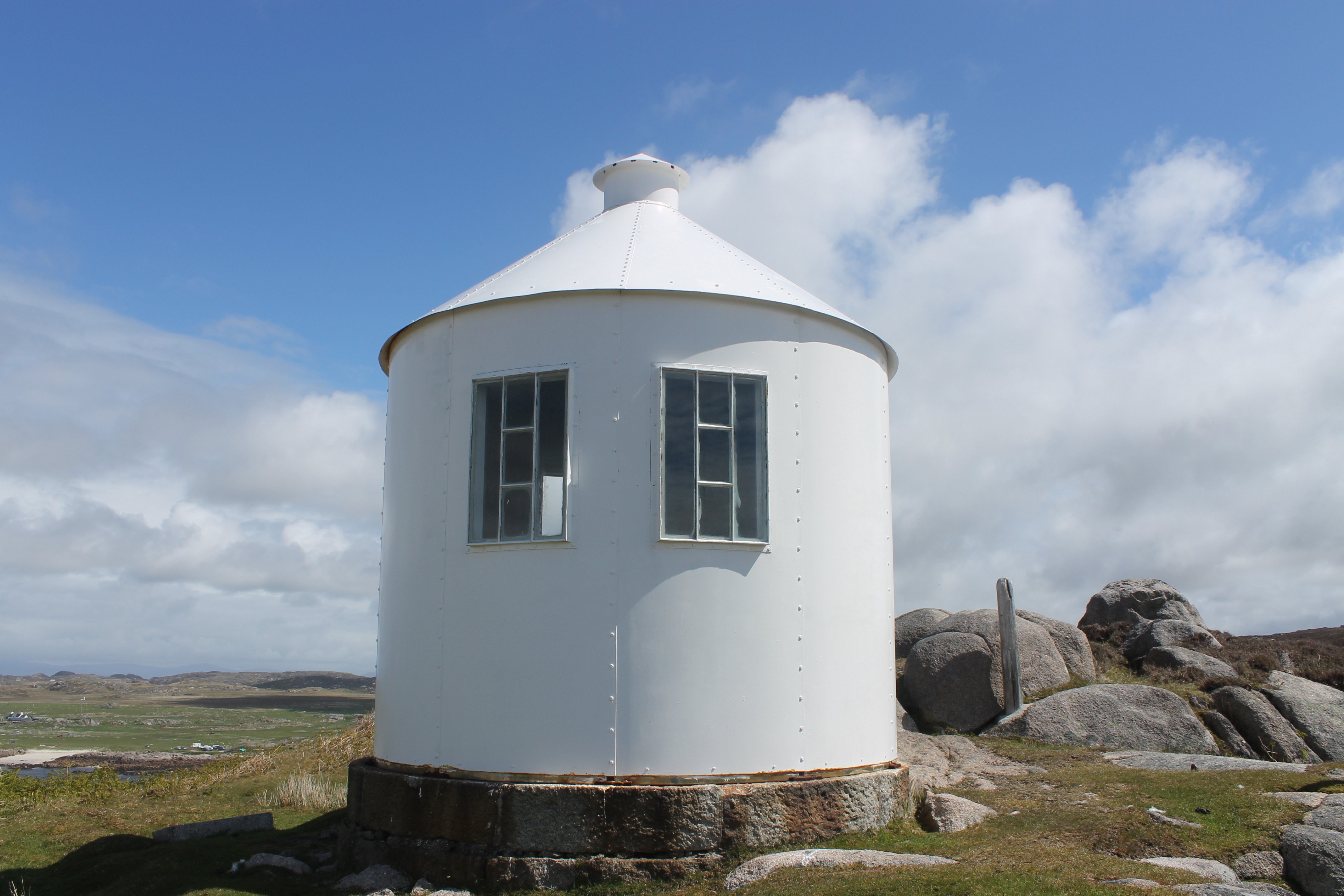
The observation tower on Erraid, with windows looking out towards Dubh Artach and Skerryvore
We spent an afternoon walking across to Erraid, a tidal island, and exploring the island. Erraid was used as a base for construction of the Dubh Artach lighthouse, including the quarrying of the granite for the tower. While the lighthouse was in operation, the keepers and their families lived on Erraid and the observation tower was also constructed. We visited the tower and were able to get a distance glance of Dubh Artach lighthouse (more on this one too in another post coming soon). Robert Louis Stevenson visited the island while his father was involved in constructing the lighthouse and set his novella ‘The Merry Men’ there as well as a chapter in ‘Kidnapped’. It’s a fantastic little island and even more enjoyable with the knowledge that you need to get back before the tide turns!
The beacon at Dunollie
Our final day on Mull was spent visiting Iona. On our return journey to Oban we noticed the Northern Lighthouse Board’s maintenance vessel, Pharos (which we had previously seen at Bell Rock and on our way out to St Kilda), parked up a short distance from the Oban ferry terminal. We took a drive up and noticed that the Northern Lighthouse Board have a terminal there, which is a base for their vessels, but also where passengers for the Hebridean Princess alight. On our way north to Appin, our base for the following week, we stopped to look at the Dunollie beacon a bit closer up.
The following week was a blur of boat trips, remote lighthouses and sunshine. More on this to follow soon! 🙂
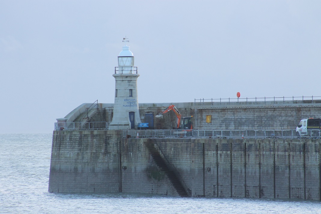
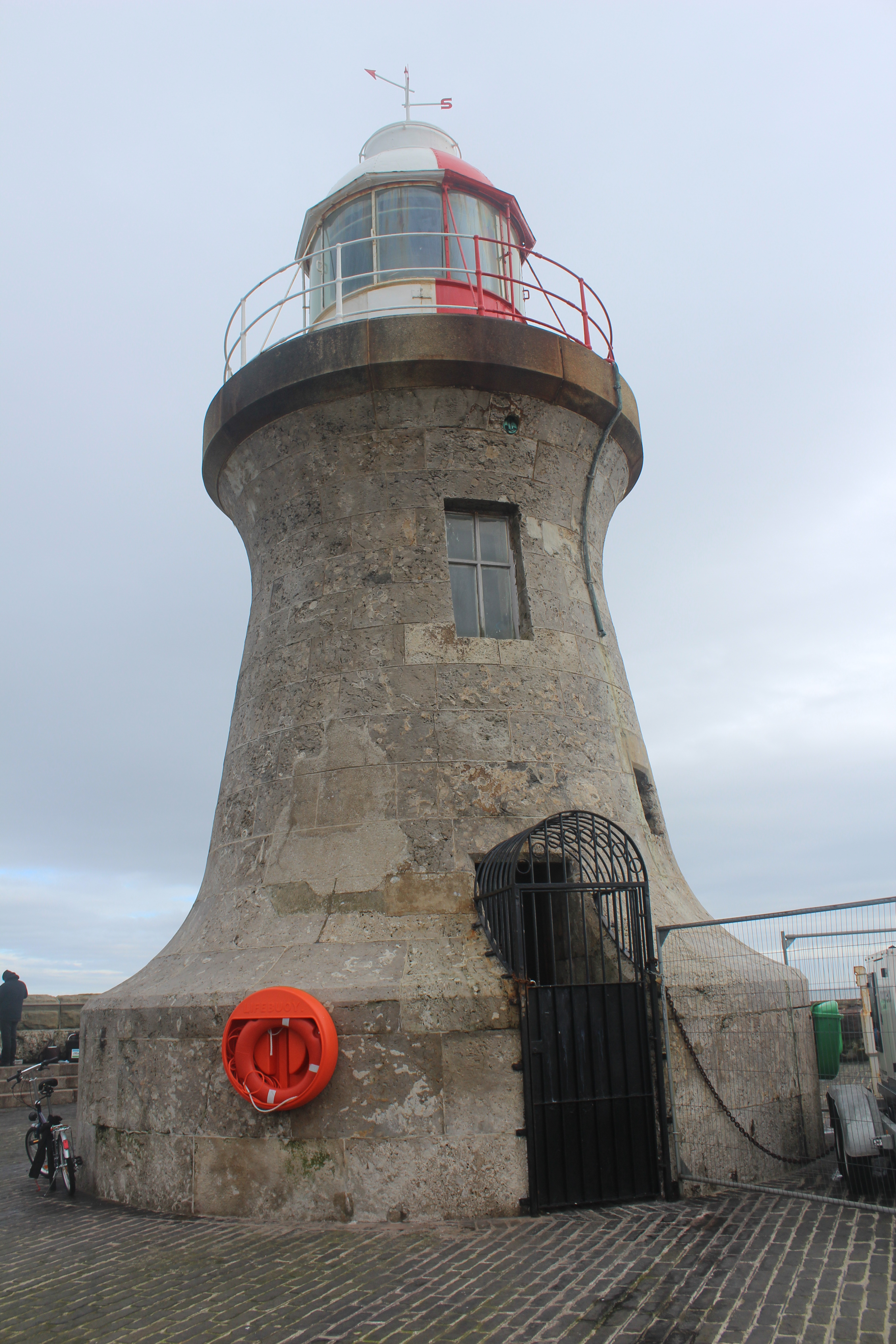
Through all of my travelling around the country visiting lighthouse, there was one in particular that I’d yet to reach and was standing out like a sore thumb on the mapping software I use to keep track of which I have been to and those I haven’t. This lighthouse sits on the end of the pier in Folkestone harbour. The closest I had come to seeing this one was my final stop at Dungeness on my lighthouse tour and also a trip over to Dover to see South Foreland and those around the Kent coast. Somehow it had been left out on both occasions and, not being a place I’d regularly go anywhere near, I wasn’t sure when I would get the opportunity to see it. Fortunately, during a visit to the Isle of Wight in January, we had a morning to spare before we had to head north, so we made a bit of a detour during our trip from Gatwick Airport to Lancaster – by, of course, heading in completely the wrong direction. Luckily, getting to Folkestone from Gatwick is very straightforward so we had no issues finding the pier – we’d also planned ahead and printed maps which helped.
Folkestone harbour lighthouse
The pier itself is currently closed to the public (a Kent Online article from last July may explain why it is currently not accessible), so we were not able to approach the lighthouse itself and had to settle for a view of it from the entrance to the pier. It’s quite an attractive structure with a weather vane sitting on top and the words ‘Weather is a Third to Place and Time’ painted in blue on the side of the tower. At the time we didn’t pay much attention to this, but having done some research into why these words appear on the lighthouse, I’ve found out that they were part of a piece written by Ian Hamilton Finlay, an artist/poet who died in 2006. According to the Folkestone Triennial website, where there is more information, these words are “a practical reminder of how important the weather is to all who work at sea. It also suggests how the weather – onto which we tend to project our moods – colours in and gives meaning to the two dimensions of our normal self-awareness: place and time.” It’s nice to see an added dimension to a lighthouse visit – even if you don’t really notice it at the time. It would be nice to visit again some time, although I’ve mentioned before that it’s taken me a few years to finally get there!
The old lighthouse at Glasson Dock
After we’d left Folkestone we headed for Lancaster, our stop for the night. The following morning we were racing against the weather, which was due to turn bad throughout the day so we were keen to reach Ayrshire (where Bob’s parents live) at a reasonable time. However, it was of great importance that we did a little “tidying up” in the area before leaving Lancaster. On my original tour back in 2012 I’d attempted to visit the lighthouse at Glasson Dock, but had been unsuccessful, mainly due to it being a weekend and access being restricted. Having Bob (and more detailed maps) with me this time, I thought we probably stood a better chance of finding it and it turned out it wasn’t so difficult. It was second time lucky with this one and we were able to get a good view of it. In its day it may have been quite a nice little building with a prominent position, but now it is completely overshadowed by a huge building and is looking very derelict and forgotten. You will see from the picture above that it’s not a typical lighthouse and we were very intrigued by its history, so I set about trying to find out something about it while we headed north. There’s not a lot of information available, but from the Panoramio website I was able to find out that it was built in the late 18th century and registered as a grade II listed building in 1985. It’s such a shame that it’s now been left to serve very little – if any – purpose and is unlikely to attract any interest now that it is surrounded by such huge buildings, which I believe were built and are owned by Glasson Fertilizers.
I’m not sure if we’ll have another lighthouse adventure before May now, but if we do I’ll be sure to report on it. Otherwise, it’ll be news from trips we have lined up to Skye and Mull as well as a number of boat trips in May and June. We hope to get to Dubh Artach and Oigh Sgier lighthouses, weather-permitting! 🙂
Just under two weeks ago we welcomed a very new addition to the UK lighthouse tour – our son Seumas!
For the nine months leading up to Seumas’s birth, we visited a number of lighthouses, including a tour of Kinnaird Head lighthouse where we purchased a certificate to prove that he (in the womb) had climbed to the top of the lighthouse.
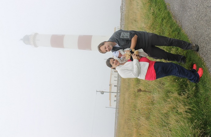
Of course, it was never going to be long before Seumas visited his first ever lighthouse after joining us in the outside world. Although we were all keen to be home after being released from Raigmore Hospital, we made the effort and took a slight detour to Tarbet Ness lighthouse. Although it was just as misty as the first time I’d visited this lighthouse, we managed to get a family picture including Seumas’s Association of Lighthouse Keepers teddy bear.
As you might expect, we already have plans to help Seumas to visit some more lighthouses in the coming months. We’ve also received some fantastic lighthouse gifts for him, including matching lighthouse jumper, hat and mittens from Bob’s mum as well as a knitted lighthouse, and I managed to find a lighthouse sleepsuit for him too.
Let’s hope he grows up to appreciate lighthouses just as much as his parents do. On the other hand, he could just find it all completely embarrassing as he gets older! Only time will tell!
The day after we arrived home we had a visit from Martyn who I had met on my lighthouse tour back in 2012. Martyn is walking around the coast of the UK and I met him at a B&B in Withernsea. He got in touch to say that he had reached the north coast of Scotland and we arranged for him to stop by the house on his way from Strathy to Dunnet. It was good to see him again and introduce him to Bob, as well as Seumas, of course. He is progressing well around the coast and has some big plans for taking his walk further afield once he is done with the mainland.
So, it’s been a life-changing month, but certainly the beginning of (what we hope will be) a new chapter of adventures with our little boy in tow! 🙂
Having been a fan of lighthouses for many years, but never having been to any events or lighthouse locations specifically for International Lighthouse and Lightship Weekend (the third weekend in August), we decided it was about time I did!
On my tour I’d stopped at Noss Head Lighthouse, just to the north of Wick (so not quite so far from home this time), but Bob had informed me since that there was an exhibition relating to the old optic at Wick Heritage Centre. So, taking advantage of the fact that it was that particular weekend, we set off to visit the Centre.
Rather than going straight there we took a small detour and stopped off for lunch at the Whaligoe Steps Café, just a short distance down the road from Wick. They serve some fantastic soup there and I’ve not yet managed to encourage myself to try anything else there as I enjoy the soup (and homemade bread) so much.
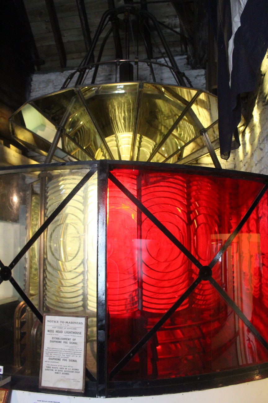
The old optic from Noss Head lighthouse
Arriving at the Heritage Centre, we were given a short introductory walk around and while the staff member strolled on through the lighthouse exhibition saying only ‘This is the lighthouse exhibition’, we made a mental note of where our first stop would be. The story behind the lighthouse optic now being at Wick Heritage Centre is that when the lighthouse was de-manned and automated in 1981, the plan was to just scrap the old optic and replace it with new technology. Fortunately Maisie Sutherland, a founder member of the Wick Society, stepped in and organised for the optic to be delivered to and displayed inside the Heritage Centre. So, we have Maisie to thank for allowing many people to continue to enjoy the optic and (I suppose for many), it is the only chance they will get to see what the Fresnel lens looks like close up. They’ve got lots of other lighthouse and maritime memorabilia there too and it’s great that it’s being preserved.
From the Heritage Centre we drove north to see Noss Head lighthouse itself. On the way we stopped for tea and cake at Rivendell’s Rumblin Tum Café, which was a great little place we’d never discovered before. The owner not only runs the café, but also makes some fantastic wooden carvings and can do personalised carvings too. A wonderful little discovery for us!
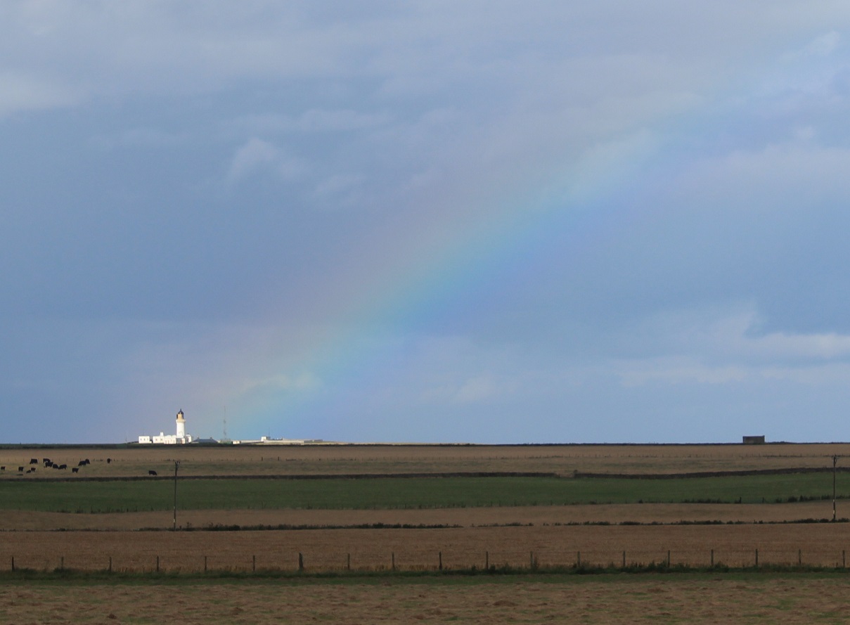
The lighthouse at the end of the rainbow
At Noss Head we weren’t able to get close to the lighthouse itself, but could see it from the car park. It was looking lovely in the sunshine when we arrived. We decided to take the opportunity to stroll along to Castle Sinclair Girnigoe while we were in the area. We’d spotted it a number of times from the road, but never been close so it seemed like the perfect opportunity. Some areas of the castle have been cordoned off, clearly for safety reasons, and it does look like work had begun at some point to maintain it, but much of it is now in ruin and there’s no sign of a roof anymore. Still a really interesting place to look around and the cliffs surrounding it are stunning.
As we headed back to the car the rain began and we were treated to a lovely view of Noss Head lighthouse with a rainbow coming out of it! At least that’s what I saw anyway! 🙂
Another day of lighthouses and tourist activities lay ahead of us on the Western Isles and, once again, the sun was out. We were intrigued to find out more about and visit the beach on which the Lewis Chessmen had been found centuries ago. On our way there we passed a merry band of scarecrows (or figures) at the side of the road that we had previously seen on our first day. We stopped to see them and I partook in some pretend drumming alongside the piper and accordion player.
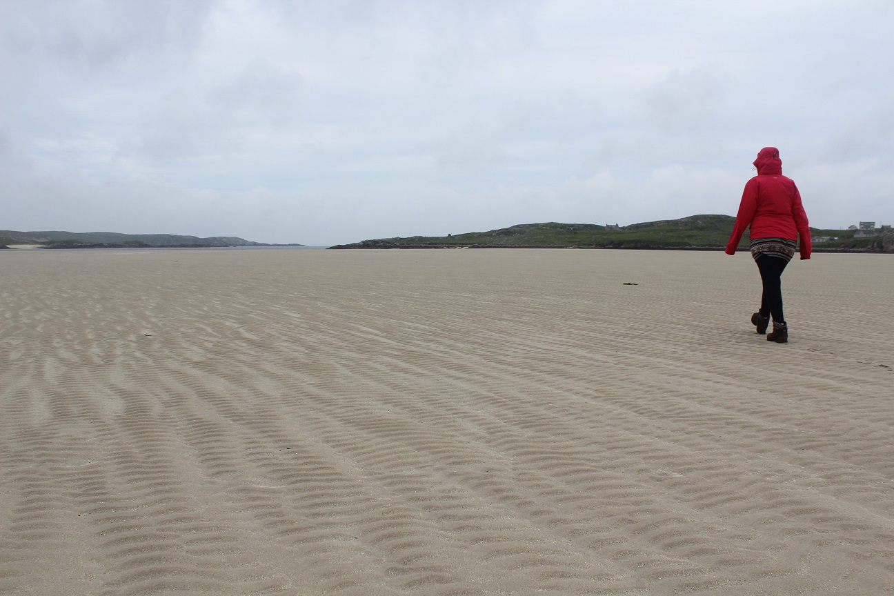
A long stroll out to the sea at Uig beach
We travelled on to Uig, spotting a couple of large sculpted chess men replicas on the way there, and arrived at the biggest beach I’ve ever seen. Although it’s not the widest beach, with the tide out it was quite a walk to reach the sea and we were cautious not to spend too long near the water’s edge in case the tide started coming in quickly as we’d have had a long way to run back to shore! We followed this walk up with a stop off at the museum and café in Uig. There was a little more information about the chessmen at the museum, but also some really interesting exhibit pieces showing what life was like for those living on Lewis in the past.
As always, Bob was looking for an opportunity to do some hill-bagging while we were there. His previous trips to the Western Isles had mostly comprised of travelling on to somewhere else or hillwalking so he was enjoying being a bit of a tourist for once. However, we couldn’t go to Lewis without bagging one of its hills. Reaching the top of the hill turned out to be a lot easier than though in the end as a road led us almost up to the top, so all we had to do was climb one set of steps before we reached the peak where there was some fantastic views of the surrounding area on Lewis and other islands nearby.
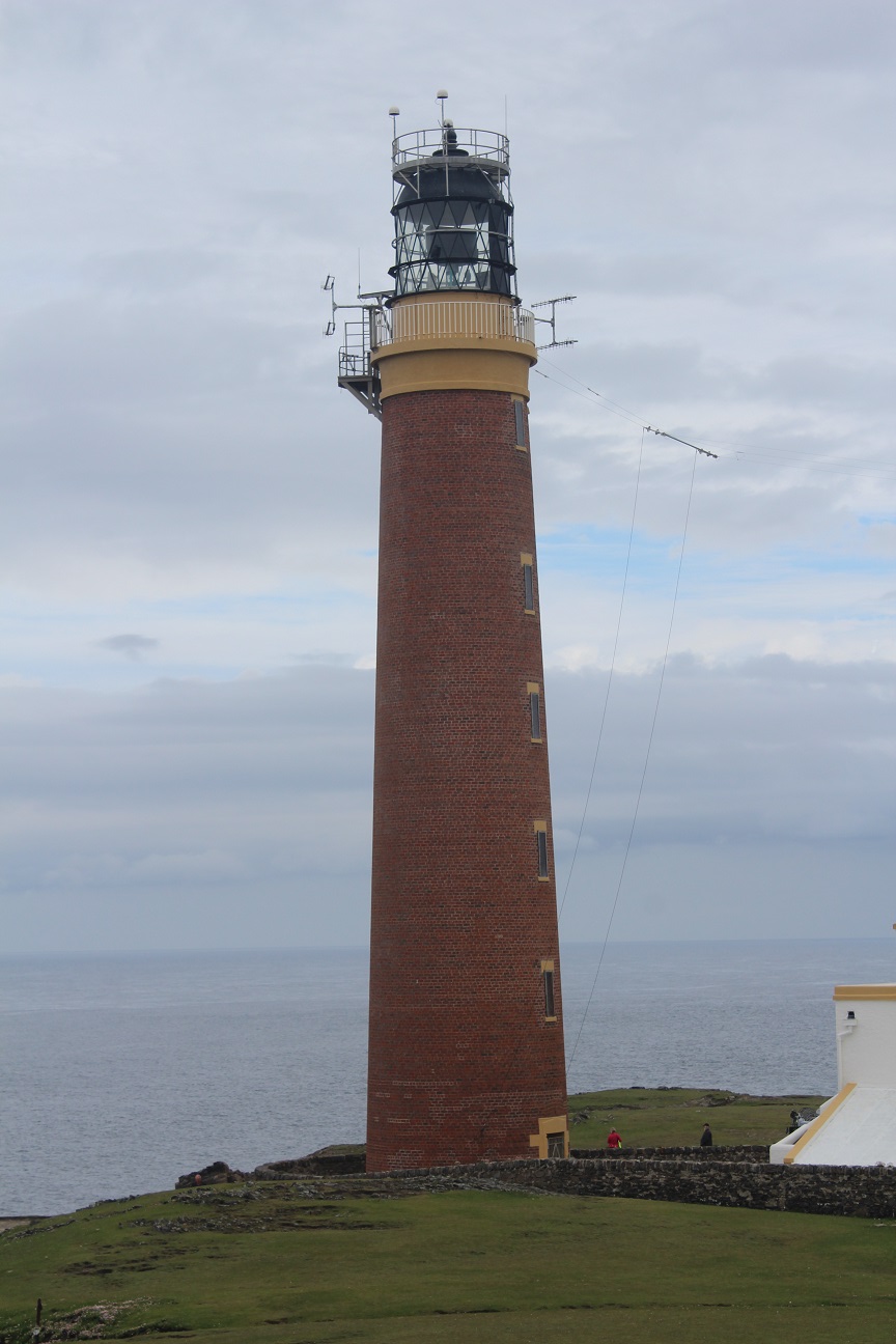
The lighthouse at the Butt of Lewis
Knowing that the Callanish standing stones were a popular attraction on Lewis we decided to pay them a brief visit and return later that day when the tourists were gone. The weather had gone downhill slightly during the day, so we had a quick look around at the stones before heading for our very exciting next stop – the Butt of Lewis. We’d both seen some fantastic pictures and videos of the lighthouse at the Butt of Lewis with massive waves crashing up above the high cliffs there, but there was nothing of that on the day we visited. There is a real sense when you get there that you are at the end of the road and there’s not a lot between the cliffs there and Iceland, although we were surprised to see how close we were to Cape Wrath and, therefore, home! It was great to see another different style of lighthouse, which itself (in my opinion) doesn’t look dissimilar to a chess piece. It’s natural brickwork with no white paint in sight (on the tower anyway) made it stand out from the rest. We enjoyed wandering around the impressive coastline there for a while and seeing the huge cliffs, which seem to dwarf the lighthouse in places. I was surprised at how many people there were walking around, although it did look like there was at least one group of adventurers around and I imagine it might be one of those places where you would choose to start or end some sort of endurance challenge. On our return from the Butt of Lewis we stopped at the Eoropie Tearoom for a drink and I was delighted to see, just along the road that someone had some small handmade stone structures outside of their house, one of which was a lighthouse with an operational light – I’m very easily influenced by these things!
Callanish standing stones
On our way back towards the Callanish standing stones we stopped off at a single standing stone a short distance off of the main road. We also decided, allowing the tourists to have fully disappeared from the standing stones, to stop for dinner at the Doune Braes Hotel where we had some amazing food. I’d definitely recommend it to anyone visiting Lewis. We then had free reign at the impressive Callanish standing stones when we arrived. It is a fantastic site with the cross-shaped layout of the stones and the circle in the centre. If only we were able to travel back in time to see its development!
Before we called it a night and headed back to the campsite in Siabost, we popped in to see Dun Carloway, an old broch tower (an Iron Age dry stone structure). Although it’s old, we were still able to climb some of the original steps and it was another example of a site that has clearly been well-maintained without it looking too well-maintained. The Western Isles are very good at that!
The Norse mill
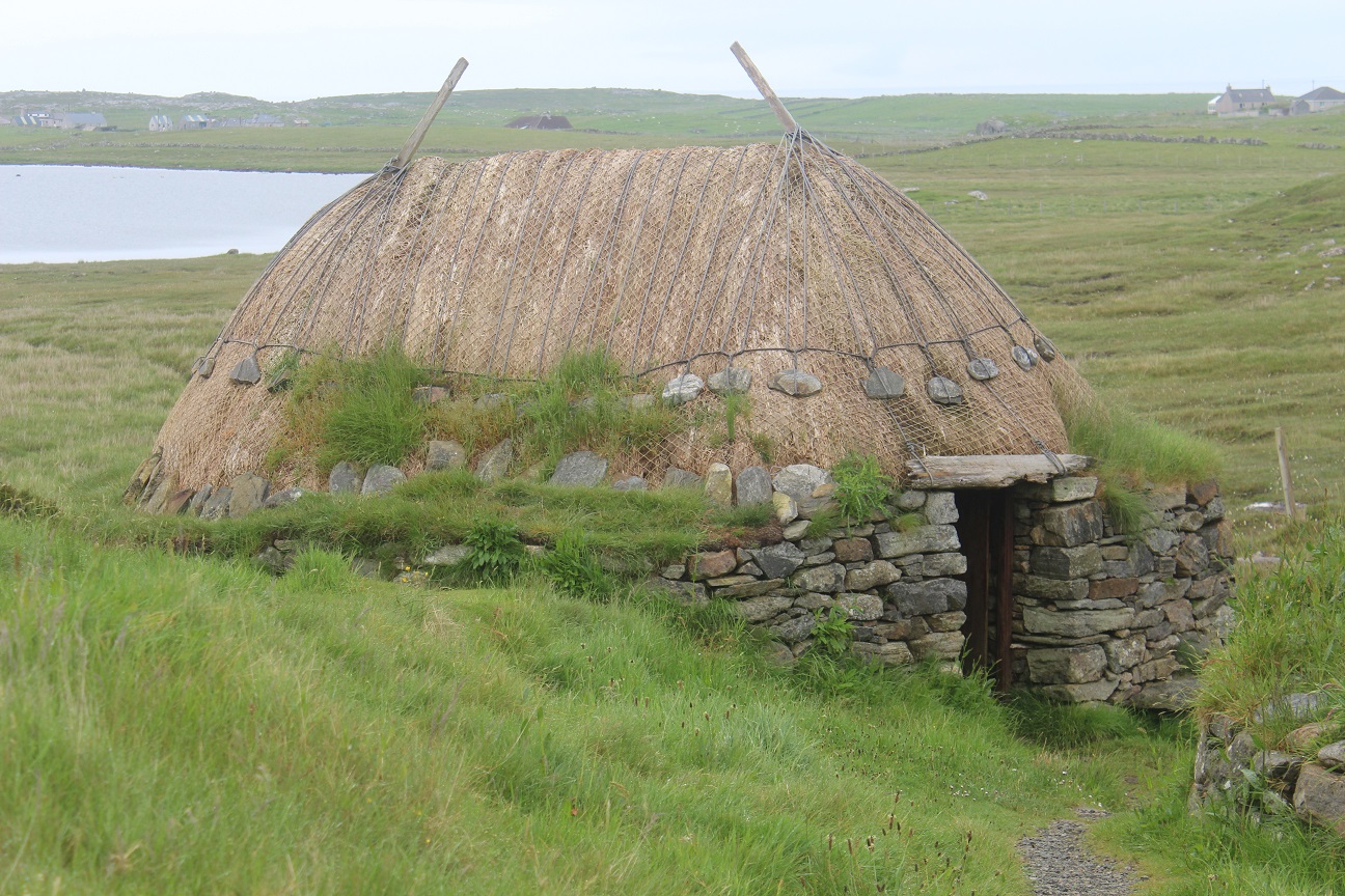
Friday was our final day in the Western Isles, but fortunately we had enough time to do some more exploring and, of course, bag some more lighthouses. However, we began our day with a visit to the nearby Norse Mill and Kiln – again here are more examples of two buildings that are very well preserved, but haven’t been turned into multi-million pound attractions. They’re actually very well-hidden and the laminated sheets of information about them are tucked away. Some really great handiwork must have gone into them originally, even if the roofs have needed a lot of work over the years to maintain their thatched look. Gearrannan Blackhouse Village was the final of our tourist stops for the trip where we found out more about cutting peat, weaving and the lives of those who used to live in the village. A really interesting place to visit and nice to see that they have kept some of the houses in the condition they were in back in the day, although some have been renovated as accommodation for visitors.
Tiumpan Head lighthouse
We had two more lighthouses to fit in before catching the ferry. The first was Tiumpan Head, which sits at the north east end of the Eye Peninsula to east of Stornoway. Visibility while we were there wasn’t particularly good and we didn’t hang around for long as the lighthouse cottages are now home to kennels and I knew Bob wasn’t comfortable with the continual barking of the dogs there. I see why it may be a good location for kennels full of barking dogs, but the noise did detract a little from the experience of seeing the lighthouse. As is the case with many others, Tiumpan Head lighthouse looks very similar to many of the others, which actually isn’t so common in the Western Isles as there appears to be no set “look” for the lighthouses there.
Arnish Point lighthouse
Our final stop before heading back was Arnish Point lighthouse. We’d seen it on the approach to Stornoway as we arrived on the ferry, so it was just a matter of finding it from the main road. After a little driving around and “trial by error”, we finally found a bit of a dirt track that seemed to lead in the right direction. Aside from a couple there walking their dog there was no one else around. Being on the other side of an industrial estate probably doesn’t make it such a frequented spot and it was clear on the approach to the lighthouse that the area hasn’t been used much in recent years. The lighthouse itself though has been well-kept (as many operational lighthouses are) and is a fairly squat little tower. It may not be far from the harbour, but it’s a very quiet little location, even if you do get the feeling that being there isn’t recommended.
The ferry journey back to Ullapool allowed us another glimpse of Arnish Point as well as Cailleach Head and Rubha Cadail lighthouses, as we’d seen on the outward journey. We’d arranged to stay at a B&B in Lochinver that night and I was incredibly glad of a real bed after camping for the week. The following day Bob was joining his fellow volunteers from the Assynt Mountain Rescue Team for the Sutherland Trail in 24 hours challenge fundraiser. They successfully completed the trial with Bob setting off on the first of his legs (his second was during the night) while I headed home. I then met the team the following morning just after the final group had reached the end in just under the 24 hour time limit. A great achievement!
So, that was our week on the Western Isles with a few trips further afield. We had been so lucky with the weather and seen some amazing places. We shall definitely be heading back there again in the future 🙂
While the first half of our trip to the Western Isles hadn’t involved much exploring of the Western Isles themselves, the second half of the week was dedicated to just that.
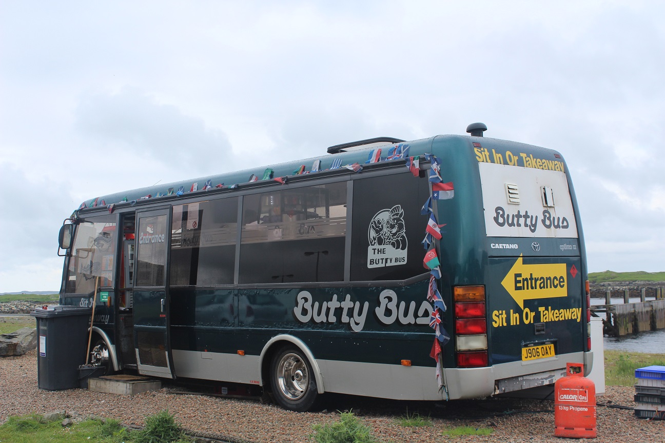
The Butty Bus in Leverburgh
We kicked off the Wednesday with a visit to the Butty Bus in Leverburgh, which is a converted coach serving tea, coffee and hot filled rolls at breakfast time. They have some seats inside so we sat watching the general goings-on at the harbour while we had breakfast. A great little place!
While we waited for the Seallam! museum to open we stopped off at a local craft shop, upstairs from the local convenience store. Our main reason for wanting to visit the museum was to see the exhibition on St Kilda and the evacuation in 1930. We’d been really intrigued by the whole story during our visit to St Kilda the previous day. The museum had a really interesting display of old photographs as well as some more general exhibitions about Lewis and Harris (and a small café area serving hot chocolate too!)
Eilean Glas lighthouse
From the museum we headed toward Tarbert and then took the turning towards Scalpay to begin our walk to Eilean Glas lighthouse. We parked up near one end of the Heritage Trail and set off. Based on the mapping we’d used, we expected a fairly well-marked path to the lighthouse, but it wasn’t to be. Strangely enough there were some coloured posts along the way, but there was very little consistency with these and we ended up making it up as we went along! Once we’d spotted the lighthouse from a distance though we decided to abandon the post idea completely as we had very little confidence in them. There were some fantastic views of the red and white striped lighthouse on the approach with the Shiant Islands in the background. The lighthouse sits on a small peninsula and as we approached we could see there was a sense that there was a real disparity between the condition of the buildings there. While the stripes of the lighthouse were all perfectly maintained, the surrounding buildings were falling into disrepair, although it looked like efforts had begun to make improvements. There was a sign on the door of the old lighthouse keepers cottages saying that ‘Friends of Eilean Glas’ had been set up to improve the buildings following damage from vandals. It said that more information was available at the Scalpay Post Office, so we made a mental note to stop off there after our visit. Part of the building that made up the old lighthouse is still present at the site and a plaque is on display explaining that it was one of the first four lighthouses to be built in Scotland and was first lit in 1789.
Gob Rubha Uisinis lighthouse from a distance
The return journey from the lighthouse was a lot more straightforward. Bob was keen to reach the high point of Scalpay and we followed a path that seemed to go in the right direction. The path looked fairly new, which explained why it hadn’t appeared on our map and happened to run right back to where we had parked and alongside the island high point. It also gave us a distance view of Gob Rubha Uisinis lighthouse, which sits further up the coast of Lewis. Based on the maps I’ve seen, this lighthouse looks to be the most remote in the UK in terms of access, with a lot of rough terrain covered in small lochs to cross. We were also able to see the northern tip of Skye as we walked back.
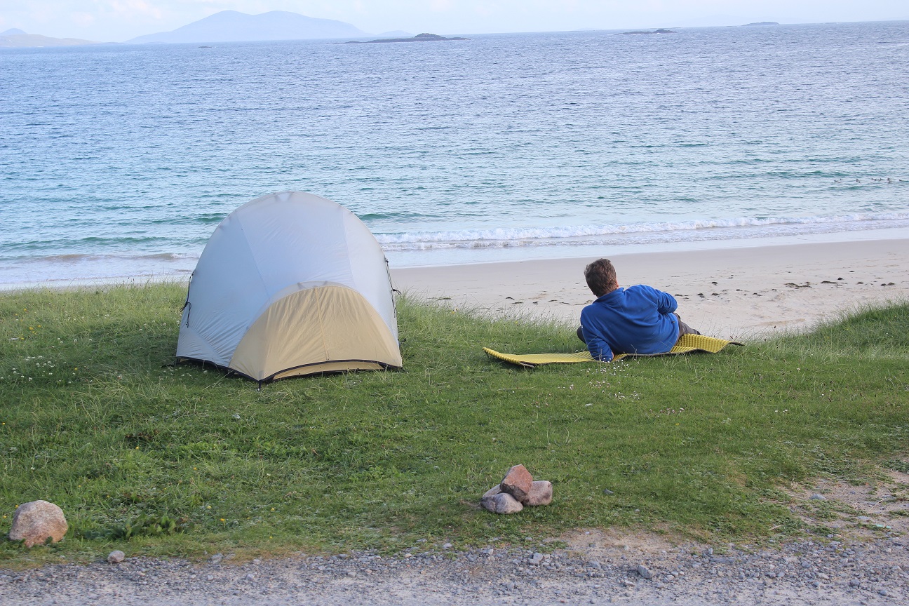
Relaxing at Huisinis beach
As mentioned above we planned to stop off at the local Post Office to ask about the Friends of Eilean Glas plans. Having found the shop we asked the lady for more information and we were informed that there were currently no plans underway as the individual who had set up the trust was serving a prison sentence for fraud. It’s such a shame that everything has come to a standstill and hopefully someone with a genuine interest in making the necessary improvements steps in at some point. We grabbed an ice cream from the shop and Bob then drove us back to Lewis and to our campsite location for the night, Huisinis beach. The local residents run a small bathroom block, which we took advantage of and Bob pitched the tent just above the beach with the doors facing the sea. We had our own little barbeque and then spent the rest of the evening enjoying the beautiful views of the beach.
This is possibly my most delayed post to date, but very much a worthwhile one covering a trip we took out to the Western Isles back in June.
We were due to set off from Ullapool by ferry to Stornoway on the Sunday and had a nice, leisurely journey over the to west coast. We stopped off for a walk at Ravens Gorge Walk near Rosehall, which was a really picturesque and quiet stroll. We then had a short time at Knockan Crag in the North West Highlands Geopark, which I’d seen before, but never stopped at. We made it to Stornoway with plenty of time for an ice cream before our ferry.
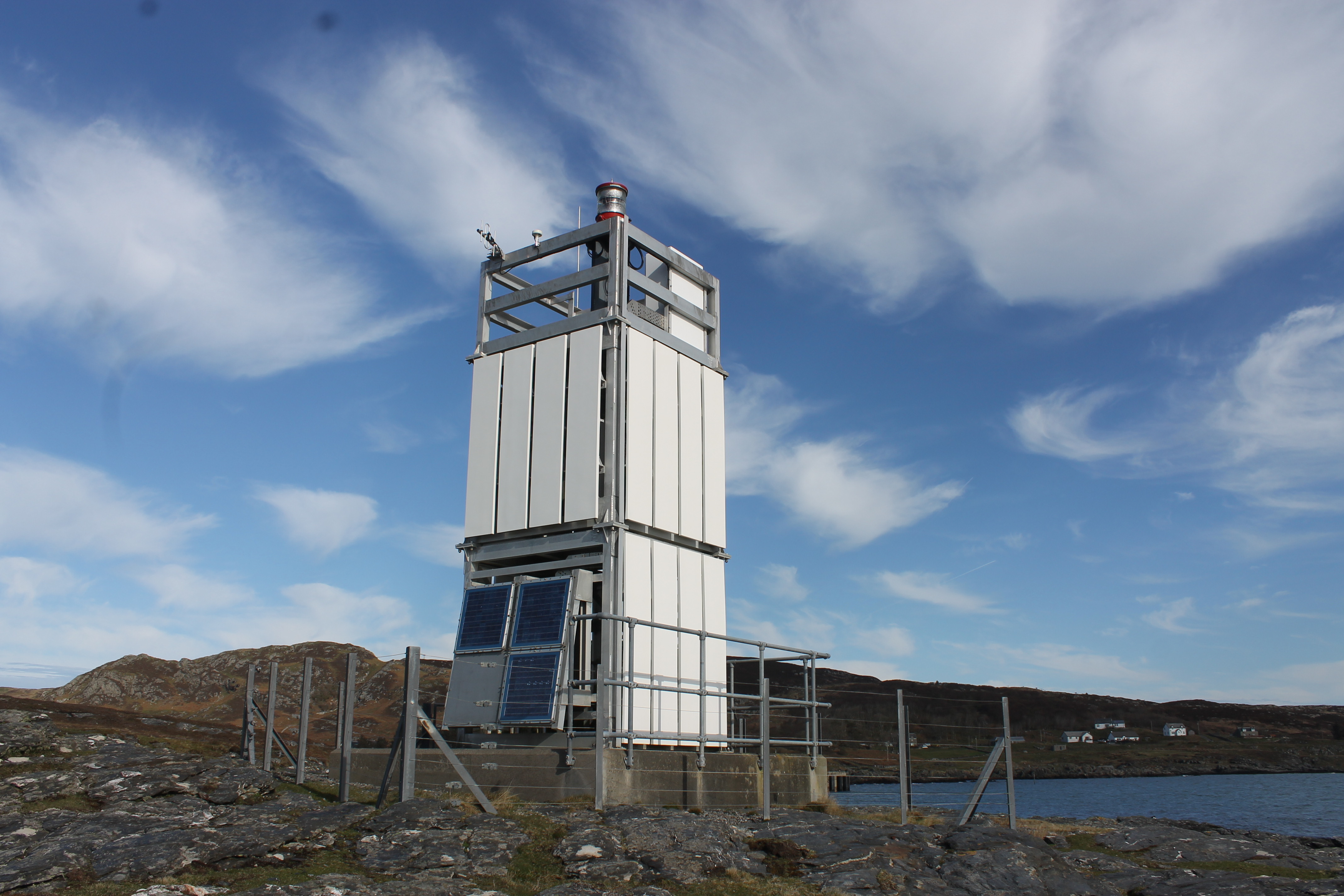
The new structure at Cailleach Head
Our lighthouse bagging kicked off during this trip with views of the Rubha Cadail lighthouse at Rhue just to the north west of Ullapool. We also saw the structure at Cailleach Head, north west of Scoraig. We’d been informed about this lighthouse before by a friend of Bob’s who had explained that there had been a local campaign in the area when the old lighthouse was removed and replaced with one of the Northern Lighthouse Board’s ‘flat pack’ (as I call them) structures. The old lighthouse has since been rebuilt in Scoraig and is open for visitors. So that’s somewhere for us to go in the future! As we continued our journey to Stornoway there were plenty of scenic views of the countless islands on the way. There’s truly nowhere like the west coast of Scotland in the rest of the UK.
As we approached Stornoway we spotted Arnish Point lighthouse to the south of the harbour – more on this one later! Upon arrival we headed across Lewis to Cnip where we were setting up camp for the night. There was a beautiful beach next to the campsite and we enjoyed an evening stroll before bed.
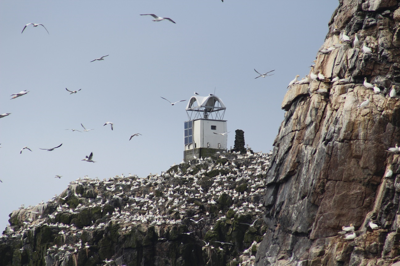
The beacon on Sula Sgeir
We had a long day lined up for Monday. Bob had arranged, in advance, for us to join a group on the Sea Harris boat from nearby Miovaig. The trip took us on a 3 and a half hour journey to Sula Sgeir. On the trip we saw Aird Laimisiadair on the west coast of Lewis from a distance as well as the Butt of Lewis lighthouse (more on that one to come too) on the very north tip of Lewis. Sula Sgeir has colonies of gannets and fulmar – as well as some puffins – at that time of year. We also got to see the beacon on the island, an interesting building unlike any I’ve seen before. It’s not a big island, but the quantity of birds flying around it or on the land itself would suggest otherwise!
North Rona lighthouse
From Sula Sgeir we then headed east to North Rona, which I was very much looking forward to as it has its own lighthouse and we – as well as the other boat on our trip – were the only ones due to be on the island. It took around 45 minutes to reach the island where we all climbed into RIBs to land on the rocks. From the rocks it was a fairly easy stroll up to the island high point (the reason everyone else was there) and the lighthouse. The sun had come out and we all happily wandered around in the sunshine, enjoying the remoteness of the island and sharing it with nothing but some sheep and birds (including some diving bonxies)! While Bob was there to reach the high point he was also more than happy to bag the lighthouse with me and fortunately these two objectives sit right next to each other. We were given a perfect length of time on the island and then enjoyed relaxing back on the boat, watching the seals in the water and eating ginger cake, while the RIBs returned everyone to the boats. We were then treated to a tour around the outside of the island before beginning the journey back. We returned back at Lewis late, but were in time to pick up a Chinese takeaway in Stornoway before heading to Harris (the smaller, southern section of the island) to set up camp in Horgabost ready for another adventure the following day.
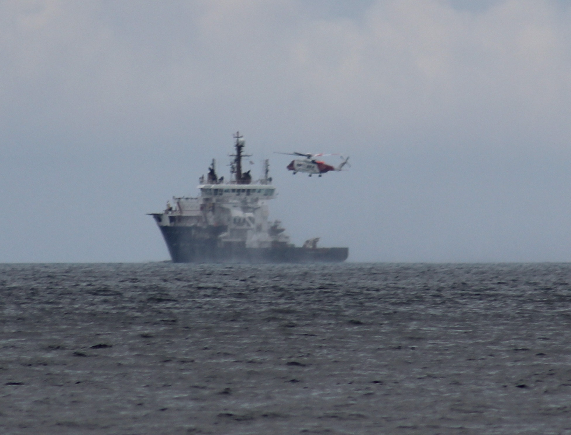
The Pharos and Stornoway Coastguard helicopter
Tuesday’s adventure yet again involved Sea Harris as we joined then for a scheduled trip out to St Kilda, which lies 41 miles (66km) west of the Outer Hebrides. For many this is a once-in-a-lifetime trip, but for Bob it was a fairly normal thing to do – being his fourth trip out there! We set off from Leverburgh that morning for a three-hour boat trip to the main island of Hirta. In comparison to the day before it felt relatively short! On our journey there we passed the North Lighthouse Board’s maintenance vessel, Pharos (which we had previously seen at Bell Rock), and witnessed the Stornoway Coastguard helicopter airlifting a member of staff from the ship. We also caught a glimpse of the lighthouse on Siolaigh island, part of the Monach Isles.
High street on Hirta
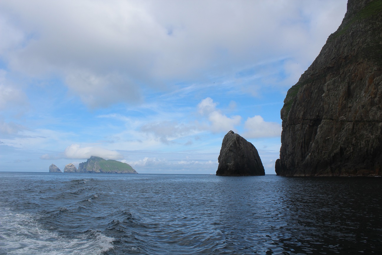
Just before we’d reached Hirta we had some stunning views of some of the other islands that make up St Kilda, such as Boreray with it’s head in the clouds. Hirta itself was also fantastic and Bob was keen to show me the view from ‘The Gap’ across to Boreray and the two sea stacks – the highest in the UK – next to it. Before this we listened to a short introduction to the island from the National Trust for Scotland team out there. The island seemed really busy in comparison to those we’d seen the day before! After enjoying the views across to Boreray for a while we headed back down to the old village, which was evacuated by its residents in 1930 after they made the massive collective decision to leave the island. Now the only permanent residents are the soay sheep who roam freely around the old blackhouses and not-so-old stone houses. We saw the graveyard, the old church and school room as well as the museum. We sat near the old gun, which has never been fired before and enjoyed the sunshine before heading back to the boat. There are no lighthouses on any of the islands of St Kilda, but there are a couple of leading lights at village bay on Hirta.
St Kilda
Before heading back to Harris, we were given a tour around the islands, seeing the highest sea cliffs in the UK, the islands of Soay and Boreray, as well as Stac Lee and Stac Armin. Bob recounted his previous visits when he’d climbed to the high point on Soay, Dun and Boreray, and his plans for one day reaching the top of both of the stacks.
On the return journey Seumas, owner of Sea Harris, kindly phoned ahead and booked us a table at The Anchorage near the harbour at Leverburgh. We had a lovely meal there and a quick stop off at St Clements Church before arriving back at the campsite.
At the beginning of May we were down in Devon for a friend’s beautiful wedding day and had decided to drive almost the full length of the UK to get back home the day after the wedding.
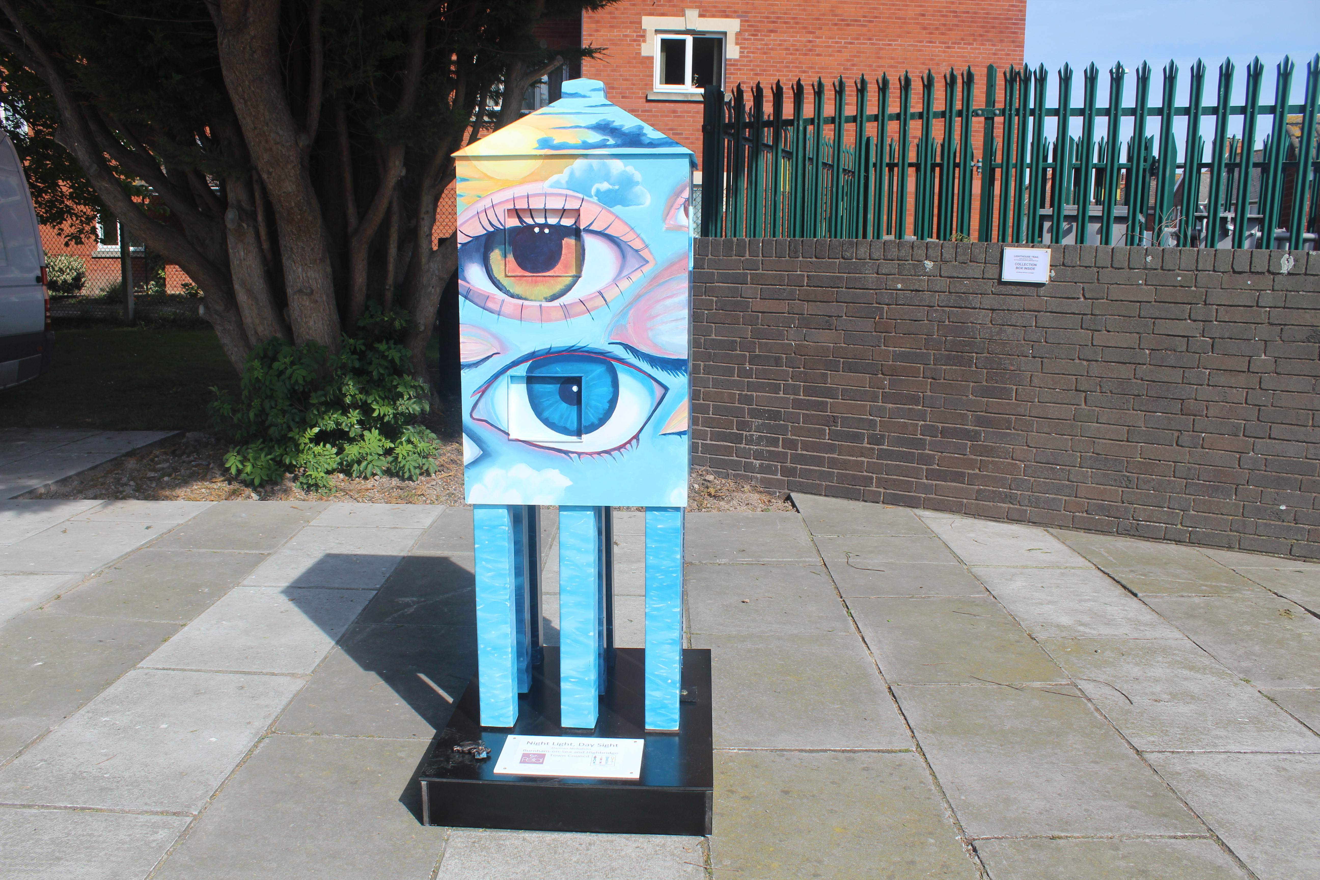
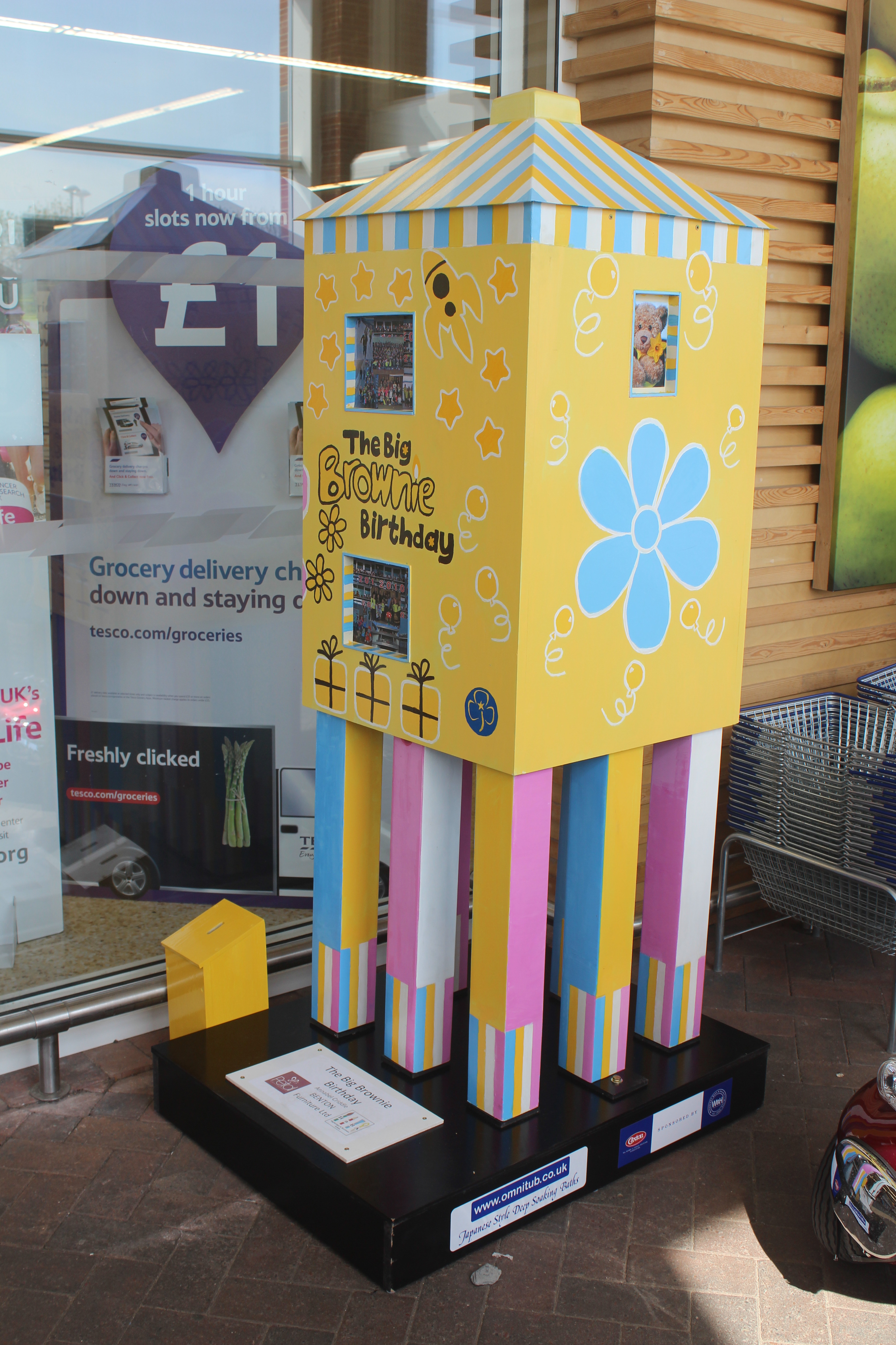
After leaving the venue I did a little research and discovered that it was that very weekend that the Burnham-On-Sea mini lighthouse trail was being launched. We calculated that we would have a short amount of time to be able to drop in to Burnham-On-Sea as it wasn’t far off of the M5. The 33 mini lighthouses are based on the design of the Low lighthouse, which is a wooden pile lighthouse, which sits happily on the beach. The smaller 6ft versions have all been created and painted by the Highbridge and Burnham Artists and positioned in various locations around the town centre and slightly further afield.
The Brownies lighthouse at Tesco
We arrived at the Burnham-On-Sea tourist information centre about ten minutes before it was due to open and ruined their last moments of peace by barging on in (well, if the door is unlocked…). I’d read that this was where we could get hold of a map of the lighthouse trail. We then had a whizz around the town and saw 11 of the lighthouses outside various buildings, including the police station, arcade, Tesco and the RNLI shop. The money raised from the lighthouse trail will go towards a local cancer charity, so it’s lighthouses for a good cause – what could be better! At some point I hope to get back to see the others, but I think they are only on display for a certain length of time before being auctioned off.
As we moved further up the road we were able to spare a little more time to stop in at Heysham for a quick look at the lighthouse on the end of the pier there. It was a very quick stop and the structure has clearly seen better days, but good to get a view of it.
We’re off to the Western Isles tomorrow, so I should be able to report back on lighthouse progress made over there shortly 🙂
Over the Easter weekend, Bob and I organised a trip over to Colonsay off of the west coast of Scotland. Surprisingly, neither of us had been their before, although Bob had sailed into neighbouring Oronsay to bag the highest point on the island.
Starting our journey from home, we took a leisurely drive down to Oban for the ferry, stopping in Glencoe for lunch and taking a look around the old Ballachulish Slate Quarry. The weather was beautiful and we were even treated to a clear view of Ben Nevis and it’s surrounding mountains when we passed through Fort William.
Fladda lighthouse
The ferry ride over from Oban to Scalasaig on Colonsay gives you a great taste of the beauty of the islands in the area. We were able to see across to Mull, Scarba, Jura and Islay on the way there as well as many others. We were able to spot the lighthouses on Fladda and the south west end of the Garvellachs on the way as well as Ruvaal lighthouse on the northern point of Islay as we approached Colonsay. Of course, we also spotted Rubha Dubh lighthouse when we arrived, which is located just to the south of the harbour in Colonsay.
Once we were on the island, we decided to go for a drive around the island before checking into the island’s only hotel, the Colonsay Hotel. The drive didn’t take us long as the island itself is only 10 miles long and 2 miles wide. We stopped off near Kiloran Bay, which we planned to stroll along to get to the island high point at some time over the weekend. The sun was going down and we spent a while enjoying the views and then headed to the hotel.
Rubha Dubh lighthouse
The following morning we started off the day with a wander across to the lighthouse. There are some fantastic rocks around the bottom of the lighthouse. It is the type I quite often call “flat pack”, but the surrounding scenery and views across to Jura and Islay made it all worthwhile. We then enjoyed sitting on the small harbour beach for a moment. We stocked up on supplies for the weekend at the small general store and then took a drive to Machrins beach where we went for a wander as the tide went out.
Walking to Oronsay
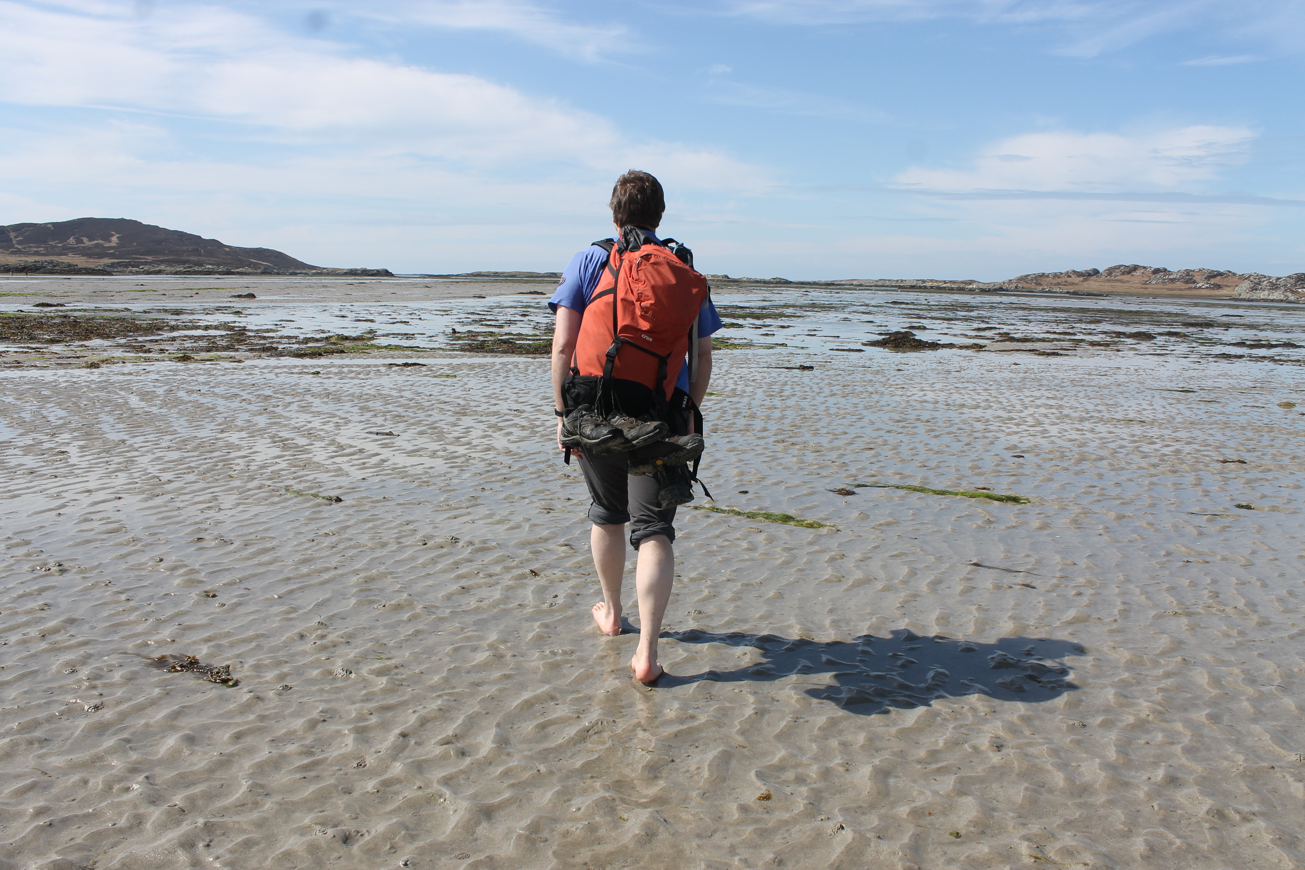
Our next plan for the day was to take the walk across to Oronsay at low tide. There is a space of around 4 hours when it is possible to walk across to the island. We set off shortly after another couple, noticing that they had wellies on while we were just in trainers and walking boots. The stroll across the 1 mile(ish) stretch of sand was lovely until we got to the point where the water was coming up to our ankles. Our solution: take our shoes off, roll our trousers up and go for it. The water was cold and, at one point, Bob very kindly gave me a piggy-back across the deepest section. It was greater fun though and, again, the weather was perfect. Once on the island we walked along the main path to the south side of the island and the priory, where we were able to see the northern-most point of Ireland to the south. Stopping there to look around and have a mini picnic, we then began the walk back to make sure we made it back across before the tide started to come in. The walk back was a little less cold and we walked the whole distance without shoes on – as did everyone else, it seemed.
Before we called it a day, we paid a visit to the bookshop and the brewery. We enjoyed a lovely meal at the hotel that night with views down to the harbour and islands in the distance.
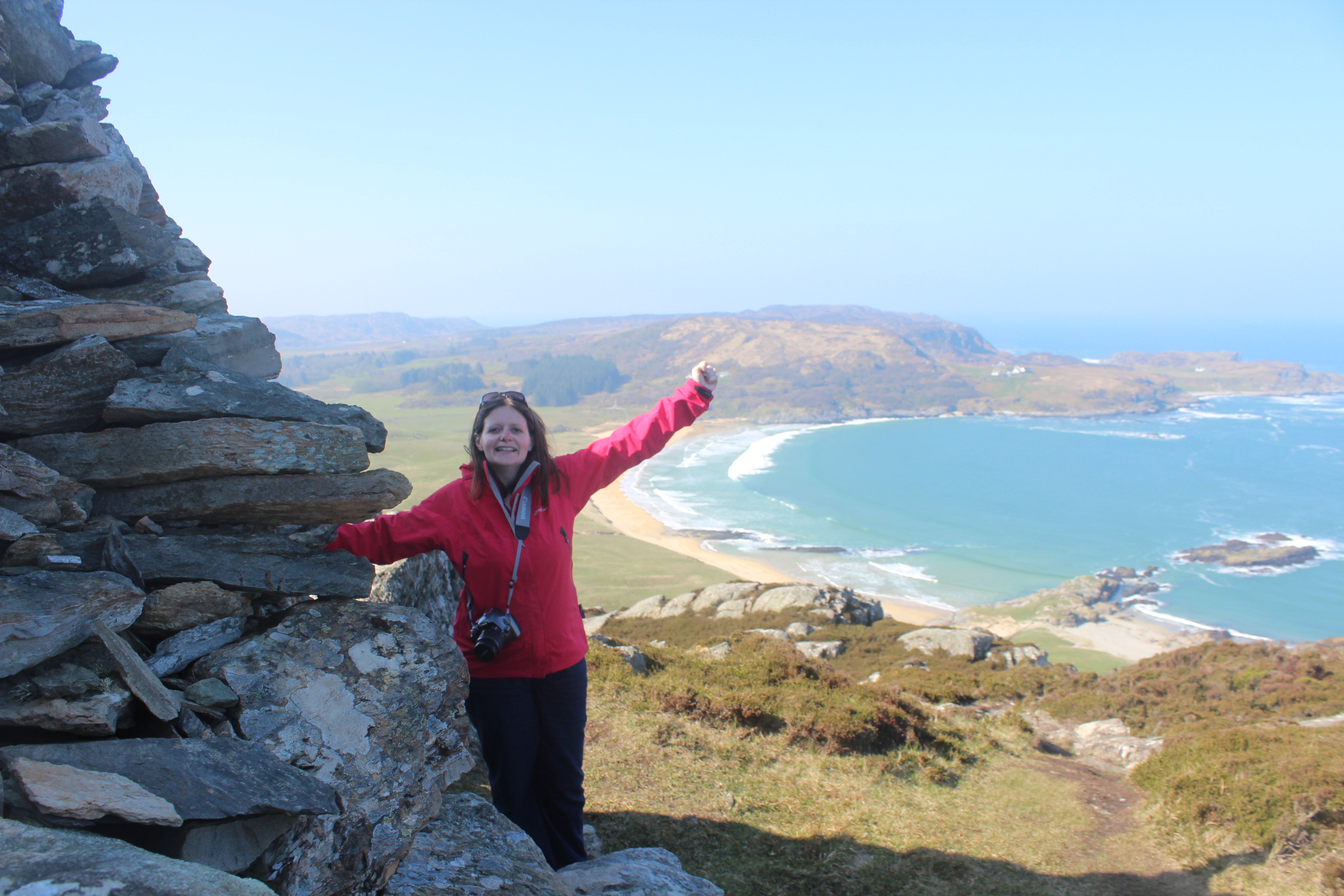
Reaching the highest point of Colonsay
The following day our main aim was to reach the highest point of the island. We noticed the cows next to the main path so we decided to access it from the beach instead. The tide was a bit stronger that day, but it was still beautiful sunshine. The walk up to the high point was fairly straightforward and we had some amazing views, including an almost birds-eye view of the large whale that has been created off to the north west of the hill which people add stones to regularly to try to fill in. We were planning on walking to it after leaving the hill, but decided against it when we realised we were unlikely to get a better view of it from ground level. On our way back along the beach we took our shoes off again and Bob went for a paddle while I did my best to avoid the cold water.
At the Woodland Gardens
Driving back around the island we stopped off at a couple of standing stones in a field at the side of the road. Bob then walked up a hill called Beinn nan Caorach near Machins beach while I followed his progress with the camera from the car park. We returned to the hotel again for lunch while an Easter egg hunt was going on in their garden. Our next stop was the Woodland Garden at Colonsay House where we saw all sorts of plants and flowers and had a short spin (and it was a spin) on a rope swing. Our final walk for the day was Beinn nan Gudairean which offered fantastic views in all directions from the viewpoint. I sat and enjoyed the sunshine while Bob dashed off to bag the trig point. We then had dinner at The Pantry before boarding our return ferry.
A view from Easdale
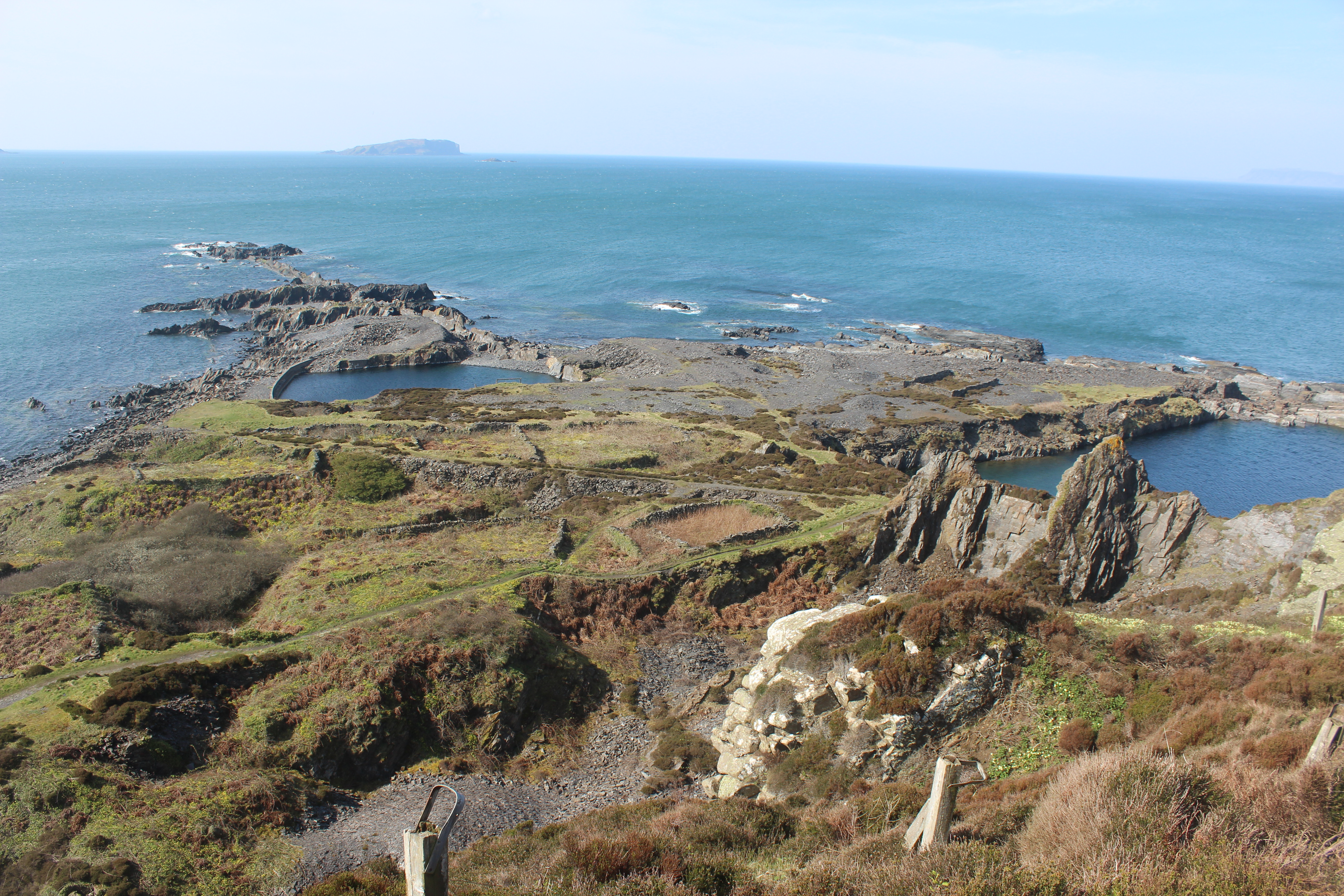
We spent that night in Oban and decided to go on a minor detour the following morning before we started the drive home. We drove to the Isle of Seil, crossing the Clachan Bridge (a Thomas Telford construction also known as The Bridge Over the Atlantic’. Bob was keen for us to hop over to Easdale, a small island off of the west coast of Seil and so we caught the little boat over and spent a while wandering around this fascinating little island. I was very amused by all of the wheelbarrows near the harbour, which the residents of the island use for carting things about. We walked around the circumference of the island, seeing the old slate mines that became disused when they were flooded. We bagged the island high point (of course) and then stopped at a lovely little café before we got the boat back.
Our penultimate stop on the trip was the Sealife Centre north of Oban. The three seals there were adorable, particularly the one that came to see us at the side of their tank (we think she might have been called Pippa). We also saw a couple of otters, crabs, seahorses, starfish, and some weird and wonderful little fish!
Port Appin lighthouse
The final stop of our weekend was at Port Appin where we went to see the lighthouse there, which sits on a small island just off of the coast. I’d been here on my lighthouse tour, but Bob hadn’t and we also spotted the old lighthouse on display next to the village shop. The lighthouse at Port Appin was, in 2001, painted pink with yellow spots to show the local residents’ anger at the lighthouse being under threat. It was due to be replaced by one of the “flat pack” lighthouses, but fortunately the residents won in the end. Apparently the residents have threatened to do the same again this year in protest over a new sewage pipe being installed along the coastline. We’ll have to wait and see what happens!
So, that was our weekend. We certainly crammed a lot in, but we also made the most of the weather and had a brilliant time! 🙂
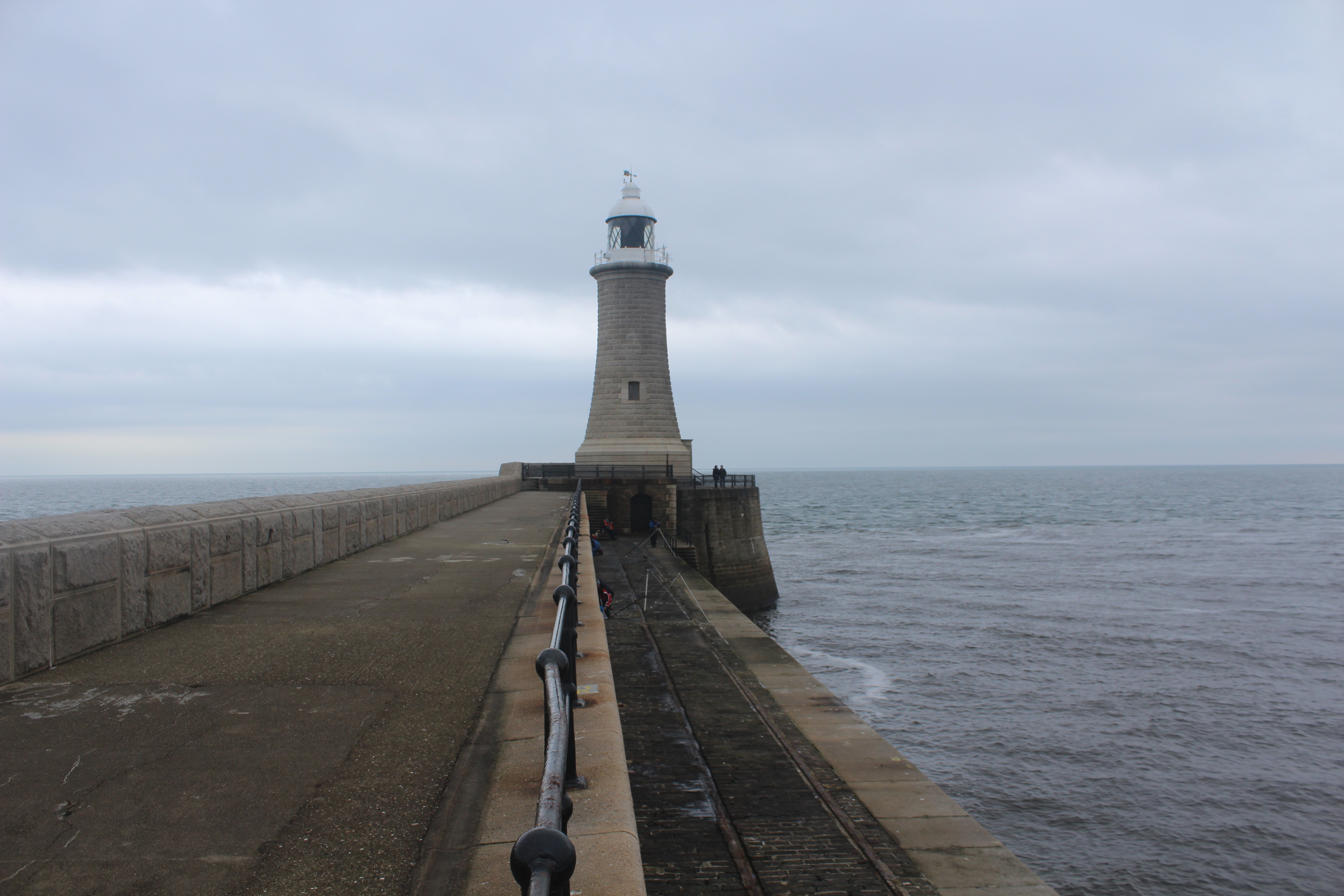
After travelling down to Durham last month to attend this year’s Fire and Ice Expeditions ball, we spent some time in the area the day after the ball before home. On my month-long tour I’d visited South Shields and seen the two lighthouses on the ends of the piers at the entrance to the Tyne, but not actually walked up the piers to get a closer look. With a few hours to spare this is what we decided to do.
Starting off in South Shields, we set off along the south pier, which was surprisingly long. On the way out we could see across to Souter lighthouse to the south and Herd Groyne, an interesting lighthouse sitting just at the inner entrance to the Tyne. There are a few more lights along the side of the river there, including a couple of almost identical white square towers across in North Shields. There were plenty of fishermen and walkers about that day and you could see why it was a popular place to go for a wander. The lighthouse itself made a change from many others in that the outside of the lantern room is painted red on the Tyne-facing side and white on the sea-facing side.
The lighthouse on Tynemouth pier
Our second stop was just on the other side of the river where we could access the lighthouse at the end of the pier off of Tynemouth, although hopping across that small stretch of water isn’t quick! We parked up just down the road from Tynemouth Castle, which overlooks the pier. This pier wasn’t quite as long, but had some lovely surroundings, including a tiny beach and green areas. We enjoyed a slightly more sheltered walk out to the lighthouse, taking in the castle walls built into the edge of the cliff. The lighthouse to the north of the river entrance is very well-maintained and – judging by some of the pictures about of it during stormy weather – you can see why it needs to be. A picture of it was recently used widely in the media with a huge wave crashing over it and there seem to be many more where that one came from.
It was a nice morning spent getting some fresh air next to the Tyne. There are some lovely lighthouses in that area and it’s not hard to visit a handful in one day, so definitely an area I would recommend visiting to any potential lighthouse enthusiast! 🙂